Monthly Archives: May 2015
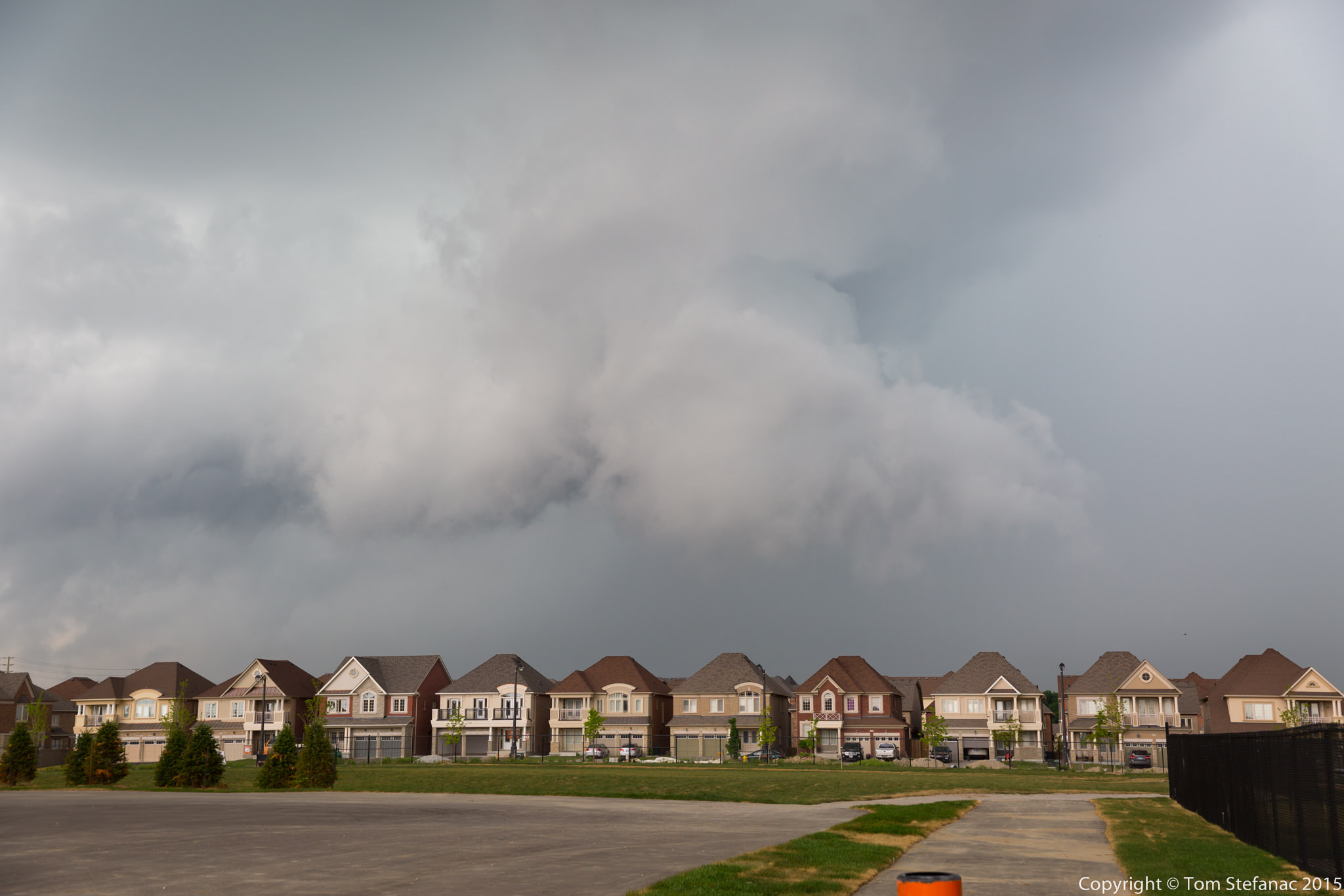
May 30th 2015
The models two days prior had already indicated that today was going to be a long chase day with a slow moving cold front and pre-frontal trough sparking off convection as it crept into a warm southwesterly wind field. By 11AM storms had already started to quickly form and by midday the action was in full swing.


May 18th 2015
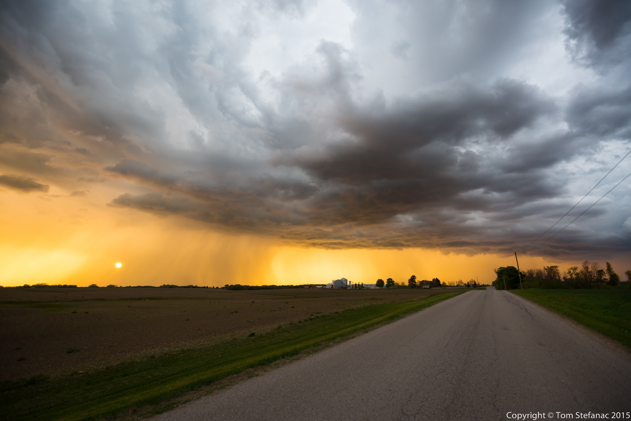
Today was the first “real” Southern Ontario chase that presented any possibility of actual thunderstorms. Having gotten back from tornado alley I was not storm deprived but I was not expecting much either. After chasing down in the alley, Southern Ontario can be pretty boring. I usually don’t feel the storm vibe here until late June or early July when SDS (storm deficite syndrome) begisn to set in again.
The play was going to be along a cold front swooping in from Michigan. There were indications that there could have been some storms earlier in the day around 18Z/2PM along a pre-frontal trough however mid level subsidence crushed everything. I spent a few hours at the Cambridge Onroute service centre. Things inititally looked somewhat promising but then the cu field quickly began to show signs it was just turning into pancake cloud. Pancake cumulus is a term often used by pilots to describe cumulus that hit an inversion and stop growing vertically but instead flatten out and turn into stratus, from the air they look like pancakes apparently.
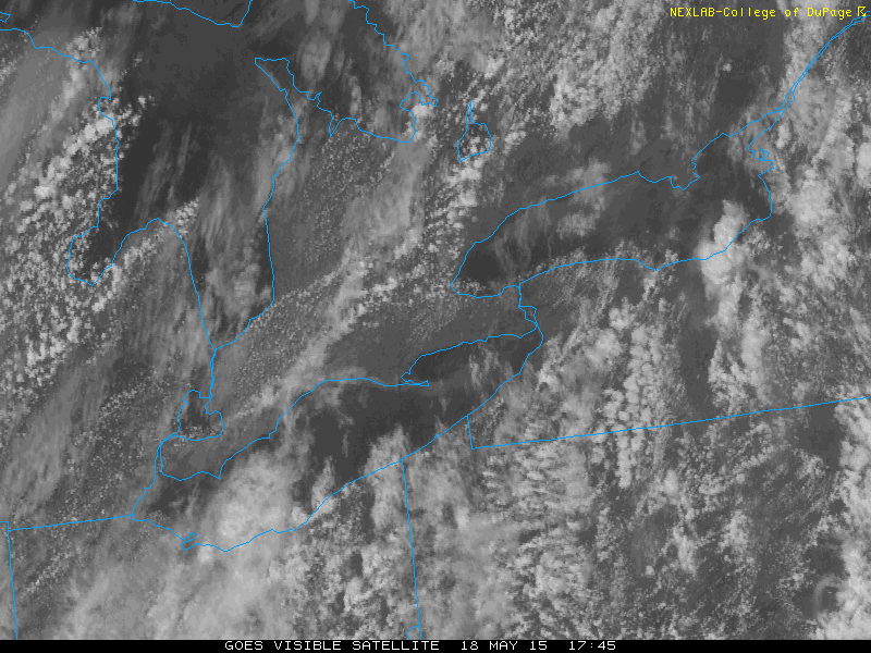
Again, the only area of pre-frontal convergence was right between the lake breeze boundaries just west of Hamilton and you can see how the clouds are flattening out and not growing any taller. They were all hitting this nasty 600mb inversion and it was just halting their development.


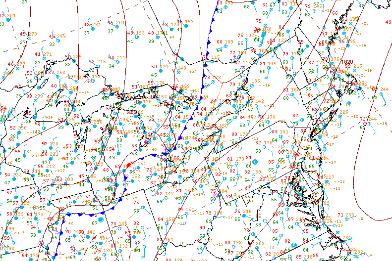
May 3rd 2015
Today was the first real chase day that showed some potential for severe storms. A thermal trof was swinging in from the west and coupling itself with a cold front descending from North Dakota into Eastern Nebraska. The best lapse rates were right on the nose of warm air where there was a southeasterly wind field. The biggest problem at the time was a lack of good 500mb support but otherwise bulk shear numbers were set to rise as the day progressed.
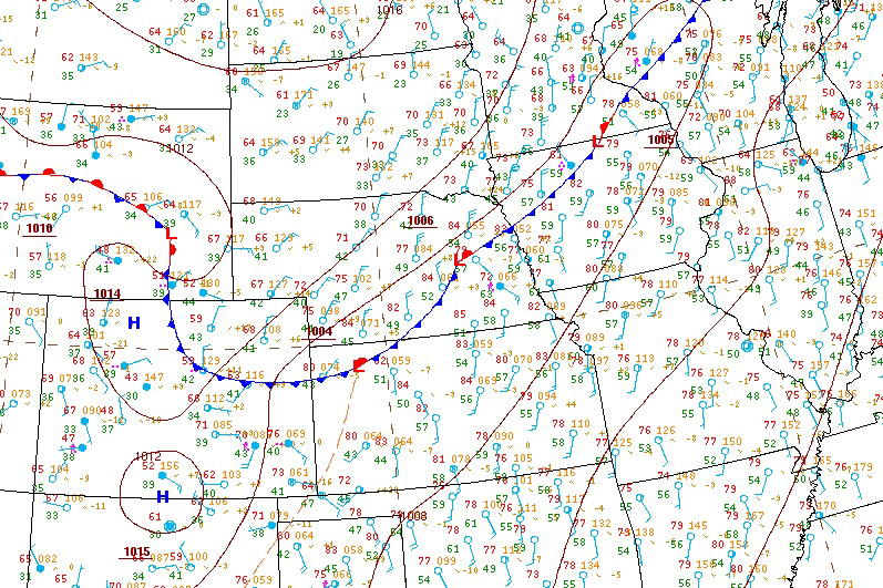
HPC surface analysis 21Z May 3rd 2015


iPad Air 2
Before I write one word praising Apple or the iPad let me be very clear, I’m not an Apple fanboy. I prefer the Android ecosystem and the flexibility and openness of their devices which include an easy to access and manipulate file system. However there are some things that just work better in combination.
In this case the iPad Air 2 is the ideal platform for the latest version of RadarScope which runs smoothly and virtually flawlessly. The iPad also provides a very stable portable / mobile hotspot for other devices to connect to and the added or increased precessing power ensures that there are no hiccups. So between the hardware and software everything runs very smoothly.
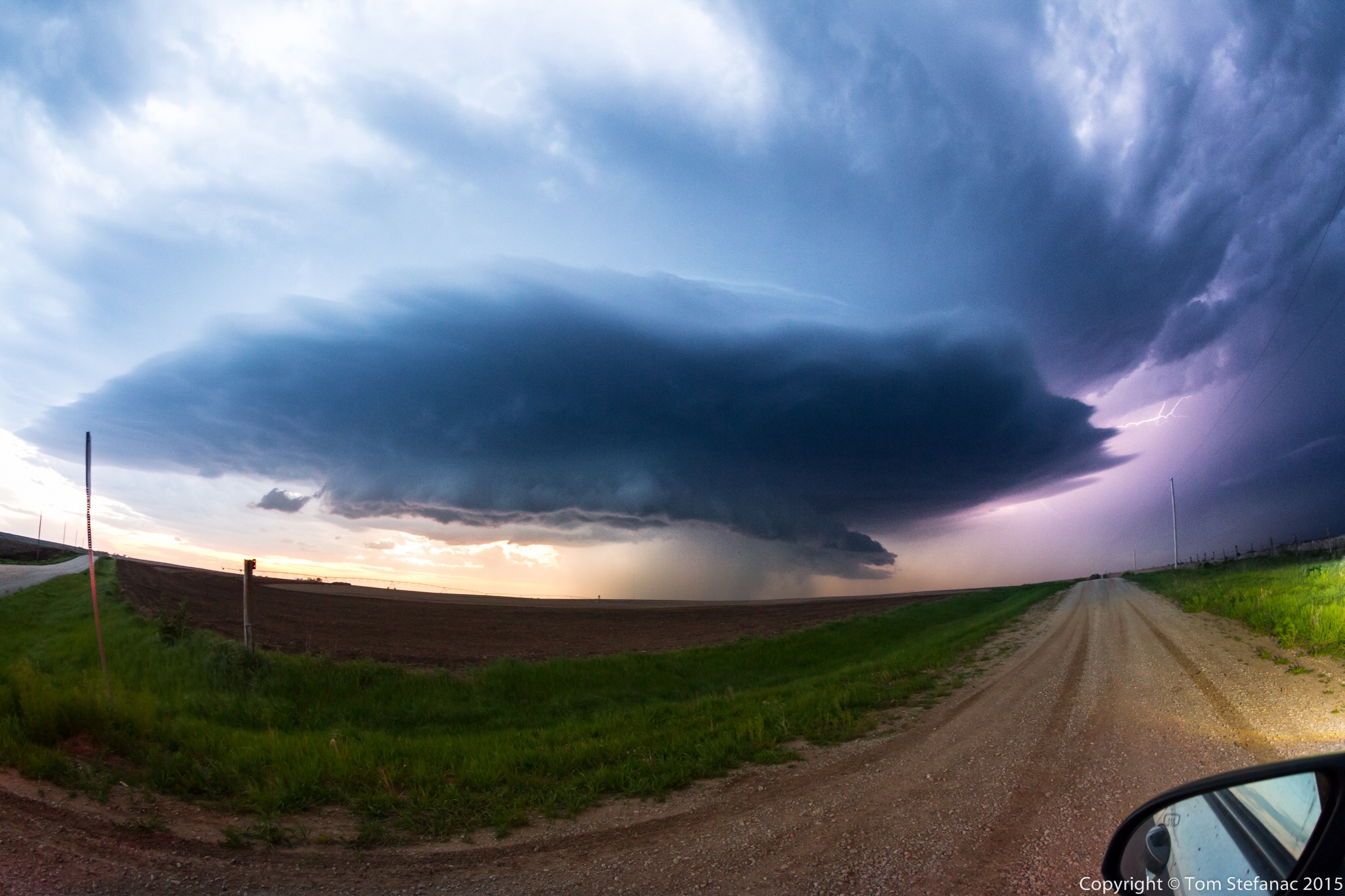
Jen holds the iPad Air 2 in a field showing the radar image of an encroaching supercell thunderstorm which is visible in the background
The reason why I chose the iPad instead of a larger Android tablet is two fold. Firstly, it was simply the only tablet on the market which offered both GSM and CDMA service, so in theory it can run on standard 3G/4G LTE networks but it can also run on Verizon and Sprints weird GSM/CDMA hybrid technology. Secondly, I already have a bunch of Android tablets and wanted something different which would give me a pure integration for RadarScope. Hence, the iPad Air2 was the perfect device to allow me to accomplish both. Using it as a hotspot also allowed me to mitigate the need for an expensive portable hotspot. I find the more devices you need to link together, the more problems you’ll have and the more likely it is that something will go wrong.
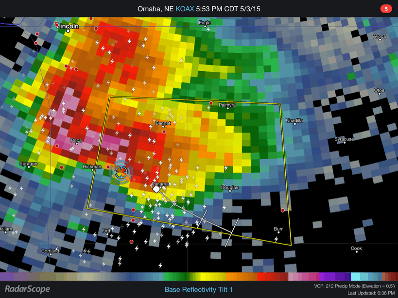
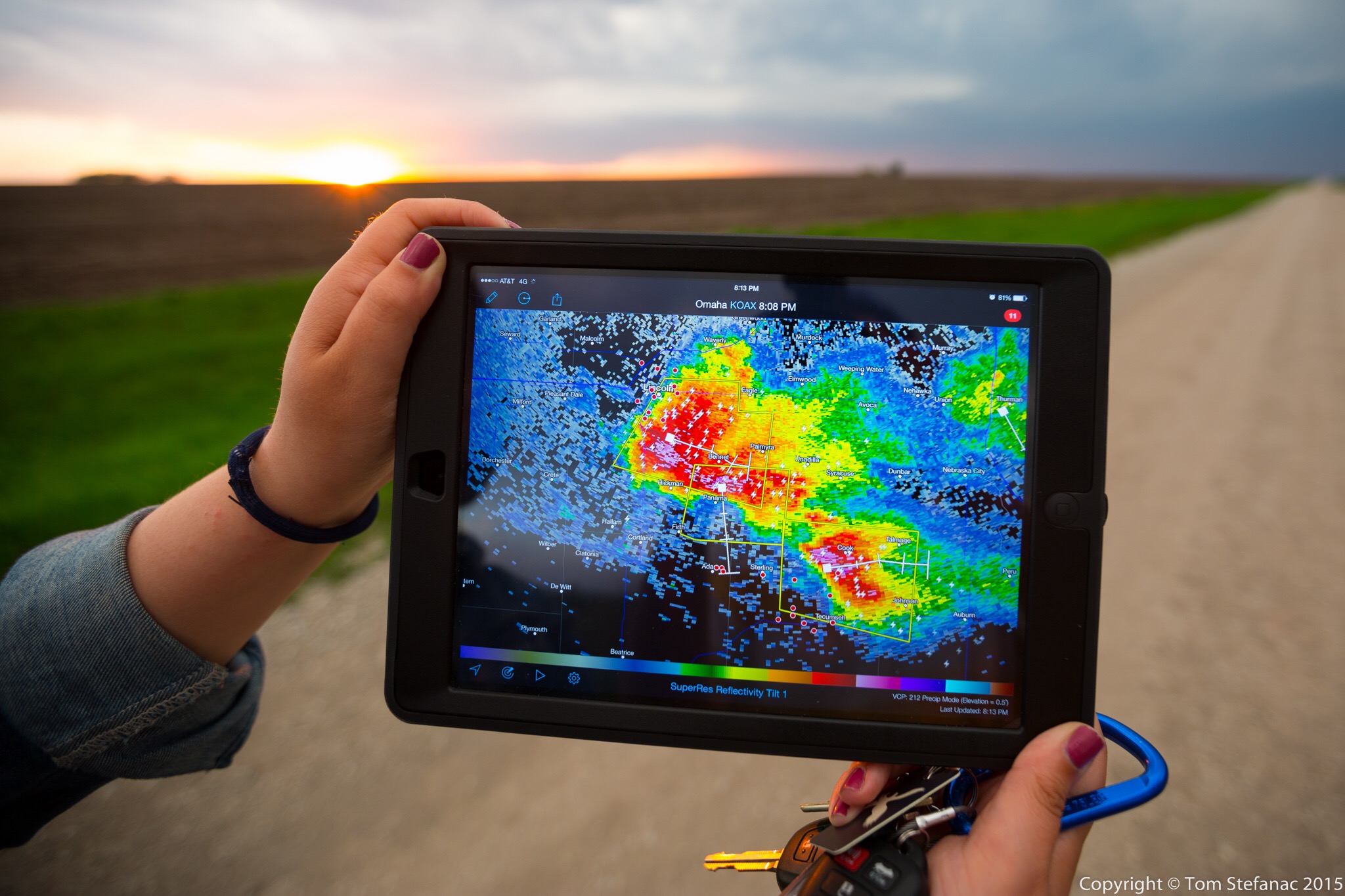
RadarScope showing a large supercell near Hickman NE using Level 3 data
Here’s a small GIF loop taken from the iPad using radar scape showing standard level 3 data from the KOAX radar in Omaha, Nebraska. We’re the blue circle which is derive from the GPS chipset that’s built into the cellular modem in the iPad.

RadarScope showing a chain of storms rolling across central Kansas using Level 2 data.
Here’s another shot showing the iPad in action as we drove through east-central Kansas. You can see that the iPad is in “hotspot” mode sharing the connection with my Dell Tablet which had GREarth running. You’ll also note that the radar data is very fine. RadarScope calls this data “super resolution” but it’s really just the 0.5 degree Level 2 radar data. The beauty however is that the WDT server strips the rest of the layers (0.8 through 19) out and you just have the lowest available level which is really only what we care about when chasing and looking at reflectivity data. By sending out only the needed layer the file is substantially smaller than it would normally be. For example if I attempted to view this same radar data on my Dell Venue 8 using GR2AE one frame of radar data would contain all 19 tilts and be approximately 3mb in size. It’s not a big deal when your in an LTE zone but once a hundred chasers show up and start straining what limited cellular framework there is even LTE data will slow down. Now just imagine trying to use GR2AE when you only have 1 bar of 3G data. So for me it’s simply a more efficient way of looking at the same data.
There are of course trade offs, GR2AE is an incredibly powerful piece of software sporting NROT, MEHS, and other specific algorithms which require all tilts and are extremely accurate and very useful. It can do circles around RadarScope but the reality is when your chasing, you just need basic radar data, all the fancy stuff is for the analysis after the chase or best served as tools that forecasters need when issuing warnings in real-time.
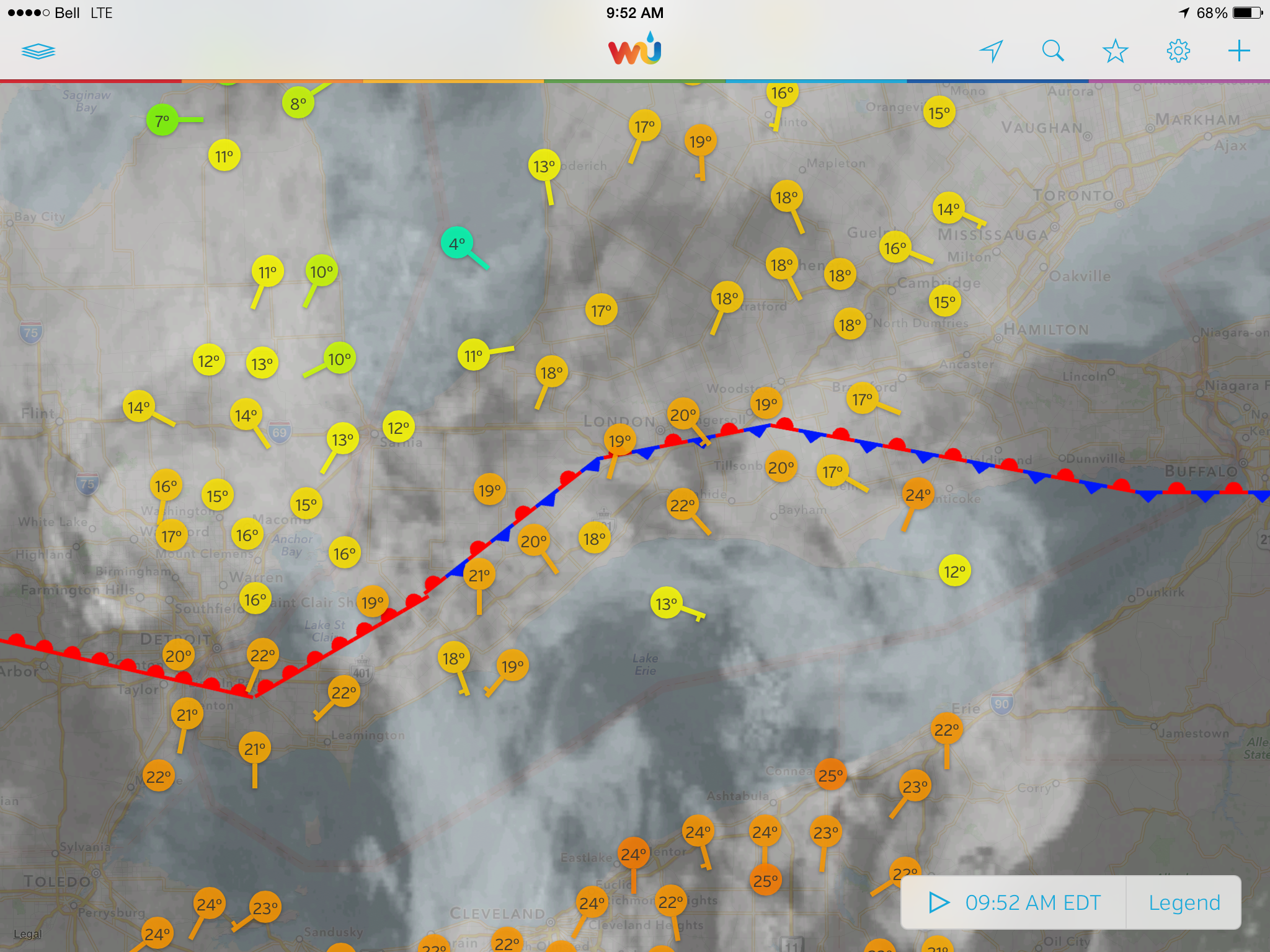
WunderMap App showing surface observations, a stationary front and visible satellite data over Southwestern Ontario
The iPad is also a good tool when used with iPad specific applications such as WunderMap. To explain it in a nutshell, if you know what GREarth is, then WunderMap is an extremely watered down version of that. The one thing the WunderMap App boasts which few other programs can offer is data from personal weather stations and some of this data is real-time updating ever 2 seconds. My own weather station updates every 5 seconds and is used in the WunderMap app. Obviously you need to take any data from these stations with a grain of salt since the quality control and placement can be questionable but it still provides a huge volume of actual observations far greater than you could ever get if you were only use airports, METAR stations and mesonets. So this iPad specific app can be very useful for quick nowcasts or simple situational awareness.

Chase Vehicles
Over the years I’ve had a variety of different vehicles. The first on the list was my mom’s old 1998 Chrysler Intrepid. The car held together well and ran for a good 17 years but in the winter of 2015 it bit the dust.
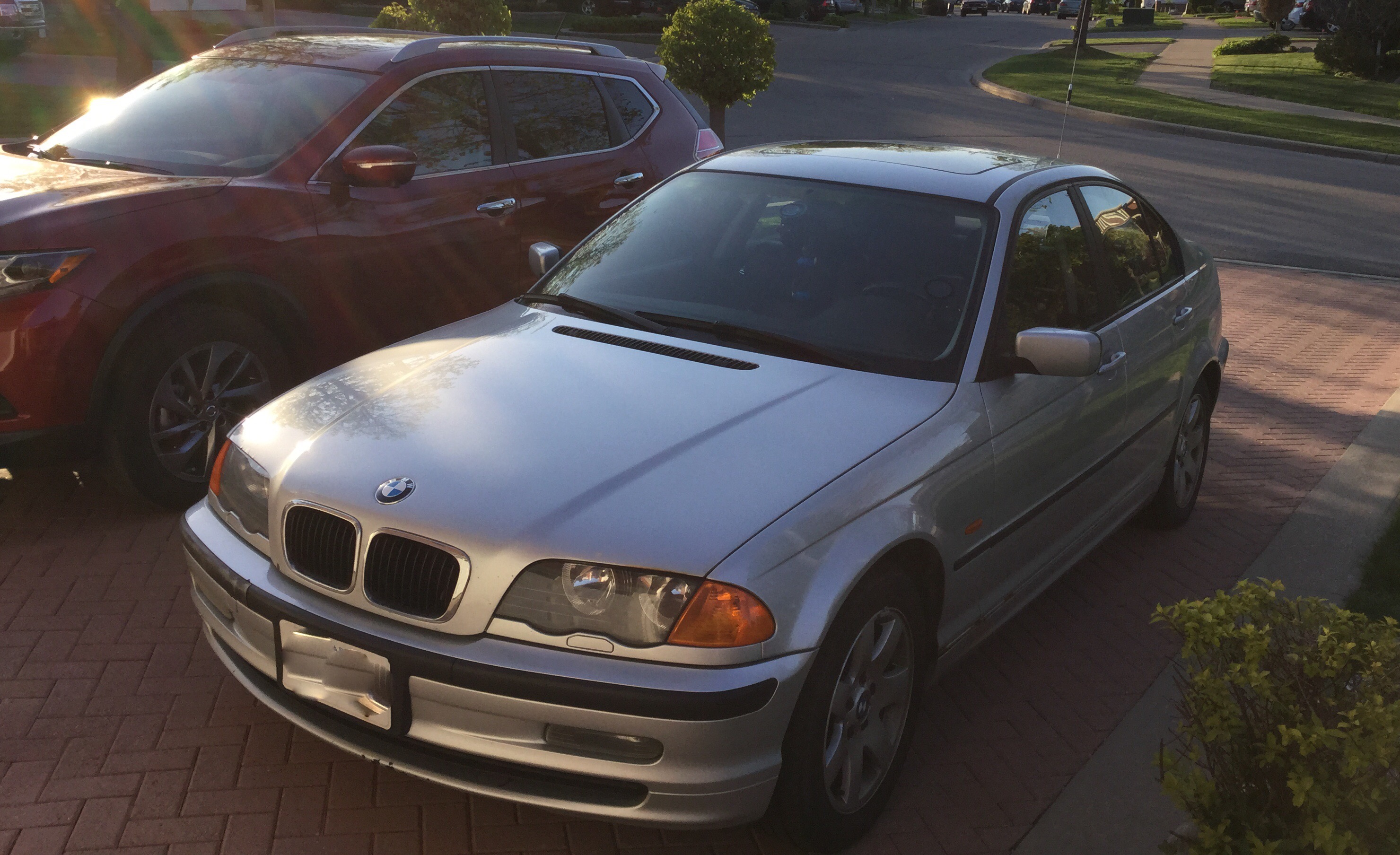
My 2000 323i BMW with a trunk mounted antenna
My personal vehicle, a 2000 BMW 323i is presently my Southern Ontario chase vehicle. It’s getting up there in age, wear and the body is starting to slowly go. I would never dream of taking this car down south into the central plains of the U.S as it would likely get “hurt” by the large hail stones that those storms can produce. Unlike the great plains, hail is a far lesser risk in Southern Ontario and it’s extremely difficult to find anything that can really start to threaten your vehicles body.
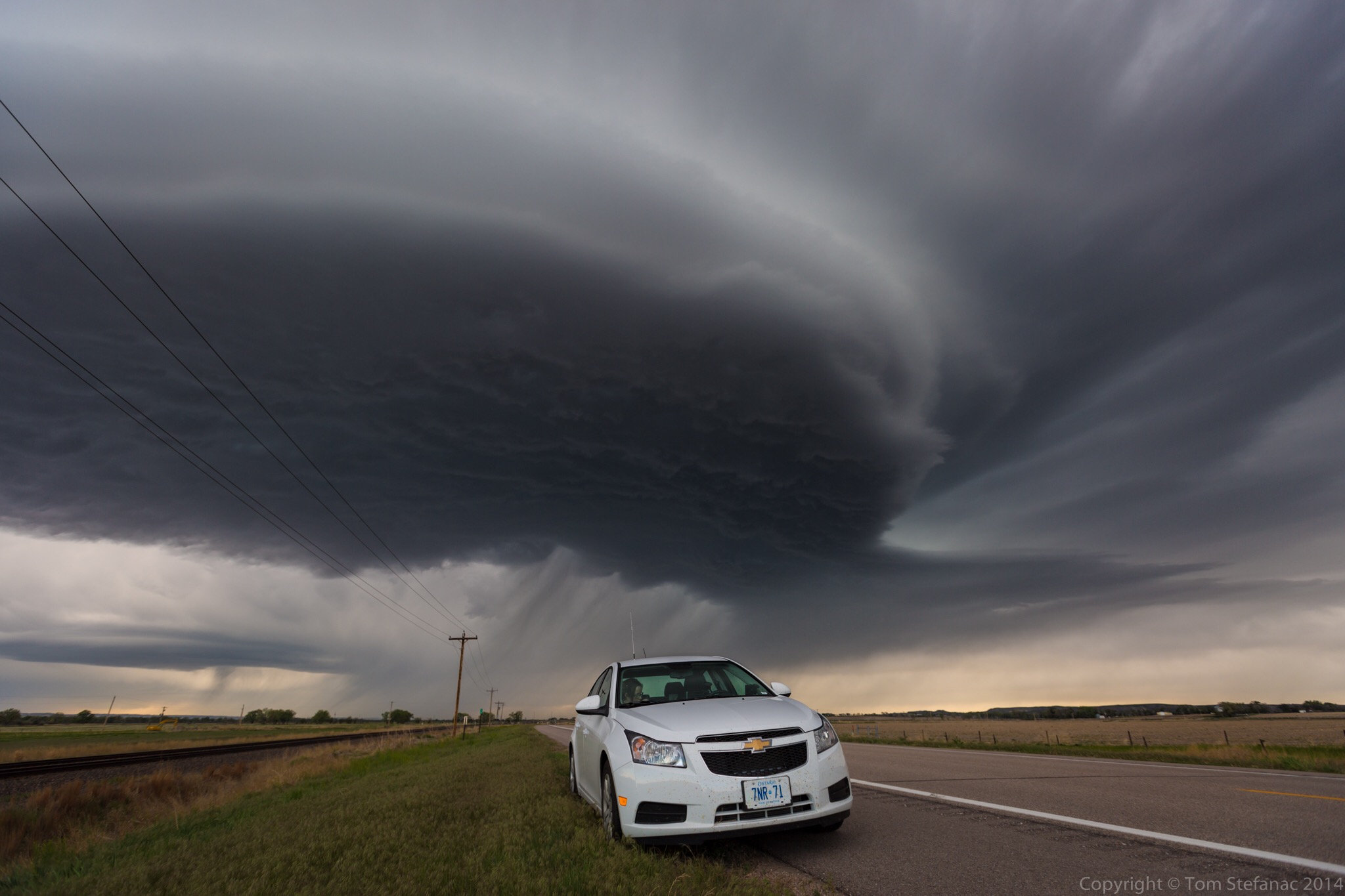
My 2014 Chevy Cruze in Nebraska as a low precipitation supercell bears down
As far as rental vehicles go, I’ve used a 2010 Honda Civic, 2011 Chevy Impala, 2014 Chevy Cruze and more recently a 2014 Toyota Corolla. The “joy” with all these vehicles is that my installs need to be sturdy yet completely temporary without any trace once the car is returned. Whether it’s a rental car or not, I treat all vehicles as if they are my own and really take care of them.
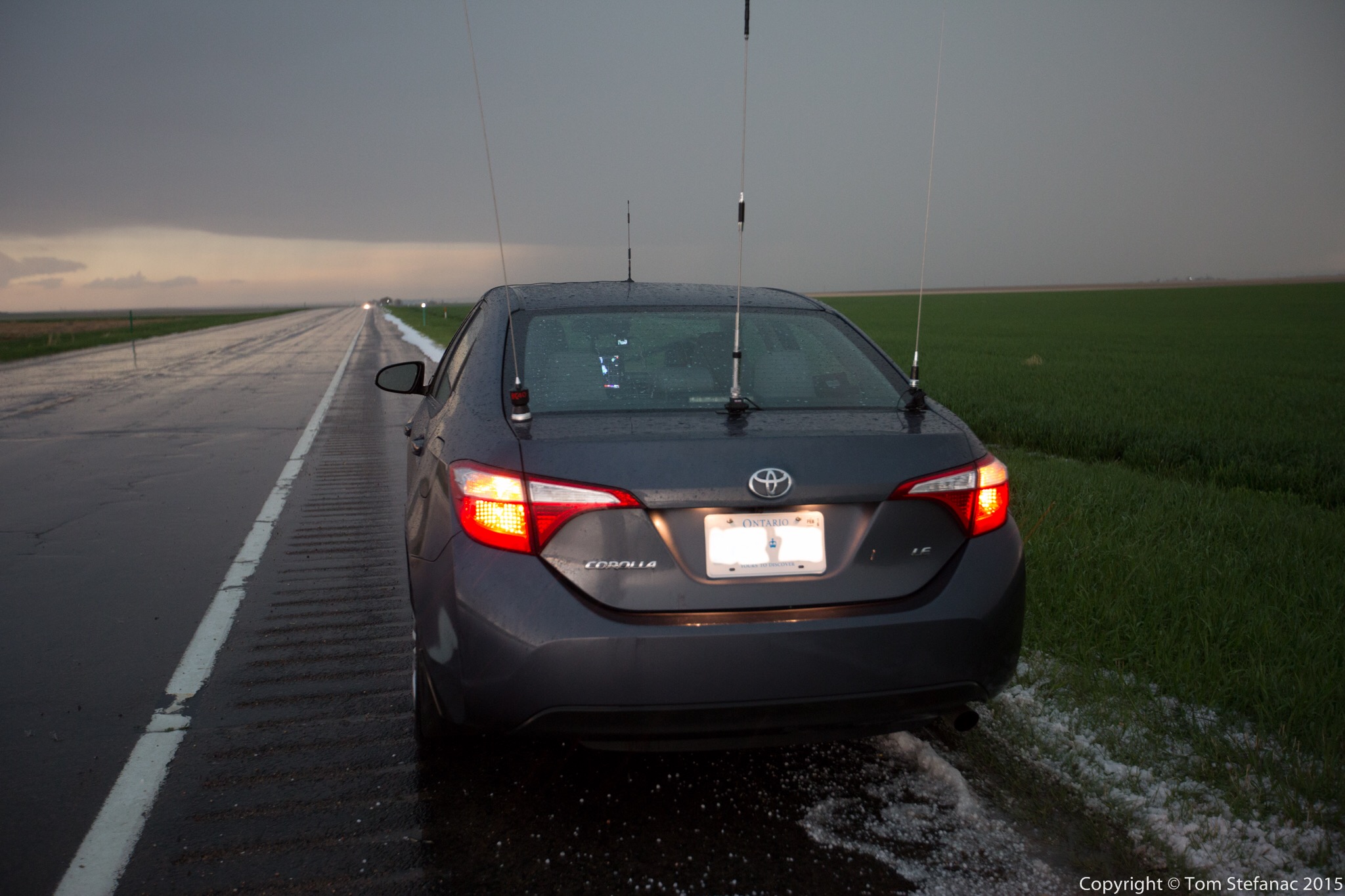
My 2014 Toyota Corolla on a Colorado highway after flooding rain and small hail
No matter which vehicle I’m using, whether it’s my own or another there are a few basic items that always go.
The first thing is my HAM radio, I’ll always take my Icom V8000 with a 5/8th whip antenna that’s trunk lip mounted. If there’s space I’ll also take my quad band Yaesu FT-9800. I like the V8000 becuase it has a whopping 75 watts of power and when you couple that with a high gain whip antenna you can go the distance. It’s also very efficient for simplex transmissions maximizing the efficieny of low power transmissions. The FT-9800 gives me flexibility to use any repeaters that are in the area no matter what the frequency so I can always get into or listen in on any skywarn or canwarn nets.
The second item I always bring is my manfrotto magic arm / Sony CX700V combo. This ensures I always have a good working dashcam that I can pan/tilt/zoom. I’ve also recently become a big fan of just using my GoPro inside for super wide shots through the windshield. The GoPro is a Hero3 Black unit and shoots beautiful 2k video. Between the two cameras I can get a wide and tight shot of the same or different subject matter which is great. It also minimizes windshield clutter.
The third item or items I should say are my tablets/mobile computers. Currently I have a Nexus 7, iPad Air 2 and Dell Venue 8 running a full Windows 8 desktop environment. The Nexus 7 is great for PYKL3 while the iPad Air 2 hosts a cellular chipset and not only provides me with a mobile hotspot but runs Radar Scope beautifully. Lastly, the Dell Venue 8 can run windows native programs like GREarth, Level 3 and Level 2 Analyst without any issue in addition to a host of other programs such as Digital Atmsophere and Unidata IDV. These three devices I can power from two Anker chargers, and there’s very little draw on the vehicles electrical system plus the batteries last forever and they occupy very little space unlike a clunky laptop.
My essential non-optional items are my cell phone, camera gear, GPS and a road atlas. I also carry basic emergency gear with me at all times which includes some pylons, flares, a safety vest, first aid kit, bottled water, electric tire pump, automotive tool kit, full gas canister and jumper cables. In theory, I should be able to handle most any emergency with my basic emergency gear. The biggest threat all chasers or anyone doing a lengthy road trip in a relatively rural area faces is a flat tire. Depending on the severity of a flat, a canister of run-flat tire filler can prolong your drive when coupled with a good electrical tire pump. The other option is changing the tire then and there at the side of the road which is where the cones, tools, vest and even potentially flares come in handy. The gas canister is also a good idea. I’ve been in situations before where storms have knocked out power and suddenly I have to drive 200km on a quarter tank of gas. A 10 or 20 litre can will get you an additional 150 – 300 kilometers and more importantly gives you peace of mind that you’re okay.
The GPS is a no-brainer, when used correctly it does all the hard thinking for you or at least the majority of it. Plus, it keeps you on track, when your chasing and busy thinking about so many other things it’s easy to miss a turn but the GPS will at least remind you that your turn is coming up. Plus you can see all the roads around you and it’ll help with your judgement calls. There is one major problem though with anything electronic, and that’s the possibility of failure. As such, I always keep a road atlas with me, the atlas never fails, does not need batteries or a power cable and works in any weather. I also like to use the atlas to see rest stops, nearby towns, primary roads and it gives me a quick refrence of what’s around.
You might be wondering why I seem to choose smaller 4 door sedans over midsize vehicles? The answer is simple, for me, chasing does not have to be about having the biggest or baddest vehicle on the road. I choose my vehicles based on the volume of space I need. Smaller vehicles also have better gas milage and better overall range. Larger SUV’s are certainly more capable off road but I find choosing to go off road can be a disasterous idea at times, especially since these roads can have my uknowns such as obstancles, flooding and hazards like potholes. No matter what vehicle your in, attempting to cross a flooded roadway with an uknown water depth is dangerous, and no SUV can drive beyond a dead-end road in time to escape a tornado or hail core bearing down. So with these things in mind, I realise that I don’t really require the added benefits of all-wheel drive or higher wheel bases that suv’s provide. Instead I choose to stick to paved roads, or only venture short distances with plenty of escape time on unpaved roads.