Monthly Archives: June 2015
June 27th 2015
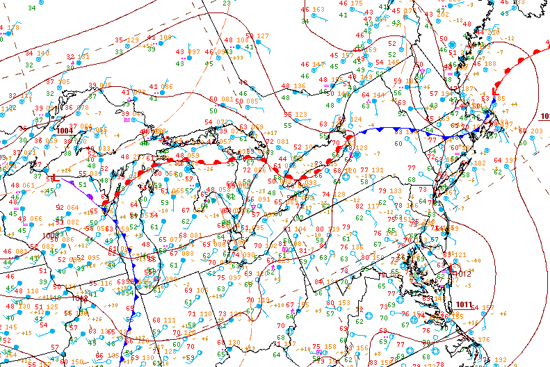
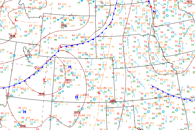
This was a very unusual weather patter for late June. Basically, a low pressure system amplified by a neutral trof developed over southern Illinois and quickly deepened when an MCS formed with the center of the low and fed back energy. The low pressure system then quickly tracked north-east from Indiana and occluded as it reach Southern Ontario. Despite the occlusion occuring, there was enormous low level wind energy and weak instability which allowed the system to continually fill with rain and weak embedded storms all in addition to remnant moisture from the pre-existing MCS.

Despite this being a synoptic system that really just made for a miserable and cool weekend, I somehow decided that it would be a good idea to head down to the Lake Ontario shoreline. It was actually very tropical storm like with constant winds and rain bands battering the shore and his actually created some interesting weather.


June 25th 2015


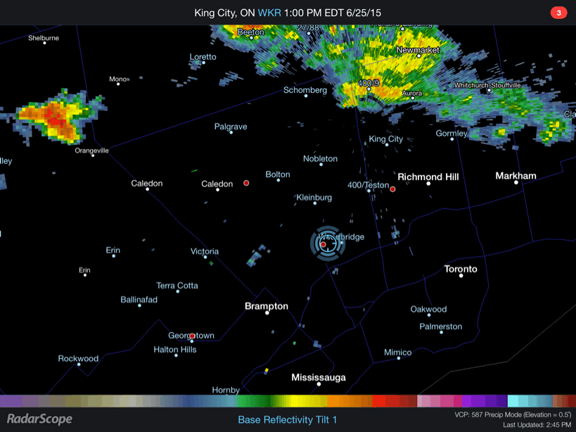
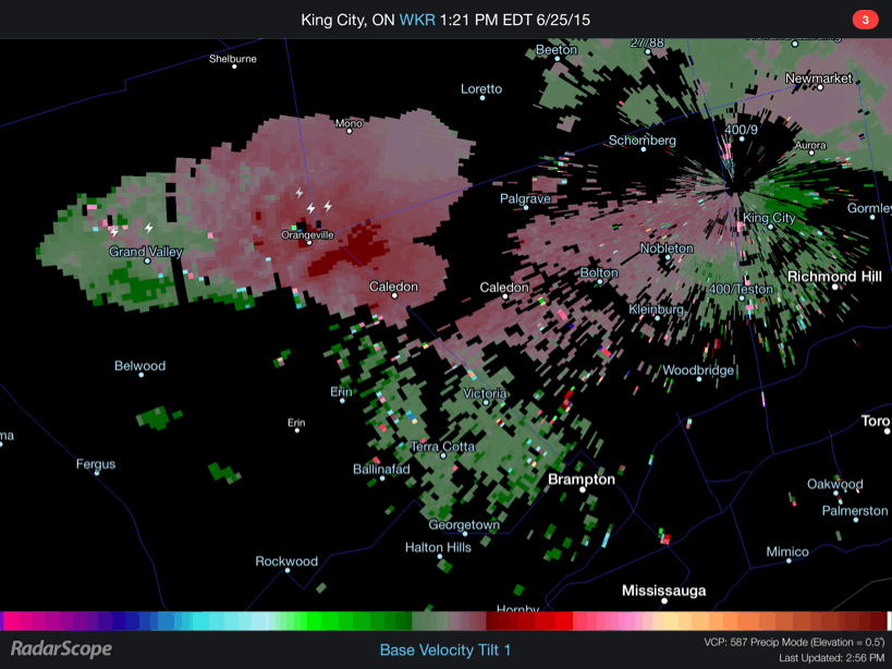
Here are a couple GIF loops showing the storm and the associated velocity couplet. You’ll also find a time-lapse video at the bottom showing the supercell mesocyclone and associated wall cloud in motion with clear rotation.
June 8th 2015
This was one of those somewhat unusual setups where storms were poised to fire along a trough from a secondary low behind a weak cold front. The initial cold front brought weak storms and drenching rains overnight and into the morning.


April 30th 2015
This was the real start of my chase-cation. There was a very marginal potential for severe storms and tornadoes were a virtual impossibility based on probabilities. It was a usual weird as could be high plains setup where by some miracle of the storm relative wind fields and near non existent moisture, the high plains would somehow produce storms which would grow in strength by evening and eventually everything would be pushed out by a cold front sinking south from Wyoming. Weird things happen above 1500 meters in elevation!


May 11th 2015
On this day a messy warm front which was severely stunted by the cold water of the great lakes struggled to make it into Southern Ontario. Shear profiles supported a linear squall line at best along a trof line and energy was very weak with peak cape around 800 j/kg.