Posts By Tom
The APRS RX-iGATE Problem
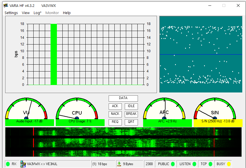
The receive only iGATE problem.
Today we live in a world full technology that simply did not exist when APRS was developed, in fact the simple TNC that is the driving force behind everything has evolved greatly. Today, TNC’s are more sensitive than they were years ago but the APRS system faces several problems.
Even though modern TNC’s are quite robust, they underutilize the available audio spectrum. If we look at systems such as VARA and Packet, they have a much broader range of sounds that are used to pass traffic. A TNC on the other hand has far fewer audio tones limiting the total throughput. These means there is virtually no error correction, whereas if the entire audio spectrum were used there would be the potential to fold error correction data into APRS signals. But this is a topic for another day.
The current APRS systems in two worlds, there is the traditional packet APRS system which is essentially RF data flowing through the air and hitting digipeaters, gateways and of course APRS stations which can be portable, mobile or fixed. Then there is the APRS-IS network which is the internet side of the APRS system.

Originally APRS was deigned to be an independent system, which it can still function as today, but of course it would be silly to not integrate the APRS RF system with the internet which is why we have the APRS-IS system. This is the means by which many modern iGATE’s and even Digipeaters send RF data to the APRS-IS network.
The idea behind digipeaters was that sites which had a great location (such a mountain top) would capture and repeat APRS signals until they made it to their desired destination. This system works but there are a few problems, in places where you have a substantial amount of traffic and few digipeaters, you can run into substantial bottlenecks and put individual digipeaters under enormous stress. Furthermore, if there is a break in the system, a gap that an RF signal cannot jump between sites, there is a potential break in the system. It is also highly inefficient to route traffic thousands of km away and around to get to a user when the most efficient means would be a straight line. So of course, the internet can take a substantial amount of strain off the RF side of the system and directly route packets to their destination.
But here in lies the problem. APRS was designed to be a two-way system, transmit and receive. Afterall, how in the world are you supposed to receive signals, messages and pass traffic otherwise?
Today we have a major problem growing with APRS, it is a combination of a lack of user understanding and the proliferation of cheap technology.
I recently heard a fellow ham mentioning he wanted to use a SDR and raspberry PI to create a RX only iGATE. We ended up having a great discussion about it, but this is a common recurring problem and misconception. The fellow ham was interested in mobile stations and helping to get them into the APRS-IS network not understanding that APRS is not APRS-IS.
APRS tracks with Digipeaters & iGATES
Today depending on where you are, there is anywhere form a 3:1 ration to 11:1 or greater for receive only iGATE’s to those which are fully bi-directional. The problem is that this breaks what was once a fully bi-directional system.
As an example, let us say I want to send a packet message to a fellow ham several hundred km away. He is within range of a digipeater, and I am within range of both a digipeater and receive only iGATE. I send him the message from my radio, and he receives it. He then responds promptly responds. Now because my signal into the iGATE is stronger than that which made it to the digipeater, the RX iGATE takes preference as the gateway. Unfortunately, because it is receive only, it can’t transmit his response to me. My radio, waiting for a message received confirmation beacon decides the message has not gone through since there is no confirmation. So, it tries again and re-sends the message. Again, the RX only iGATE picks it up and sends it to my friend. He again responds. Of course, I never receive his response.
You can see how this is immensely problematic, if it is easier for me to get messages into the network than receive then we have a broken loop problem.
Bi-directional APRS messages flowing back and forth
Unfortunately, many hams do not understand this and treat APRS as a one-way beacon system only worried about injecting data into the APRS-IS network when in fact it is not designed this way. The other argument I hear is that the iGATE’s fill in the gaps. This may be true if they acted like voters do in a commercial system and the TX-iGATE was several hundred watts, but that is not the case.
So, what is the solution? It is not simple, but there needs to be a filtering implementation where receive only iGATE’s look at the traffic to understand whether it is message traffic or not. These gateways can then flag message traffic in the APRS-IS system as received via RX only iGATE. Then the system would have to ignore any duplicate messages/retries. The system would have to be intelligent enough to force received beacon messages back through the system once the transmitting station is within range of a bi-directional gate or digipeater. Any responses to the original message would have to be held until this time and then pushed through until the designated recipient station send a confirmation that the response has been received.
As you can see the above is not easy to implement but is becoming necessary as the number of receive only gateways quickly outpaces those which are directional.
I would also strongly encourage hams to look at methods to build bi-directional gateways such as through utilizing a TinyTrak4, mono-band 2m radio and Raspberry PI. We do not need more receive only iGATE’s, we need more bi-directional systems, in fact APRS should really be a 100% bi-directional system as it once was.
So please consider this the next time you are thinking of setting up a receive only site.
The RTTY Contest Problem
Sorry, I cannot pass this emergency traffic right now because there is a RTTY contest….
There is truly little in the HAM Radio aka: Amateur Radio world that I complain about, especially in the digital modes since I play around with them a fair bit, but there is one major exception. RTTY contests!
RTTY signals washing over a Winlink VARA-HF connection
RTTY or Radio-Teletype is one of the original forms of text based digital communication implemented in both commercial and amateur high-frequency radio and even on the VHF band. While technology has come a long way and RTTY use has dwindled there are still RTTY enthusiasts just like CW (or morse code) enthusiasts and other users. So even though RTTY by all standards is an outdated old method of data transmission, there are still people out there who engage in RTTY conversations.
My issue does not lay with RTTY enthusiasts, but rather what happens when we have contests in specific modes and the effect these contests have on large portions of multiple HF bands.
It is no secret the three primary bands radio amateurs use are 80 meters, 40 meters and 20 meters. These bands have unique propagation characteristics that are dependent on the time of day, solar cycle and intended use. For example, 20 meters is a daytime band with a good low noise floor (relative to other bands) and signals can often travel thousands of kilometers. So, if you are floating in a boat out at sea some 2000km away from the shore and need to check email at 9AM, 1PM and again at 5PM, that is your band. During the evening hours and overnight the 40-meter band can really go the distance, the noise floor is usually not as good as 20-meter but not horrible by any means.
But what if you are floating in your boat and you are only about 800km from the shoreline during the daytime? The problem is, the 20-meter band may overshoot (literally) the Winlink RMS gateway station you want to connect to, so in that case you go lower in frequency to 40 meters and presto, it works. If you are even closer, 80 meters might be more reliable with faster data rates due to a better SNR although the noise floor is typically higher than 40 meters.
But what happens if there is a RTTY contest? Nothing, you will have a hard time getting through regardless of the band you use! Hopefully, you have some other way of getting in contact with the shoreline when you need parts or have an urgent email waiting for you from a land based relative!
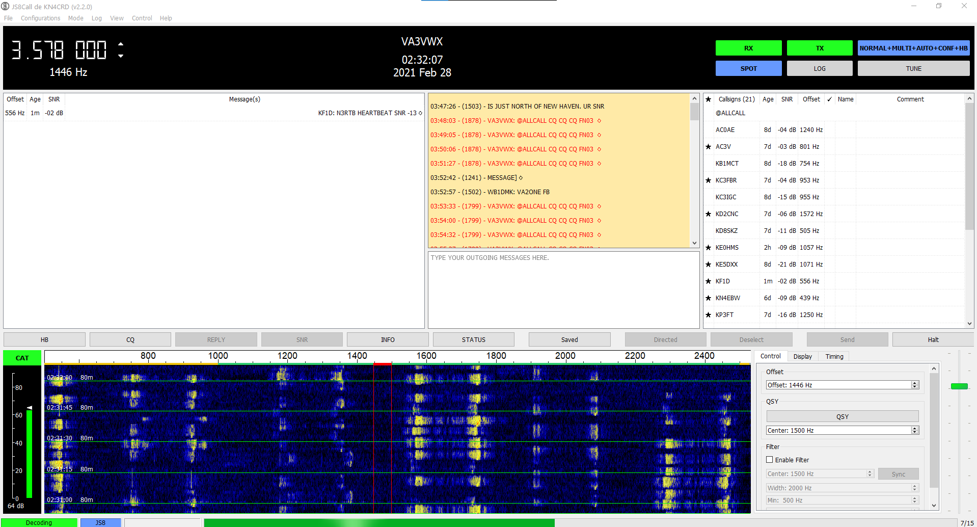
RTTY signals in the JS8Call software
Okay, so you are floating in your boat and your VHF marine radio cannot reach anyone and the HF marine radio is acting up, but that is okay because you can relay messages through JS8CALL on your amateur radio and even get data into the APRS-IS network. You can literally use APRS to send a SMS via SMSGTE to your emergency contacts on shore who can then send you a Winlink email! At least they will know you are in trouble, right? Well, if you look at the waterfall above…. nope, good luck! JS8 which uses the FT8 protocol is robust, but it is always nice to hear heartbeat beacons that give you a SNR. If they can hear you, they let you know, and you know then your message has gone through!
Except, that is not going to work because the RTTY contest is bleeding all over JS8CALL and where all the relay stations reside and HB section too. GOOD LUCK!!! With RTTY signals washing all over, you are in trouble.
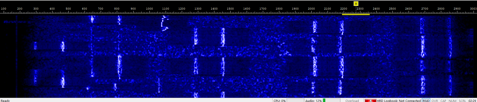
RTTY signals in a standard waterfall
The problem with RTTY that no one likes to acknowledge is that it is a largely inefficient outdated mode. Unlike FT4, FT8, PSK31, JS8CALL, SSTV modes, Olivia etc. which all tend to be narrow signals and stick to little 2700 HZ wide portion of a single frequency or two frequency, RTTY signals are quite wide, noisy, do not tolerate interference well and do not stick to any small area or frequency during a contest.
When there is a FT8 or FT4 contest, everyone is generally confined to a small section of whatever band they are operating in and these signals do not interfere with the rest of the band. The same is largely true with PSK31 and other modes where users tend to be confined to small slivers of the band.
Meanwhile, with RTTY, it is like having a very wide FT8 signal and everyone just sits all over the place all day long, it is akin to using the whole digital and even a large chunk of the CW section of an HF band for FT8 with magnitudes of greater inefficiency.
Sure, contesting is fun, and I do not have anything against RTTY, but when it creates problems for all sorts of users across large sections of different bands, we have a problem. Now I understand, Winlink RMS sites sit across a multitude of frequencies in the digital section of the band plans and we cannot reasonably expect there not to be any overlap. I understand that, but that is not the problem, the problem is every single RMS gateway is crushed by RTTY traffic rendering all the HF Winlink system unusable and that is a problem. It even renders the tiny sliver of spectrum JS8 uses almost unusable, that is a problem. In fact, the only part of any band RTTY contesters seem to avoid is that part occupied by FT8 signals because even a weak FT8 signal will walk all over a strong RTTY signal and there is always a ton of FT8 traffic. So, all these contesters avoid it like the plague.
So here is my proposed solution:
All contesting bodies need to lay out a specific range of frequencies on specific bands to limit interference with other digital modes, end explicitly state that points will not be awarded for stations operating outside of said frequencies. There can also be time restrictions placed of specific parts of band to help get traffic through. Yeah, that means more RTTY signals will be packed together into a tighter space, but ham radio contests are supposed to be fun, they are not life and death, they are not important priority and welfare traffic. That is what people need to understand. When you need to use 80m, 40m or 20m for important traffic, the last thing you need is someone calling CQ CONTEST making it harder for that important traffic to pass. Just ask the CW users how they feel after a RTTY contest and you will know, something is seriously wrong.
May 19th 2019 – Childress, Texas
Okay quick short long update…. hahaha I know it makes no sense!
So we started the day in Woodward, OK and it was nice to finally sleep in catch up on some much needed and missing sleep. We decided a late checkout was best. In an interesting twist, we booked the room well in advance and it turns out Greg Johnson and his chase tour were staying at the same Super8 in Woodward.
Look a funnel… NOT
It was nice to meet Greg again and I also got to see Chris Chittick again, the last time we truly spoke at any length was at a gas station just south of El Reno in 2010 when he was with Reed Timmer in the Dominator. I also got to meet a few other twitter users who I regularly engage with including Jade and Randy. So we hung out a little at night and I took this selfie the next morning before we headed off to our target hotel in Childress, Tx.
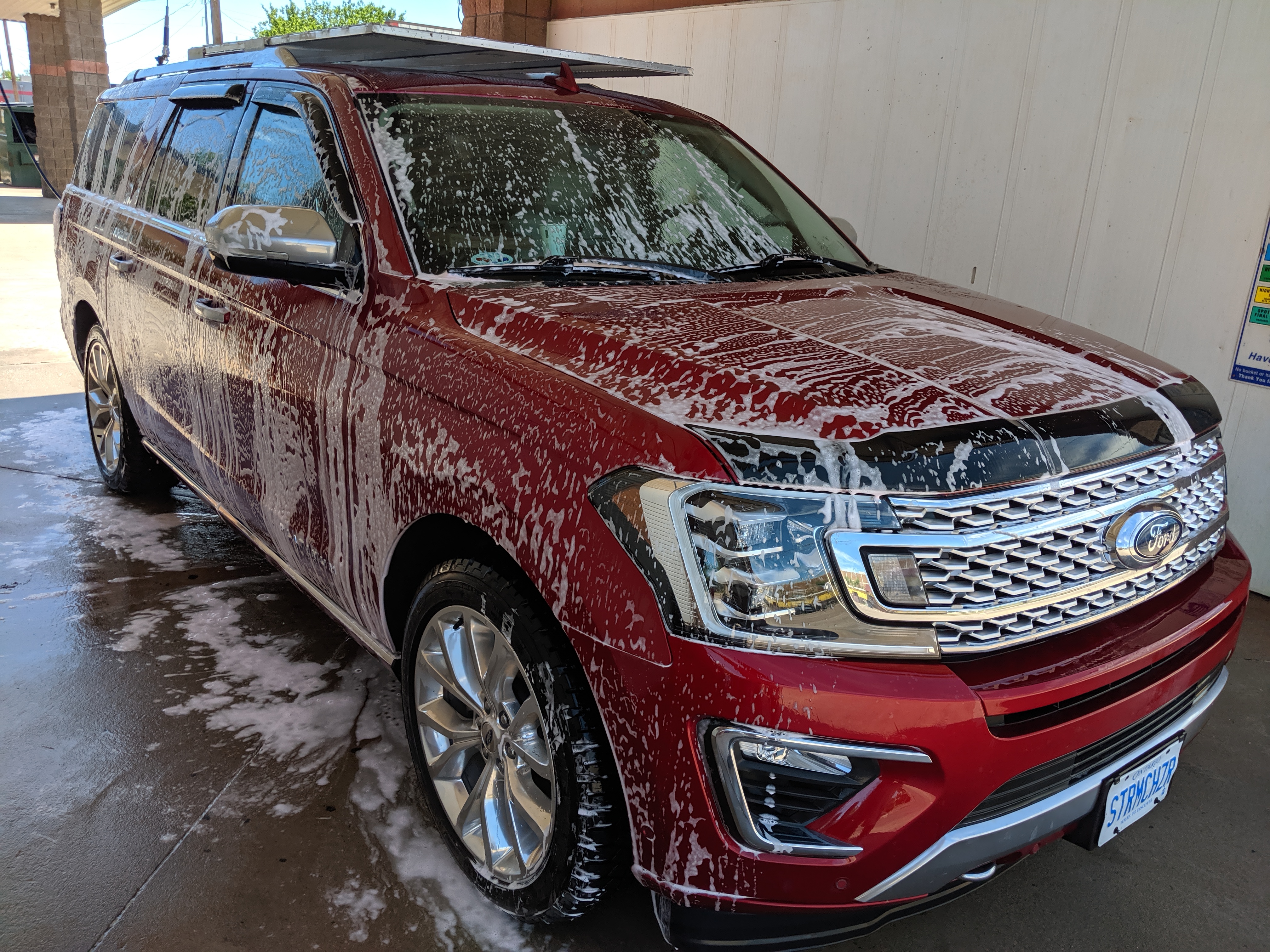
Cleaning the Ford Expedition
MaryAnn made sure we cleaned the chase car! She can be a little OCD and the fact it was covered in dirt and mud spatter from the previous days chase was killing her. So a quick was resolved that issue for the time being. After the wash, MaryAnn was in communication with Kathryn & Dave, two fellow chasers from Chatham Ontario that I’ve never met in person, who were also in Woodward. We all met at the local Braum’s Ice Cream shop and had lunch, it was a pleasure to meet Kathryn & Dave in person.
After lunch, it was southward to Childress. It was a nice pleasant drive that brought us through Wheeler Texas, a little town which I’ve been through many times and ironically is the setting for a movie of which I’m the executive produce (Sixty Minutes to Midnight). Our director Neil Mackay had never actually been to Wheeler in person so I made sure to send him some quick photos showing this his pre-production research had paid off.
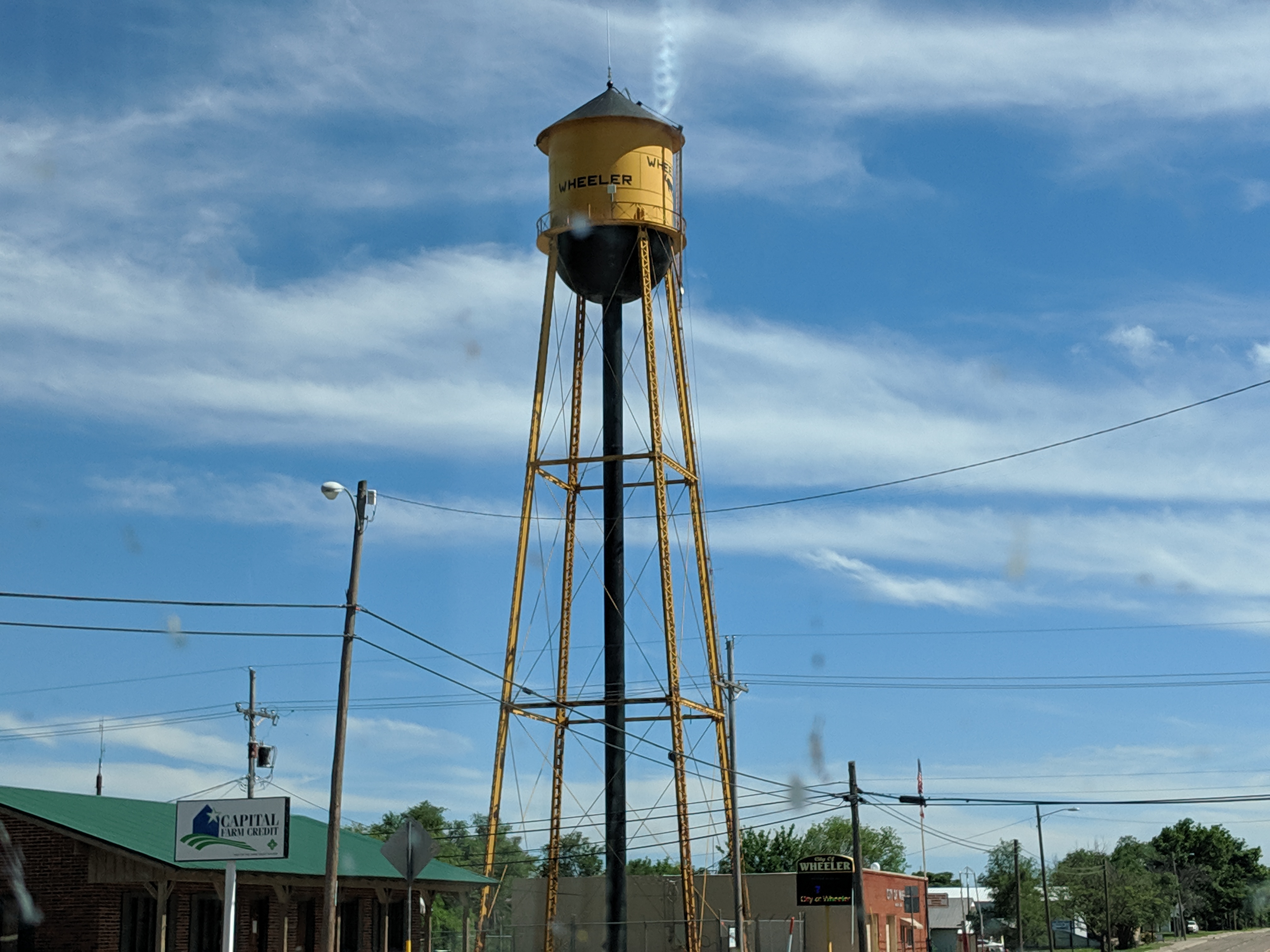
Wheeler Texas
Once we landed in Childress, we did the usual stuff, hit the store and grab some food. We actually booked out hotel at around 11:30AM before we had even left the Super 8 in Woodward, and it was good that we did. The hotel actually had chasers when we arrived at 5PM and by 8PM the place was an absolute zoo, which was a good thing. I ran into several chasers who I’ve spoken with over the years and then had the opportunity to meet a legend in the chase community, David Hoadley.
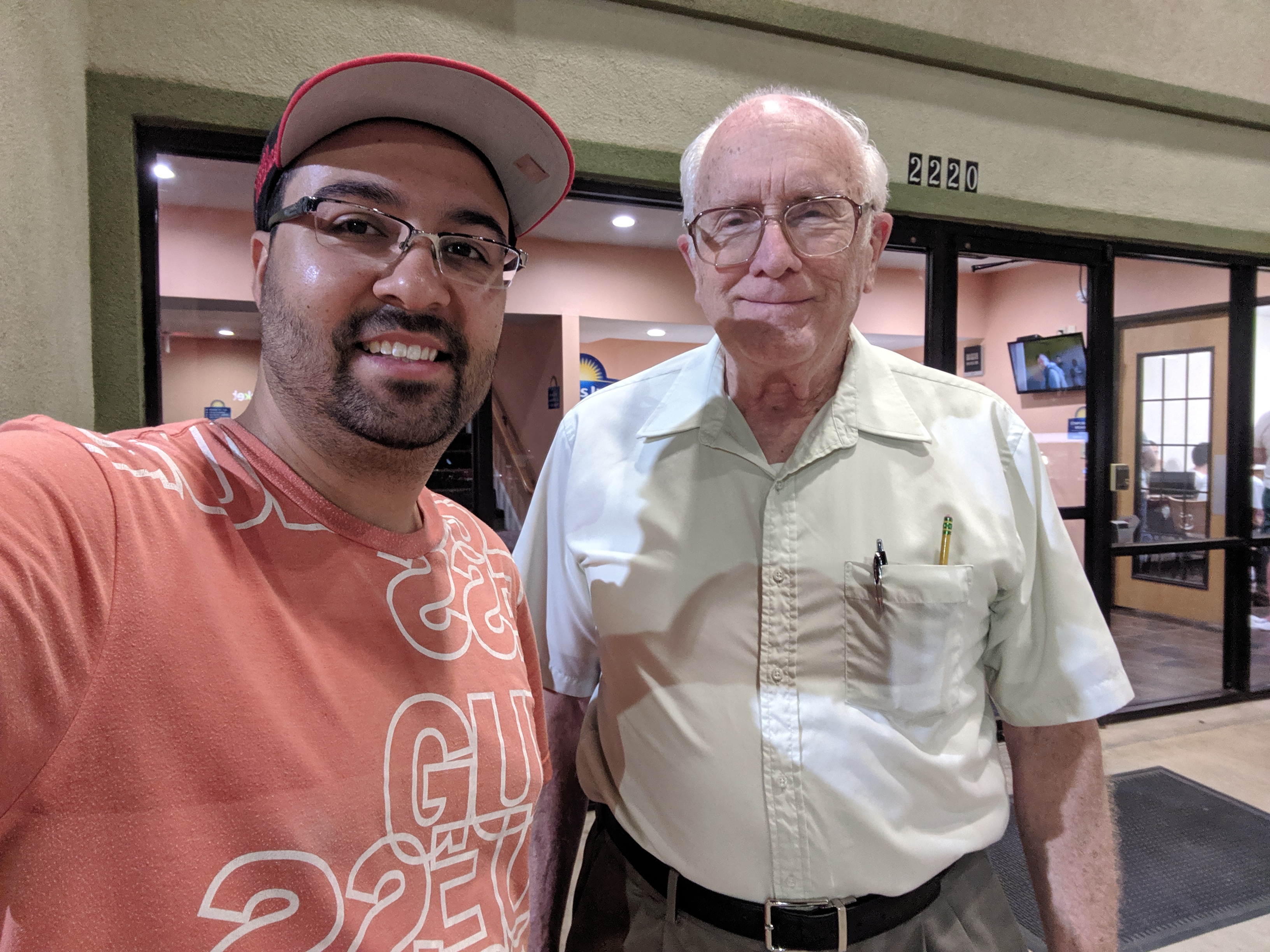
David Hoadley posing for a selfie
David was the original founder of Storm Track Magazine and essentially is known as the first recognize storm chaser. He essentially started it all as a professional photographer and has written about the ethics of chasing, photographing storms and many things over the years. In many ways he is a true legend within the community and I’m overjoyed to actually meet him in person. We had a brief 10 minute discussion and he was a wonderful person to talk to. He is also such a wealth of knowledge it is just phenomenal.
Now on to the serious stuff… tomorrow is a serious day. While I storm chase to see the amazing power of nature which is just mesmerizing there is the reality that things on high risk days can get out of hand quickly. My focus will be on the safety of our group, and to make educated, safe and intelligent choices to help us find out way to any potential tornadoes and do so without getting in trouble. Likewise MaryAnn will have the responsibility of safely driving the vehicle even in potentially adverse conditions. Safety is priority one, which means eyes on the road and eyes on skies. When there are this many chasers in a potentially small areas people do silly things and collisions, which can be serious are a possibility. Our goal is to avoid any such issues.
There is another thing storm chasers sometimes forget. On days where the risk is high and large long track tornadoes are expected, there is a high likelihood some people will lose their homes, properties and potentially their life. This is something I do not take lightly. I have witnessed enough devastating tornadoes to know what happens, I have seen enough communities wiped off to map to know the pain such devastation these events cause. I absolutely, do not wish for a tornado, I do not wish for anyone to get harmed. As a chaser, I’m going out there to see nature, I can’t stop it, I can perfectly predict it and I don’t with such devastation upon anyone. As a group there is an understanding that if we come upon tornado damage, we will render assistance as best as we can and we pray that people who may be in the path of these storms are spared any destruction.or loss.
So with that said, it weighs heavy on me knowing that tornado may be a day that changes some peoples lives and I hope that I’m wrong but fear that I will not be.
May 18th 2019 – Woodward, Oklahoma
Started the day off with tornado warnings to our south in Texas as a line of storms went up. We spent the night in Miami, Oklahoma east of Oklahoma.
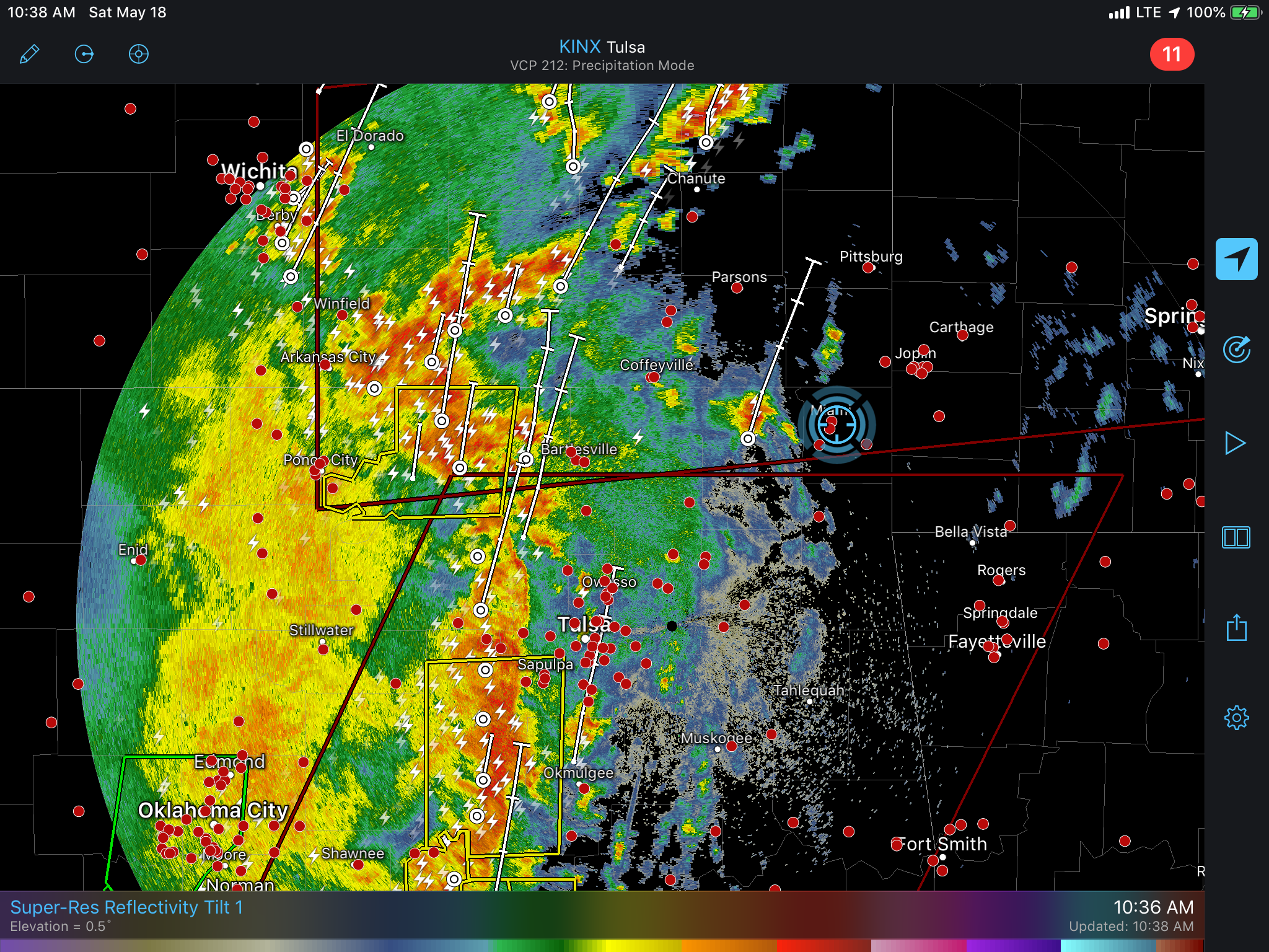
We targeted Woodward early on and chased a few storms very briefly as we punched through the MCS / QLCS that was expanding north from southern parts of Oklahoma and North Texas. Despite a couple brief mesocyclones showing up on radar the storms lacked any serious surface interaction.
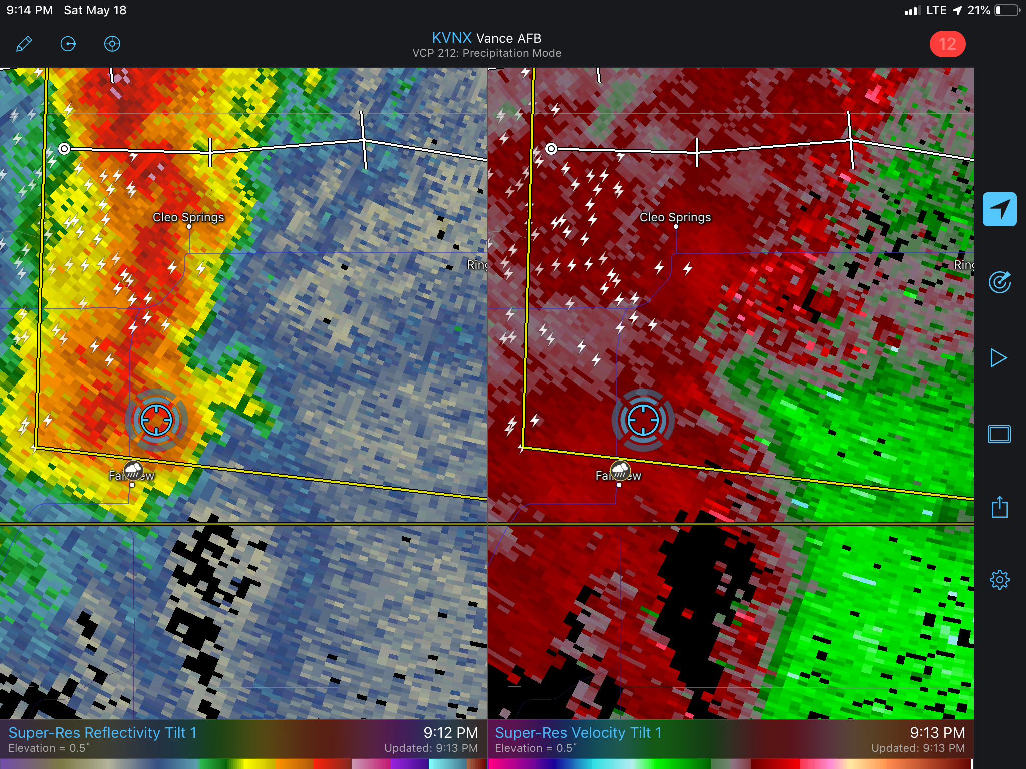
After some fine tuning we ended up in Waynoka and watched the storms initiating literally over the town.

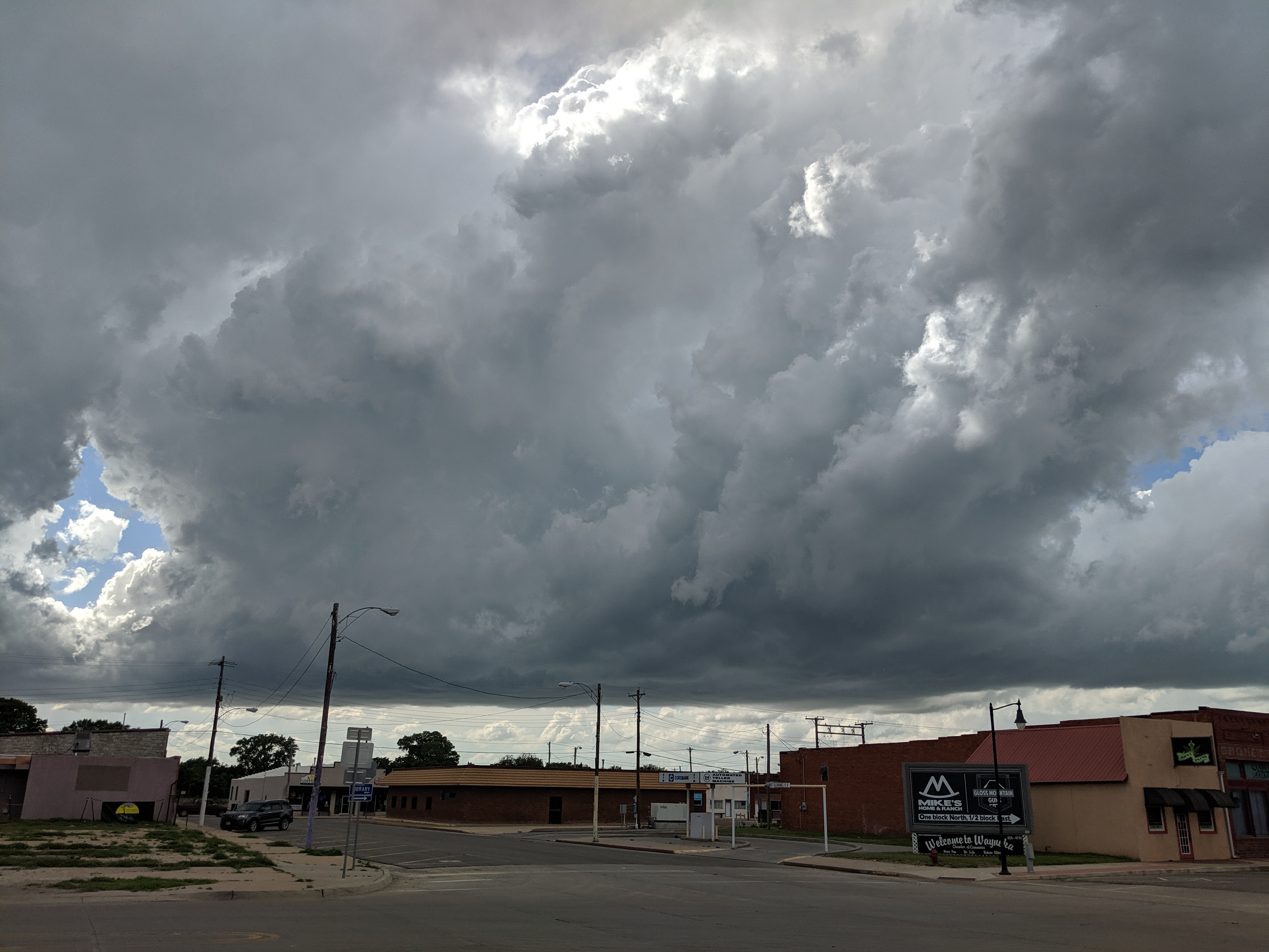
The storms looked good initially but it became apparent pretty quickly that the energy.values had been over estimated and the storms lacked good mid level and upper support despite low level wind fields and even the surface flow supporting discrete supercells.
We watched a few storms, one which became photogenic and even had to wolf down dinner as a storm with a couplet blew through.
Heading to Woodward for the night, update with photos to follow.
May 17th 2019 – Ontario, Canada
Well it’s here, departure day!
I only got about two hours of sleep last night and hit the road at 5AM.
I met with MaryAnn at 7:50AM at her place in Strathroy, loaded out her vehicle and we’re now on the road in Michigan heading to the airport to grab Neil and Matt.
No destination target yet. I’ll begin working on that shortly!
May 14th 2019 – Toronto, Ontario
So I’m at the point now where I’m packed for the most part and here’s what I’ve learned over the years.
I have always habitually over packed, and it arises from the fear of needing something I may not normally bring. When chasing at home or locally I bring all of my lenses, 4 DSLR cameras and two or three video cameras. It may seem like overkill but I have had cameras go down at the least opportune times and having a backup has served as a remedy to this. Also, bringing all my lenses means I can do anything whether it be macro or super-telephoto, even artsy fisheye stuff is fair game.

The lens collection
What I’ve come to discover over time is that for tornado alley trips, I really don’t need the majority off the stuff I bring. It ends up just becoming a slog fest where it feels like I’m moving everyday with pelican cases, backpacks and the like. At the end of a long chase day the last thing you want to do is move stuff when you’re mentally and physically exhausted, and this is on top of the fact that batteries need to be charged and memory cards need to be cleared. I’m also burdened with the task of figuring out the next target. So the last thing I want to do is move a bunch stuff.
I’ve come to discover that on these trips I really just use the workhorse equipment. The two lenses I fallback on are the Canon 11-24mm ultra-wide and 70-200mm telephoto. In years past I’ve brought everything, and I mean everything including the 800mm which is just overkill. From a practicality point of view, because of haze and atmospheric distortion, you can’t really zoom in past 200mm, there’s simply too much clutter in the air, so for tornadoes and storms anything beyond the reach of a 200mm lens is impractical. In an ideal world the 24-70mm should also be on my list but the reality is that I rarely use this lens with storms, everything is either ultrawide or zoomed in. I have found the 24-70 is good for lightning, but it tends to be most useful towards the upper end in the 50-70mm range. So I’m still unsure as to whether it’ll be coming along.
When it comes to video, I just rely on two cameras, the Sony AX100 which is a beautiful camcorder, and the Sony A7RII which is phenomenal in all conditions. The camcorder sits on the dash but can quickly be put on a tripod. It offers all the features and function of a video camera which is important because trying to make a DSLR a video camera is painful, and having a built in zoom with a rocker servo and momentary auto-focus are sometimes very important. The A7RII on the other hand is a DSLR but for the chase trip I leave it fitted with a Canon 16-35mm wide angle lens and it just shoots beautiful wide shots of storms.
Here’s the problem ultimately with having and bringing too much gear – despite what you think you can do in your head, the physical reality is very different. In 2010 for example while a nice cone tornado dropped from the sky in Watonga OK I was so busy trying to operate 4 cameras I did not really enjoy it all that much. It’s a physical impossibility to shoot with two DSLR’s and keep track of two video cameras at the same time. On later trips I tried to just leave GoPro’s going all the time but then you end up wasting memory, and their lenses get dirty. In the end you don’t really pay attention to any specific camera, and what you get is poor quality content. It’s better to just focus on one or two things and not worry about a plethora of gear.
Cone tornado in Watonga, OK – May 2010
The other issue to consider is loadout and how that affects your ability to safely observe. There are many situations where you simply do not have much time at one location and every second you spend unloading photo and video gear is one less second you have to use it and one more second you have to spend putting it back in the vehicle. So ultimately, you cut down your observing time and if you underestimate the amount of time needed to pack up and run, it’s easy to get into real trouble, and it’s a lot harder to get out of trouble than it is to get into it.
May 13th 2019 – Vaughan, Ontario
Just a couple things to share.
But first i’ll start with a story from earlier this morning…
I stopped at a local Walmart for some socks and a couple pieces of clothing. It was a miserably rainy day so I dawned my waterproof shell, headed out and did the shopping. I then drove some 40 km north of the city to my mechanic for a quick oil change. My intent was to leave the car and take the subway back downtown so I would arrive at work on time.
Everything was fine, arrived at my mechanic in Concord (Vaughan) without issue. My mom had called and offered to drive me to the subway station to save me a 15 minute bus ride.
She arrived and it was then, as I transferred my work related items to her car that I realized my wallet had vanished!
I quickly checked my mechanics shop, then called the Wal-Mart in Etobicoke near Sherway gardens… nothing, no wallets had been turned in.
I was pretty panicked and frustrated at this point. I asked my mom to drive me back to the plaza parking lot, I had an inkling it had fallen out of my jacket as I hopped into the driver seat of my SUV.
About 20 minutes later I was back where I had started. I headed in to Wal-Mart and just then I saw it on the customer desk behind the counter! It was soaking wet but together, and I really don’t carry cash and in this case there was none lost but I didn’t care, it was my license and health card I was concerned about. The Walmart employee told me it had just been dropped off by someone who found it in the parking lot.
I can tell you, that’s one hell of a way to start the morning! What a relief and my lesson has been learned, I’m bolting this wallet to my forehead!!!
I’m so thankful whoever turned the wallet in did so, I can’t thank them enough!
Turning towards weather and chasing, Maryann has installed a rather large hail guard to protect the moon roof (moon roofs are basically giant sunroofs because… the moon is bigger than the sun??? No idea why they’re called that).
This will be a huge help, hail is always a battle, I do my very best to not put the vehicle through any sizeable hail but it’s not always easy and sometimes things go south and there’s simply no escape. The windshield is the most resilient and easily repairable glass in the vehicle. It’ll take a lot to break it. The moonroof is about the worst thing to break, it’ll expose everyone to the outer elements, have the vehicle interior soaked along with gear and prove a considerable setback. So having a hail guard prevents us from losing our roof.
I’ve also put in a rush order for an Inspeed anemometer, I already have one unit, but a second will serve as an important backup.
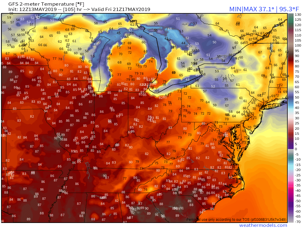
GFS afternoon 2M temperature forecast – May 17th
In other news, I’m happy to report that the GFS is continuing to bump up temperatures, we might not really need our sweaters after all, looks like the warm air will make a solid push deep into SW Ontario, so aside from a cool morning, the rest of the day Friday looks warm and sunny.!
May 12th 2019 – Toronto, Ontario
With just over 3 days remaining, the final push to prepare, sort and pack for the trip is underway.
There have already been multiple tornado outbreaks of varying scales in the southern plains.
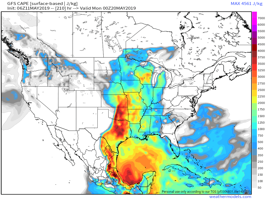
Cape Forecast – Sunday May 19th 2019
As much as I hate looking at operational model runs for convective events days to weeks in advance, the GFS, CMC and ECMWF have been in general agreement showing a very active and prolonged multi-day severe weather episode unfolding. It’s a repeating pattern, one after the other back and forth from west to east until the end of the month before ridging begins building in.
While this storm forecast is important, a more immediate and pressing matter to deal with is the clothing forecast for the drive down. Silly as this may sound many storm chasers, especially those coming from Northern climates tend to dress inappropriately, either wearing too much, too little or not dawning transitional clothing. It’s easy to assume it’ll be hot at the final destination but the weather on the way there is often cool and unsettled.
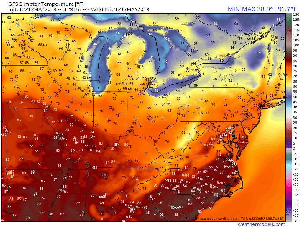
The GFS 2M temperature forecast for the afternoon of Friday May 17th 2019
So for the first leg of the journey Friday it looks like spring wear, once we get deeper into Illinois we’ll finally transition into summer like weather as far as heat and humidity go.
After the dreary spring weather here in Southern Ontario and a painful lack of warm fronts, I’m ready for some sunshine and heat!
May 1st 2019 – Vaughan, Ontario
Well it is the spring season and the chase departure day is quickly approaching!
It’s never easy organizing trips like these because you always end up planning them months in advance and you’re really working on climatology. It’s not easy to guess whether the beginning or end of May will be the “best time” and ocean signals only go so far, a sudden blocking ridge that shuts down the plains is possible even if ocean patterns suggest it is unlikely months in advance.
This year I’ll be heading down as the team navigator & forecaster once again. Maryann Williams will be driver (she’s a little insane) and was kind enough to lend her vehicle as the chase car. Our friend Neil Ellis from New Zealand will be joining us and we’ll have a new companion, a professional photographer Matthew Breiter from Minnesota.
I wasn’t able to head down for the 2018 season in part due to my wedding and work obligations that simply did not spare me the time. But this year will be different and the trip is booked as of March.
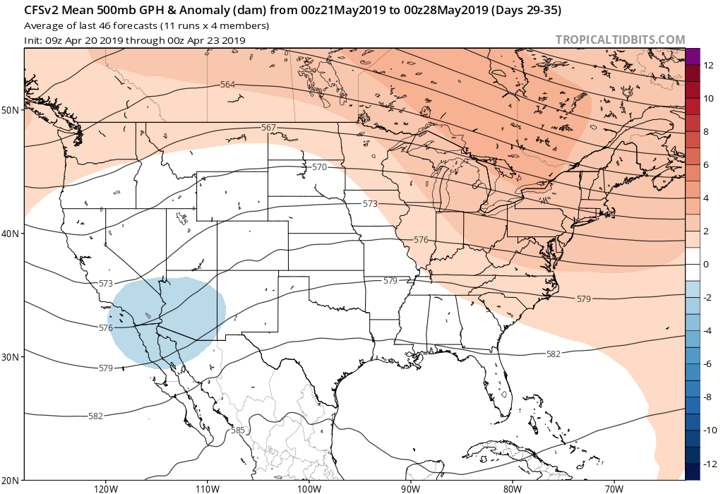
The CFS outlook for May
Getting into the models, the CFS predictions of a major western trough which continued for much of the winter, through March and April seem to be coming to fruition. The CFS thus far, and even with the weekly data, continues to show an amplified western trough for most of May with an emphasis on the latter half of the month.
The plan is to head down for the second half of May leaving on the 17th and returning at the beginning of June just as the death ridge starts to build in over the plains and cap off the more major activity.
The Great American Eclipse
*** All images in this post and many more are available for purchase through Alamy ***
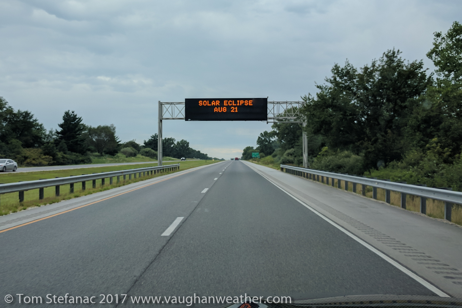
Eclipse sign
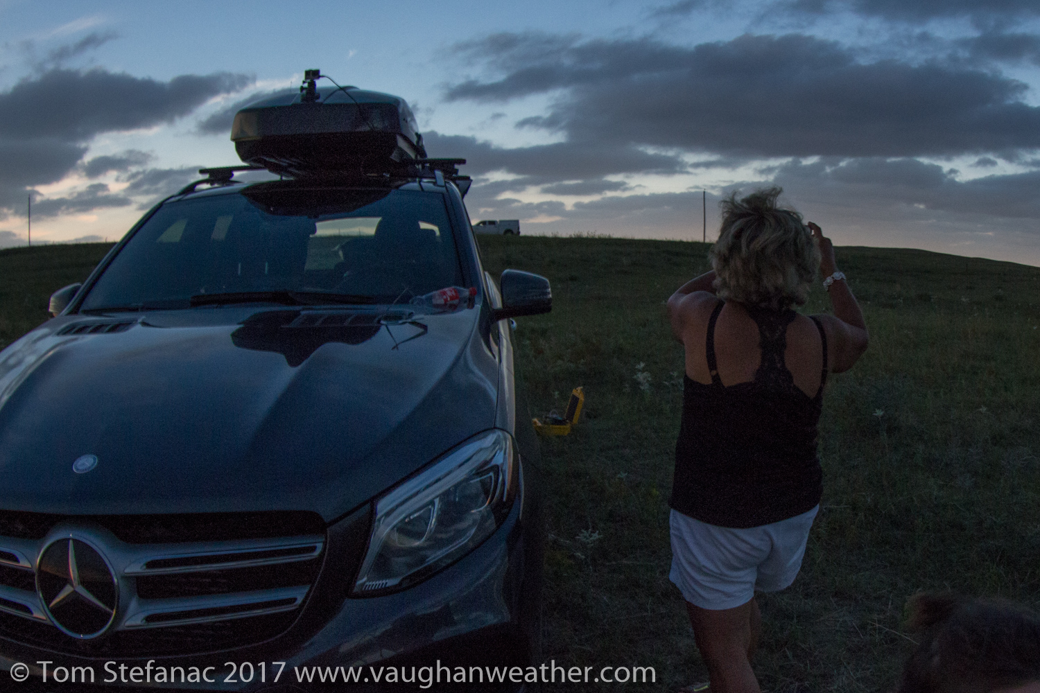
If you’ve read my previous post titled “Chasing the Great American Eclipse” then you’ll know that I have been planning to chase this eclipse for years! This eclipse really was something special, and lived up to all the hype without the doom that was forecast.
I left my home in Vaughan, Ontario on the morning of Saturday August 19th and made a b-line for the border in Port Huron, Michigan with my fiancee and mom who came along for the trip. I had booked a hotel room prior at the Super 8 in Peru Illinois for that evening. The distance from my home to the motel was about 940 km or a good solid 8 hour drive. I arrived around 11PM that night and had a pretty good sleep.
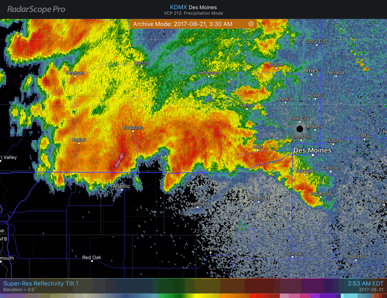
Thunderstorms running across I-80 through western Iowa
The following morning I hit the road at 11AM and headed straight for Des Moines, Iowa which is about 400km from Peru. I booked all my hotels roughly a month prior, I paced out the distanced and made sure I gave myself tons of flexibility to work around any cloud cover. I had initially intended to do most of the driving Sunday but figured it was a safe bet to stretch it out over two days instead. I spent the extra cash and booked the Ramada in Des Moines in order to treat myself to some luxury in the form of a nice swimming pool, good room service and half decent in house dining.
I initially intended to hit the road around 5AM targeting Beatrice Nebraska but the weather abruptly changed my plans. Basically there was a zone of instability running right along the path of the eclipse from central Nebraska down into northern Missouri. The risk of thunderstorms was a daunting reality! After a rather stressful couple hours looking at the evening models and data I decided that a 1AM departure would be necessary to head to the clear skies far west closer to the Wyoming border. I theoretically did not have to leave at 1AM but I wanted to give myself a buffer and there was a second problem emerging in the form of a big ugly MCS that was descending on Des Moines and had the potential to slow my commute.
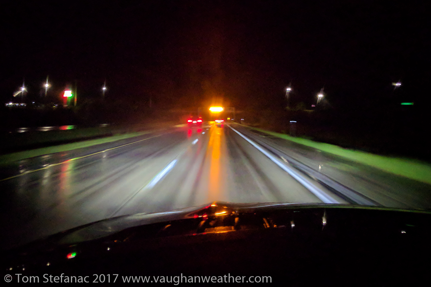
I-80 waterlogged by thunderstorms
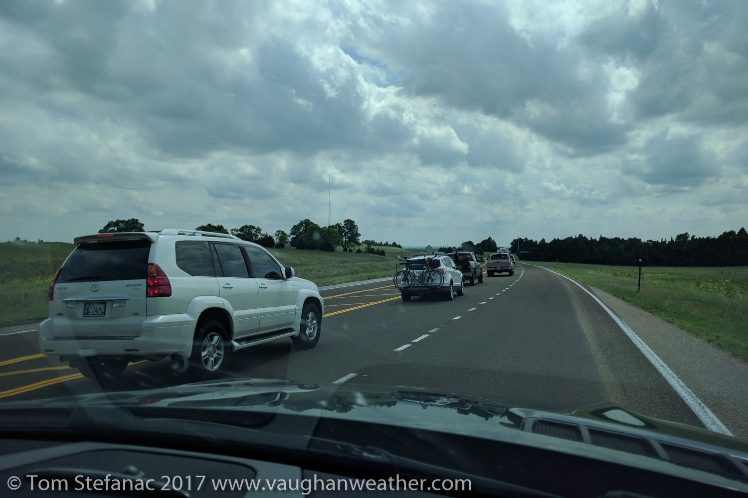
We we’re able to load up the SUV with seconds to spare just as the MCS closed in with gusty winds and blinding rain. It was a pretty grueling drive from that point on, I was basically cutting through storm after storm for about 250 kilometers as everything lined up along the interstate in a big west to east line.
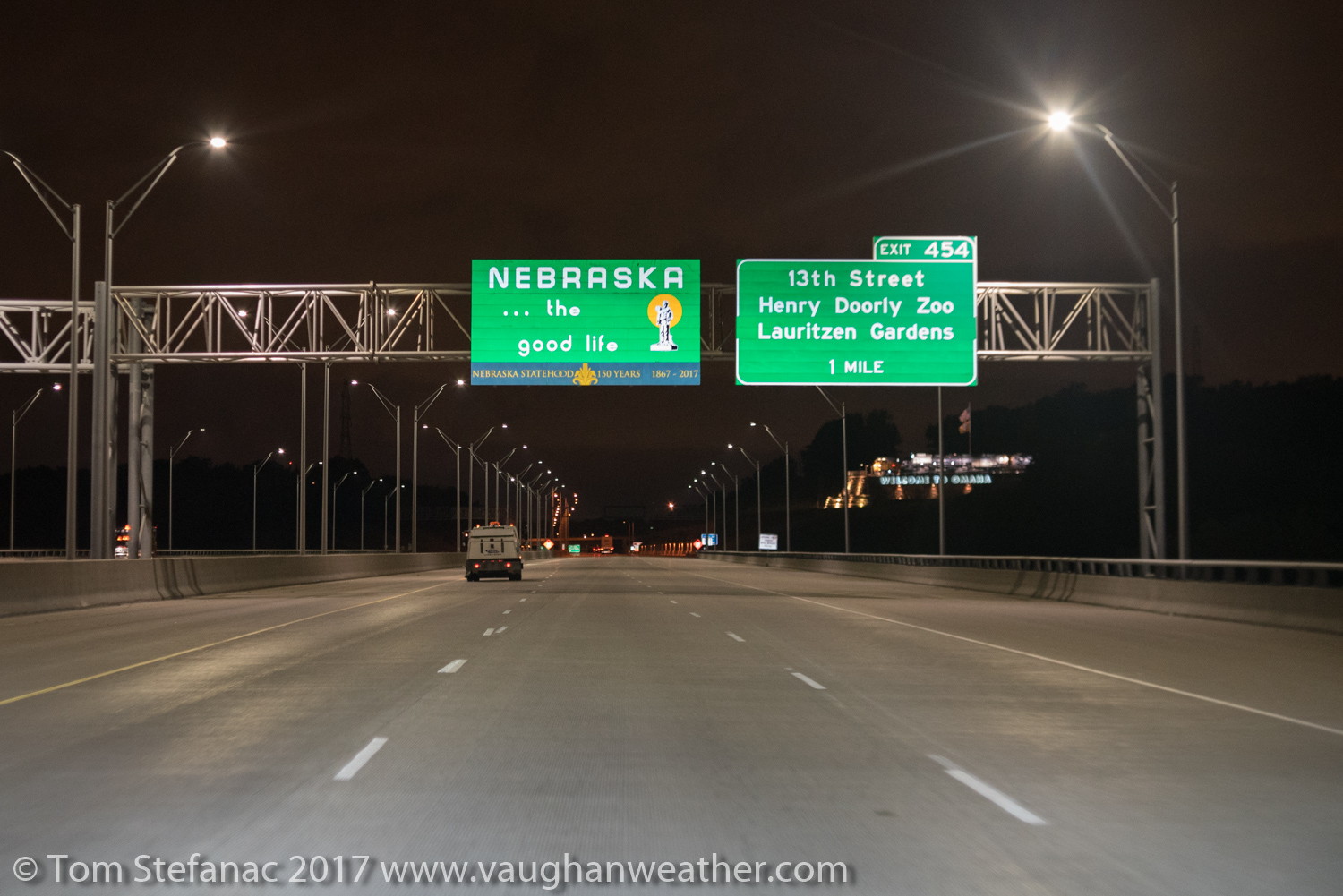
Entering Nebraska at 5:00AM Monday August 21st
Eventually the skies cleared and the roads dried up just as I was crossing the border into Nebraska. What was a grueling drive suddenly became much more enjoyable! At this point it was 5AM and I was making good progress knocking off the kilometers. The only problem was that I did not have a concrete target. I was looking at real-time obs, infrared satellite data and early runs of the HRRR model to see what my best options were. I decided to head for Grand Island and make a move after that based on the weather observations. The distances involved were huge and while I felt I had plenty of time at the moment, it was just an illusion that would not last long with a mid morning deadline looming. I really wanted to be in position at least thirty minutes before the start of the eclipse to settle in and get all the gear sorted.
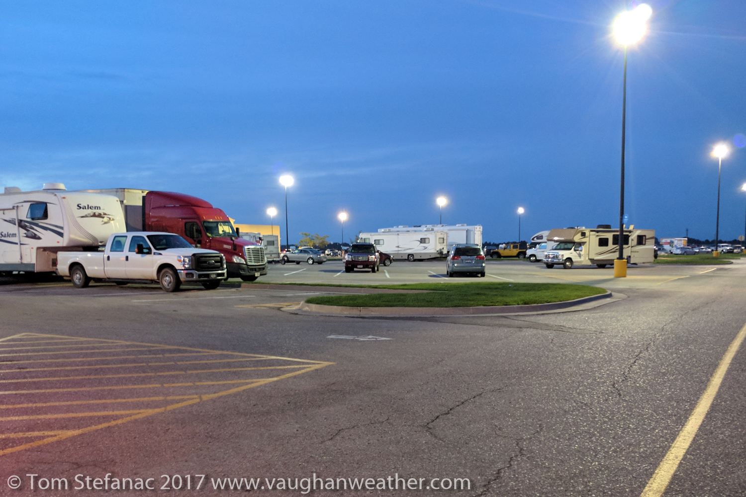
Busy Walmart in Grand Island, NE at 6:20AM
We made a quick fuel, food and coffee stop in Grand Island. The hotels were full, the streets were empty and the local Walmart which happened to lay only a few hundred feet off the center line of totality was rammed with campers spending the night while enjoying the luxury of food and fully serviced washrooms.
If you think about it, the Walmart really was a primo spot, no one would bug you, everything you needed was a one minute walk away, they’re open 24 hours and they had good wi-fi coupled with great cell phone coverage.
In retrospect I would have been safe watching the eclipse from Grand Island but at the time my main concern was some wispy high level cirrus pushing north from Colorado. While the cirrus may have been no big deal for most viewing the eclipse, it is absolutely catastrophic if you want good photos. Shooting through cirrus is like shooting through wax paper, you can do it, but everything comes out soft, there’s simply too much diffusion. So rather than risk having high level cloud problems, I decided to continue northwest towards Stapleton.

Heading north on Highway 2 near Hazard, NE with low level fog and high level cirrus
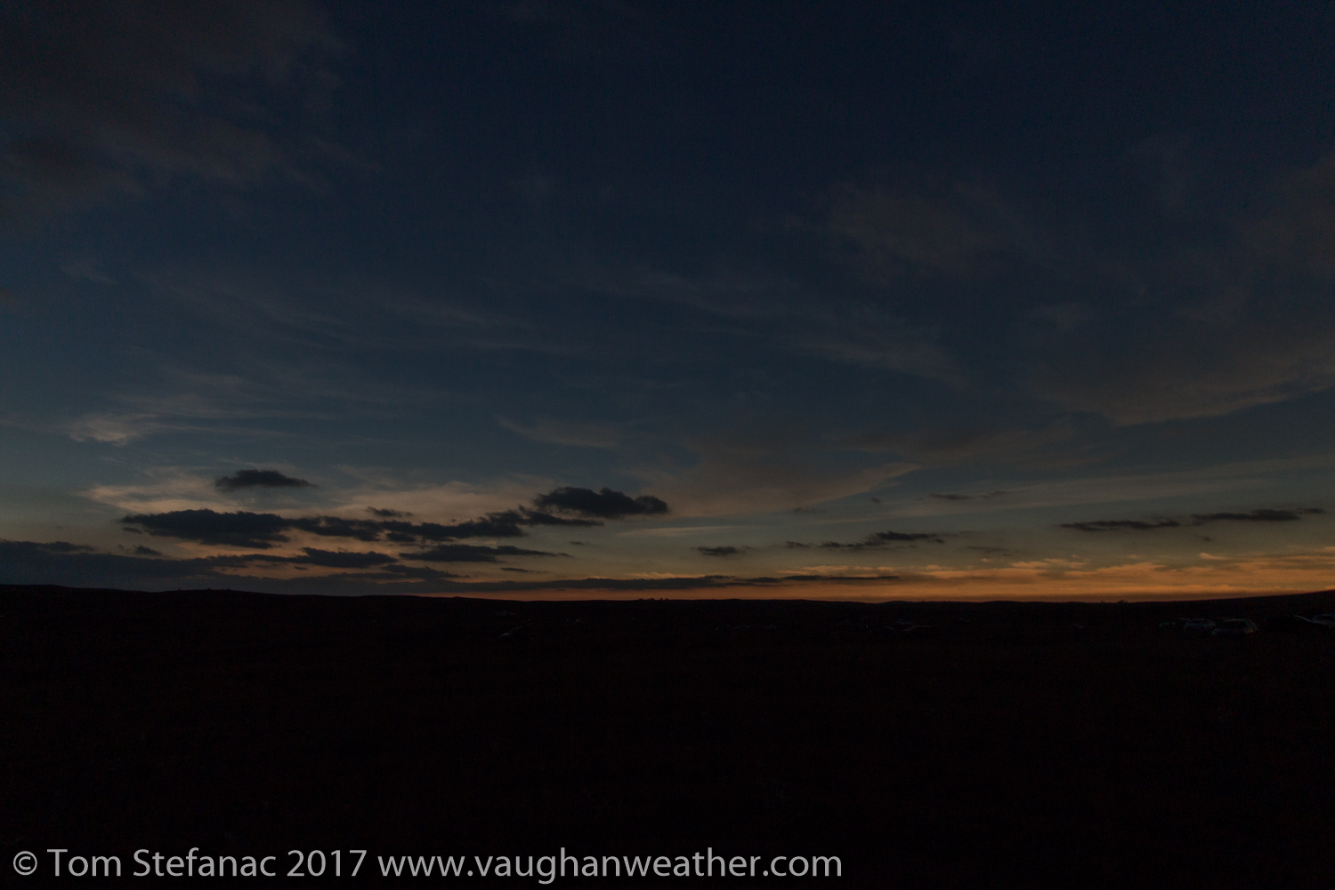
The drive up to Stapleton was pretty scenic, the sun eventually peaked out above the horizon and thin wispy high level cirrus came into full view. A shallow layer of radiation fog was also burning off rather quickly. I crossed the center line of totality several times along this highway while heading to Stapleton.
Things were great until the radiation fog began to get thicker, and thicker, and thicker. Eventually it was not really burning off and I could see it was increasing in depth. The blue sky above my head shrunk and began to turn into more and more of a milky white colour until it was simply gone. I was concerned but decidedly we pushed on with the northwestward journey. I certainly did not like what I was seeing but every ounce of conviction and instinct in my body told me not to worry, in the back of my mind I knew that it would burn off.
Eventually at about 9AM and 30 kilometers outside of Stapleton in the hilly terrain the fog began to break-up. I can’t tell you how relieved I was to see that, and to my surprise, the high level cirrus was all but completely gone. Unfortunately, my cell service had also vanished with the fog and clouds. I could make and receive calls but the internet data was running at a snails pace.
Rows of eclipse gazers parked in fields near Stapleton, NE with stratocumulus above
Suddenly, the weather observations I had been relying on were totally unavailable to me! Further frustrating was that as the fog burnt off, the clear sky was suddenly slowly being populated by stratus and stratocumulus. Again, I knew in the back of my mind mind that eventually this cloud too would burn off as vertical mixing increased but as with all weather, there’s never a guarantee that it’ll run on schedule and by this point it was already 9:30 AM and time was running out.
With no real data, I had to eyeball and “feel out” my odds, so I decided it was best and safest to continue pushing northwest towards the next town on the map known as Tryon. I actually had to do a double take, I kept reading Tryon but I wanted to say “Tyrone”. The rather thick strotocumulus slowly gave way to clearer patches and eventually the clouds began to turn into puffy fair weather cumulus. This was a great sign, but I could still feel the stickiness in the air, it was very very humid and ideally, drier is far better for less cloud and any potential fog.
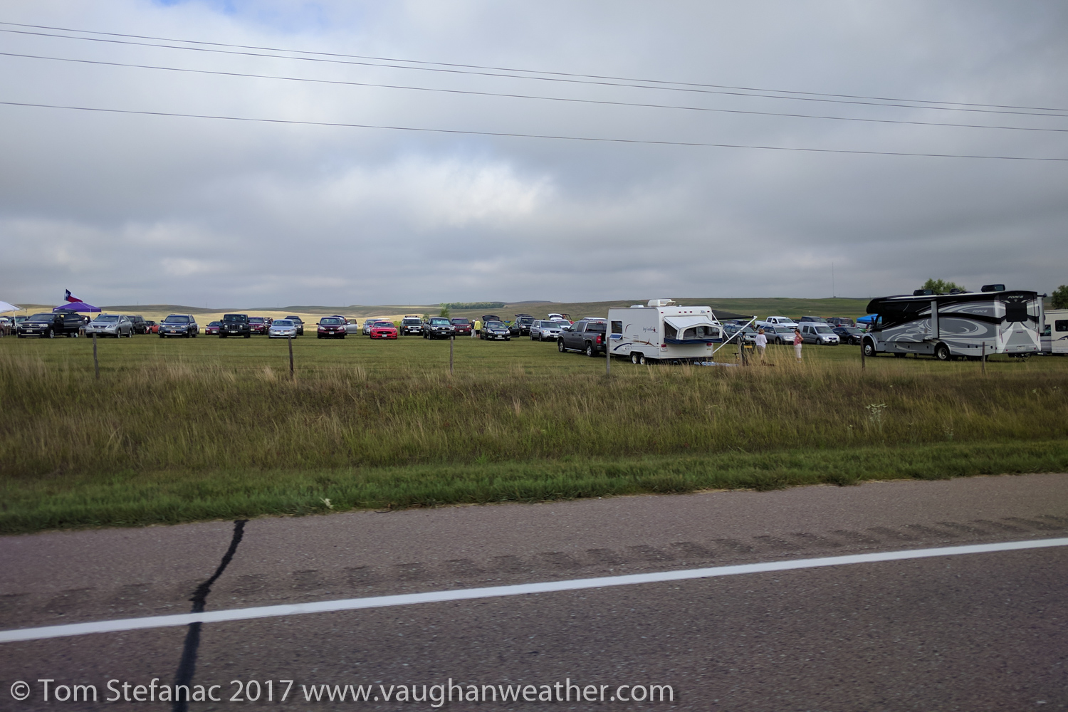
I finally arrived in Tryon around 10:30 AM and began to hastily look for a parking spot. I edged my way to north side of town and found a farmer offering parking in his field, jackpot! I drove through and parked right on the eclipse centre line. I was right where I wanted to be with sunny skies and no real risk of cloud cover from any level.
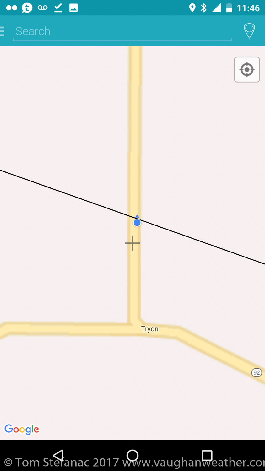
NASA eclipse shapefile center line with my position overlaid via MAPinr for Android.
Once parked I quickly began to unload the car and get my gear in order. I wanted to grab some photos of the sun before the eclipse and then capture the progression of the eclipse sequentially.
Cumulus clouds bubbling at my location
Probably 15 minutes after parking (around 11AM) some weak cumulus began to bubble up directly over my head. It was a little concerning since one poorly placed cloud is all that’s needed to ruin the adventure. I kept staring at the sky between getting setup and more cumulus began to bubble up above my head. I was sort of dismayed at this point since the sky above should have been totally clear, but my guess is that the residual moisture was so high in the boundary layer it was just coming back as cloud. There was little in the way of wind so the thermal heating was allowing the cloud to form right above me. At this point the eclipse was now probably 10 minutes away from starting and I was extremely concerned but then I had sudden relief. Clearing in the sky opened up to the north and the clouds were slowly drifting south. Eventually the clearing pushed in and the cumulus which was now beginning to dissipate moved south and away from the sun.
So once again I was relieved, the sky was clear and I hastily continued to setup my gear. The field I had chosen to park in (with a small fee paid to the rancher) began to steadily fill with vehicles. It was nice in a way since while I wanted to be free of distraction still having other people around (albeit at a distance) added to the feel of the atmosphere, it created a bit of a stadium feel, everyone was there for a spectacle of nature that was going to unfold.
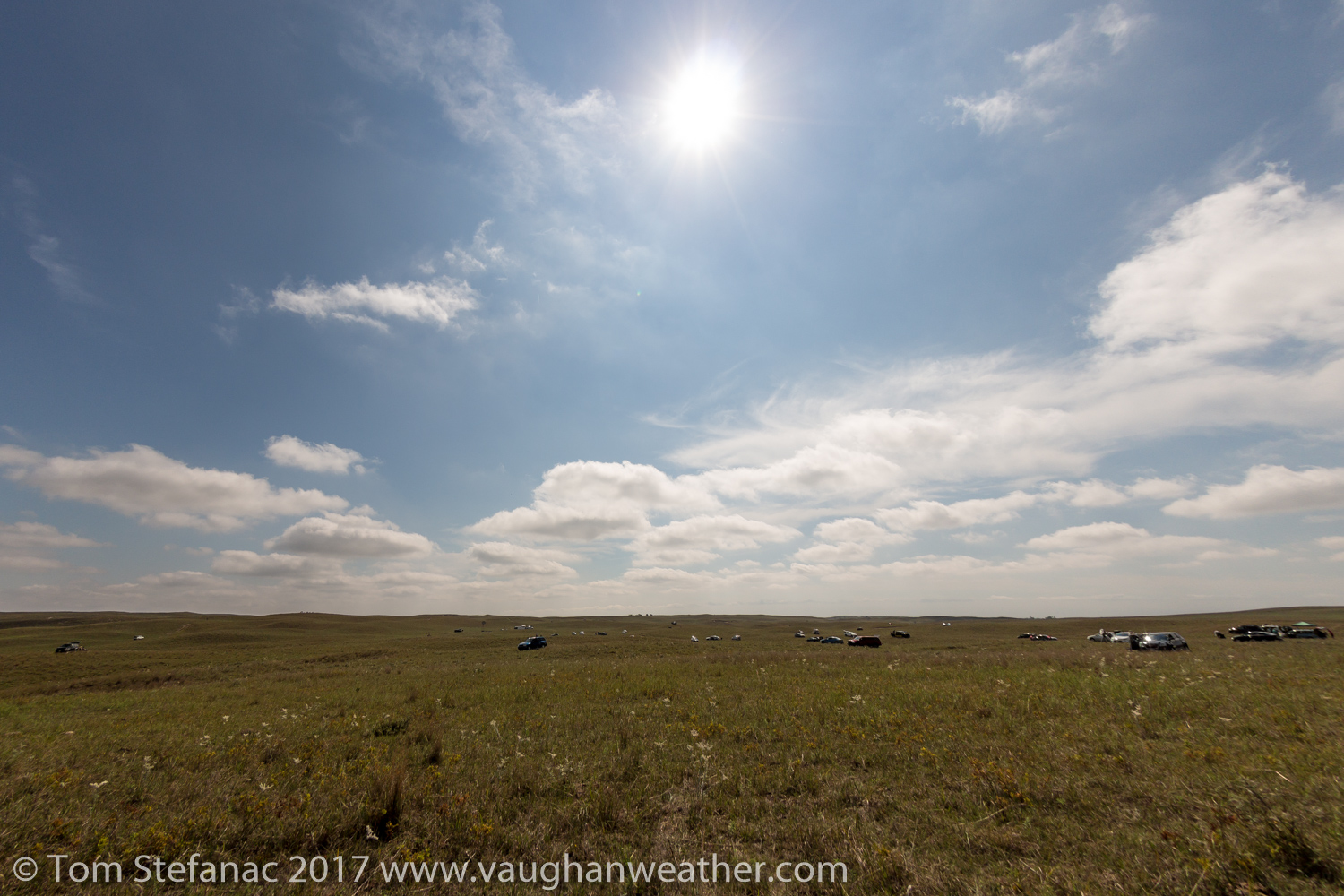
Eclipse watchers gathering in Tryon, Nebraska
I snapped this photo of the sun at 11:17 AM, just 13 minutes before the start of the eclipse. I took it in the process of tuning the camera settings. It was weird looking at the sun, on the one had the day looked like any other day, there was nothing strange about it. There was no hint of the moon in the sky and sun looked like it always does.
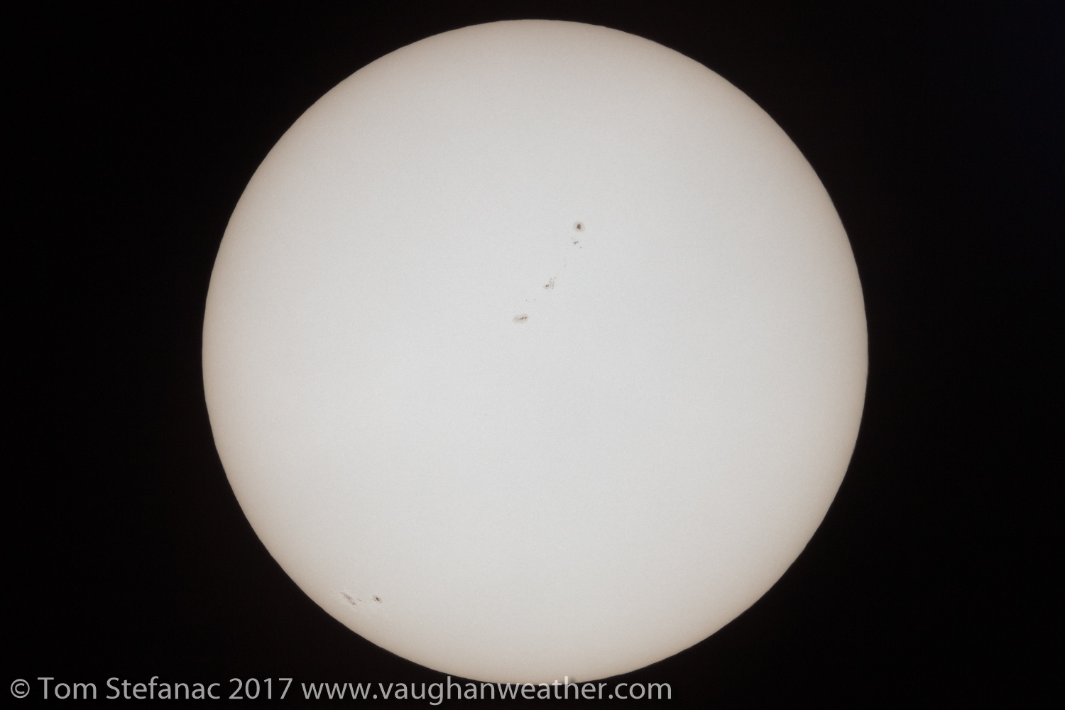
Photo of the sun 13 minutes before the start of the eclipse
I could not imagine that in a few minutes the moon would slowly begin to obscure it. It’s a hard feeling to explain, there’s nothing to indicate that anything you’ve been told is correct and while the math might add up there’s nothing within view to cumulatively show that math adding up.
I kept checking the time on my watch and using an application on my phone which calculates the eclipse event times using GPS data. It kept showing the start of the eclipse was getting closer and closer yet the sun and day felt so normal. As crazy as it sounds, I had this moment of doubt, I thought to myself “man, I really hope everyone is right and there’s going to be an eclipse today”. I know it sounds insane, but that thought really crossed my mind.
I kept looking at the sun through my protective glasses thinking to myself “I don’t believe this is going to happen”. I’m not a pessimist or anything and I understand math, science an how it plays into astronomy but being so use to weather where there is never any certainty, I was mistakenly subconsciously applying that same lens and frame of thought to a totally different process. Celestial bodies are in motion, we know their motion, it’s relatively easily predictable and there’s nothing to cause deviation. Whereas when I look at the weather, we simply have far less information, there’s far less certainty, much more going on and sometimes that thunderstorms I chase and forecast don’t blow up from clear skies.
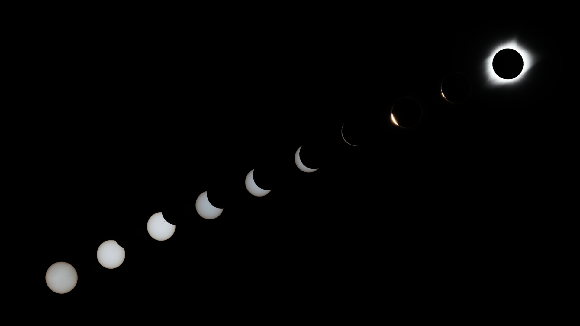
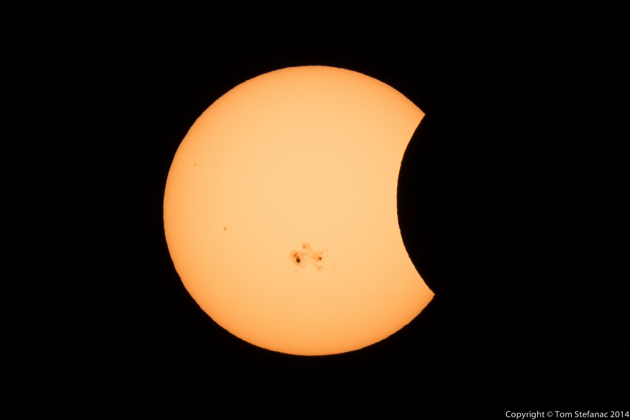
Start of the eclipse, two minutes after first contact 11:32 CDT / 16:32 UTC
I looked at my eclipse application again and the count down to the start of the eclipse read 3 seconds, 2 seconds, 1 second, zero…., the eclipse was starting. I quickly snapped a photo and dawned my eclipse glasses and there it was, the sun had a small sliver missing from the top right corner. The eclipse was actually happening and right on schedule. Up until this point it had all been theoretical, everything was a prediction, nothing was tangible. I had driven 2400 km on pure speculation and theory. I don’t know why it was so amazing to me that it was actually happening but suddenly the anxiety of possible failure seemed to fade away. I was actually relaxed and breathed a huge sigh of relief!
The hour and 23 minutes leading up to totality felt very long and truth be told, totality was what all the buzz was about, the partial obscuration was cool but I had seen it before. I wanted the main show to begin but you can’t rush nature. I filled the time by taking photos of the slow progression of the moon obscuring the sun, the sky slowly darkening, family group photos and generic things. I also took time to tinker with my GoPro and video camera. My camera shy fiancee opted not to be in any photos on this website sadly.
Watching the eclipse unfold
While watching the eclipse it was a scorcher! The sun was just beating down and I felt like I was melting. My mom (holding the umbrella) felt the same way, but at least she was able to get some shade. The scorching heat did not last very long though, about half way to totality the sun began to visibly wane in the sky and the day suddenly did not seem as bright as it was before.
As time progressed and more of the sun disappeared behind the moon the air began to feel slightly cooler. The air temperature itself at this point had not leveled out but what was occurring was more of a sensory perception illusion. The human body detects visible light, near infrared, UV radiation and long wave infrared (thermal infrared) as heat. That’s why standing out in the sun feels substantially hotter than standing in the shade even though there may not be any substantial change in your body temperature. Thus with the suns diminishing intensity, the body naturally has less light to interpret as heat and you feel cooler despite the air temperature remaining constant or even increasing.
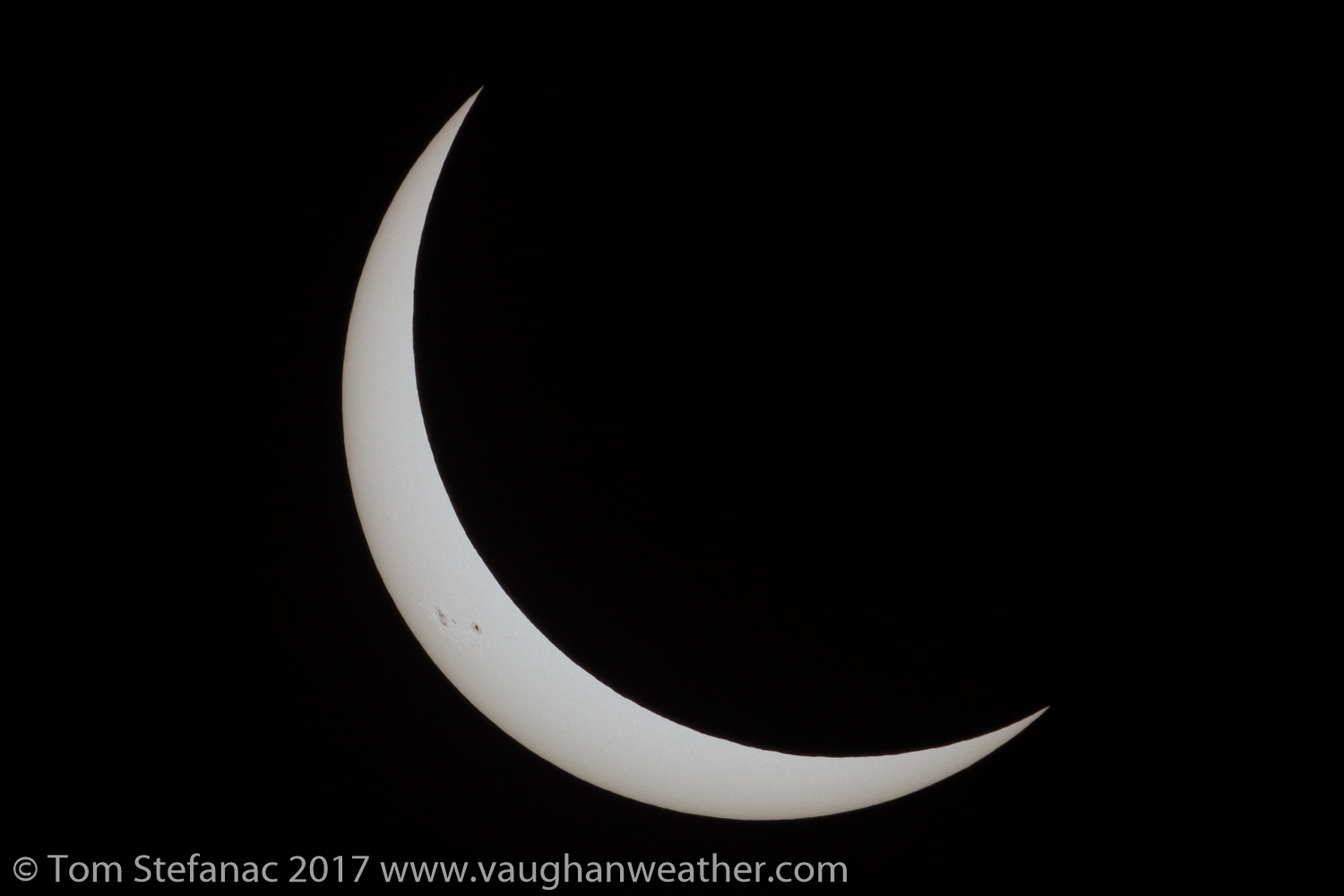
The sun 10 minutes before totality
At about 10 minutes from totality, the day still seemed pretty normal. Nothing odd was happening, except that the sun was visibly dimmer, but no dimmer than it would be with a moderate layer of cirrus diffusing the daylight. The nearby farm animals were acting normal, the cows were just grazing and going about their business, birds and insects were flying around and the eclipse gazing dogs were simply going about their business seemingly unaware of what was coming.
Things began to get interesting about 5 minutes away from totality, the daylight began to visibly fade rapidly and a sudden chill could be felt in the air, there was so little sunlight that the air itself began to cool quite rapidly dropping closer to the dew point and bringing the relative humidity right up. I could feel my hands and everything getting sticky in the growing humidity. The birds and large insects (dragonflies / butterflies) that were buzzing around earlier began to slowly vanish. The sky was also becoming eerie, it was growing darker but the sun still appeared very bright to the naked eye. It was an odd feeling but very much expected from my past experience with partial eclipses and literature I had read, but this however was on a much grander scale.

HDR composite with/without solar filter 1:05 before totality
Suddenly everything changed just one minute away from the start of totality! A late evening darkness began to envelop the landscape and the sun now fading rapidly cast a glow that was about as strong as bright moonlight. I was busy getting ready for baileys beads, but I took a moment to look at the northwestern horizon and was amazed to see a huge zone of darkness rapidly expanding and seemingly growing in height consuming the horizon. It was the moons inner shadow (the umbra) approaching at a cool 2500 kph (1535 mph). I wish I had taken a second to photograph it but that thought at the time did not cross my mind. Suddenly, the dogs that were eclipse watching broke out barking like crazy, they finally realized something was not right. The cows nearby remained completely silent and motionless. By this point the air was now very cool, to the point where you almost needed a sweater and very sticky from the climbing humidity..
The clouds which had disappeared were also now starting to reappear in pockets! The reverse effect was occurring, while the sun heated and mixed the air to burn them off, the air was now cooling and the mixing had stopped essentially reversing the processing. Fortunately one stray cloud quickly passed without obstructing my view and the sky remained clear just as totality was about to set in. There was so much happening in such little time, I was changing camera settings and getting ready to blast off photos while above the stars one by one began to become visible, but totality was still not upon my location.

Baileys Beads & the Diamond Ring
Even though about 99.5% of the sun was blocked, the last remaining rays that produce the diamond ring effect and baileys beads were so bright they still wholly overwhelmed the camera until totality was 10 seconds away. Then, and only then did the shimmering beads appear across the lunar limb and quickly fade one by one into darkness. At this point I was just blindly taking photos and full out staring at the sun with my eyes. It was just absolutely amazing!
As the last shimmering point of light vanished, darkness overtook the land! Then, the silence was broken by cheering and clapping, only to be outdone by the sound of a roaring jet engine as NASA scientists chased the eclipse from a WB-57 aircraft. It was incredible, words simply cannot describe the feeling in that moment, the surrealism of what was occurring, day had turned to night in a instant, there was twilight on the horizon, dogs were losing their minds, people were clapping, cheering and a jet engine could be heard roaring past on the edge of the umbra. It was just surreal!
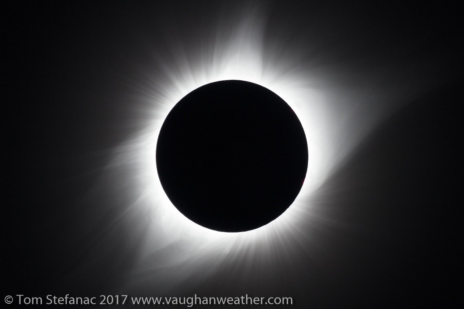
Totality revealing the suns glowing corona
The suns corona which was slowly becoming visible was now fully revealed! Red prominence’s could be see bending, twisting and blasting off into space, the orange-reddish glow of the suns chromosphere was brightly visible and the fine detail in the corona was visible giving it a wispy, wiry type appearance.
As I watched the corona, it’s subtle motion was revealed with a little bit of elasticity as as the suns gravity and varying magnetic charges played upon it. I would say it moved about as quickly as a vibrant aurora, but was far easier to observe with much more detail.
I did take a moment to take everything in, I did not want to experience the eclipse through the lens of a camera, I actually wanted to enjoy it as a tourist or the average Joe.
Looking around, I found the strange 360 degree evening sky to be somewhat fascinating and odd. It was basically like the sun was setting in every direction, or I guess contextually, no specific direction. I took a longer exposure of my mom looking at it and trying to get a photo on her phone. It was very dark, you basically needed a flashlight to see fine details, it was very much like night. The photo on the right contextually is more true to life as far as brightness goes but even so it’s still probably 1-2 stops brighter than it actually was. During totality the sky overhead was very dark, with virtually nothing other than the sun and stars visible.
 My mom looking at the eclipse |
 The twilight horizon during totality |
This complete twilight horizon was going to be a short lived affair, as the moons shadow kept moving east, the western horizon began to grow bright and brighter signalling the approaching end of totality. With this in mind I made sure to take a variety of solar photos, one of the features that was quite rare and is not well shown in photographs are the suns prominences.
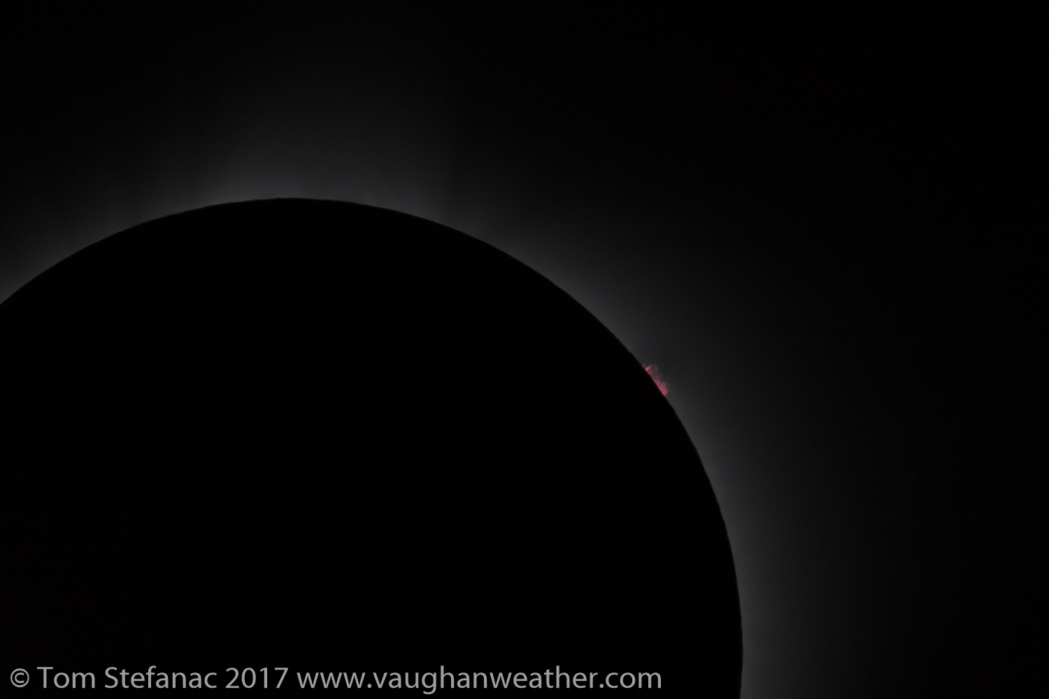
Red prominence twisting off into space
The prominences also known as filaments are basically charged strings of helium and hydrogen plasma that twist out along magnetic loops. They’re predominately anchored to the suns surface but can reach thousands of kilometers out into space. During the eclipse, several were visible around the edge of the sun appearing as a reddish pink colour in the visible light spectrum.
Photographing these microscopic features when compared to everything else requires a crisp aperture, ideally F8 to about F13, and and a relative fast shutter to beat down the light from the fainter corona blowing them out. Unfortunately there’s really no way to capture all the elements of an eclipse in a single photo due to the great variation in light intensity across different portions of the event.
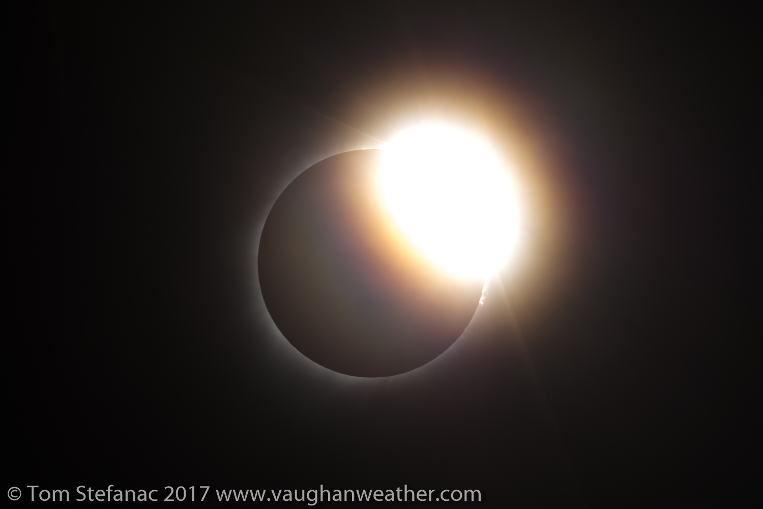
Diamond ring marking the end of totality
Like all good things, even an eclipse must eventually end and time was running out, totality at my location had a mere duration of 2 minutes and 40 seconds. The west horizon in the span of about 10 seconds suddenly became very bright and edge of the moons umbra was fast approaching, totality was about to end. Then the first shimmers of bright sunshine made their way across the moons mountain to once again reveal baileys beads and the diamond ring effect.
I snapped off dozens of photos, I was certainly trigger happy but more so because the baileys beads event occurs so quickly and there is a huge difference between how the beads look every half second. It’s much like sports photography at a fast paced game, an image will change significantly in the span of just a couple seconds and baileys beads with any eclipse is no different.
Before I knew it, the eclipse had ended and the moon was moving away from the sun, daylight was returning and it was gradually getting brighter by the second. I had made a mental note somewhere amidst my eclipse planning to make sure that I saved data from the news GOES 16 satellite. The satellite is an amazing piece of technology capable of beaming back images of the earth as frequently as every minute.
The new rapid update imagery with increased resolution gave a remarkable view of the moons shadow as it passed across the landscape. The satellite sees total darkness or near total darkness as white. Part of this is spectrum folding within the decoding software, but it gives a great idea of where total or near total darkness fell. What a year to have had the launch of this new powerful weather observation satellite.
 NASA GOES 16 weather satellite visible channel (red spectrum) imagery of the eclipse |
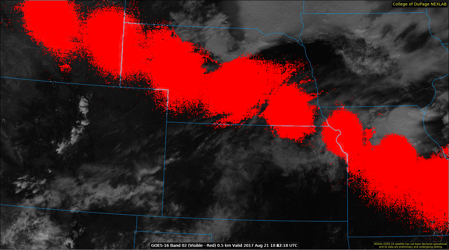 The moons umbra highlighted in red at 5 minute intervals from the GOES 16 data |
As the eclipse slowly ended, the fellow eclipse watchers which had been parked in the field around me proceeded to leave, some rather quickly after totality had ended. A few die hard fans like myself stuck around to the very end, but truth be told there was not really a rush. There were literally tens of thousands of people rushing out to jam up the roads. Unlike a movie theater, sporting event or concert where everyone is coming from the same source, this was more like rush hour traffic where hundreds of people were coming out of different office buildings all along the route. There really was no beating the traffic.
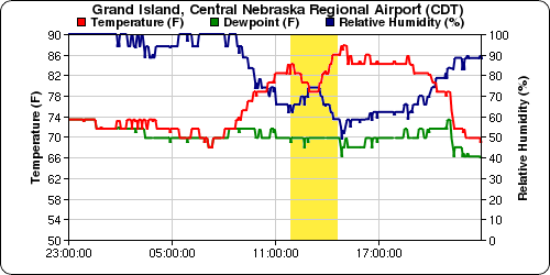 Grand Island Nebraska – Temperature, Humidity, Dew Point |
 Grand Island Nebraska – Wind speed and direction |
What I found meteorologically interesting was the extent to which the eclipse had killed a nearby developing cumulus fields and induced a stratocumulus field. Despite the relatively short duration of the event, with the solar input dropping from a few thousands watts to nothing it’s easy to understand how significantly even this short duration can effect the larger weather pictures, at least for a time before the atmosphere recovers and convection resumes.
Cloudy skies after the eclipse from diurnal cooling during the eclipse
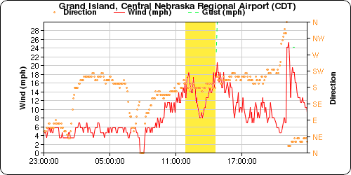
With the loss of daytime heating the wind fields also diminished substantially as the air calmed down and convective mixing slowed to crawl. There was no weather station in Tryon, but KGRE in Grand Island which also experienced totality had very similar weather conditions. You can see how the relative humidity approached 75% during totality with the air cooling from a pre-eclipse high of 30C / 86F down to a low of 21C / 71F just as totality was ending.
I was surprised at the extent of local cloud cover after the eclipse. Part of the cloud was a product of an impending MCS collapsing south from the north, but the majority of it was well ahead of the MCS and the result of boundary layer and low level saturation none of them
There were some clouds during totality but fortunately they stayed away from my field of view, so I really did dodge a couple bullets and luck did play a role.
Merging onto US-83 South from NE-97 heading into North Platte
Once the eclipse had fully ended we packed up and hit the road. Traffic was initially light, then gradually became heavier and heavier. Once we approached North Platte, Nebraska everything seemed to grind to a halt. This was an area where there were no alternative routes due to the local geography of a nearby river. So in that regard, jumping on a dirt back road was not an option, the only option was to tough it out with everyone else and try to make the best of a slow drive.
The town of North Platte itself was a zoo. There were lines for everything, the bathroom, fuel, food and anything else imaginable. I took two diesel jerry can with me which I filled up before leaving for the trip and fueled up in Grand Island earlier in the day. Between the superior range of diesel fuel, my near full fuel tank and two reserve cans we did not need to stop for fuel. A reassuring observation I noted was that the truck fueling stations were pretty desolate, so if I had to I could have just pulled up to a transport truck card lock and filled up. I have a truck fuel nozzle to vehicle grade nozzle adapter for just such an occasion.
We passed a couple of broken down vehicles and a few vehicles which looked to have run out of fuel while idling. I was critical to note that some peoples idea of an emergency fuel can was a little 5L / 1.5 gal container you’d use to fill up a push mower. In perspective if you’re getting 8L/100km on the freeway, in bumper to bumper traffic your getting something like 15 – 20L/100k or maybe even less. So even with amazing fuel economy you’ll still only get 60-70 km on that little tank and realistically maybe 15-20 km in bumper to bumper traffic. In rural Nebraska it’s not uncommon to drive 100 km or more without ever seeing a fuel station.
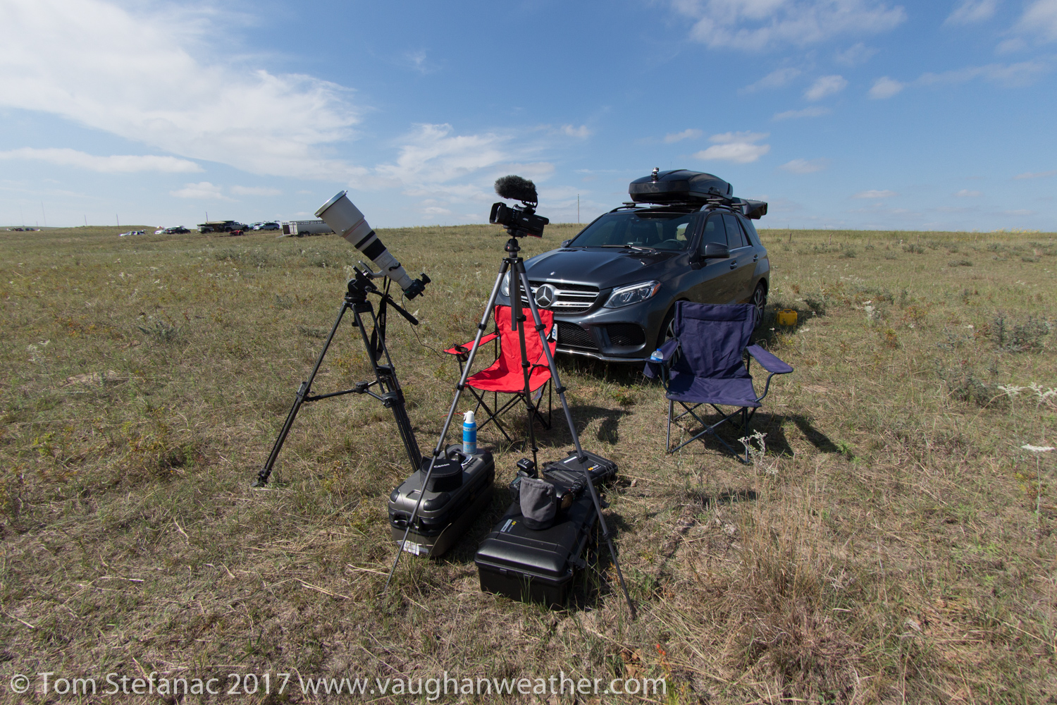
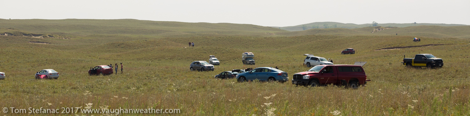
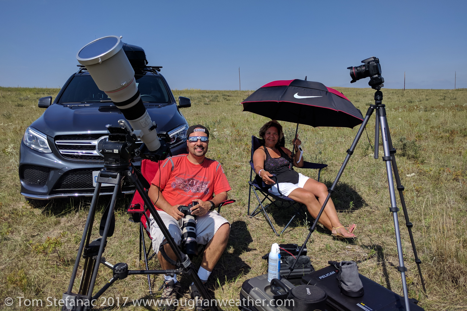
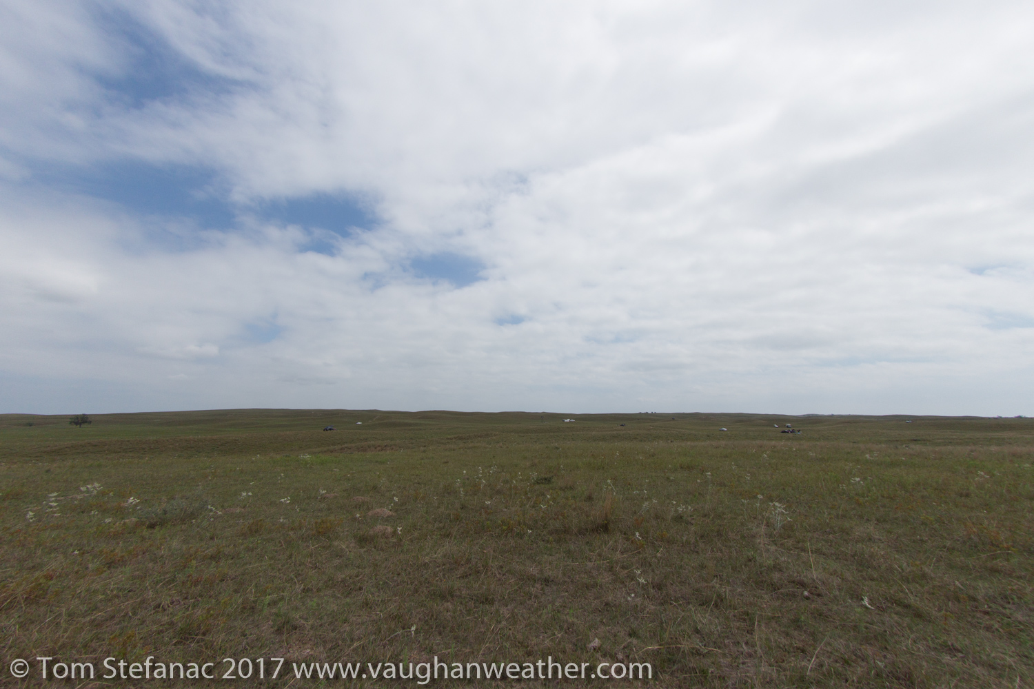
Vehicle and gear out in the field waiting for the eclipse
My logic was simple, driving a diesel vehicle and having 40L of reserve fuel plus a full 93L fuel tank would give me 133L total, enough to travel 1600 kilometers at 8L/100km realistically or 665 km at 20L/100km if I was getting abhorrent fuel mileage in stop and go traffic. That’s enough range to basically leave the state if need be and certainly enough to find somewhere to fill up. It also gave me the option to drive potentially hundreds of kilometers off-road if the apocalypse started.
Fortunately traffic thinned out south of North Platte and the interstate was moving very well. I had booked a room in Omaha at the local Microtel for the night to shorten the following days drive to the airport in Sioux City, Iowa where my mom would be flying out to connect in Chicago before arriving in Toronto. As luck would have it, we were blasted by the MCS (visible in the satellite loop above) late that evening while leaving the Texas Roadhouse restaurant near the hotel. Seeing as I had driven most of the night, my mom drove most of the time after the eclipse, although she had serious problems following the GPS nav commands. Thankfully my fiancee Jen kept her on track while I drifted in and out of consciousness in the backseat.
All in all the eclipse trip went out without a hitch and I never had to ditch any hotel reservations, all the planning was enough without any real over planning. The following day (August 22nd) I dropped my mom at the airport and my fiancee and I headed to back west across South Dakota to visit the Badlands near Wall and eventually the Black Hills and the Keystone Area.
Here is a short video showing the moments leading up to totality and it finally occurring.
Chasing the Great American Eclipse
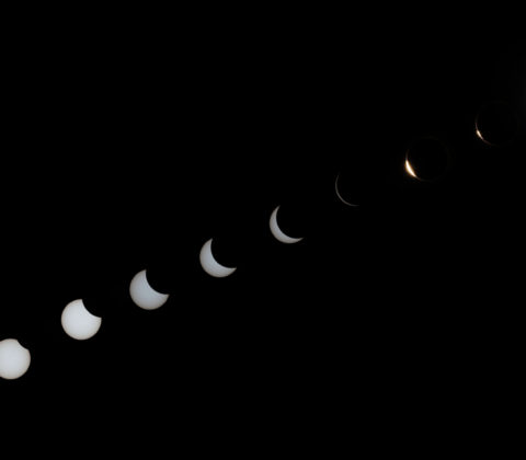
I’ve been waiting pretty patiently for this eclipse since the early 2000’s when I decided to hunt down the next total solar eclipse that would arise in North America. What makes this eclipse so special is that it is not annular but rather total. Annular eclipses are cool, but the moon never actually completely covers the sun. With a total solar eclipse the moon fully covers the sun and a multitude of observable phenomenon occur which simply don’t during an annular eclipse.
For example, with a total eclipse not only is the transit of the moon visible with its slow disappearance but so too is the Baily’s Beads phenomenon which are the last slivers of sunlight squeezing past the various mountains on the moon. As the light vanishes suddenly, out of seemingly nowhere, totality begins and the suns corona emerges with red prominence’s visible on the edges of the disk. The sky become so dark that the brightest planets and stars become visible. It’s an incredible view!
But enough with the geek talk, let’s get down to business!
Chasing a solar eclipse is much like storm chasing. You have a general area of preference for viewing, you have a list of tools that you need, you have to be in the right place at the right time and lastly you need to know what your end goal is, what you want to get out of the eclipse. Fortunately, unlike storm chasing where we don’t really know what’s going on until those final few hours before the storm, with an eclipse we know when it’s coming, where it’ll be longest and the type of eclipse. The decision then becomes where exactly to head to watch it and will it give us what we want?
In my case, I want to have the longest duration possible for totality with the best chance of see the corona. Unfortunately, the area with the absolute longest duration is not necessarily the most favorable location when it comes to cloud cover. In this case both the areas presenting the greatest eclipse and greatest duration are in Southern Illinois and nearby Northwest Kentucky.

Precipitation Totals – Station Plots – August 2016
The problem with Southern IL and Northwest KY is that in August, especially mid to late August, the humidity tends to be very high! Plants are typically at their largest and foliage most extensive. This means transpiration rates are very high driving up local humidity values. There’s also abundant moisture that advects northward from the Gulf of Mexico which itself is beginning to get very warm by this point and posing a more substantial tropical weather risk. The high humidity values that arise locally and from afar make daytime cumulus clouds prevalent and the resulting thunderstorms a near daily occurrence. Couple this already cloud littered unstable environment with the lesser risk that the remnants of a tropical cyclone in the Gulf of Mexico may dive north and you have a recipe for great uncertainty with the potential for abundant cloud cover.
A thunderstorm isn’t even the problem so much as a weak cumulus field which could easily lead to just one single poorly placed cloud obstructing everything! Unfortunately, there’s simply too much humidity, vertical instability and resulting cloud cover. To put it in perspective, even if only the sky has 5-10% cloud cover, that’s too much! It just takes one cloud to ruin it all.
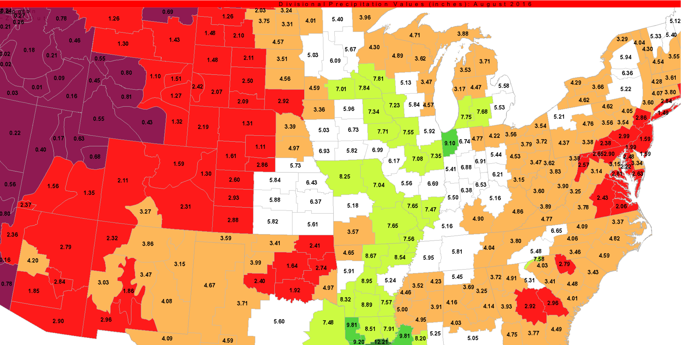
Precipitation Totals by Zone – August 2016
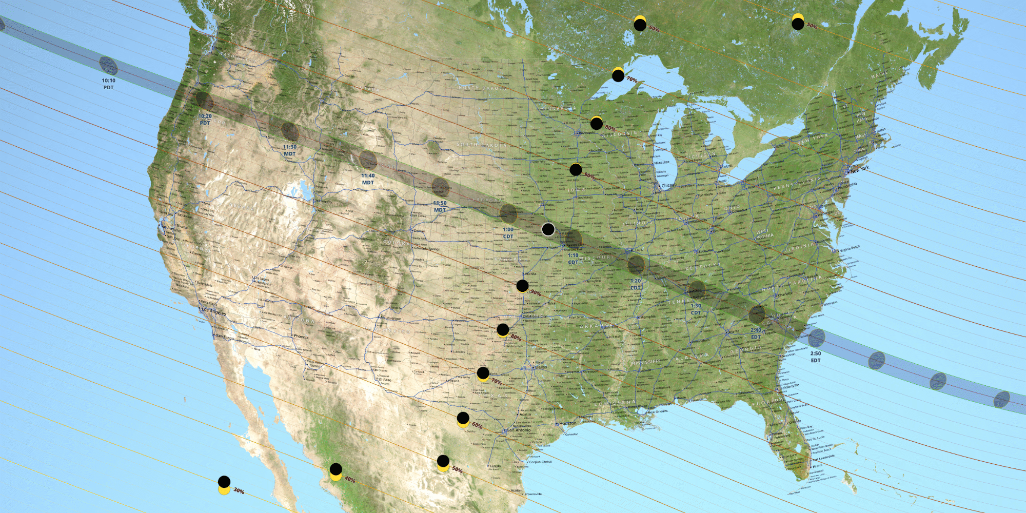
In order to avoid potential cloud cover, my eyes are drawn to the west, particularly the Nebraska/Missouri border where humidity values fall off east of the Mississippi but the duration of totality is still on the order of 2 minutes, 39 seconds, merely 3 seconds shorter than the greatest duration of totality in Illinois . Looking at the rainfall maps, it’s clear that the diminishing humidity values heading west translate directly into less rainfall which translates directly into less cloud cover at all levels. In fact if looking closely, it’s easy to note how the rainfall totals drop drastically west of Grand Island, Nebraska along the 98th Meridian. This is in part due to an increase in elevation, the dry downslope flow east of the Southern Rocky Mountains and diminishing vegetation density. This area is geographically where the Great Plains begin and the Central Lowland Plains fade off, the heavier forest cover tends to follow the moisture and naturally because of this sits east of the 98th, but the vegetation west becomes more grassy and shrubby meaning there simply is not as much transpiration to be had. The ground also becomes progressively more dusty and rocky, especially towards North Platte and Scotts Bluff which is directly reflective of the decreasing moisture in the atmosphere.
One other consideration which I will discuss in more detail a little later is the timing of the eclipse. The eclipse will begin in the west and travel towards the east. For areas that are far west into Oregon, morning fog, haze and low level stratus pose a threat since they may not burn off in time, and east of the Mississippi River where the eclipse will occur closer to noon, daytime heating will give rise to increasing cloud fields that will likely become denser with the potential for afternoon thunderstorms across Kentucky extending to the Atlantic cost of South Carolina.
All these factors combined suggest that the greatest potential for completely cloud free skies at all levels is generally from central through western Nebraska into Wyoming.
 Cerulean Kentucky – Greatest Eclipse at 2m 40.1s – 12hr drive @ 775 miles |
 Lick Creek Illinois – longest duration at 2m 40.2s – 12hr drive @ 800 miles |
|
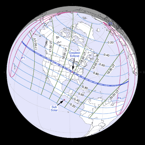
Given that Nebraska has the greatest potential for the least overall cloud cover, I need to consider driving options. Obviously the shorter the drive the better. The irony for me is that the two shortest drives are where the greatest and longest duration of totality occur. The two farthest options are where the least cloud cover from a climate stance occurs. It’s not an easy choice for me because I’m comfronted with the option of driving as little as 11.5 hours or as much as 19 hours. The eclipse also occurs progressively earlier west due to the time zone change and natural path. What this means is that there is no room for recovery. When chasing storms, the trend is that things farther west trigger later than things further east. So if storms are expected at 6PM EDT, 6PM CDT and 6PM MDT, you gain an extra hour heading west which each time zone since it goes from 22UTC to 00UTC. The eclipse is very different, it moves from west to east against the timezone change and very quickly, when the eclipse happens in Oregon it’ll only be a matter of 25 minutes before Nebraska see’s it. As a concrete example, the eclipse will start at 16:04 UTC (9:04 AM PDT) in Oregon on the Pacific coast and begin in central Nebraska just 30 minutes later at 16:34 UTC (11:34AM CDT). Then less than 20 minutes later it’ll begin in south central Illinois at 16:52 UTC (11:52 AM CDT). So even as I drive west and cross different times zones, I don’t actually really save any time, in fact I lose time since the eclipse moves from west to east. Logically this would suggest I should travel east, but again, the moisture increases and makes the cloud risk prohibitively high. Thus there is no room for error and driving calculations must exclude time zone variances. Of course anyone chasing the eclipse should strive to to be in position and setup well before the eclipse begins. It also means I need to choose a target location sooner rather than later should I head to Nebraska versus Illinois. |
|
 Tyron Nebraska – driest & likely least cloud cover – totality 2min 33s – 19hr drive @1275 miles |
 Fanning Kansas – closer than Nebraska, still cloud risk – duration of totality 2min 38s – 15hr drive @ 1000 miles |
Fortunately the one advantage weather junkies have over many others is the ability to forecast and really comprehend the weather. While you can always attempt to plan things based on statistics, the statistics only really matter if they’re right the day of and that’s a huge risk to take because statics are just the overall weather pattern for a given area over a certain time frame smeared together. The reality is that the weather always varies from day to day, minute to minute and even the most favourable statistic are no guarantee of anything. I like to think of statics and climate patterns as a loose guide, they help narrow down the viewing window, but can’t be used to fine tune it.
It’s important to realise that the most important decision making will occur in the final three days leading up to the eclipse. Then when weather junkies and eclipse chasers should be fine tuning their forecast. I’ll be looking for strong ridging, areas that are devoid of moisture at both the low, mid and upper levels as well as the upstream environment for any potential cloud producing weather.
I can’t stress how important it is to look for weather patterns that favour clear air at all levels with good visibility and are prohibitive to human induced cloud growth such as contrail development behind airplanes.
An important but lesser consideration for eclipse chasers will be air quality and smoke contamination from wildfires. I’ll be doing my absolute best to avoid any smoke plumes anywhere that could potentially set haze upon the viewing opportunity.
Photographic Tools

Looking at the highly reflective MrStarGuy Solar Filter
For me personally, a large part of the eclipse will be having the opportunity to photograph it.
I’ve been slowly building my photographic arsenal leading up to this day for years and as crazy as it sounds, the 800mm lens is one thing I specifically purchased primarily for the eclipse. If you had to ask me about what my motivation was to purchase it, the eclipse was really the single most important event that pushed me over the edge and believe me, if I could have afforded the Canon Ef 1200mm lens for $180,000 I would have purchased that too. But make no mistake, I’m not rich and the 800 really did break the bank.
I did consider telescopes before purchasing the Canon 800mm, but by the time you outfit a telescope and find one which has excellent optical quality you’re back in a similar ballpark with cost. The difference is, the lens is a lens which is great for everything from sports and nature to eclipses, while a telescope is really not useful for anything except celestial objects. That said, a 1000mm or 1500mm equivalent telescope is still slightly cheaper than an 800mm canon lens.
But having a big lens is just one part of the equation, understanding how to use the lens correctly is a whole different ball game.
Unlike everything else, the sun is not something you can just photograph. Because the sun is so bright, trying to shoot the sun with an unfiltered lens would result in the immediate death of the sensor exposed to it. Think about it like this, a lens really is just like a magnifying glass, it focuses concentrated light on a smaller area. If you can burn paper and set fire to hapless ants with a simple magnifying glass, just imagine what would happen to a camera sensor on the receiving end of that huge super amplified 800mm image. Needless to say, the results would not be good at all!
In order to protect the camera and lens, I’ve employed the use of a special daylight sunlight filter manufactured by MrStarGuy. It’s basically a specialized aluminum foil film sheet that significantly reduces the brightness of the sun only allowing a small but safe amount of light to pass.
The filter is similar in blocking power to a 1000x ND 3.0 filter. It’s so strong nothing else at all is visible except the sun when placed over the lens, and unlike a standard photographic ND filter, there is no colour cast. Most photographic ND filters tend to add a magenta tint to the image, the tint grows stronger as the blocking power of the filter increases. Thankfully, these colour casts are easy to remove with modern digital photography, but with the MrStarGuy system there is no need for colour correction as there is no tint which is a small but added bonus.
October 23rd 2014 Partial Eclipse
The filter to my surprise is optically very clean with no visible degradation to the image quality. The second thing that’s very important about this filter is that it is quickly and easily removable.
The filter is really only to be used during the first 95% of the eclipse, but once totality nears and the Umbra (moons inner shadow) approaches, it’s imperative to open the lens up in order to capture Baileys Beads, the suns corona and any prominences once totality occurs.
Then as the eclipse passes the midway point and 3rd contact begins I’ll quickly need to put the filter back on as totality ends and the umbra gives way to the penumbrra (moons outer shadow). This is the phase where the light intensity begins to grow again and the strength of the light can become damaging for optical devices, observers and camera sensors.
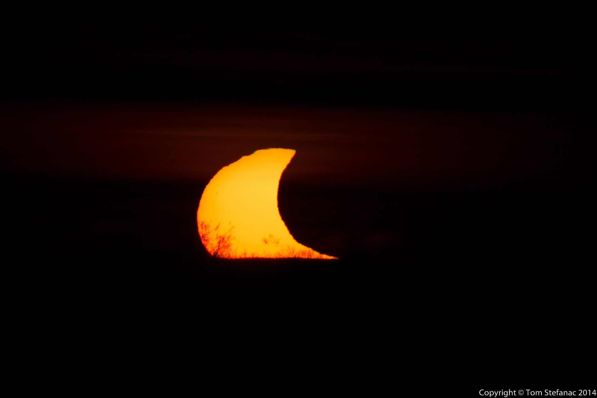
To give an idea of what the sun looks like when using a powerful blocking filter, here’s a sample from the October 23rd 2014 partial eclipse. Unfortunately just as the eclipse was starting to get going the sun set. But here you can clearly see how the sun looks with a filter as the moon passes in front. This photograph was taken using a 400mm lens and B+W ND 3.0 1000x filter. There is no colour correction as the sun was beginning to set and very orange.
Another important point to note is that a good sturdy tripod is really a must when shooting the sun, especially towards midday. Trying to hold a heavy piece of glass or anything up towards the sun is never easy! It’s better to let the tripod do the heavy lifting so you can focus on the photos.
Now a tripod is not a must, but a tripod becomes much more important during totality, especially if you’re interested in a somewhat longer exposure to capture all the fine detail in the suns corona. As a lens become longer, whether it’s a telescope or photographic lens, even the slightest shake or jitters become highly amplified.
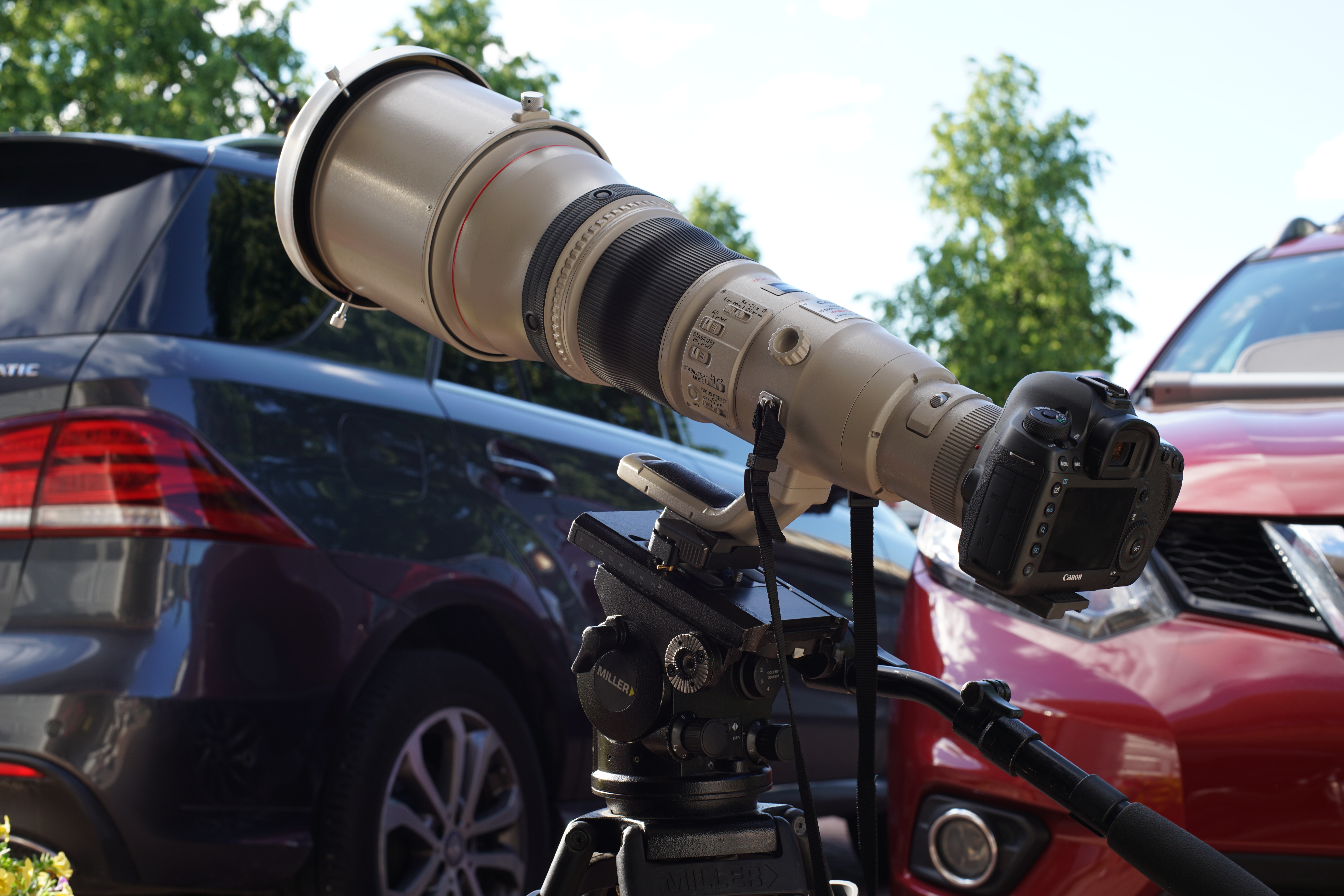
The Canon EF 800mm f/5.6L lens with a MrStarGuy Solar Filter
There is one caveat, unlike a photograph of a static subject, the sun and moon are moving. This means that even with the use of a tripod, if the exposure is too long blurring will occur and the movement of the sun along the photographic plane increases with the magnification factor. So as a lens becomes bigger or more zoomed in, the shutter speed too must increase to prevent motion blurring, and this is something a tripod or image stabilizer cannot prevent, only a faster shutter speed has the power. Anyone into astrophotography or sports has dealt with motion blur. If you leave a shutter open too long star trails are the result. The longer the exposure, the longer the trails and the greater the blurring.
One solution to celestial motion I have not mentioned is a tracking motor/tripod system. There are telescopes out there with automatic tracking that are specifically designed for night sky photography. Tracking telescope/tripod systems are highly effective if setup correctly but very expensive and not typically designed for traditional photographic equipment. So the one solution to motion blur that does not involve a faster shutter is a tracking system.
During an eclipse the dark disc of the moon will give the sun a pacman type appearance as more and more of it is hidden out of view. During a total eclipse there are 5 phases, first contact, second, totality or max occultation, third and forth contact. First contact is the point when the moon first passes in front of the sun, second contact is around 50% coverage, totality or max occupation is the maximum possible coverage at a set location, and then third and fourth contact are the ending phases as the moon revels the sun once again and occultation returns to 0%.
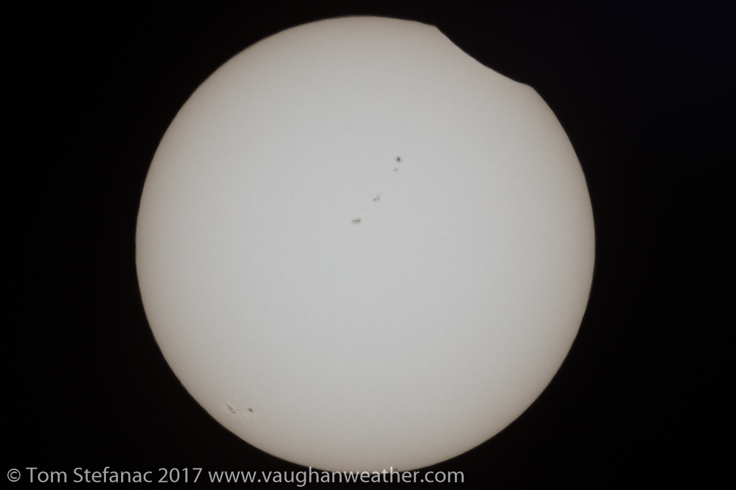
The sun through the Canon 800mm lens with a small sunspot visible using the MrStarGuy solar filter
Because the solar intensity varies greatly during an eclipse it’s very important to remain on top of light levels. The human eye is masterful at adjusting itself to the ambient light level, that’s why it’s easy to walk from a bright resturaunt out onto a dark street without noticing how much the luminosity has changed. Yet on a camera you’ll easily be pushing 20 or more F-stops between daylight and moonlight, and closer to 50 f-stops if looking at the sun without a filter. An eclipse is one of the most extreme natural light variances you can find in nature short of a volcanic eruption blocking out the sun. Because of this it’s important to always keep on top of your cameras metering and constantly adjust exposure levels as necessary.
October 23rd 2014 Partial Solar Eclipse Sunset
You might also notice the sun in these images appears white, and that’s because it actually is. The sun is white because it emits all visible wavelengths of light. If you look a photo of the midday sun, or the sun without earths atmosphere obscuring it, it has a spectral colour balance of around 5600k which is basically white. Stars that are hotter than our sun tend to be a little more blue and stars which are cooler appear more red. From an artistic point of view, I personally prefer photographs of the sun to have a slight orange tint to them, it just feels a little more natural, what kid ever painted the sun white in their kindergarten class?
For more information and a great tutorial including exposure charts for various focal lengths, apertures and iso’s visit Mr Eclipse. This website has a plethora of highly useful information to help you plan and achieve the best possible results during the eclipse.
Helpful Resources & Links
Tornado Alley Blog
May 25th 2017 – Vaughan, Ontario
We’re safely back and the chase is over! What a year, there was plenty of down time but when the storms came in waves, they certainly produced and we had a very successful trip with numerous tornadoes, and beautiful storm structure!


.jpg")


April 30th 2017 – Kansas City, Kansas
What a night. What started with a cold early morning commute, ended with us spinning in circles after chasing a weak line of storms on the IL/MO border. The storms were actually linear in nature but developing in a weak energy environment with favorable low level shear for vorticity. One of the storms produced a brief tornado as we approached from the west, but we were unable get into position in time for it to be visible however several storm reports confirmed it.
Our next target is Woodward Oklahoma for a possible chase Tuesday afternoon near the Panhandle.
April 21st 2017 – Vaughan, Ontario
Well, it’s that time of year again and preparations are underway for this years tornado alley excursion. This trip unlike others which were solo runs with only my fiancée and I will actually include three other chasers. Two fellow chasers from Southern Ontario and one from New Zealand. In addition our trip will run from April 28th to approximately May 20th and will hopefully provide us with an opportunity to explore the beautiful landscapes of the American west and the absolutely stunning skies above.
While still early, the prognosis from the ECMWF weekly ensembles suggest a quick start, followed by intermittent storms that will give way to a major pacific long-wave towards the middle of May. Current climate trends indicate we will see more of a late May type pattern as opposed to a traditional early may pattern.
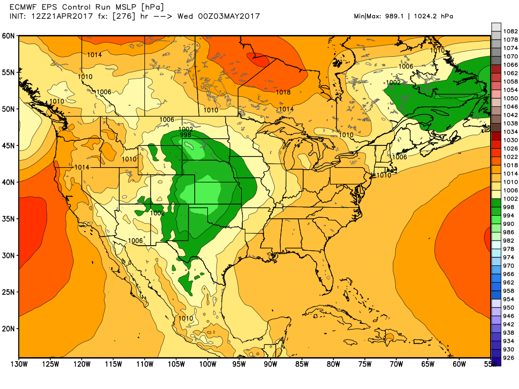
ECMWF MSLP Control Valid 03/05
Unfortunately the smaller mesoscale features which often arise such as front range convection which exists in areas such as DVCZ and near the Palmer Divide are not resolved in the longer range models. So while there is an apparent lull with the larger synoptic meteorology, we do expect there will be storms on apparent off days. Further into the future, the day 15 data which is the end of the observable run suggest a large pacific trough will likely make its way into the plains around May 9th or 10th and possibly trigger a couple high-risk storm days.

ECMWF Weekly – 15D Control 500 hPa
With that said, the forecast at this point will likely change a great deal so be sure to keep checking this blog for updates. I’ll do my best to post daily, nightly and even some rel-time reports once the trip begins.
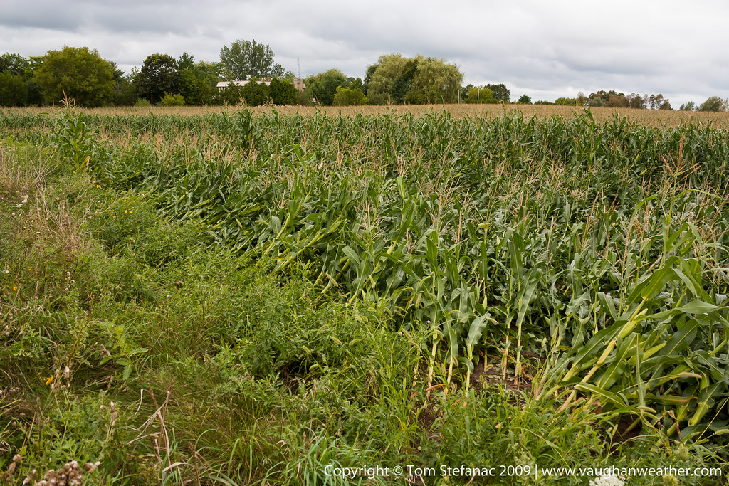
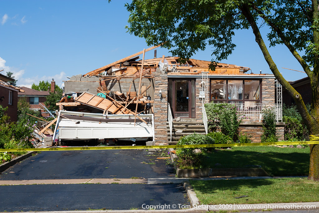
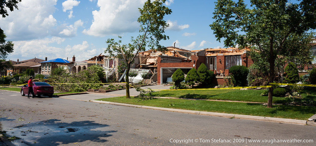
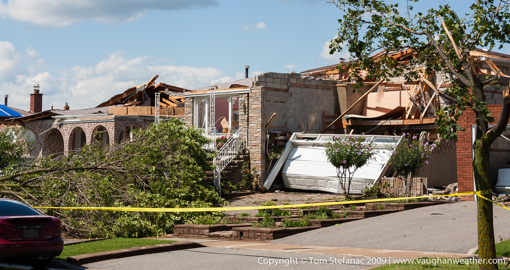
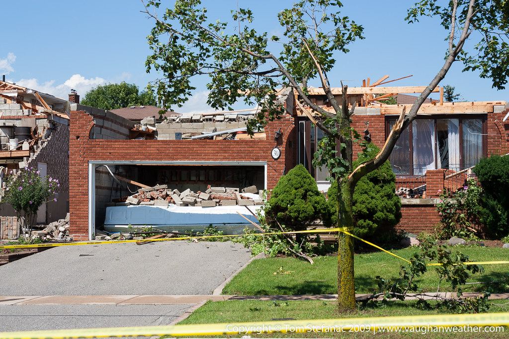
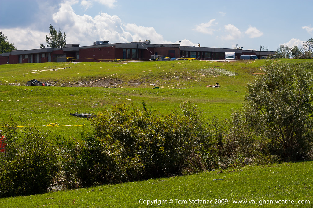
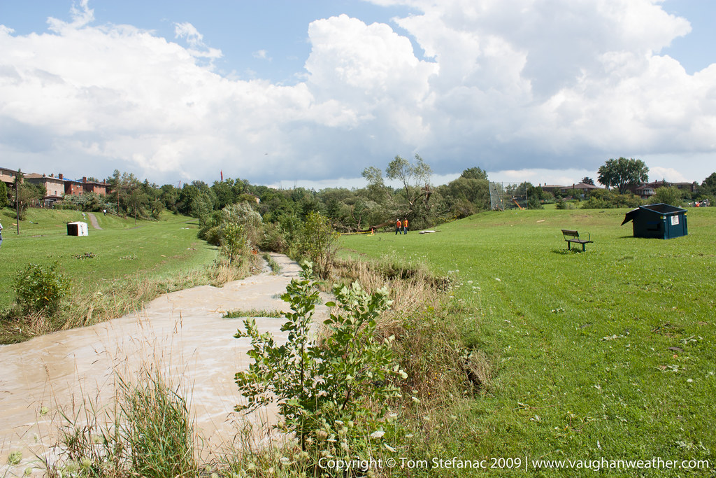
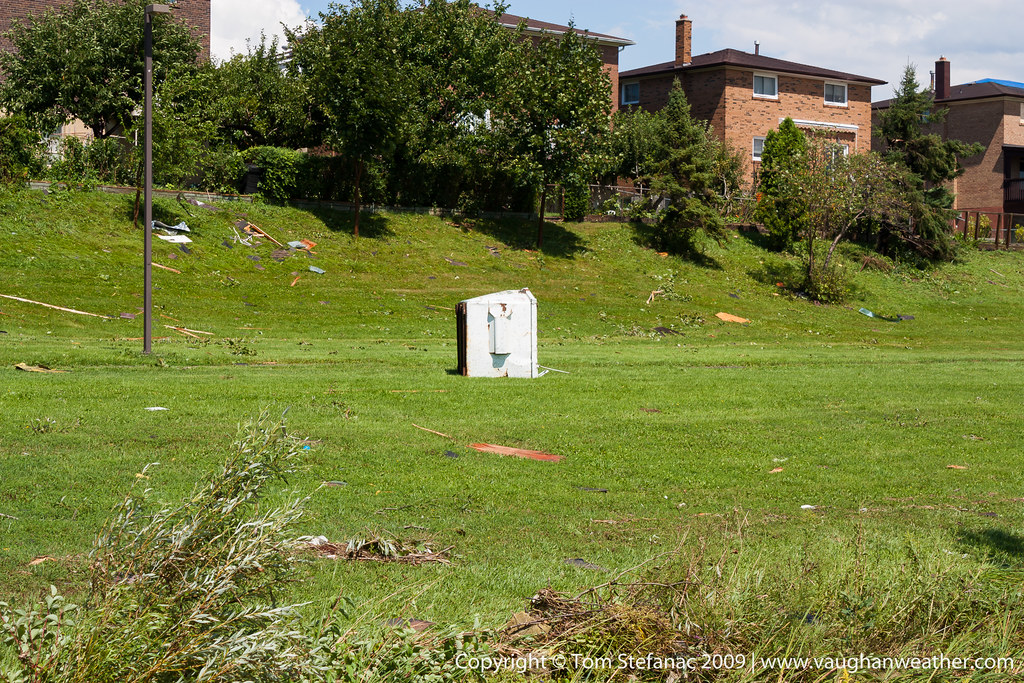
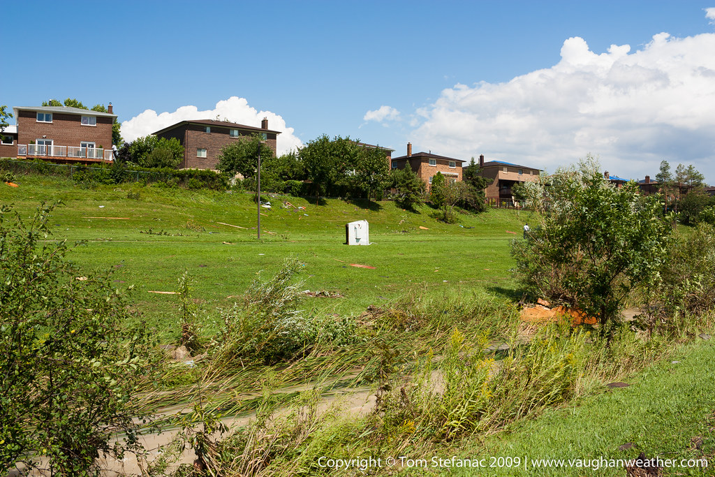
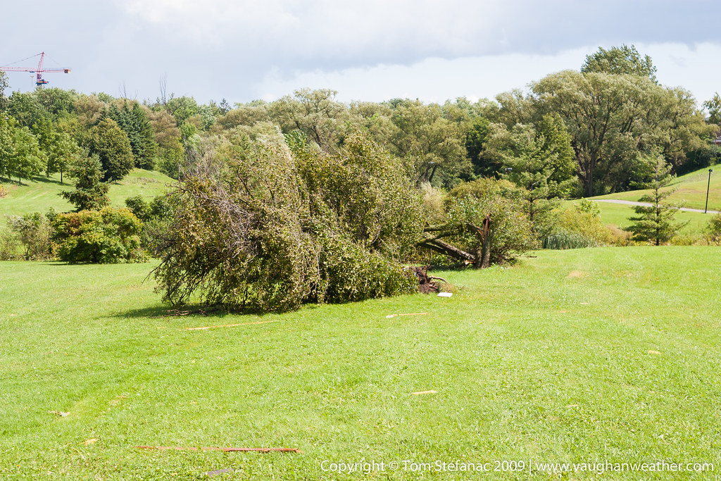
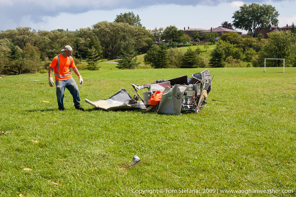
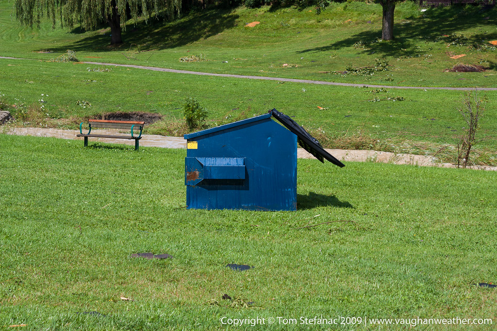
Maple – F2 – 2009
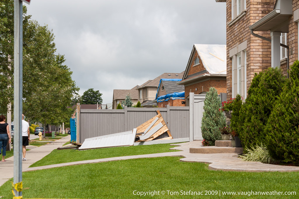
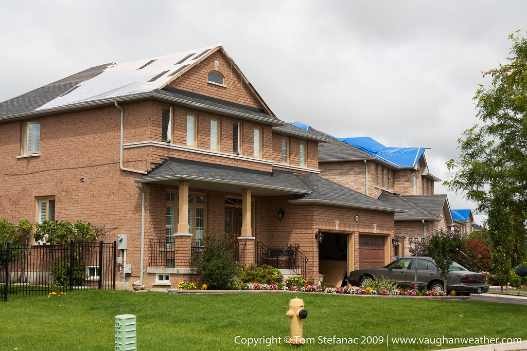
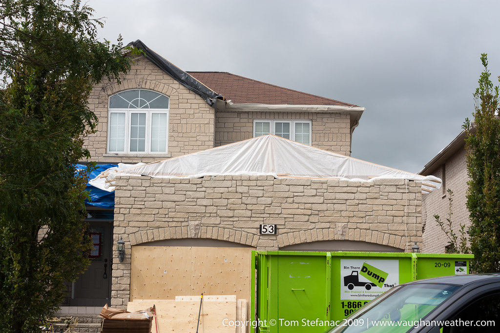
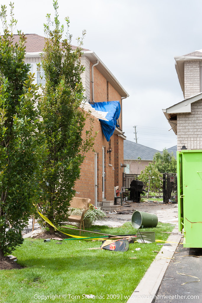
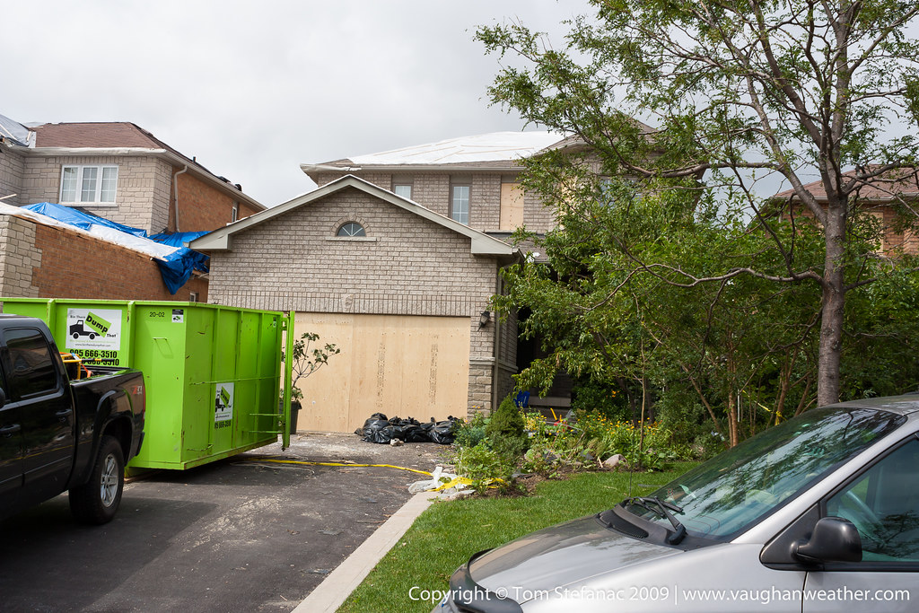
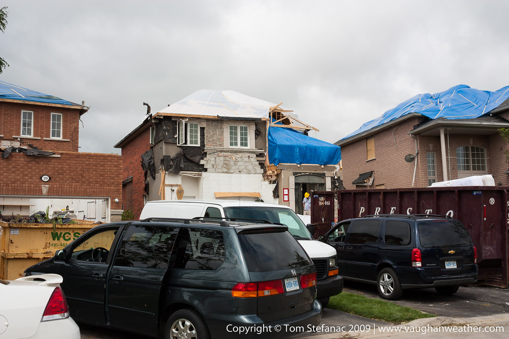
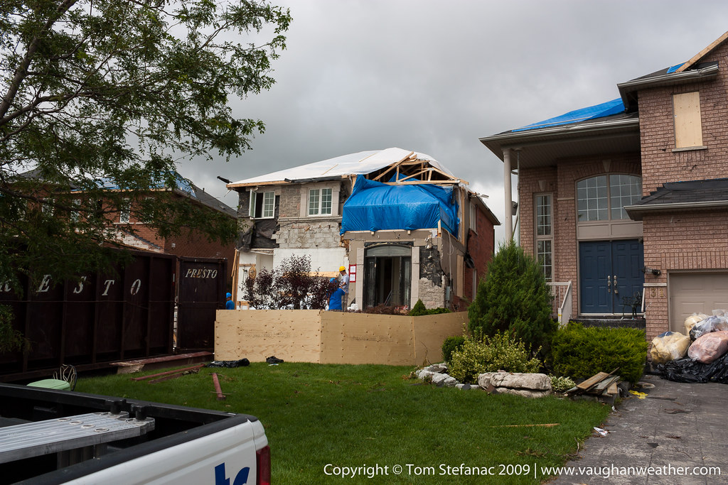
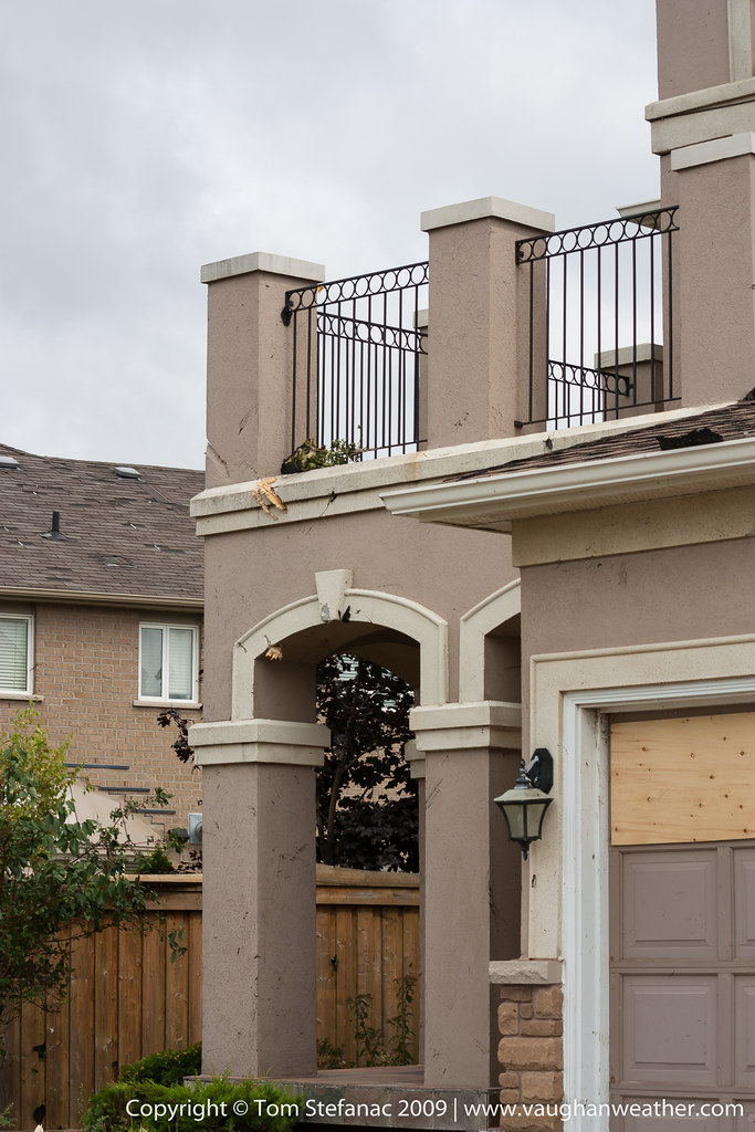
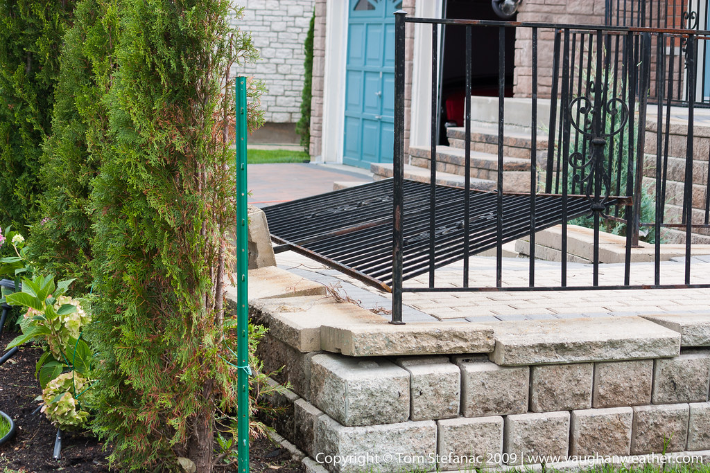
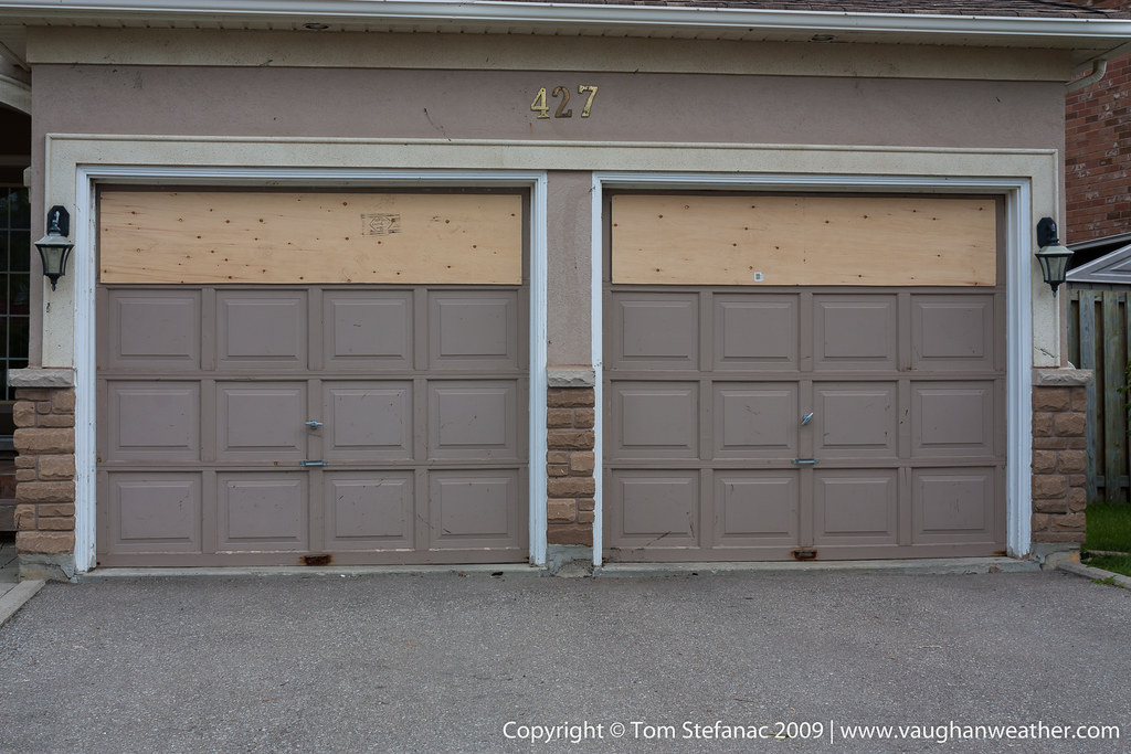
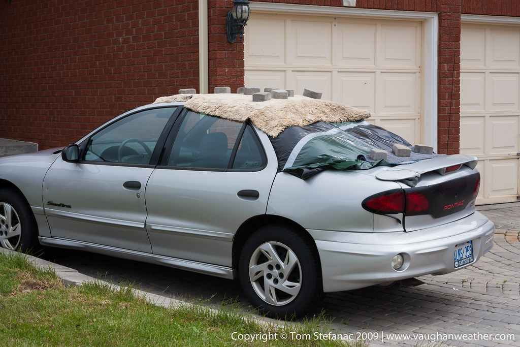
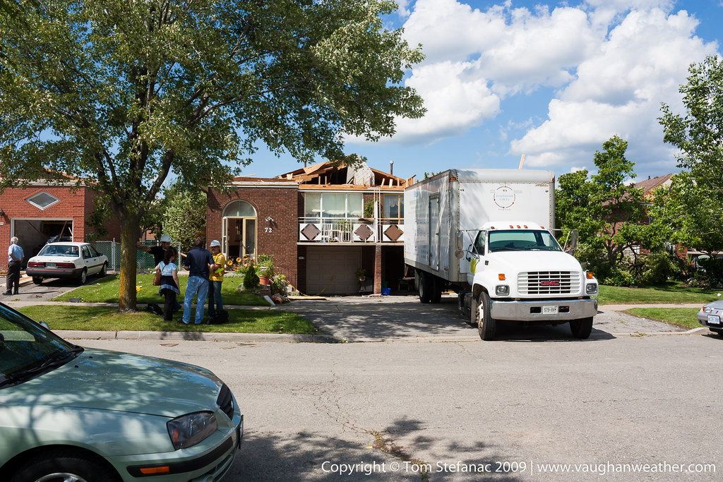
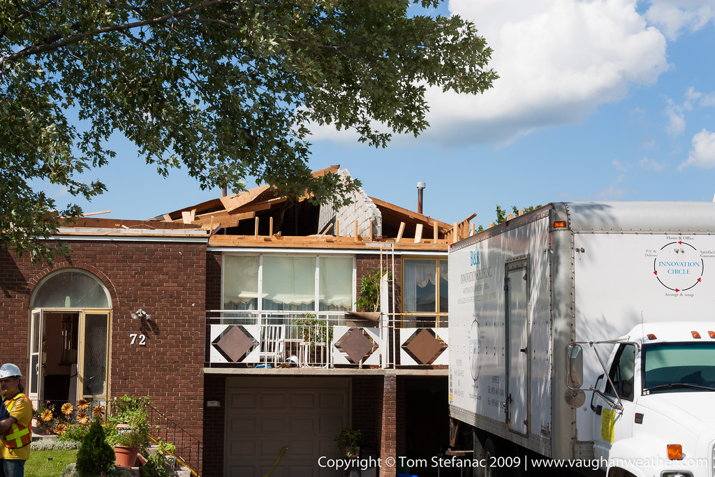
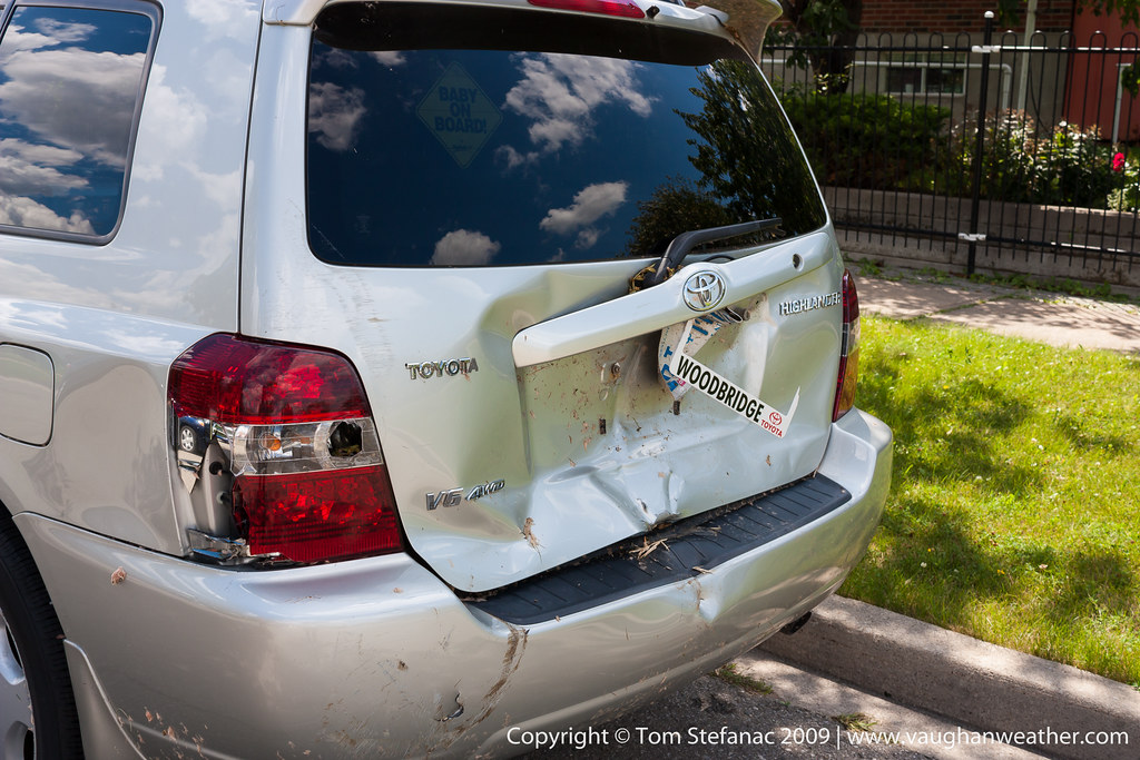
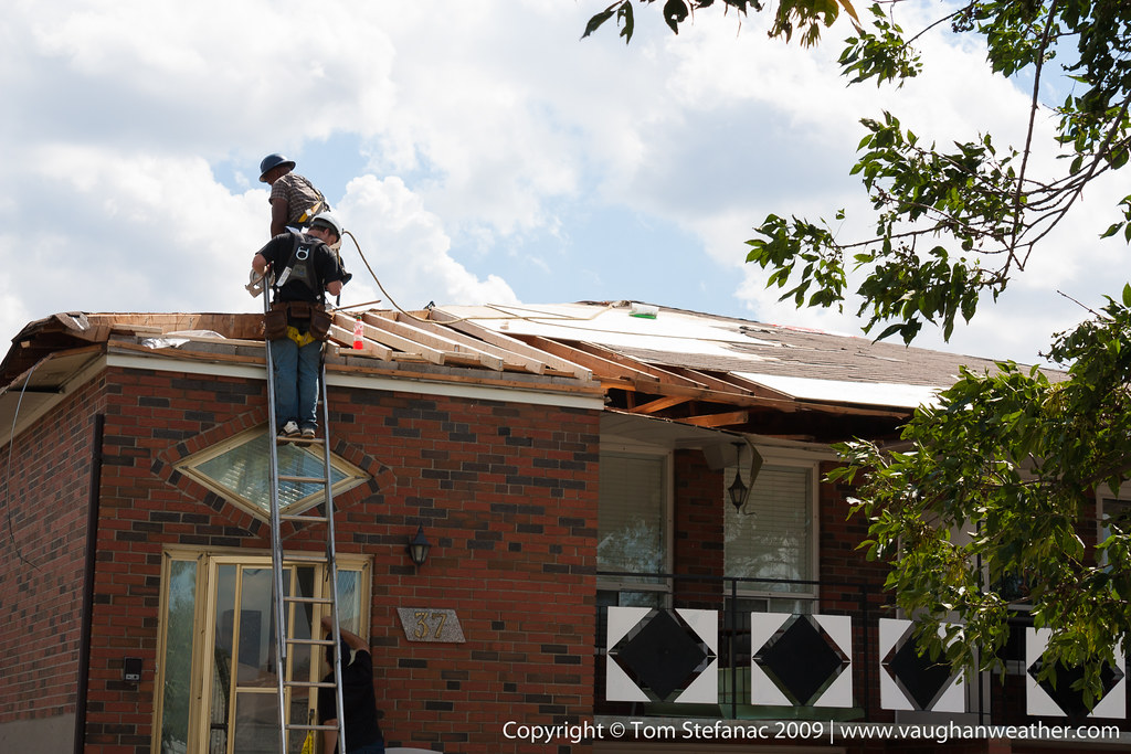
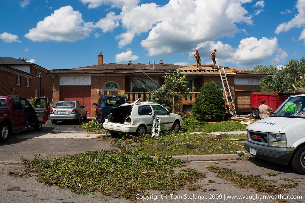
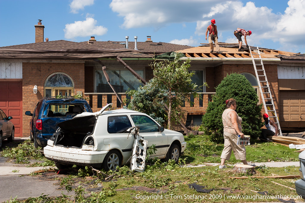
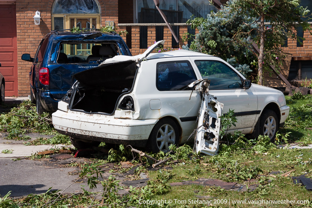
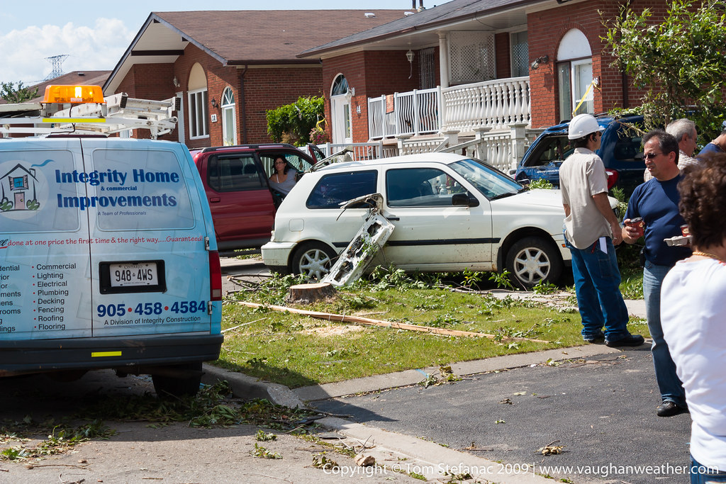
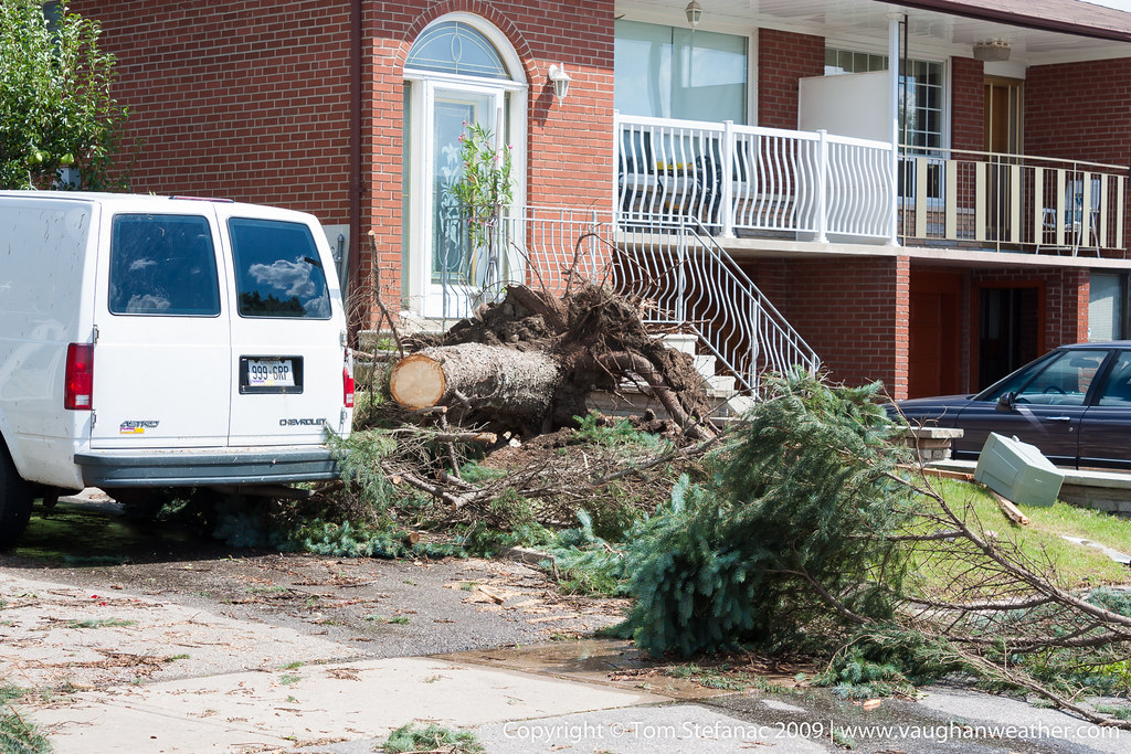
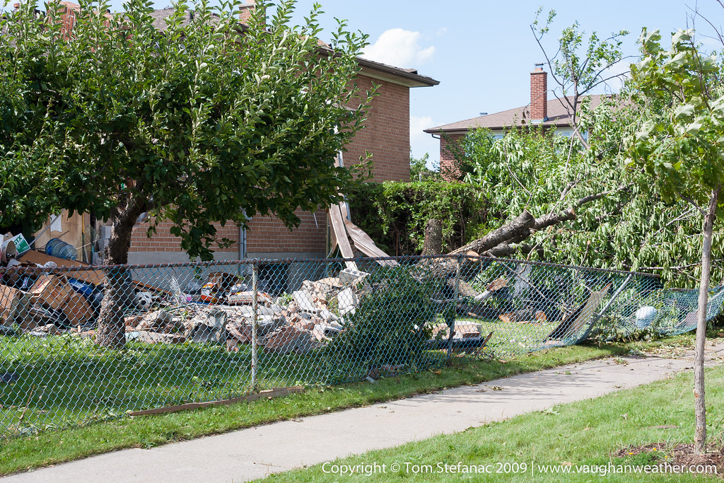
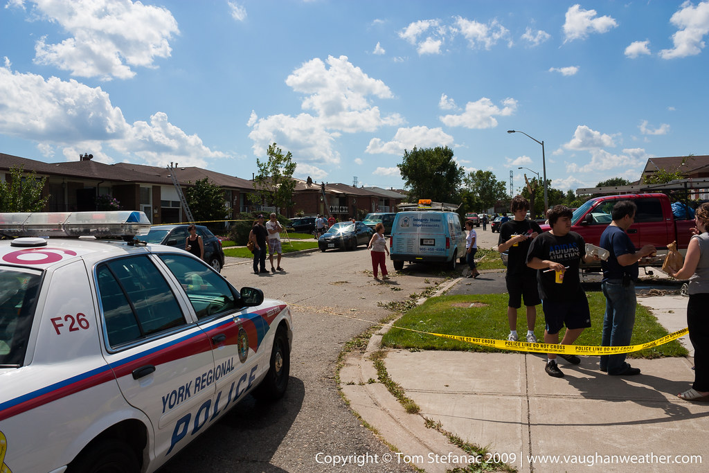
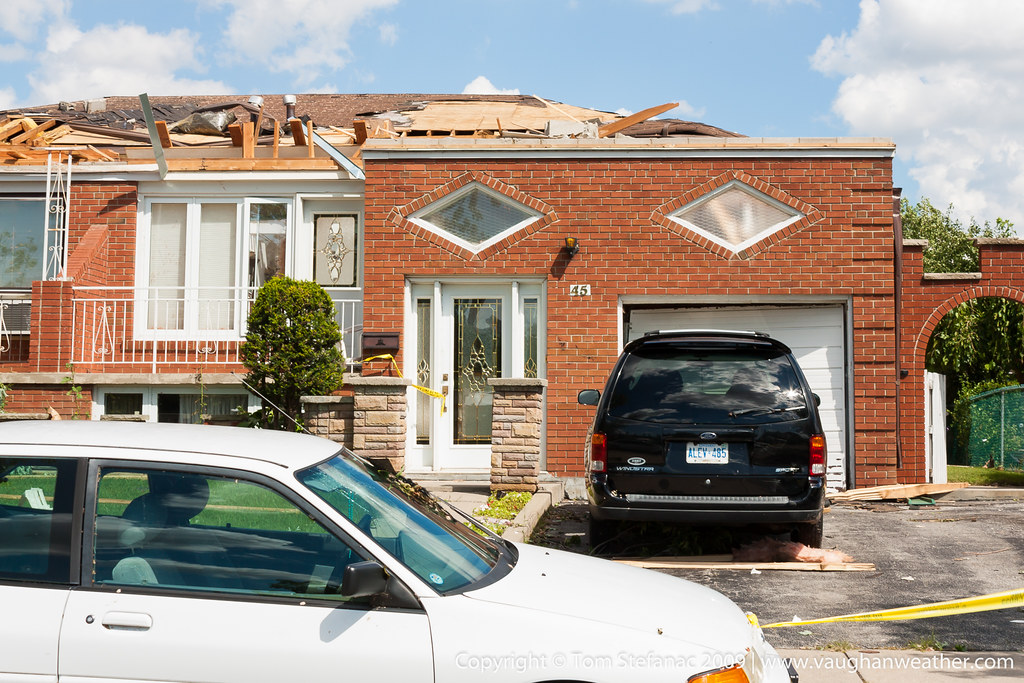
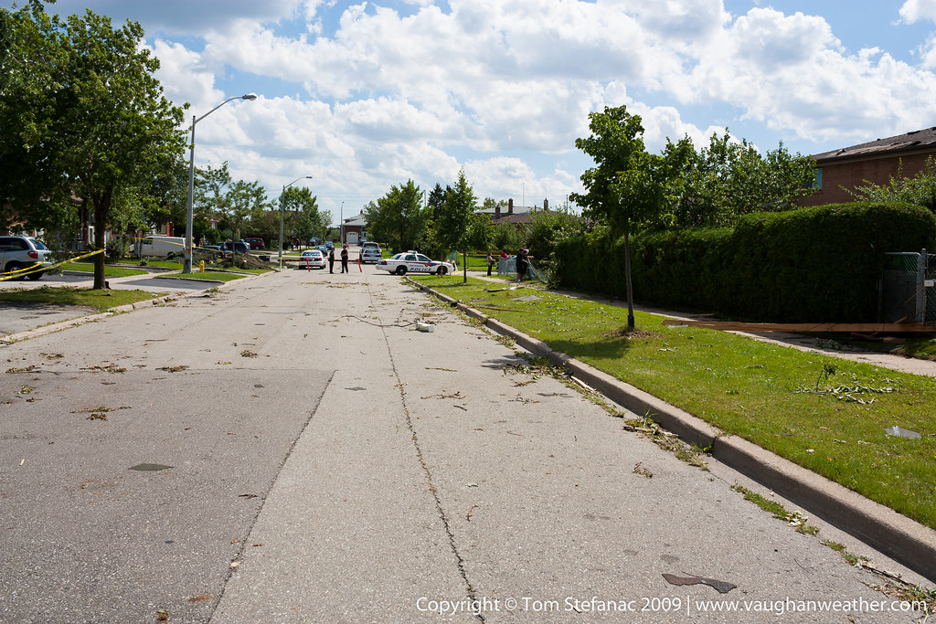
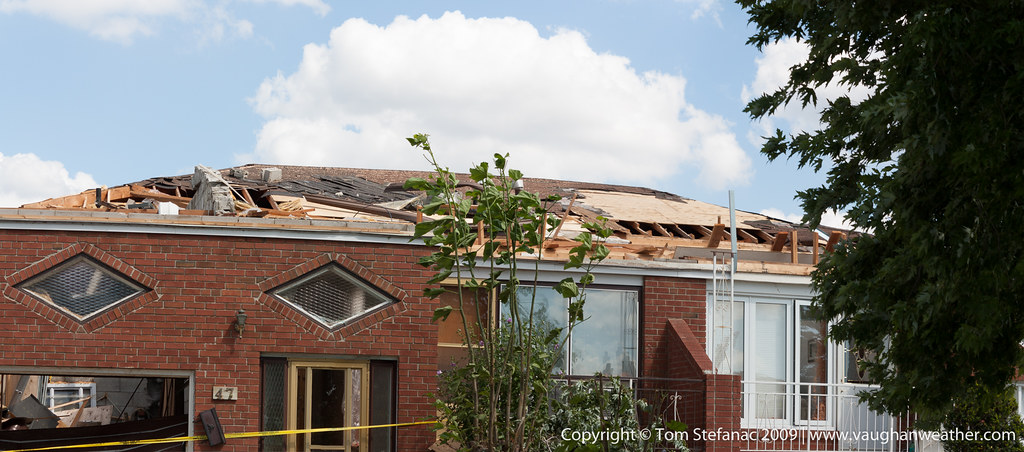
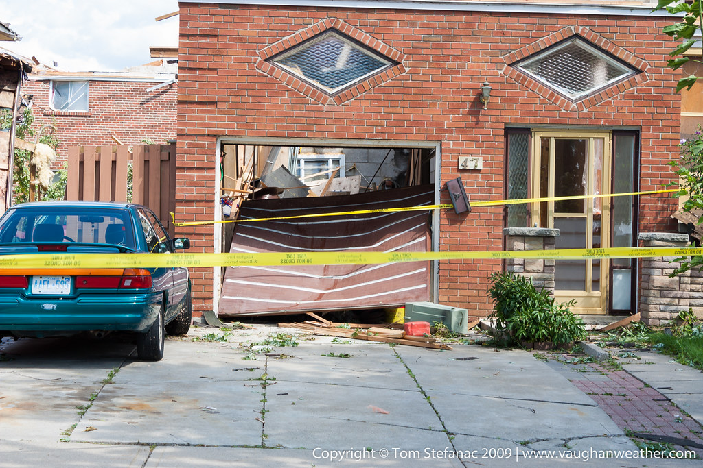
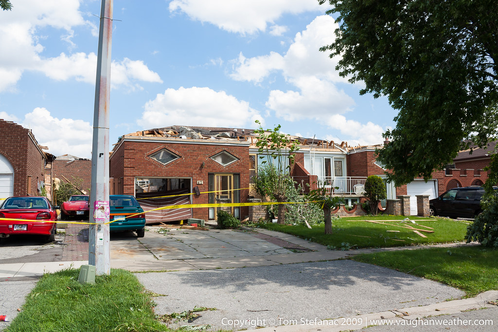
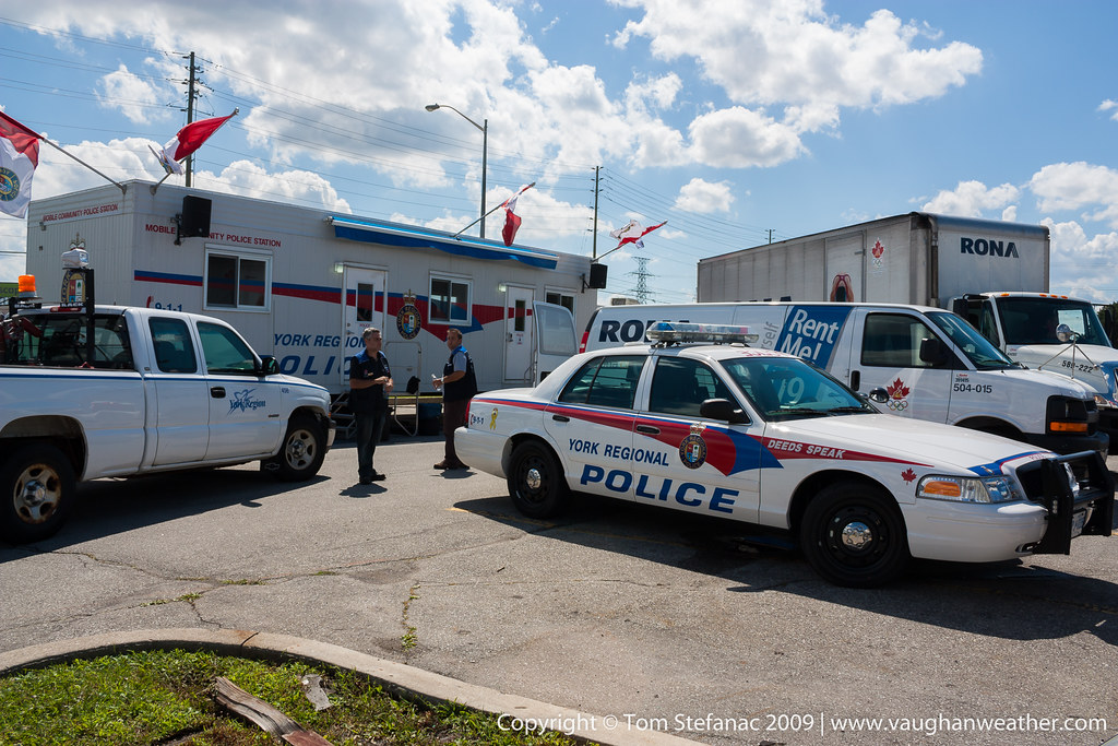
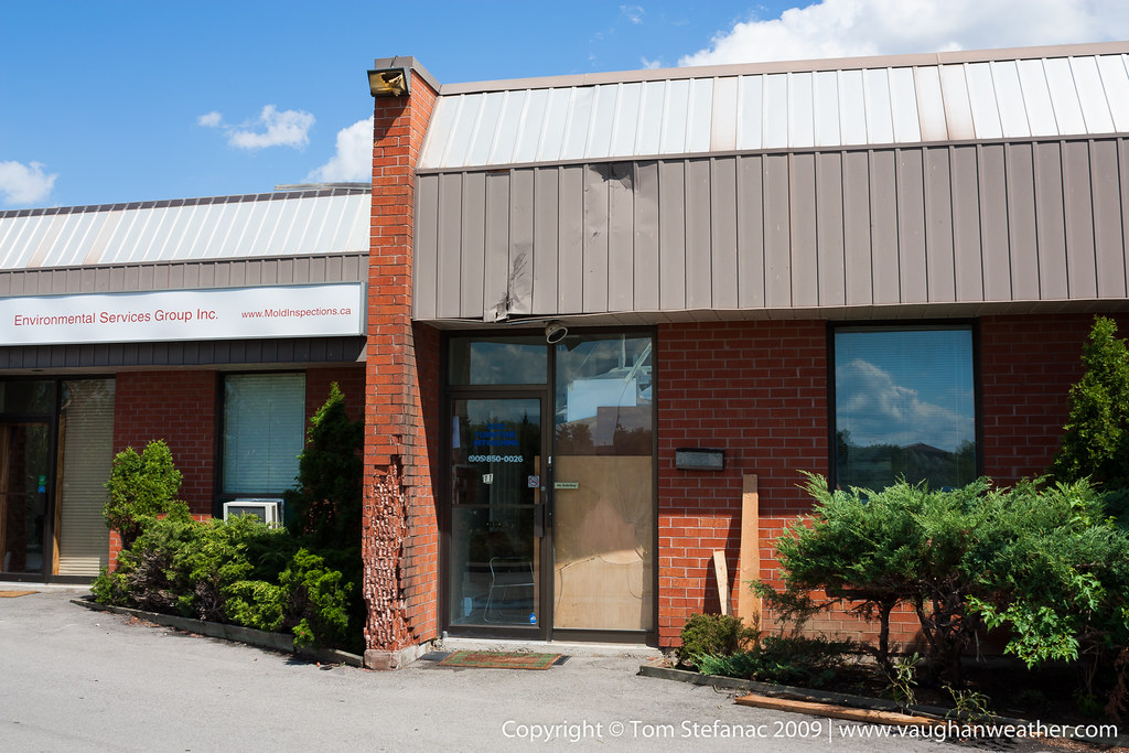
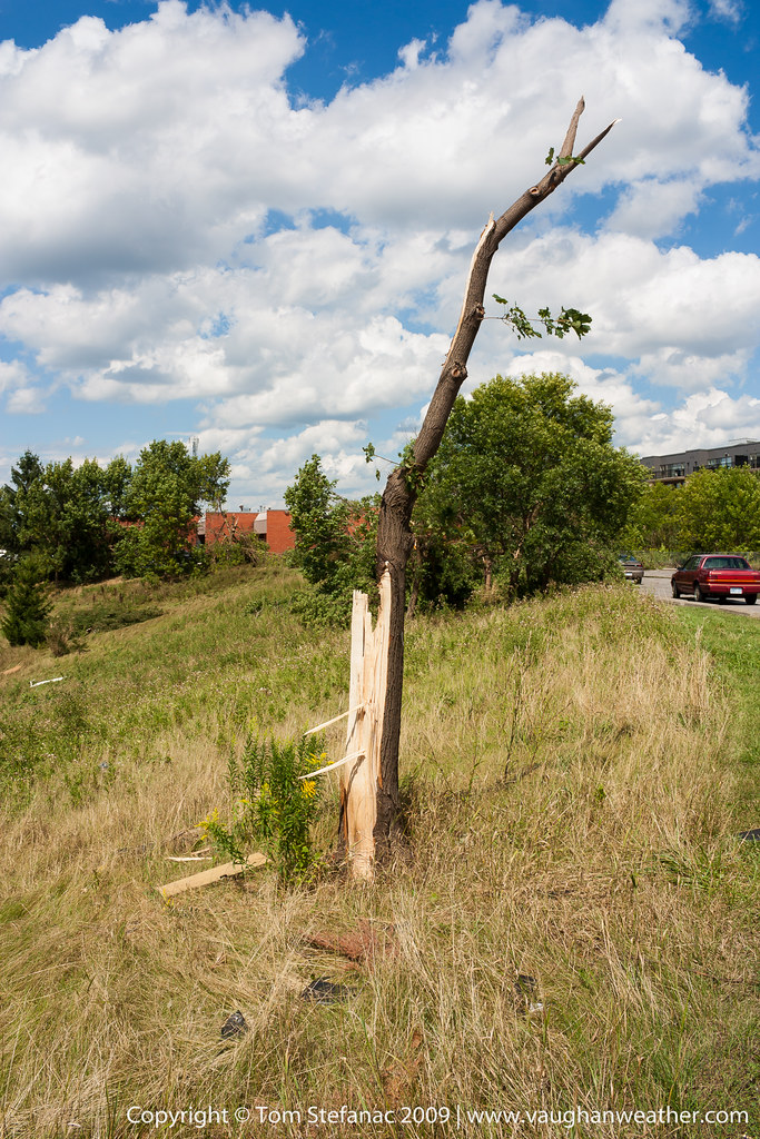
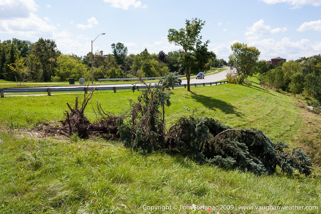
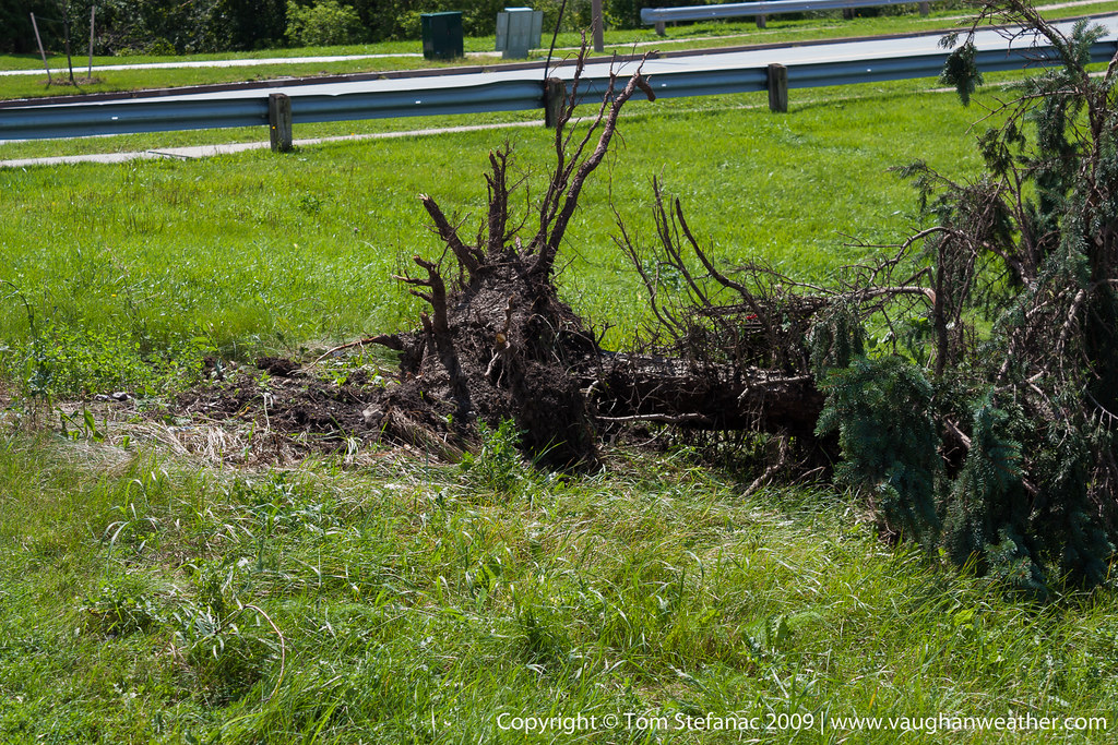
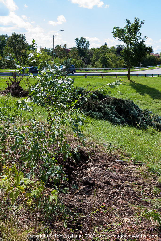
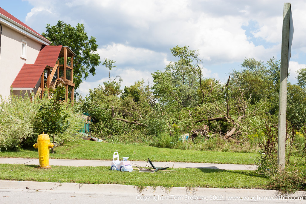
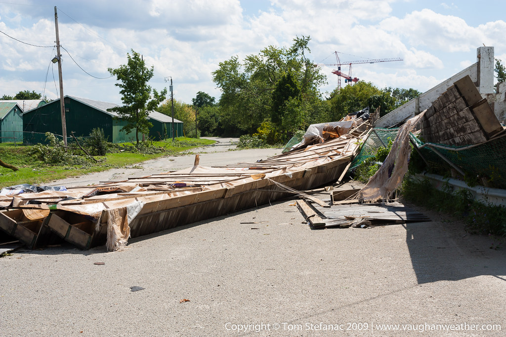
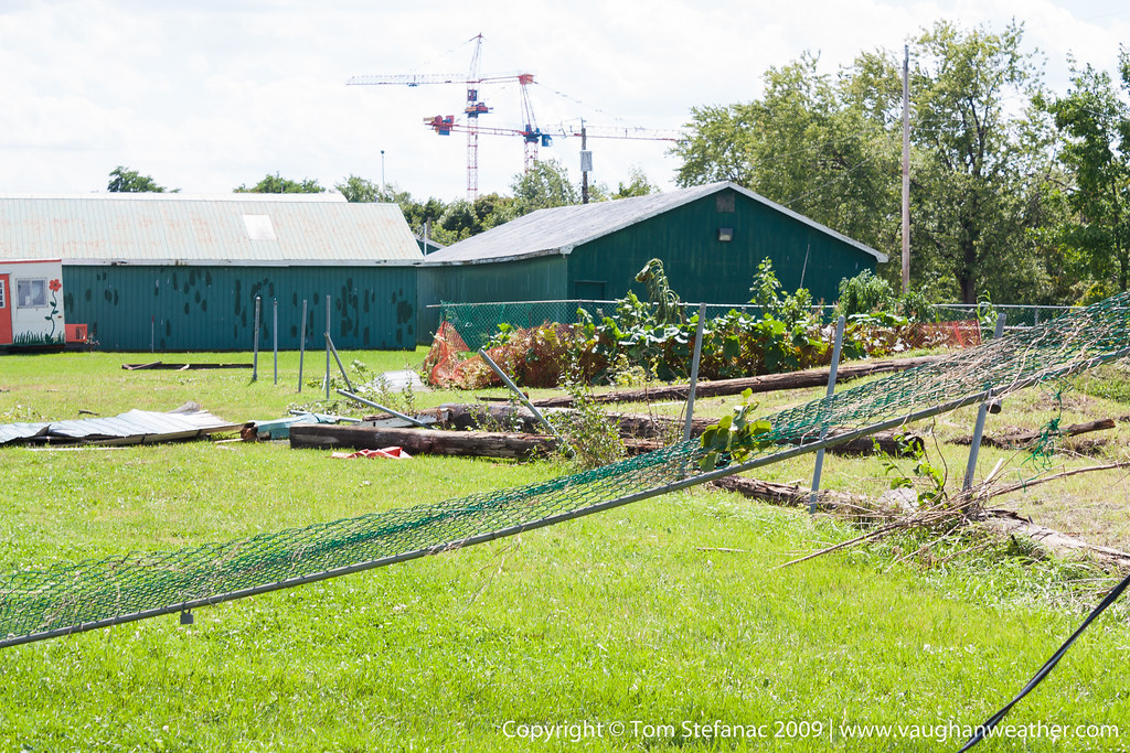
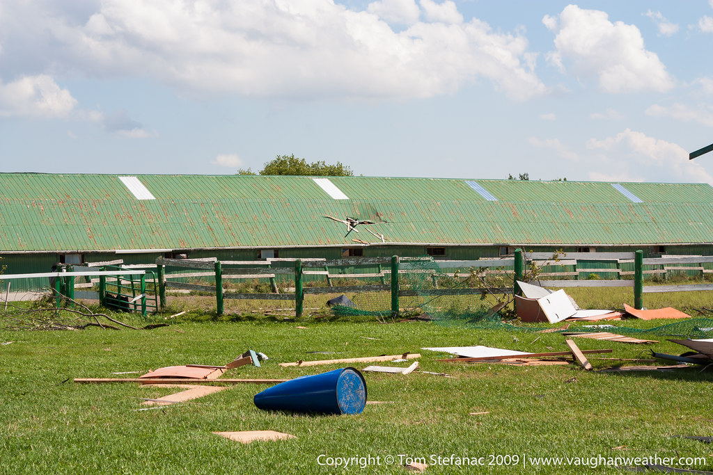
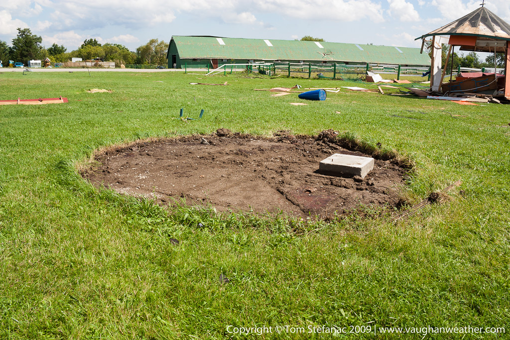
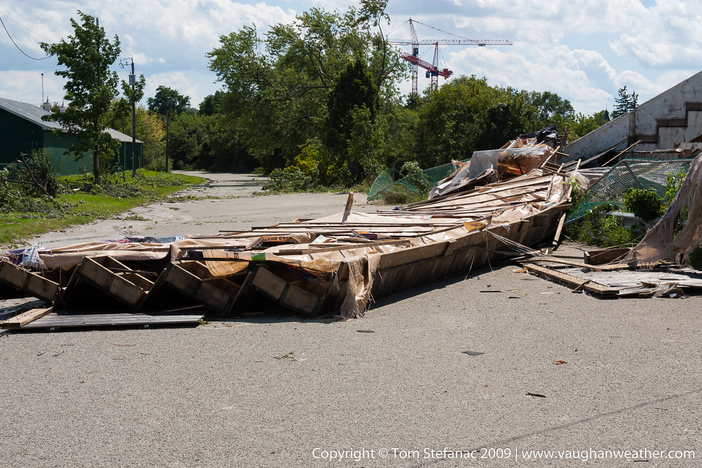
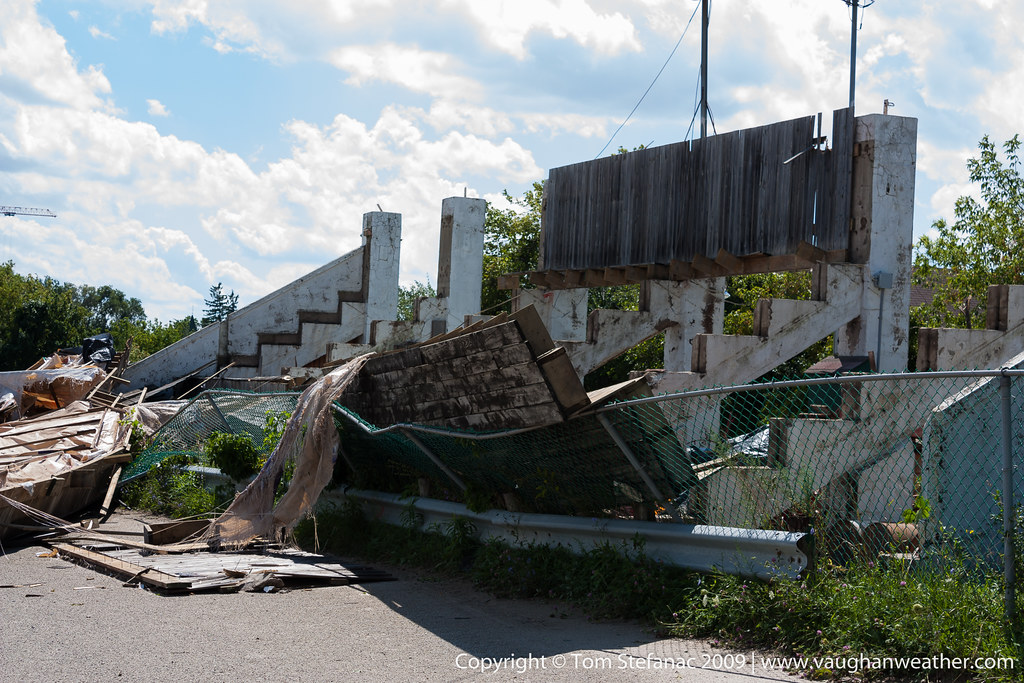
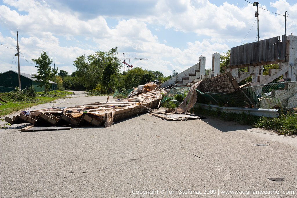
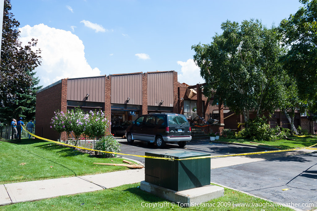
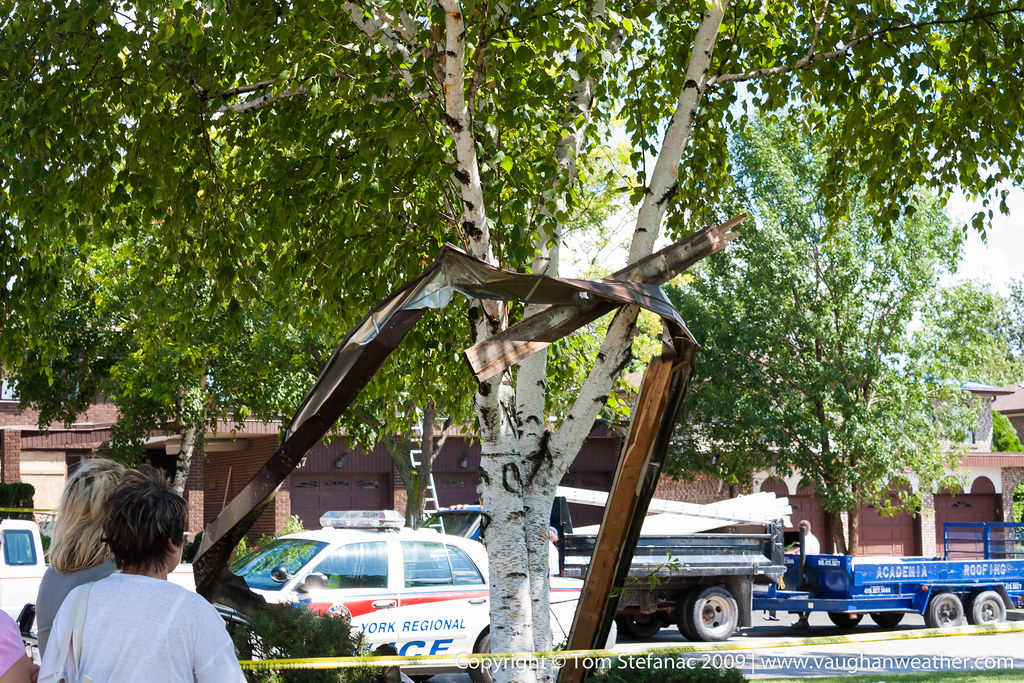
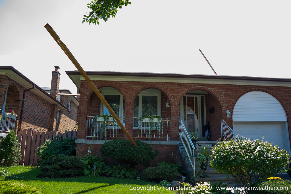
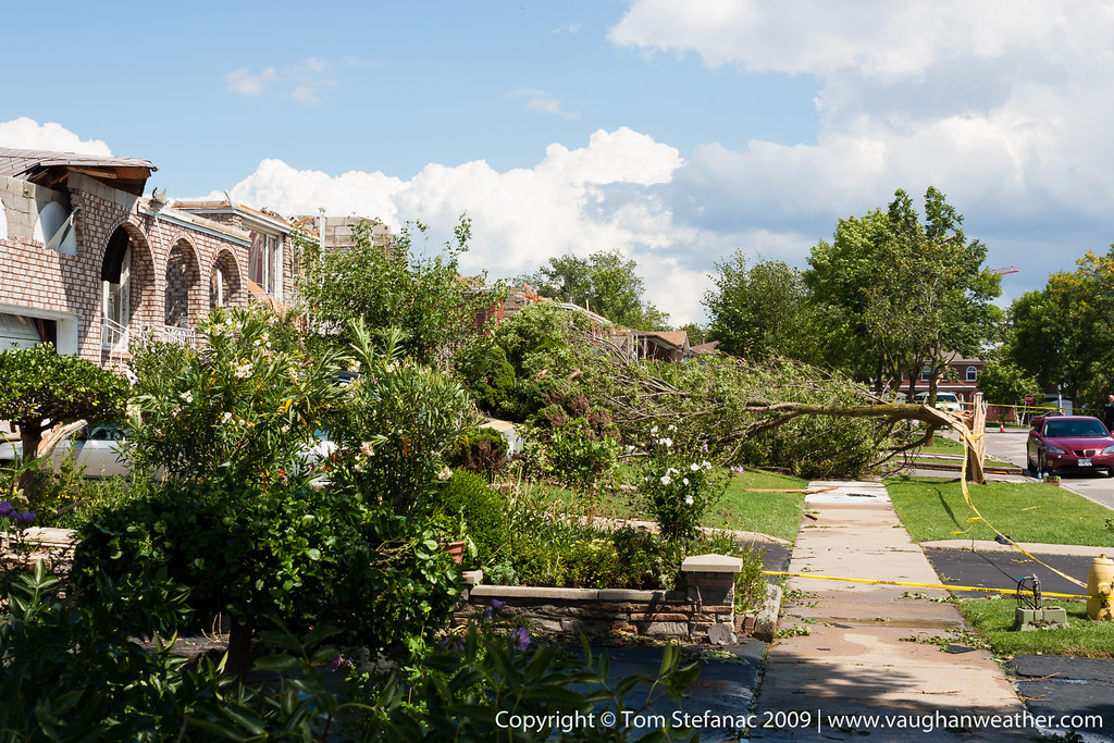
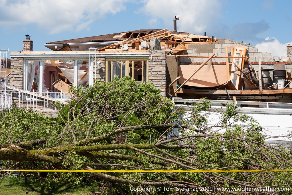
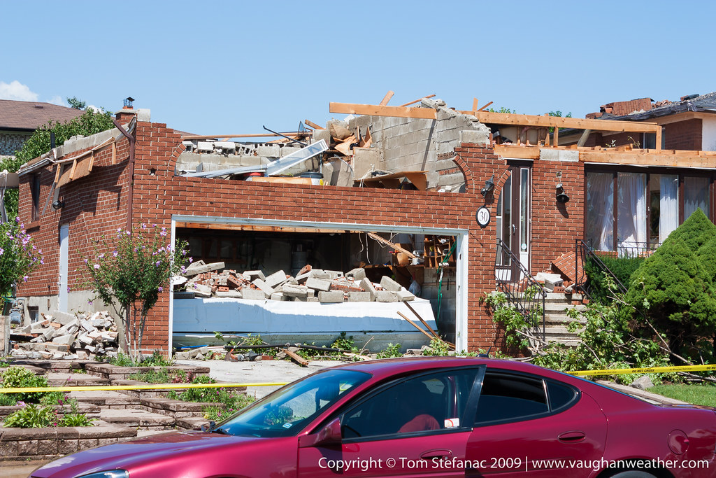
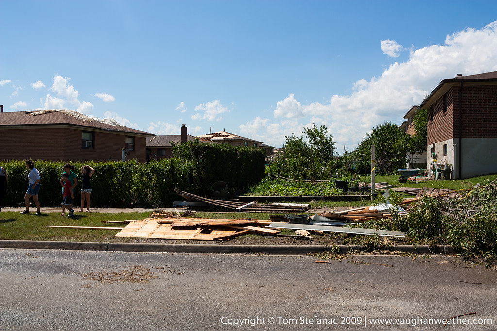
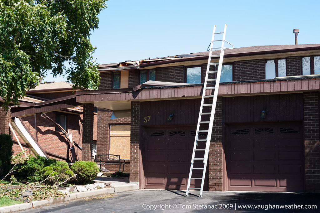
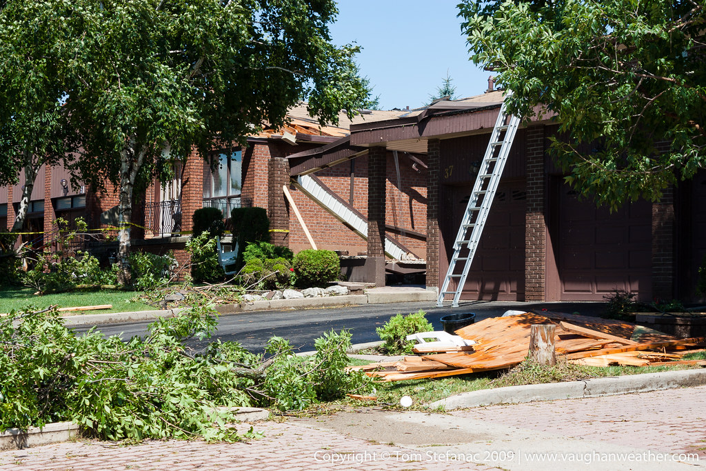
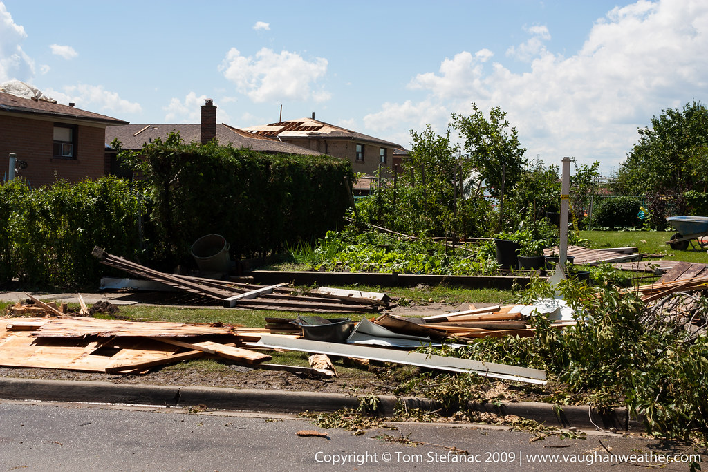
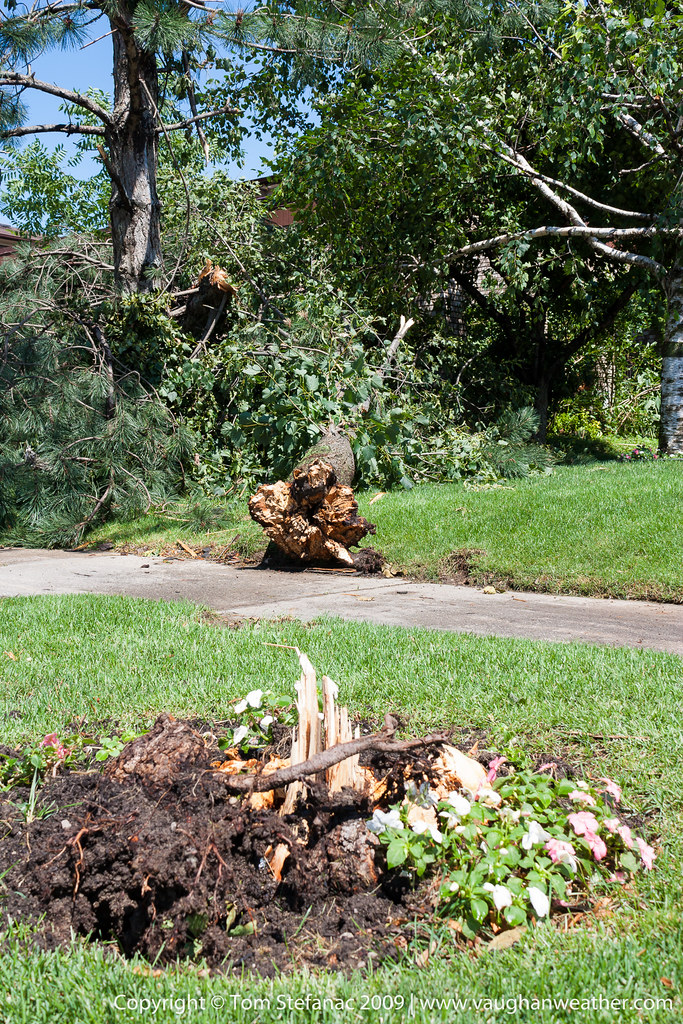
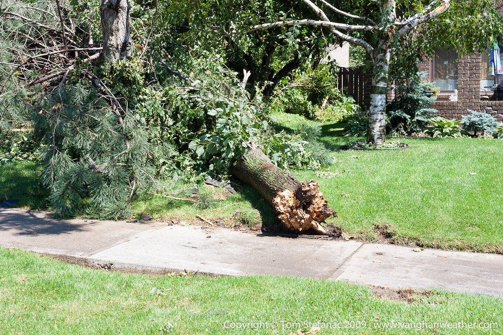
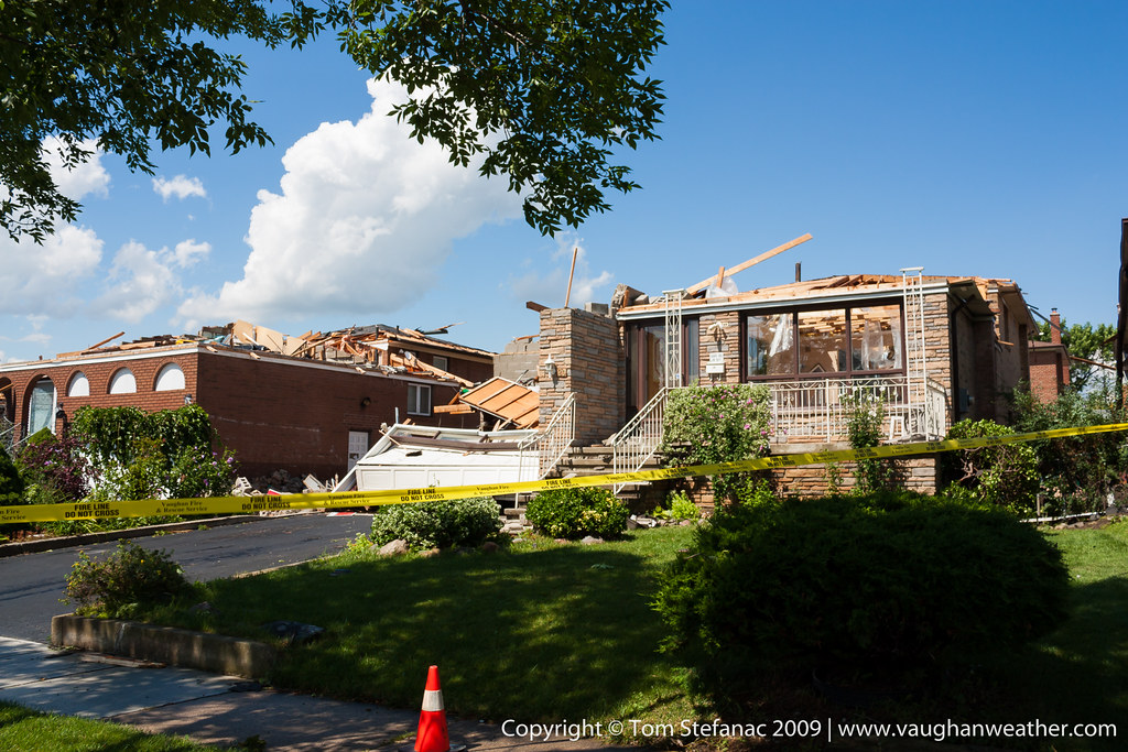
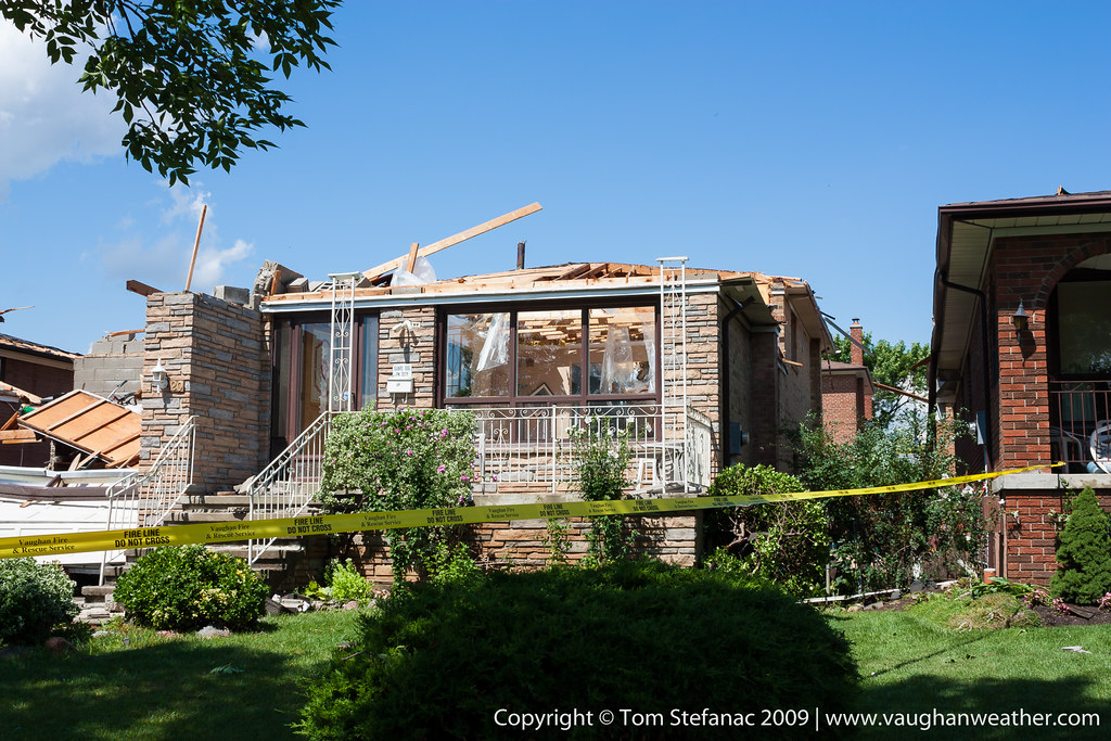
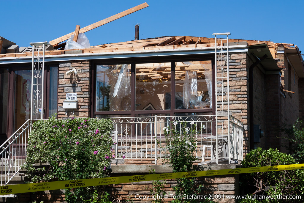
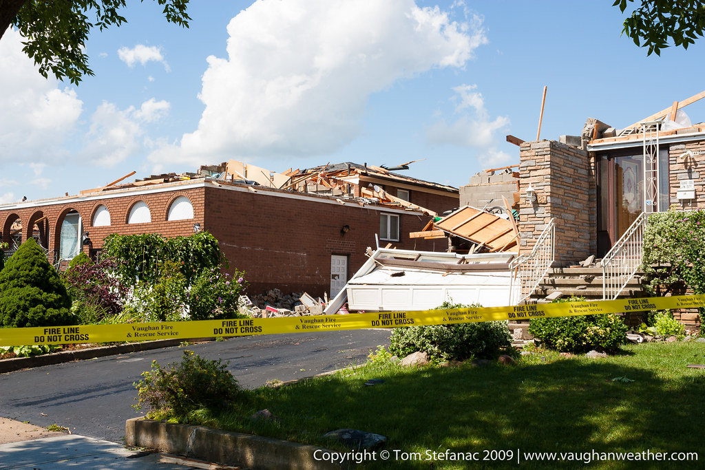
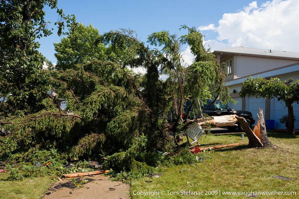
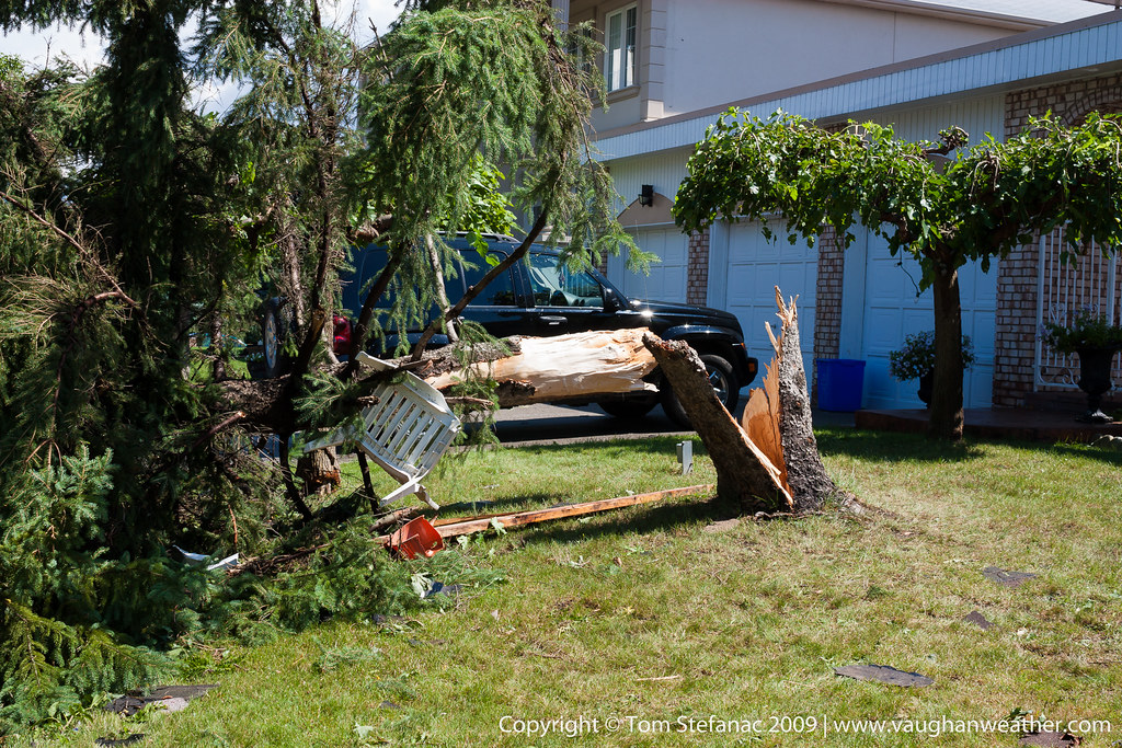
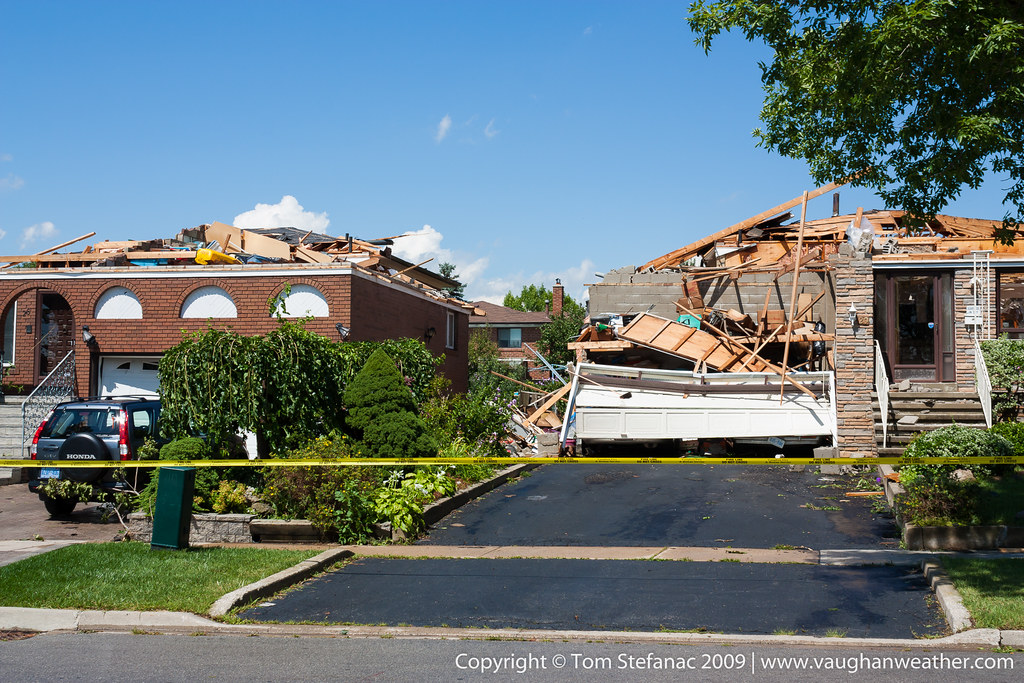
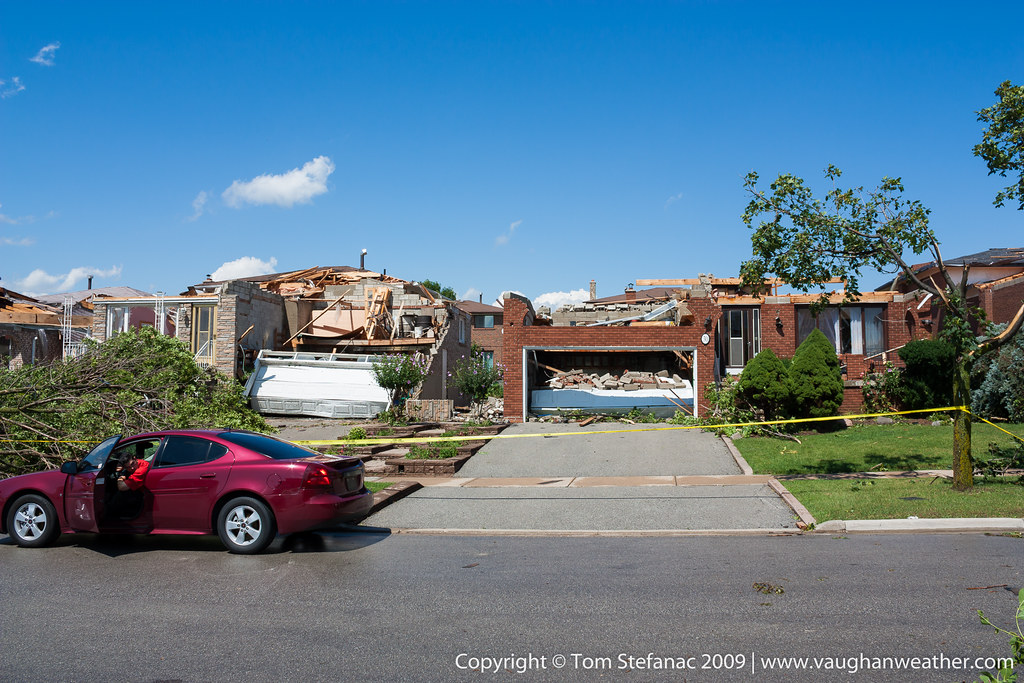
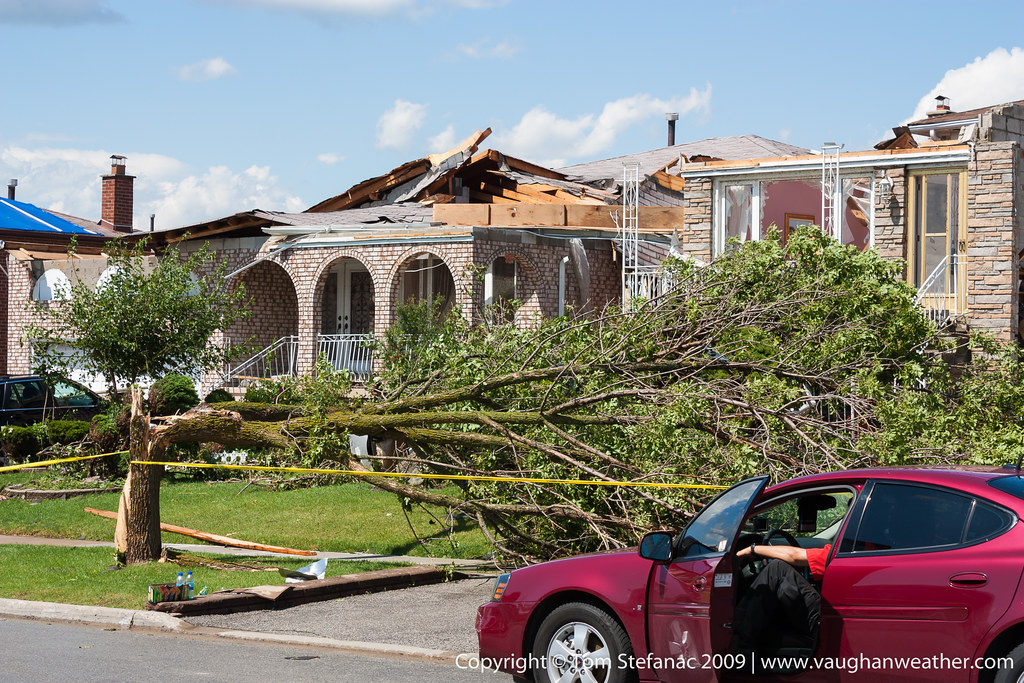
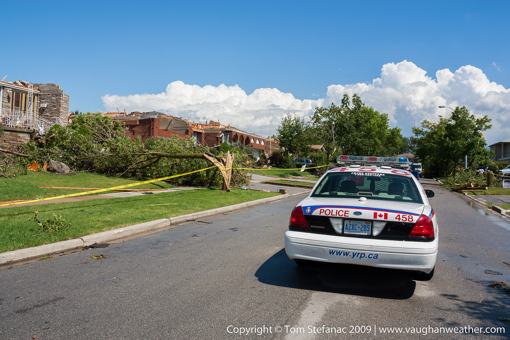
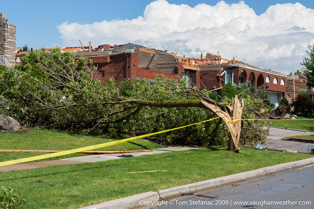
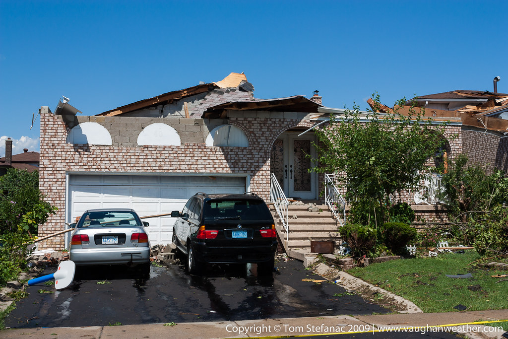
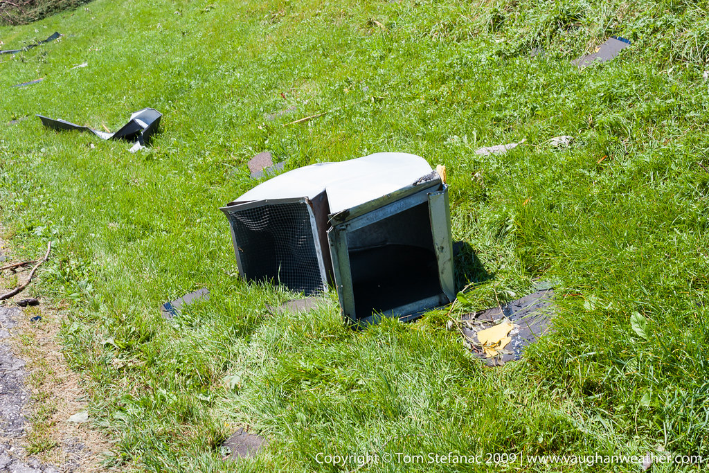
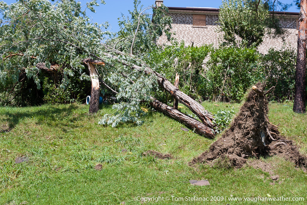
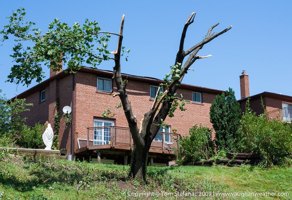
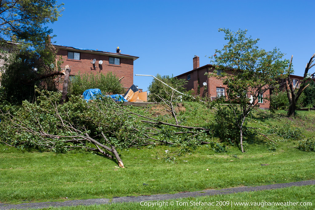
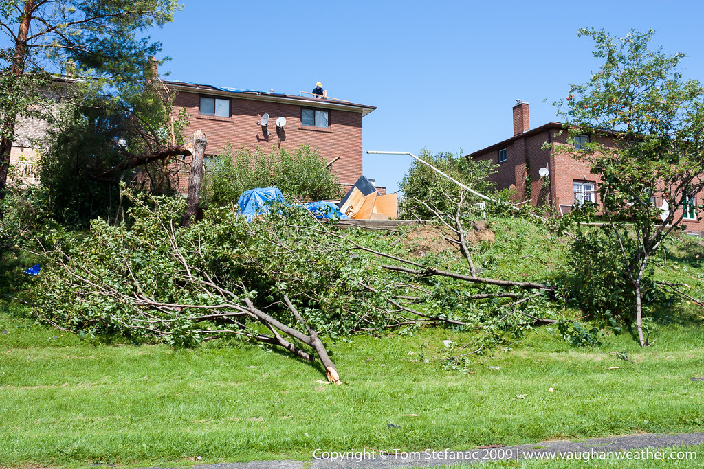
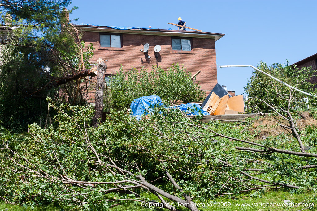
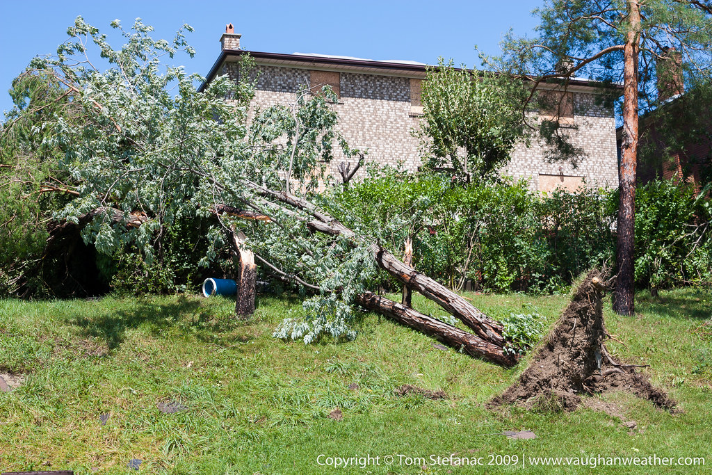
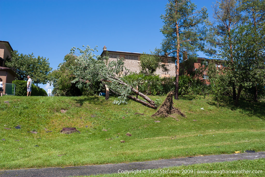
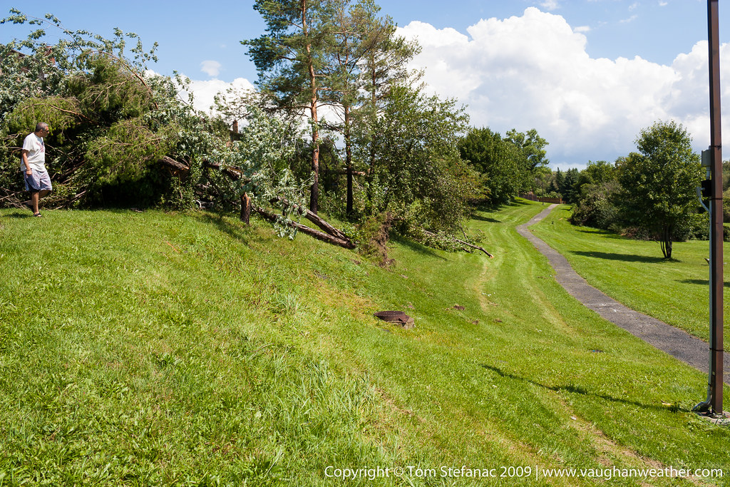
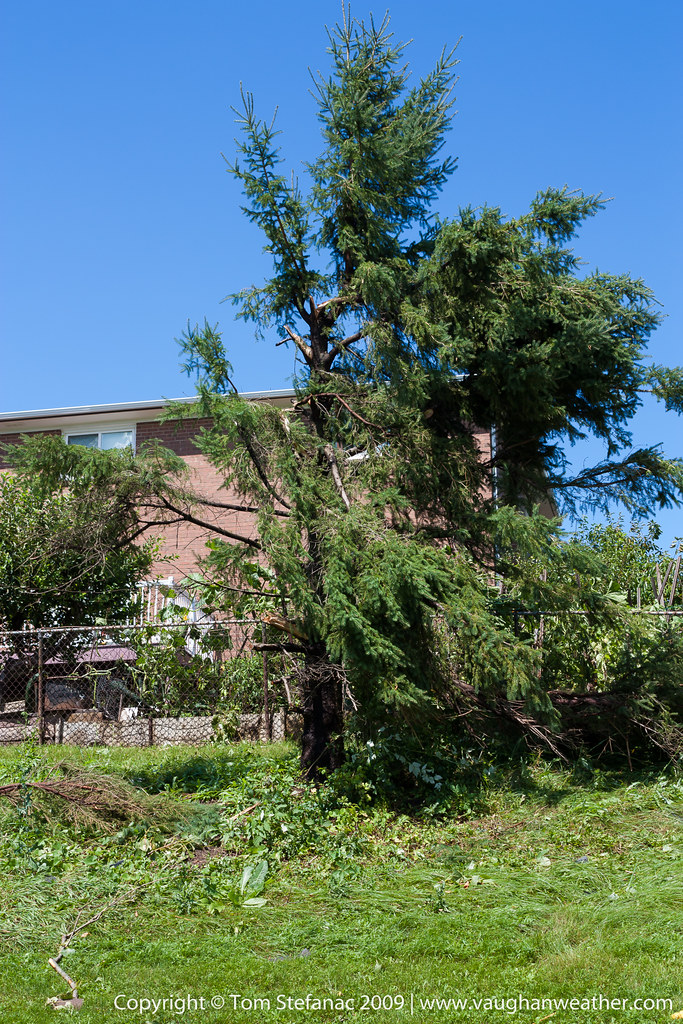
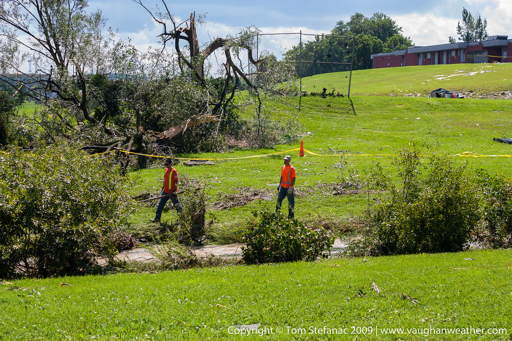
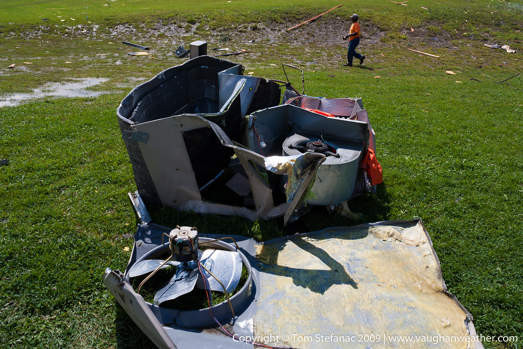
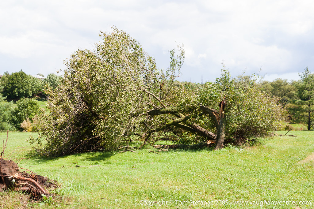
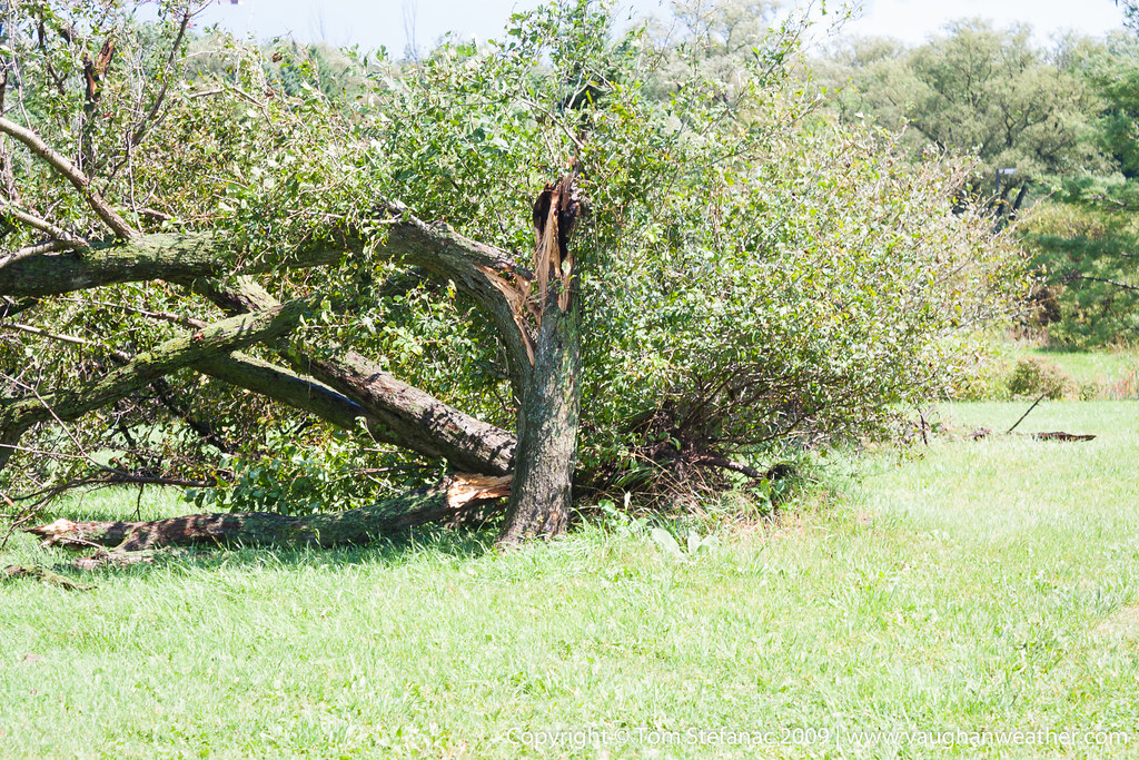
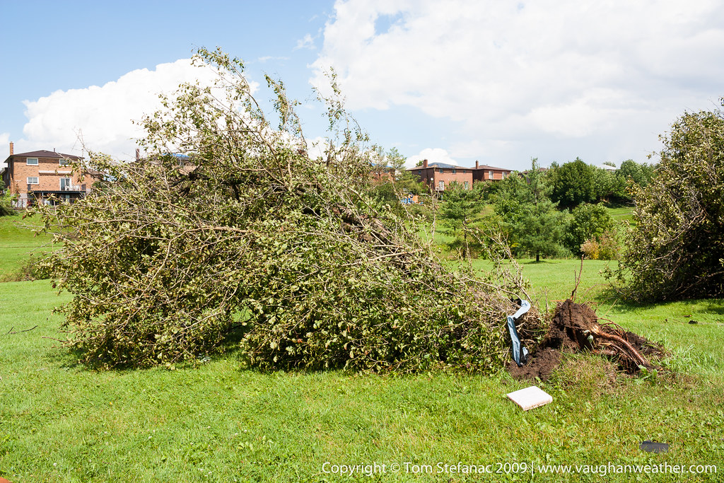
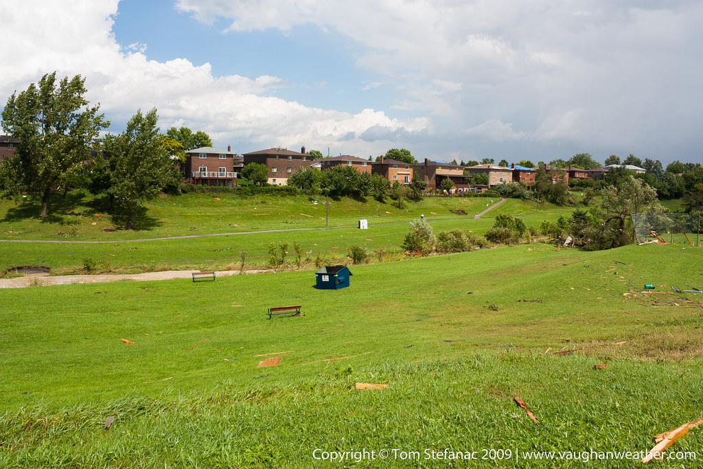
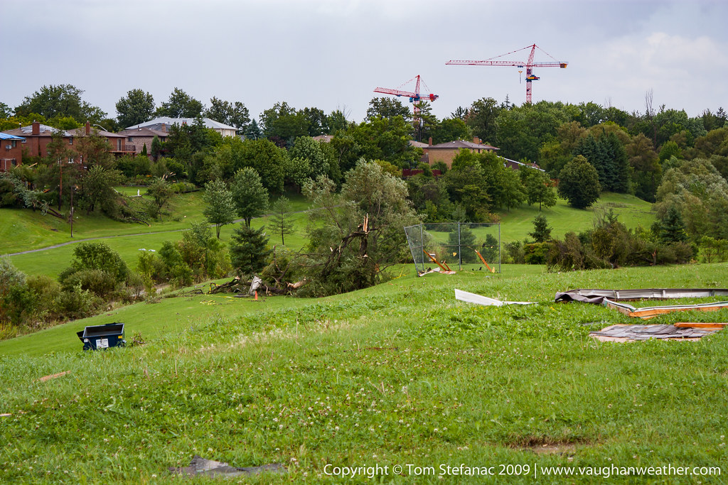
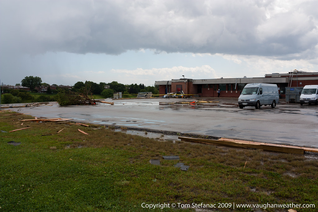
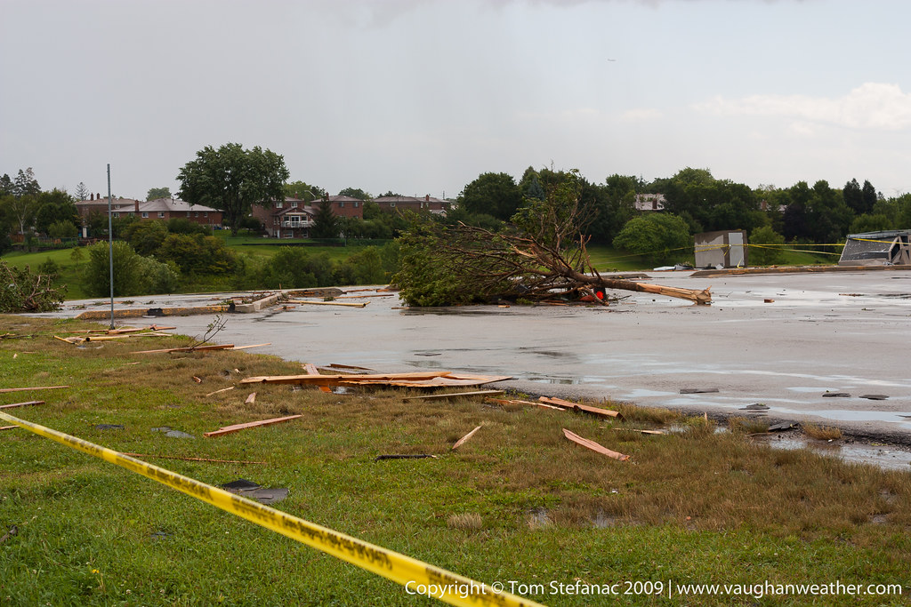
On the afternoon of August 20th 2009, a series thunderstorms grew across Southern Ontario, spawning numerous tornadoes in what would become known as the Southern Ontario Tornado Outbreak of 2009. One of the storm cells associated with the tornado outbreak spawned two tornadoes. The first tornado touched down in the community of Woodbridge, and the second in the community of Maple. Both tornadoes were given an F2 rating. This gallery shows the damage in Maple.


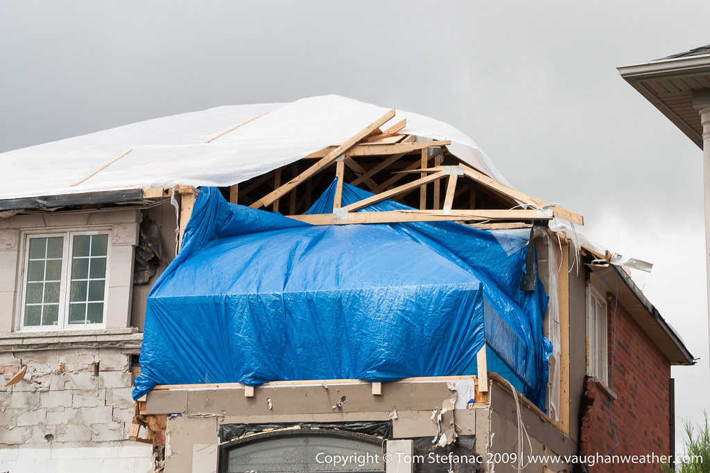


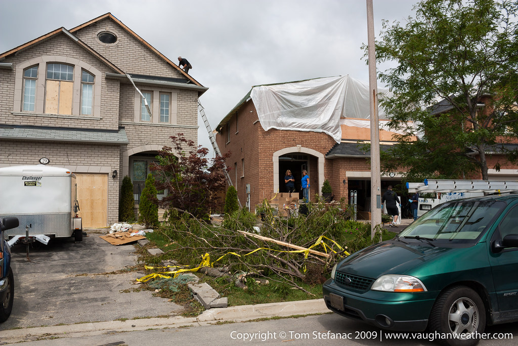

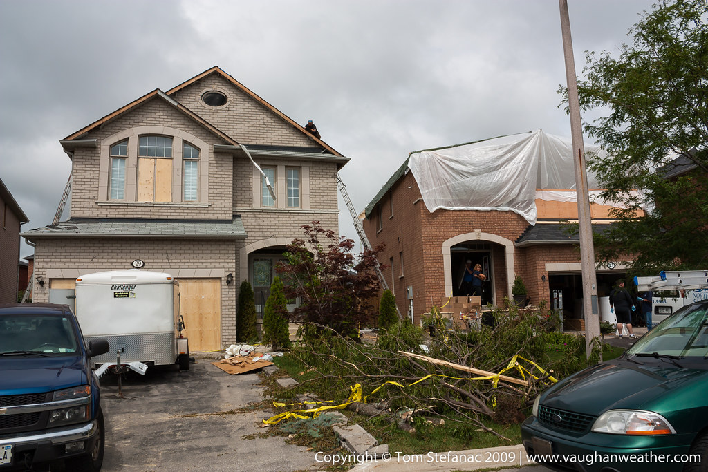

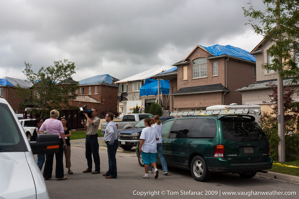

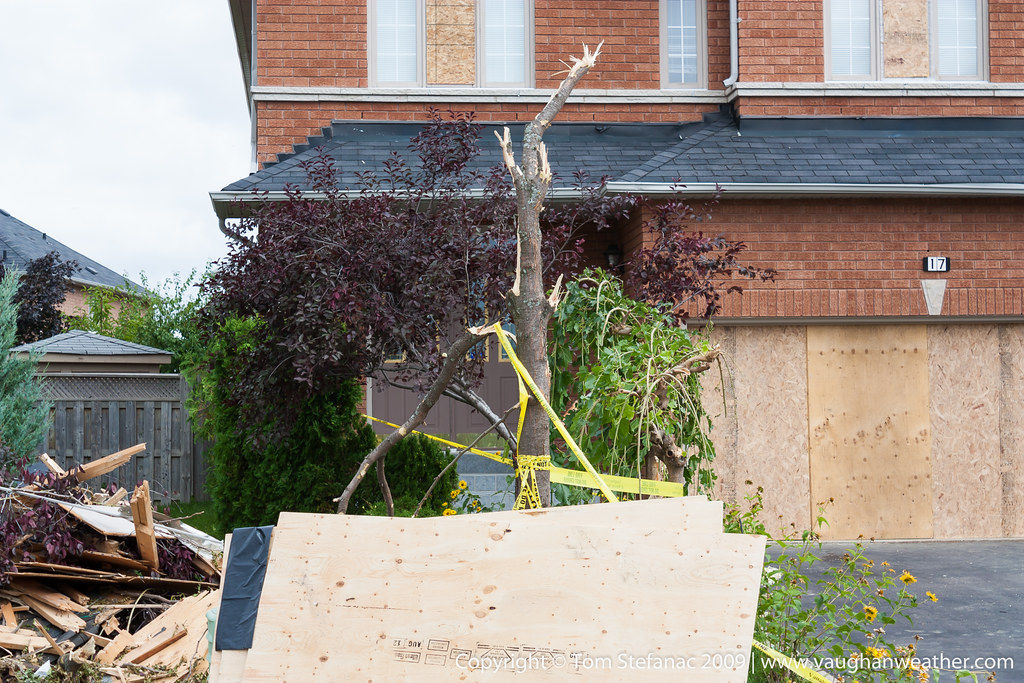
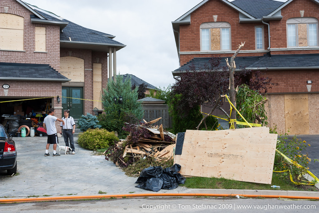
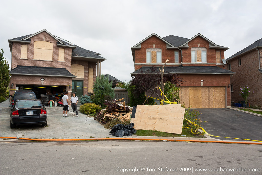
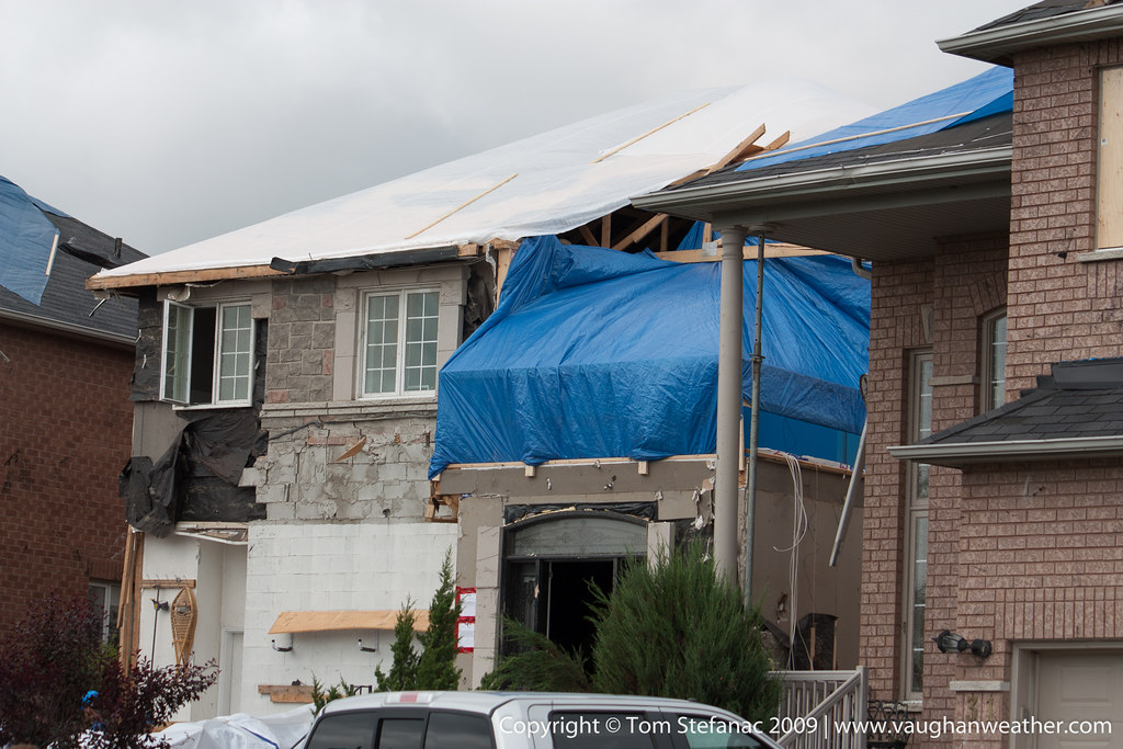


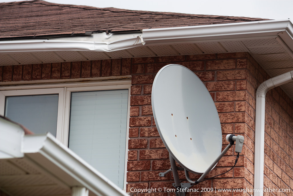
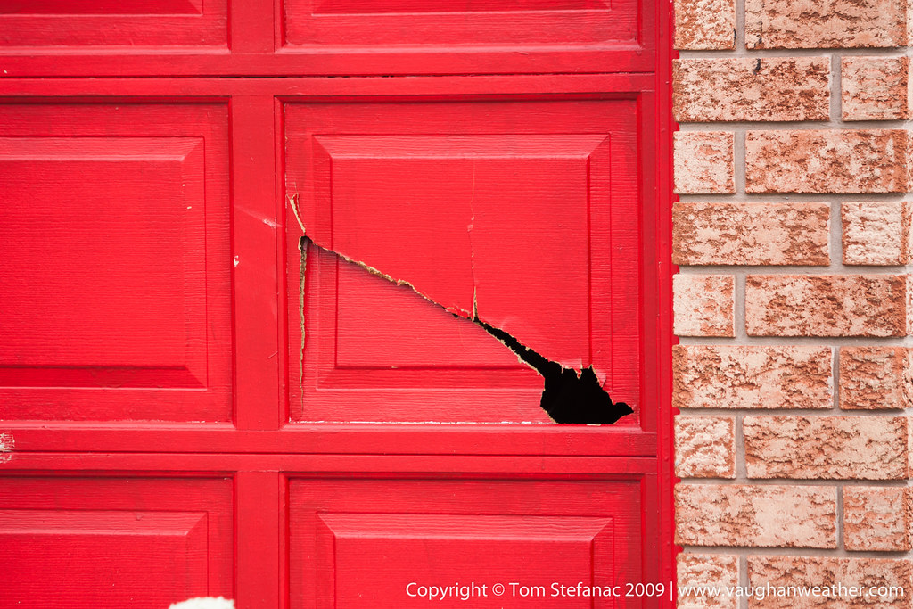

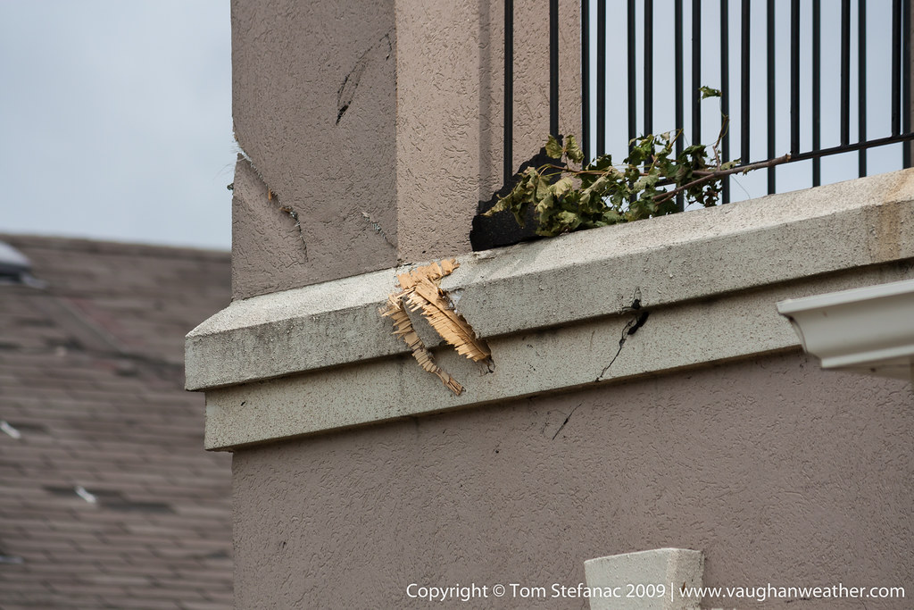
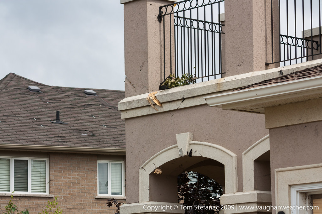


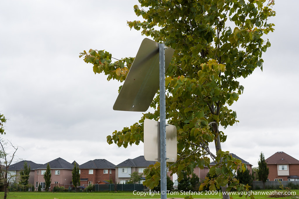

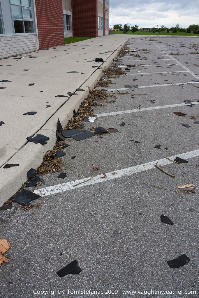

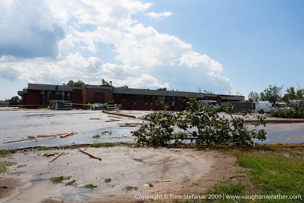
Woodbridge – F2 – 2009
On the afternoon of August 20th 2009, a series thunderstorms grew across Southern Ontario, spawning numerous tornadoes in what would become known as the Southern Ontario Tornado Outbreak of 2009. One of the storm cells associated with the tornado outbreak spawned two tornadoes. The first tornado touched down in the community of Woodbridge, and the second in the community of Maple. Both tornadoes were given an F2 rating. This gallery shows the damage in Woodbridge.


Raw video I shot moments after the tornado
Second clip
Canon 5DSR
The latest, biggest and baddest addition to my photographic arsenal is the Canon 5DSR. This beast of a camera shoots at a whopping 53 megapixels (effectively 50.6), more than double the resolution of the 5DMKIII, three times the resolution of the T4i and over four times the resolution of the XSi. Part of the reason I splurged on this camera was the desire to utilize the new Canon 11-24mm lens to the fullest, which means squeezing every pixel out this body/lens combination.

Canon EOS 5DSR
In short, the 5DSR is basically a 5DMKIII on steroids, it’s virtually the same exact body with a couple tweaks in the menu, more vibrant colours and overall better colour science with much more powerful Dual DIGIC 6 processors. The tradeoff is that the autofocus is a hair slower than the 5DMKIII and the 5DSR can only shoot 5 frame per second vs the 6 frames per second the 5DMKIII can shoot. All in all though, for landscape, weather, sky and studio portrait photography, the 5DSR is a powerful tool!
The Canon 5DSR with a Cokin Z-Pro sunset filter
If you’re wondering which camera I give preference to, don’t worry, the 5DMKIII and T4i still get plenty of use. I basically keep a different lens on each body so I can quickly achieve the photo I desire without having to switch lenses. Wider lenses I tend to keep on the 5DSR, midrange lenses on the T4i and zoom lenses on the 5DMKIII. I found that the autofocus of the 5DMKIII is superior to the T4i and yields very good results when shooting something soft like a tornado at 150-200 millimeters which might not have rigid contrast. The T4i does very well with intermediate lenses and gives the 24-70mm lens a little more reach while maintaining autofocus. The 5DSR is slower than the MKIII but faster than the T4i and yields a lot of information that can be used to crop wide-angle shots.
Enjoy some sample photos I’ve taken with the 5DSR below!

EOS 5DSR Sample Photo – Full Resolution Here
EOS 5DSR Sample Photo 2 – Full Resolution Here
EOS 5DSR Sample Photo 3 – Full Resolution Here
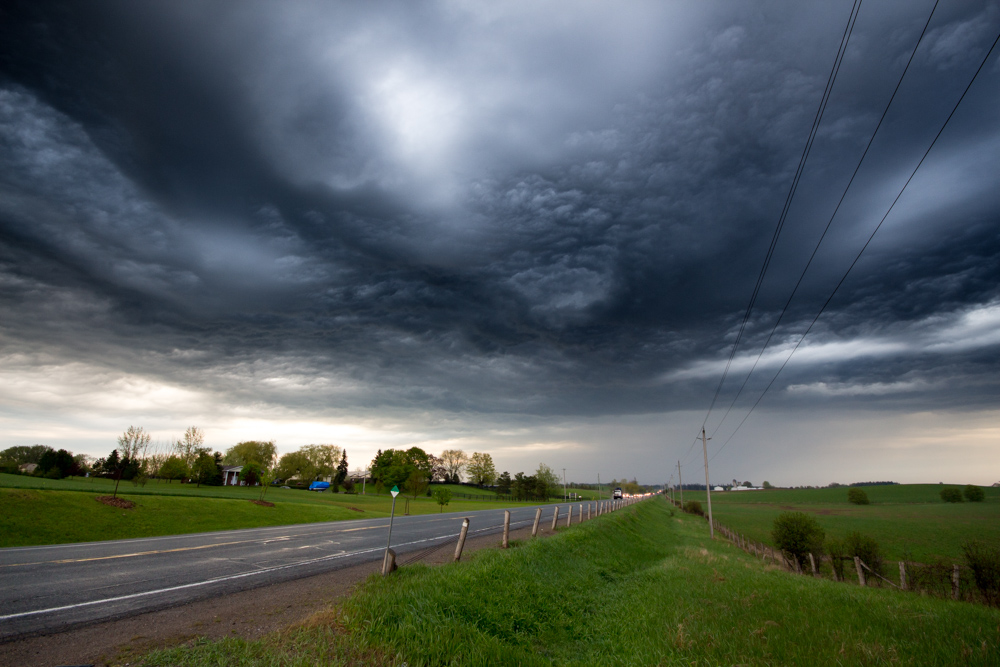

May 15th 2013
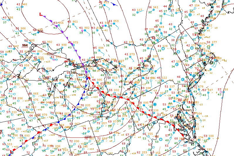
Surface analysis 12Z Wed May 15 2013


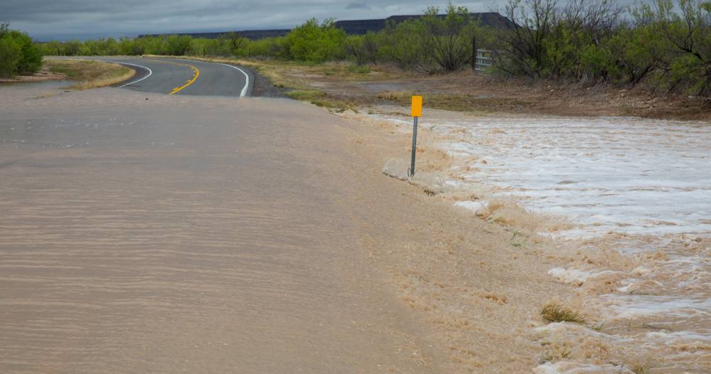
Flash Flooding – Staying Aware
Flash flooding is often an overlooked but very real danger with virtually any thunderstorm. What makes flash flooding so unique is the speed with which it can occur, often catching people by surprise. What makes it even more dangerous is that you don’t really need a special storm to produce it. Your average garden variety thunderstorm can produce flash flooding if the conditions are right.
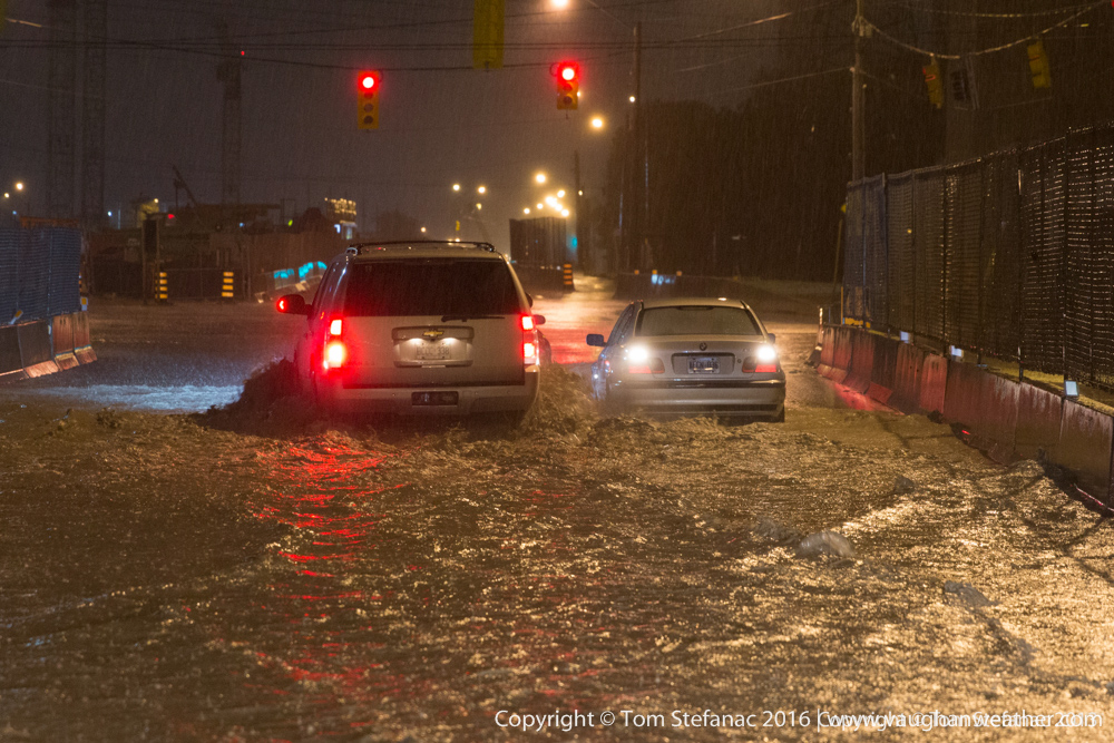
Cars crossing a flooded stretch of road in Toronto
So what’s the difference between flooding and flash flooding?
Flooding is basically the process where water covers land that is usually dry. We often hear about channel flooding (large rivers) on the news where snow melt, an ice jam or days of heavy upstream rainfall cause a river to overflow its banks. These types of flooding events are generally slow in nature and to some degree well predicted with a good estimate of peak flood levels.
Flash flooding on the other hand is any form of sudden flooding. It’s often very poorly forecasted with little to no warning and extremely difficult to model or predict. Flash flooding usually involves channel flooding (rivers, creeks, tributaries), urban flooding (failed or over capacity infrastructure) and areal flooding (ponding, pooling).
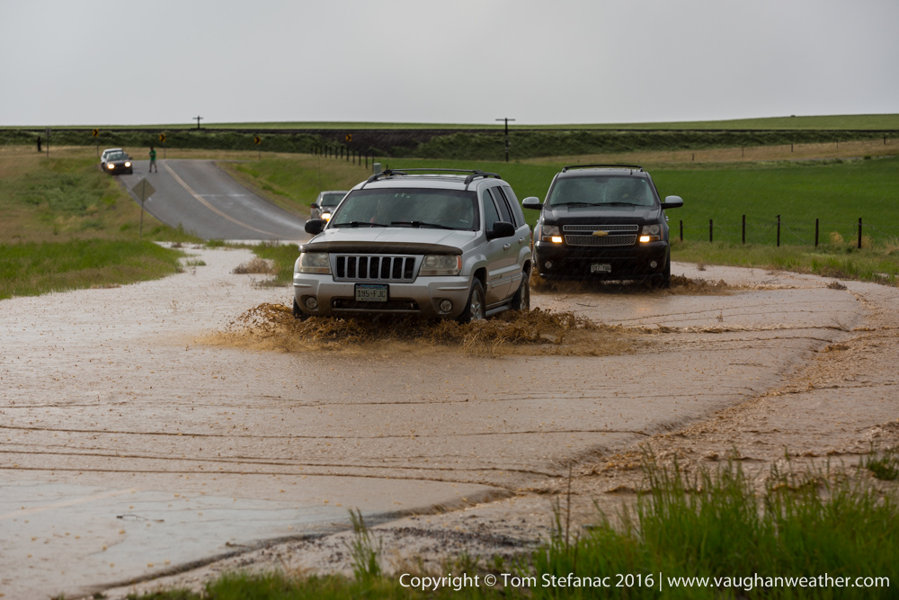
Overland flooding in Colorado
There’s no easy way to know when or where flash flooding will occur or how serious the situation will become. But there are certain elements that make an environment more prone to flooding.
The first factor flash flooding requires is heavy, persistent rainfall. A storm that is slow moving or one which back builds is a prime storm to produce flash flooding. Rainfall rates in storms can easily reach and exceed 60mm/hr or greater, and to put that into perspective that’s 1mm of rainfall per minute on the low end! In fact most thunderstorms actually produce peak rainfall rates of 100 to 300 mm/hr or about 1.6 to 5 millimeters of rain per minute. That’s why you can easily get 20 millimeters of rainfall in as little 10 to 15 minutes as a storm passes over. So if a storm produces these high rainfall rates over a specific area for any length of time flooding will occur.
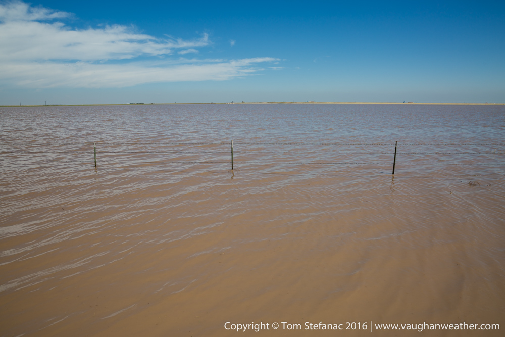
Field flooding in Texas after a very slow moving storm
The second factor is the layout of the land and it’s ability to absorb water. For example, the rainforest sees so much rain from heavy thunderstorms it’s basically an environment that’s adapted to absorb all that moisture without just flooding and falling apart. On the other hand, deserts are known as high risk areas with even a small amount of rain leading to potentially catastrophic flooding because the soil simply is not good at absorbing water.
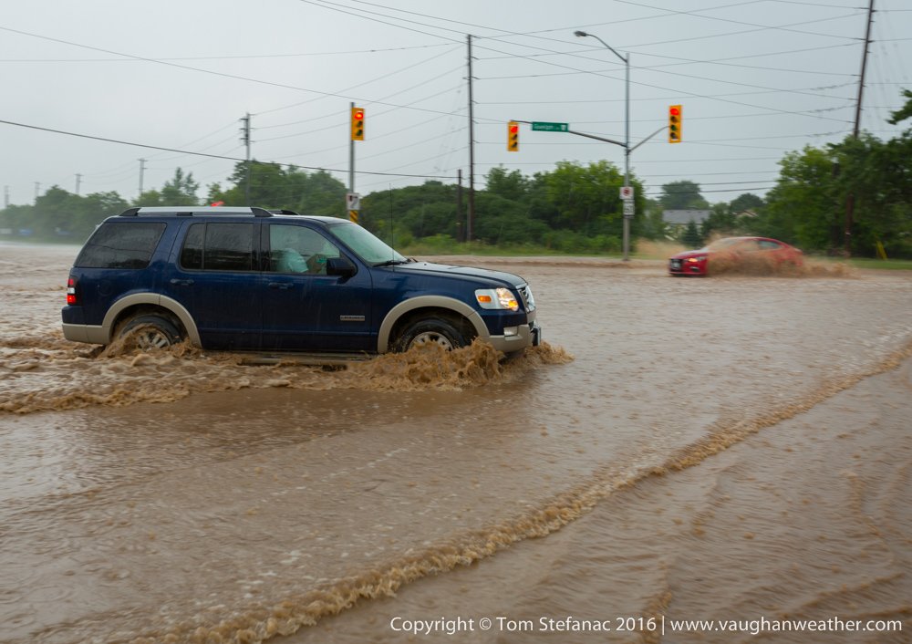
Flash flooding in Burlington, Ontario at Dundas St & Guelph Line
Hilly and flat areas have their own problems. Flat areas experience areal type flooding where water will build in say a field forming an impromptu pond and then suddenly move as a large mass (known as overland flow) from one area to another (very dangerous!). This type of flooding can strike extremely quickly with virtually no warning and very large masses of water stretching long distance can easily cover kilometers of roadway in a single swoop. Hilly or mountainous areas exposed to flash flooding pose the threat of mud and landslides which can occur with no warning and move very quickly destroying everything in their path. Channel flooding which occurs in mountainous or hilly terrain is also extremely dangerous with flood waters achieving high velocities due to large angular slopes. It’s important to remember that in all landscapes benign waterways can potentially become raging rivers.
The third factor with flash flooding is the current state of the environment with regards to saturated soil, water table depth and pre-existing water levels in channels. An environment that is already saturated with high water tables is very susceptible to flash flooding.
What are the dangers of flash flooding?
Everything from the loss of property to death is a potential result of flash flooding.
What do I do if I’m caught in a flash flood?
Turn around, don’t drown! Prevention is the best cure, if the roadway in front of you is flooding or you see that things are flooding around you, get out of the area and seek higher ground if possible. Most people who get into trouble in flash floods attempt to cross flooded roadways.
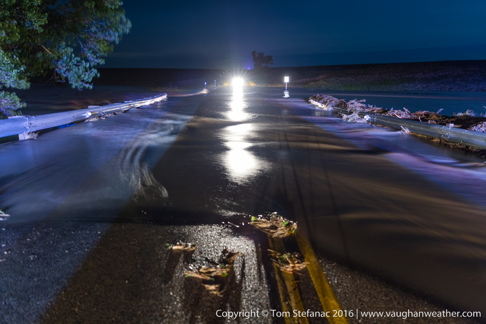
A tributary swallows a roadway in Kansas
This video below is a great example of why crossing a flooded roadway is bad, dangerous idea!
Fortunately for this individual, they we’re okay, but it’s a great video that demonstrates why things aren’t always as they appear. It’s easy to look and assume that there is a road under that water, except if your assumption is wrong, you’re in big big trouble! The safest way to get out of a jam is not to get in one in the first place. If you see the road ahead is flooded, slow down, stop and turn around. If you start driving into a flooded roadway and decided you want out, the safest way out is the same way you got in there, just backup if you can safely do so.
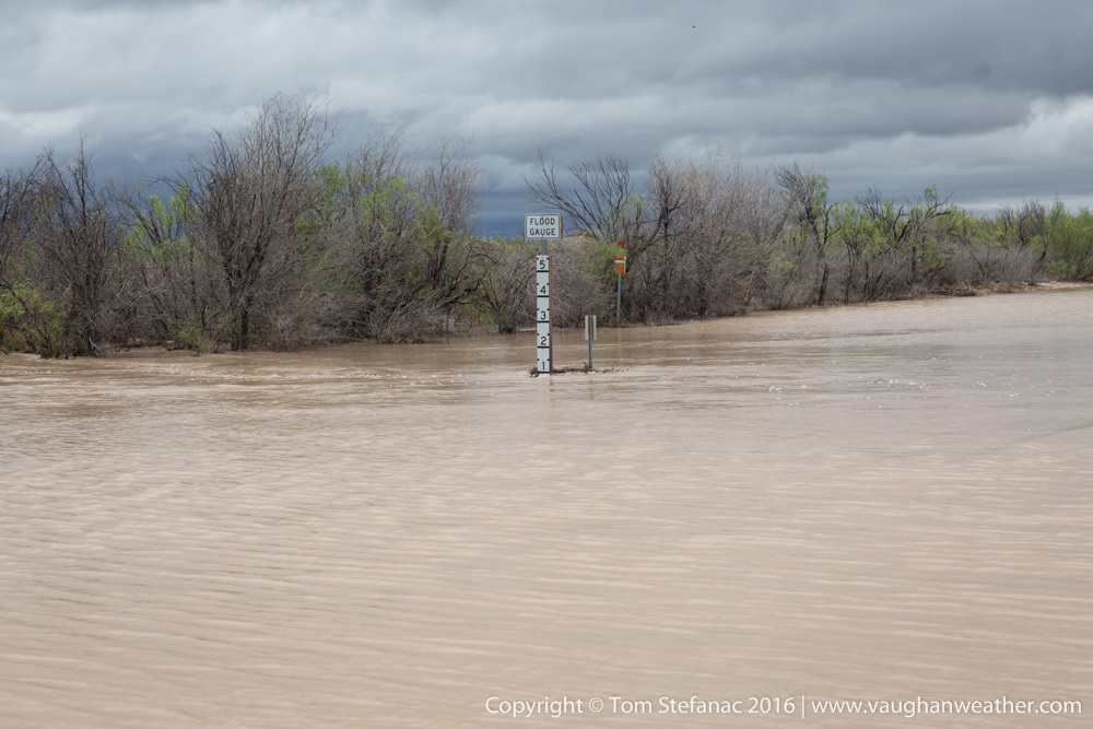
A flood guage in Texas tells drivers the depth of the water crossing the road
I’m trapped in my car!
If you find yourself in a position where you’re trapped on a flooded roadway, don’t panic. Stop, breathe, assess the situation. Firstly, grab your cell phone and keep it away from water. Second, roll down at least one window & unlock all your doors so you can easily escape your vehicle if need be (it evens out the pressure). Now assess the situation, Where am I? How fast is the water moving? How fast is it rising? How deep does it look? Can I stay dry? Is there high ground/safety nearby? What’s around that I can try to hold onto? Do I have anything in here that’ll help me float?
If the water is calm and appears waist deep, you’re probably okay. Try to stay dry, call for help on your phone and follow any instructions. If you can swim, and feel confident wading through the CALM water to an elevated portion of land and it’s warm enough where HYPOTHERMIA will not be an issue then do so very carefully but wholly at your own discretion.
If the water is calm but rising rapidly, call 911 immediately! They will likely either tell you to stay with your vehicle unless you can reach safety quickly without getting into further trouble. Don’t panic, if you have anything around you that floats or will help draw attention, USE IT.
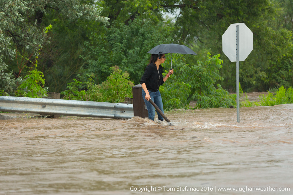
A woman dangerously attempts to cross a flooded roadway with fast moving water in Burlington, Ontario
If the water is flowing quickly and rising call 911 immediately. You will need to eventually escape your vehicle (assuming it’s being swept away), look for something to hold onto! Call out for help!!! If you’re trapped in the flow, swim with it (not against it) and try to move diagonally towards a shoreline or any area that may allow you to escape or slow down. Conserve energy, if possible try to lay in a position that allows you to float, hold onto anything that may help you safely float and keep calling for help! Even if you don’t see rescuers in your immediate area, they may be just downstream preparing to save you and you’ll need all your energy for rescue! Don’t give up, keep looking for a way out.
If the water is flowing quickly but not rising call 911 immediately. If your vehicle is not being swept away, but the water is moving quickly, STAY PUT. You’re safer not moving and waiting for rescue, if you try and self rescue you may be swept away!!! Try to stay dry, warm, and aware! Follow any instructions 911 gives you. Do not be lured out of the vehicle at all costs, stay put until you are rescued!
I escaped the flood but I’m soaking wet & cold
Take your clothes off immediately (get naked!), hypothermia is a major danger. Try and dry off with towels, seek warm shelter/fresh clothing and emergency medical attention immediately. Allow your body to shiver (it generates heat) and keep standing up. Cold blood returning to your core from extremities such as your feet is very dangerous, standing slows this process and prevents shock.
I’m a bystander, what should I do?
Don’t encourage people to do anything! Call 911 and tell them what you see, who is trapped, where you are. Reassure the trapped individual(s) they’re not alone, help is coming. Keep an eye on them and always have them in sight, be aware of their direction of potential travel downstream and keep an eye on the clock, exact times are very important with rescues and fast moving water. If you can somehow give them something helpful (life-jacket, PFD, pool noodle, etc) be very careful doing so. Don’t try and rescue people, the professionals will do that! You might make it worse. As a bystander the best thing you can do is keep the emergency services aware of the situation as they respond, you have a working phone, the victim may not, keep your phone working. Above all, stay calm, being calm allows for better rationalization. Only offer the emergency services help if asked, don’t go and get in the way!!
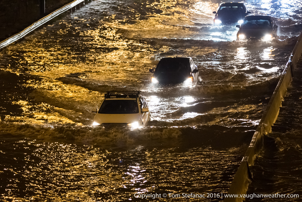
Spillover flooding as the Don River engulfs a portion of the Don Valley Parkway in Toronto
Okay, my car stopped running, I’m stuck in water and it’s shallow?
Chances are you choked the intake. Assuming you’re in no position of danger from drowning or anything, DON’T TRY AND START THE ENGINE!!! Your car might be okay, you just need a tow. If you try to start your engine when it’s full of water (hydro locked) you can destroy it. When water gets into your vehicle’s cylinders and you try and start the engine the water does not compress, instead the piston rods BEND since the piston cannot compress the water unlike the gas/oxygen mix normally in there which does get compressed. When the rods bend, bye-bye engine. People make this costly mistake all the time! If you choke your engine on a flooded road, get it towed to a mechanic before you dare attempt to start the engine.again.
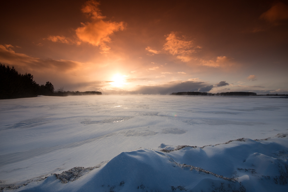
April 1st 2013
Surface analysis 21Z Mon Apr 1 2013


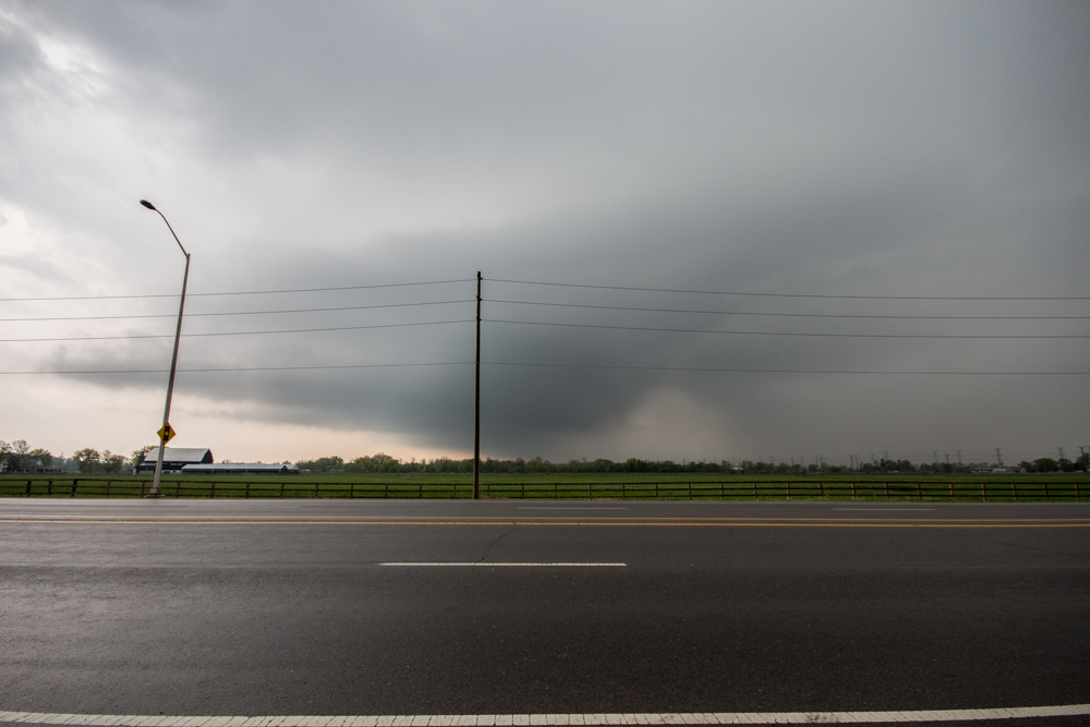
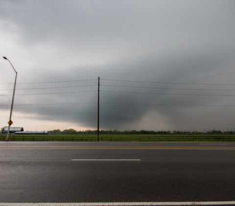
May 10th 2013
Surface analysis 21Z Fri May 10 2013


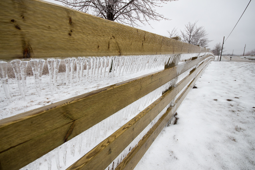
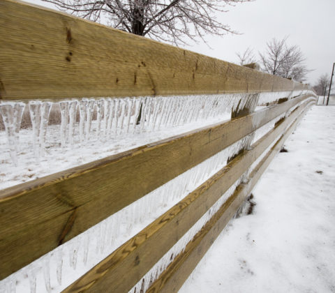
April 11th 2013 Ice Storm
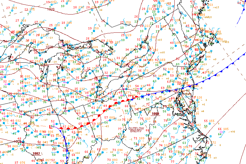
Surface analysis 15Z Thu Apr 11 2013


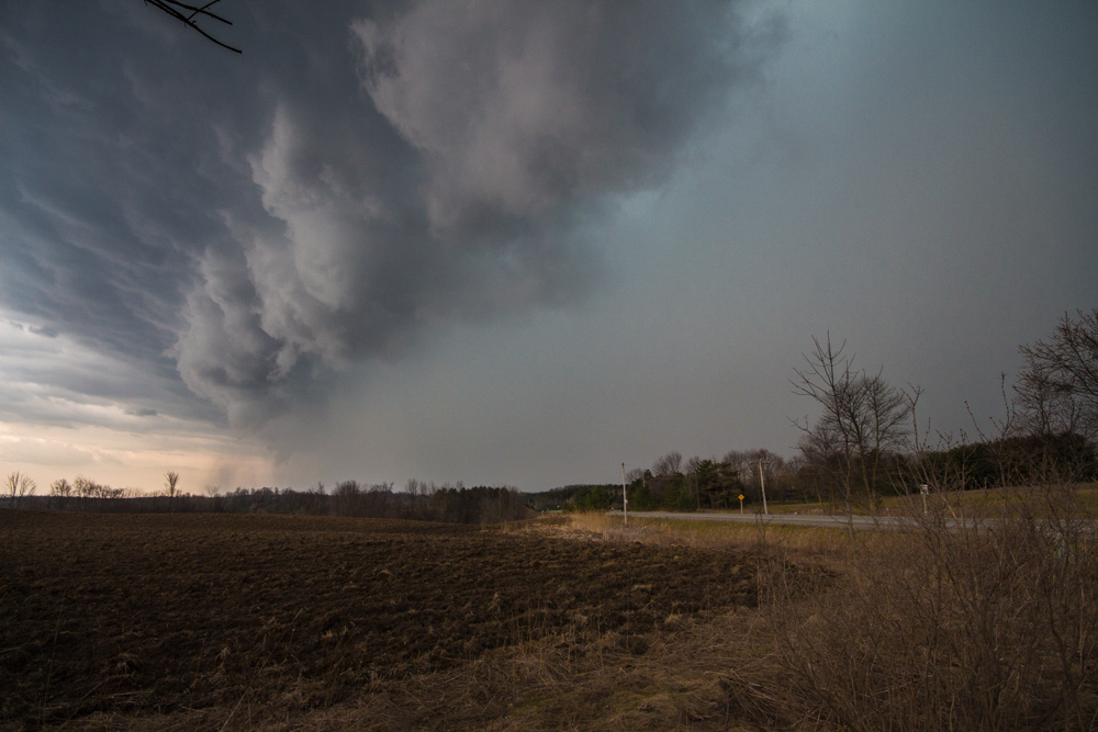
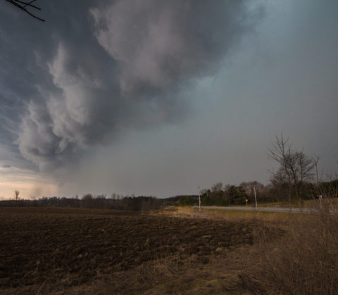
April 18th 2013
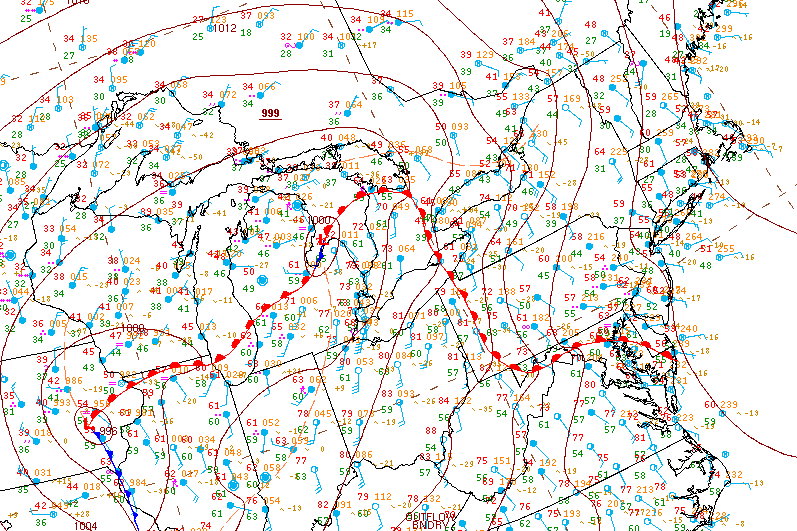
Surface analysis 18Z Thu Apr 18 2013


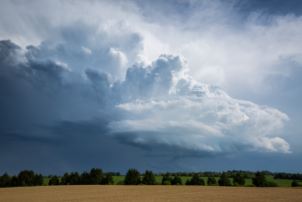
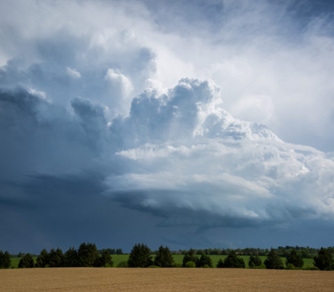


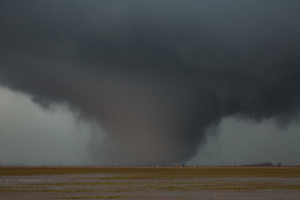
May 22nd 2016
Surface analysis 21Z Sun May 22 2016