Posts in Category: 2010 Storm Chases


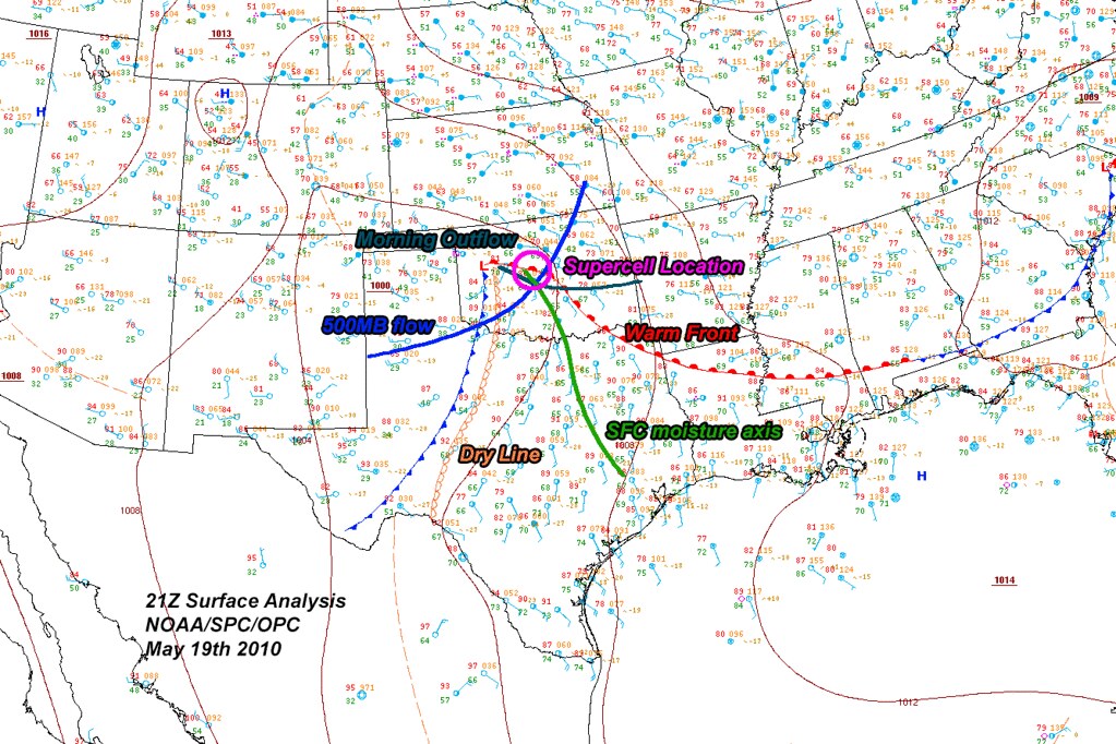
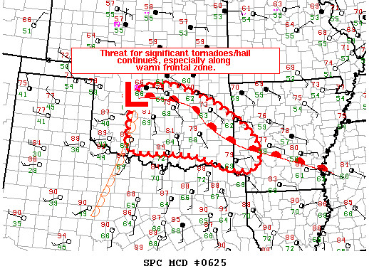
May 19th 2010
On April 8, 2014
- 2010 Storm Chases


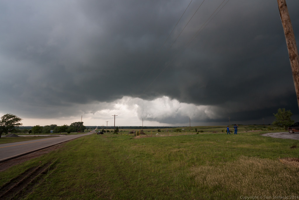


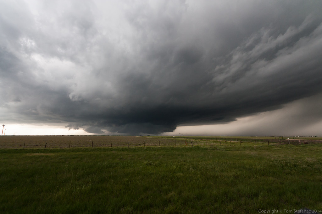
This is what storm chasing is all about, when everything comes together!

The tornado continued for a few minutes not moving much and it continued to miss everything in it's path. I was very thankful that no one was loosing property or getting injured!

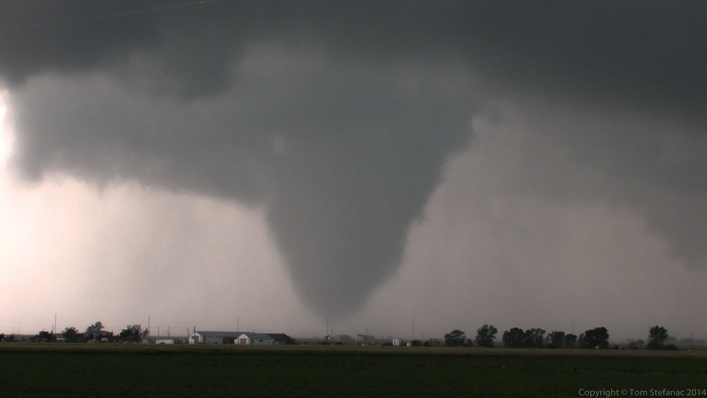
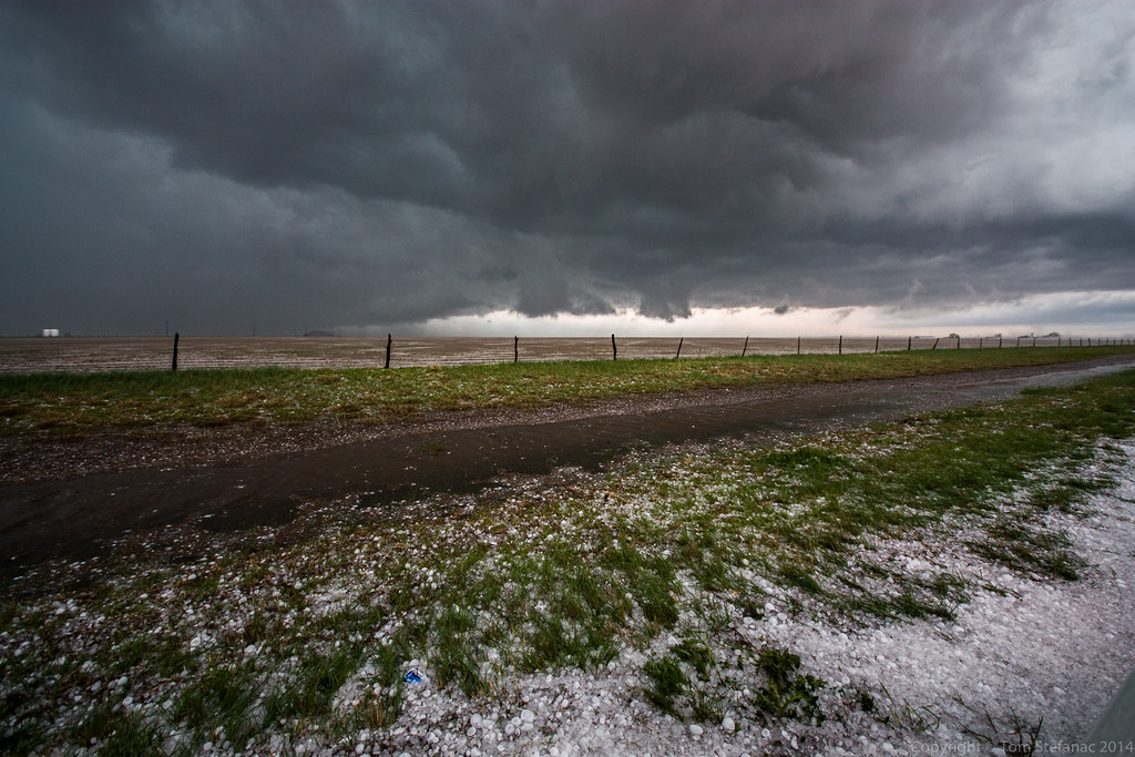
Just before the tornado began to rope out it quickly shrunk in size and started to become skinny.

I was so busy shooting video I almost forgot to grab a few stills! Fwef!

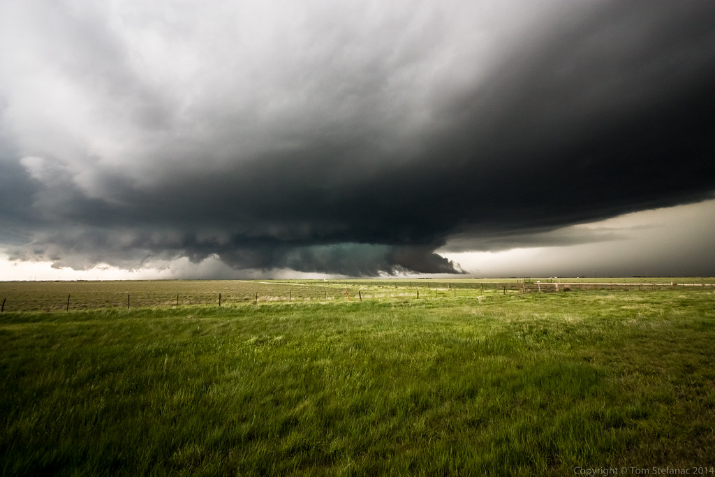
The tornado began to lift.

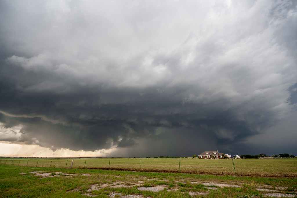
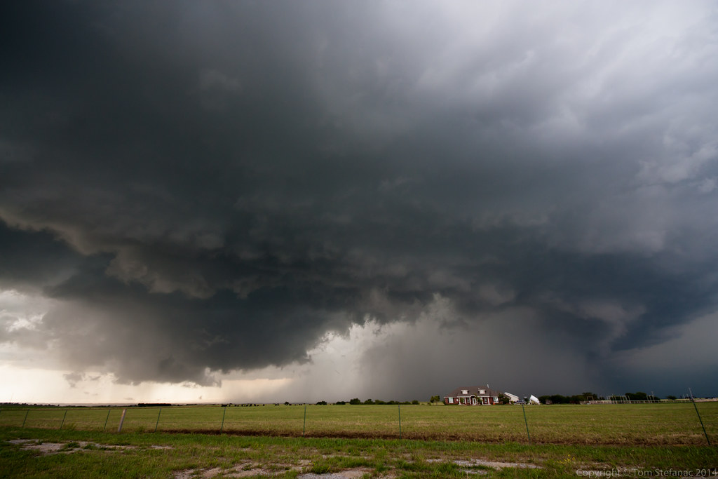
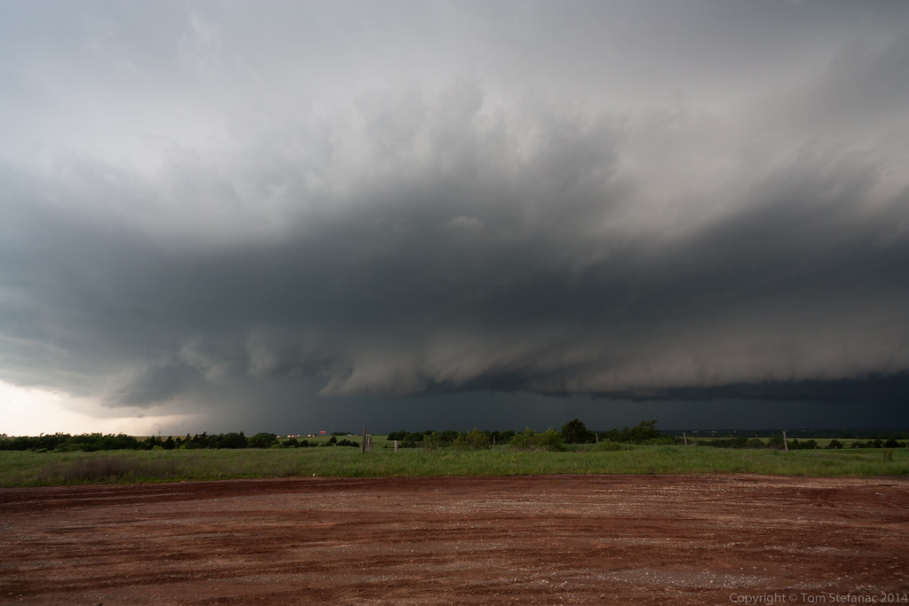
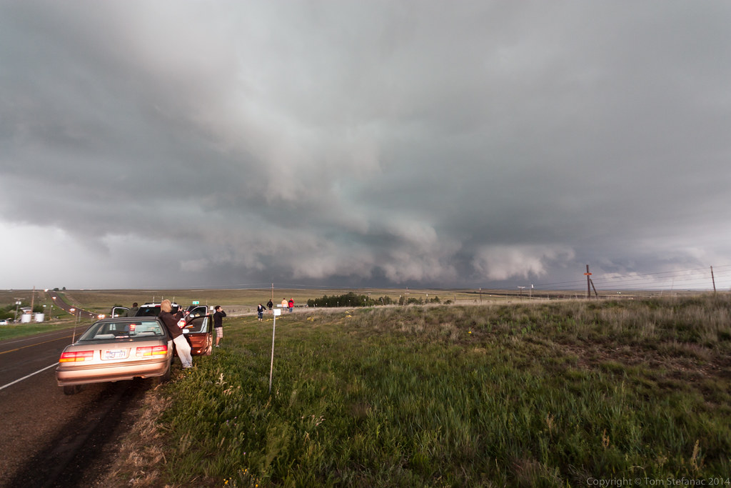
And just as quickly as it had all started, it was over! The tornado was no more and storm engulfed the wall cloud and wrapped everything in rain. I quickly moved down the road to keep ahead of this storm as it rapidly began to change into an HP monster.

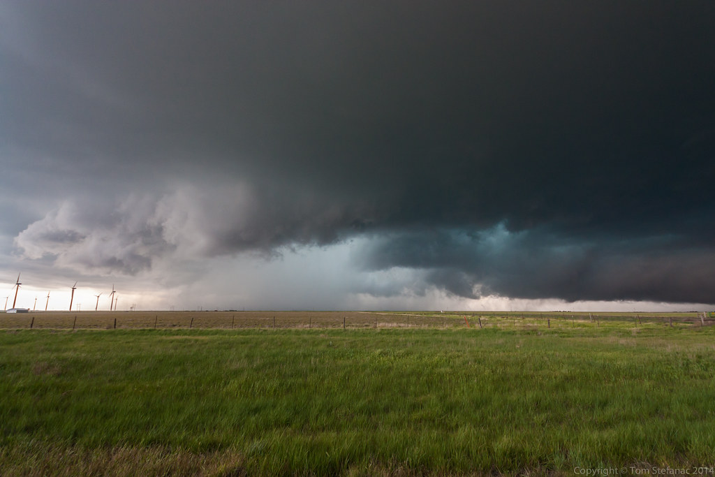
The now officially tornadic supercell (since it officially has a history of tornadoes) morphed into a high precipitation because and began to wrap itself with rain. Unfortunately that meant my options were now limited as I was not going to fight with potentially rain wrapped tornadoes and monster hail.

I shot some video of a skinny rope tornado that formed and was quickly sucked into the storm.
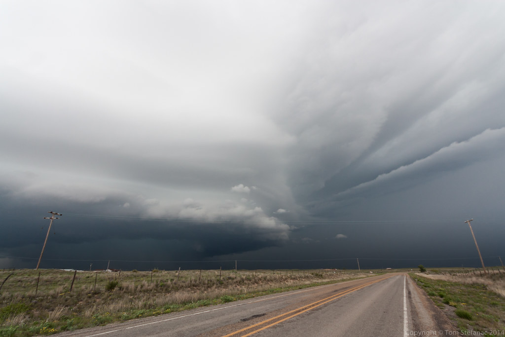
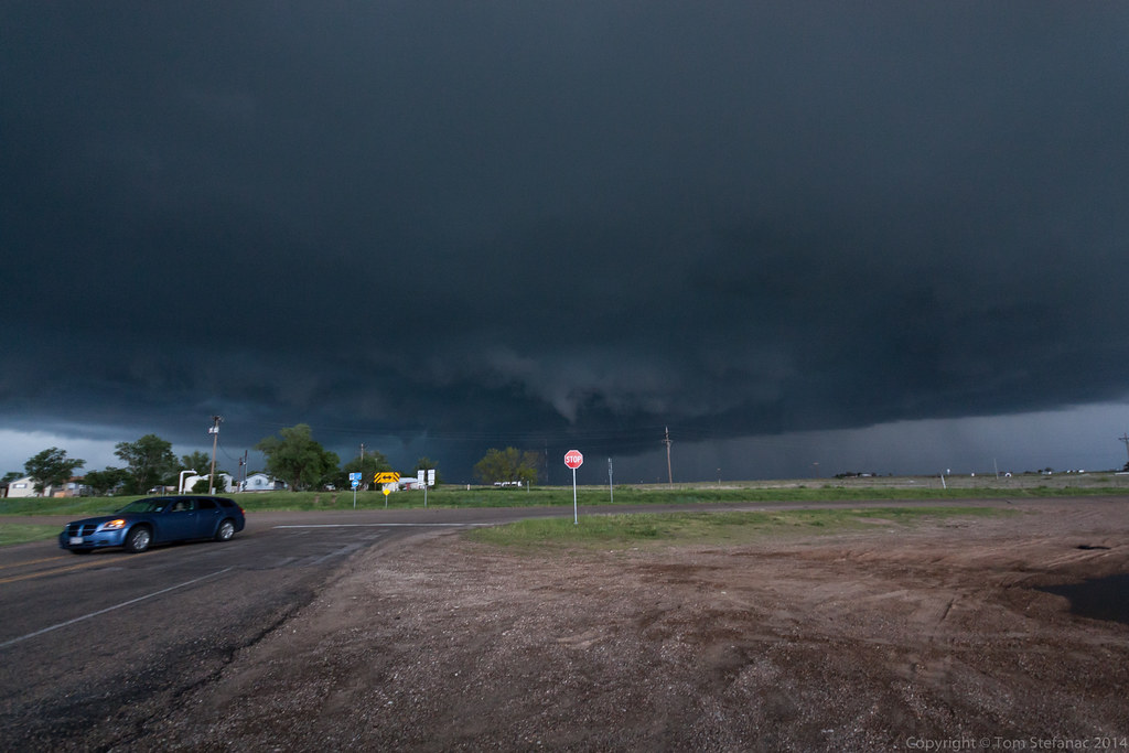
The storm by point was just looking mean and it was still tracking east into less favorable terrain.
It was at this point I made the decision to bail and head back west where fresh storms were forming.
This was a critical mistake/learning experience. Never leave a storm that has a history of producing tornadoes because it will likely keep producing them!!!
Several storm chasers who stuck with this storm saw two more stove-pipe style tornadoes. Darn I should have stuck with it!

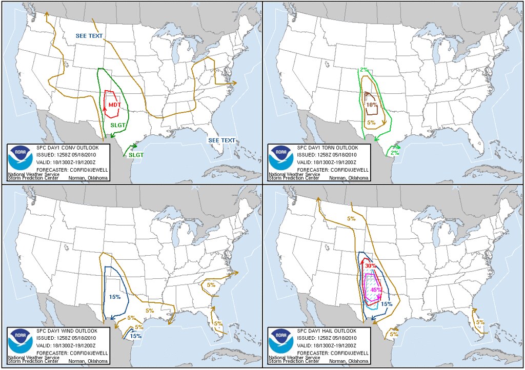
SEL0
URGENT - IMMEDIATE BROADCAST REQUESTED
TORNADO WATCH NUMBER 190
NWS STORM PREDICTION CENTER NORMAN OK
205 PM CDT WED MAY 19 2010
THE NWS STORM PREDICTION CENTER HAS ISSUED A
TORNADO WATCH FOR PORTIONS OF
MUCH OF OKLAHOMA
EFFECTIVE THIS WEDNESDAY AFTERNOON AND EVENING FROM 205 PM UNTIL
1000 PM CDT.
...THIS IS A PARTICULARLY DANGEROUS SITUATION...
DESTRUCTIVE TORNADOES...LARGE HAIL TO 3.5 INCHES IN DIAMETER...
THUNDERSTORM WIND GUSTS TO 70 MPH...AND DANGEROUS LIGHTNING ARE
POSSIBLE IN THESE AREAS.
THE TORNADO WATCH AREA IS APPROXIMATELY ALONG AND 55 STATUTE
MILES NORTH AND SOUTH OF A LINE FROM 40 MILES SOUTH OF GAGE
OKLAHOMA TO 40 MILES EAST SOUTHEAST OF MCALESTER OKLAHOMA. FOR A
COMPLETE DEPICTION OF THE WATCH SEE THE ASSOCIATED WATCH OUTLINE
UPDATE (WOUS64 KWNS WOU0).
REMEMBER...A TORNADO WATCH MEANS CONDITIONS ARE FAVORABLE FOR
TORNADOES AND SEVERE THUNDERSTORMS IN AND CLOSE TO THE WATCH
AREA. PERSONS IN THESE AREAS SHOULD BE ON THE LOOKOUT FOR
THREATENING WEATHER CONDITIONS AND LISTEN FOR LATER STATEMENTS
AND POSSIBLE WARNINGS.
DISCUSSION...TSTMS EXPECTED TO FORM IN THE NEXT HOUR OR SO INVOF
SLOWLY RETREATING W/E OUTFLOW BOUNDARY IN W CNTRL OK. OTHER STORMS
ALSO MAY FORM A BIT LATER NEAR INTERSECTION OF OUTFLOW BOUNDARY WITH
CONFLUENCE LINE IN CNTRL OK...AND IN MORE STRONGLY HEATED
ENVIRONMENT NEAR WARM FRONT IN SE OK /REF MCD 623/.
GIVEN STRENGTH OF WIND FIELD...EXPECTATION OF CONTINUED LOW LVL
DESTABILIZATION...AND EVENTUAL ONSET OF MID LVL COOLING/ASCENT WITH
UPR IMPULSE NOW IN THE WRN TX PANHANDLE...SETUP APPEARS FAVORABLE
FOR THE DEVELOPMENT OF STRONG SUPERCELLS. ONE OR TWO OF THESE MAY
BECOME LONG-LIVED...AND YIELD A COUPLE STRONG TORNADOES...AS THEY
INTERACT WITH BACKED LOW LVL FLOW NEAR OUTFLOW BOUNDARY AND/OR WARM
FRONT.
AVIATION...TORNADOES AND A FEW SEVERE THUNDERSTORMS WITH HAIL
SURFACE AND ALOFT TO 3.5 INCHES. EXTREME TURBULENCE AND SURFACE
WIND GUSTS TO 60 KNOTS. A FEW CUMULONIMBI WITH MAXIMUM TOPS TO
550. MEAN STORM MOTION VECTOR 26030.

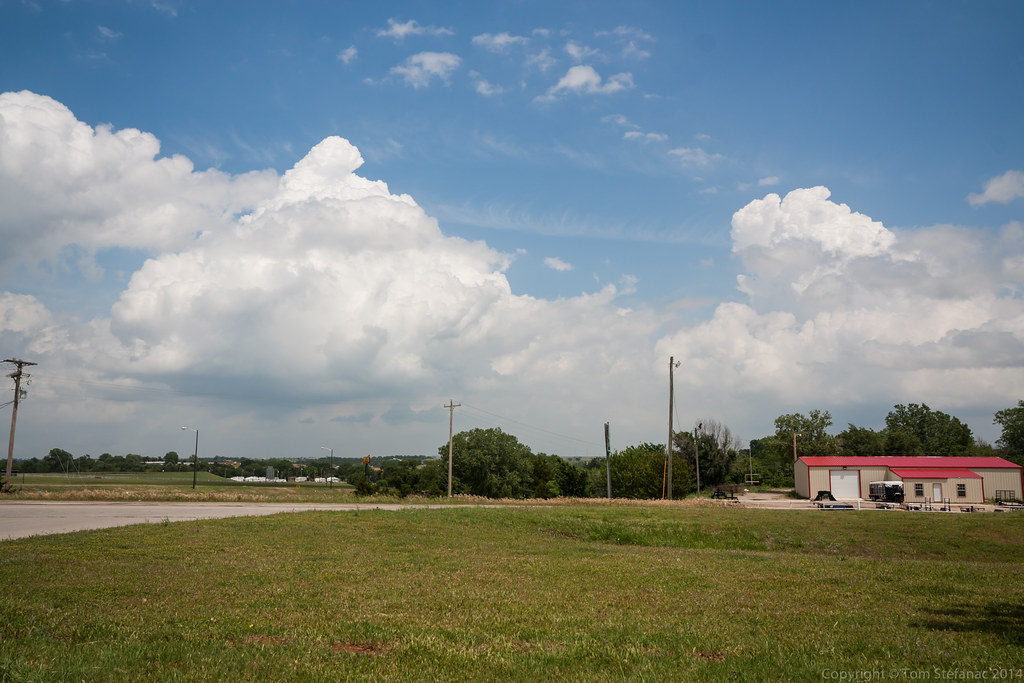
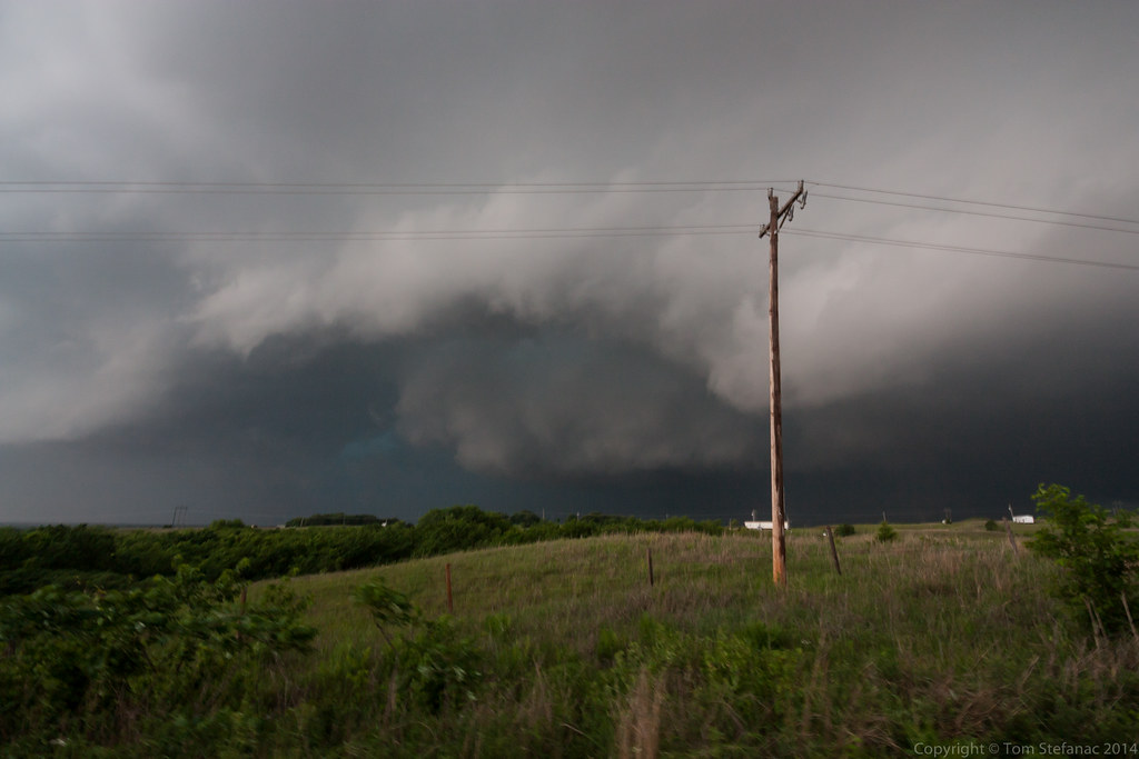
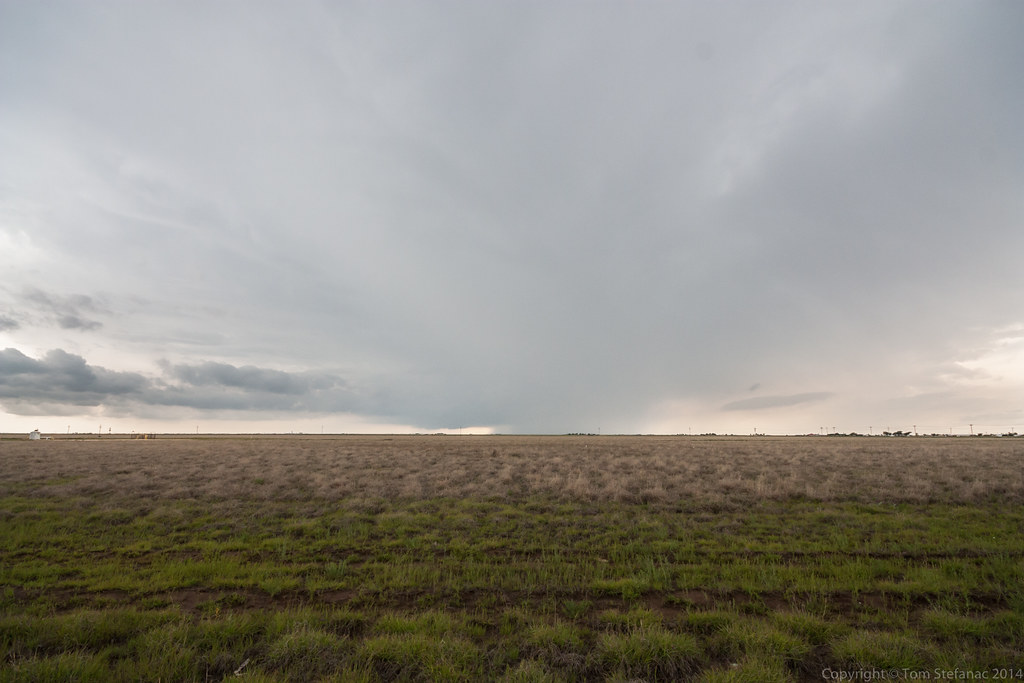
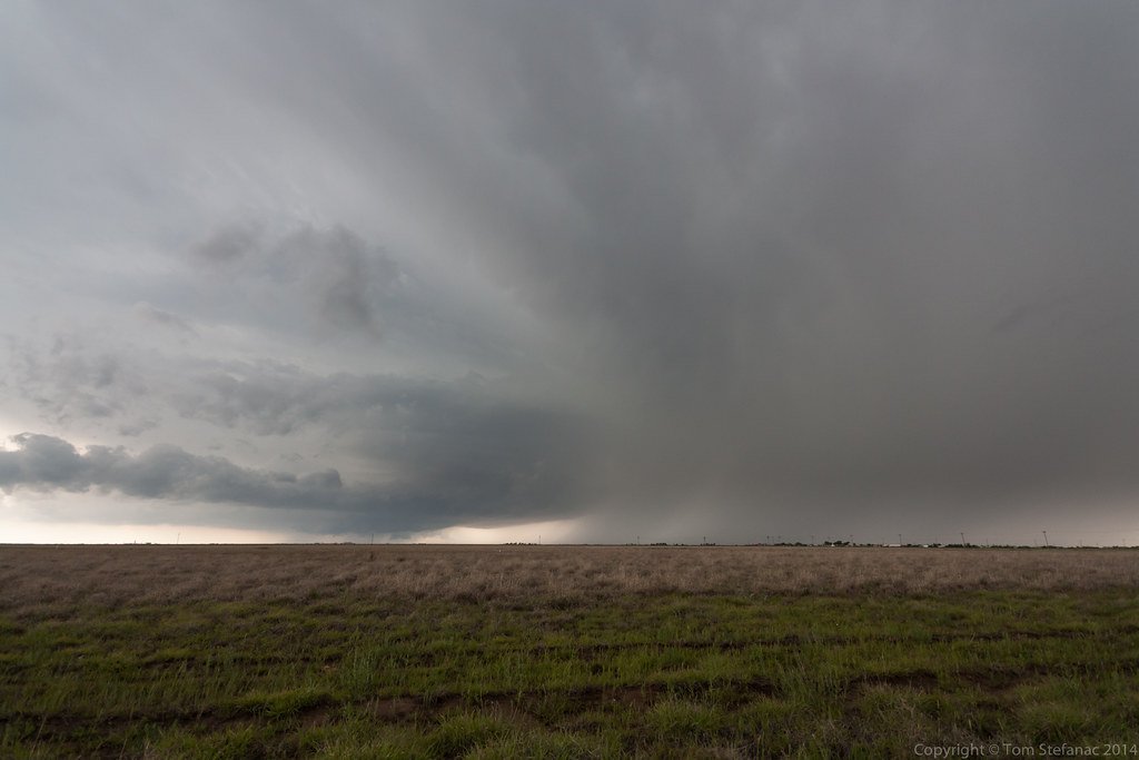
This was the anvil of the next storm I had my eye on, a wonderful supercell just a little south of the prior storm.


May 18th 2010
On April 8, 2014
- 2010 Storm Chases


The hail was also big, this was the standard size of the hail stones laying in the fields and on the road.

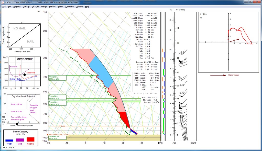
The evening sounding from Amarillo Texas showing the actual observed conditions that gave rise to the Dumas supercell.
The only problem if any was the slow forward motion, this is probably the only thing that kept the storm from producing a large tornado.
The forward motion was so slow the storm kept getting undercut by its own outflow.

I can't explain how amazing it is to see a mountain in the sky rolling over producing such vibrant lightning and cloud formations.

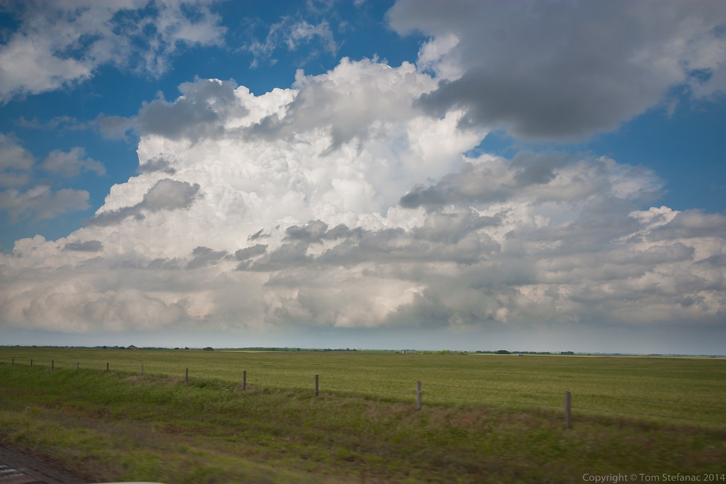
This is what 60,000ft looks like with a powerful anvil and lightning. Check out the moisture just screaming north in a huge wall!
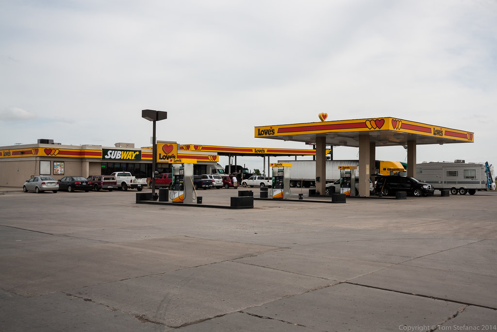
What a chase day, this storm went on for hours!
Caprock magic, that's what you call this.

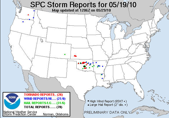
Storm reports from the SPC showing numbers funnel reports but little in the way of confirmed tornadoes