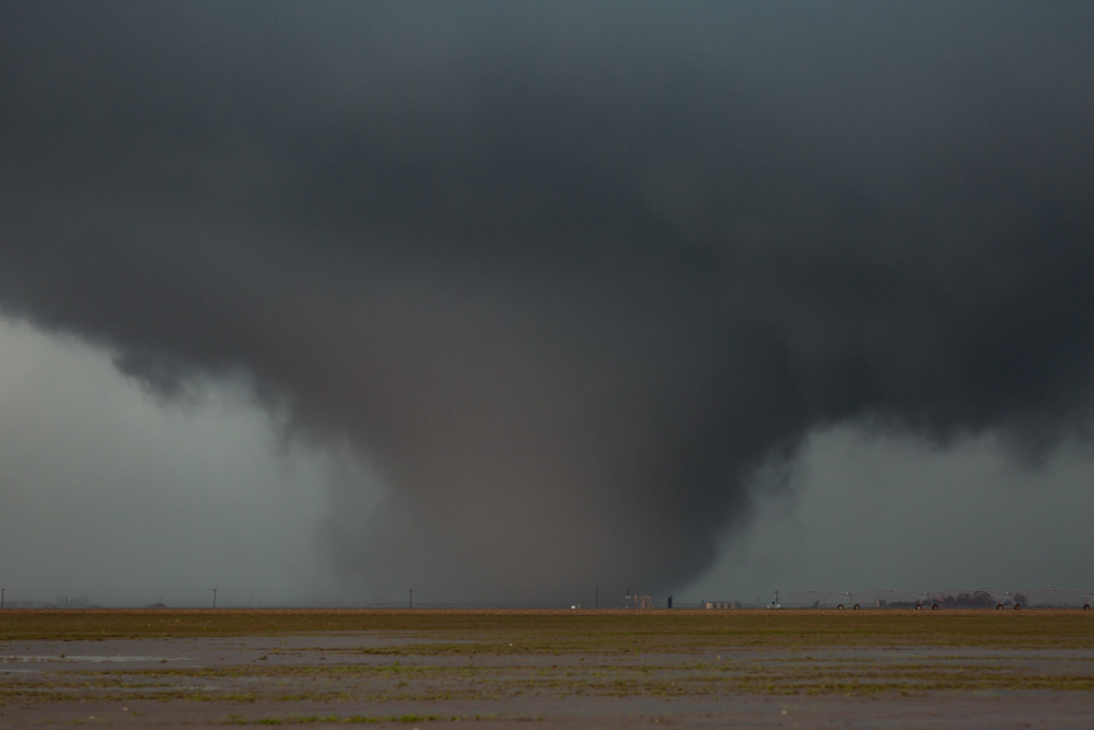
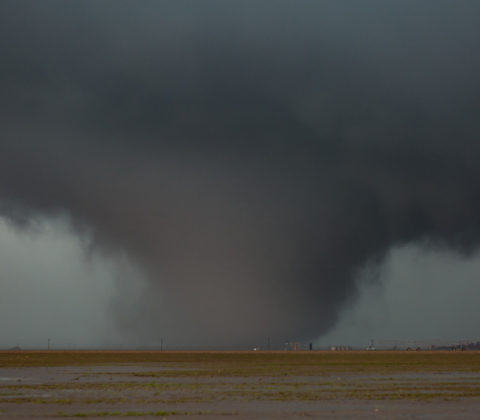
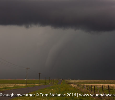
What a great first chase day! It’s amazing how variable the weather can be. Just the day before it was cold, miserable and downright chilly, but all that changed a great deal in the Texas and Okalhoma panhandle where a system swinging through set the stage for some cold deep convection. Video is at the bottom of the post. Enjoy!
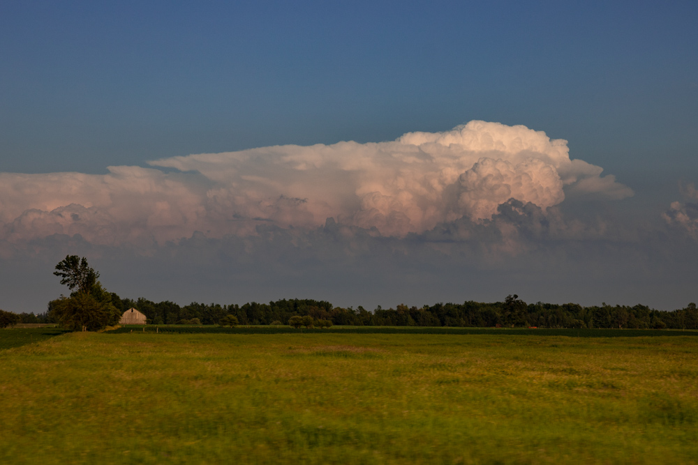
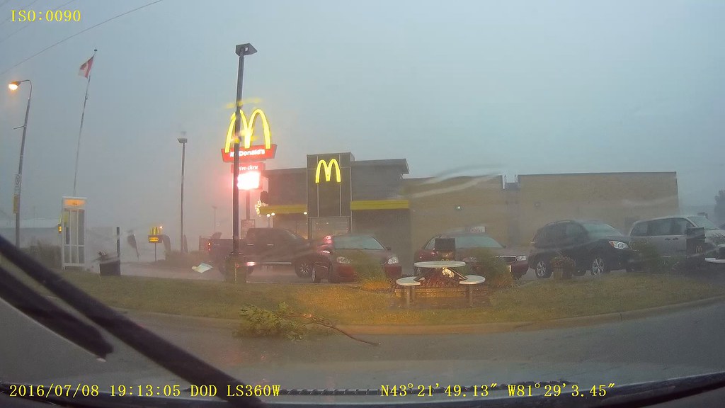
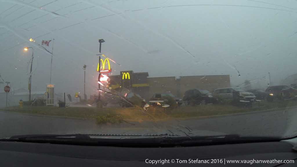
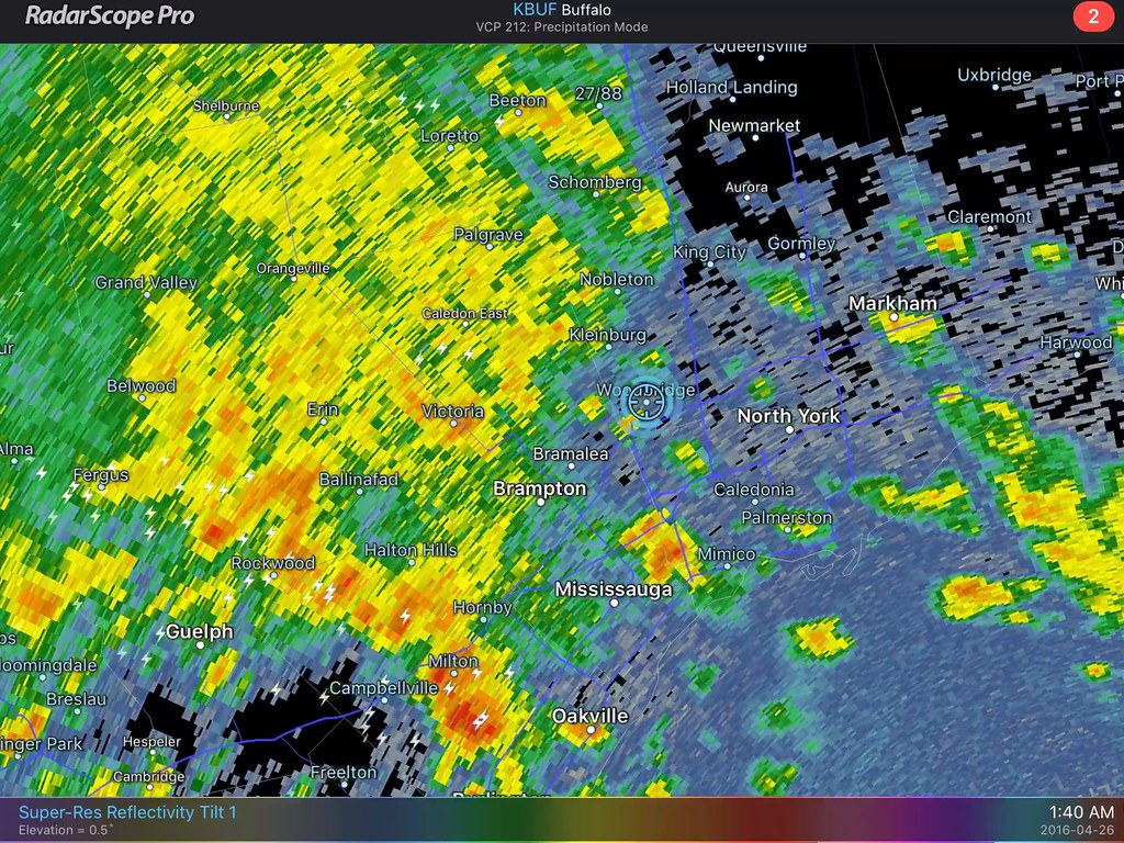
The first really active chase day of the year for Southern Ontario that was not a bust with widespread convection and severe weather ranging to hail to wind and even some local flooding. The entire day basically focus around an incoming low pressure system from Michigan with a trailing cold front that was crashing into very hot and humid air as a 500mb shortwave scooted past to the north.
After a quiet May and June, the storms were welcomed and helped to ease the drought conditions imparted across much of Southern Ontario thanks to a very dry and storm free spring and early summer.
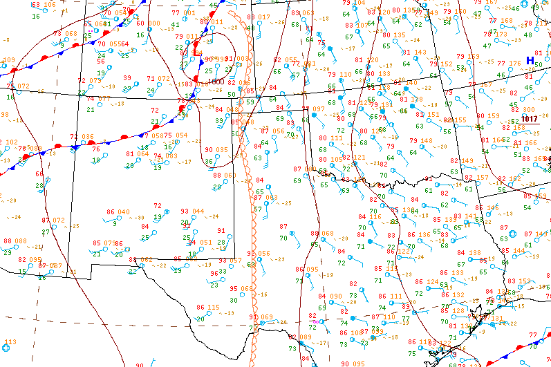
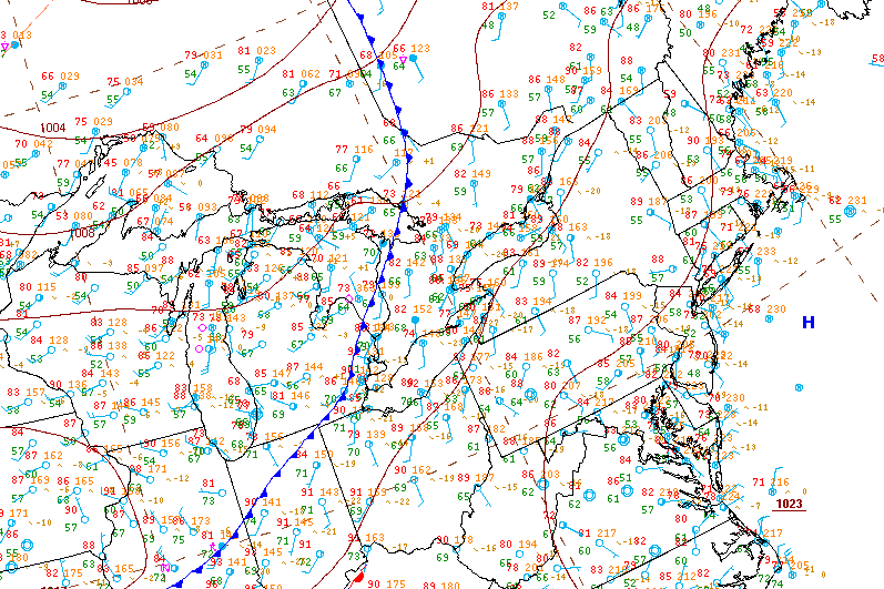
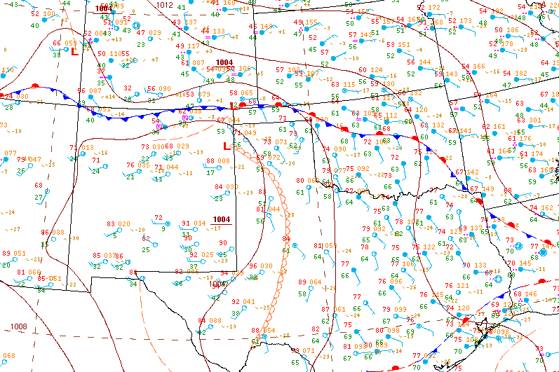
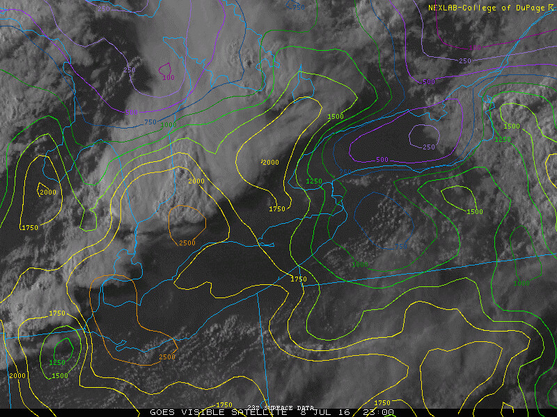
Surface analysis 21Z Fri Jul 8 2016
I started the chase day in Woodstock Ontario around 2PM as I focused on two possible targets eventually narrowing it down to the area around Goderich. As with every storm chase, looking at the surface observations and being in position early rather than late is always important and critical! Playing catchup or being unaware of the atmospheres potential is never a good thing and can really make or break a chase day.
This was one of those days, plenty of potential with clearing skies and otherwise good timing for the storms. A cold front was swooping in from Michigan while a warm front lifted through Southern Ontario bringing in hot humid air!
TD's jumped significantly just behind the warm front and boundary layer moisture was aided by rainfall overnight from a weak MCS that pushed through.
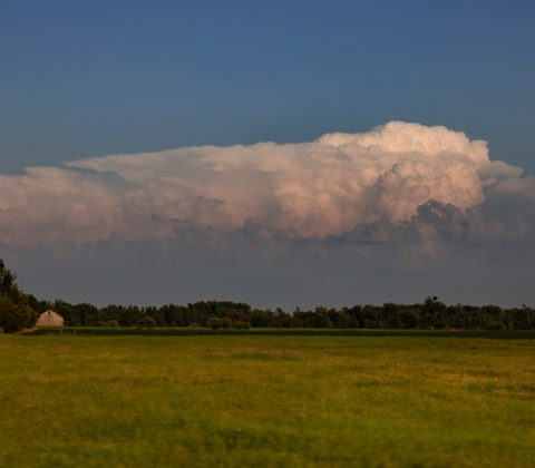
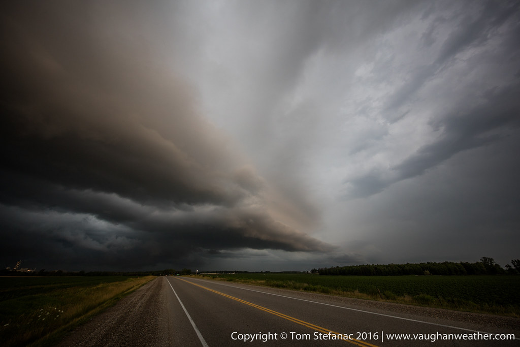
I stopped in Woodstock and eventually Mark Robinson (a fellow chaser) met up with me. We then headed off to intercept a storm that was slowly coming across the lake. This was the view over an hour before the storm was due to arrive.
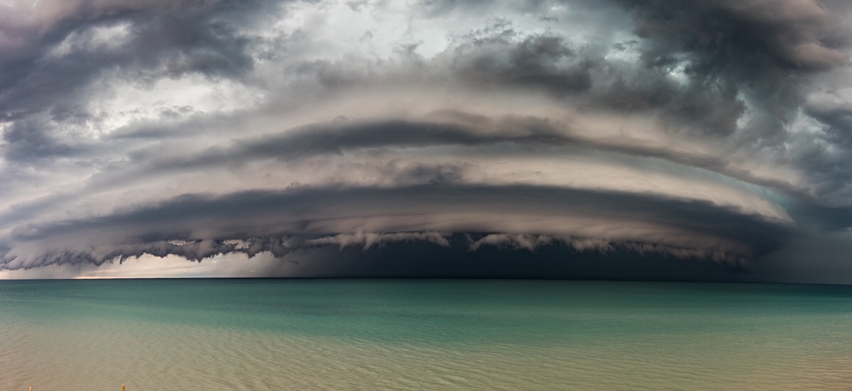
Long before the storm arrived this shelf feature was visible on the southern periphery of the storm.
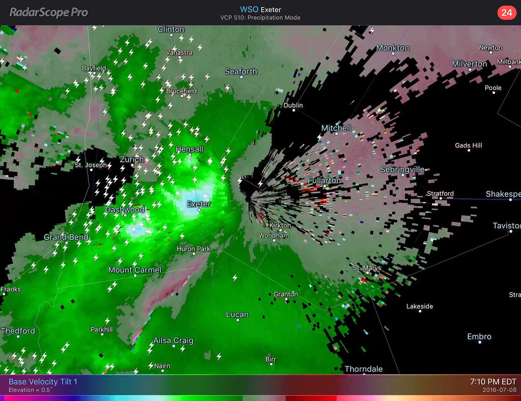
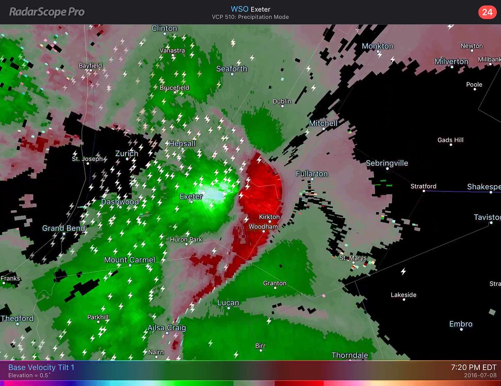
What was interesting with this storm was that it was sitting in the center of a meso low, perhaps thermally induced? Whatever the case, it was in an area of enhanced vorticity and there were winds curving into the storm from the Southeast. This was very interesting to observe, especially since the night prior the WRF-NAM basically forecasted this and was spot on!
The favourable low level winds were also effectively pushing the supercell composite index up ahead of the storm. At one point there was a strong TVS signature visible over the waters of Saginaw Bay. So there was definitely verifiable rotation occurring and all the dynamics were drifting east with the storm.
Mark with his periscope feed running!
The shelf from the storm was slowly getting closer and strong knuckle convection could be seen above the shelf feeding from left to right (south to north) into the storms dominant cell.
The storm at this time was now about 50 kilometers away and beginning to pickup forward velocity.
The latest radar scan had the storm taking on a bowing appearance with a persistent pocket of rotation in the NW quadrant where you would normally find a bookend vortex signature.
These little fingers of moisture were getting lifted all along the edge of the forward flank downdaraft.
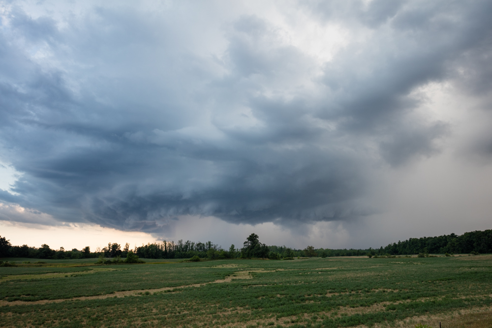
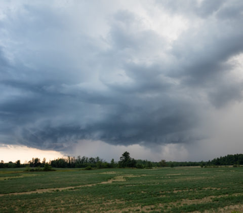
As the storm continued to close in the structure now becoming visible was just awesome!
At this point in time the rotation in the northern portion of the storm seemed to simmer down somewhat. I'm not sure if that's due to the storms distance from the radar increasing or if the rotation was actually falling off, but whatever the case, the storm still had a very impressive radar signature.
Believe it or not, this is a single 11mm image. I cropped out the shoreline (didn't like the look of the grass). The storm was much closer than it looks in this image!
At this time the storm is about 10 kilometers away!
This is one of those moments where breaking out the 70-200mm lens was a good idea! It's hard to explain, but sometimes you just need to zoom in and focus on the key points of structure that are just amazing.
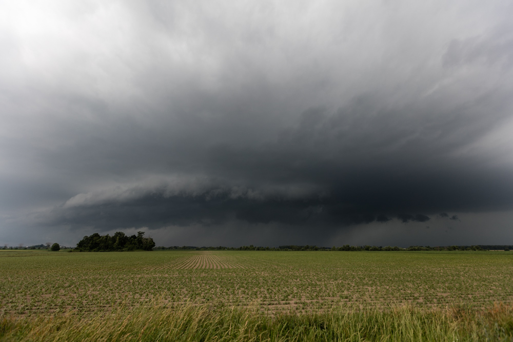
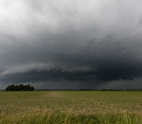
The structure on this storm was more reminiscent of a high plains supercell or a moisture packed HP storm roaring through Nebraska, but this was Canada over Lake Huron.
Despite this storm having a more linear and bowing appearance on radar, the curvature literally bent around into the primary updraft giving it that power high precipitation supercell look. The shear values were right, so this storm was definitely a super cellular hybrid of sorts.
Here's a panorama stitched together from three separate images. What a beast of a storm, just beautiful!
Around this time, the couplet was back on radar and the storm was looking even more powerful with higher dBz values showing up in the strongest portions of the storms core.
What not a true mothership in the classic sense (that's reserved for LP supercell storms) this stacked shelf really had a nice curl looked to it that had that mothership type look. If you look near the edge of the leading shelf, thanks to light refraction, you can see a thin dark line marking the edge of the marine layer. You'll not the storm bends it upwards and eats it!
I zoomed right in to show just how green the area inside one of the folds along the stacked shelf cloud was becoming. There was definitely some hail growing but the 30C air at the surface with the very high humidity was ensuring that most, if not all of it, would melt before reaching the ground.
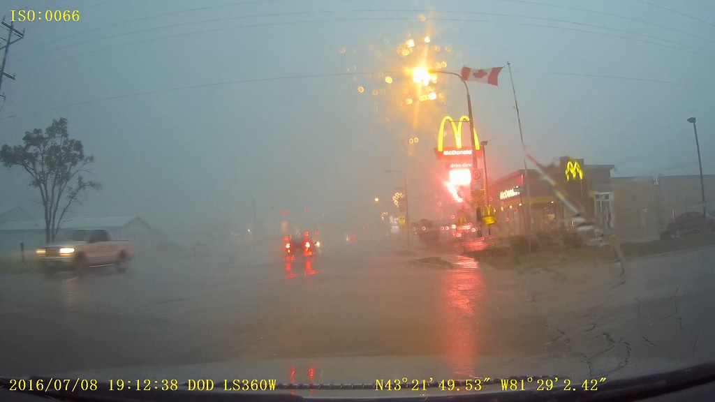
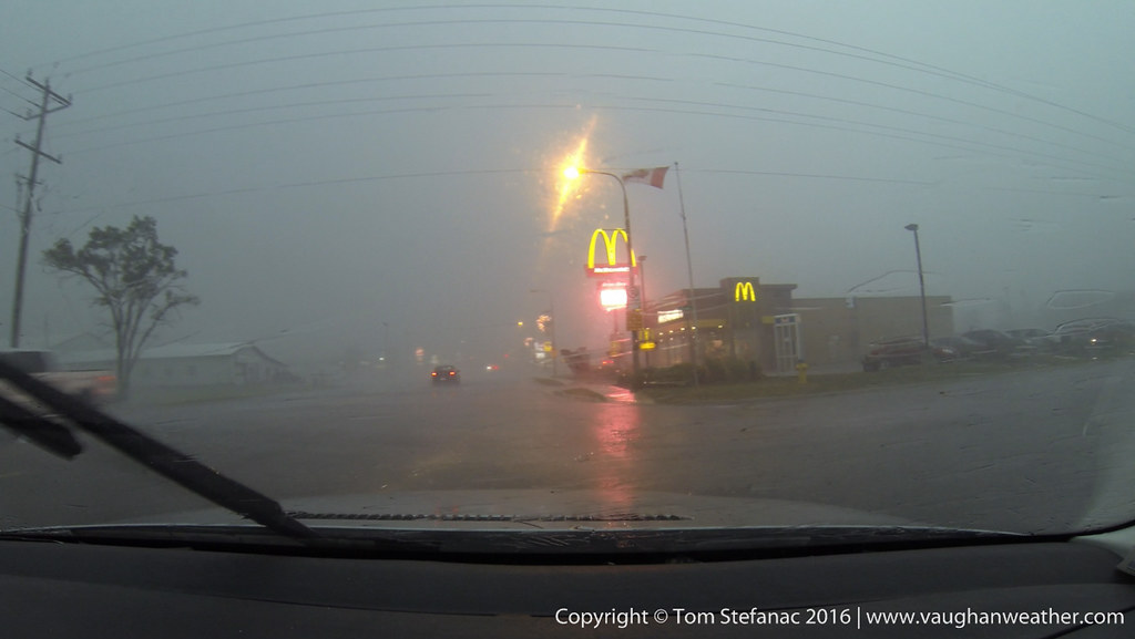
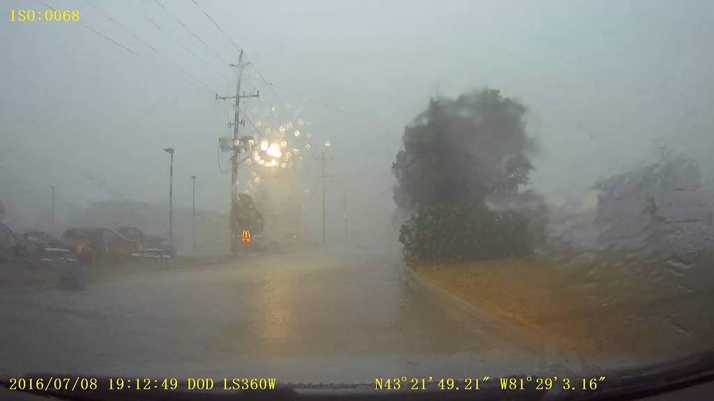
The storm was probably only 3 kilometres away at this point. The air was still calm if not blowing slightly towards the storm at the lookout location I was perched upon.
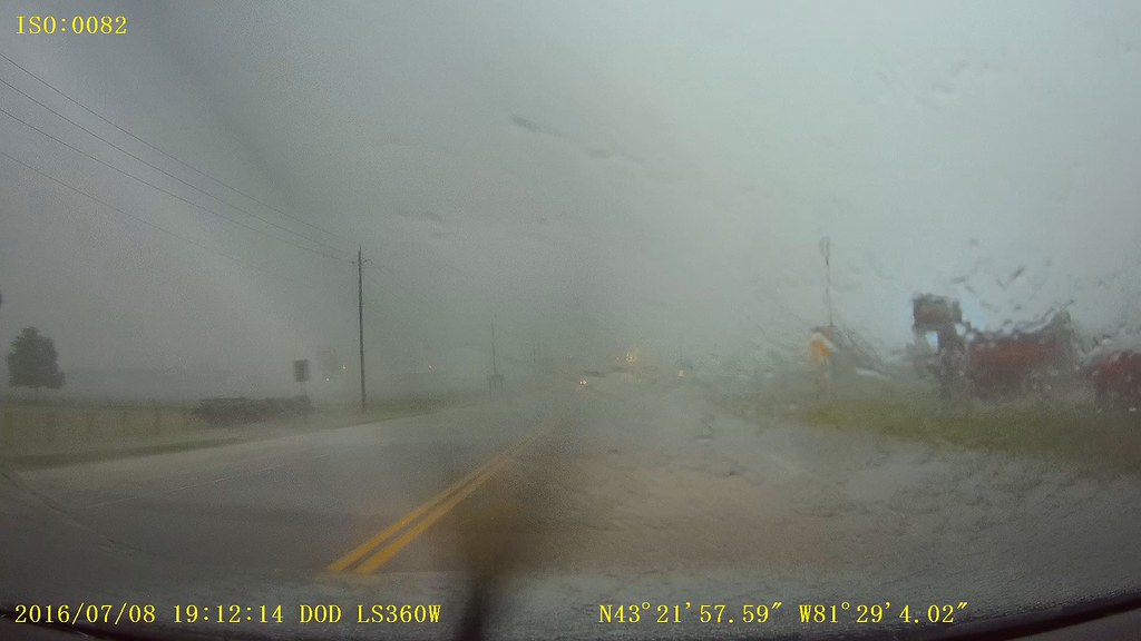
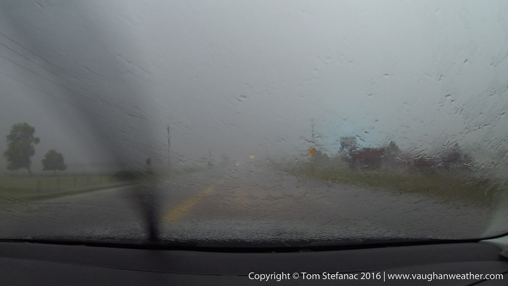
This was the last image I took before packing up and heading out. Again, this is super wide at 11mm, but rest assured, the storm was virtually on my head and I had very little time to spare.
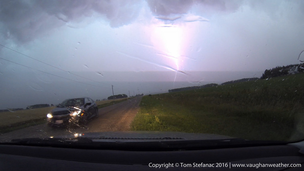
There were many lightning bolts crashing all around me which was the other reason for the rapid retreat. Lightning is the biggest danger, you can't predict it and don't see it coming until it's too late and I don't mess around, it's a killer.
I'm not sure how far away this strike was but it must have been no more than a few hundred meters at most. There was no delay between the sound and flash. A few other chasers were just getting in their car when this struck.
While less dramatic than the first frame of video, this gives a better idea of what was getting struck, and I'm still not sure? Was it a tree? Rock? Dock? Whatever got zapped sure felt it though!
Mark, John and myself bolted east to try and get ahead of the storm. This part of the province is pretty wide open and flat with only the occasional row of trees to obscure the view!
This was one of those days... I had the day off work, some gear to play with, time to kill, and there was a 1% chance of storms!! North of the city it was snow and in the Southwest a warm front was pushing in from Michigan. So I decided to head towards Sarnia.
While waiting for a possible thunderstorm, I decided to throw some grads on the 16-35 and snap some cloud photos.
I haven't put a grad filter set on the camer on a while and forgot just how awesome the effect is! You can fake it with photoshop or lightroom but nothing beats the real deal.
My only hope was for an elevated storm or two, strong easterly winds off of Lake Erie were pushing the warm front back and a stationary front became established in Michigan. There was an 8 degree difference and huge humidity difference too.
The HRRR & WRF-NAM consistently kept popping a little storm just south of Sarnia so I headed to the river and snapped some photos while I waited. This is the new 11-24mm lens that I think will serve me well in Tornado Alley.
Looking south with the super wide angle lens!
Looking up with the lens at 11mm makes this willow looks stretched!
You know, when late March rolls around most people are over the winter and this was no different, except 10 to potentially 15cm was in the works and it was April! The snow started coming down hard late Sunday afternoon and continued overnight.
I snapped this with my phone in the windshield cradle. Roads were among the worst they'd been all winter with the lack of snow earlier in the season.
It amazing, just a few days prior temperatures had been soaring into the near 20's and less than a week later we were bottoming out in the sub-zero range.
The "spring" warmup had some resturants deploy their patio gear early. I'm not sure if this was an intential strike by nature to push the patitio goers back inside?
Well.. it was a good idea to put the patio gear out last week!
All in all about 12cm coated the streets of Toronto and many of the northern suburbs.
Yeah, good thing I wore my boots!
Seriously, this was the most winterlike I have seen Toronto all season!
Soon it won't be snow but mud I'm going to be dodging. Anyway, as a Canadian there's one thing for certain... spring dosen't start until the end of April and that's a given!
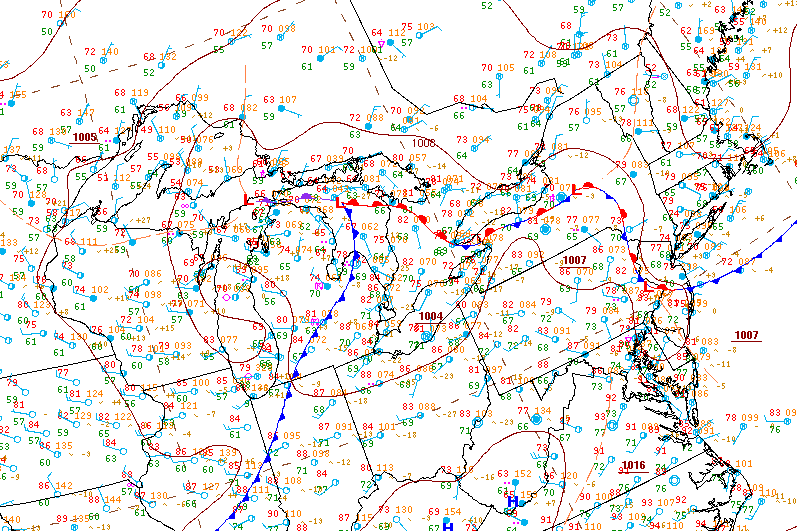
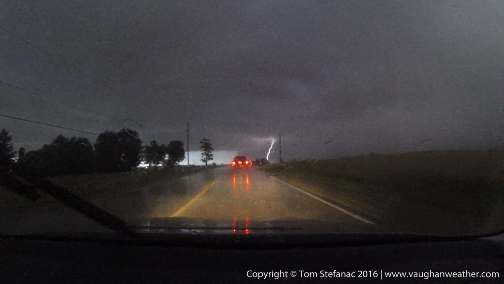
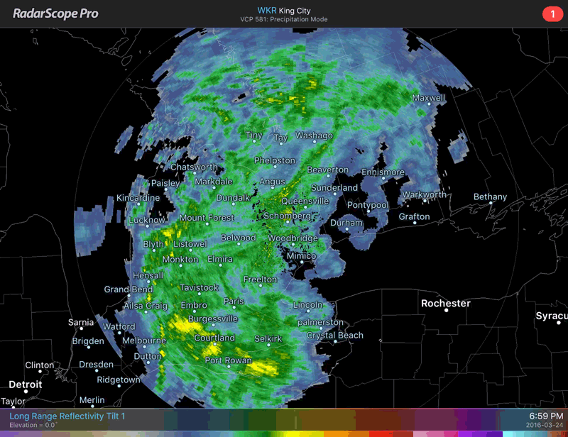
09Z Analysis - A strong low with substantial dynamics aloft and a very large warm sector, fed by tons of daylight ahead of what was a rather narrow stretch of frontal cloud cover worked into Southern Ontario. With the low came some early season thunderstorms which had small hail but were highly electrically charged.
The storms were not propogating in the usual sense, instead they were bubbling up along theta-e lines and sort of drifting north. It was odd and meant the lightning was not situated anywhere predicatbly. Plus, it was 2AM and I was actually exhausted from Easter Sunday. So I was not in the mood for a drive and figured I would try my hand from the window.. without a tripod... which I left in the car.. DOH!
The initial lightning display was great!
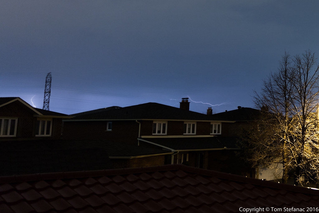
But then as the storm cell drifted north, the bulk of the lightning decided to hide behind the front tree. Maybe I should have gone for drive???!!!!
And so the night went, the rest of the bolts hid behind the trees out of clear sight. Eventually I decided to call it a night and hit the pillow!
That was until I was awoken by the extremely hard rumbling cracking sound of small hail hitting the steel roof! I called it a night right after this.
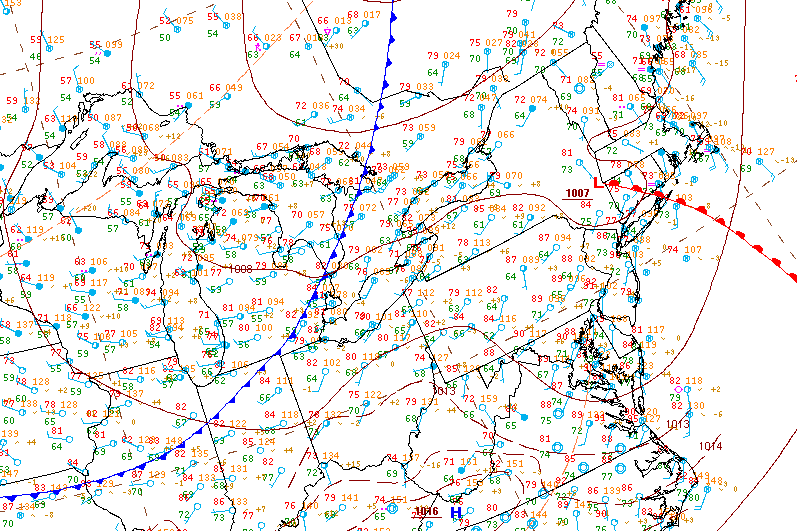
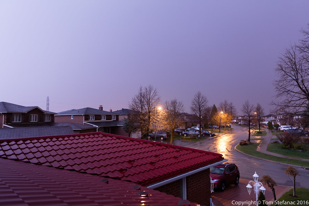
Well, it started out as a cold, dreary, barely above freezing morning. This was the scene downtown as heavy rain along the impending warm front poured down in the still dominant cold, windy easterly flow!
The warm front burst through around 3PM and cloudy, rainy, cold skies gave way to warmth and abundant sunshine. A shortwave moving in from the southwest was also bringing shallow instability with steep lapse rates and strong directional wind shear.
Not a chase per say. I was at the airport due to work and the storm associated with the shortwave slowly grew and came into view on the North-Western Horizon.
A short while later the first of the storms was literally on top of my location at the airport! I could tell by the look of the storm that there were going to be some very strong surface winds.
The storms looked mean but were basically just a mix of rain, small hail and gusty winds. You can see how this storm has a very cold look to it.
The whispy ice rain bands about to hit!
Looking northwest, about to hit!
The storm blew through in literally 2 minutes producing winds of 95 km/h!!!
This poor umbrella became an instant victim of the storm!
Later in the day a second storm cluster began to move towards Toronto from Guelph.
The storm produced some heavy rain and lightning but fell apart as it entered the city thanks to diurnal cooling during the evening.
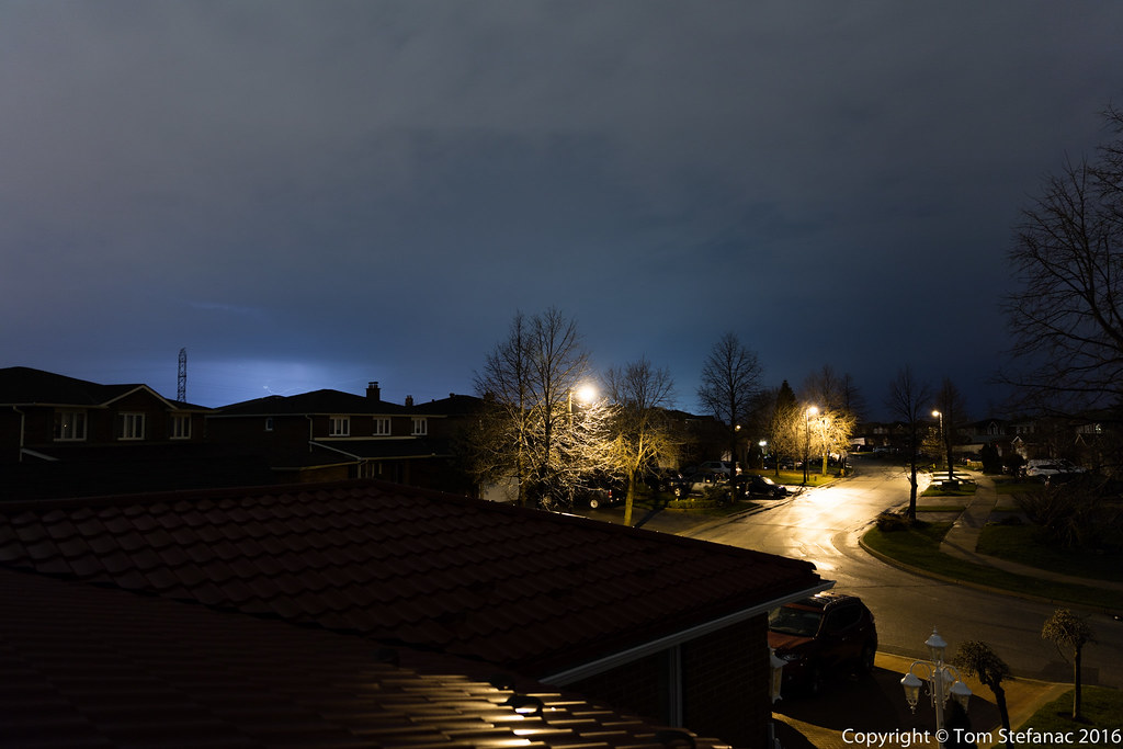
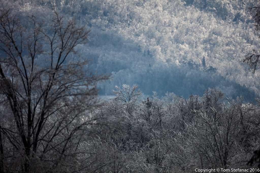
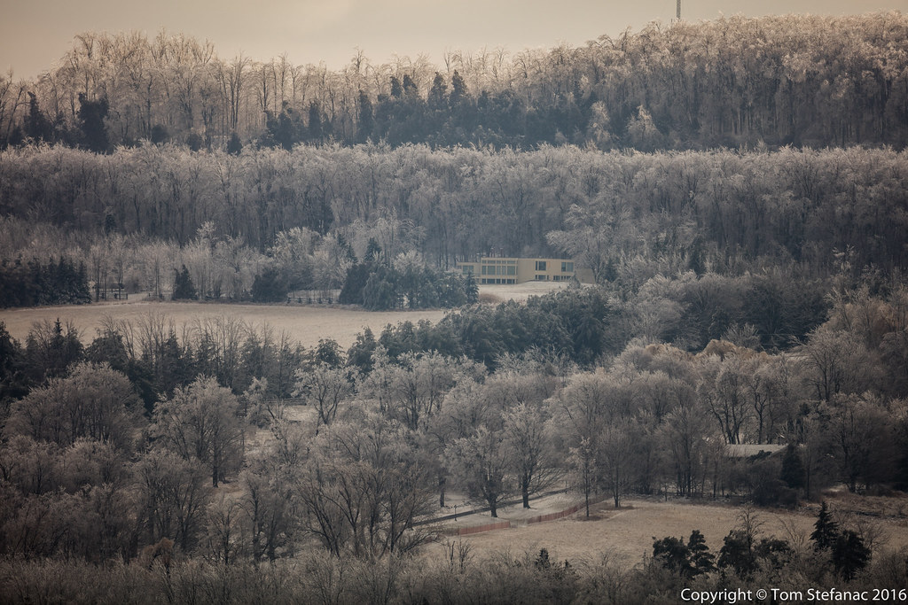
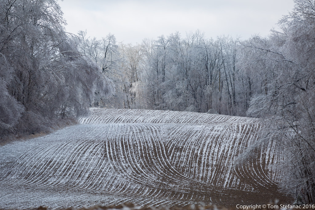
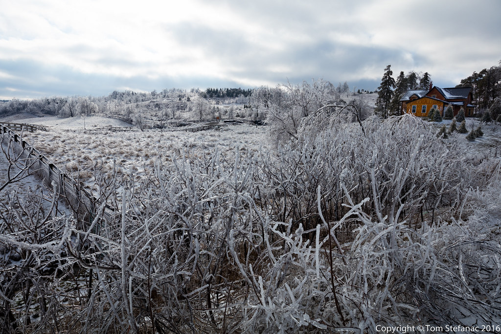
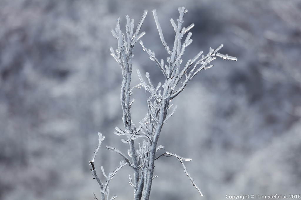
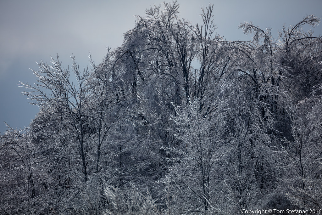
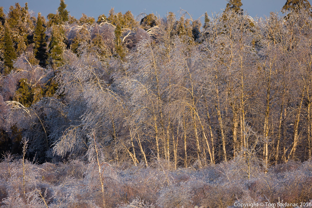
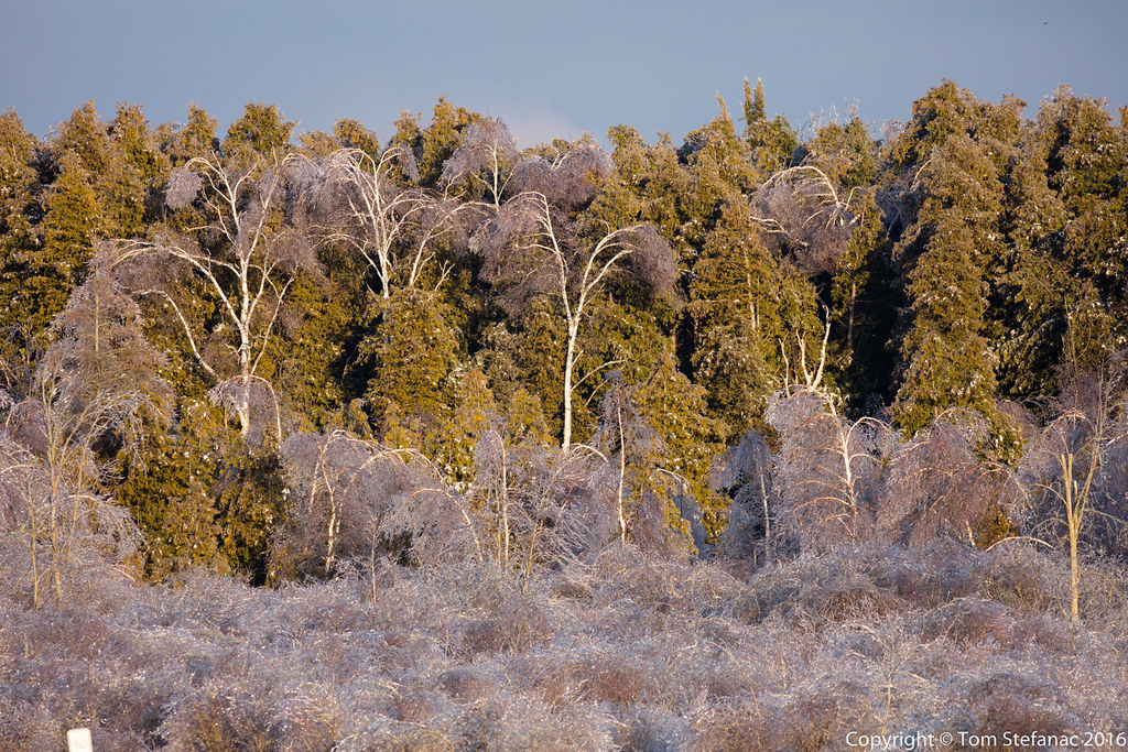
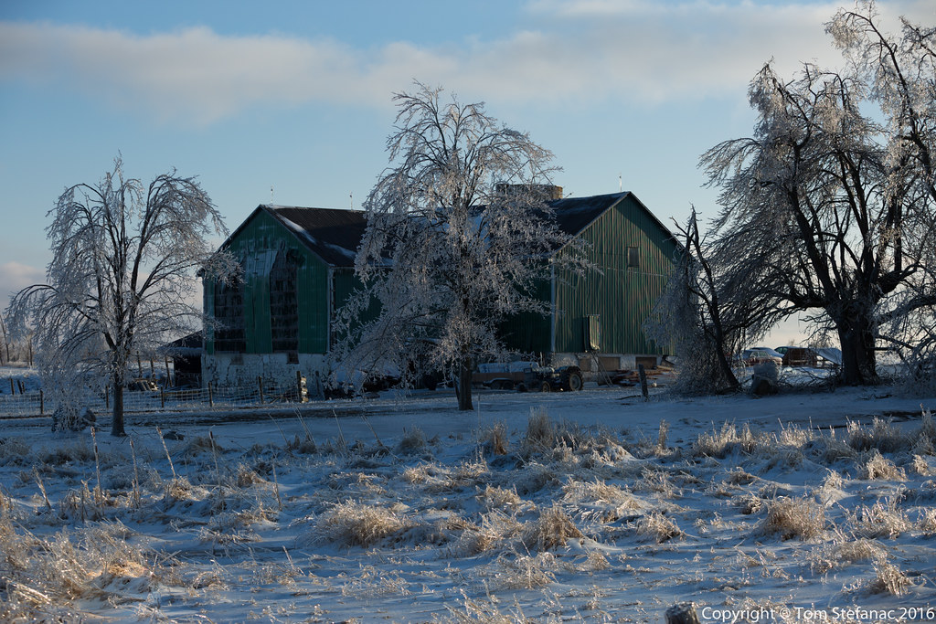
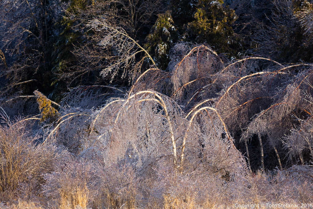
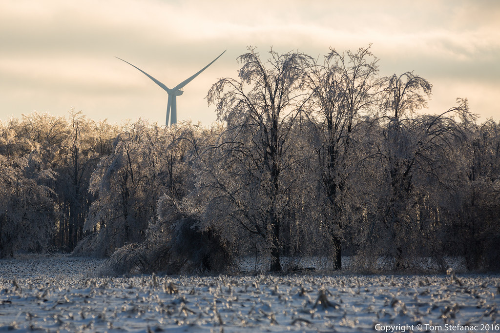
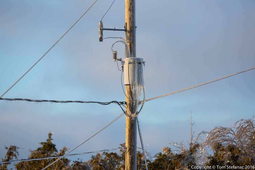
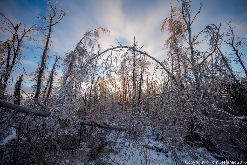
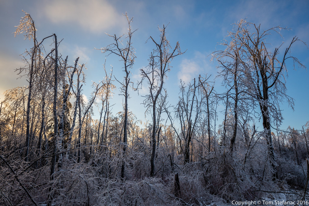
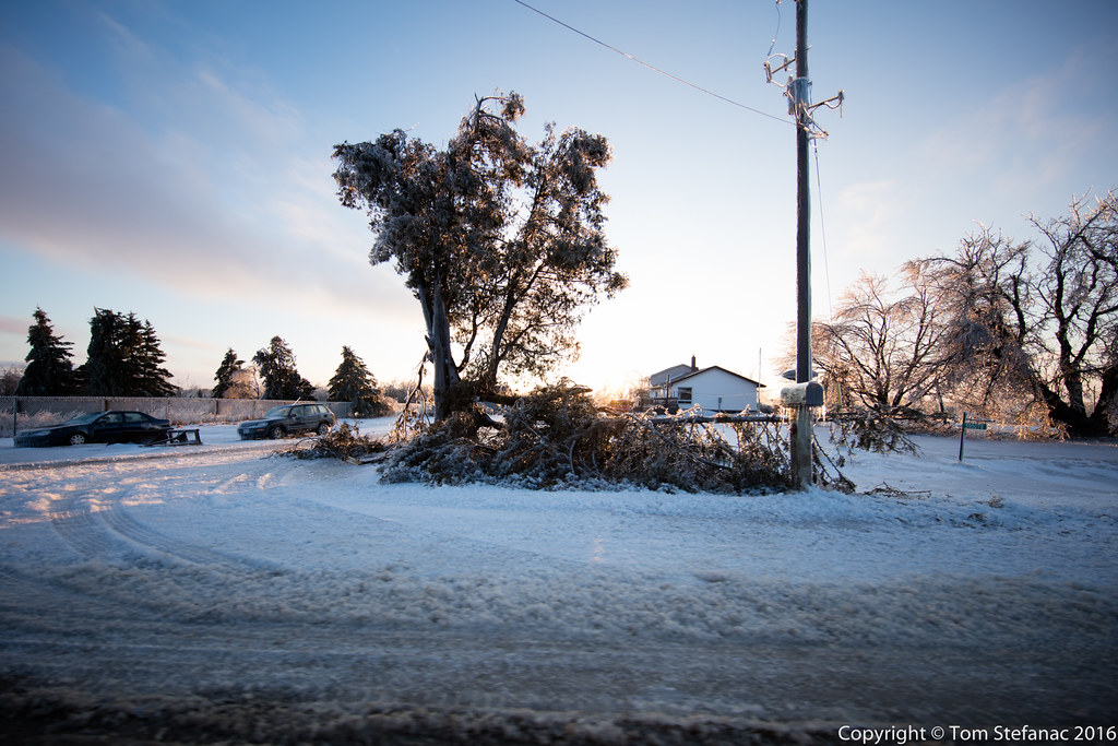
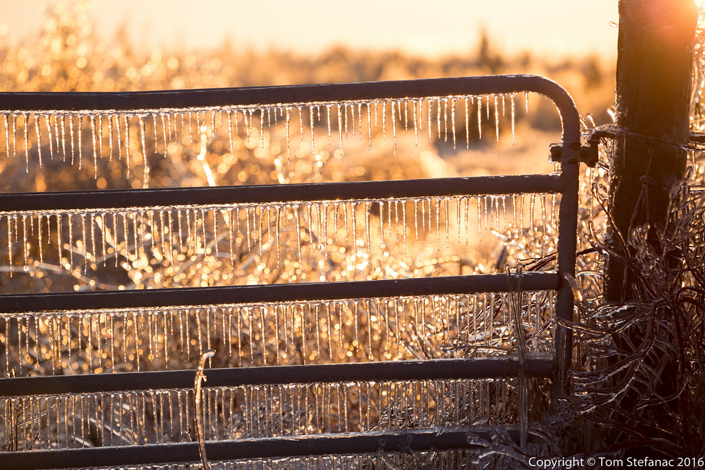
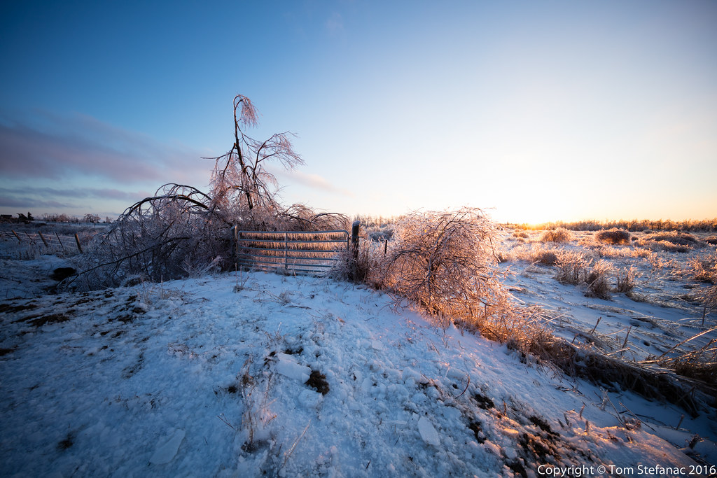
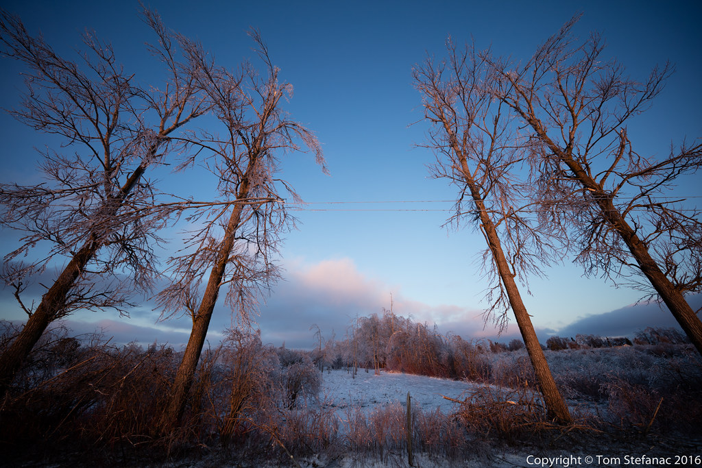
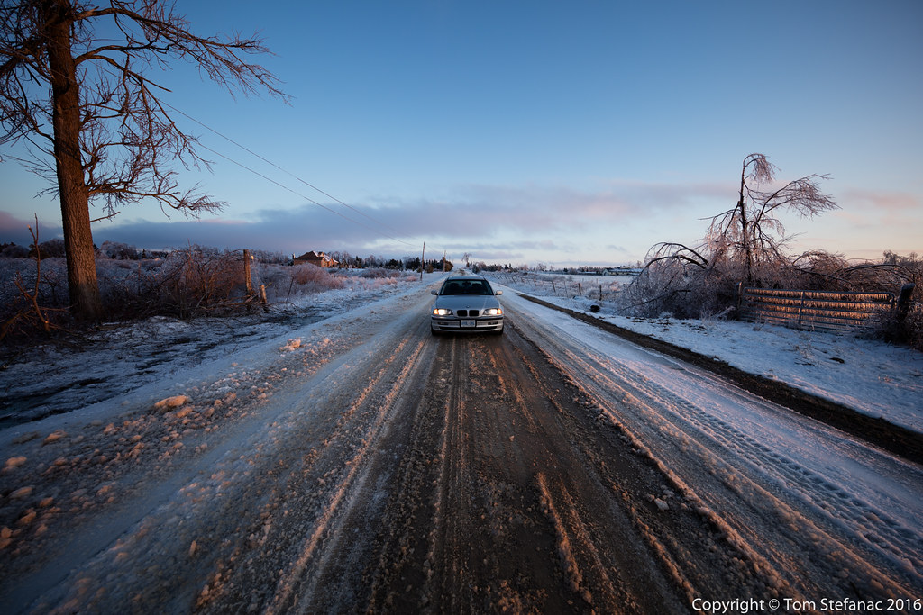
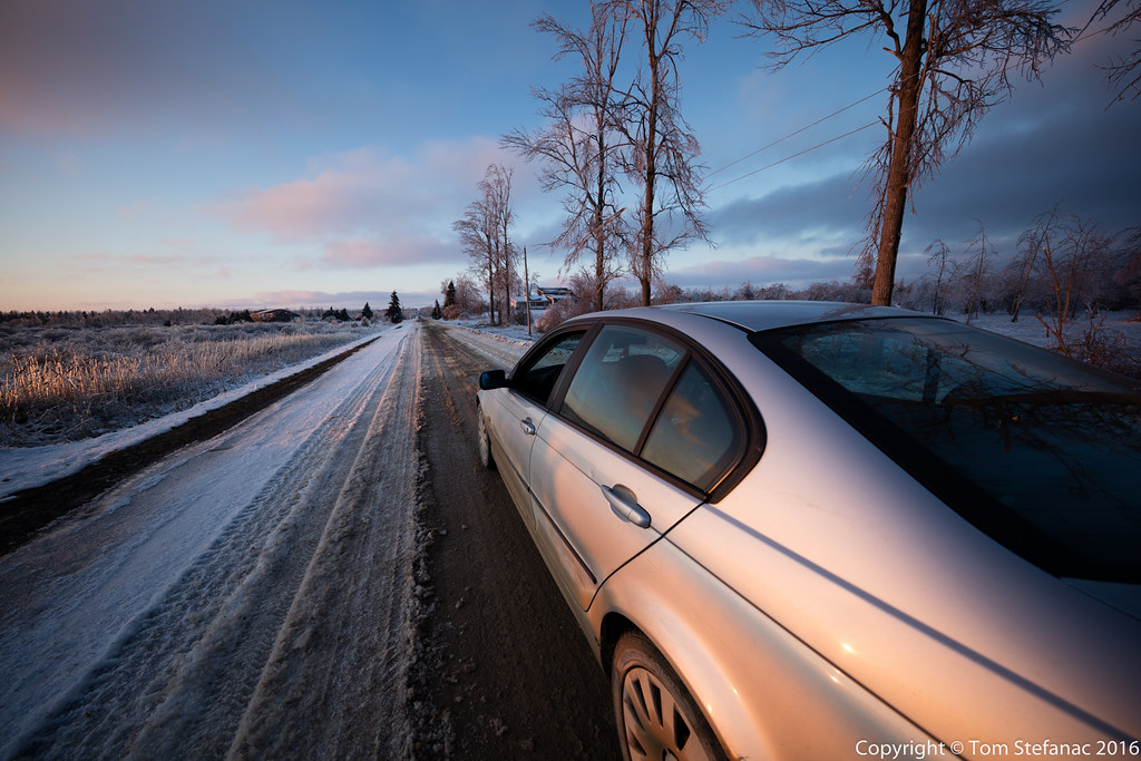
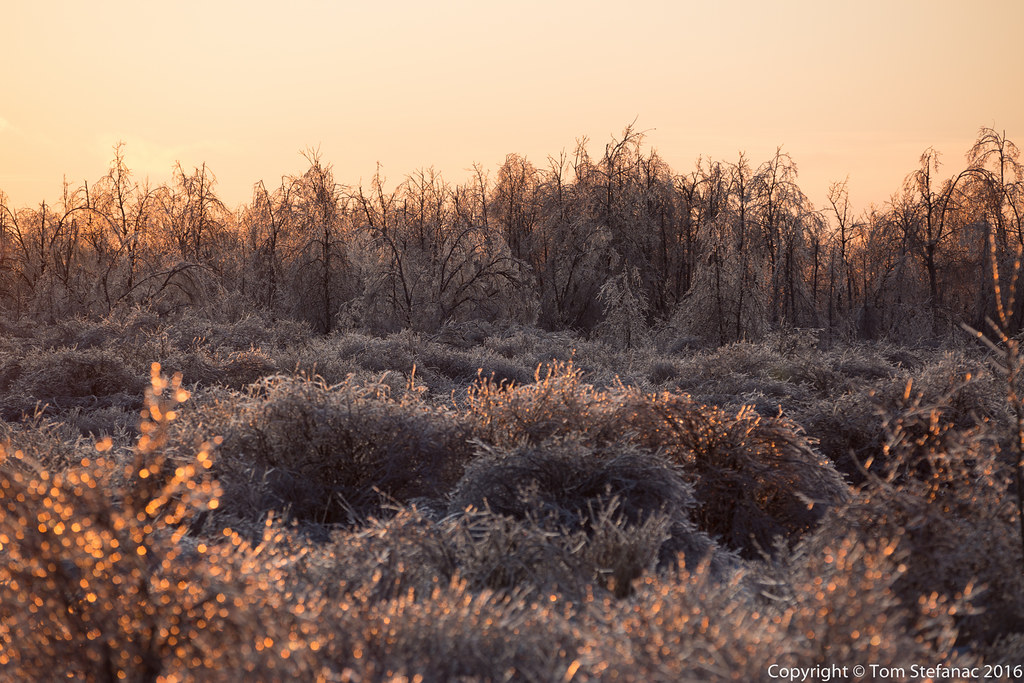
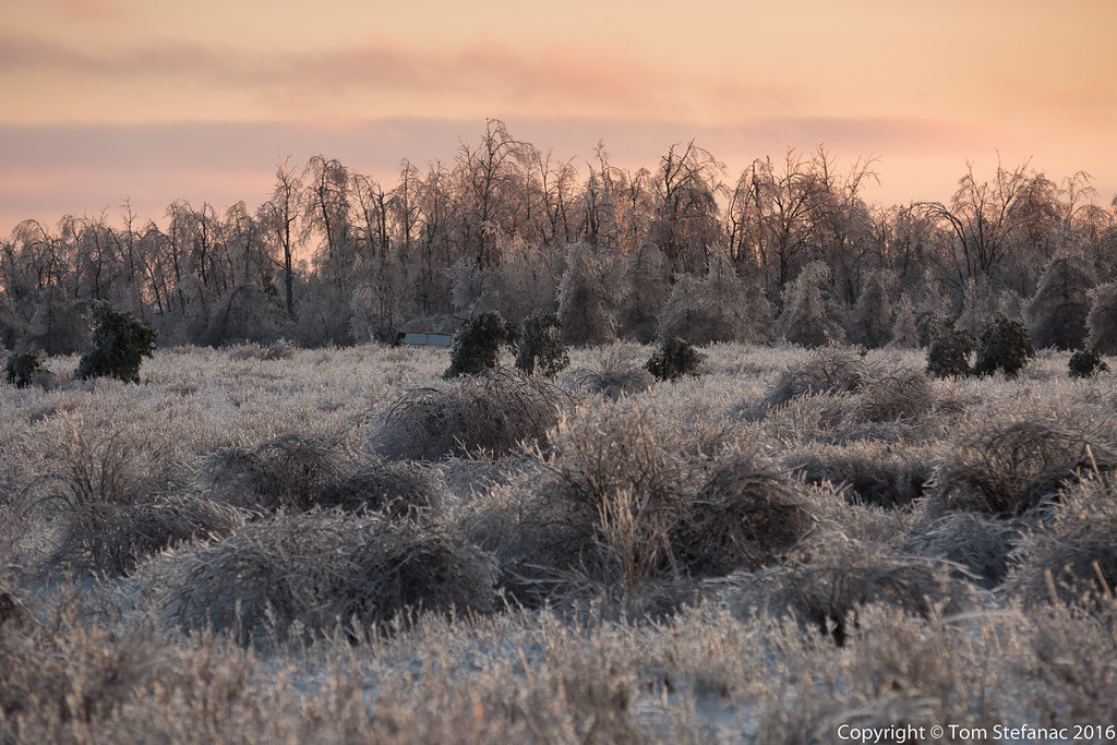
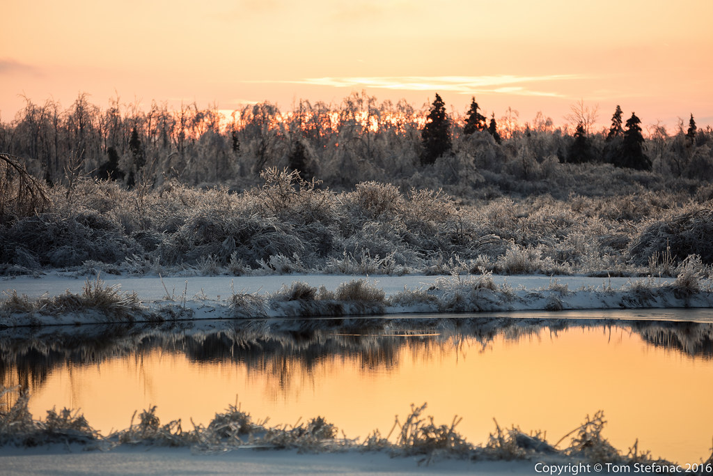
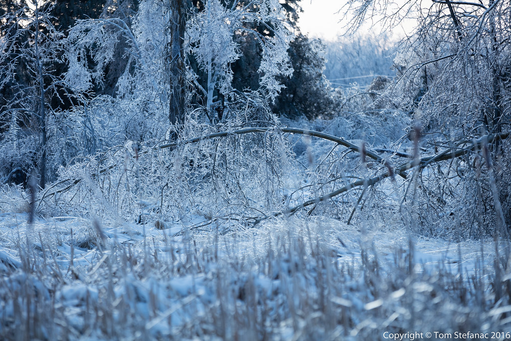
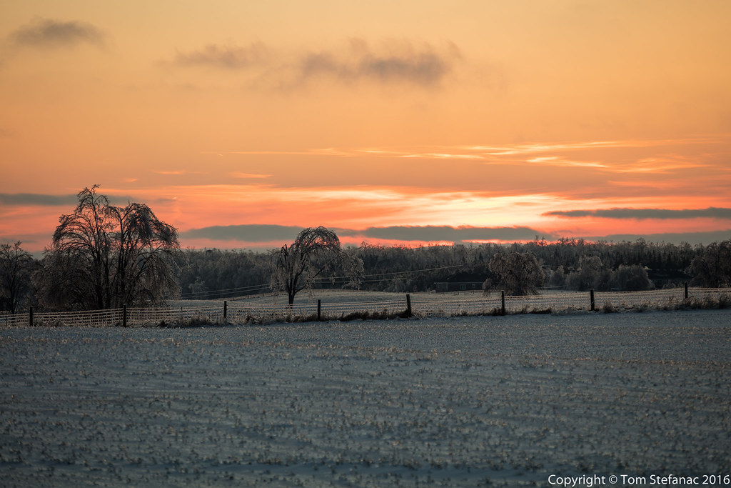
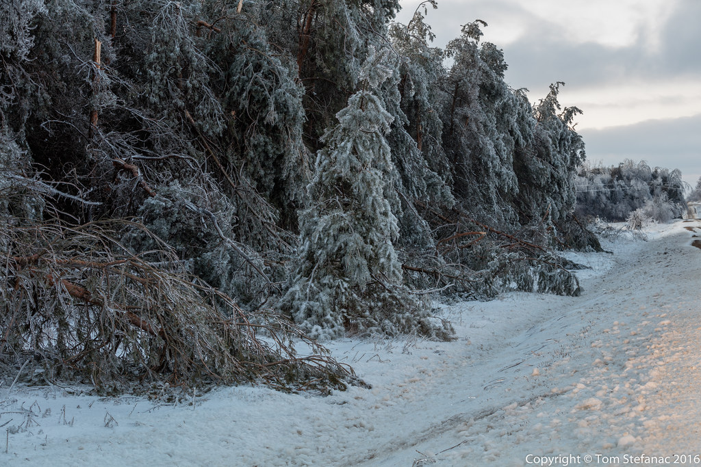
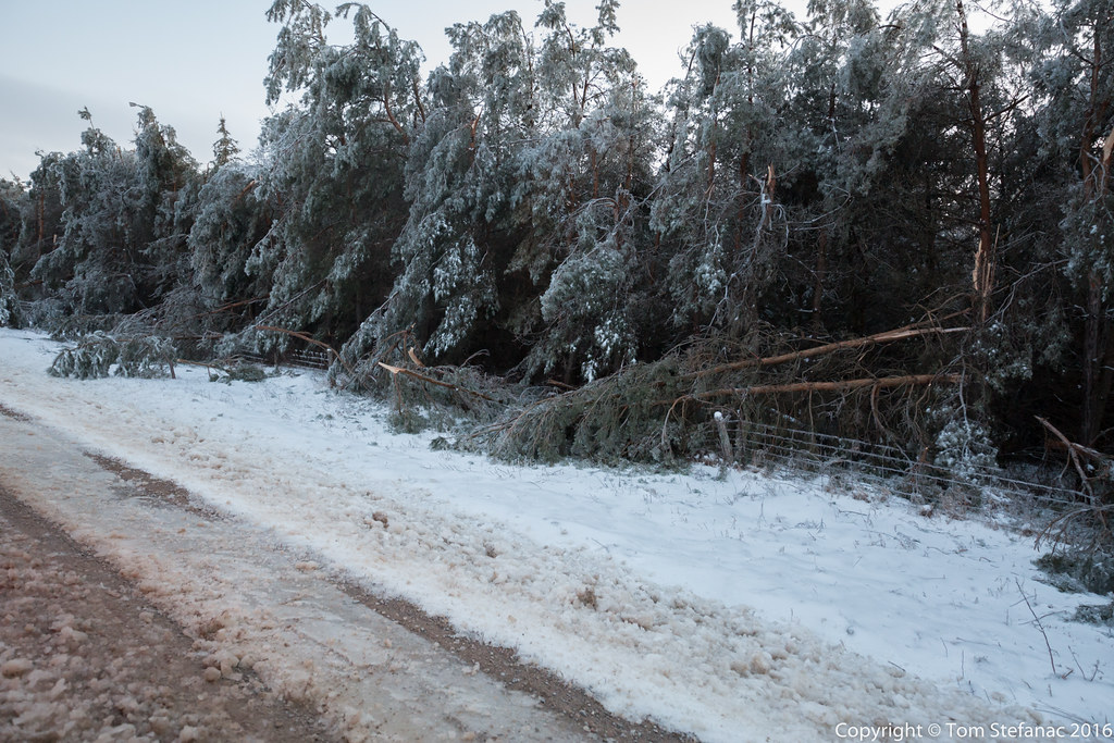
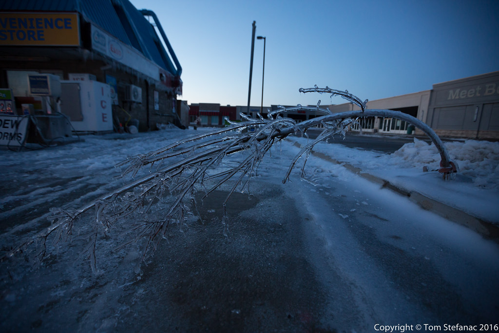
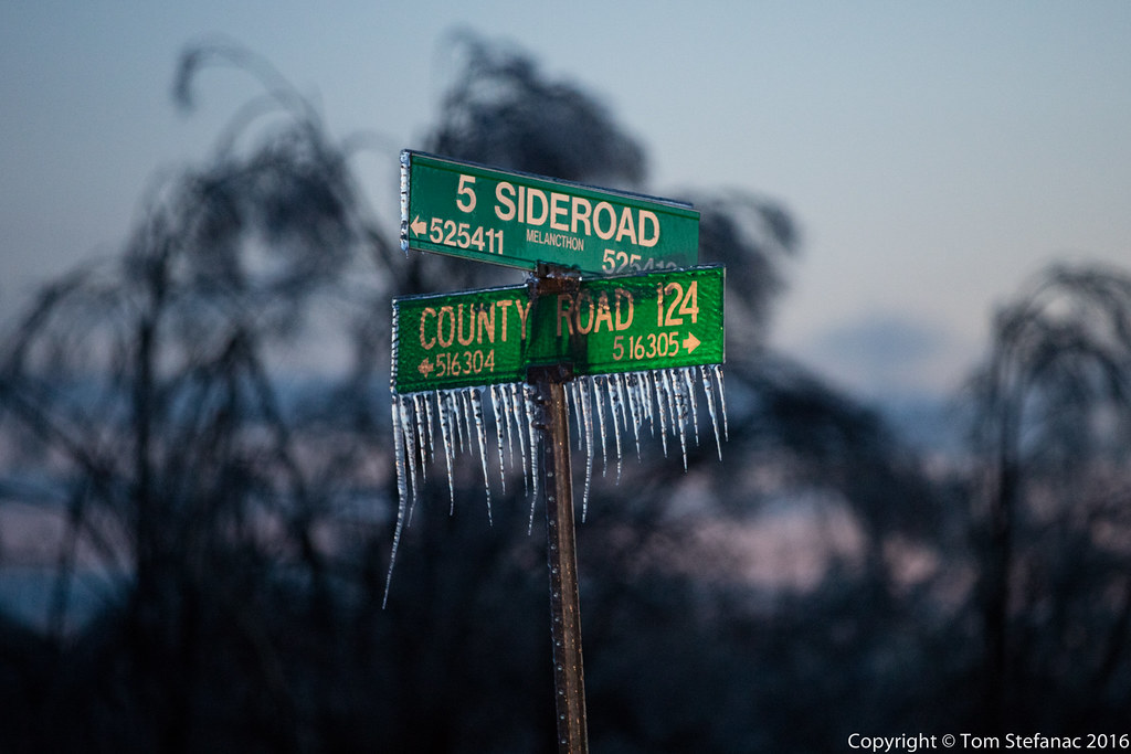
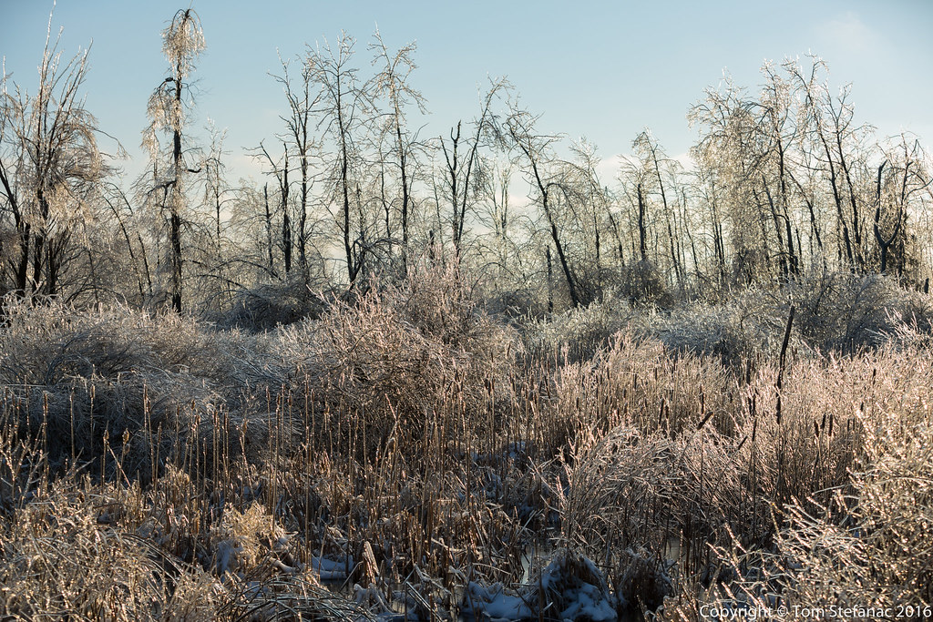
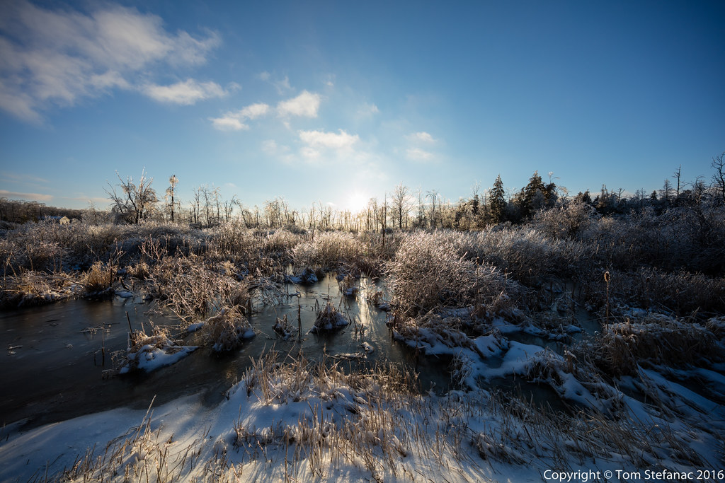
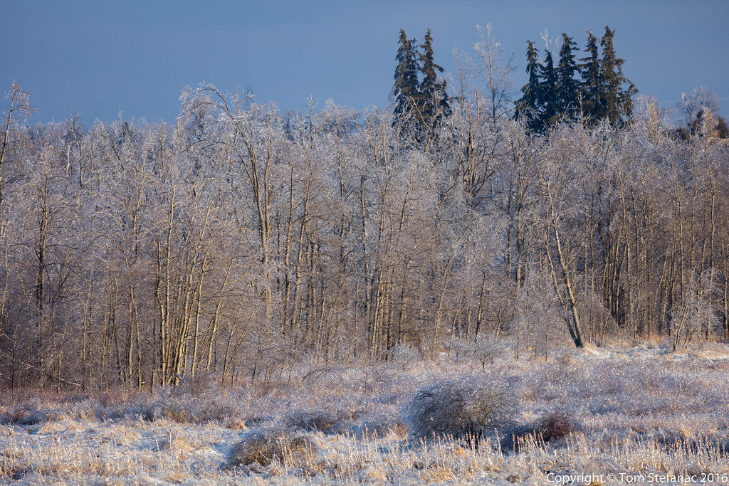
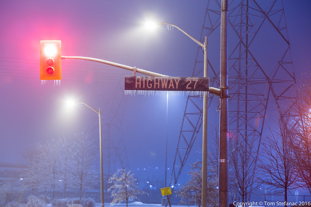
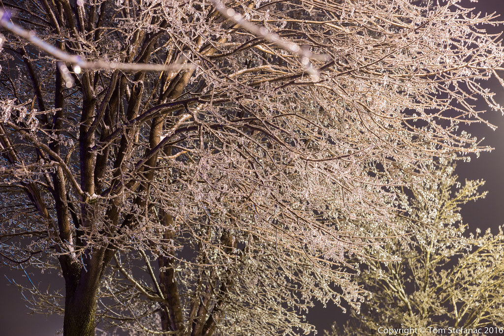
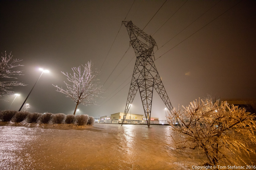
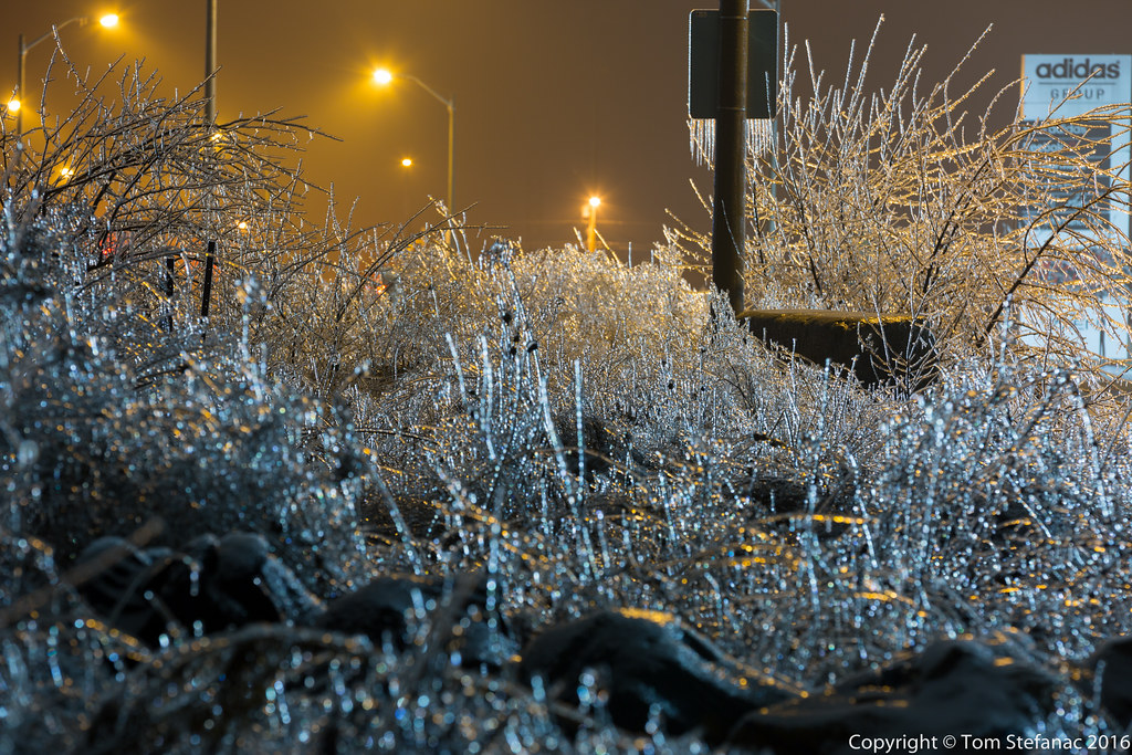
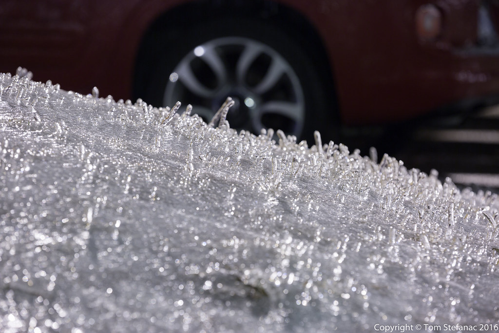
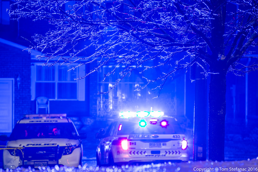
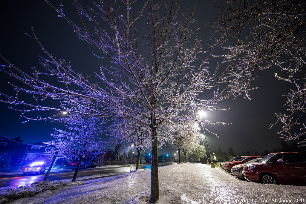
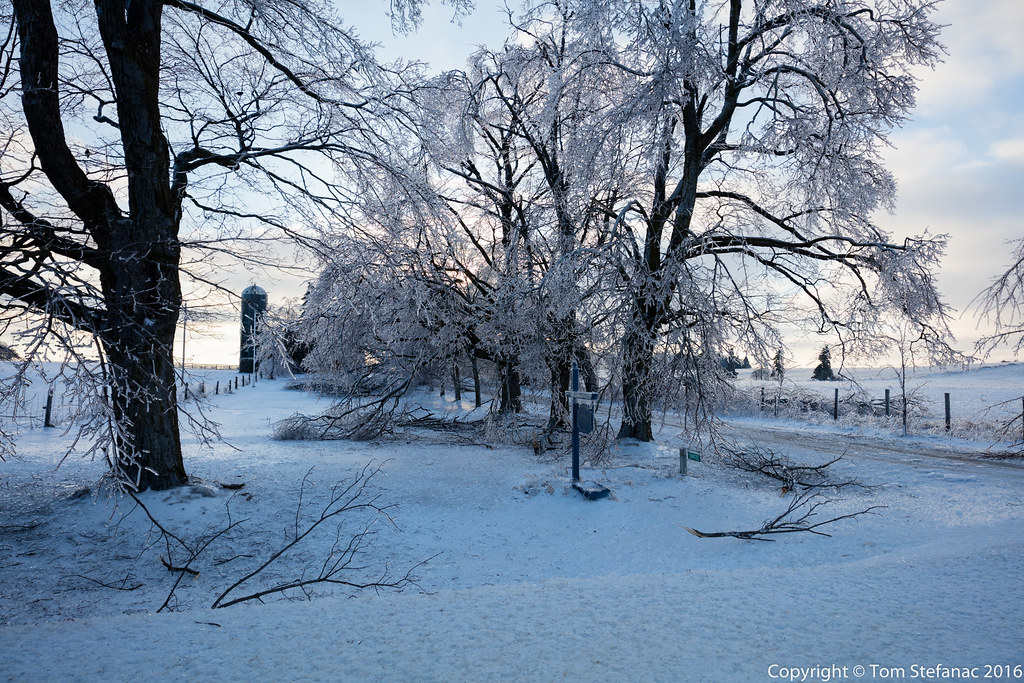
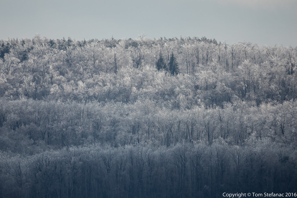
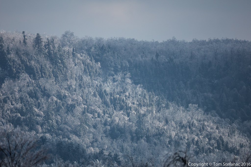
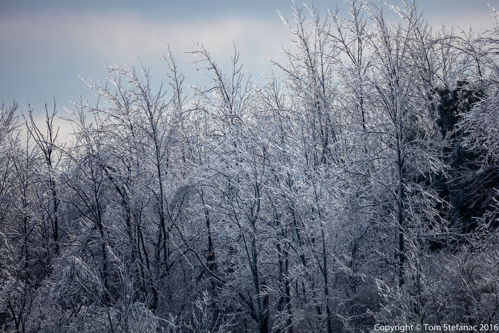
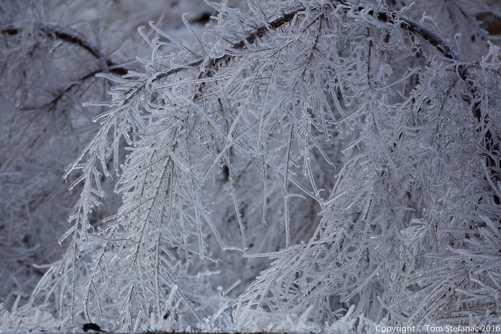
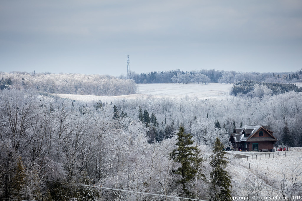
A day and night of freezing rain coated trees, homes and roads with 40-45mm of ice. The storm was a product of an Oklahoma low with a potent surface warm front that simply stalled out and could not overcome the dominant sub-freezing easterly flow just north of the great lakes. This created a perfect storm so to speak where the heaviest rain sat right on an axis of rotation and pummelled some areas just north of Toronto for excess of 24 hours. The result was significant ice accretion leading to substantial tree and infrastructure damage.
The storm while destructive was also very much a rare beast of beauty! As the low departed on good Friday and gaveway to a strong ridge of high pressure, bright sunshine broke through illuminating the glazed icy landscape north of Toronto. I headed out on a photographic journey to explore the beauty and the simultaneous destruction that nature delivered.