May 22st
Today was one of the more difficult forecast call of the trip, there was good potential north and south of Dumas, but the northern storms would not go up for a couple hours after the southern storms.
I was busy looking at models, cloud fields and surface observations for the first half of the day and decided it was best to stop in Pampa and wait. This as it would turn out, was the correct decision.
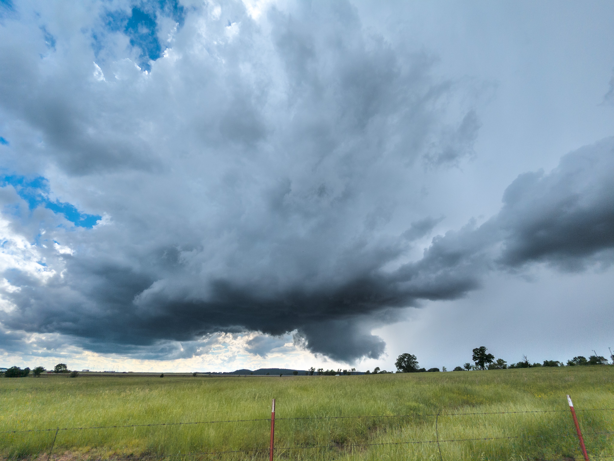
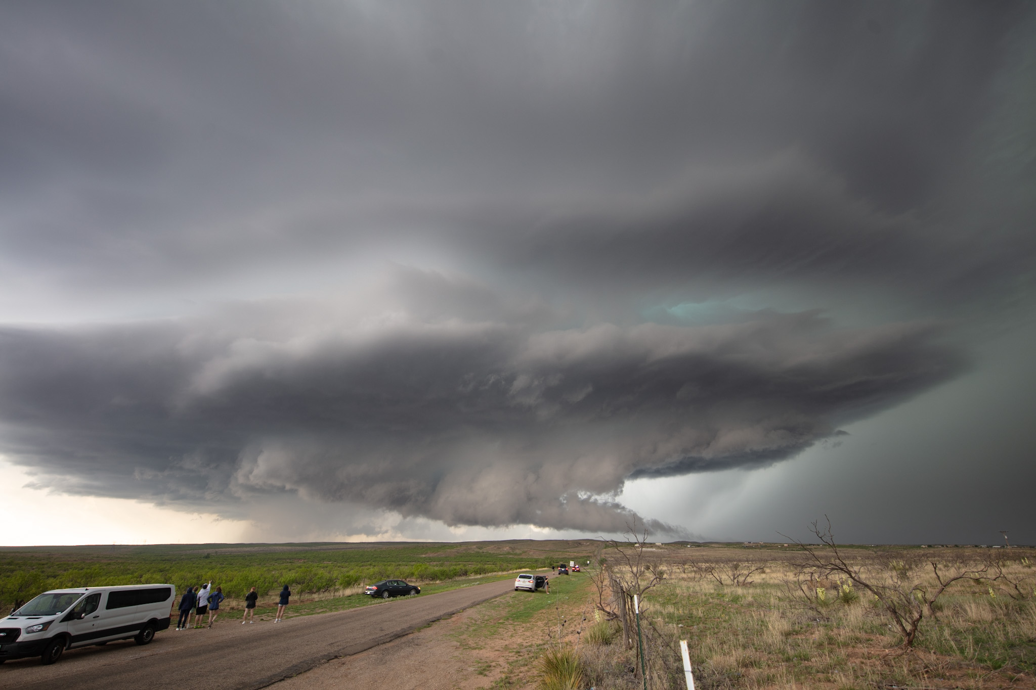
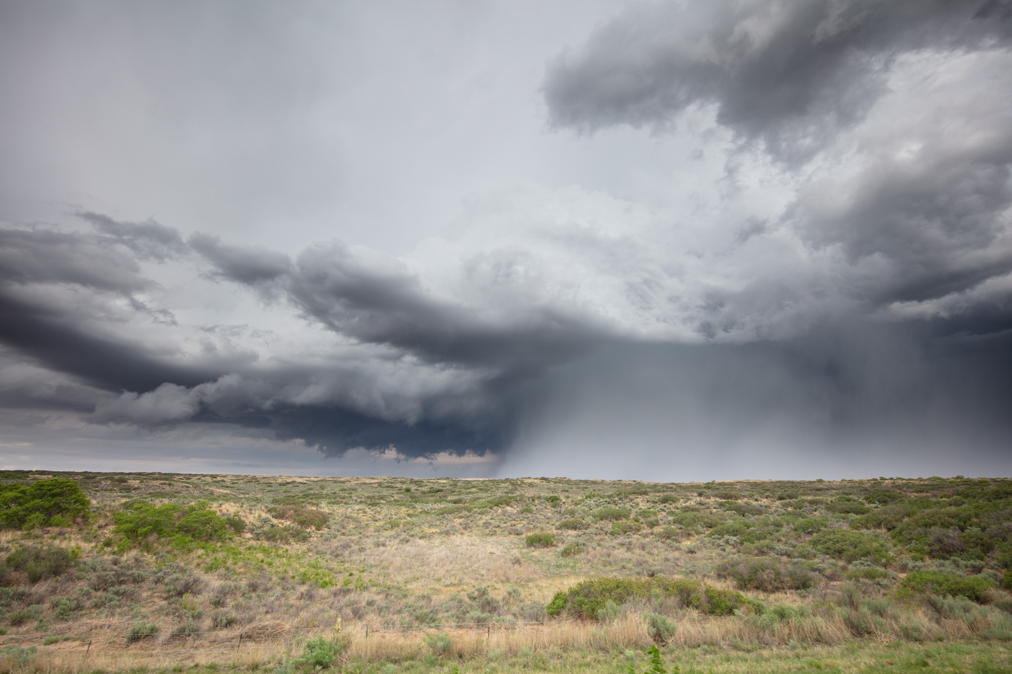
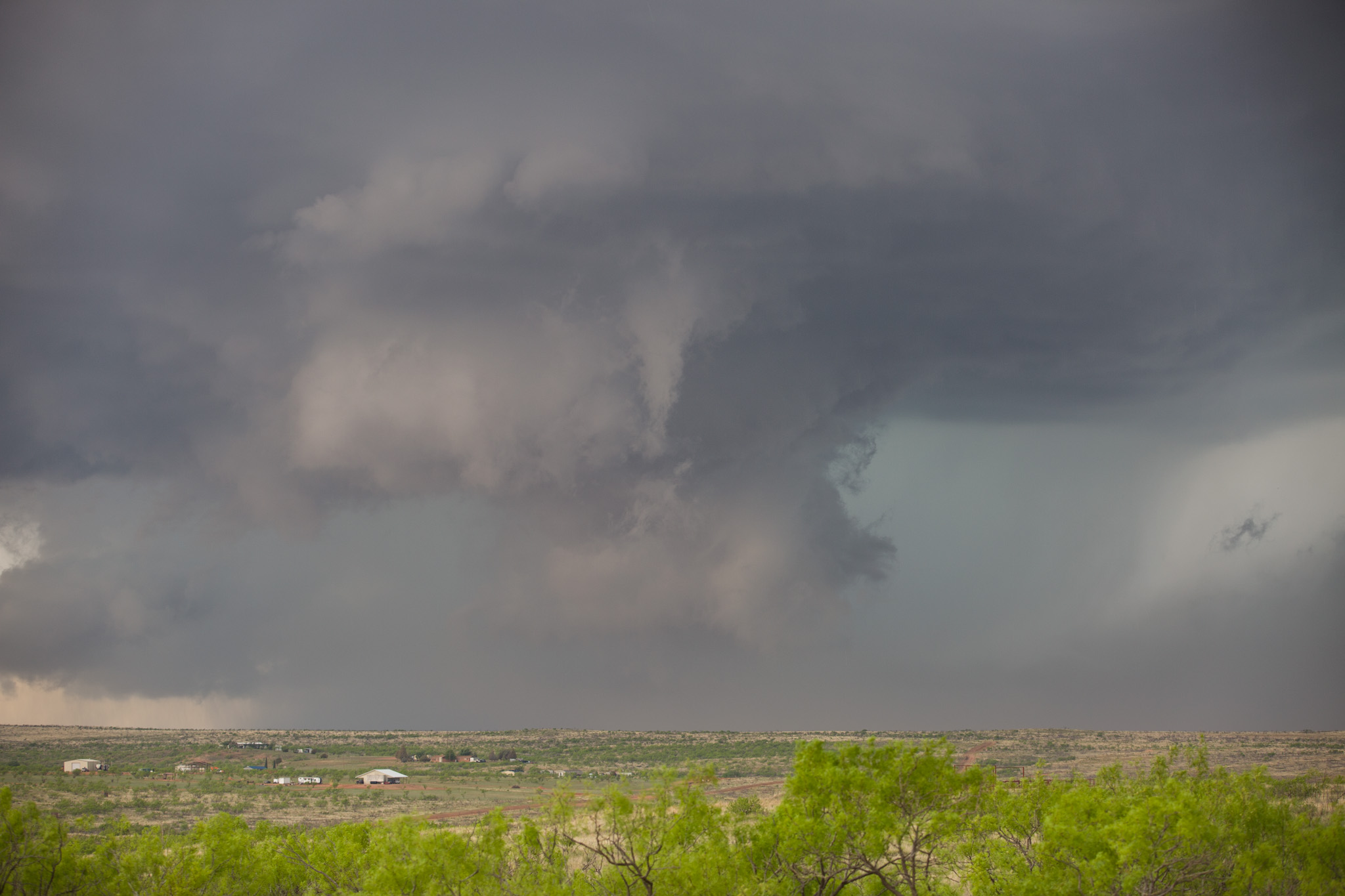
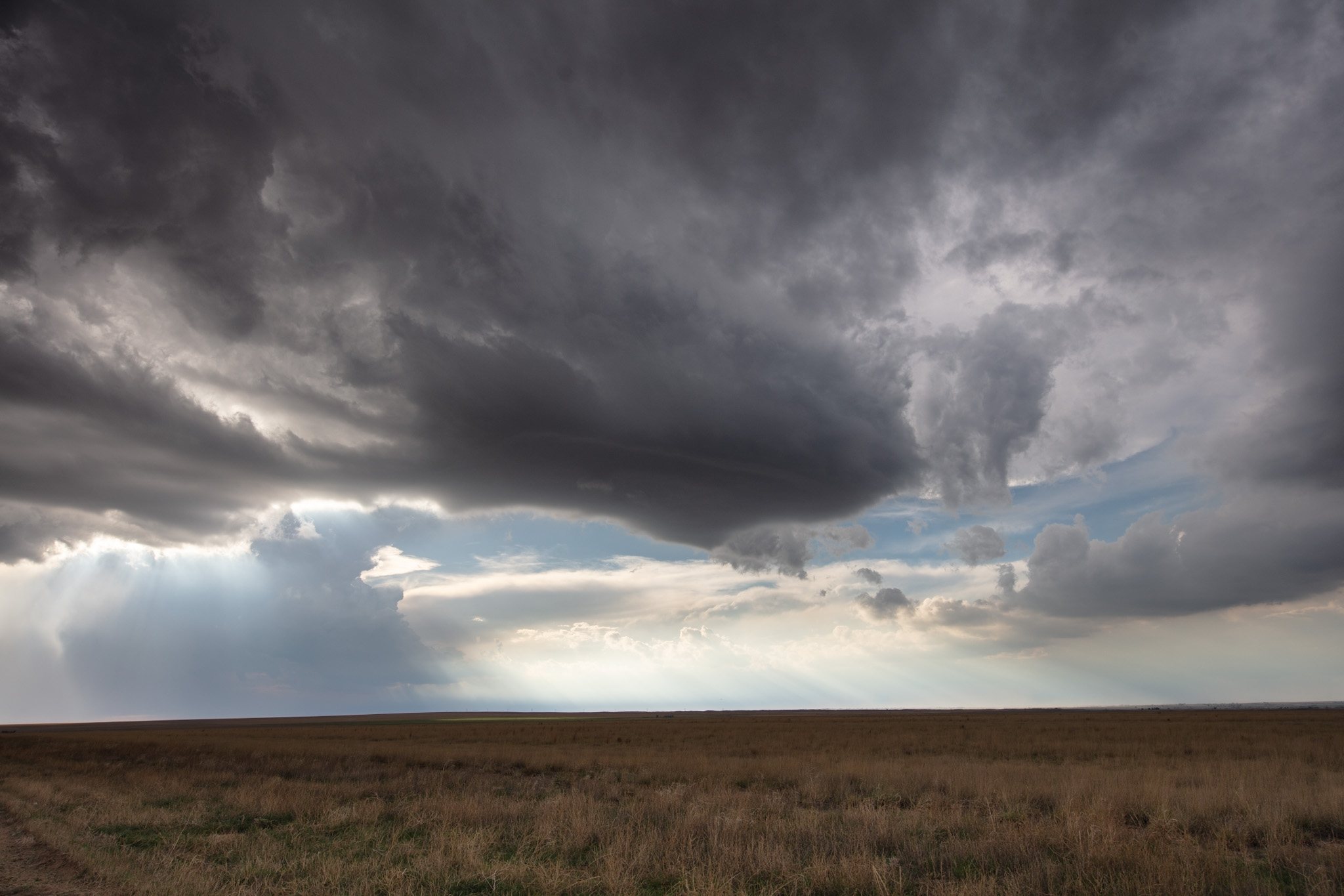
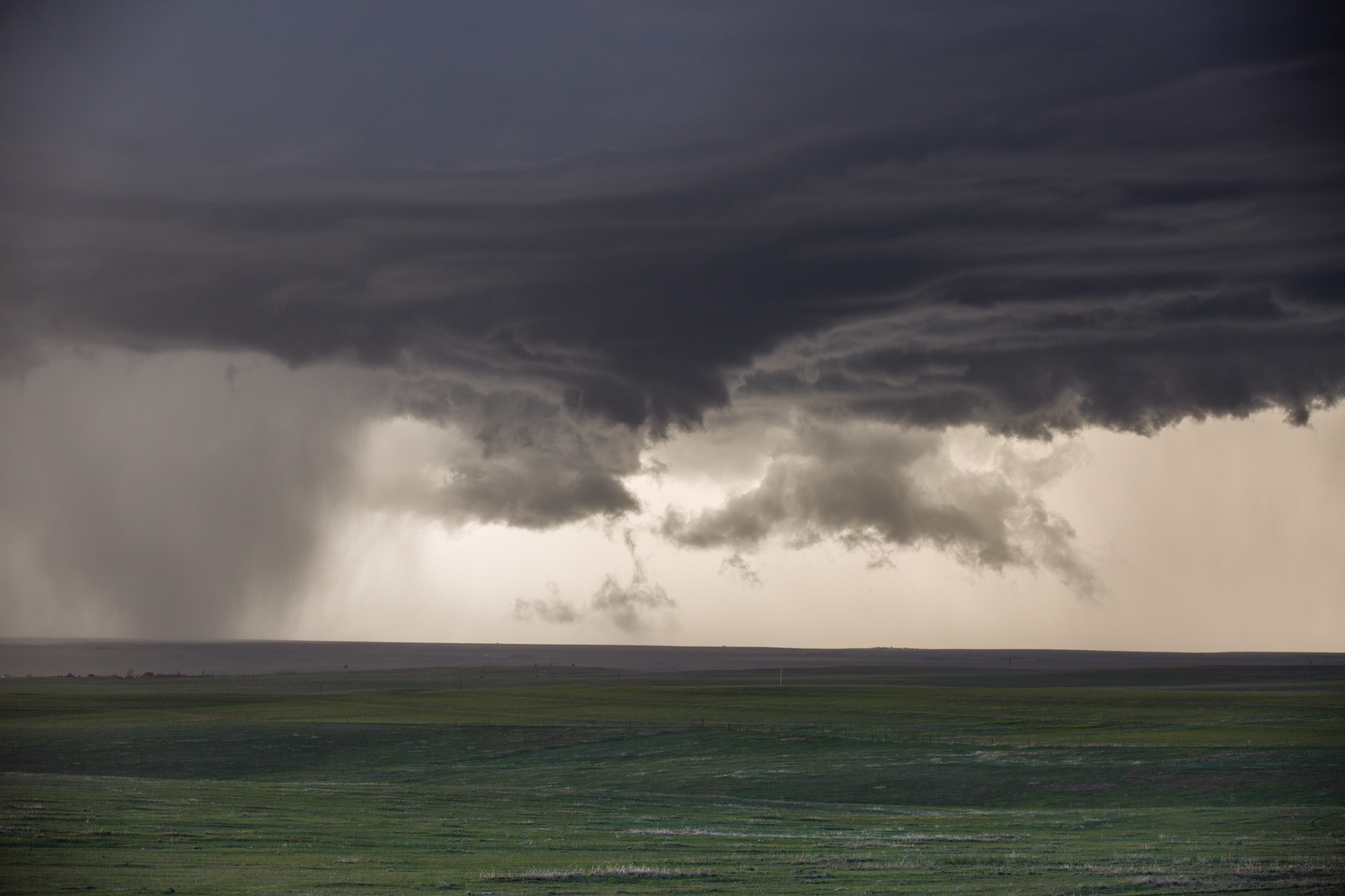
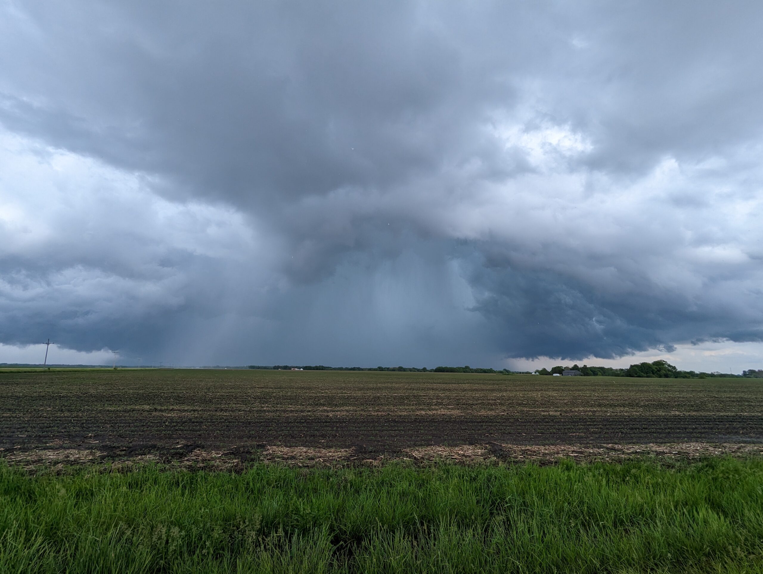
We didn’t have to wait very long in Pampa for storms to trigger and go up hard and fast. I decided we should fall south and head towards a southern cell. As we were passing through two storms situated on a boundary, one of the storms began to show excellent growth, and weak rotation. I decided we would chase it as the target storm.
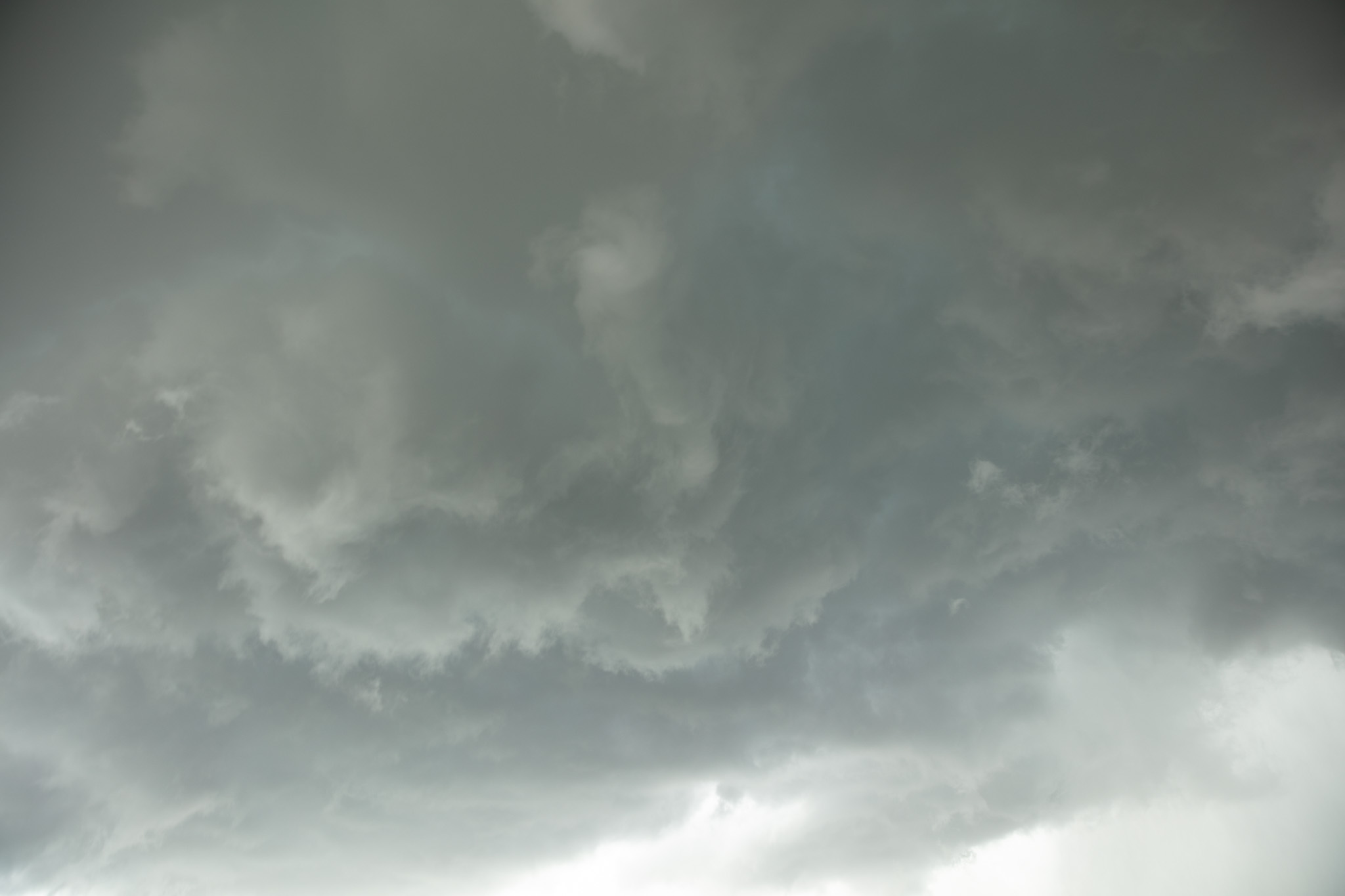
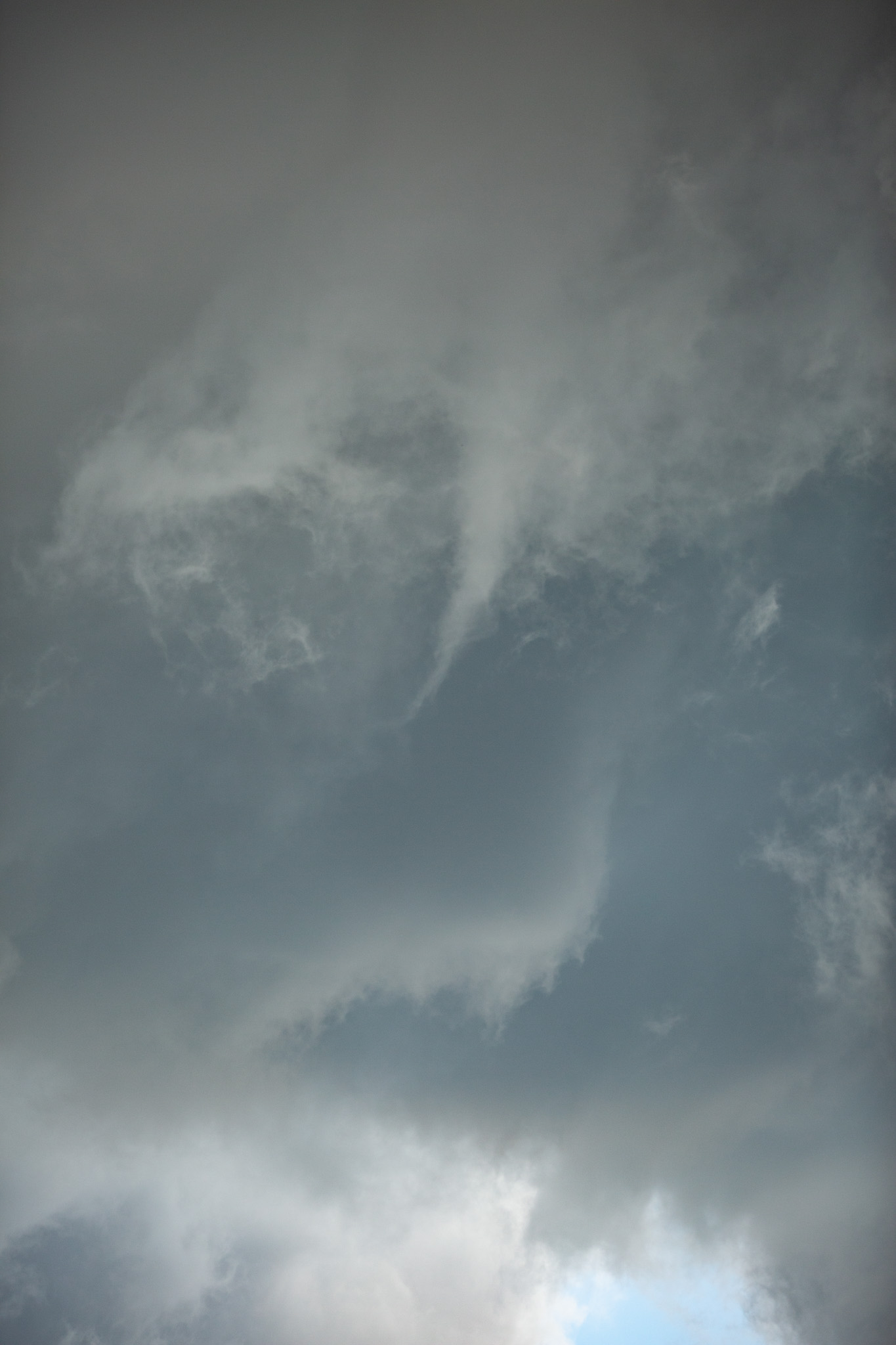
The storms really began to wind up and produce several carousel type wall clouds with many small shear funnels. We followed the storm as it drifted east where it eventually came to produce a large knobby white funnel cloud. Unfortunately, rain from a nearby storm that was getting ripped apart did interfere destructively and the storms never did get more organized.
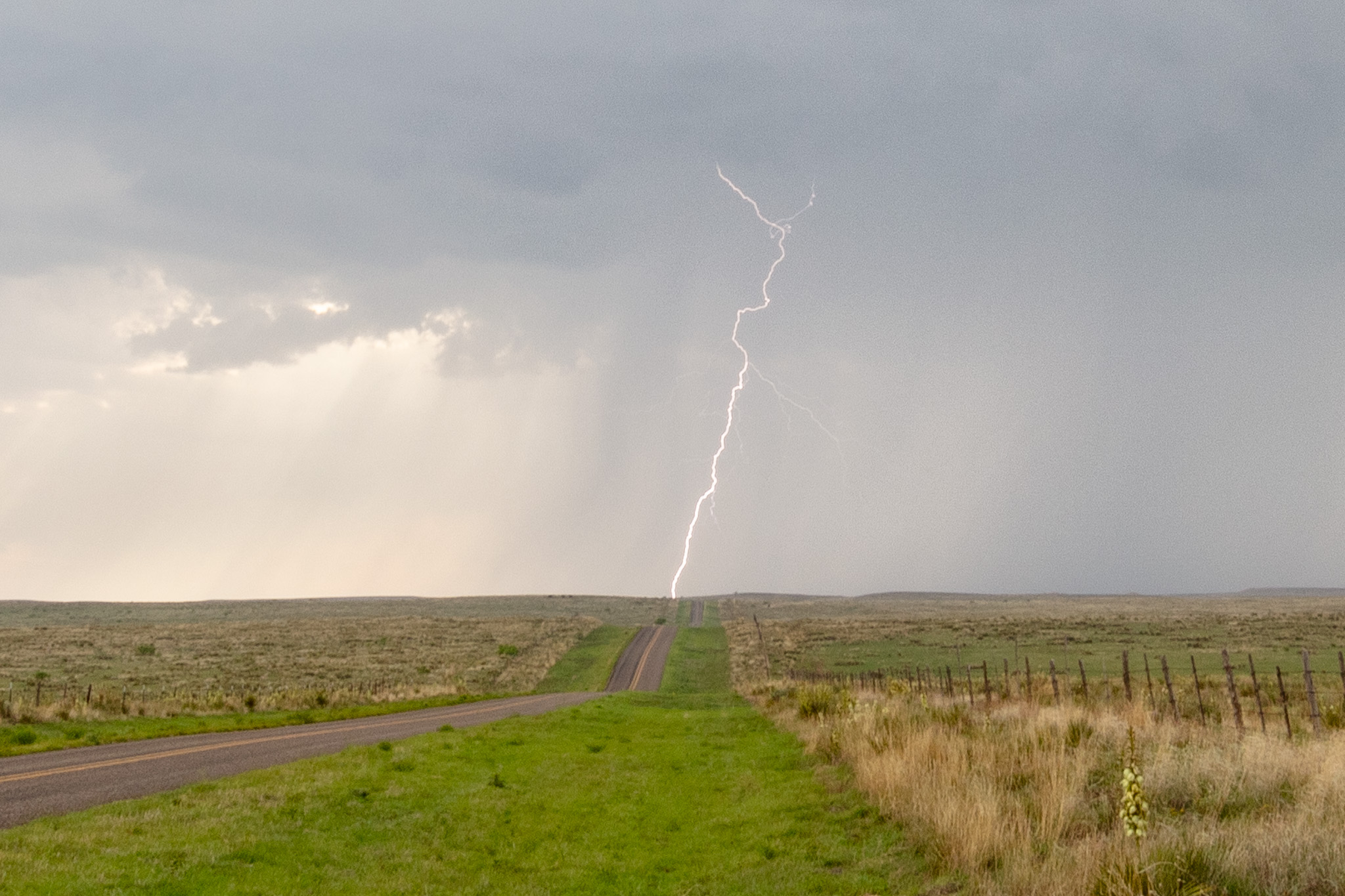
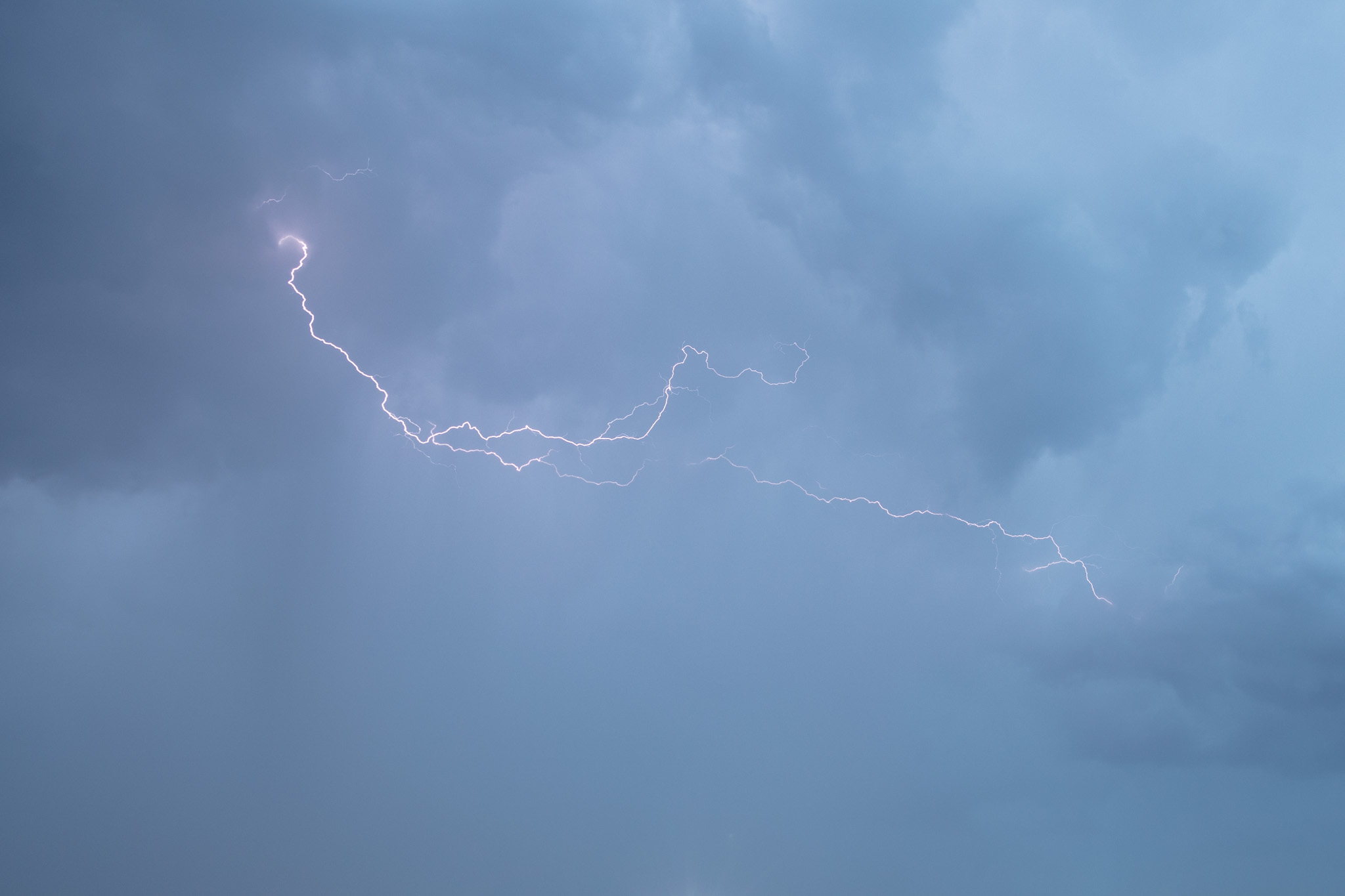
We followed the storm east for a while, watching as it cycled and even tossed out some huge lightning bolts dropping all around us with cracks and bangs.
Unfortunately, this storm become enveloped in an outflow dominant environment and slowly dissipated. I let the group know about the northern storm and how good it was looking (it was in a prime environment as far as shear) and MaryAnn decided we could make it!
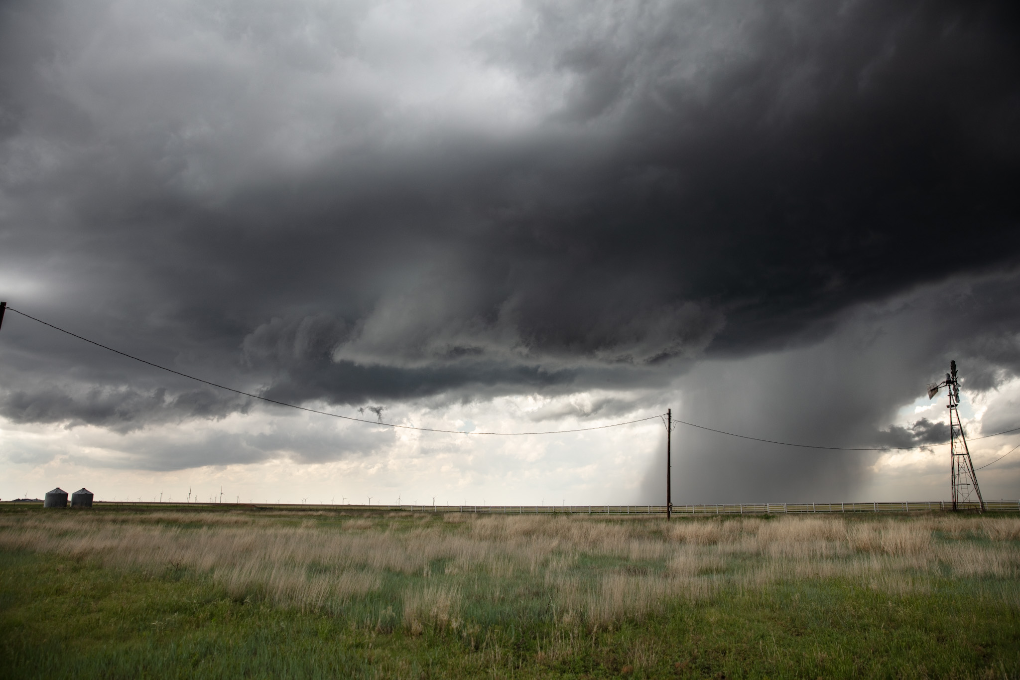
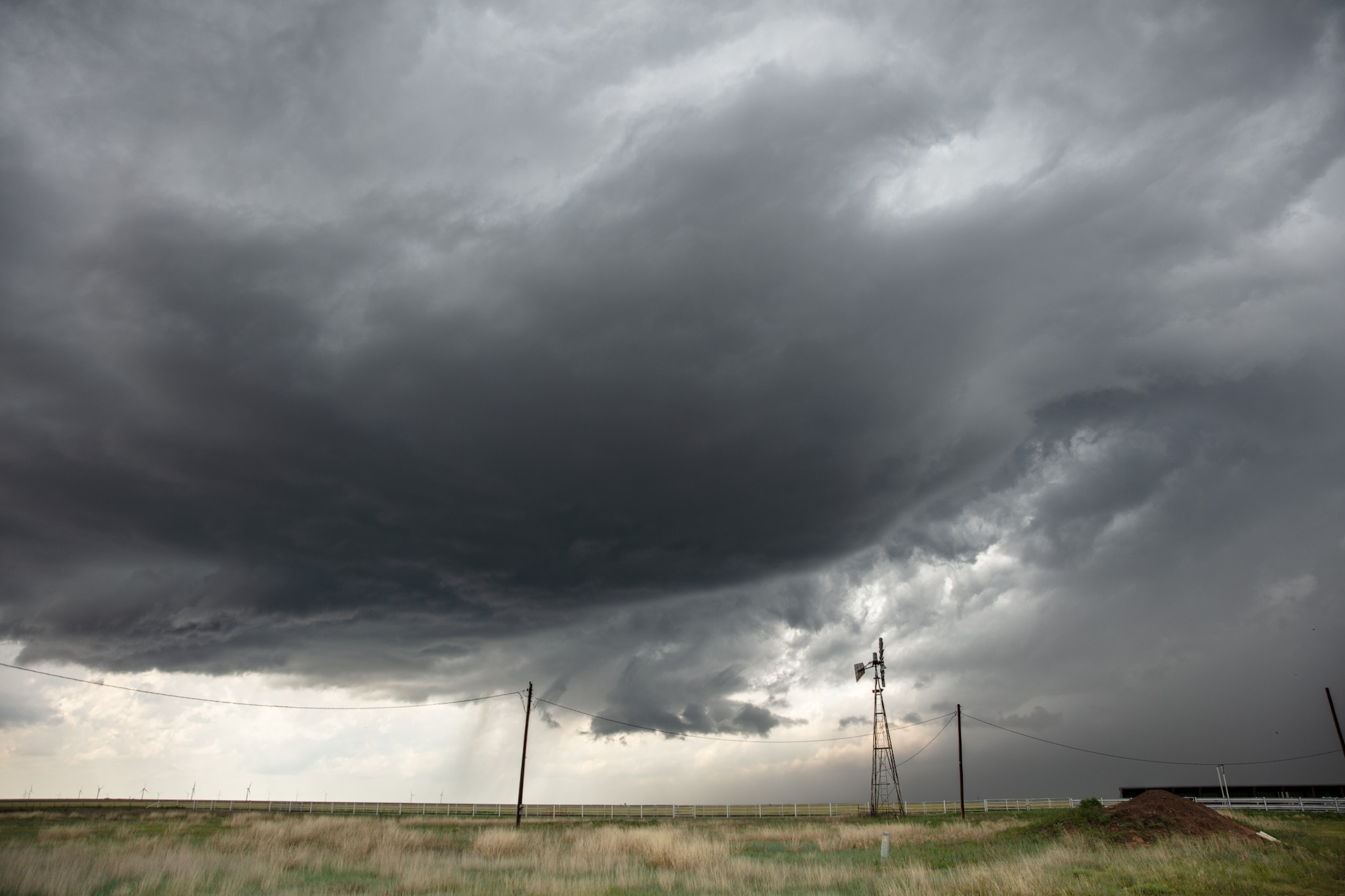
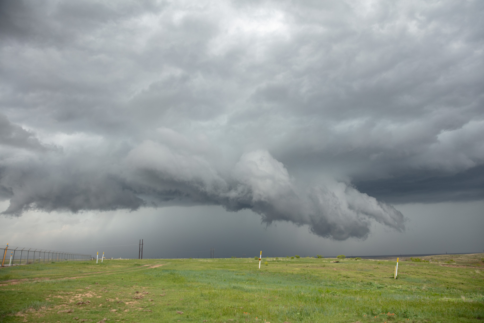
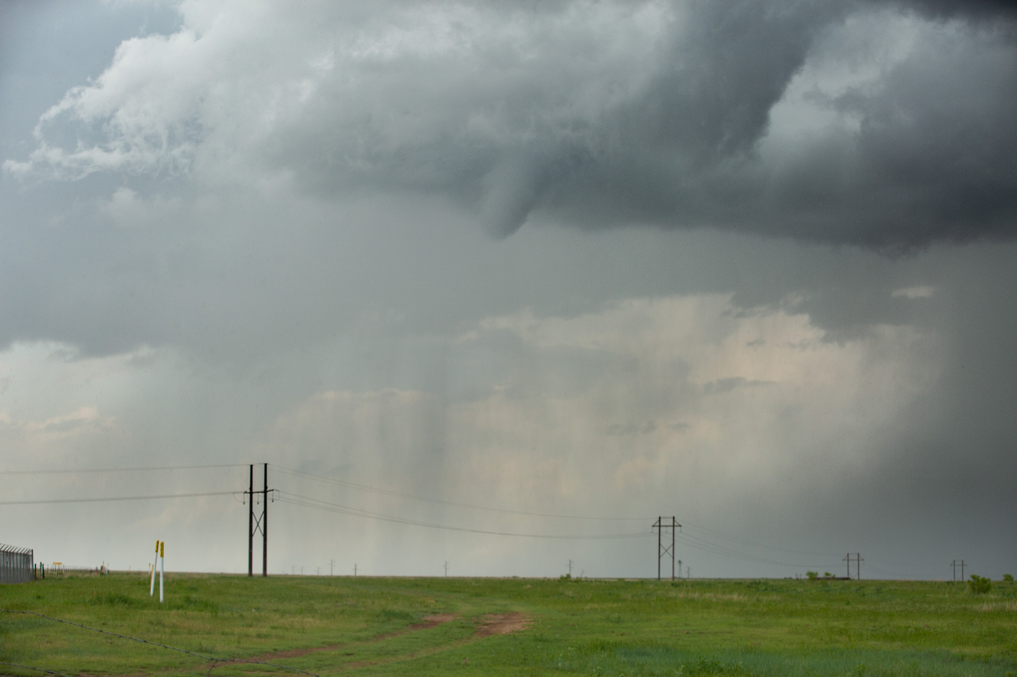
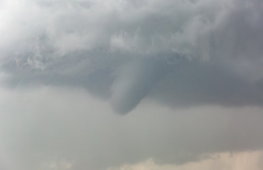
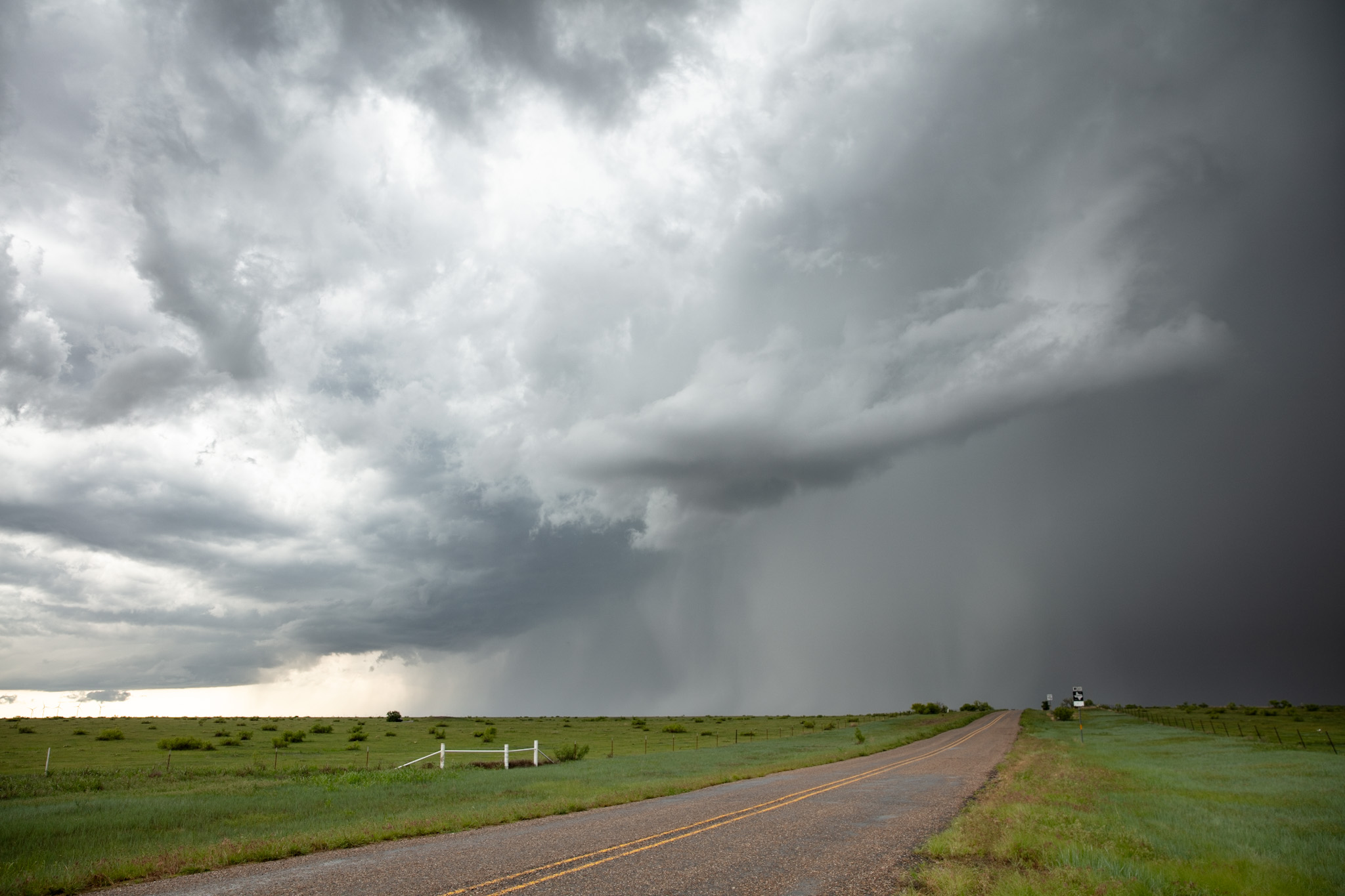
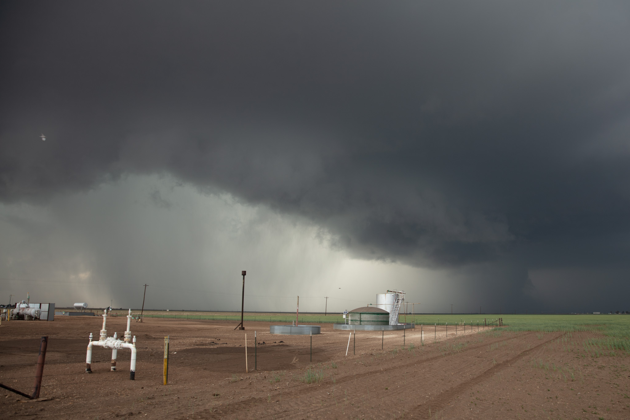
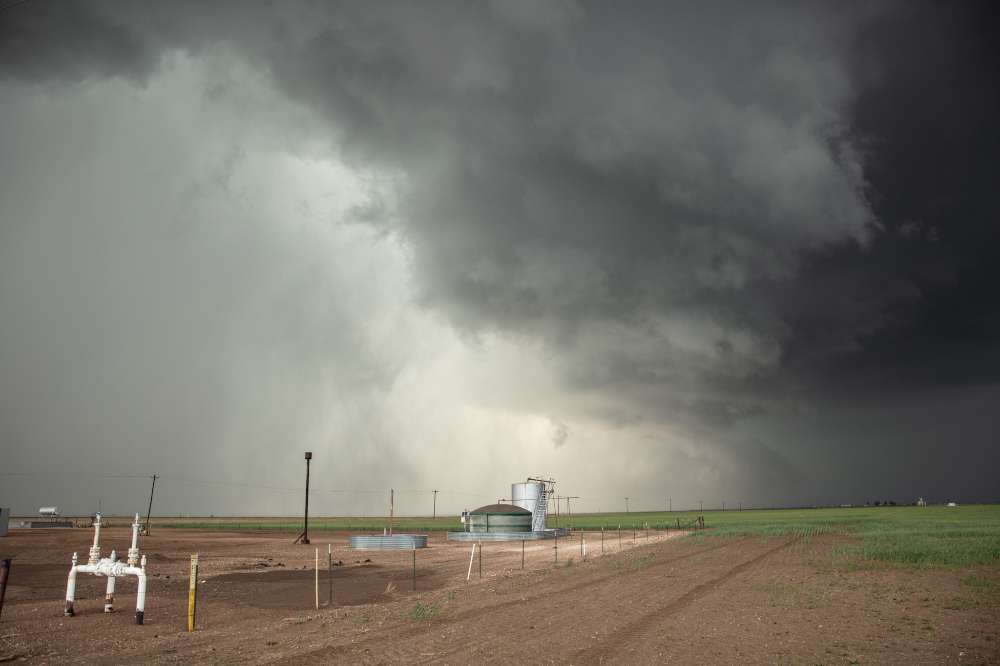
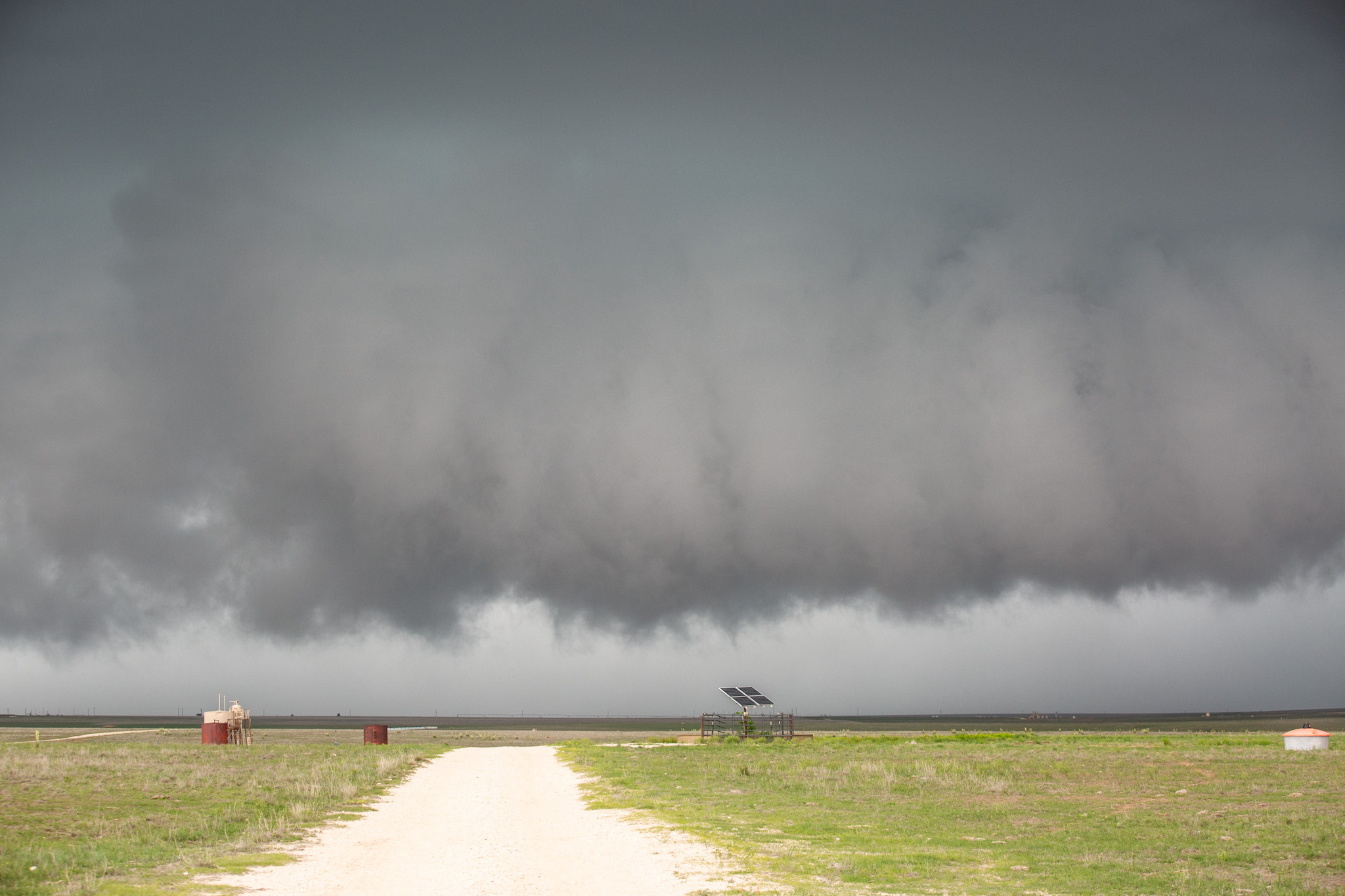
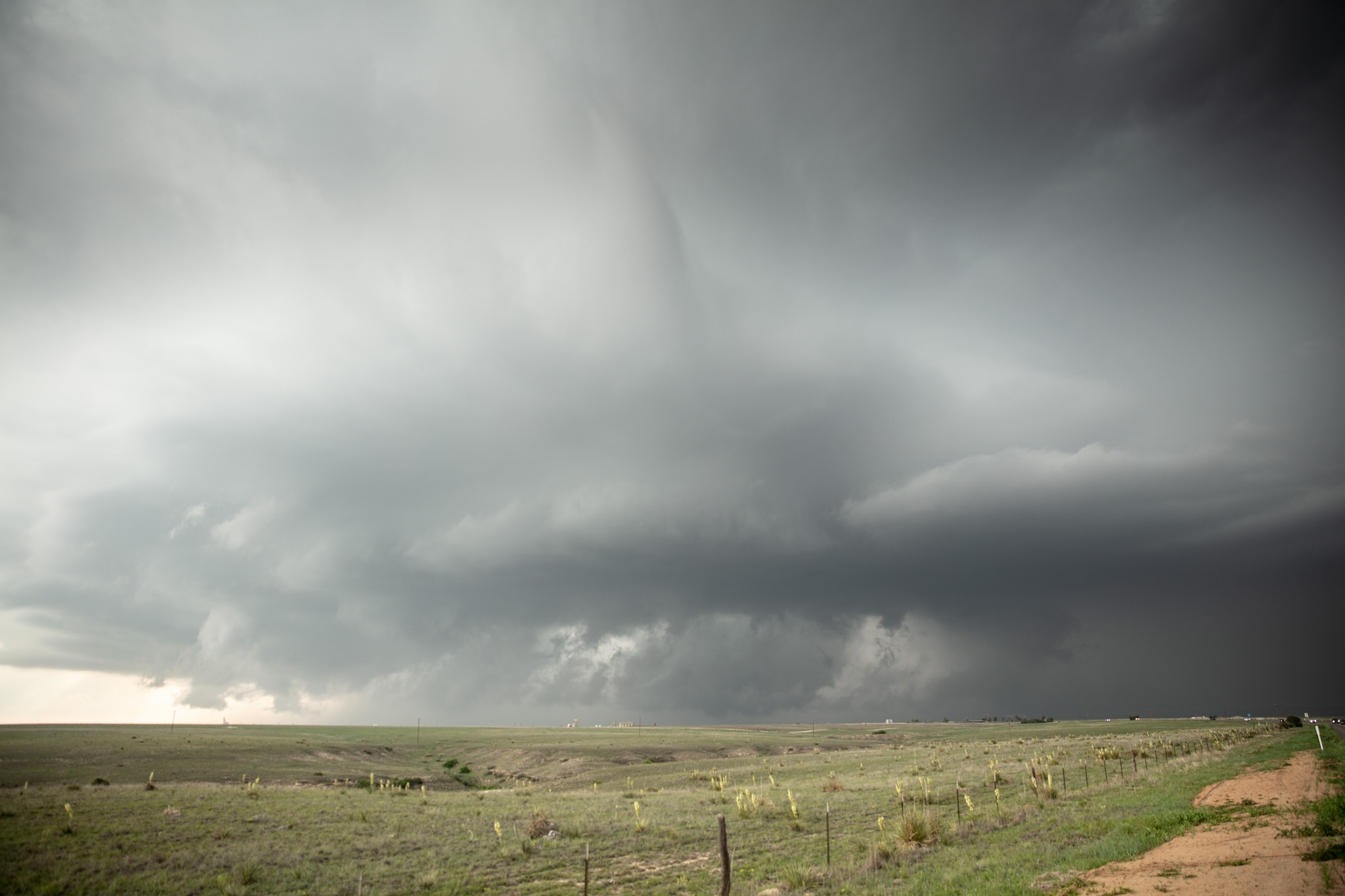
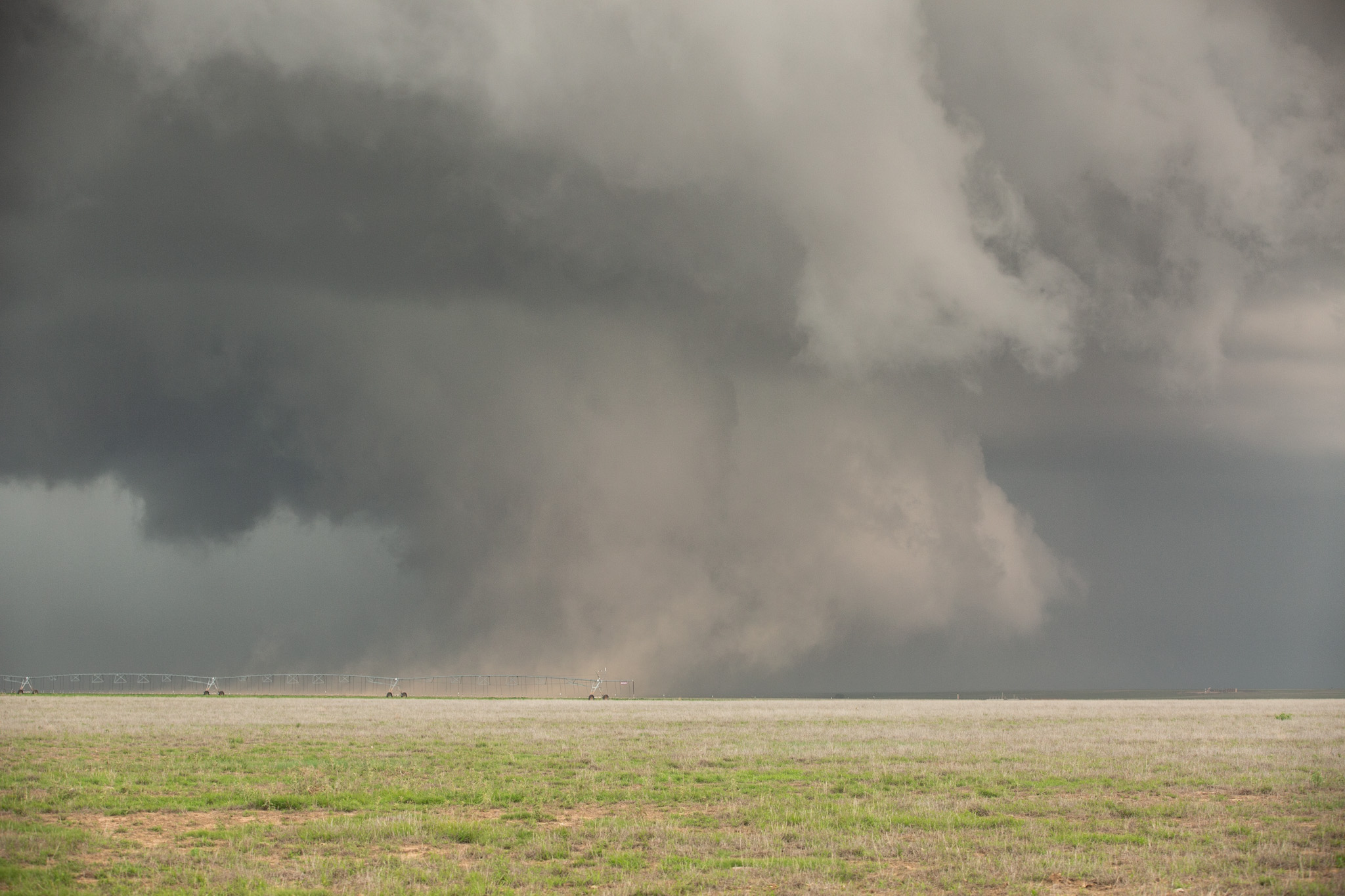
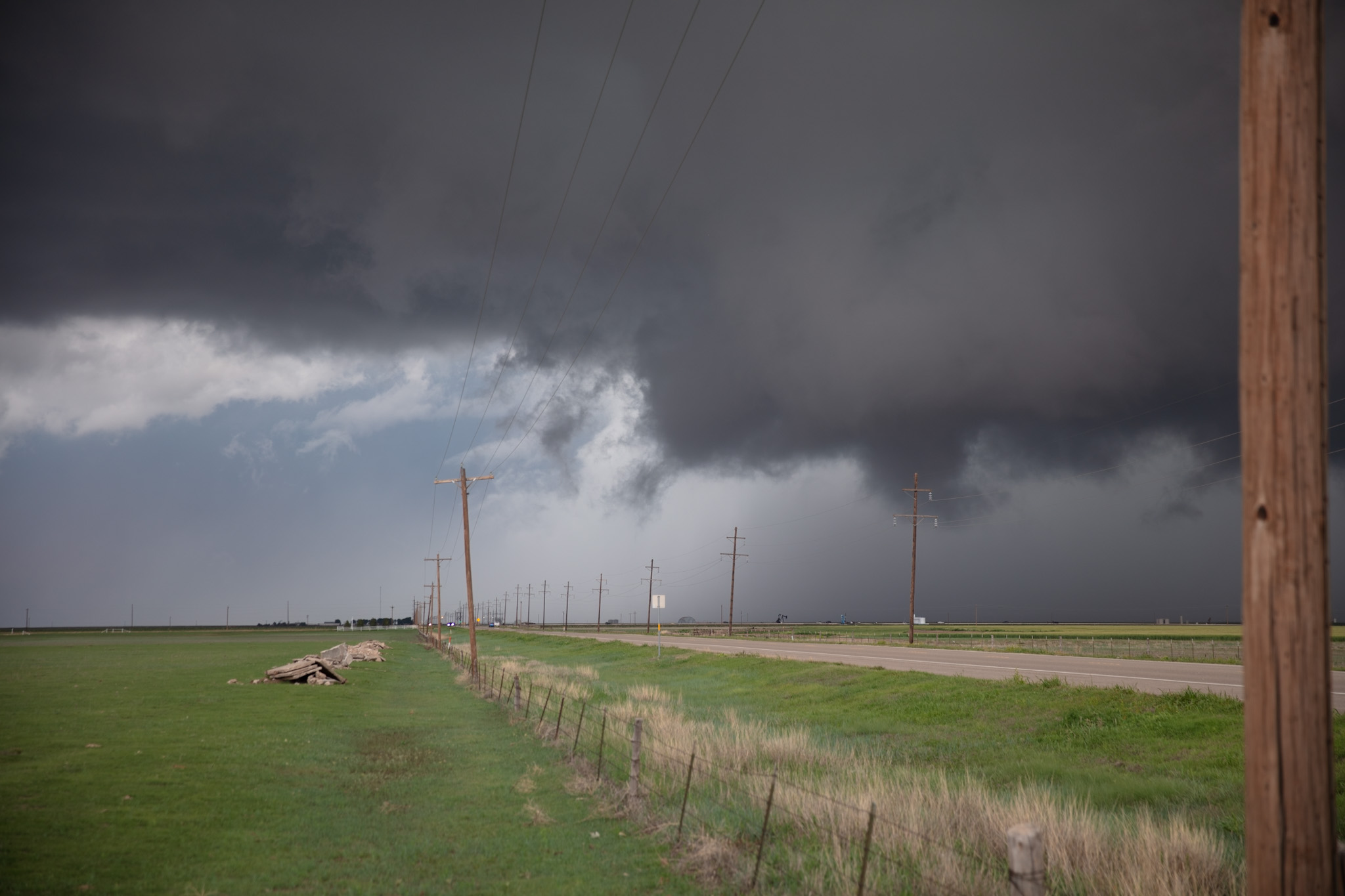
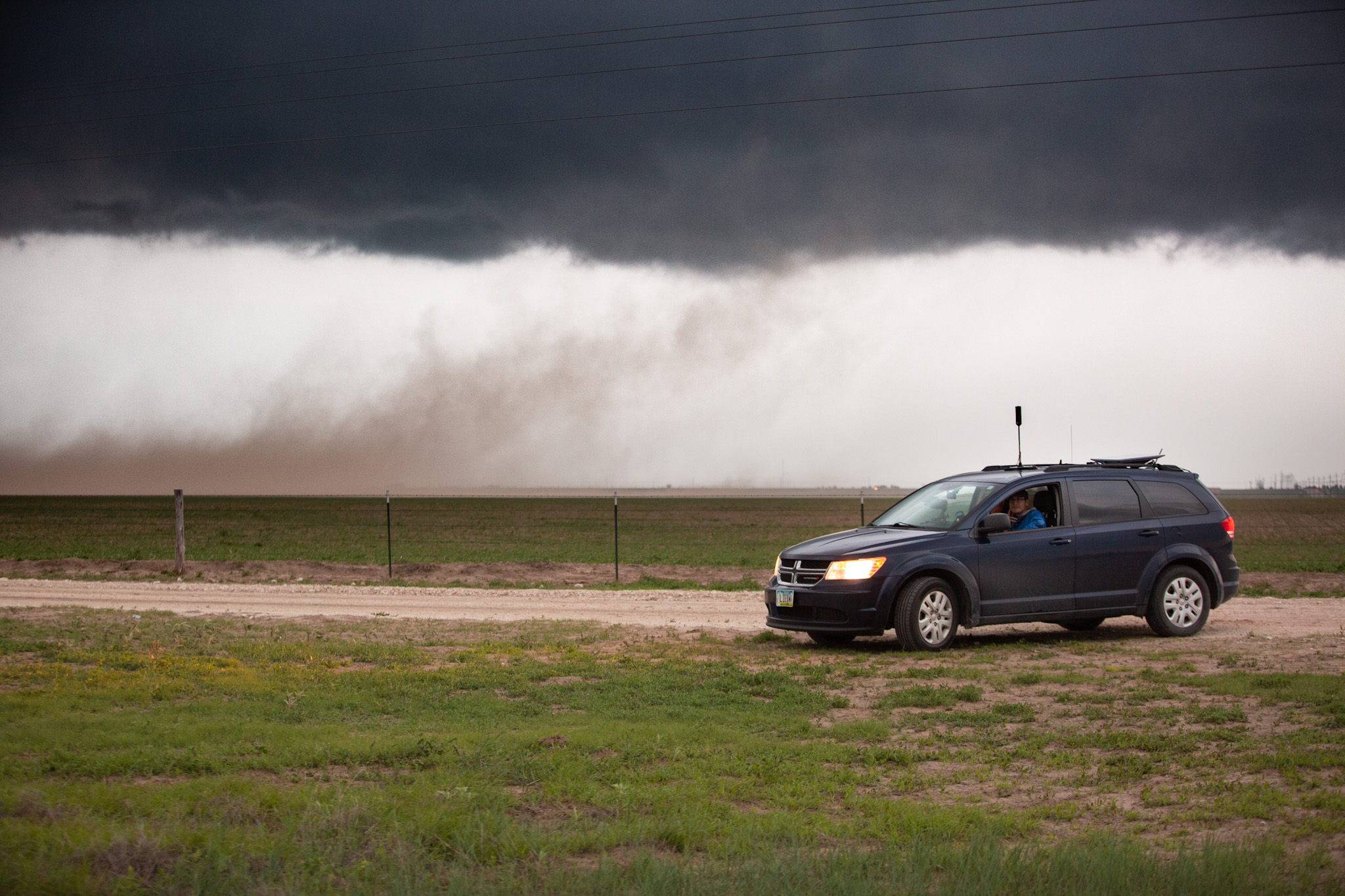
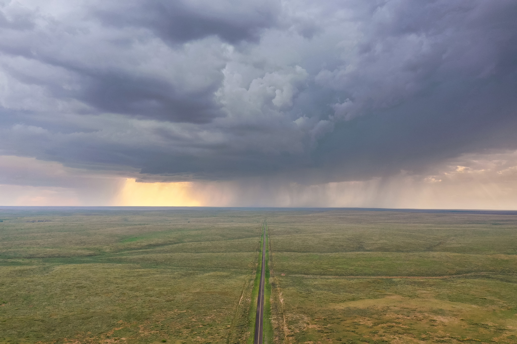
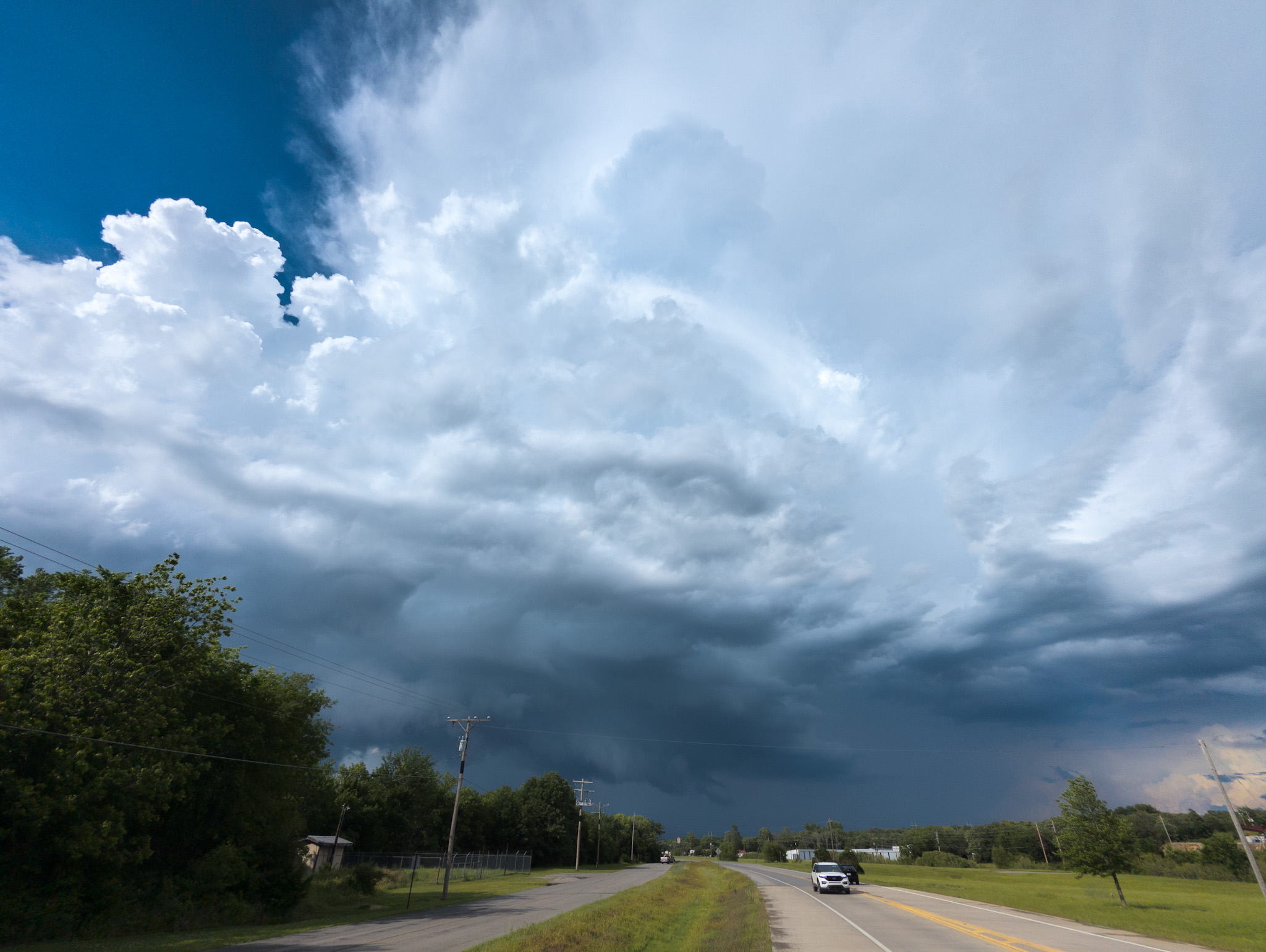
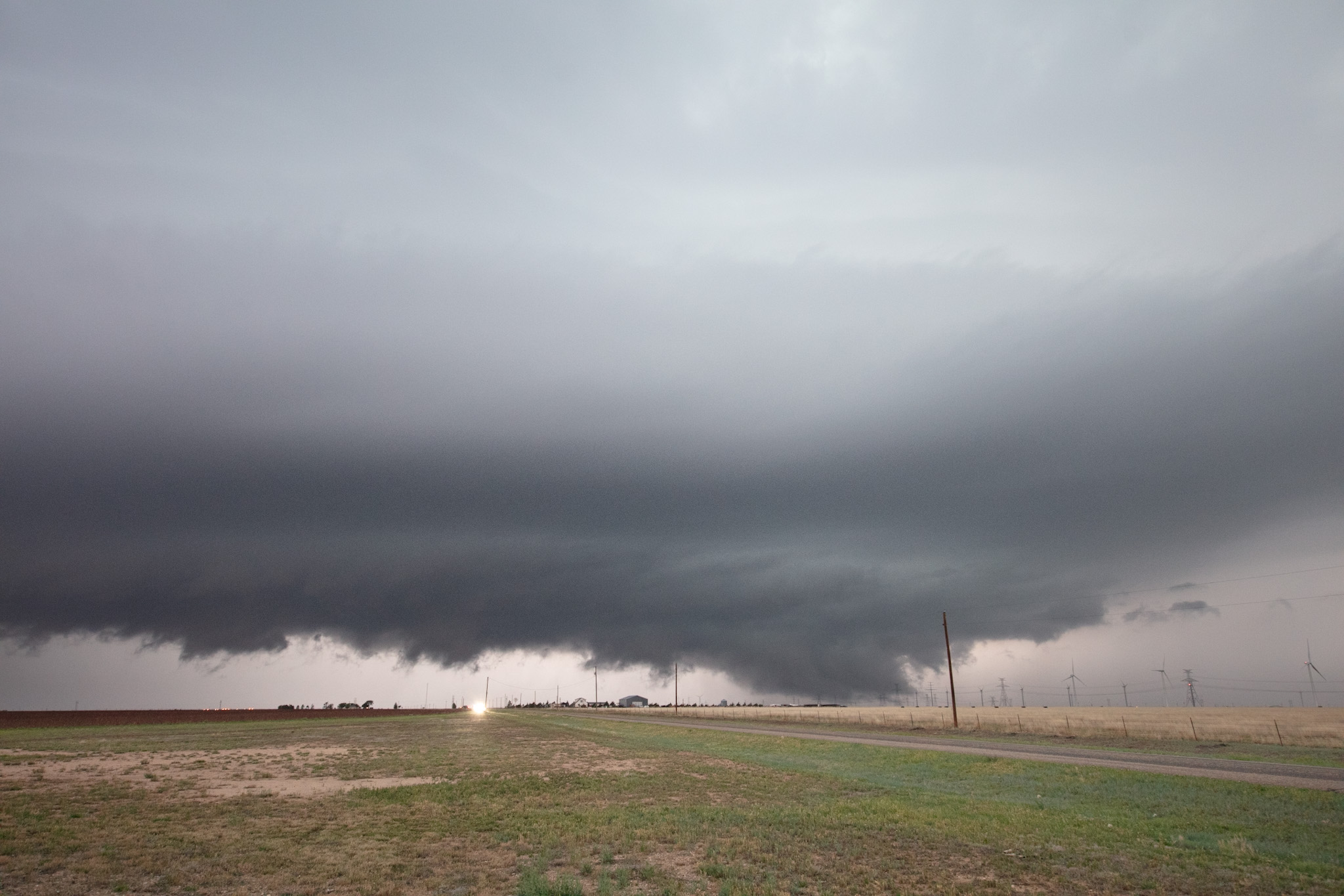
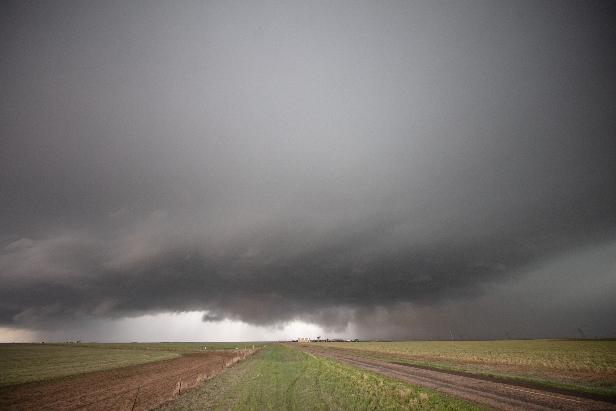
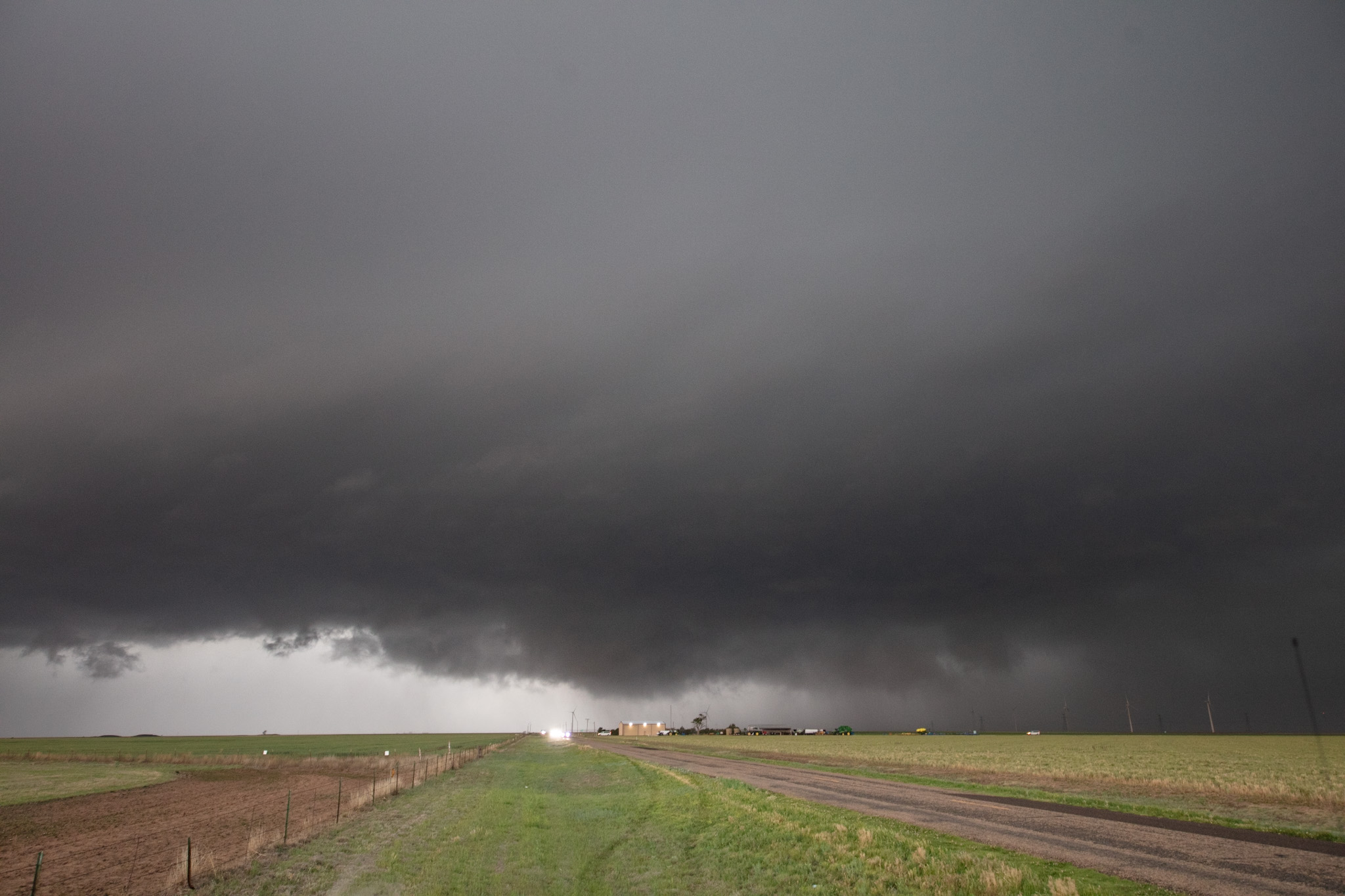
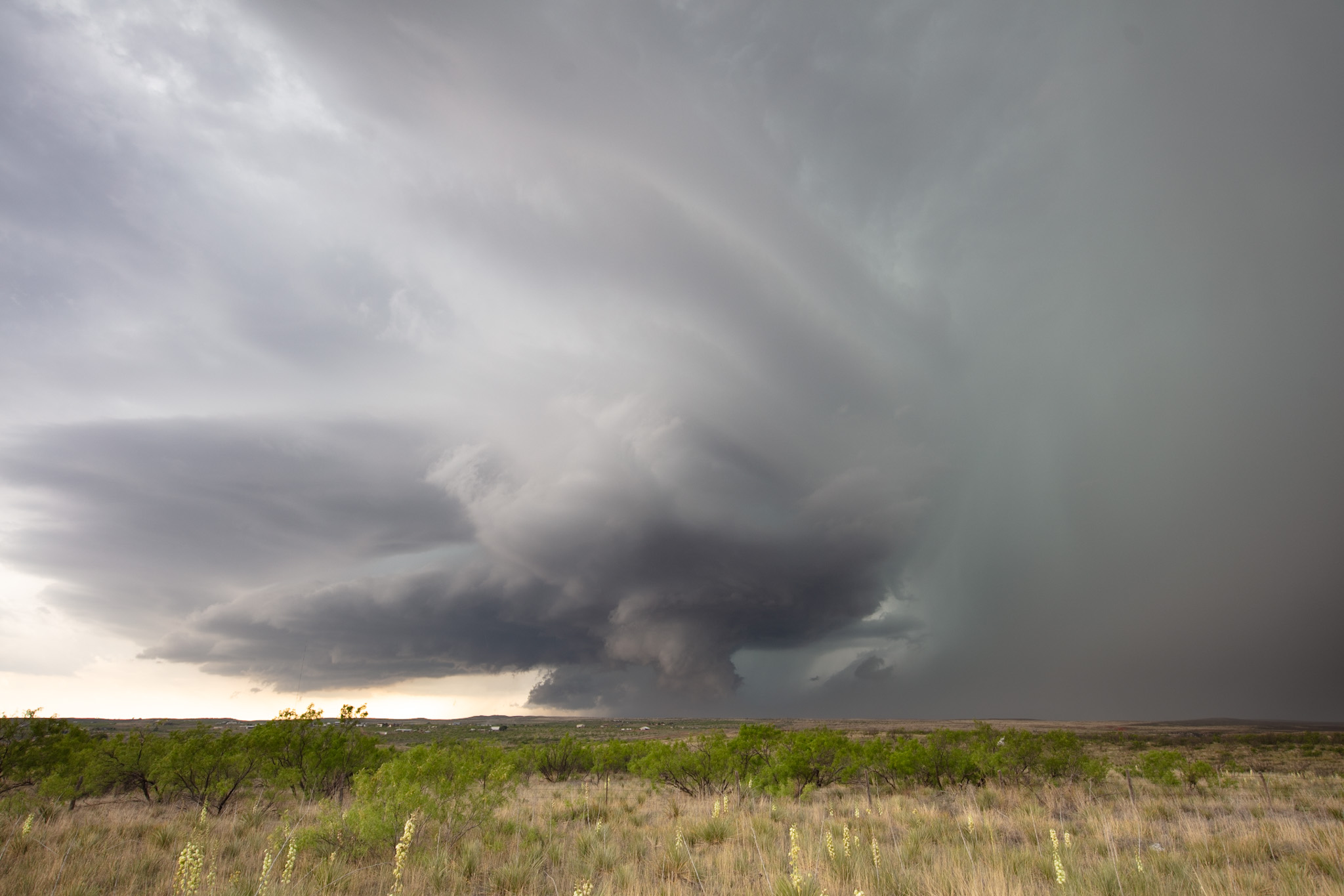
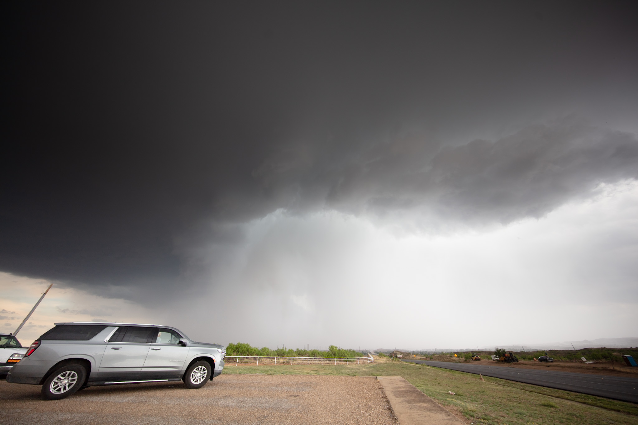
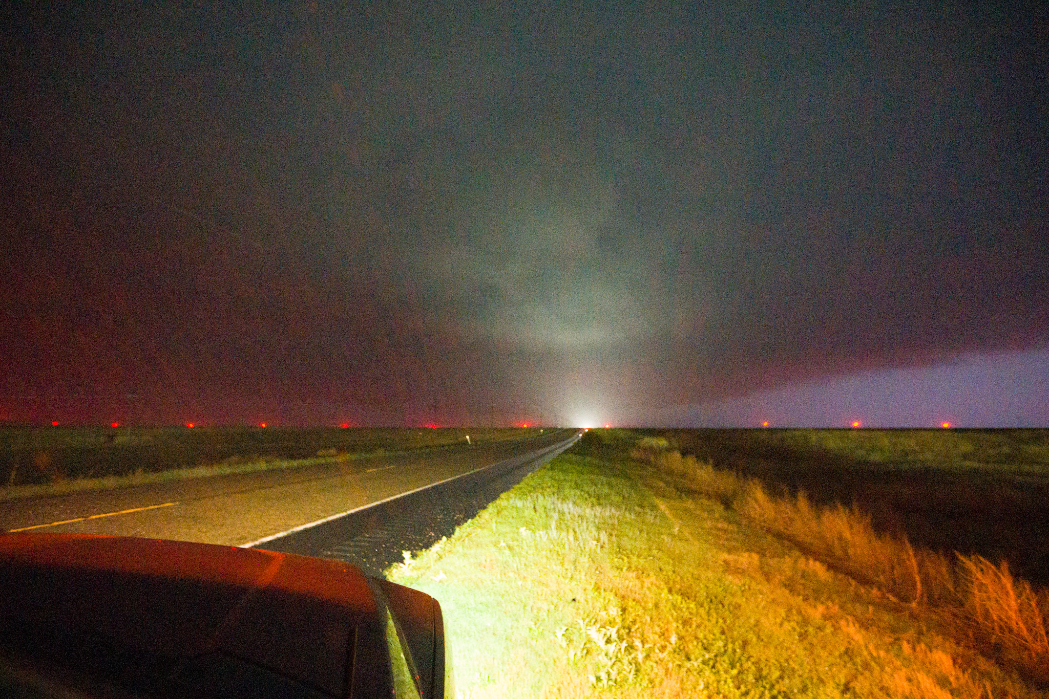
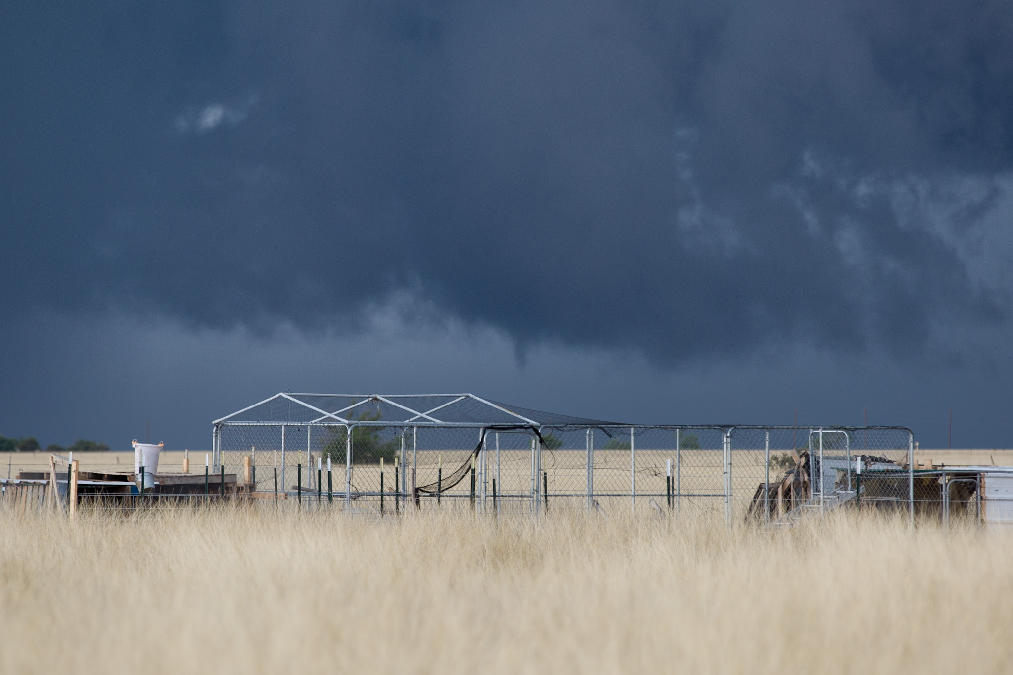
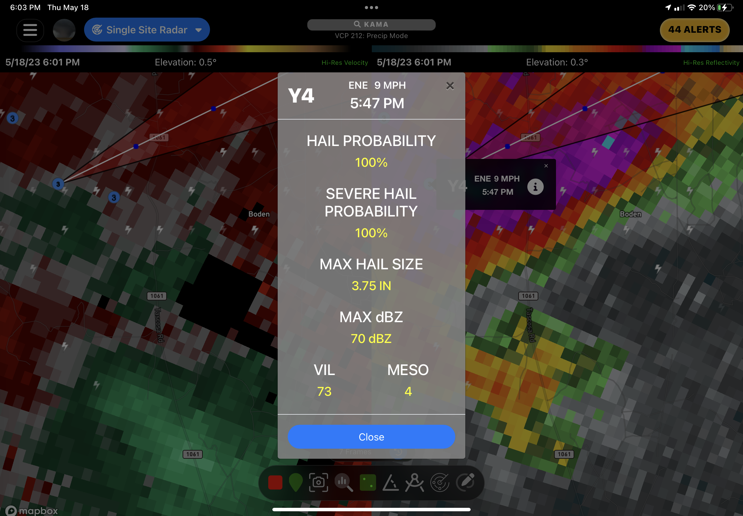
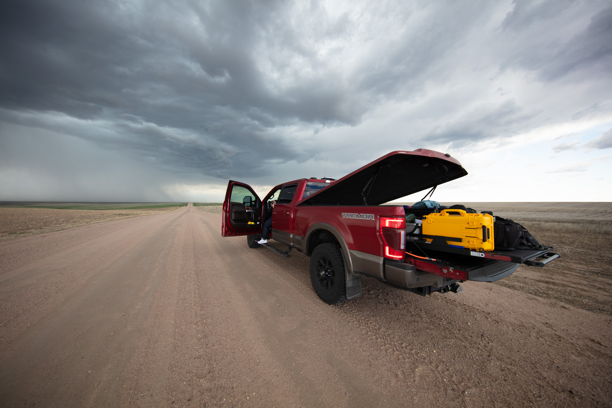
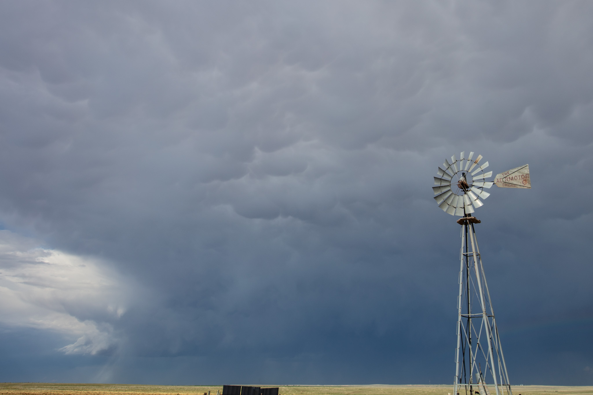
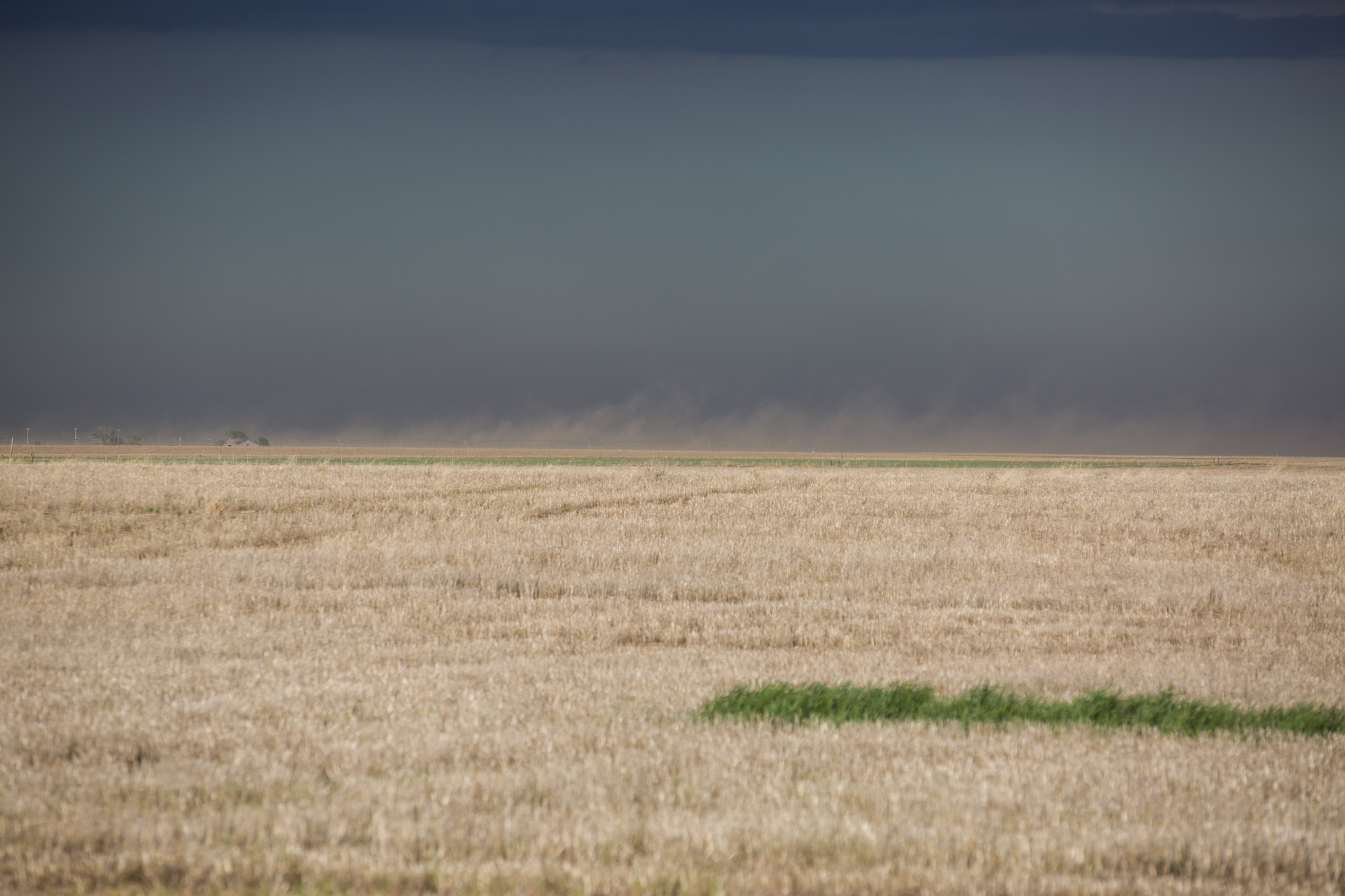
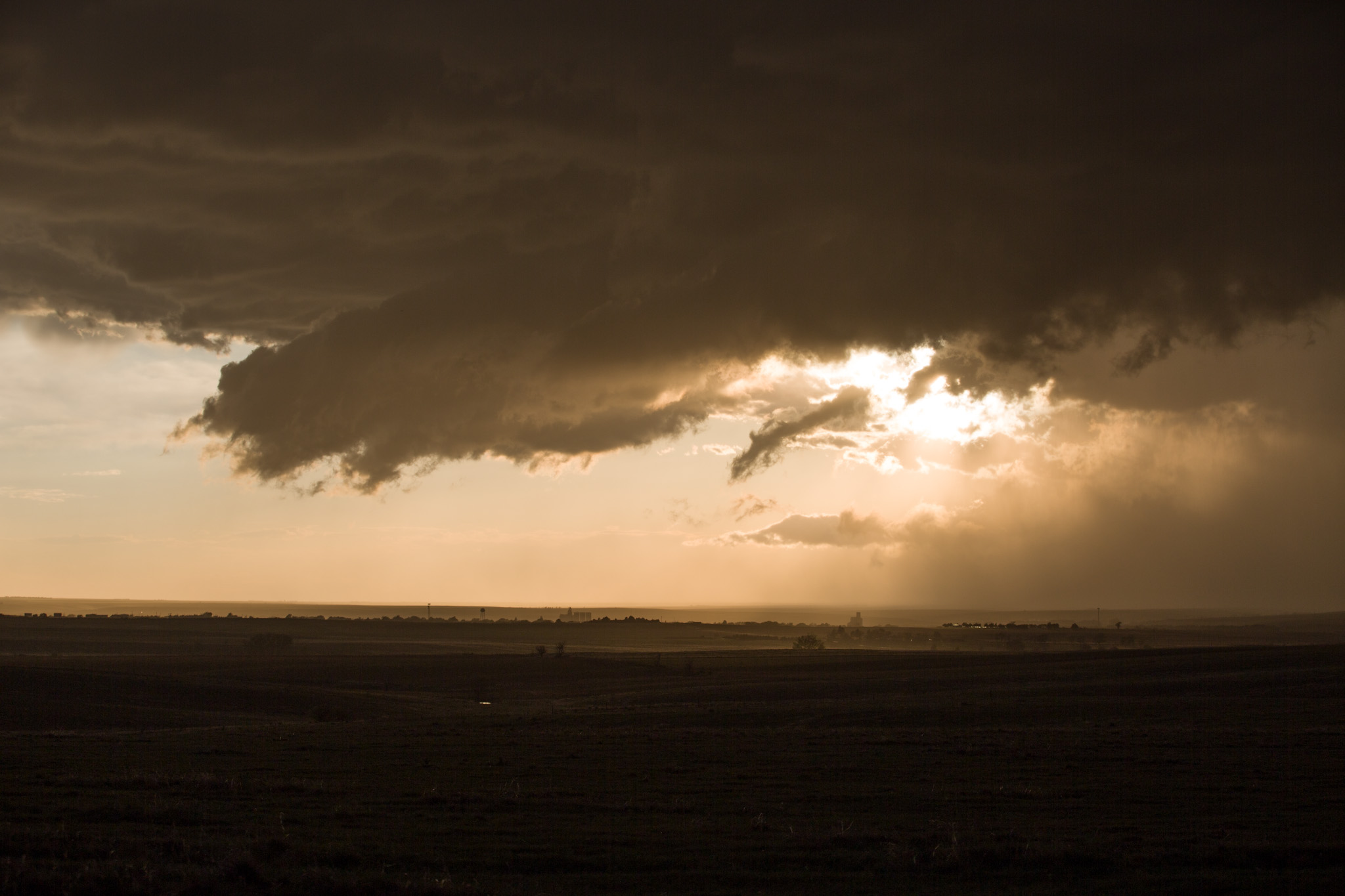
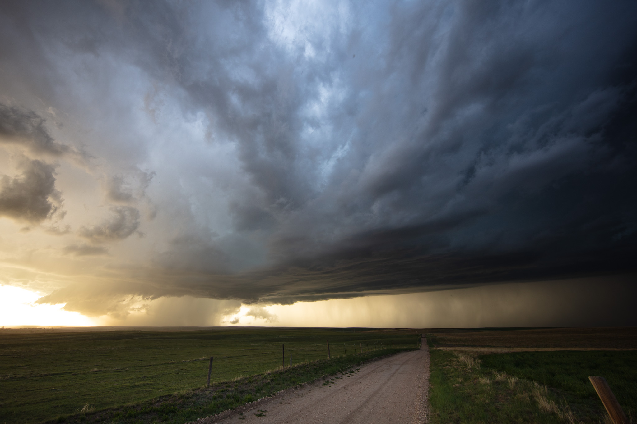
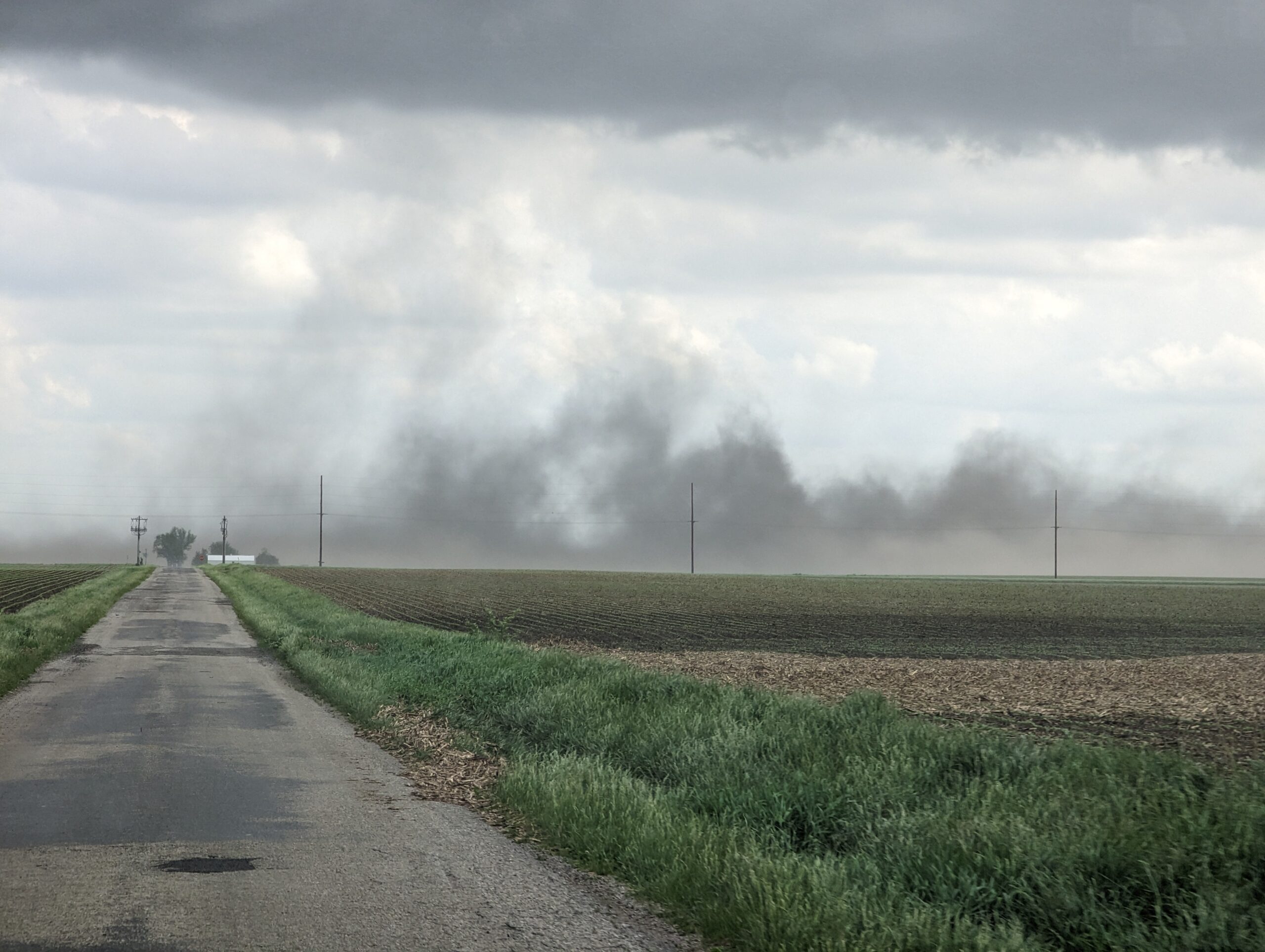
So we blasted north, through the flash flood warnings (without issue) and finally caught up to the storm north of Perryton, TX. It was an angry storm with a ton of motion and broad rotation tightening up at times.
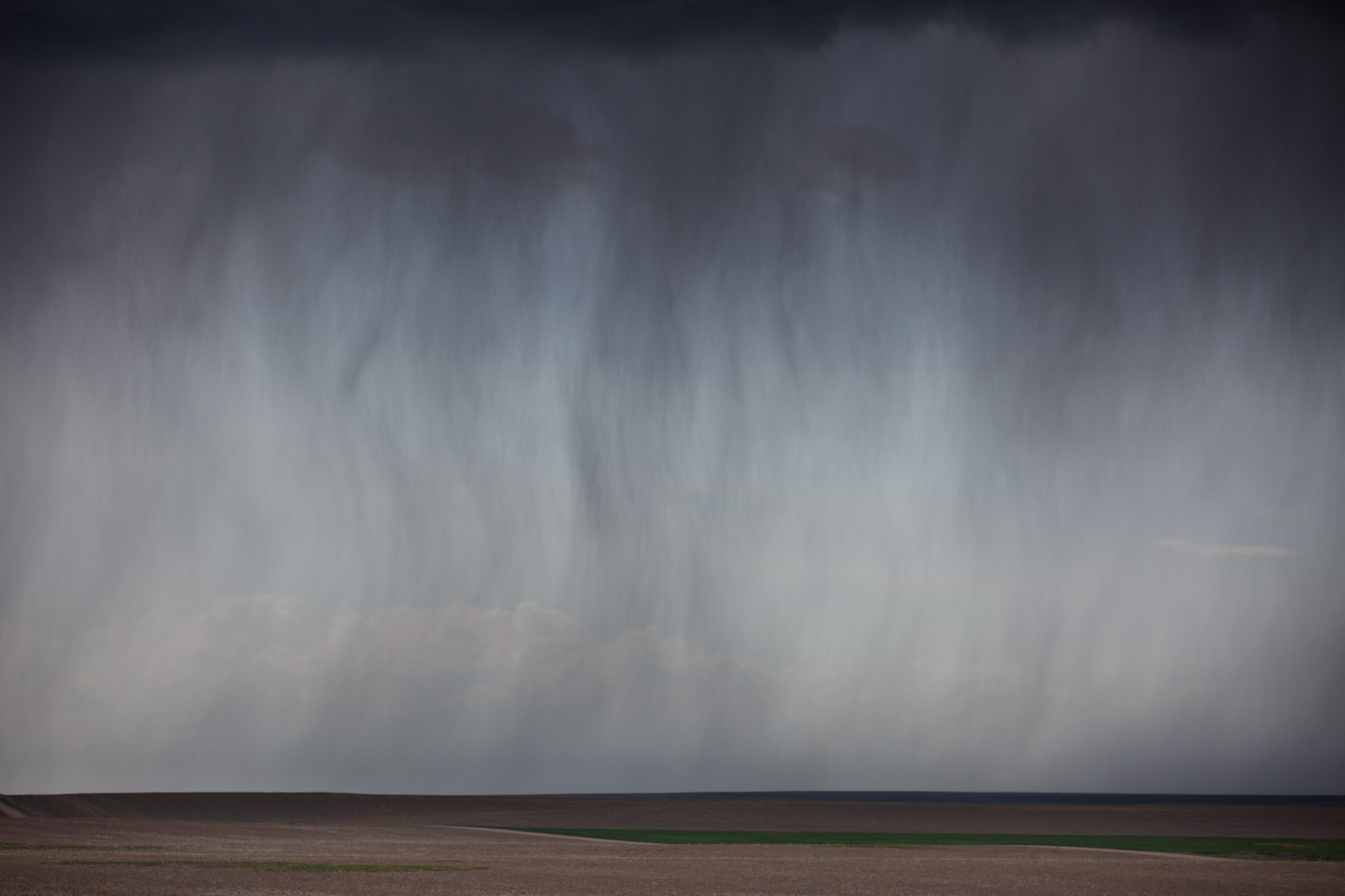
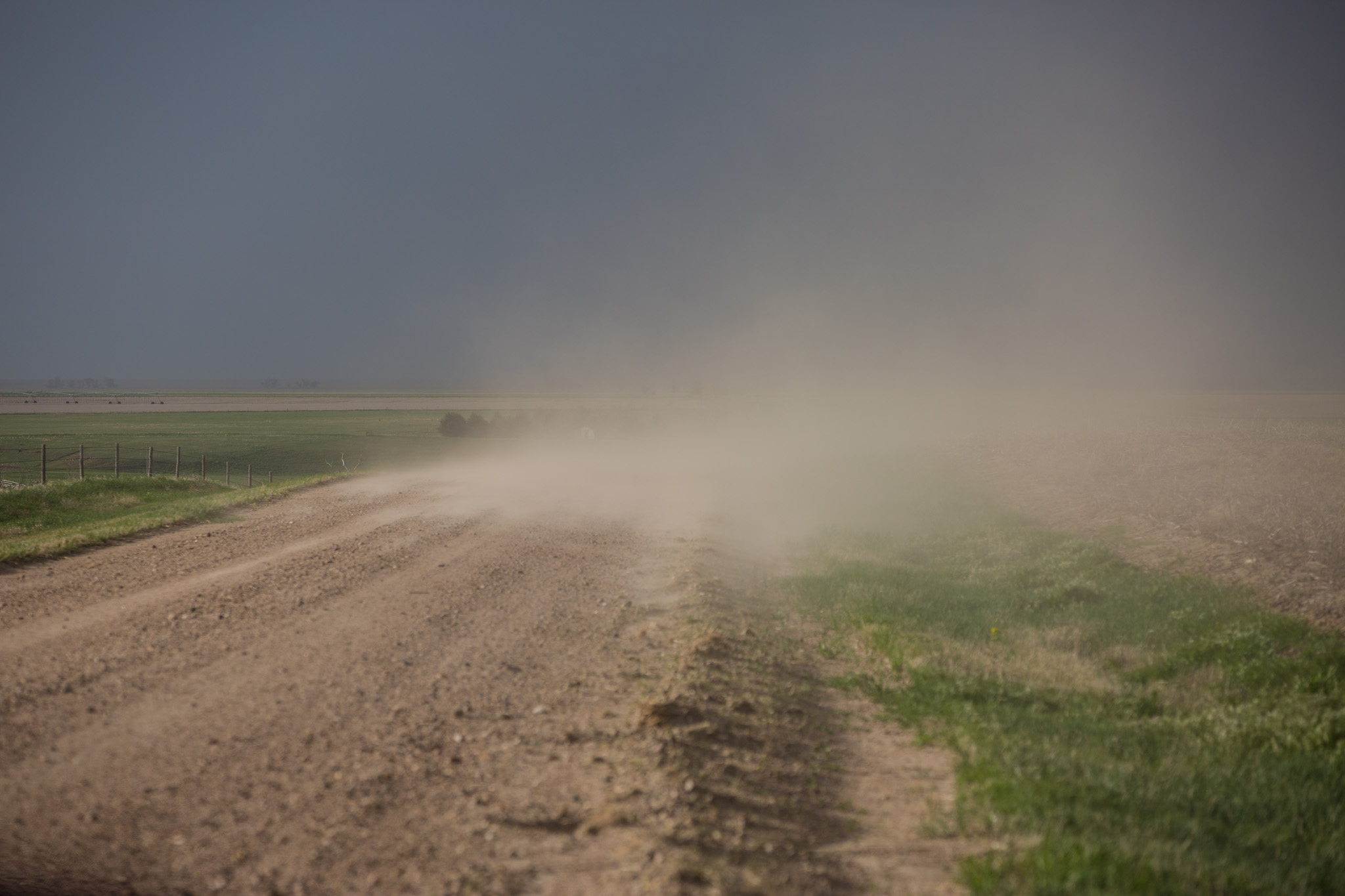
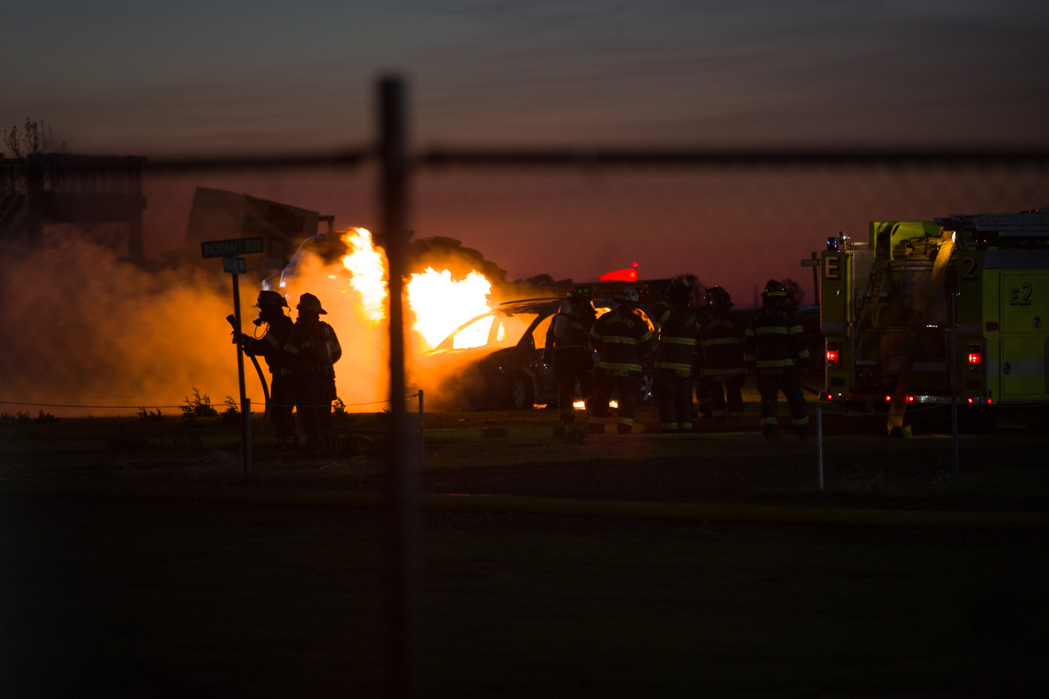
We kept jogging ahead of the storm, but at one point as I was taking photos and recording video with my camera, a tennis ball sized hailstone bounced off the grass in front of me, almost a meter (3ft) in the air. It took a split second but I realized the storm was chucking large hail out of the updraft well ahead of the core! It was time to run to the truck at lightning speed and pack away the gear. As we were getting out of Perryton, MaryAnn hammering the gas pedal to the floor, another large tennis ball sized hailstone whacked the back of the truck. The were falling and bouncing around up but we made it out of town without any damage! Other chasers and locals were not so lucky!
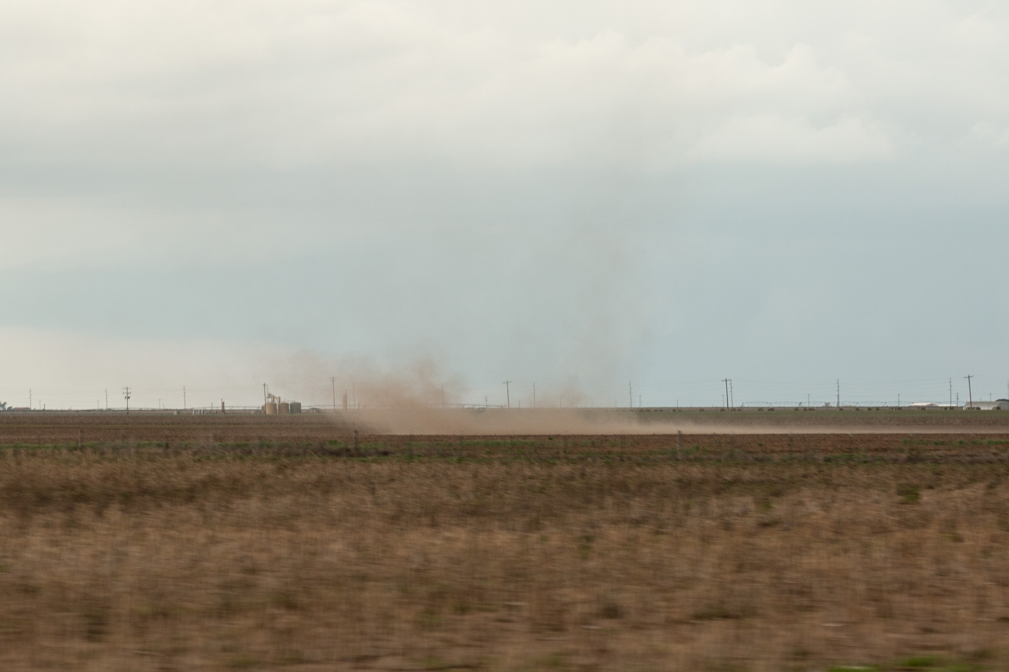
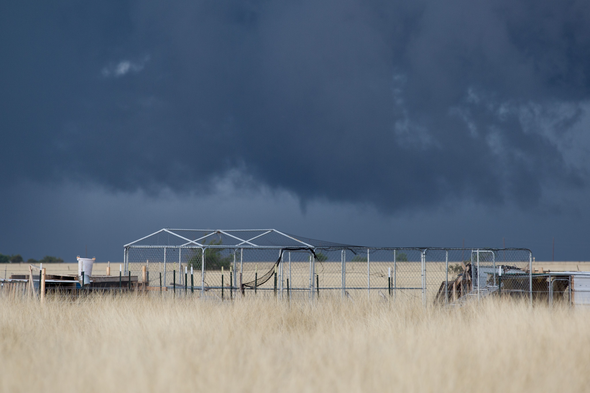
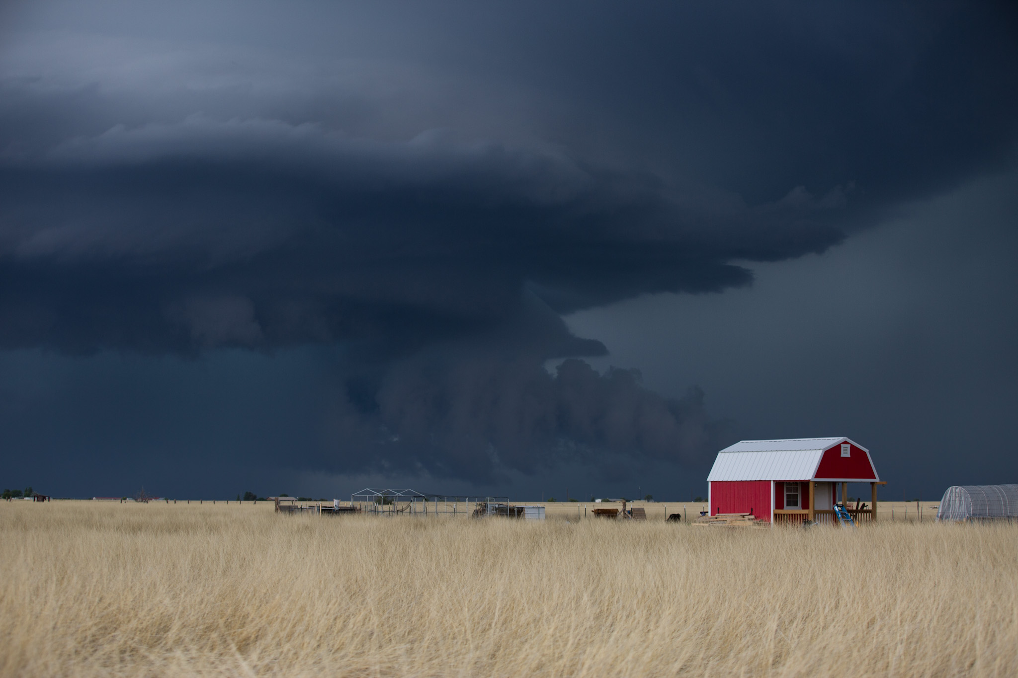
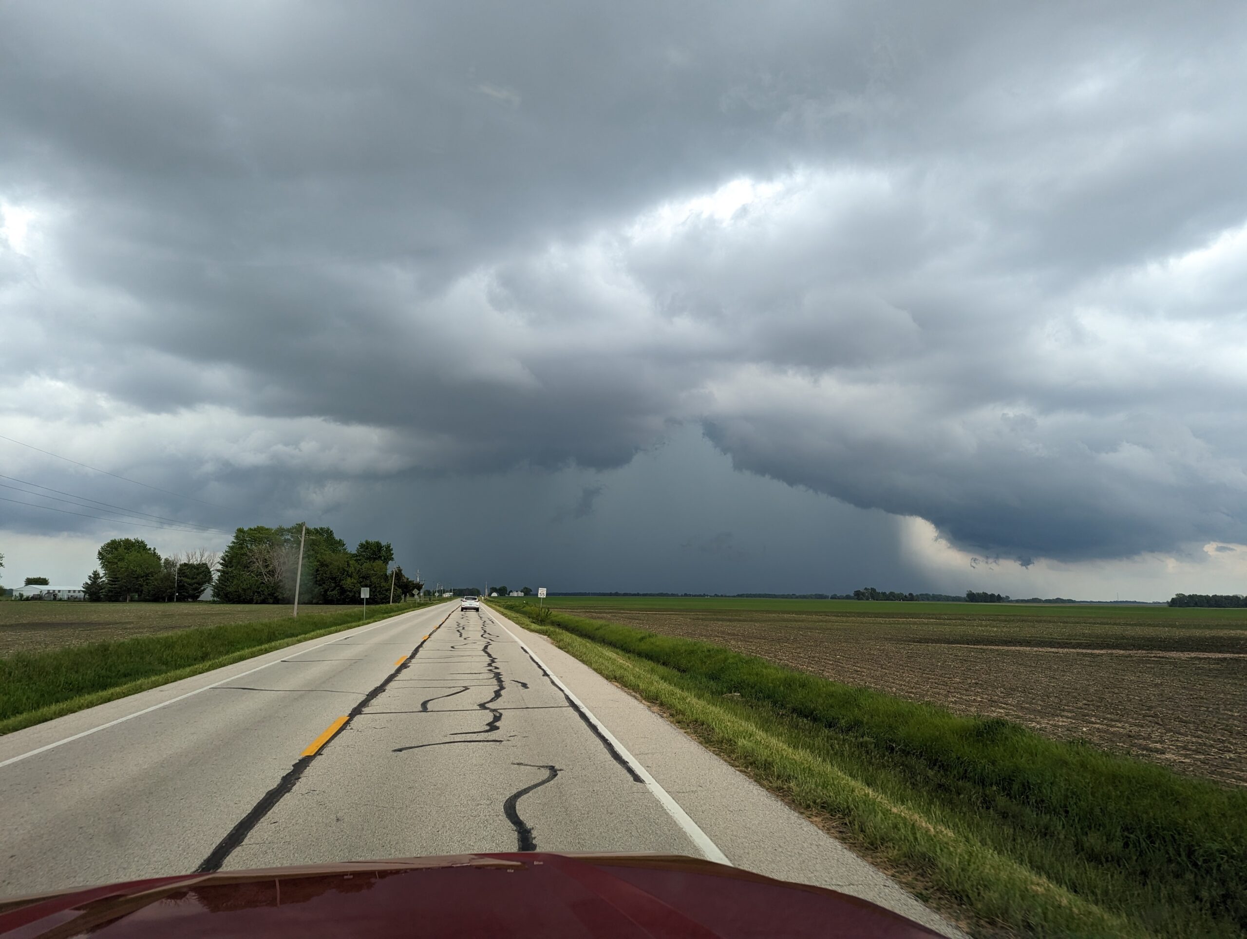
The storm continued on and produced shear funnels, gustnadoes, large wall clouds and even larger hail but no tornado despite a tornado warning being issued.
All in all it was a great chase day and we ended up spending the night in Perryton.
May 21st
After spending the previous day lowling about in Dumas and relaxing, storms were back on the horizon for today.
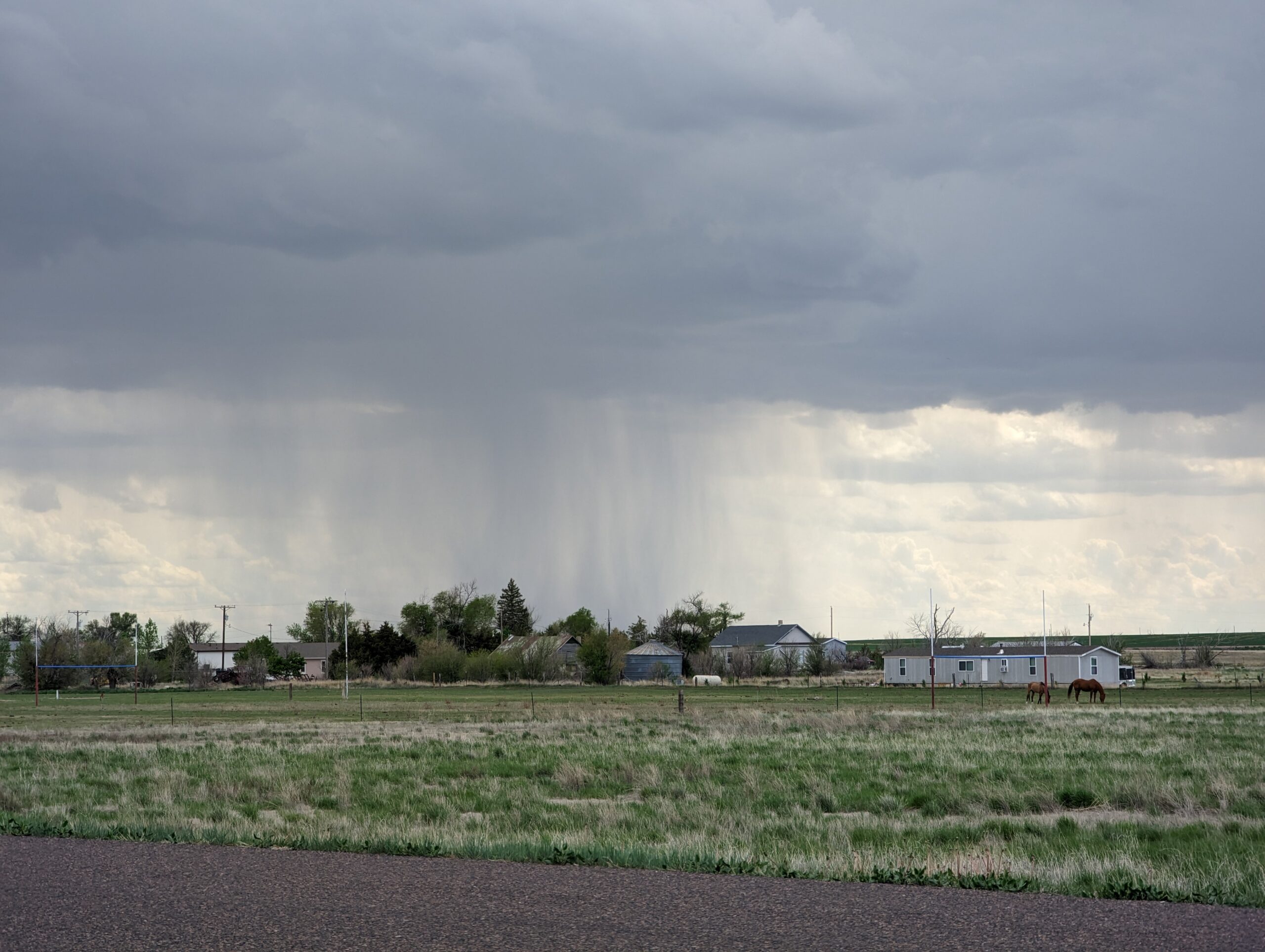
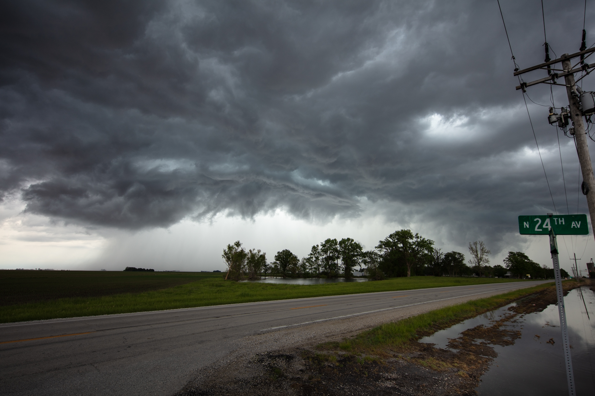
We didn’t have to go very far, around 2PM CDT the first towers and storms quickly began to shoot up just south of our location. We decided it would be best to intercept the first storms early.
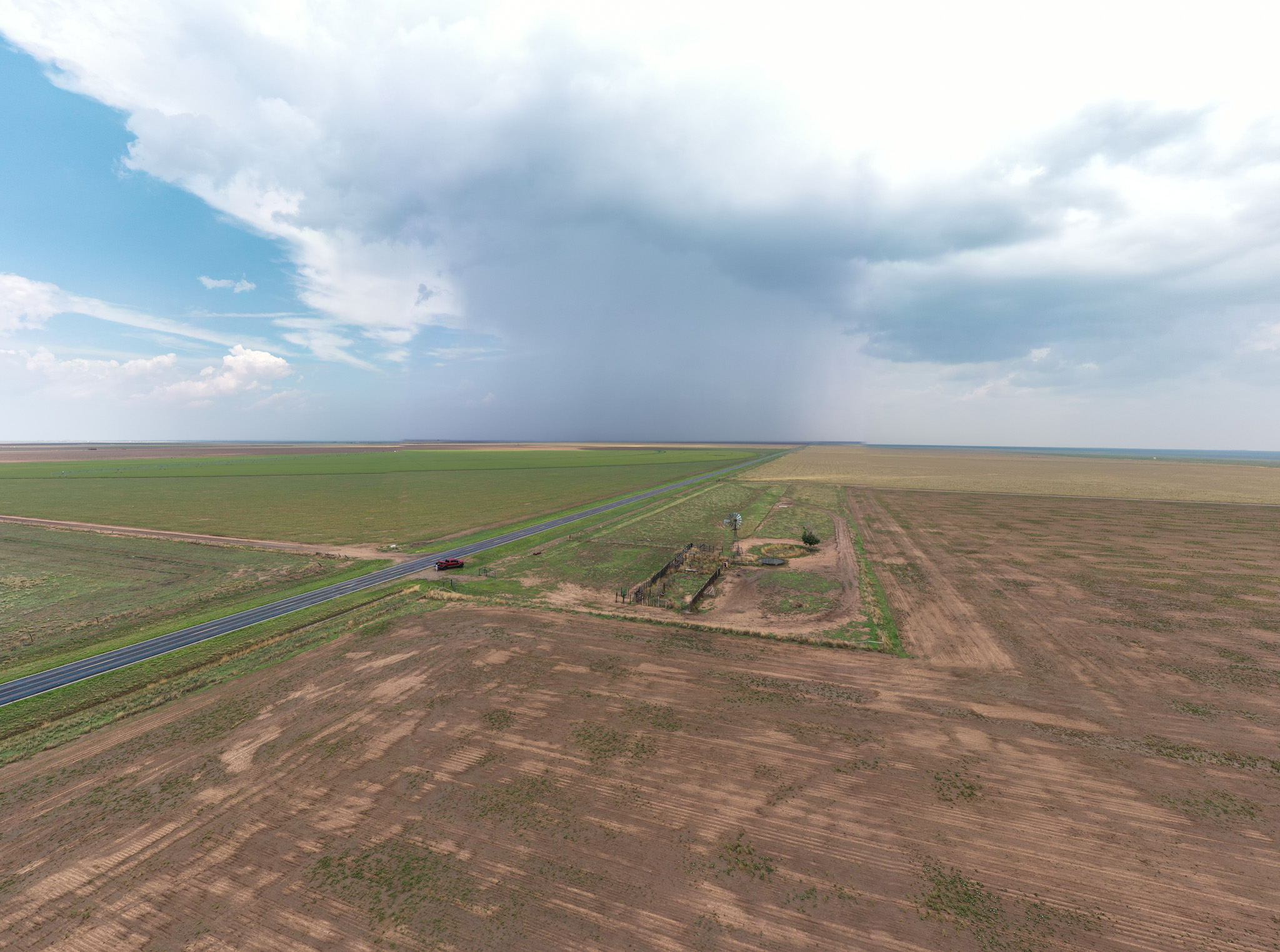
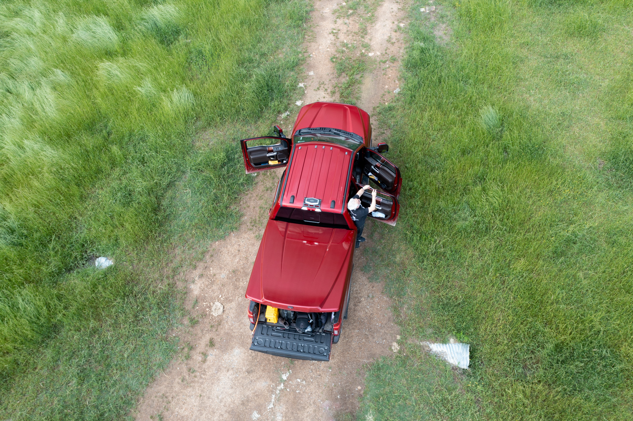
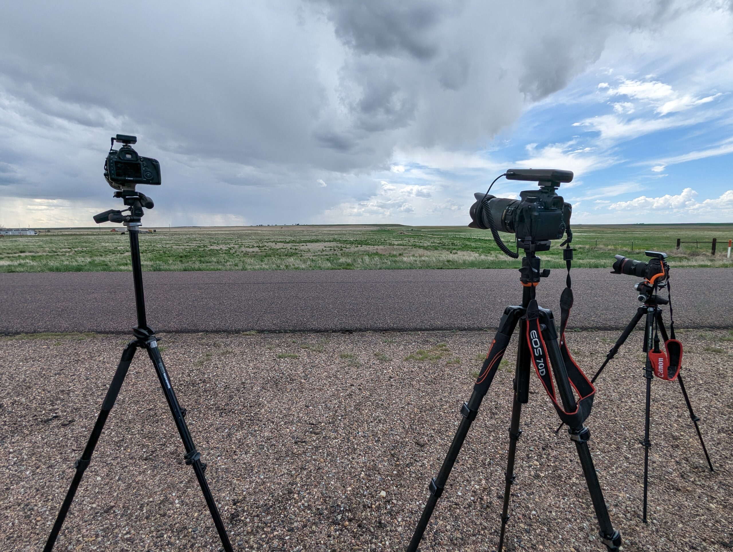
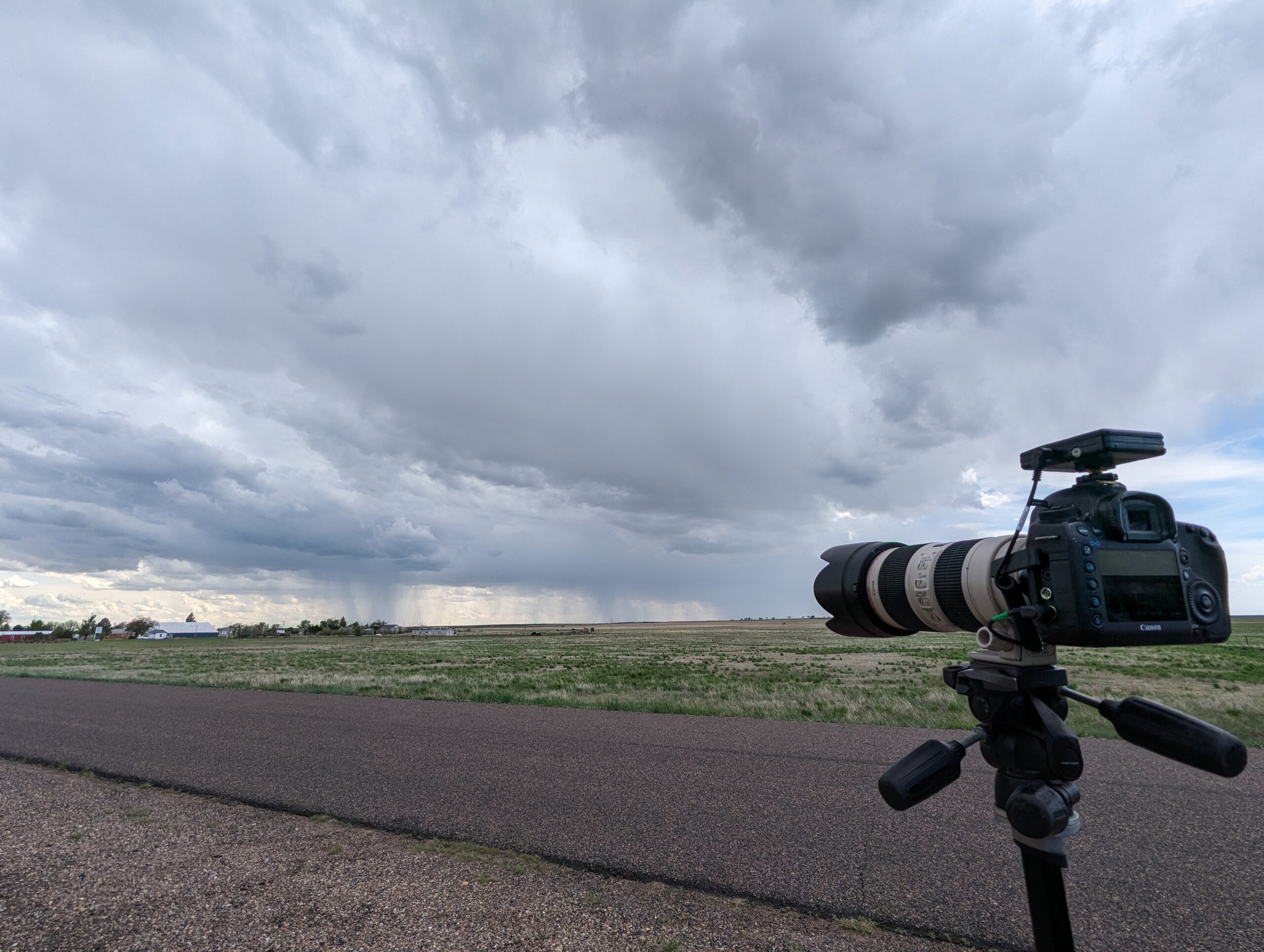
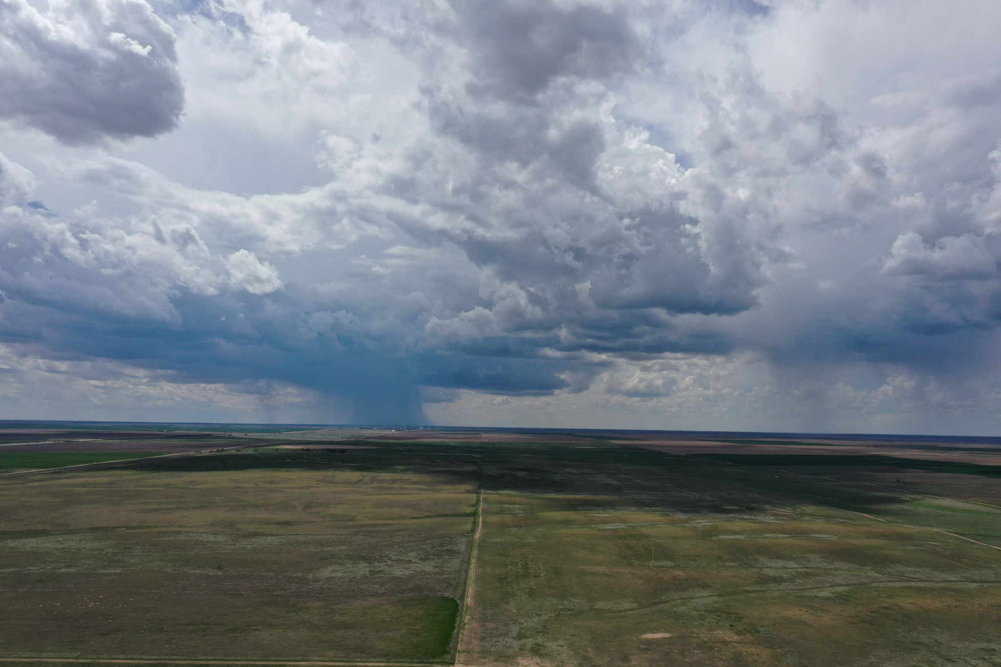
There wasn’t much to the initial round, just some gusty winds and very small hail. It did provide a good opportunity to fly the drone and get some more unique images. Despite only being 100ft off the ground, the flat and featureless terrain makes it feel like the drone is far far higher.
After this first cluster of storms, we looped back and headed west to intercept a developing line of storms. Due to a lack of roads, we too to a sraight and wide clay road due west. The road started out fine but quickly degraded into a wet, muddy, slippery mess with some deep puddles in sections. We made it through without issue and MaryAnn put her truck to the test, which it made easy work of.
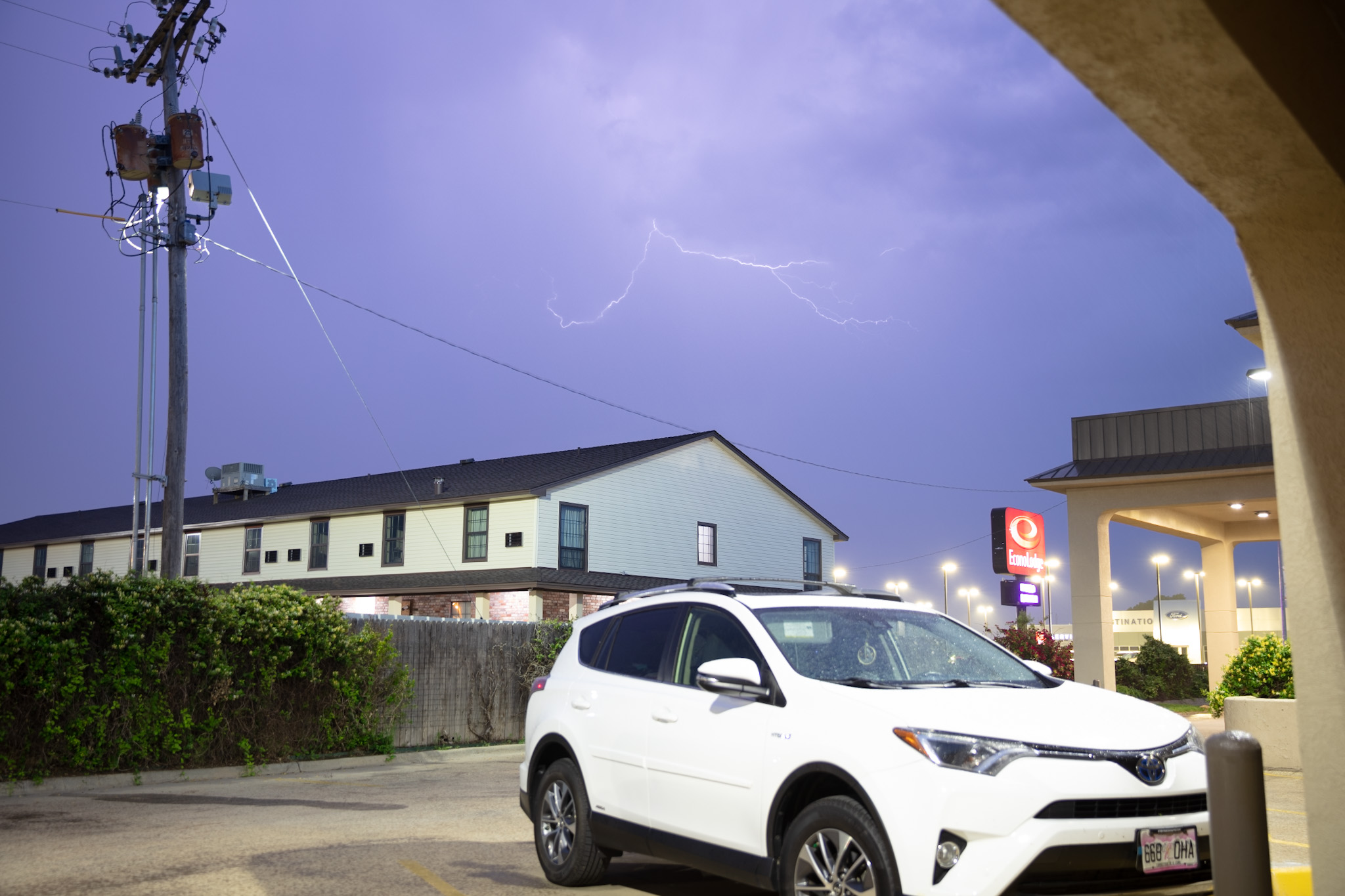
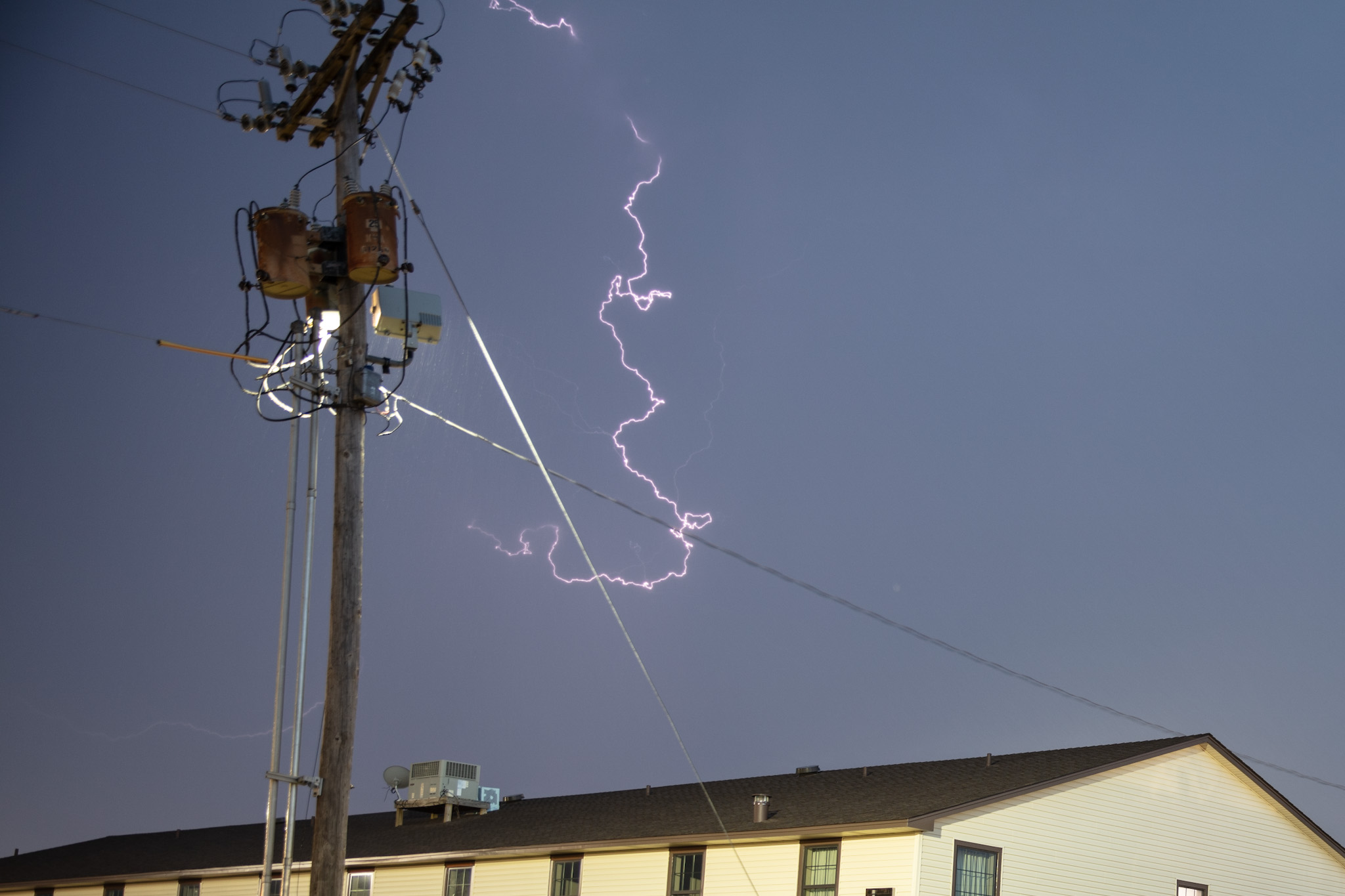
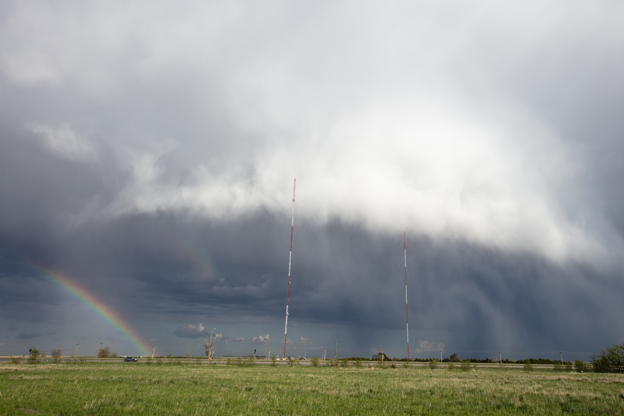
After that, we stopped for a while and tried our hand at lightning photos. We mat another storm chaser, Becca Furnish whom we spoke with for a little while.
After some more photos, we headed back to Dumas, grabbed some pizza and watched as more storms rolled in to our motel.
 default
 default
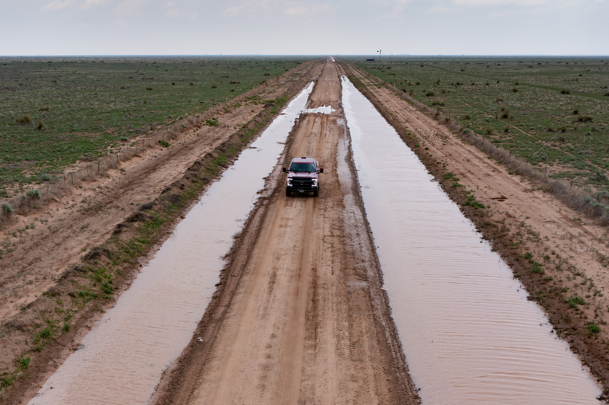
 default
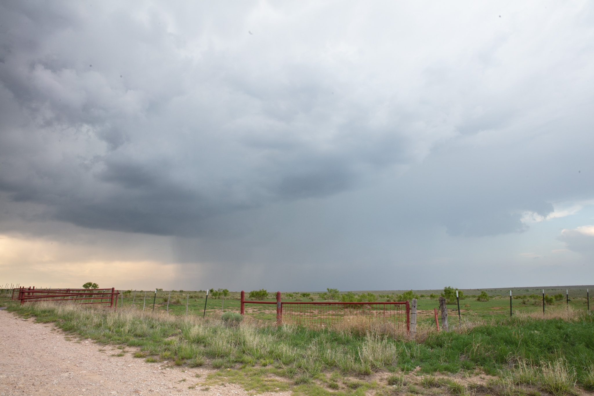
May 20th
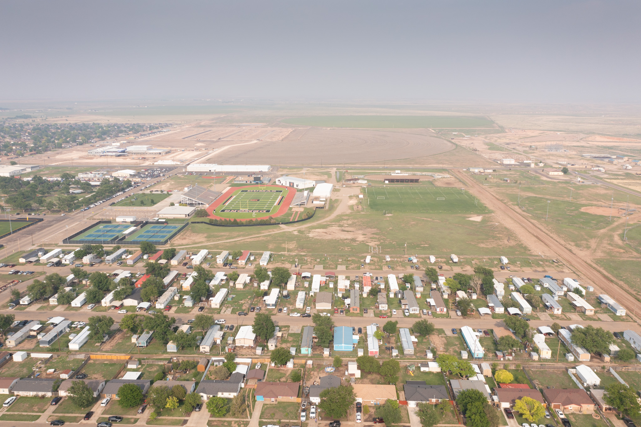
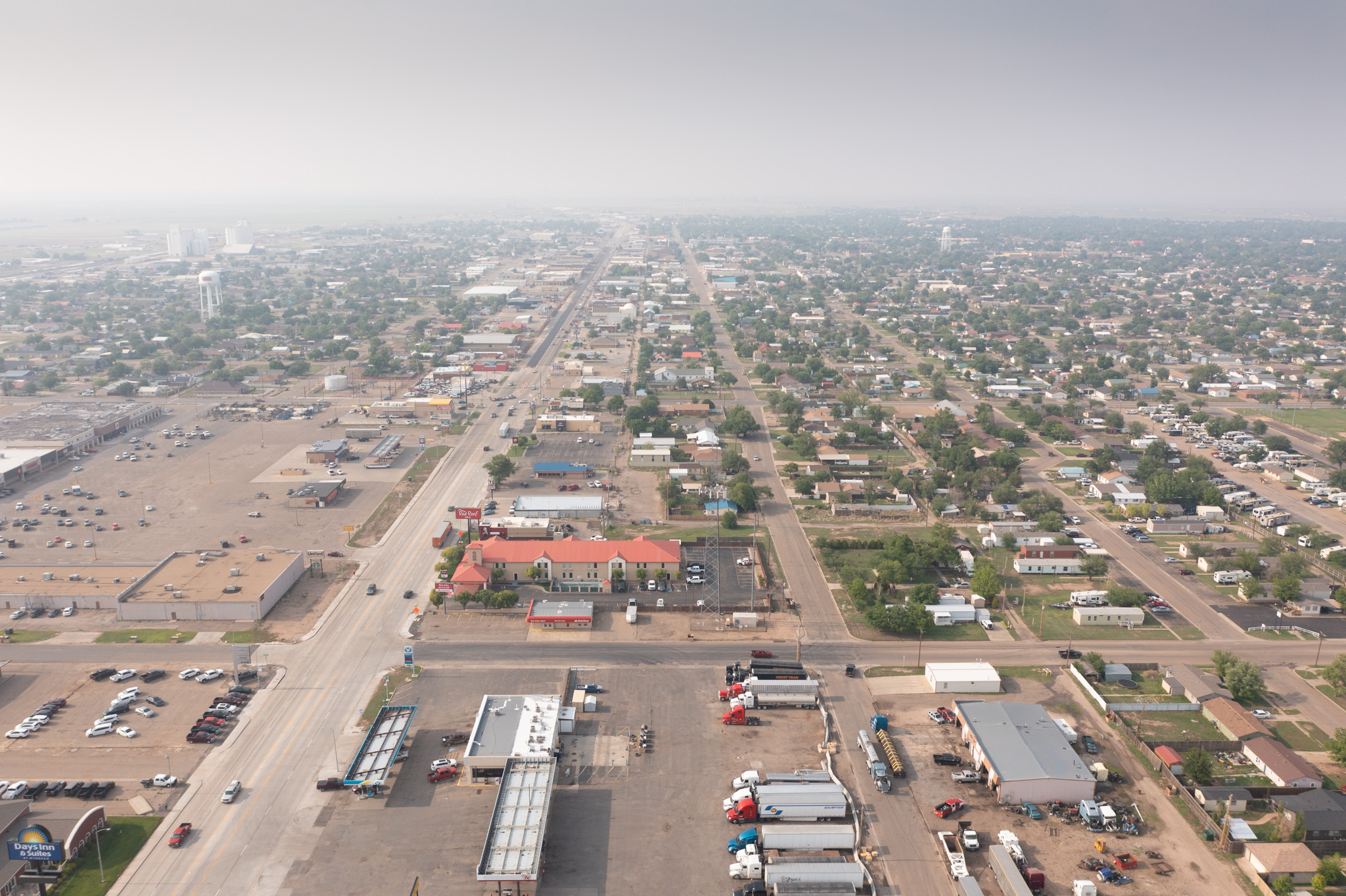
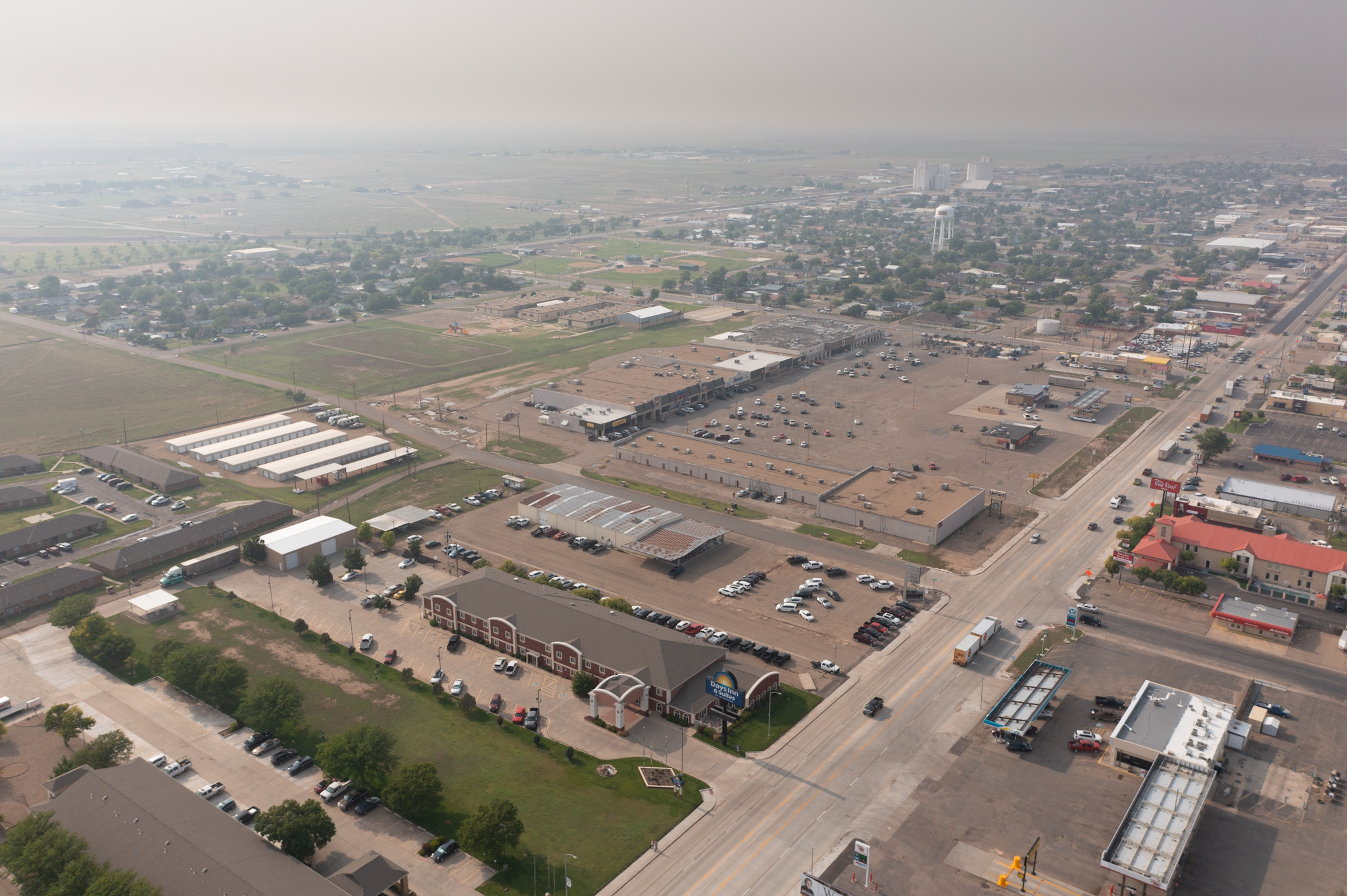
We spent the night in Dumas and had some much needed rest on this down day in the trip. Haze from fires burning in New Mexico as well as Alberta was making its way into the Texas Panhandle and creating thick hazy skies.
In the evening we visited the Texas Roadhouse and stuffed ourselves full!
May 19th
We started the day off in Amarillo and blasted east towards Henryetta Oklahoma. The McAlester area was always the target but in the back of my mind I was hoping something would go up further north or further south.
I learned early in my storm chasing career just how difficult if not near impossible chasing in the Choctaw, Ouichita and Ozark areas of Okalhoma and Arkansas can be.
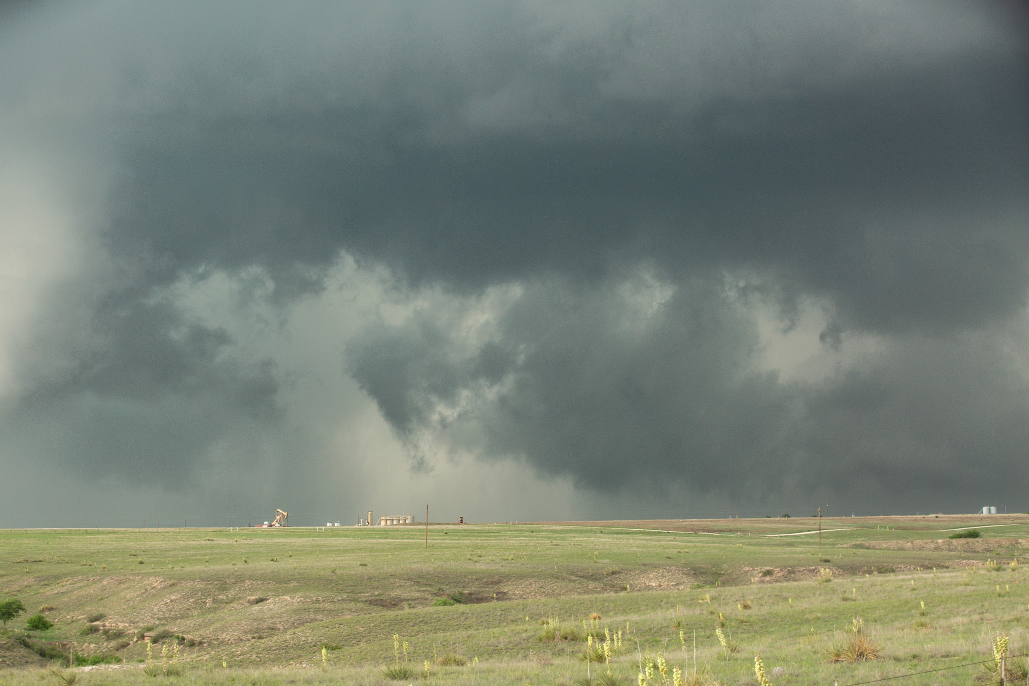
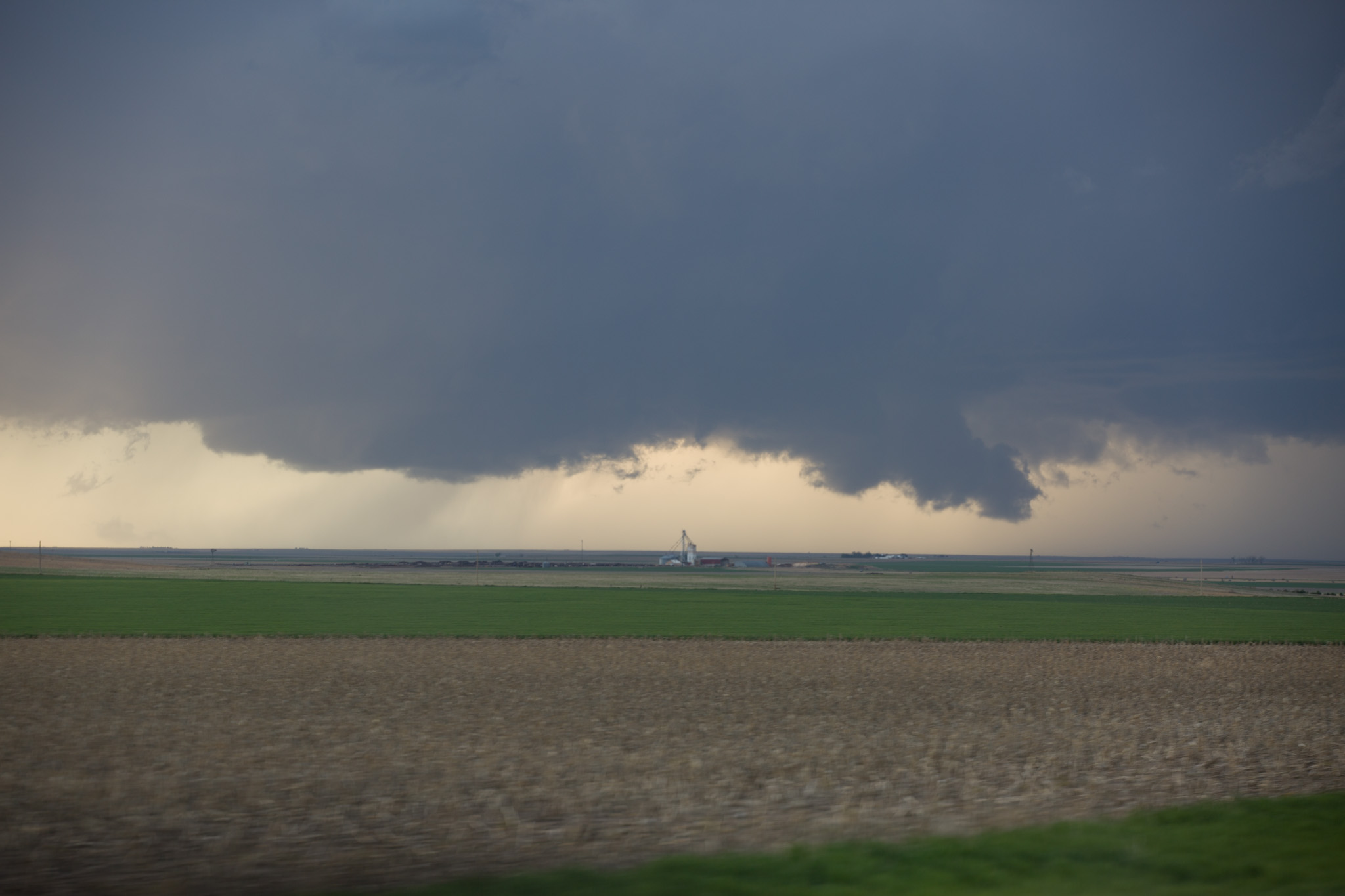
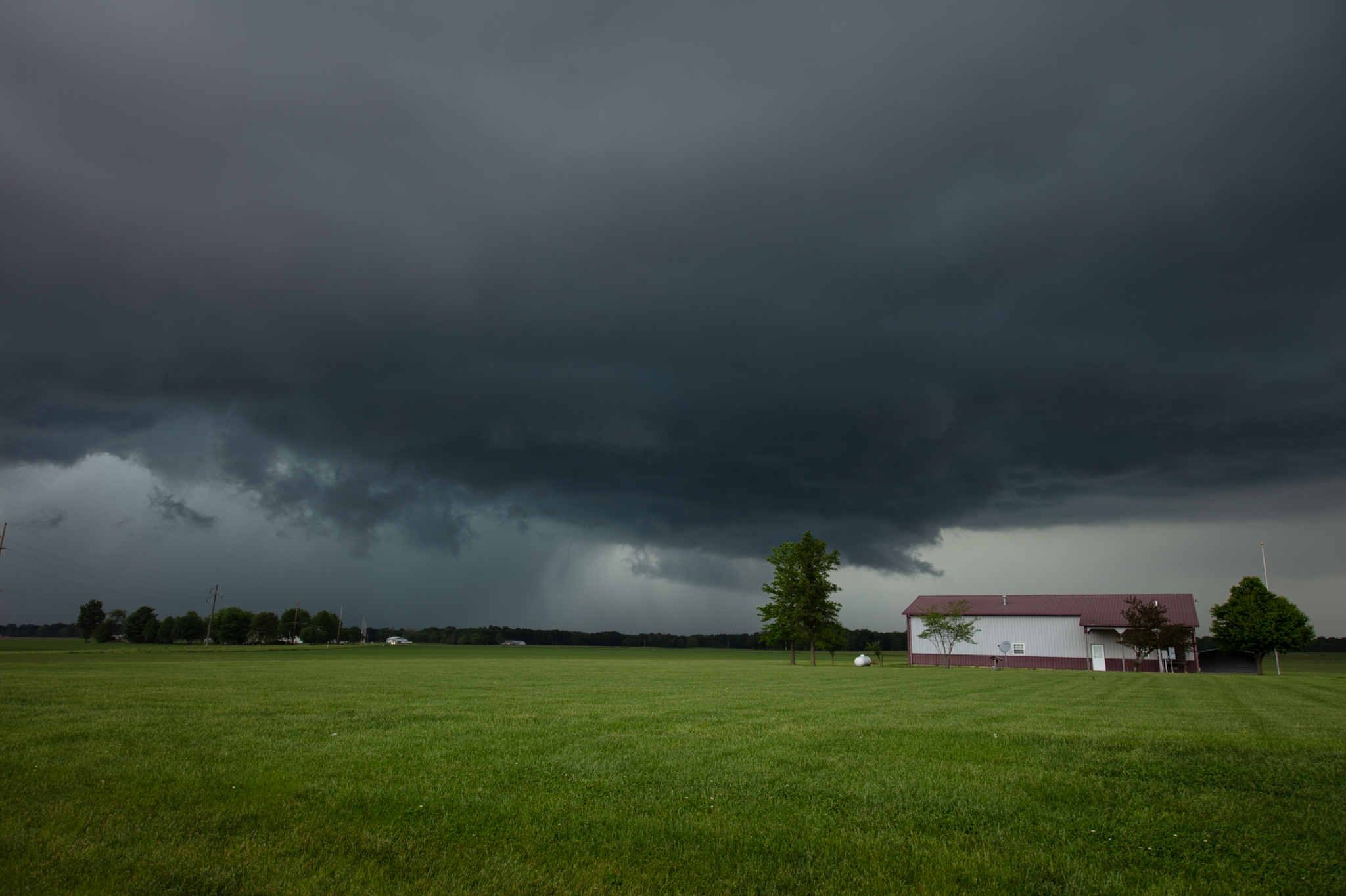
Of course, the forecast and model guidance was basically spot on, so that meant we had developing storms tracking directly into the most un-chasable area with a SPC 2% tornado risk. The first storm that fired up had very broad rotation and was just south of Henryetta while tracking towards the north of McAlester. We followed it as long as we could before having to give up due to a lack of viable roads and visibility options.
The next storm in line fired directly on the cold front, and was eventually going to move into the same areas as the previous storms. This meant the air was already worked out and energy would be limited. I have seen many tornadoes developed in seemingly worked over air but the supercells that have produced such tornadoes have been generally very intense or well organized, this was not one of those days. Now there was certainly a non-zero risk but it was hardly something to bet. Regardless, we moved into position for the last storm and it did put on a good show while tracking in our direction.
The storm eventually blew past and over our heads. We decided to call it a day and make our way back west to Amarillo for a down day on Saturday and see what our options were as a return flow means storms are likely again in the panhandle on Sunday.

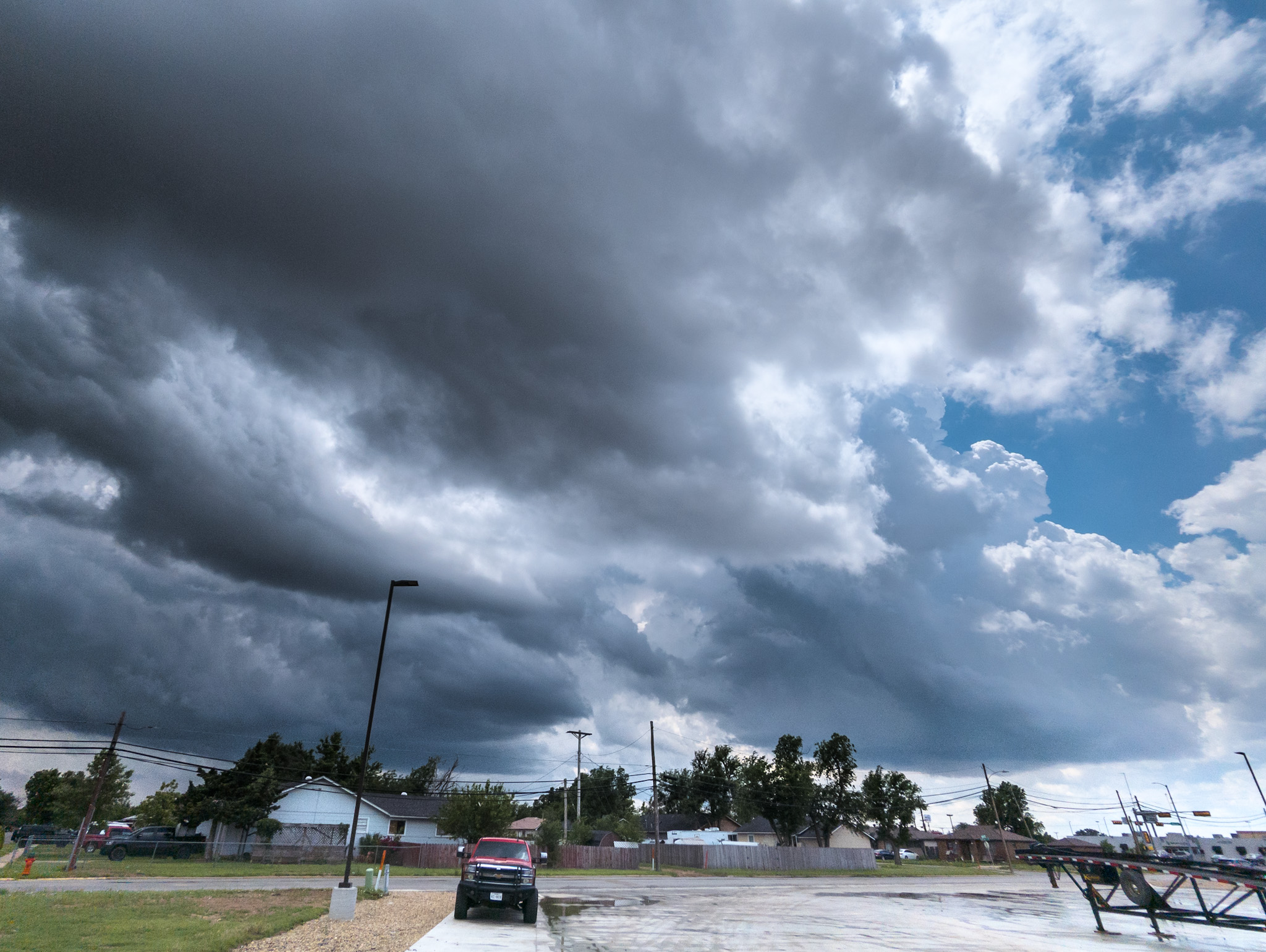
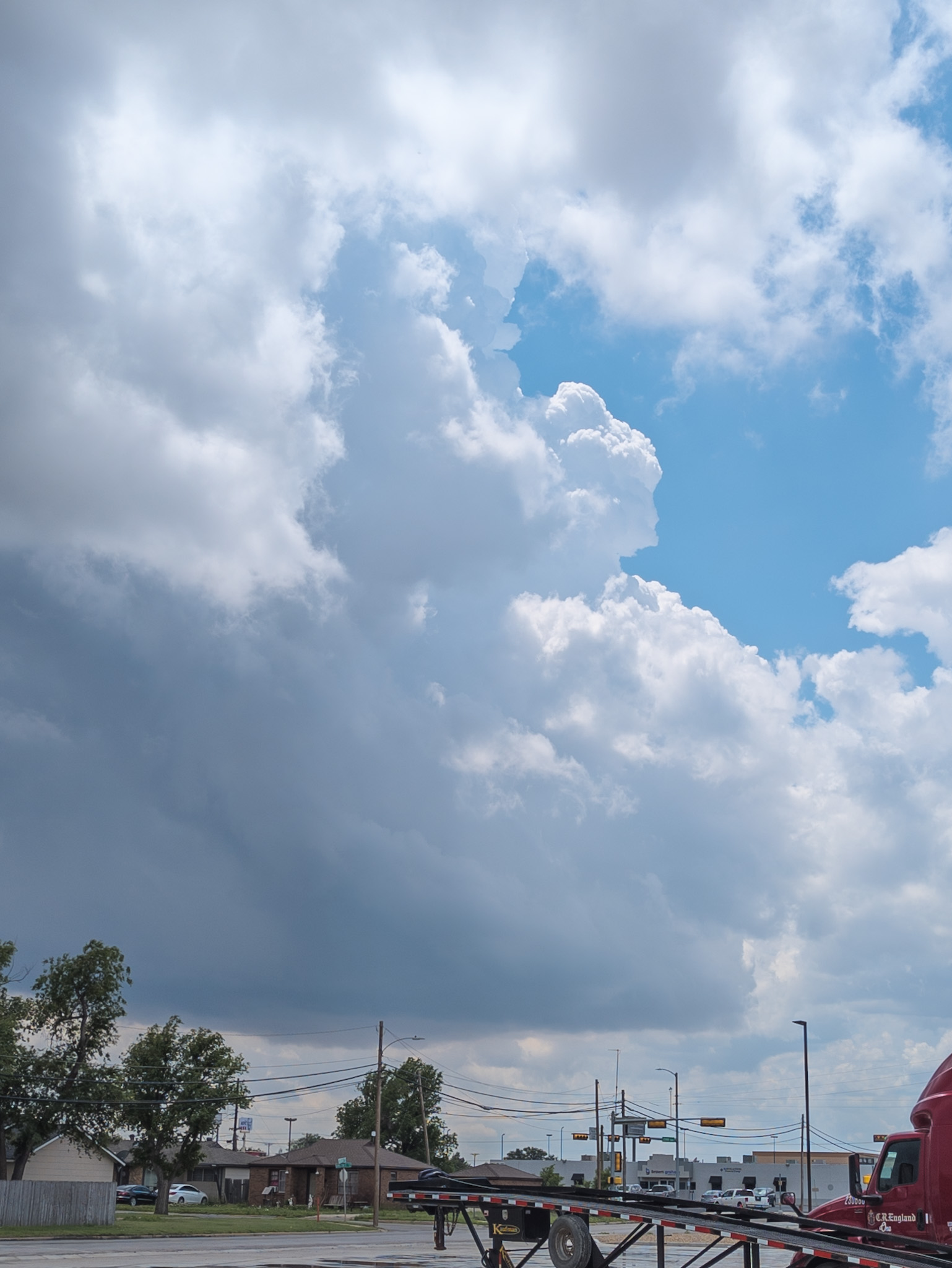
May 18th
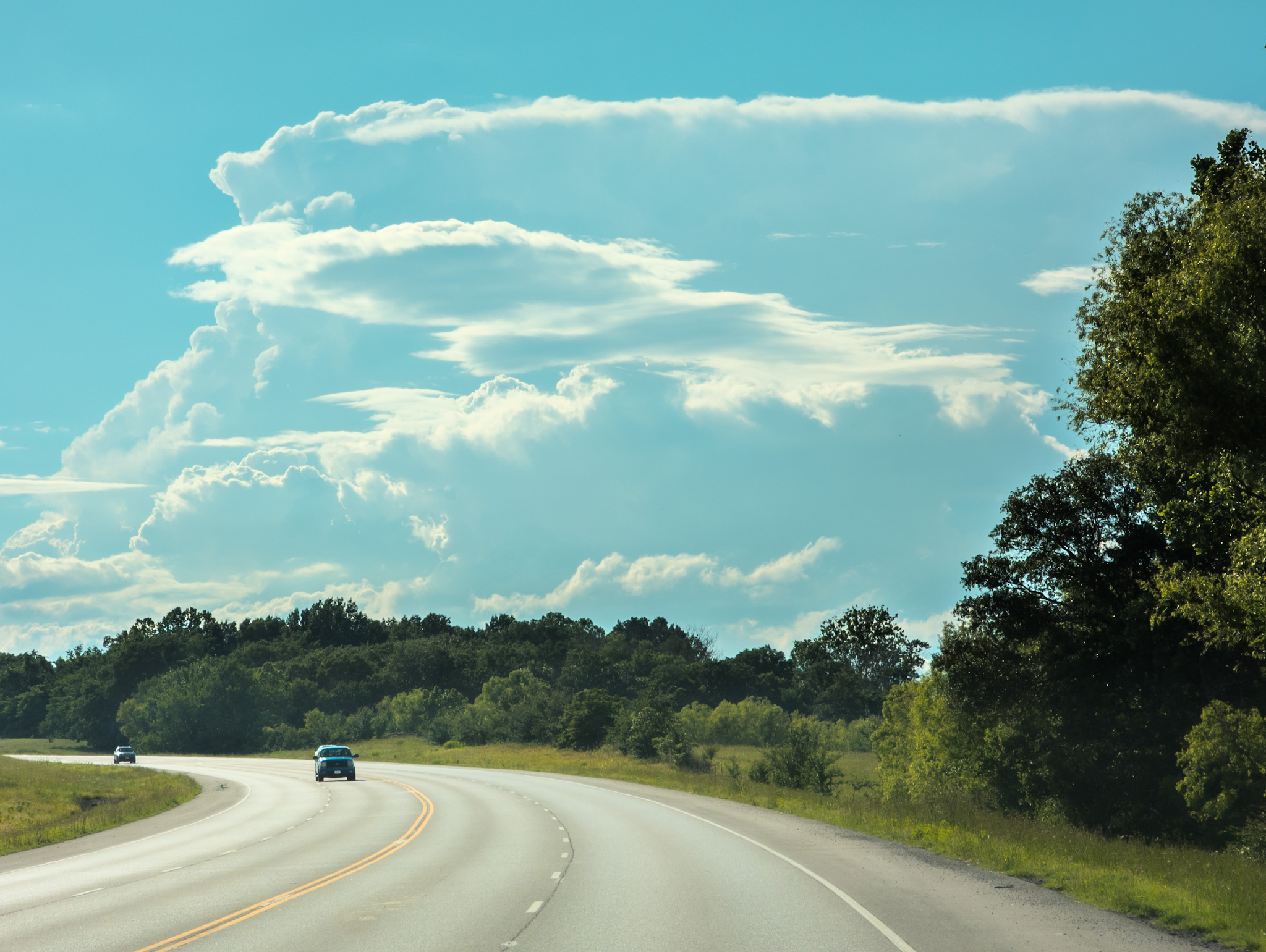
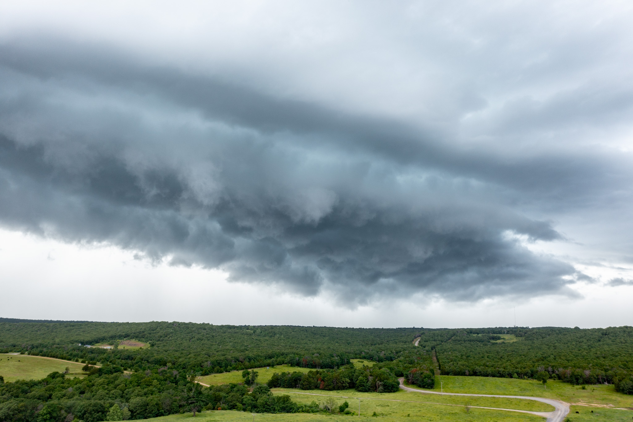
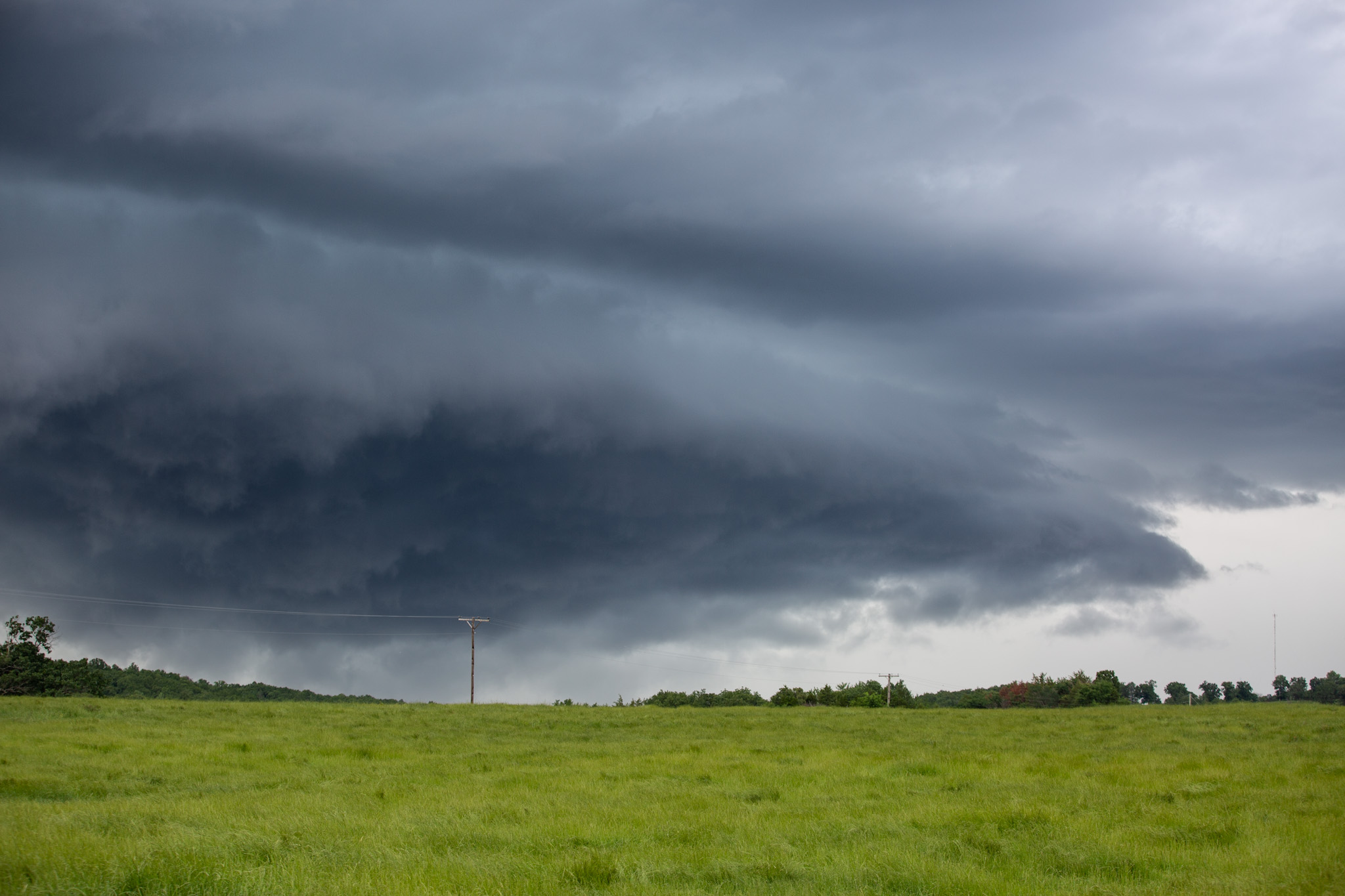
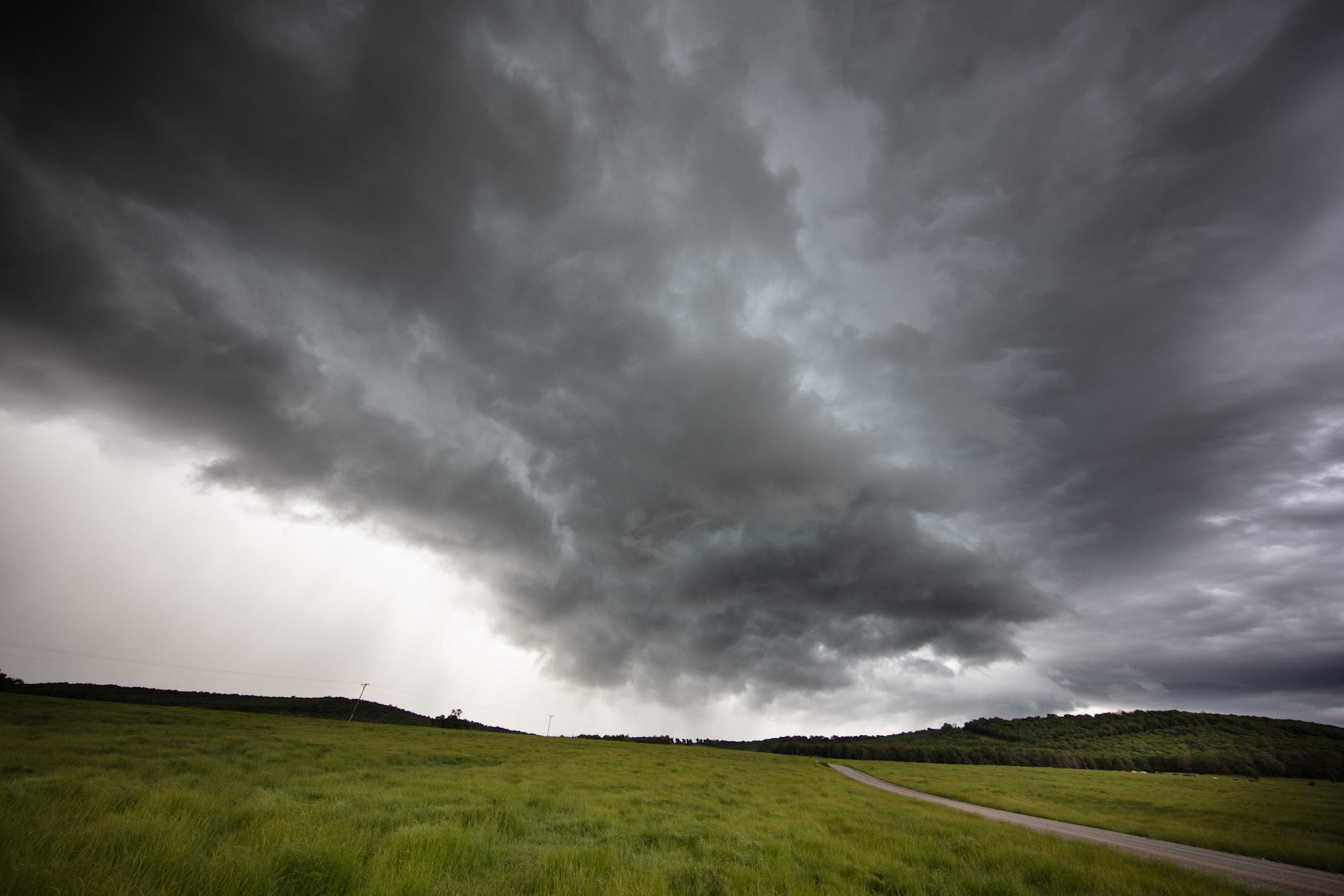
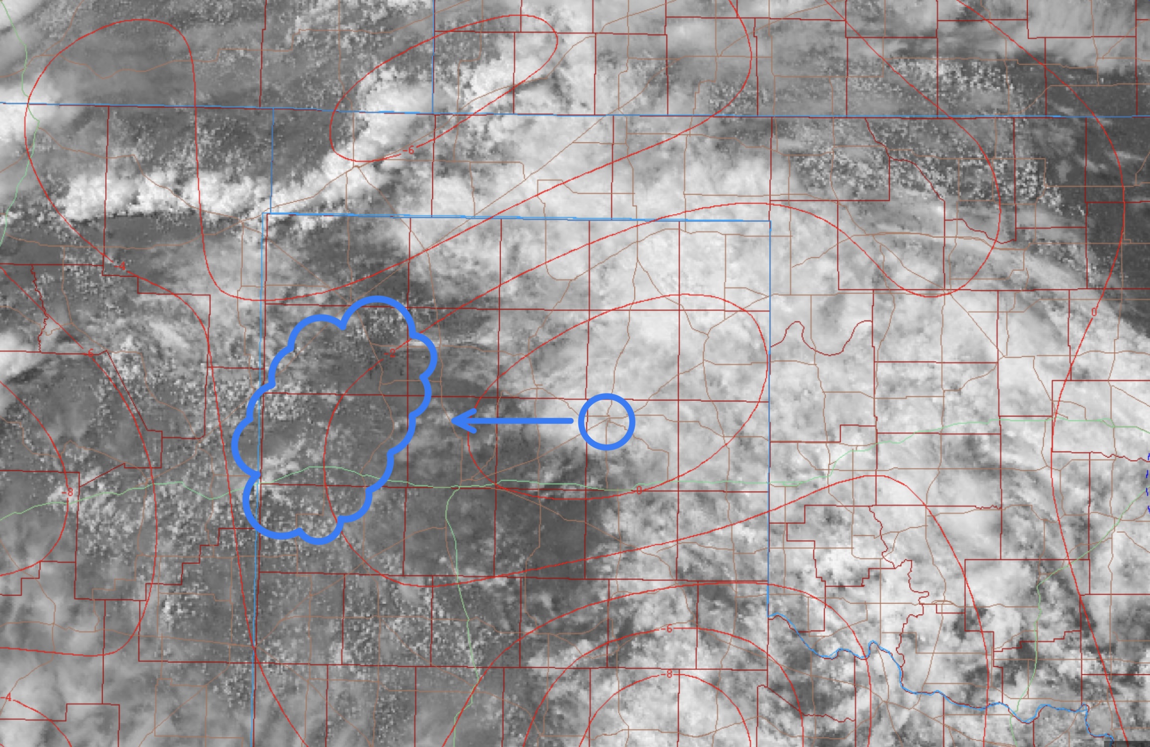
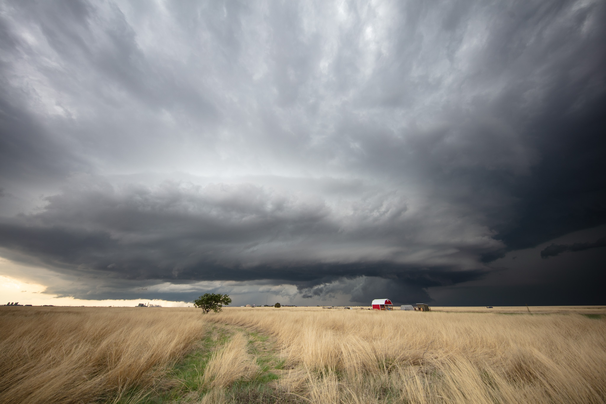
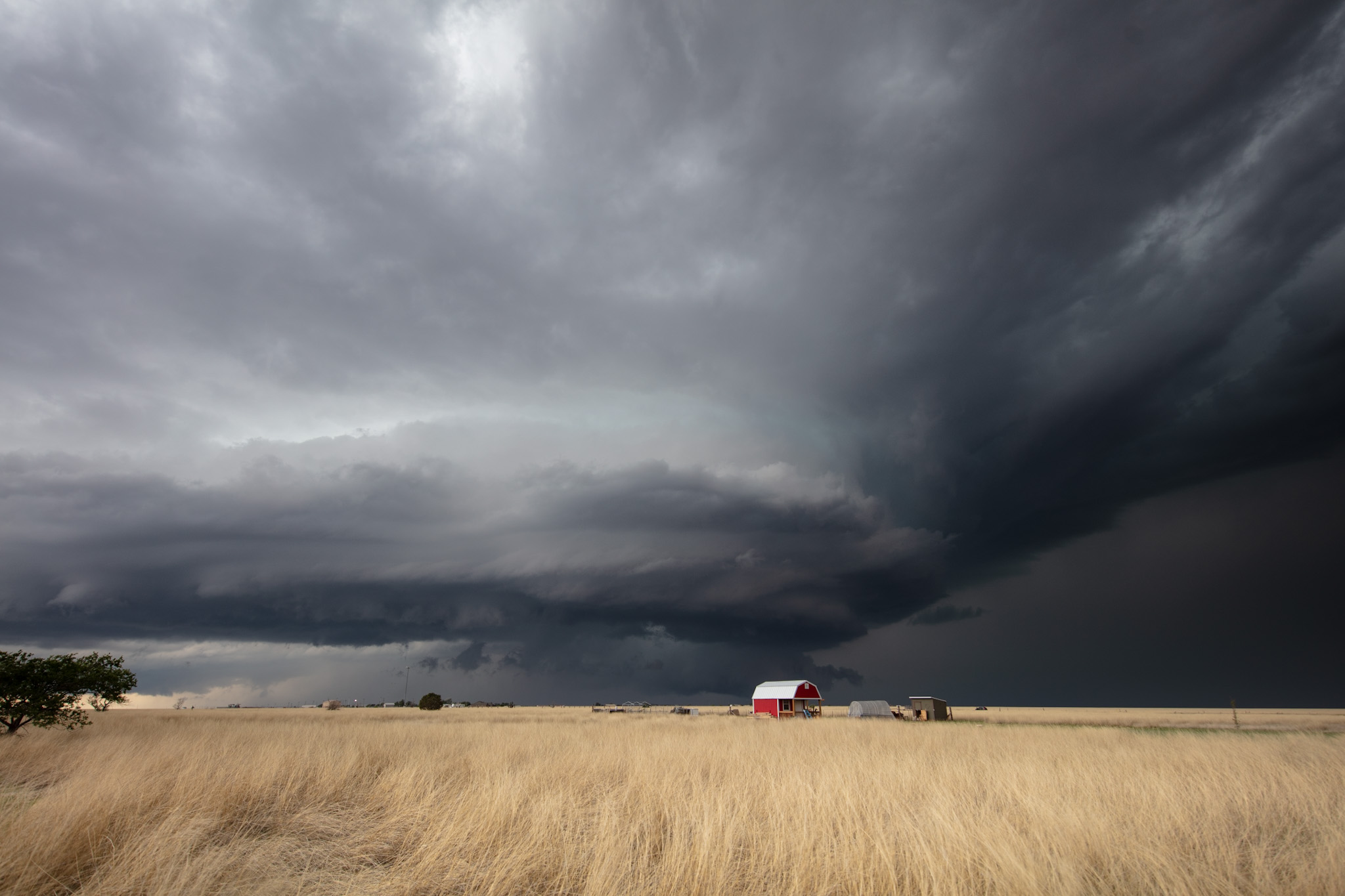
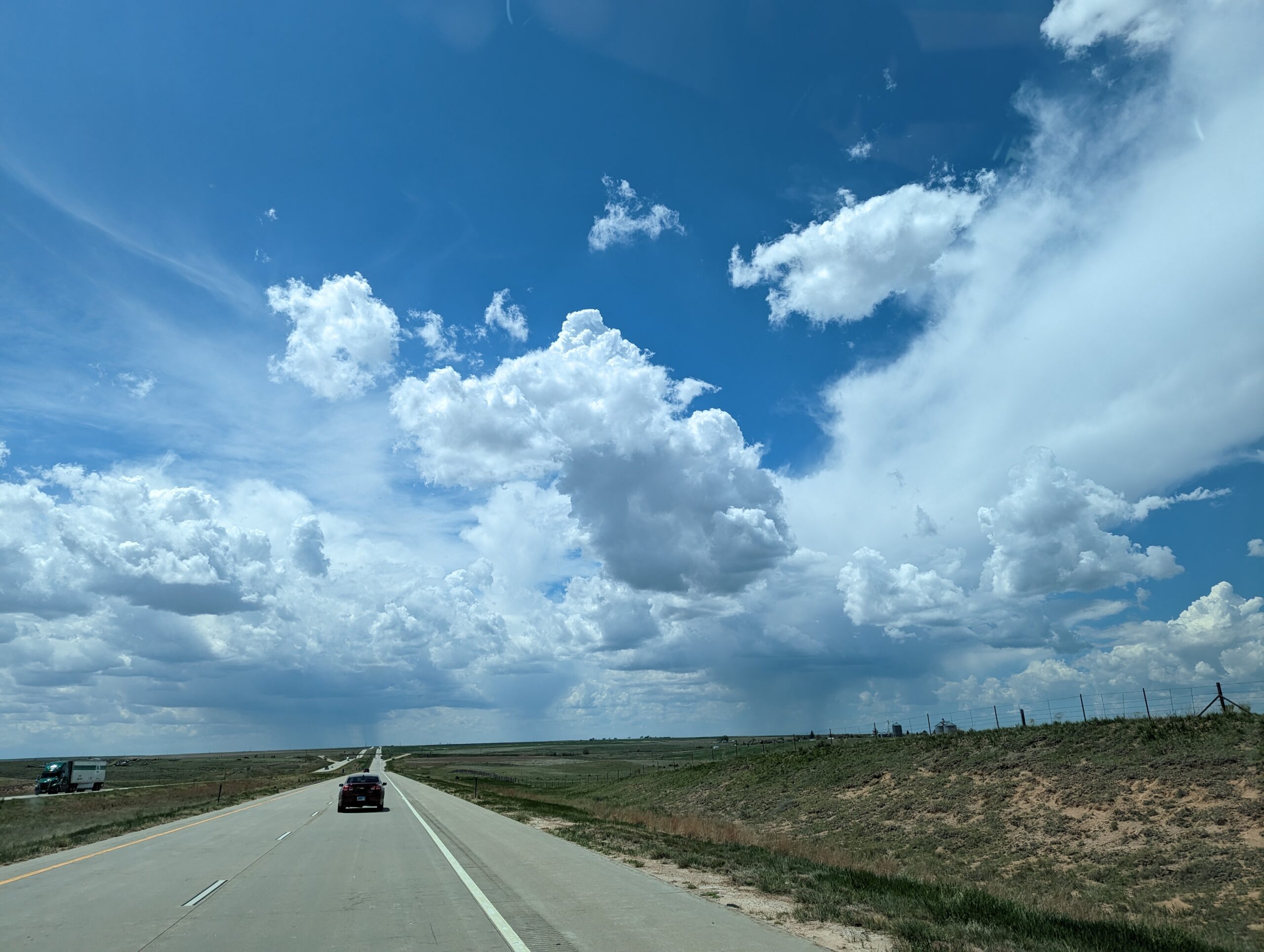
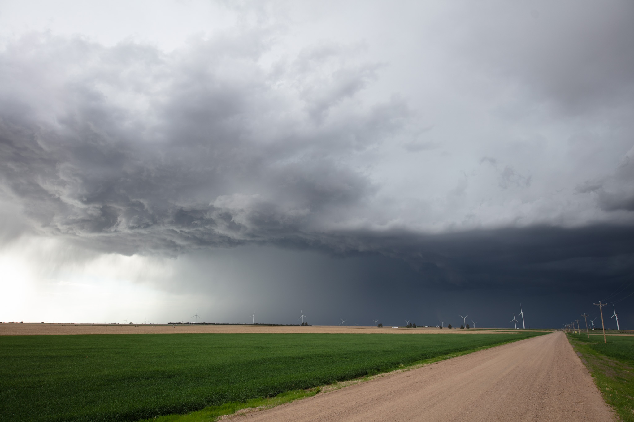
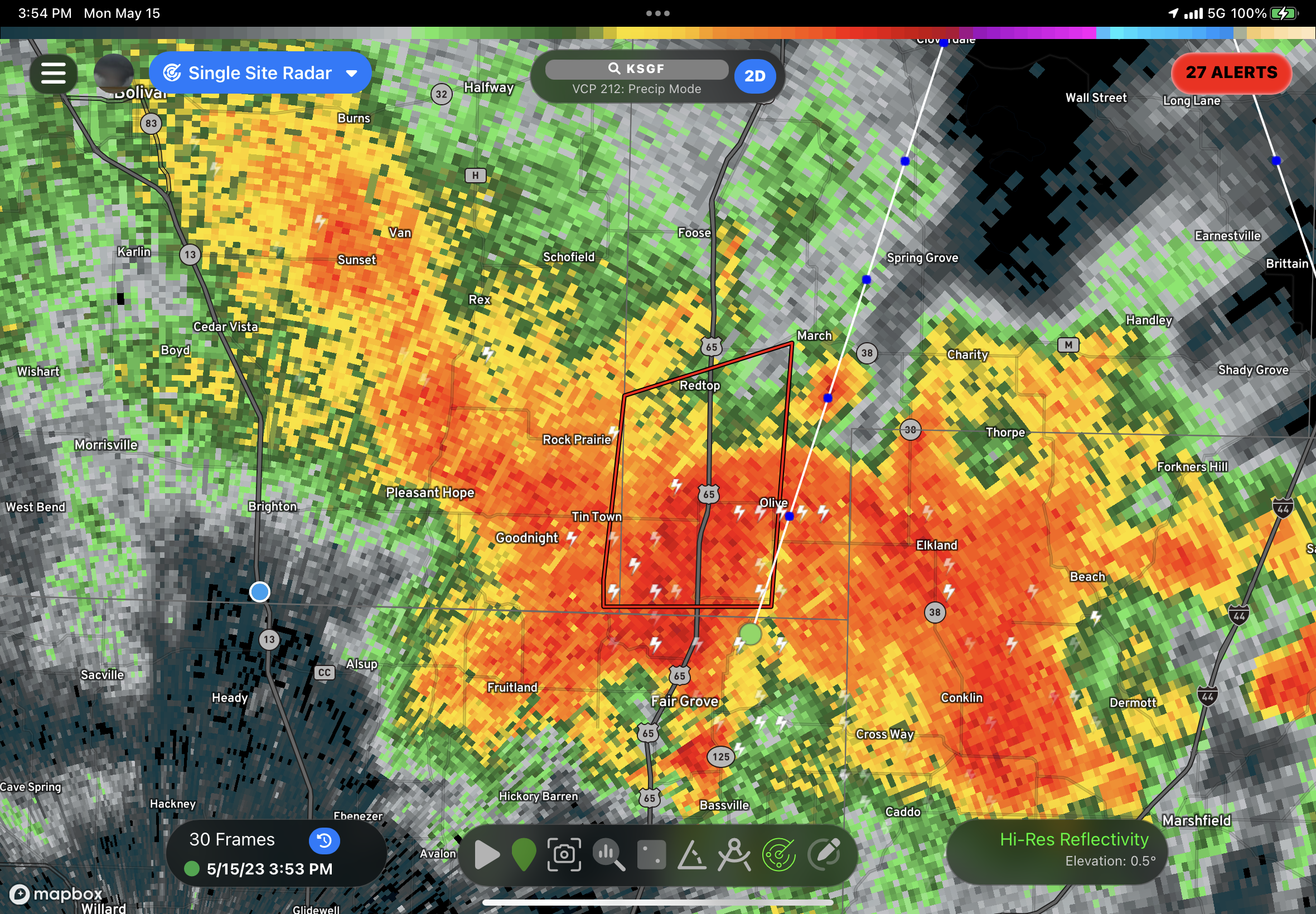
What a great chase day! We started off in Perryton TX and headed south to Pampa before working our way west to Channing TX. Morning cloud cover kept things under wraps for the first part of the day, but clearing worked into the region from west to east, with a strong convergence zone establishing itself near Nara Vista TX.
Eventually the first few storms of the day started to percolate. I was torn between taking a northern target in cooler air but with much stronger shear dynamics or waiting it out to the south Vega. There was some uncertainty but certain HRRR runs were also trying to pain a southern cell.
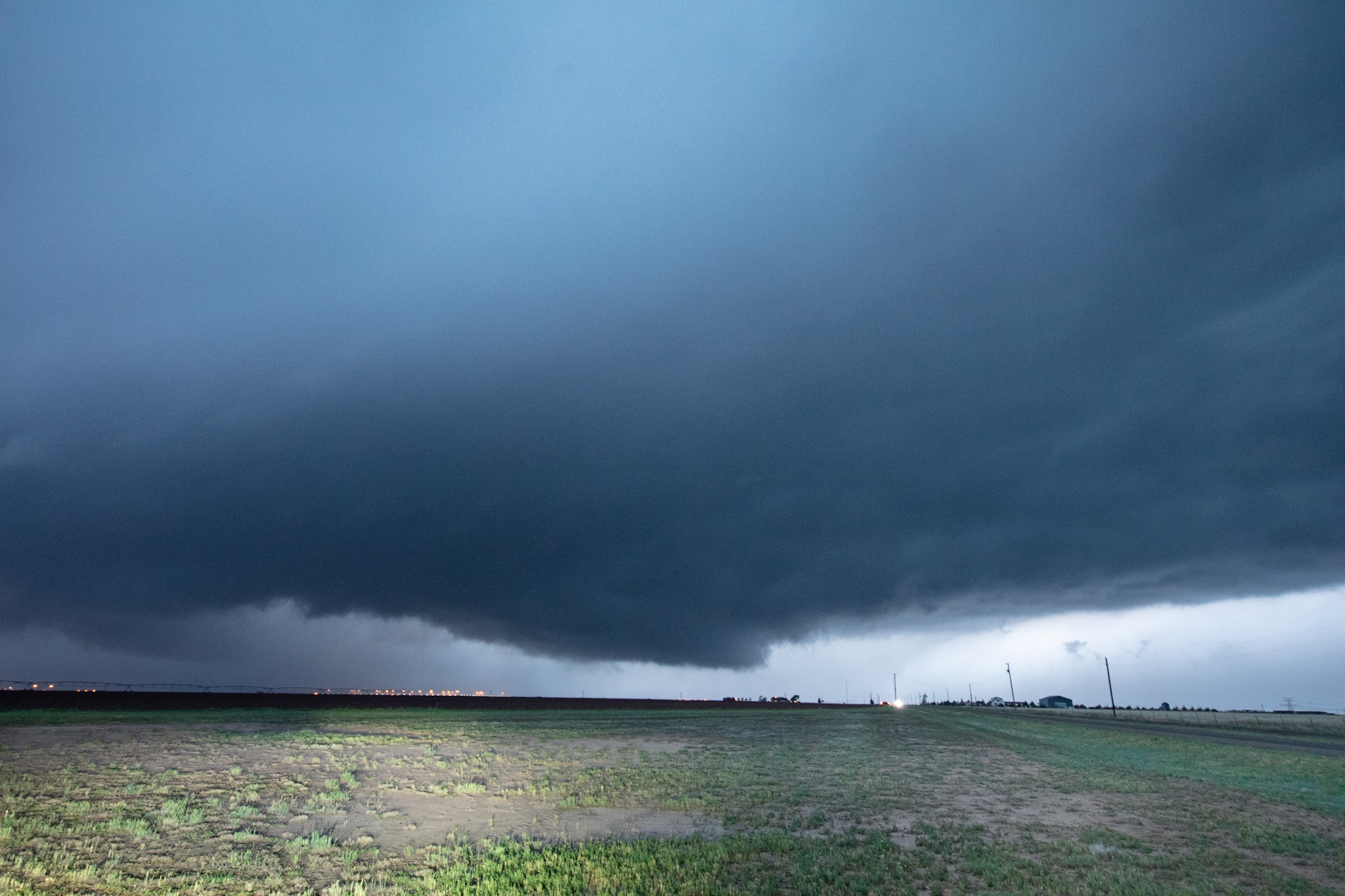
As luck would have it, three storms went up, the northern storm as expected north of Dalhart, the middle storm closest to us near Channing and the southern storm near Happy.
There was a significant chaser run on the south storm but I decided against it due to the environment not being favourable coupled with the airmass that far south not destabilizing. Temperatures around that storm were only 20C with 12C dew points, while the storms further north had 25C temperatures with similar dew points.
For a short time I did worry that I made the wrong decision as the storms north of Vega where we were started to have a slight cold pool effect and were undercutting their inflow. Finally however, a southern storm went up and became dominant.
In a moment of second guessing myself, I suggested we head north because I was concerned that the storms in our area may not become rooted. Before we got too far I made the call to fall back south to my original forecast (I hate second guessing myself) and that was the absolutely right move.
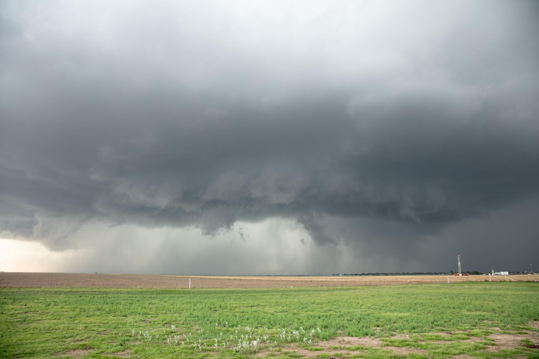
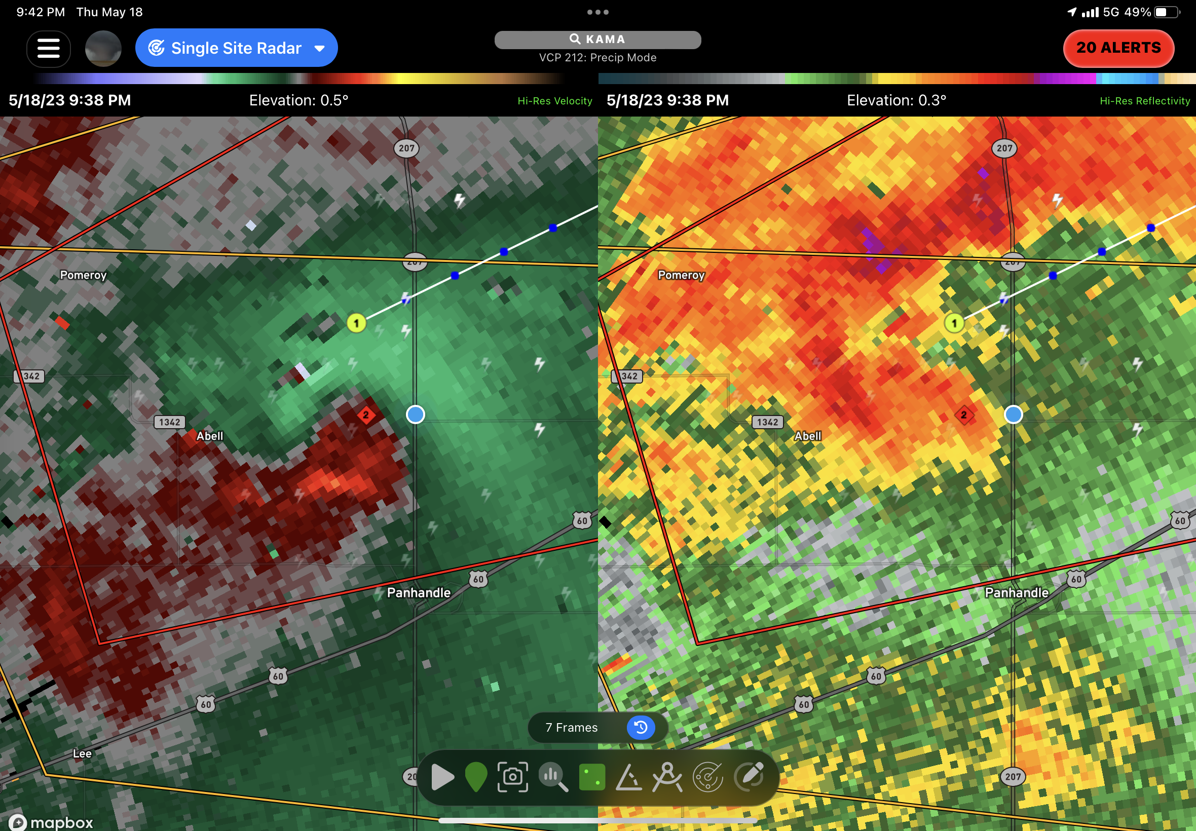
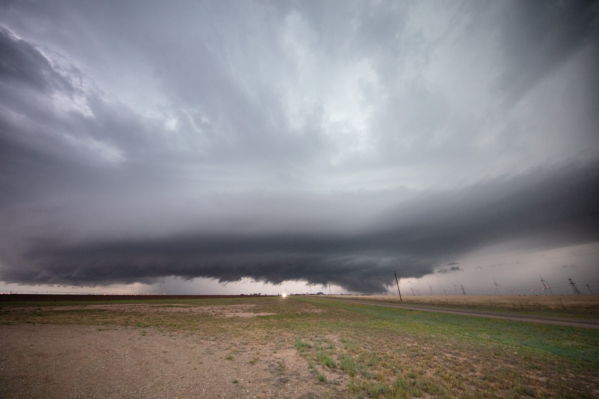
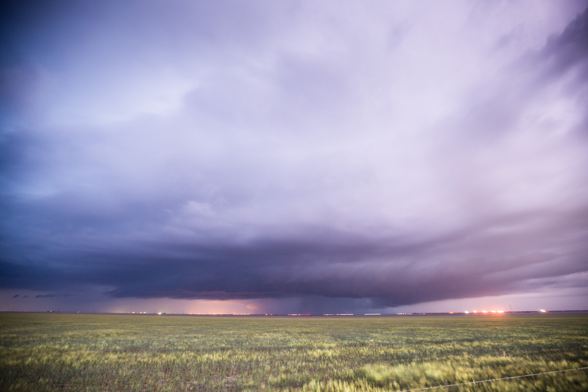
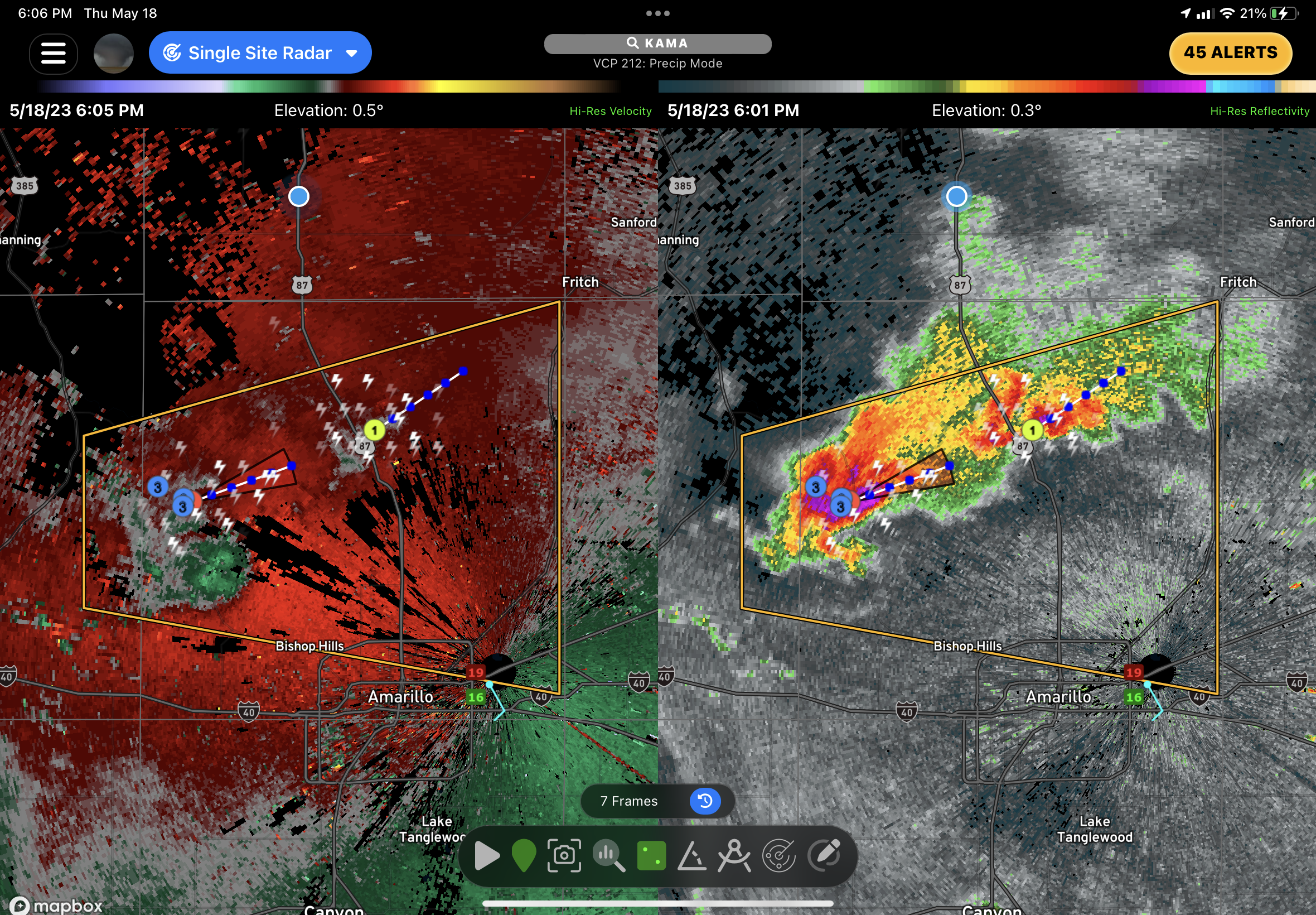
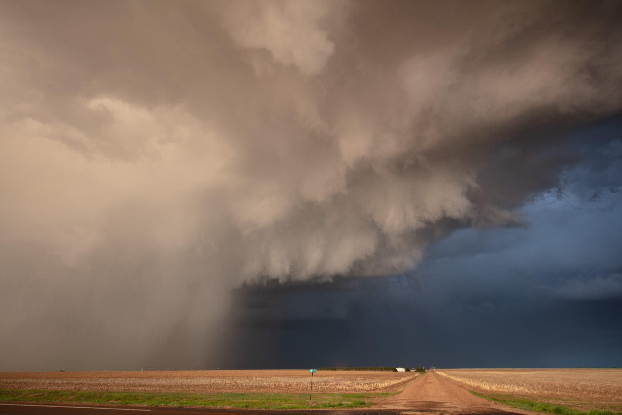
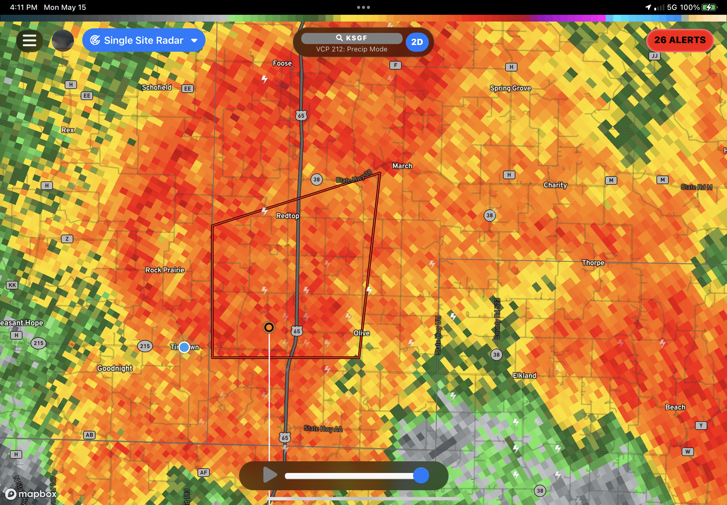
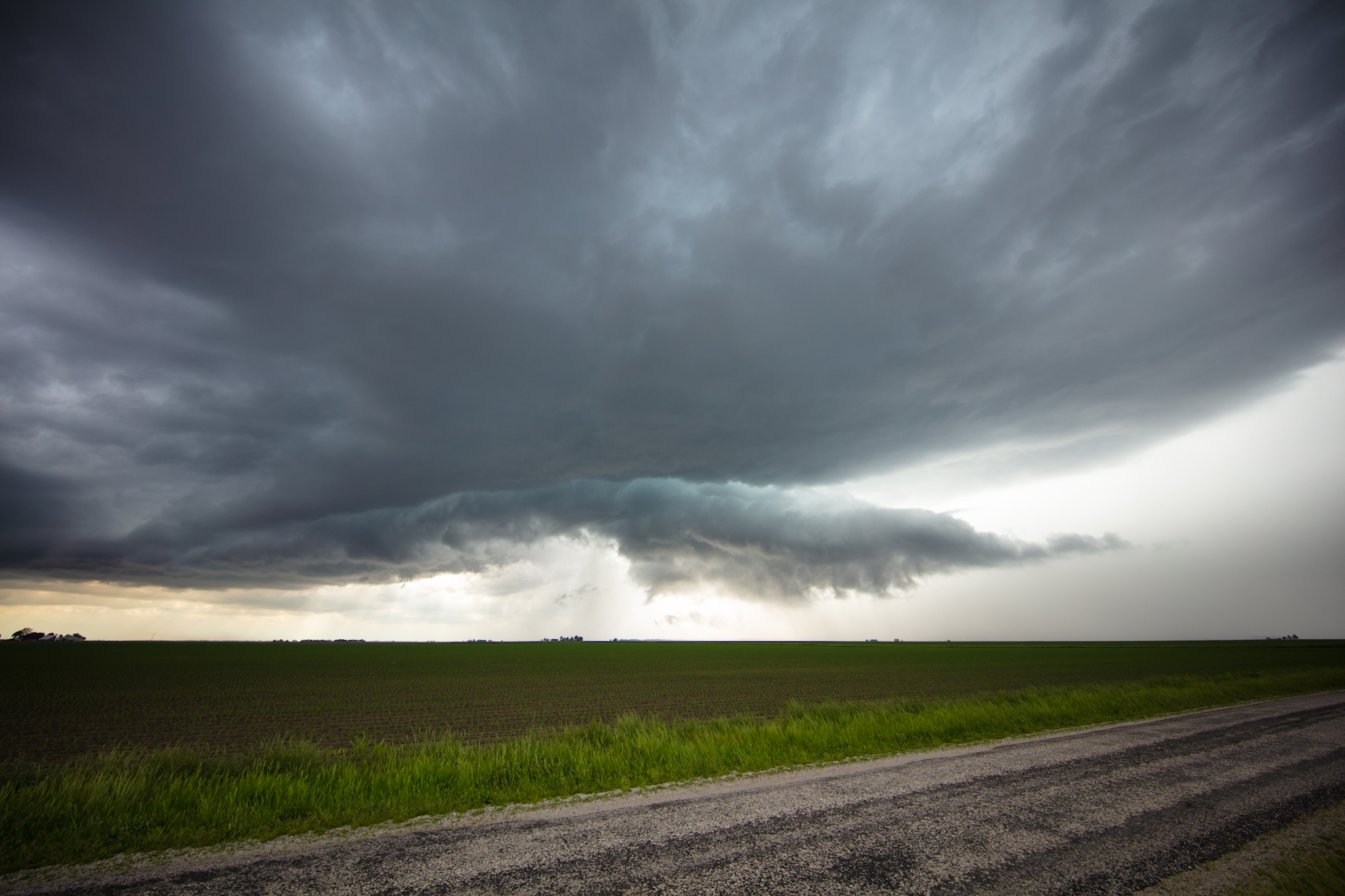
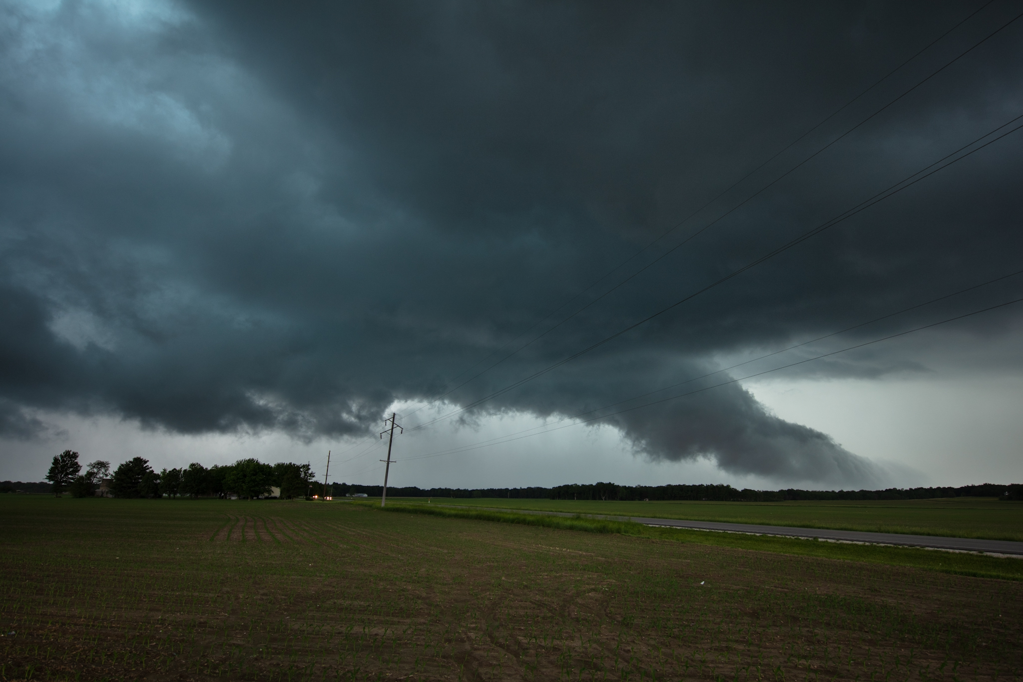
As the storm moved east and passed the north side of Amarillo it quickly developed into a supercell complete with a hook echo and broad rotation.
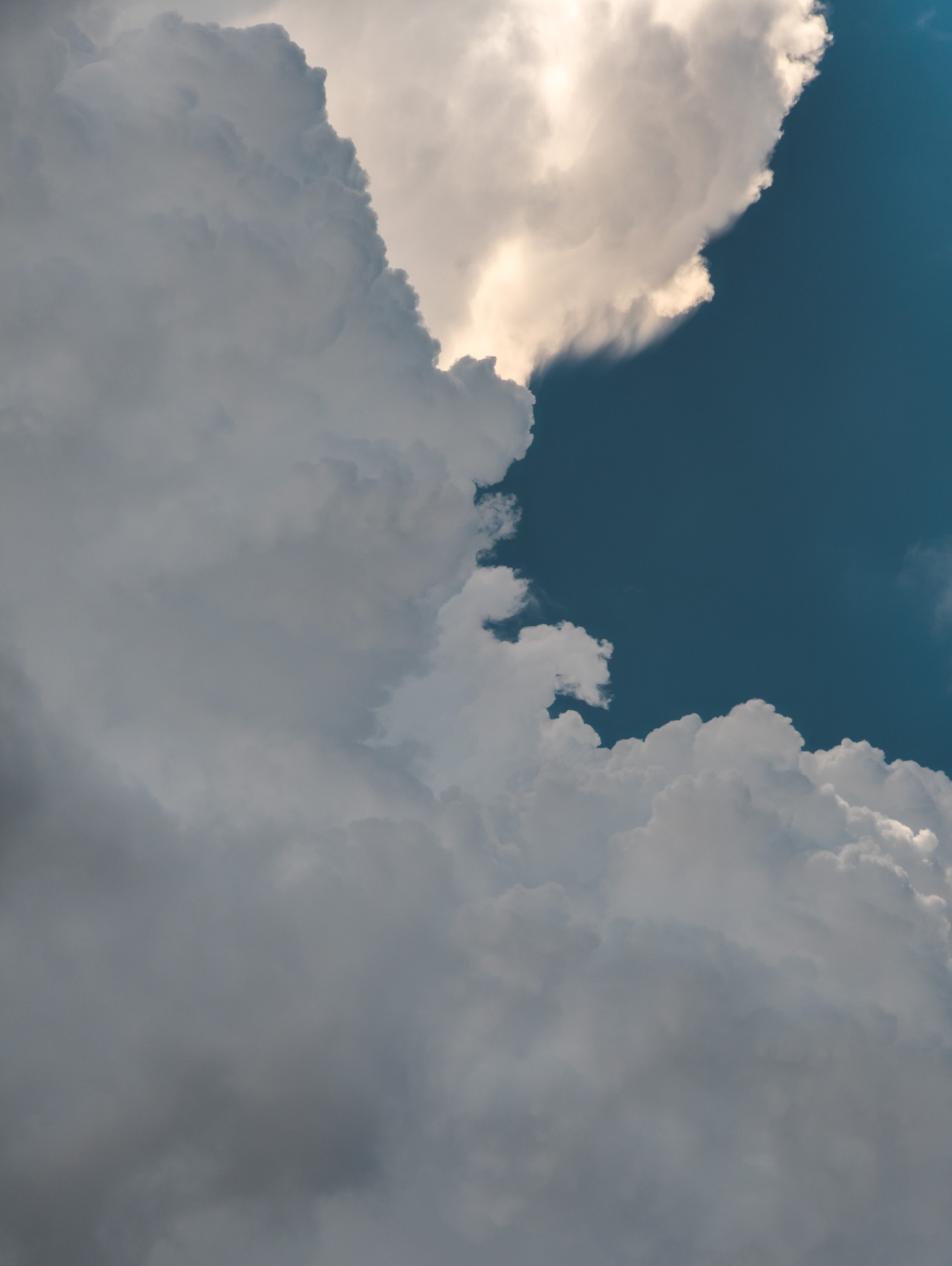
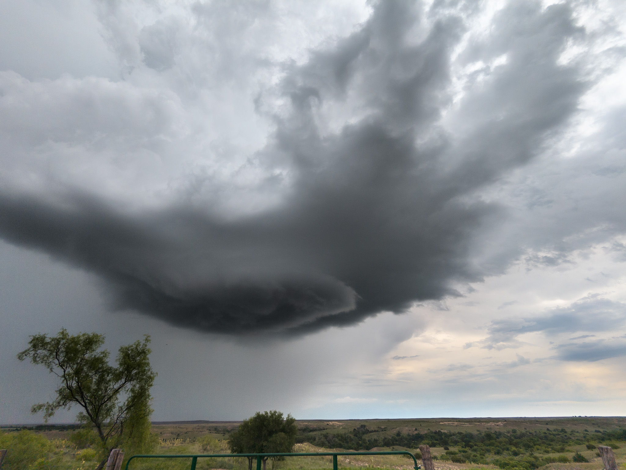
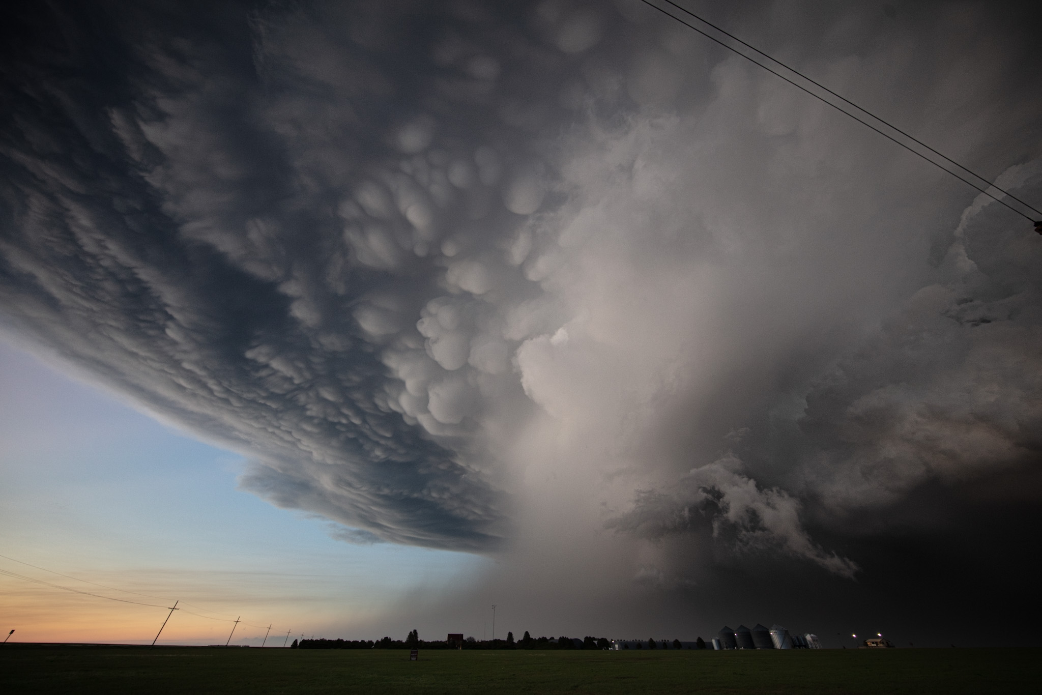
The storm did produce loose brief funnels at times but nothing ever did develop into a tornado. None the less, the storm produced what can only be described as fantastic structure turning into a series of stacked plates and having that classic supercell appearance.
The storm was tornado warned a number of times and we did cut across the hook at night but there was no visible tornado. We could clearly see across the hook so it was safe to do.
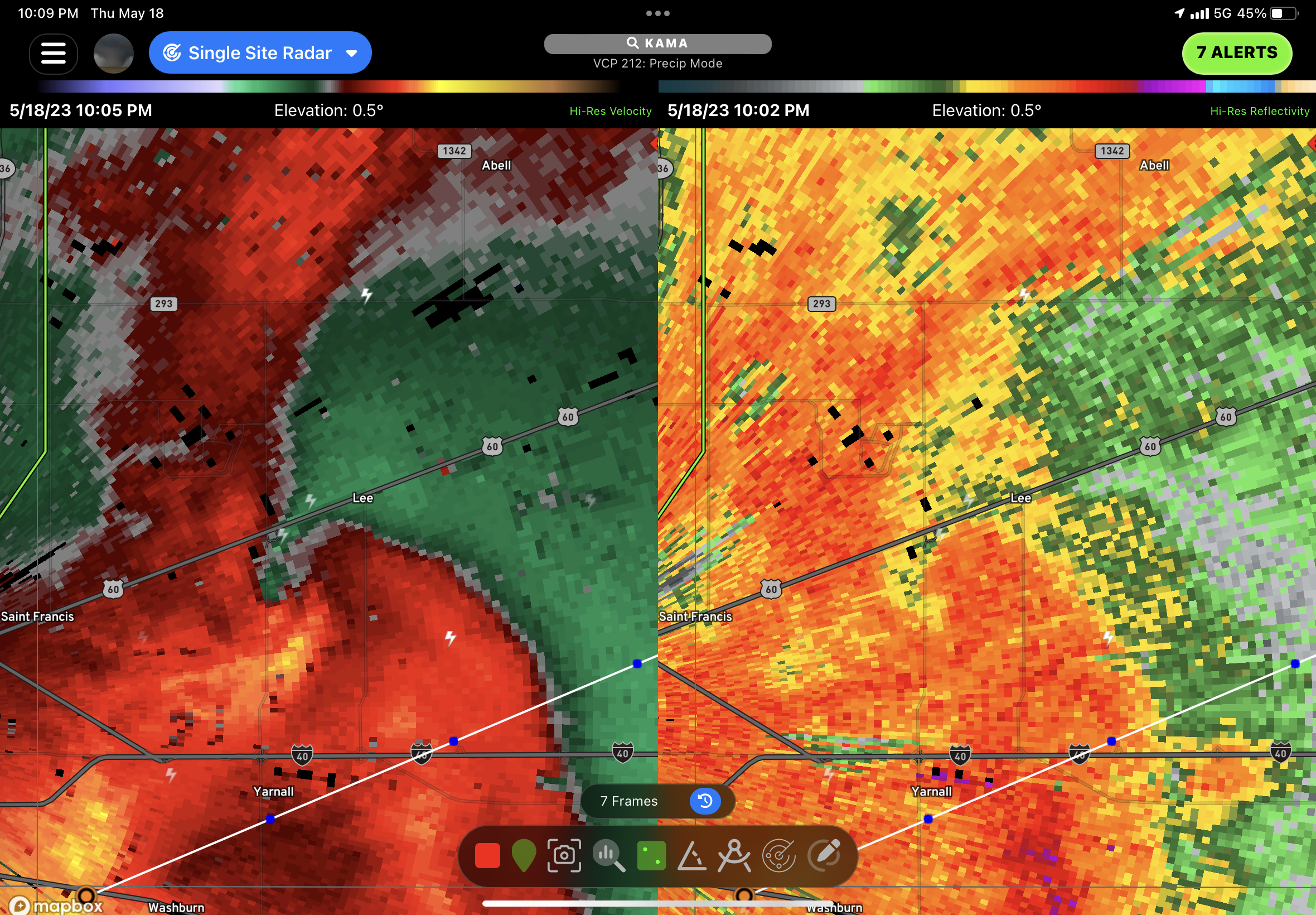
We decided to call it a night near Panhandle TX and turned around to head to Amarillo. By this point in time a large MCS had developed and there was actually a weak QLCS vortex present that was tracking straight towards us on TX-HWY 60. We punched right through the vortex and had a dramatic wind shift with some very intense winds. I was joking that the NWS may issue a tornado warning for loose couplet we were essentially driving through.
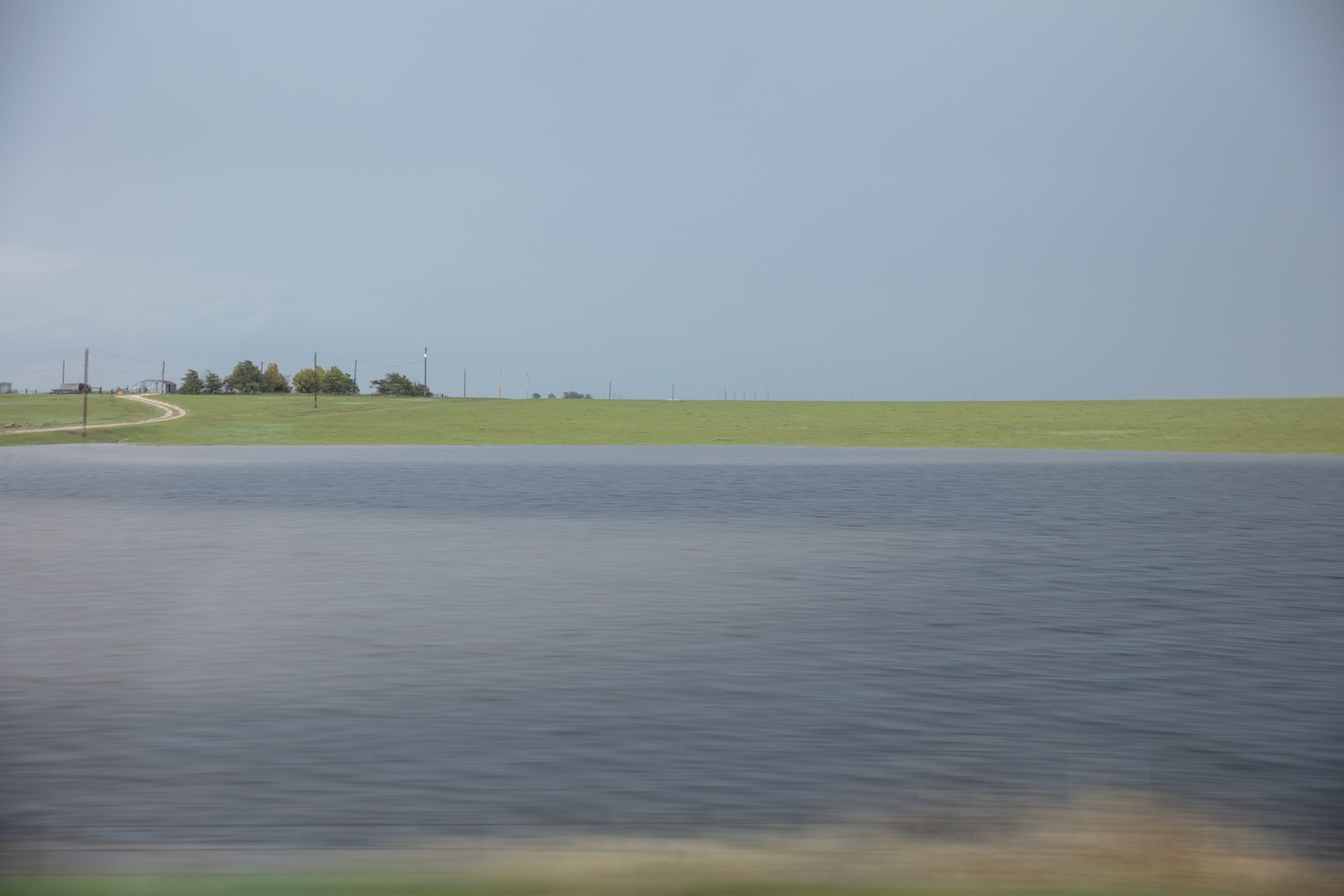
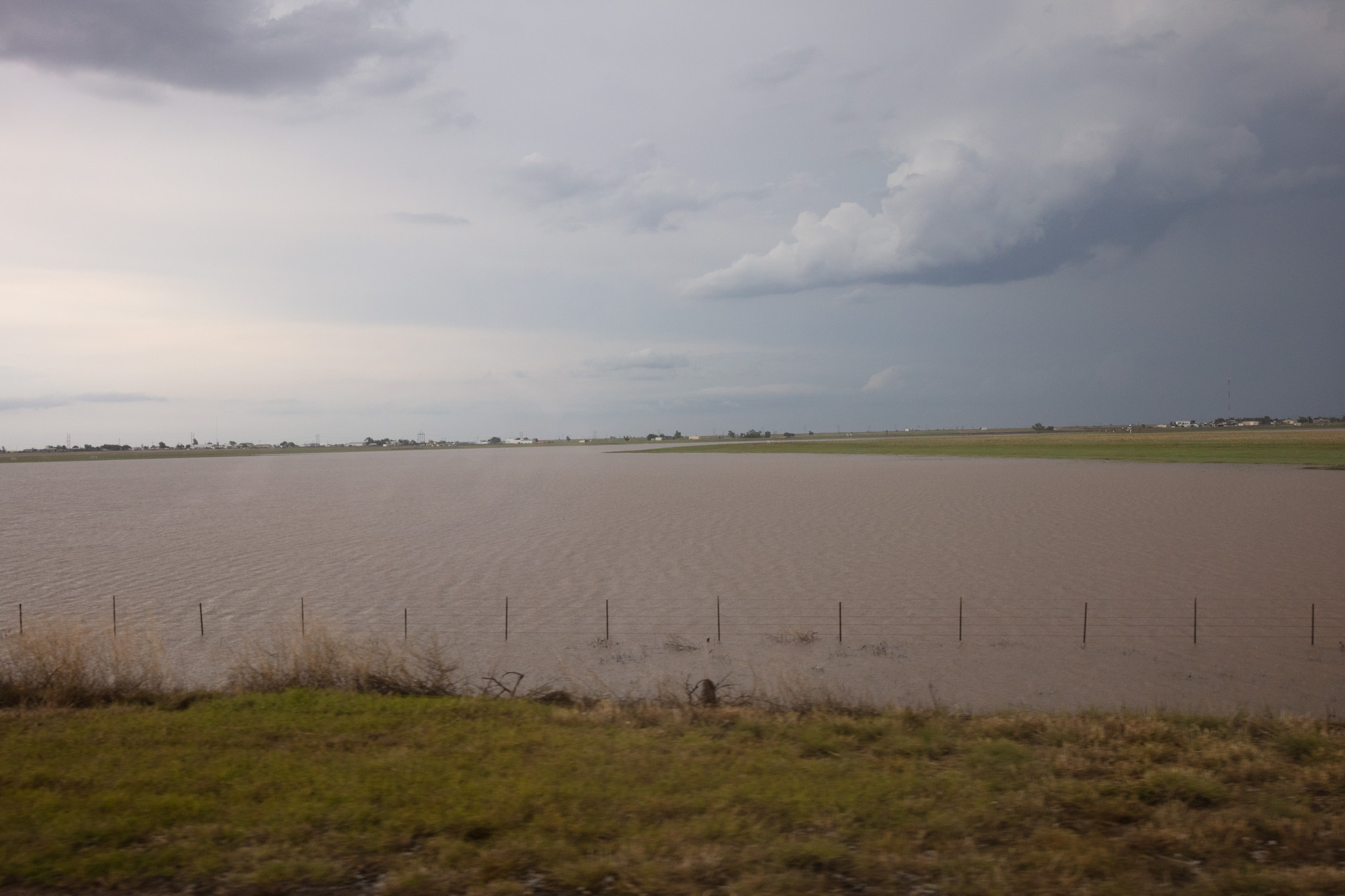
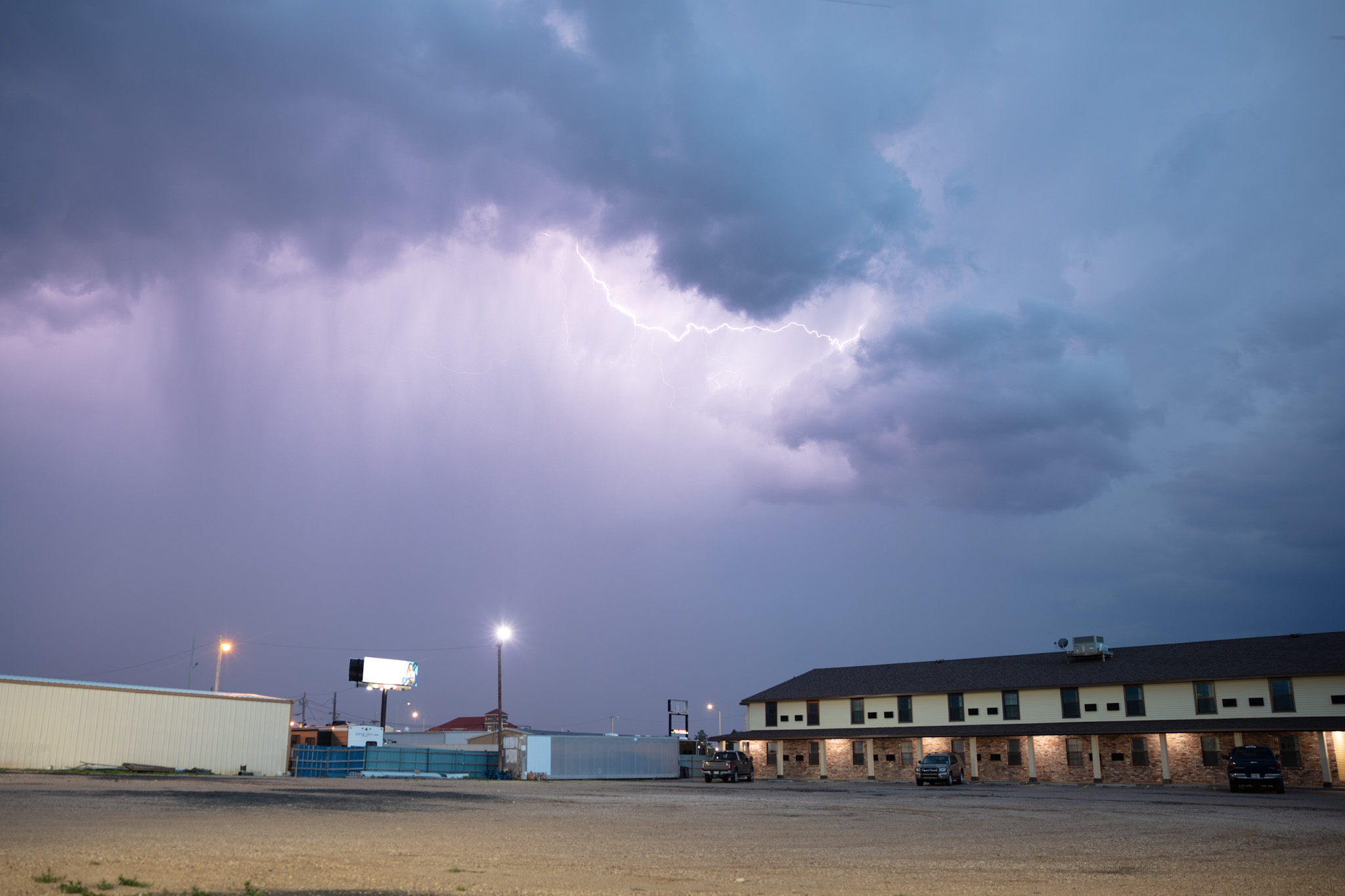
As we entered Amarillo near the airport a flash food warning was issued. Within moment we saw why, the city was just deluged with heavy rain from the passing storms and some roads had turned into rivers. Despite this and a brief slow down on the freeway, we made it to our hotel safely for a night of much needed rest.
Tomorrow is an Oklahoma day, so we will see what that brings.
May 17th
As expected, today was very marginal. The best storms would remain to the north in Nebraska and while tempting, I knew we had to fall south to Texas for the upcoming chase.
This is a common problem high plains chases, you often have a split between to target zones, and then you need to consider where you need to be on the next day and what’s a better play. This means trading off good storms sometimes which is not easy.
As luck would have it, we did not have to venture very far into eastern Colorado for storms, in fact we were basically back in the identical area we had been sitting in for the previous day.
We tried our hand at some daytime lightning photography which is am abysmal failure for all of us, and not for lack or trying, but more or less for a simple lack of lightning.
I decided to have us fall south to intercepted a slightly better looker storm coming into eastern Colorado. As luck would have it, it started to become a supercell just as we arrived only to fall apart and have the updraft shrivel away shortly after.
I decided we would call it a day and head to Perryton TX for the night so as to be in position for the next days chase. Well as luck would have it (again) as we were passing through Liberal KS some pretty strong storms erupted and became supercellular cranking out intense lightning and hail. So we had a nice show on our way to TX before calling it a night.
 default
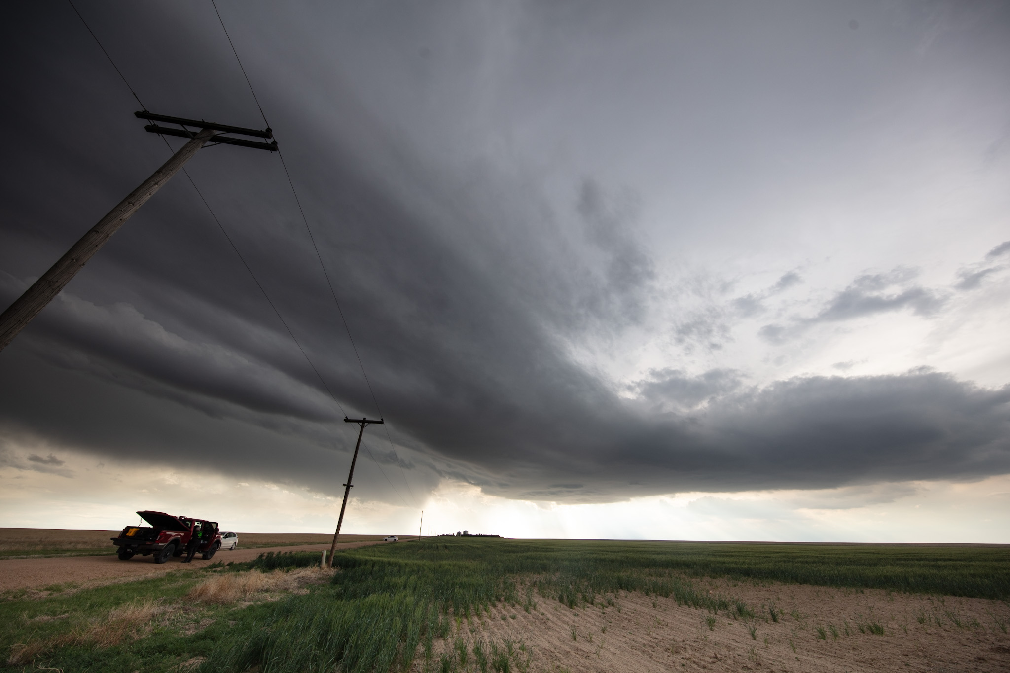
May 16th
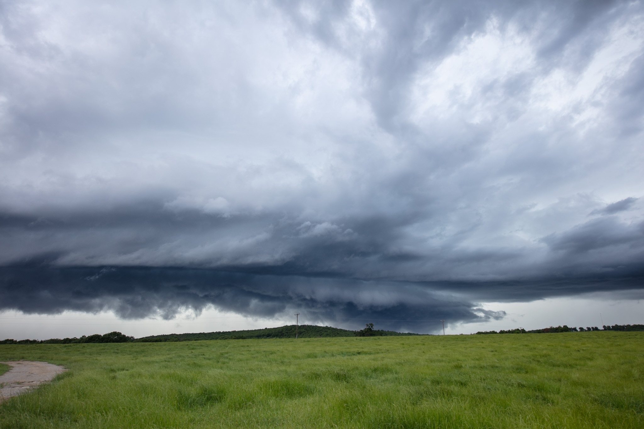
This was probably the best day yet. We started the morning in Wichita KS and headed northwest towards the Colorado border. The was a shortwave swinging through and moving south from the Ogallala area of Nebraska into northwest Kansas. With a little bit of bulk-shear helping and some cold pool development, there was potential for organized storms taking on supercell structure.
The biggest issue was that the airmass was very dry and as a result cloud bases would be in the 1500-2000 meter above ground level range. Not normally a problem if you have supercells, but less organized storms don’t do overly well without deeper moisture. That said, with the higher terrain and steep lapse rates, some of which were approaching 10C/km courtesy of the northwest flow over the mountains, any storms that did form would have the potential to become rooted and develop as they moved from Colorado and Wyoming into Nebraska and Kansas.
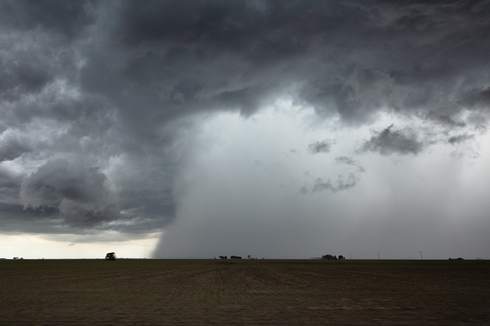
As the day wore on we watched a cluster of storms form near Fort Morgan CO and we repositioned to Burlington CO before giving chase.
The initial cluster of storms did express some weak rotation but the high based nature of the storms and the strong evaporative cooling lead to outflow that was very strong, lifting dirt and undercutting the storms inflow.
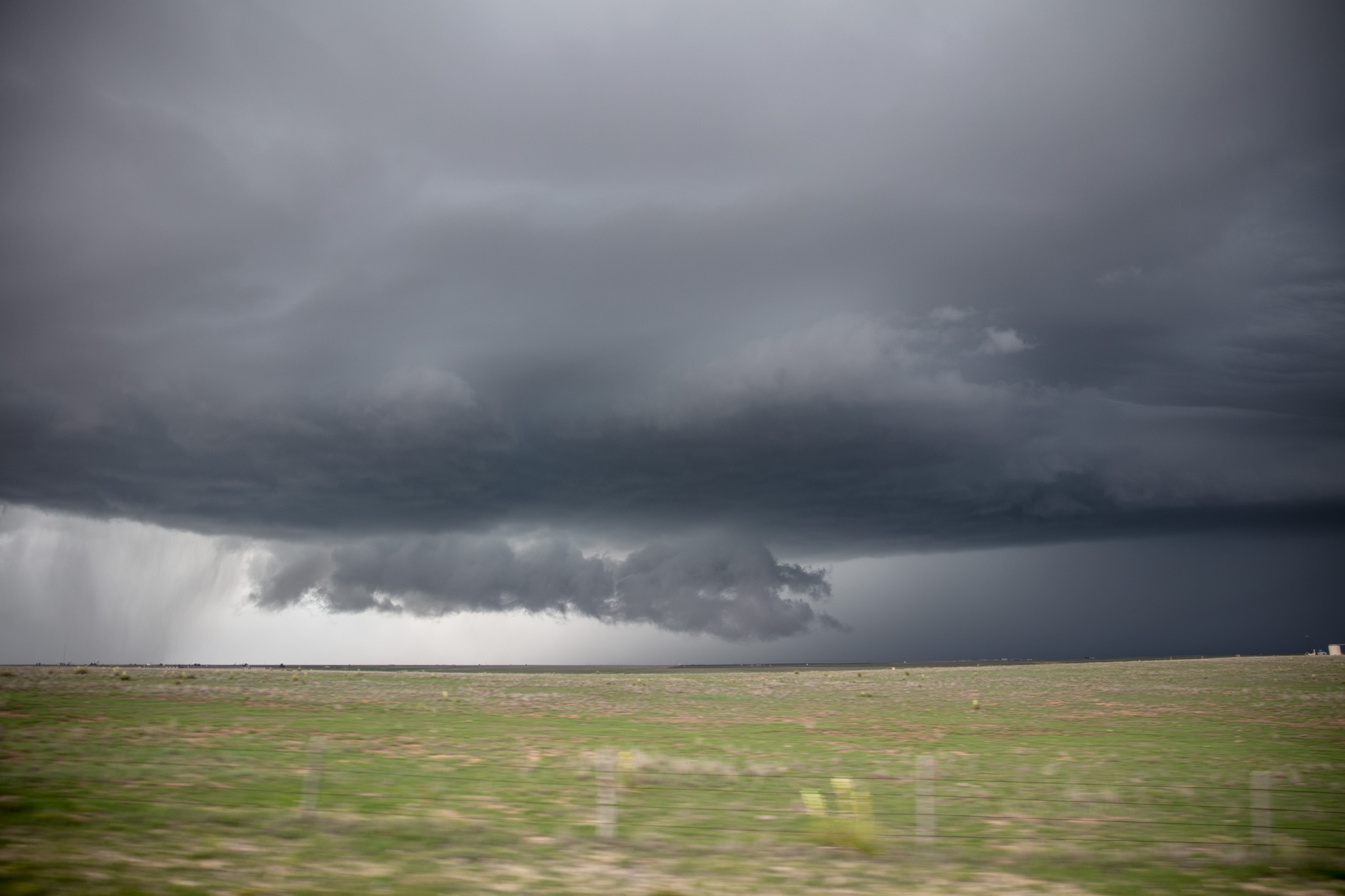
While the first line blew itself out, a second storms proceeded to progress more steadily again expressing broad rotation and producing a brief funnel cloud.
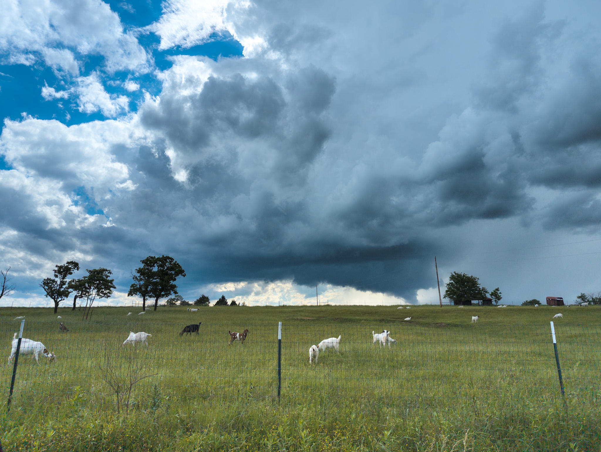
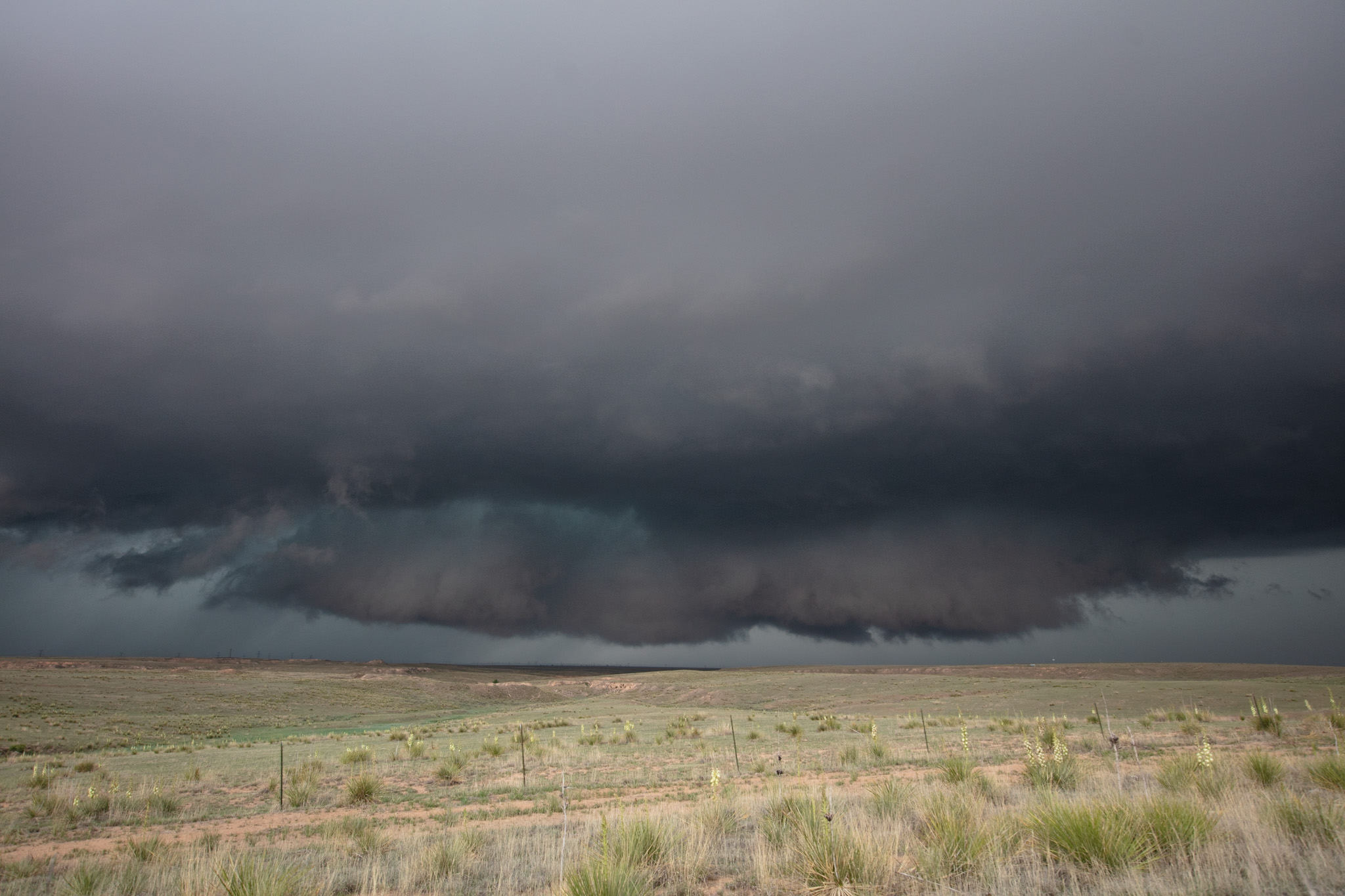
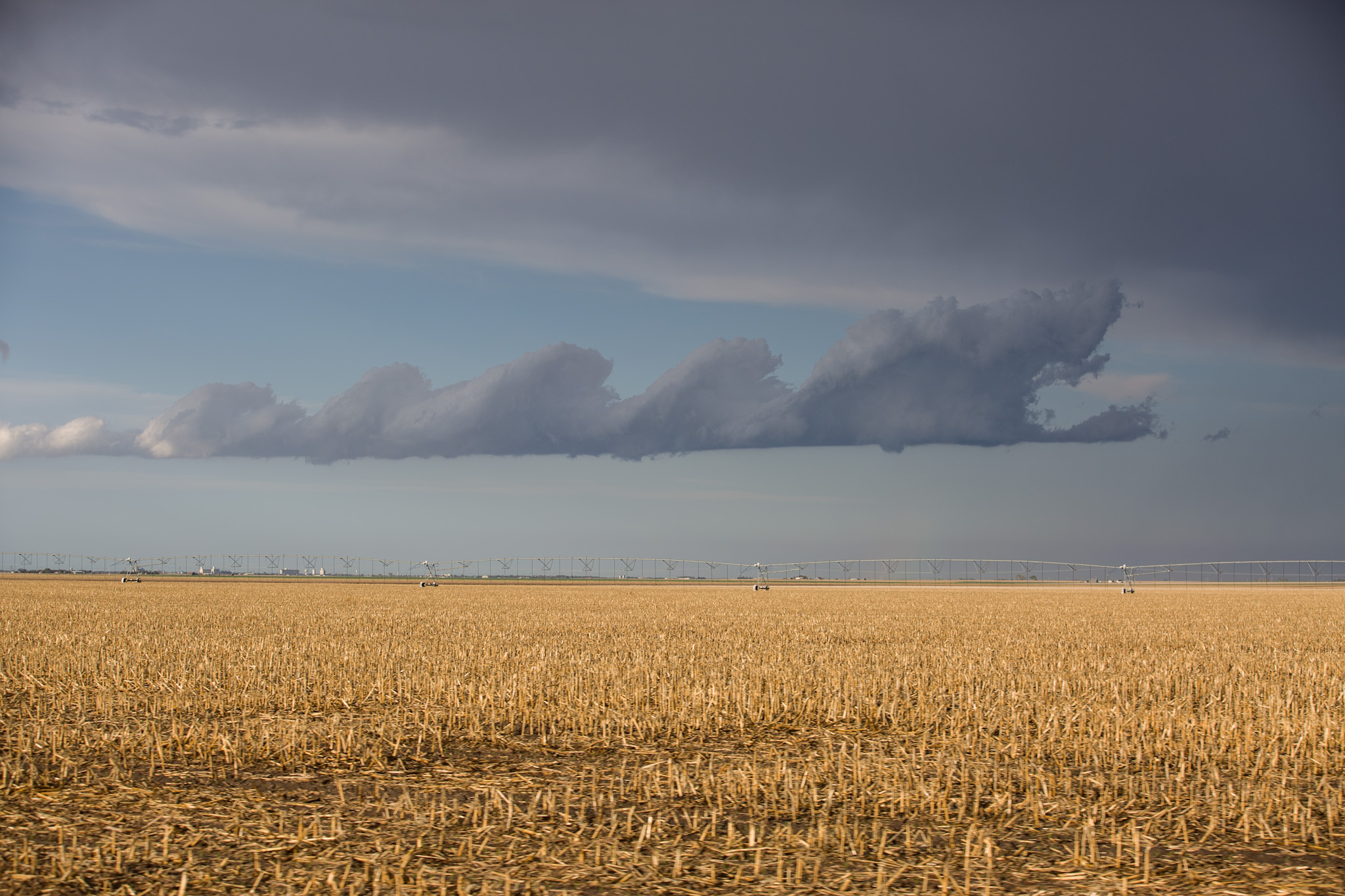
FInally, a third storm formed, feeding off the increasingly beneficial upper air conditions and the moisture which had pooled at the lower levels from the previous storms. This storm became a full fledged supercells and did attempt to produce a tornado. We had to run several times to escape the 4-5 cm hail stones.
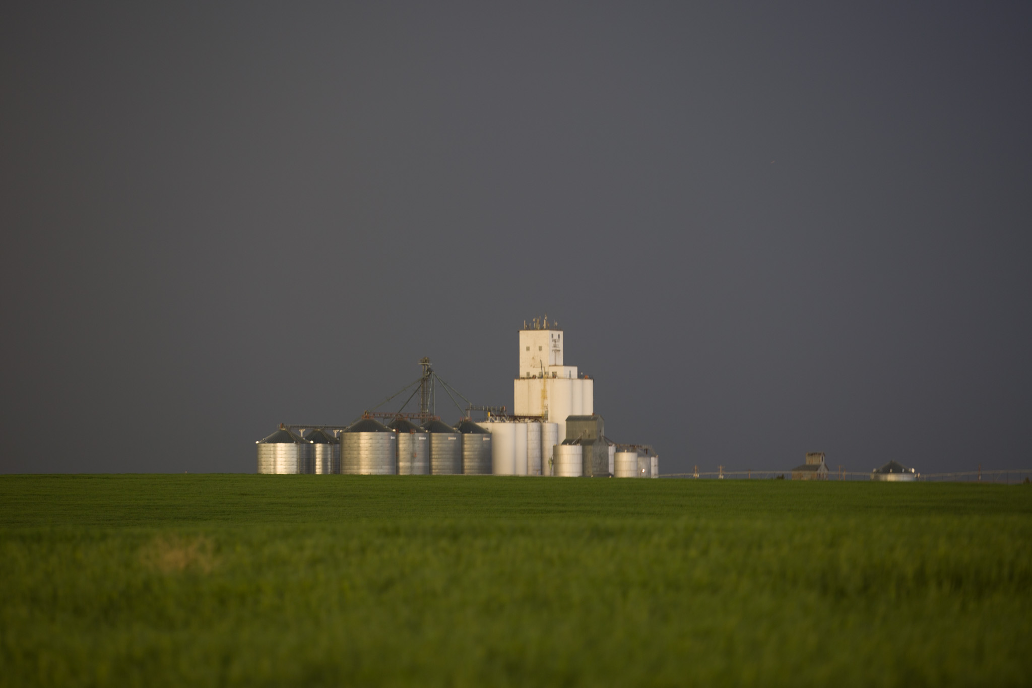
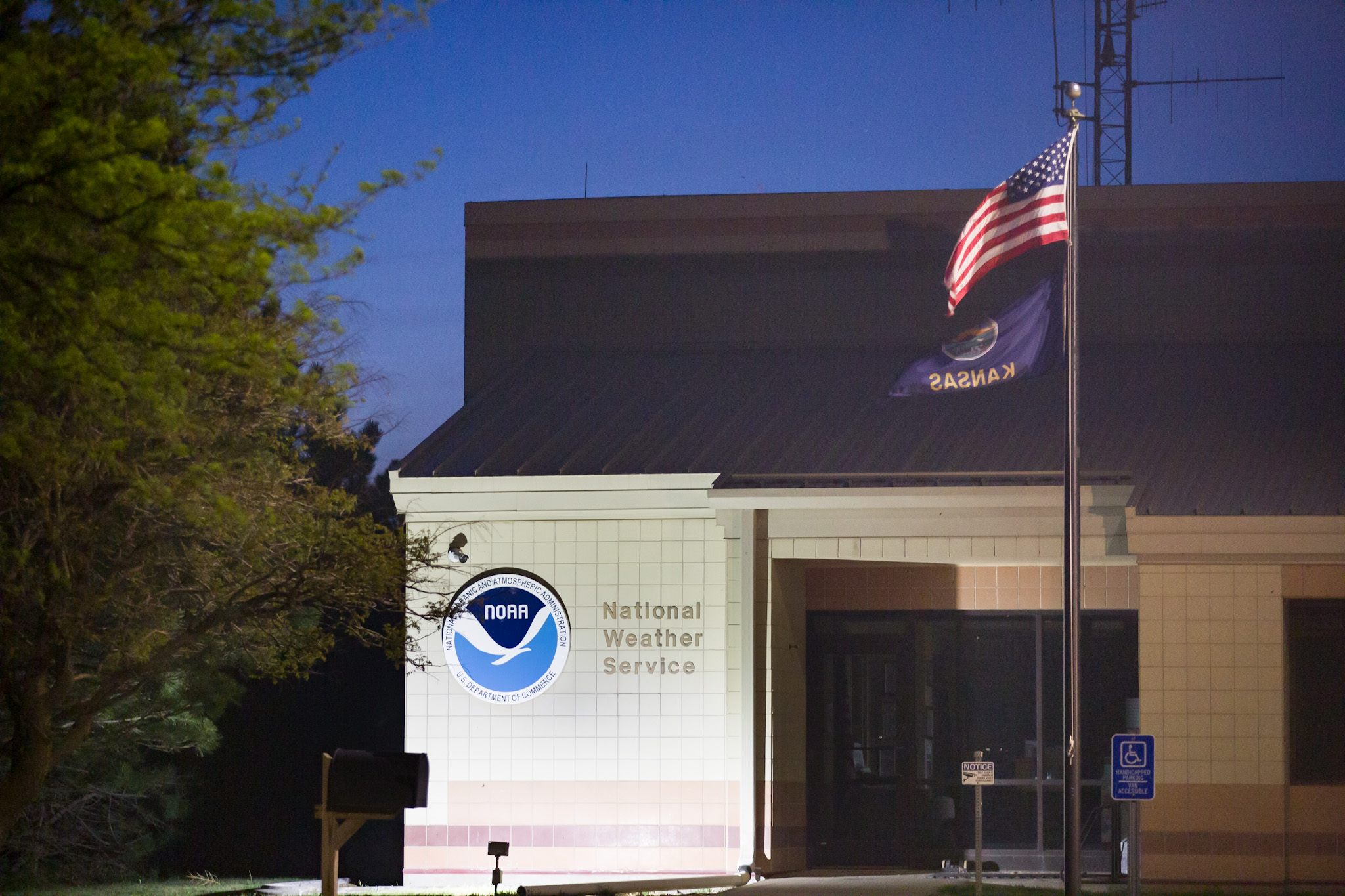
All in all it was a fun filled chase day. In the evening we visited the NWS office in Goodland Kansas and even saw fire fighters training.
May 15th
Today was an interesting day. We started the day off in Greenville, IL and quickly made our way into Missouri. The plan was to see what up and play the best looking storm. There was a good indication that some of the best potential storms would in fact be in the SE of the state near the Ozarks and that is simply an impossible area to chase due to the terrain.
We chased a couple storms that popped up near Lebanon, MO that has very weak mesocyclones. The storms were what would be defined as miniature supercells due to their relatively low tops and lack of lightning coupled with a weaker representation on radar.
After a rather boring chase in some less than great terrain we decided to call it a day and head west to Kansas for a possible play near the Colorado border. As it turns out, a storm cell working north through Bloomington MO suddenly had a brief spinup, a QLCS type tornado signature deep within a less than impressive storm.
We raced over to the nearby storm while we were less than 20km away from the center of rotation when rotation first appeared. Unfortunately as we finally were within the storm where the potential tornado would have been, everything simply dissolved. What was a tornado warned storm quickly became a flash flood producing storm.


May 14th
This was the first official chase day and we actually had a 2% tornado risk according to the SPC map. The environment was dominated by a weak 500mb flow with enough support for some supercells and organization.
As it turns out, the environment was pretty good and there was a substantial but of energy with CAPE values approaching or exceeding 3000 j/kg.
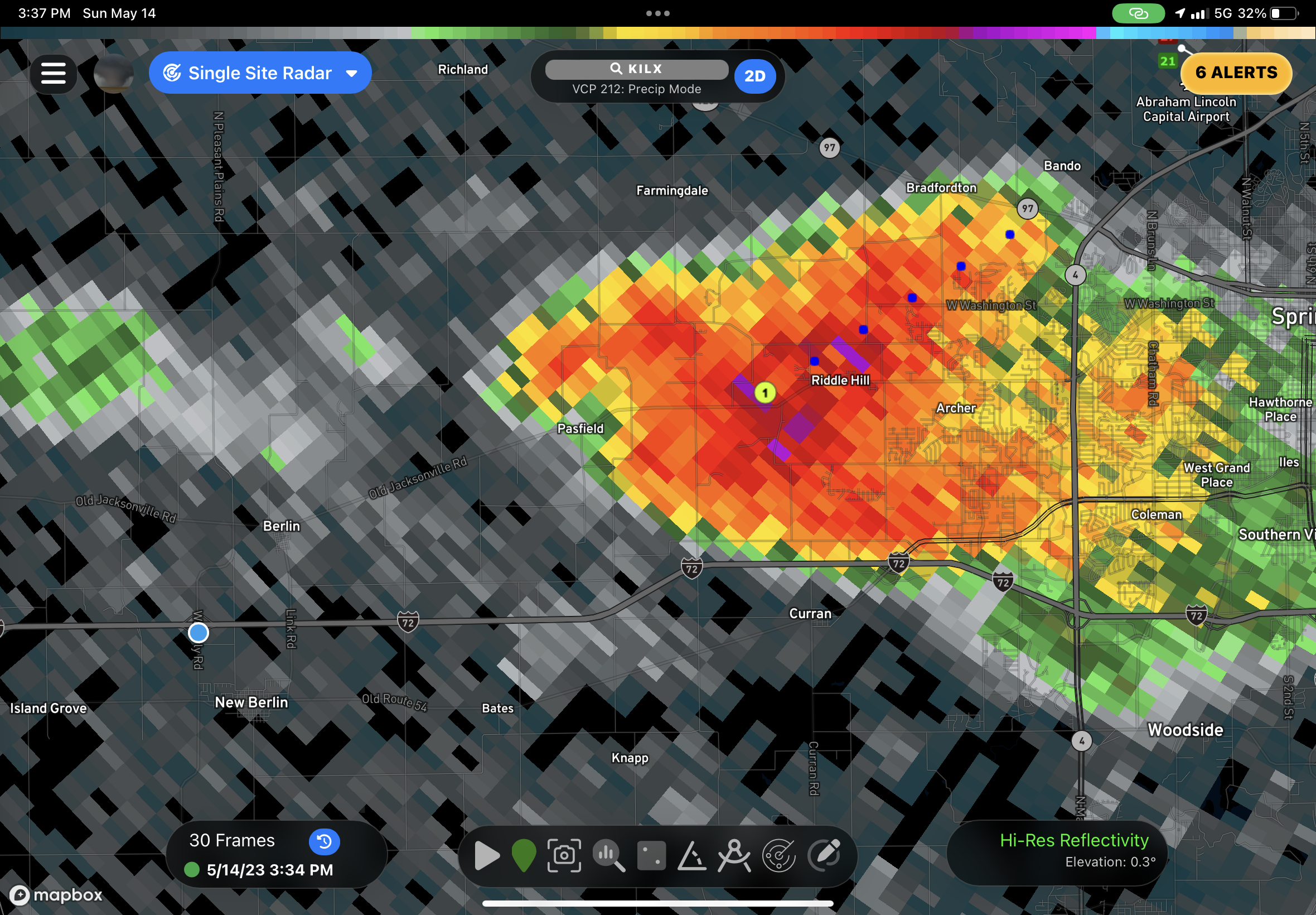
We started the day in Springfield IL and I chose the spot where I expected the initiation point to be. As it turns out, I suggested we move west due to a receding boundary. What a silly mistake, the stom fired literally exactly where it was supposed to directly west of Springfield, so I had to give MaryAnn the news to turn around and head 30 minutes back east.
It was a fairly easy intercept. The storm was initially outflow dominant but as the day wore on, things became far more organized. A second supercell developed east of the primary storms and we eventually moved on to the eastern storm as outflow killed the western most storm.
Towards the evening hours, things were really beginning to crank but unfortunately for us (lucky for Vandalia IL) nothing beyond some hail and wind was produced. A pretty fun chase day given that things well exceeded our expectations.
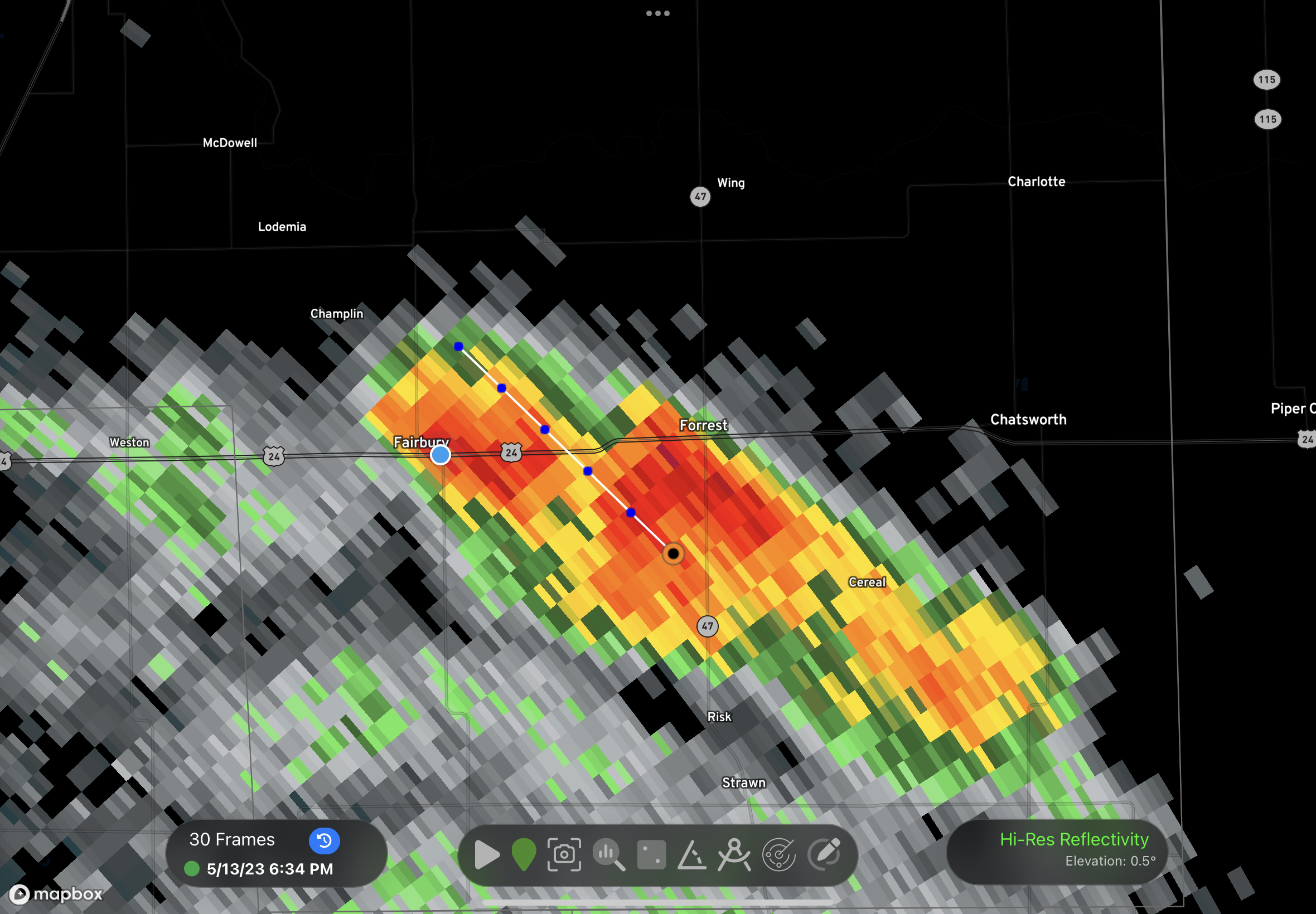
May 13th
Today was mainly a day of driving. We crossed the international border around 10AM and picked up our friend from NZ who was waiting at DTX after a long flight.
There was a slight risk of rotating storms in Illinois and the SPC accordingly included the target areas we were thinking of in a 5% risk area.
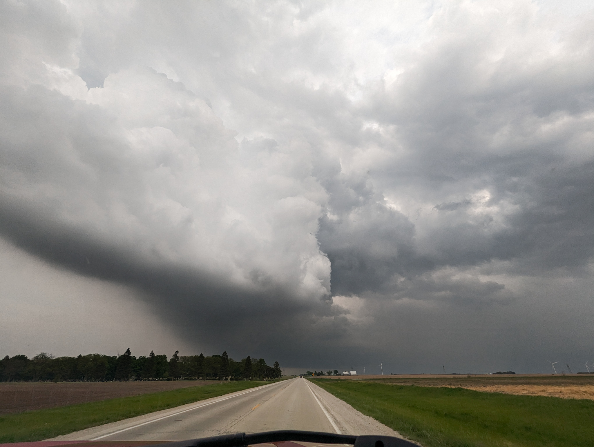
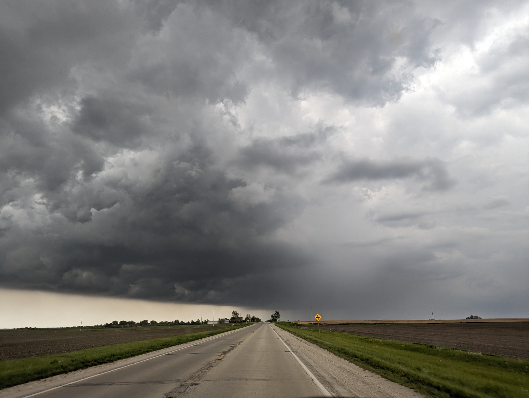
As expected, the best storms remained well outside of reach in Iowa and a couple tornadoes were reported.
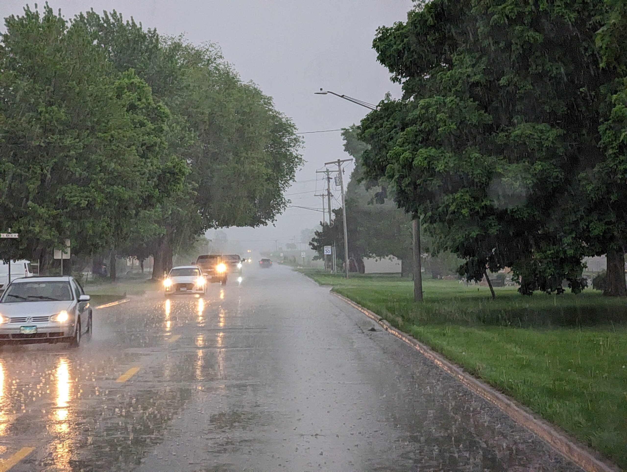
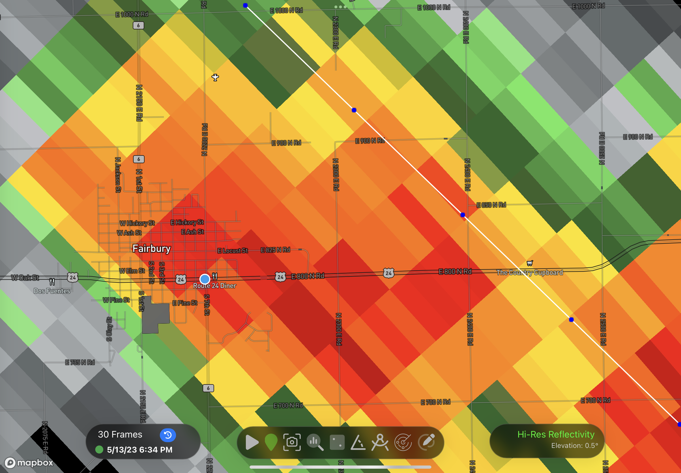
We did encounter and investigate a few non-severe storms north of Bloomington IL, but they were underwhelming as expected.
Tomorrow may prove to be a much more interesting day although the pattern at the moment is not conduce to any widespread severe weather events.