May 18th 2019 – Woodward, Oklahoma
Started the day off with tornado warnings to our south in Texas as a line of storms went up. We spent the night in Miami, Oklahoma east of Oklahoma.
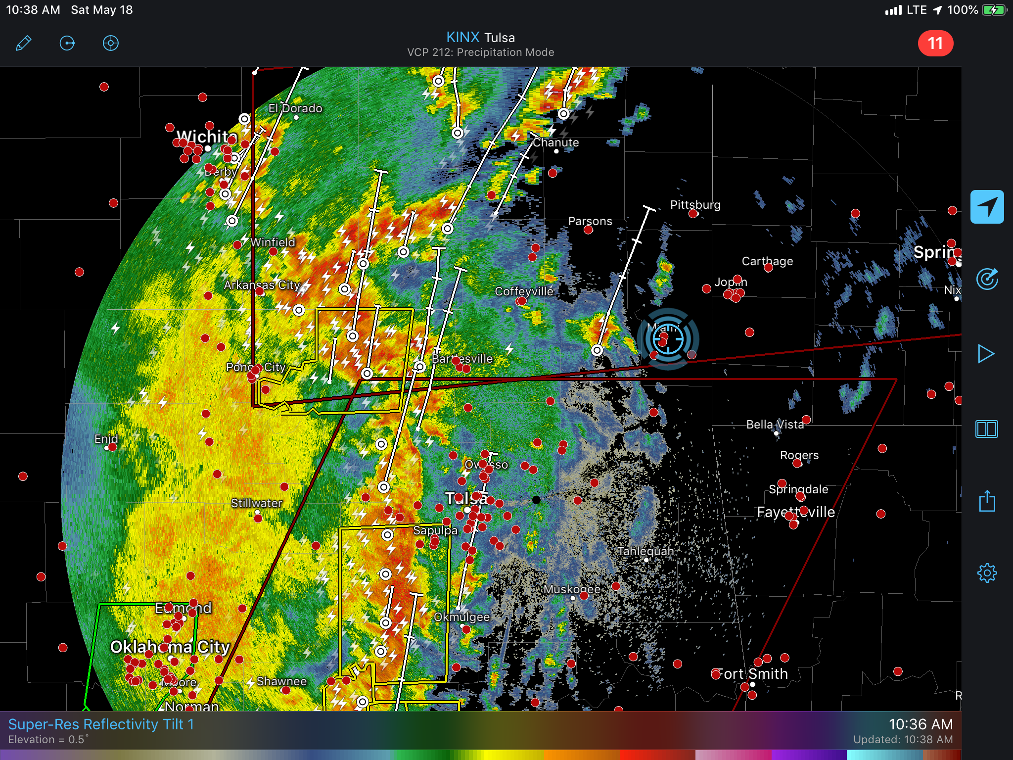
We targeted Woodward early on and chased a few storms very briefly as we punched through the MCS / QLCS that was expanding north from southern parts of Oklahoma and North Texas. Despite a couple brief mesocyclones showing up on radar the storms lacked any serious surface interaction.
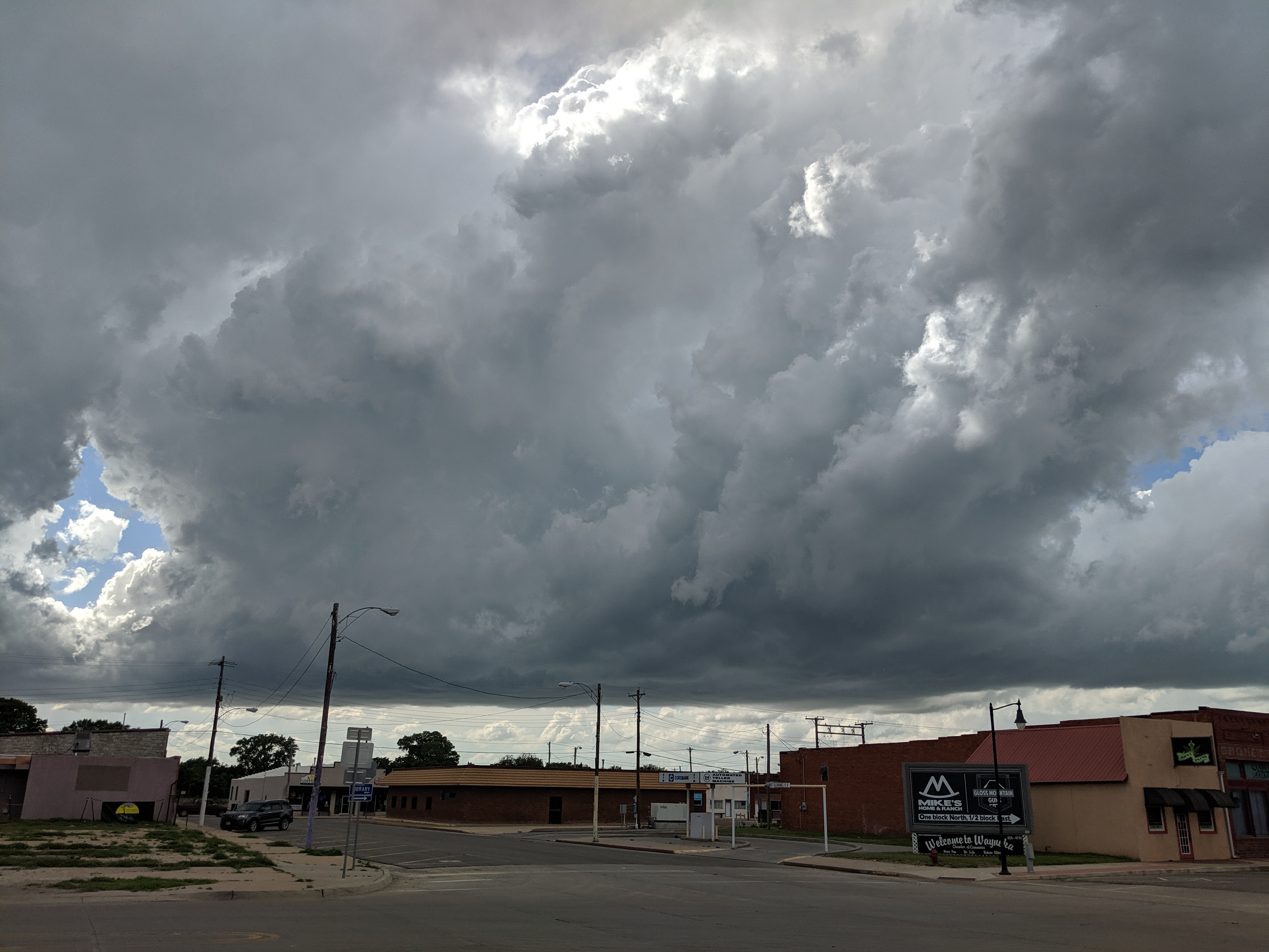
After some fine tuning we ended up in Waynoka and watched the storms initiating literally over the town.

The storms looked good initially but it became apparent pretty quickly that the energy.values had been over estimated and the storms lacked good mid level and upper support despite low level wind fields and even the surface flow supporting discrete supercells.
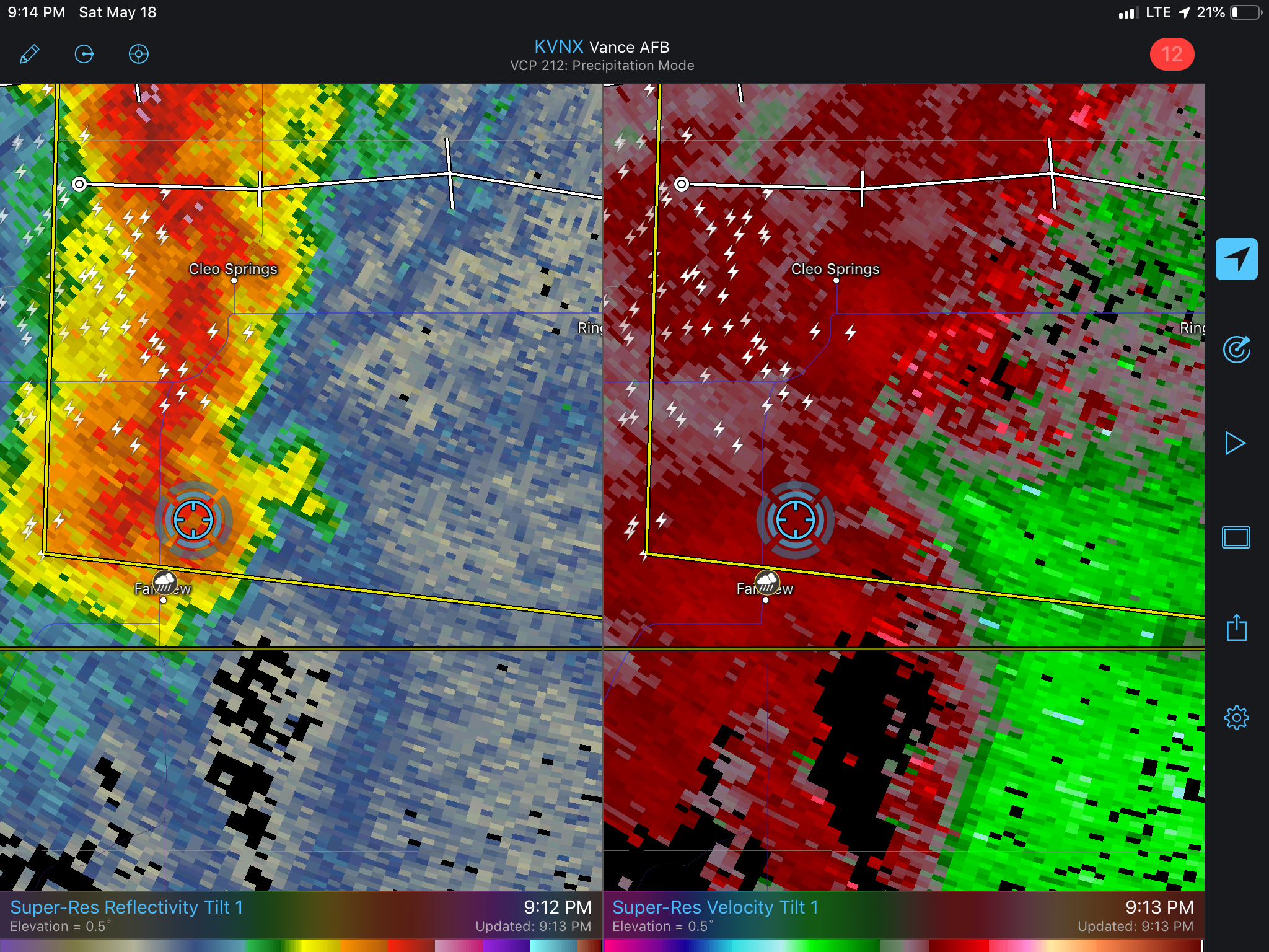
We watched a few storms, one which became photogenic and even had to wolf down dinner as a storm with a couplet blew through.
Heading to Woodward for the night, update with photos to follow.