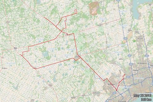
May 22nd 2013
On April 6, 2014
- 2013 Storm Chases
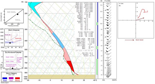
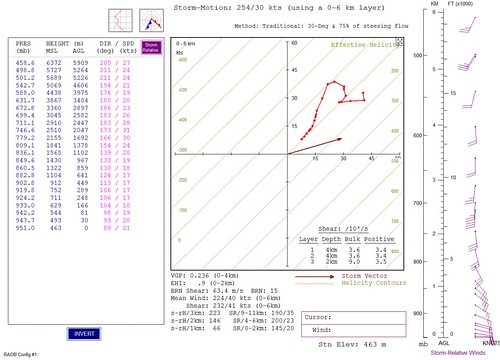
This is the technical stuff I promised. You can see the real world cape is only marginal at less than 1000 j/kg and the storm would only top out at 8.5km or about 35,000 feet which is not very high considering that these storms usually hit 50,000 feet or more.
Furthermore while the max UVV hit 44 m/s overall, surface based LI's are only -2 which in the grand scheme of things suggest sluggish upward motion.
While this type of setup does not constitute cold core convection it's indicative of mini low topped supercells.
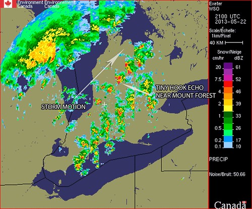
These are 30 minute radar cuts showing the mini supercell and it's evolution from grand Bend onward. I'm using the data in snow mode to exemplify the structure, the standard rain mode produces returns that are too soft/weak.
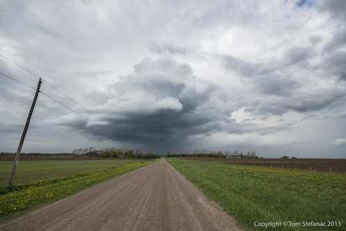
You'll see a distinctive hook echo like structure near Mount Forest just as the storm was producing that beautiful wall cloud.
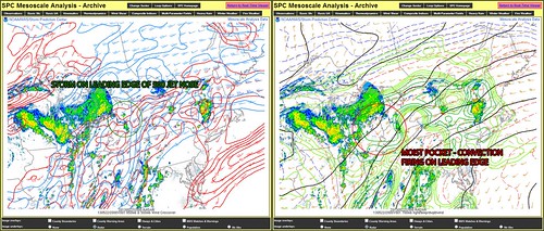
Despite a lack of energy but good storm relative shear, the storm for a brief time was perfectly positioned right along the 500mb jet nose allowing extremely good ventilation. Again, this would have been when the storm was producing the wall cloud near Mount Forest.
Unfortunately as it continued to move northward it moves into less favorable low level winds.
The storm was also riding along the edge of a 700mb moisture plume which was providing clear skies and strong daytime heating south of the storm cell. This allowed the southerly inflow to remain warm and moist at not only the surface but especially in the mid levels.
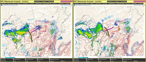
This is probably the tell tale sign of why the storm did not produce anything more than pretty clouds. One thing to note is that the SPC Meso Analysis always over estimates CAPE values so don't take the numbers at face value, just understand that there is more and less energy in certain places.
The storm fired off the boundary wave pushing northeast from Michigan and was supported by the 700mb moisture plume seen previously, this is delineated using the yellow line. At the surface ahead of the wave a warm front was pushing north which is delineated by a pink line.
The maximum shear values were attained directly along this front due to enhanced forcing at the surface.
Initially models showed the storms to fire about 1 hour later than they actually did. What this meant is that the supercell entered the Mount Forest area at 4:30PM as opposed to 5:30PM and as a result the surface front which was lifting north was barely ahead of the storm.
This meant that there was less available energy than forecast, it also put the storm in a position where it was riding and potentially lifting (becoming slightly elevated) as it rode north of the boundary on the 500mb jet nose and eventually fully outpaced the forward motion of the surface warm front.
This explains why the storm was ingesting so much crap by the time it was closing in on Barrie, it was basically either sitting directly on or actually ahead of the surface front by that point.
So ultimately the storm fired one hour too soon and did not have enough environmental energy or run time so to speak to spit out a funnel.
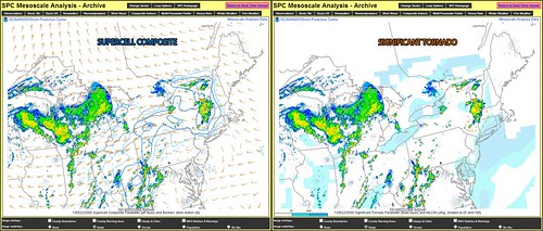
Last image, and maybe the most interesting, note the storms position relative to the supercell composite parameter and significant tornado parameter.
This just goes to shore, severe weather and tornadoes can be highly localized due to localized parameters, this is especially true in places such as Southern Ontario where boundaries are often plentiful and play huge roles in the development of severe storms.
