April 13th 2014
On April 13, 2014
- 2014 Storm Chases, April 13th 2014
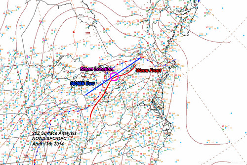
This was the first chase day for me personally. One day earlier some really nice looking storms effected the extreme portions of Southwestern Ontario but they arrived late and were a little too far for me.
Today, the storms were all popping along a warm front that was pushing north.
The main body of the convergence started in Michigan just southwest of Sarnia and spread north to Peterborough, Ontario.
Initially the front was making good progress but began to increasingly slow as it encountered the cold waters of the Great Lakes and open ground with increasing snow cover.
As convective waves moved through and laid down outflow boundaries this pushed south, against the mean flow and in essence the surface warm front began to retrograde with convective activity becoming increasingly more south as time went on.
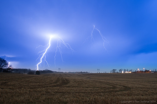
The storms were forming and travelling along a southwest-northeast axis and spitting out lightning immediately to my north.
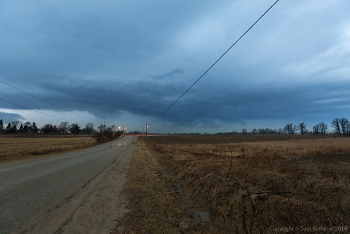
Initially I saw what looked like an elevated shelf with good inflow features but this feature began to fade rapidly with the evening light.
When I jumped out and took this photo it had all but completely vanished.
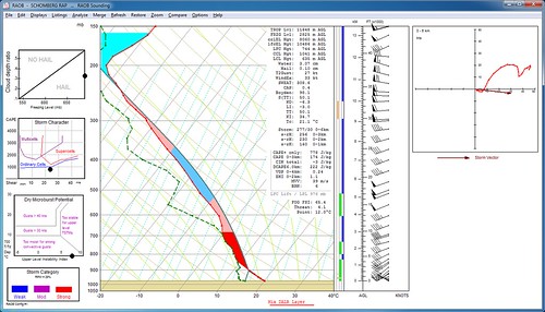
This was the MAPS- OP40 operational meso-analysis sounding for a spot just west of Schomberg.
You can see fairly shallow instability from the surface up to about 10km or 32kft.
Temperatures at the cloud top were easily into the -50's and the usual minimum for lightning is -30C or colder aloft.
Surprisingly there was no hail, this was likely due to relatively high freezing levels of 3km or 10kft coupled with weak updraft speeds.
Hail is typically a common occurrence with storms in April and May.
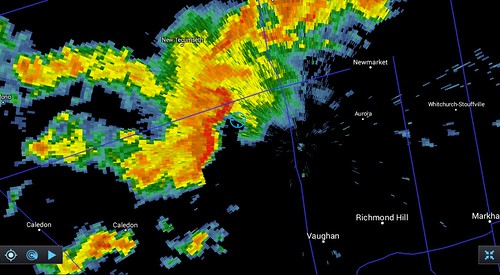
The main storm cell I was interested in was barreling due east from Orangeville. Initially I was not sure if it was going to be on the north or south side of highway 9.
As it turns out, the storm sheared-off from the ENE track and began moving due east putting it south of the highway and right where I was sitting.
It had a double bow appearance, but there was little if anything in the way of wind at the surface.
By this point, I am pretty sure everything was elevated.
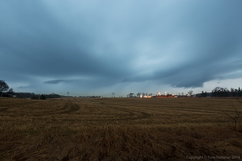
This was what the storm looked like in person. At some point, it obviously had a surface based shelf cloud, but there was plenty of outflow from previous storms hanging around and big pockets of snow cover in places creating swaths of ground fog.
Before I punched through one of these air cooled outflow boundaries the temperature was about 21C and it promptly dropped to 15C within the boundary.
So there was little left in the way of surface interaction as is usually the case with these early season storms.
