Posts Tagged: featured
May 26th 2014 – Tornado Alley – Day 10
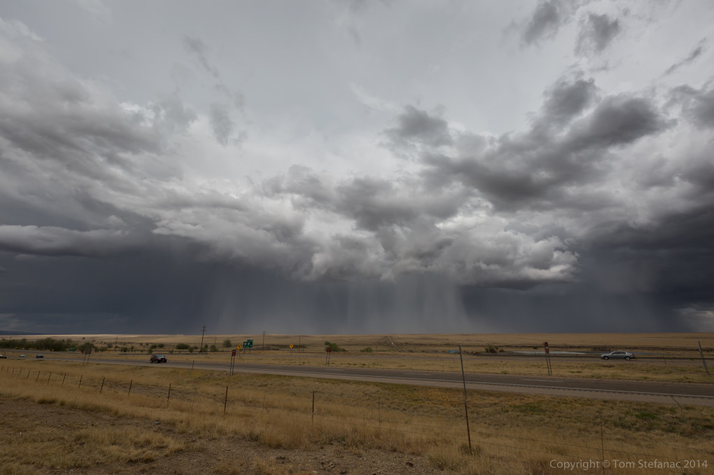
Storm began to fire off a boundary early in the afternoon between Andrews and Seminole Texas while slowly drifted east-southeast. The first storm I intercepted was just south-west of Lamesa, TX. I took me a little longer to get into position since I had to drive up from Uvalde, TX nearly 6 hours away.
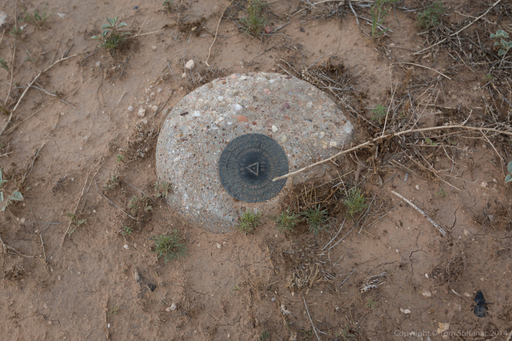
While taking photos I almost tripped on this stone, I look down to find it was part of the U.S Geologic Survey. Interesting.
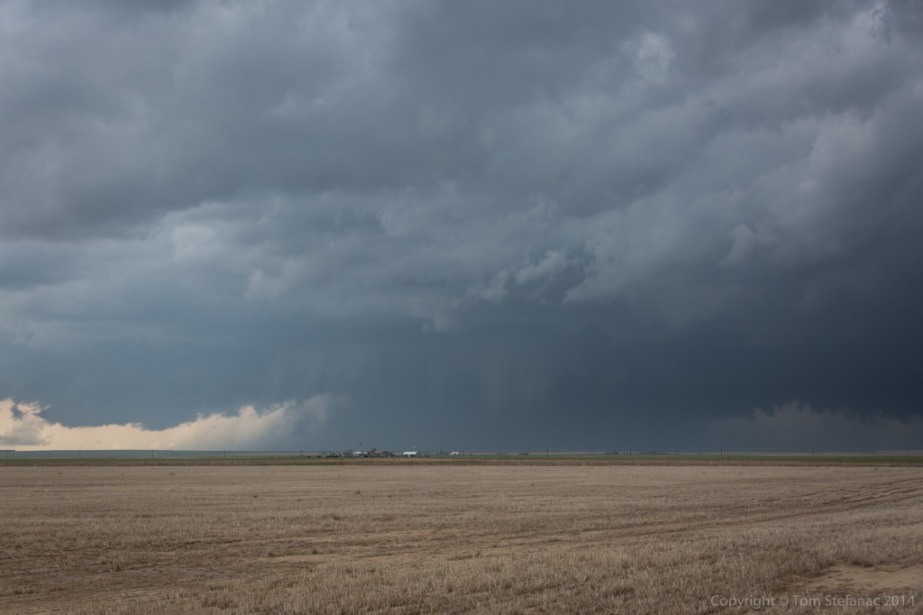
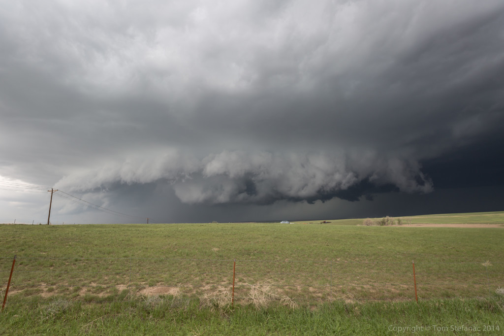
As the storm approached my position it was a little messy looking but the inflow was growing and there was a lot of upward motion. The core also had this green look to it.
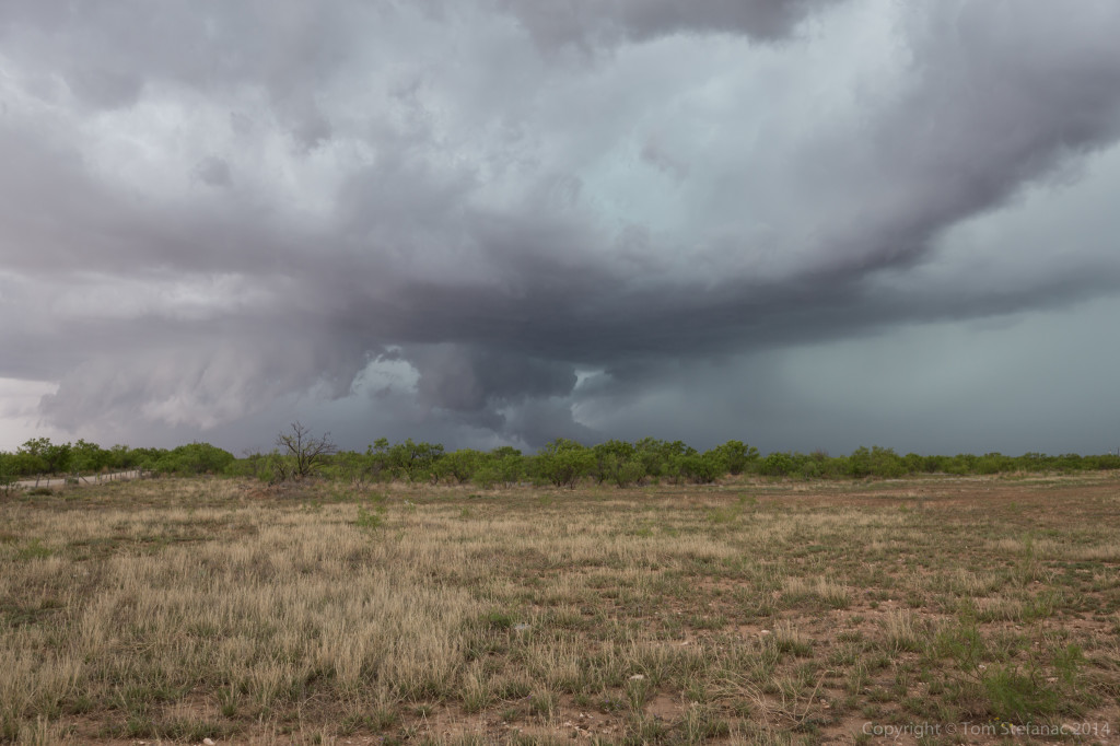
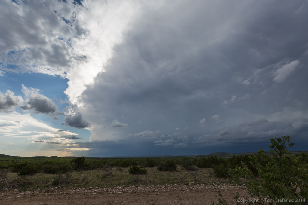
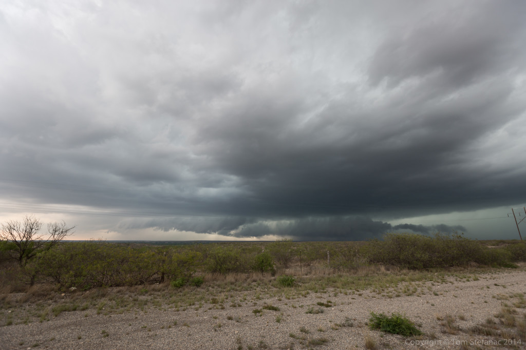
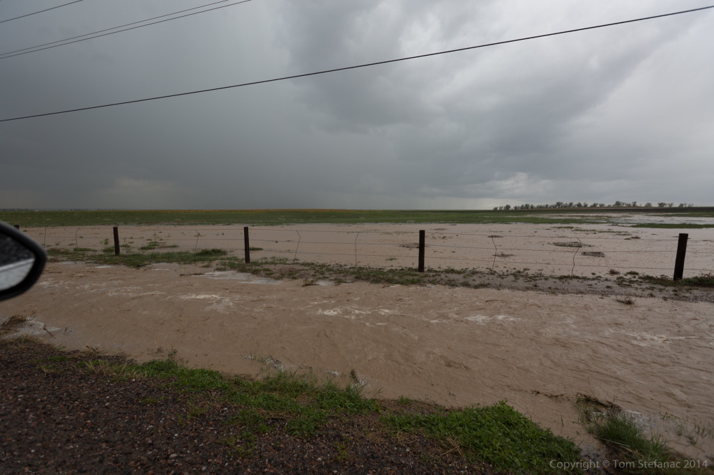
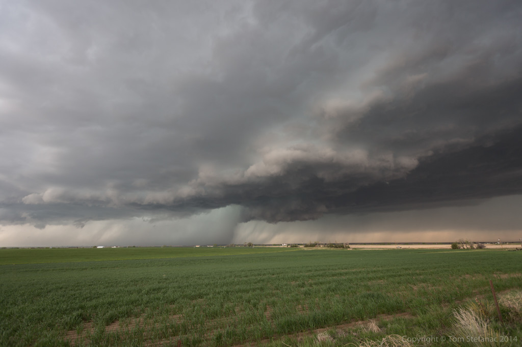
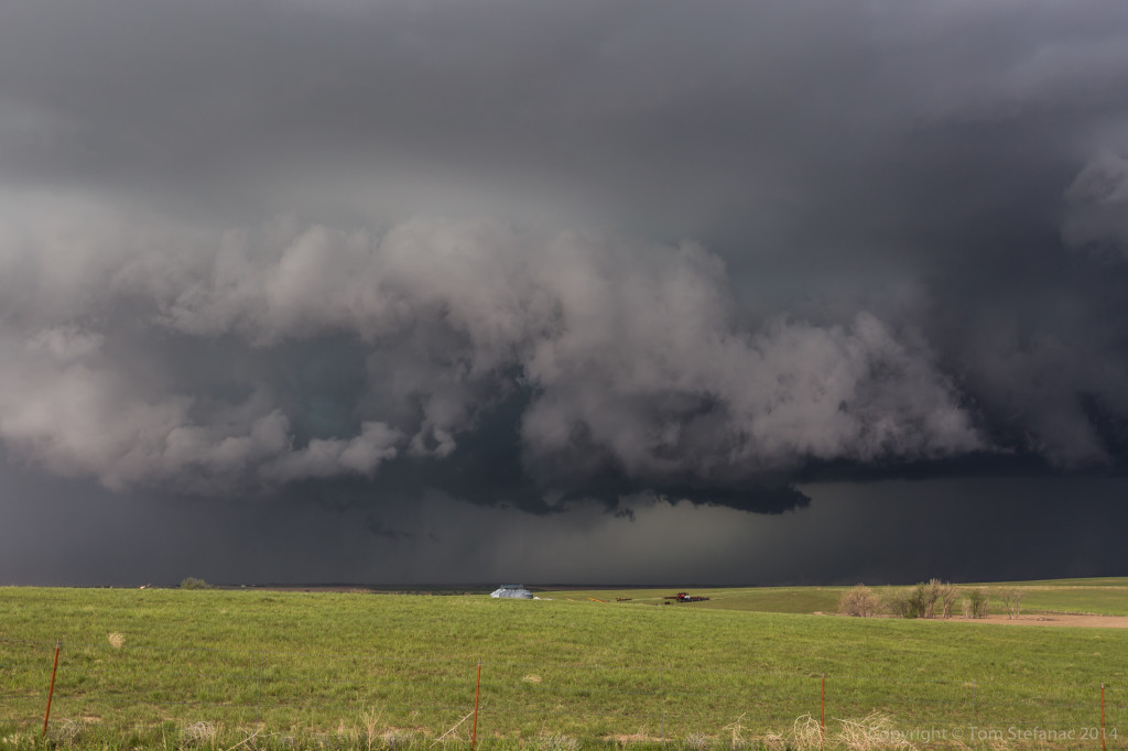
Falling south and stopping just north of Big Spring, there was an interesting inflow feature, almost like a tail that was growing and being blocked by a falling rain curtain that was wrapping around.
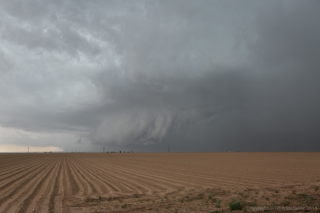
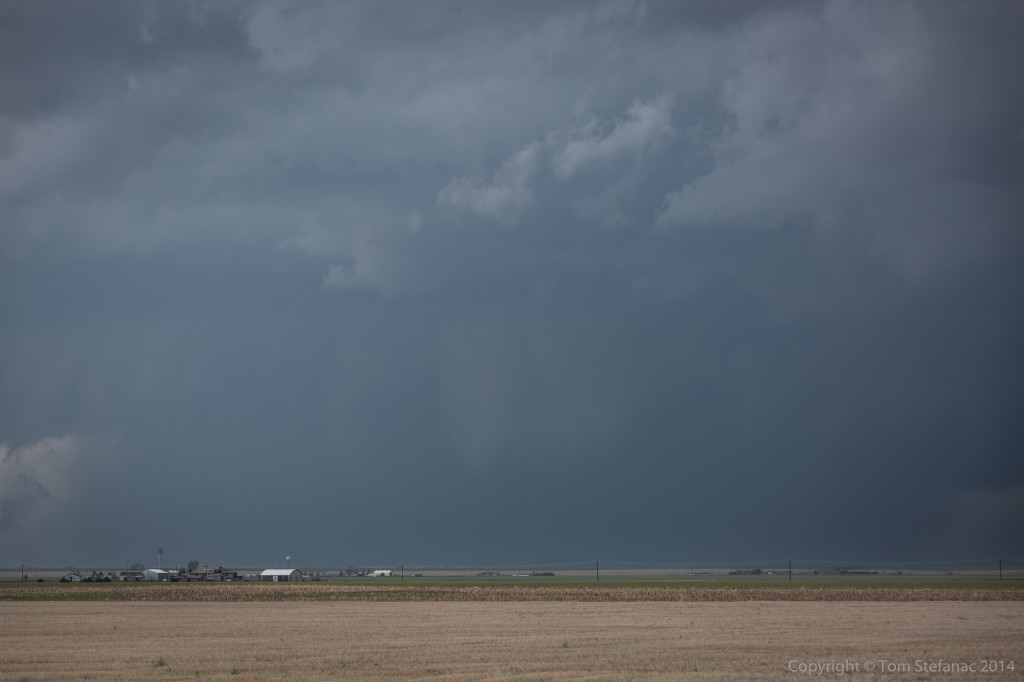
A couple minutes later the feature was completely obscured but the storm was really hugging the ground and the gate to gate rotation on radar was tightening up.
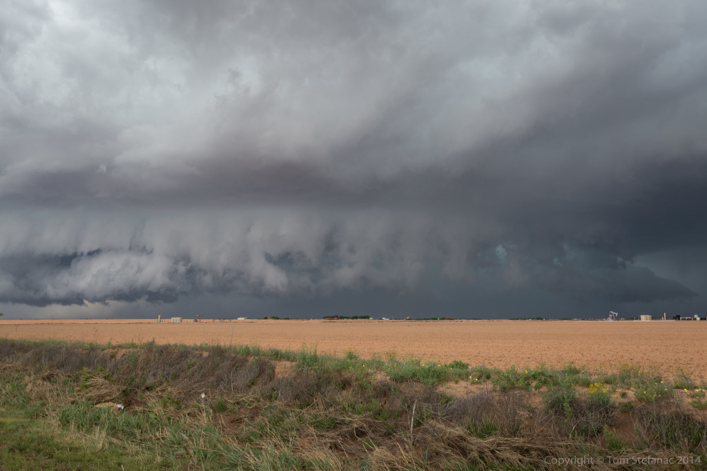
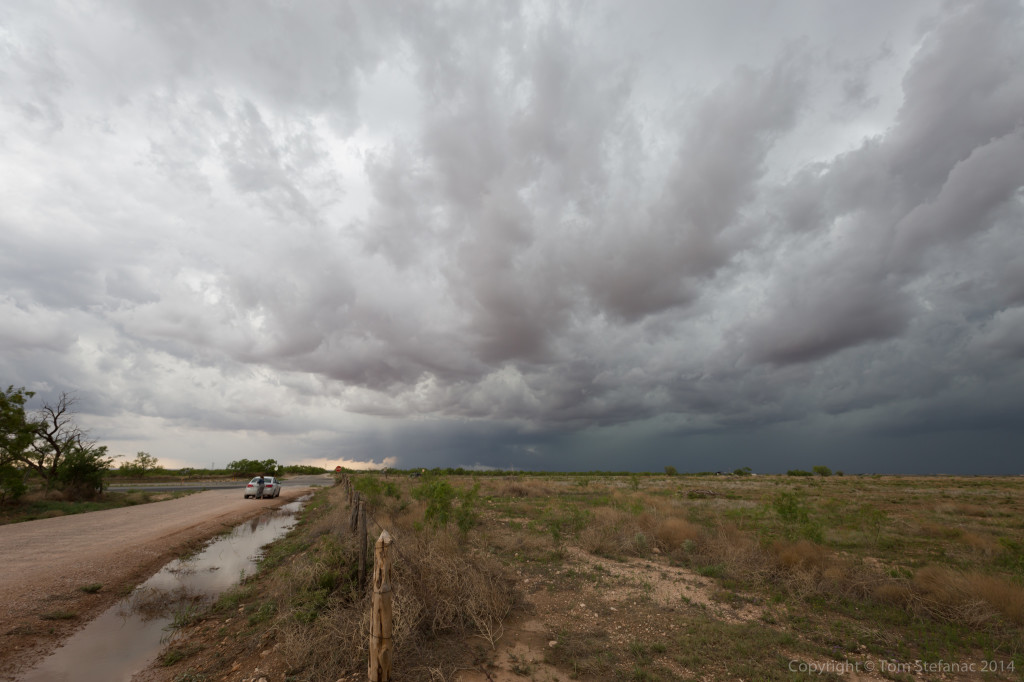
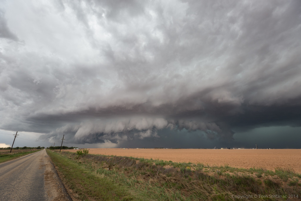
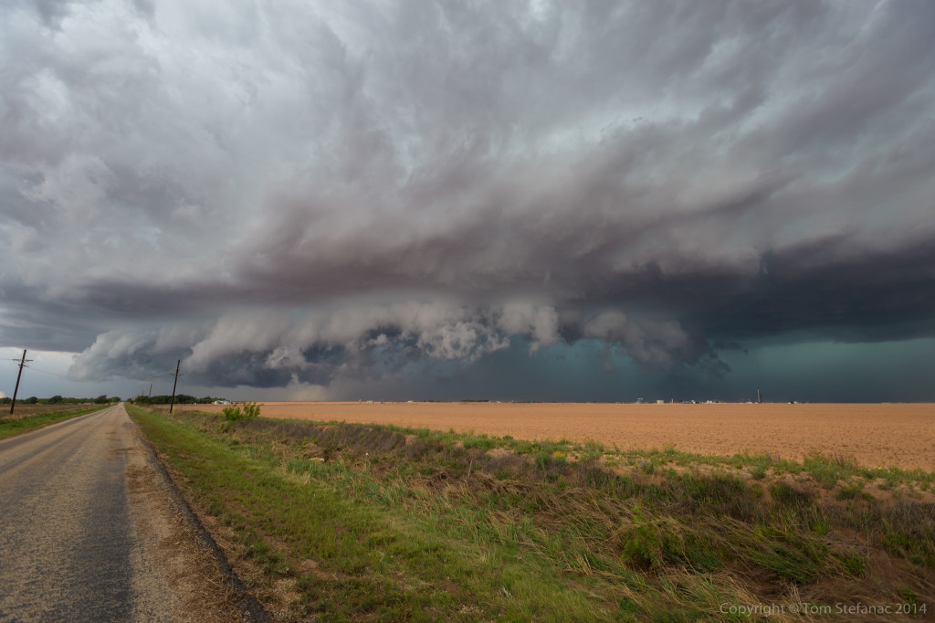
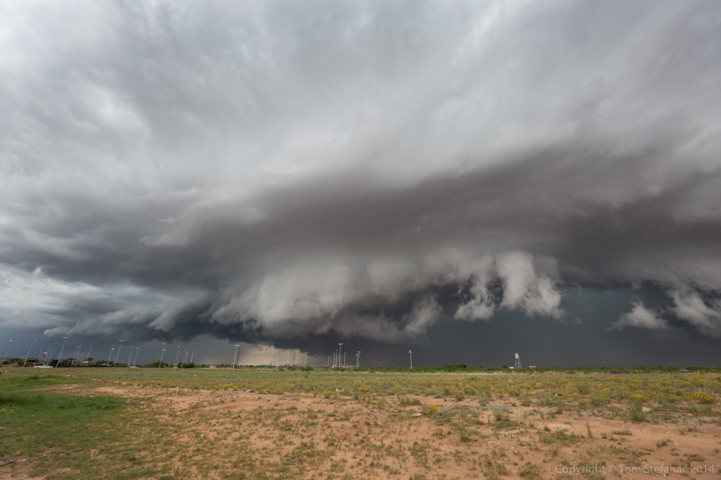
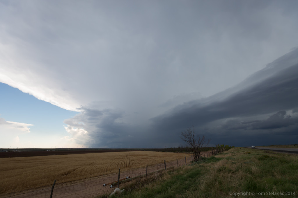
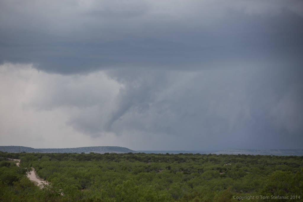
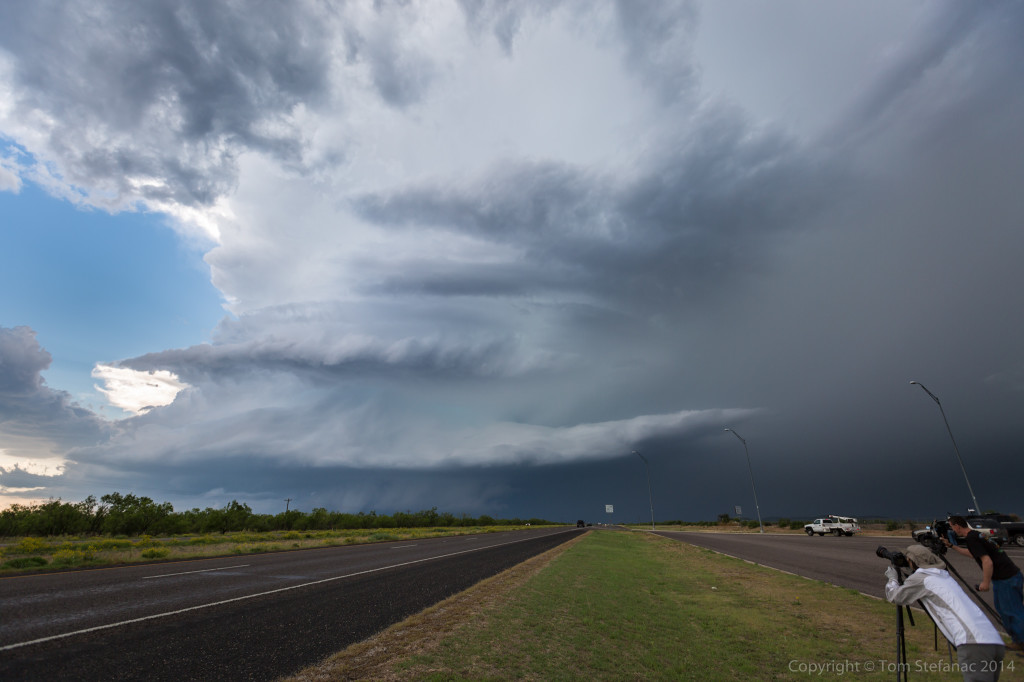
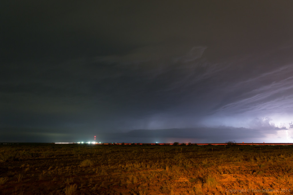
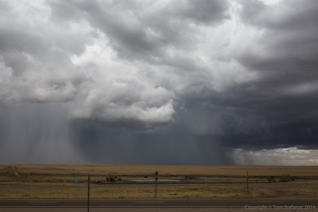
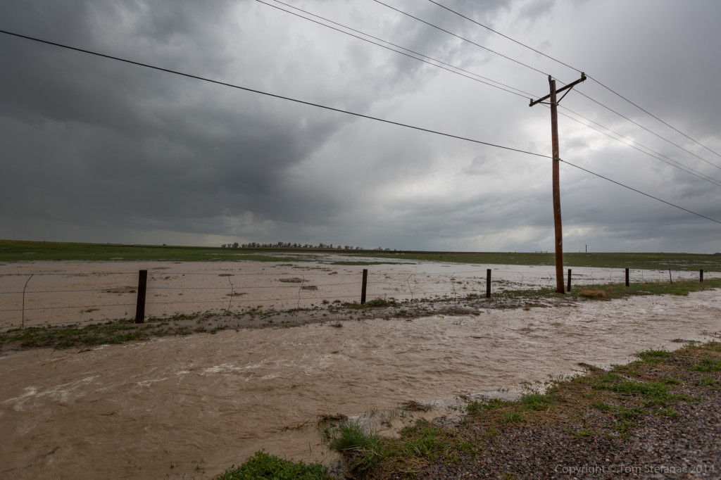
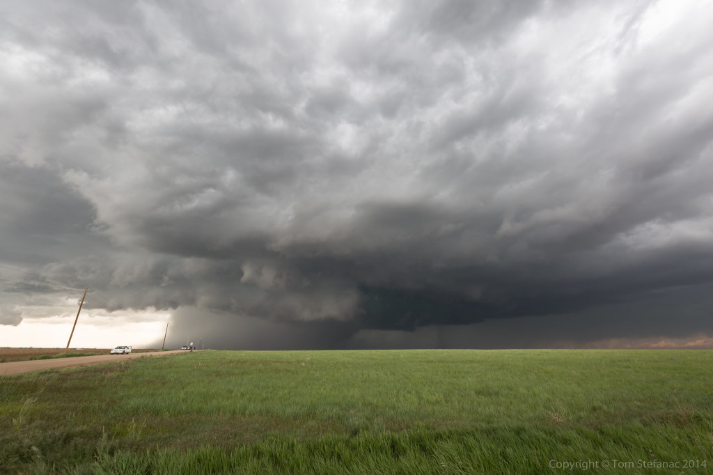
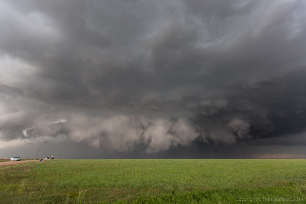
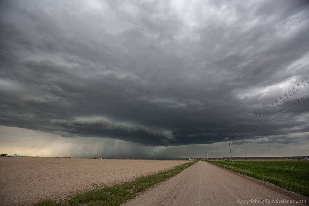
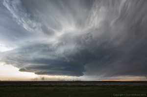
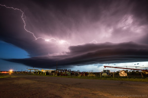
Shifting south once again, the storm continued to morph and became this scary but colourful glob of inflow, outflow and supercell structure painted in the sky against a brown field lined with grass.
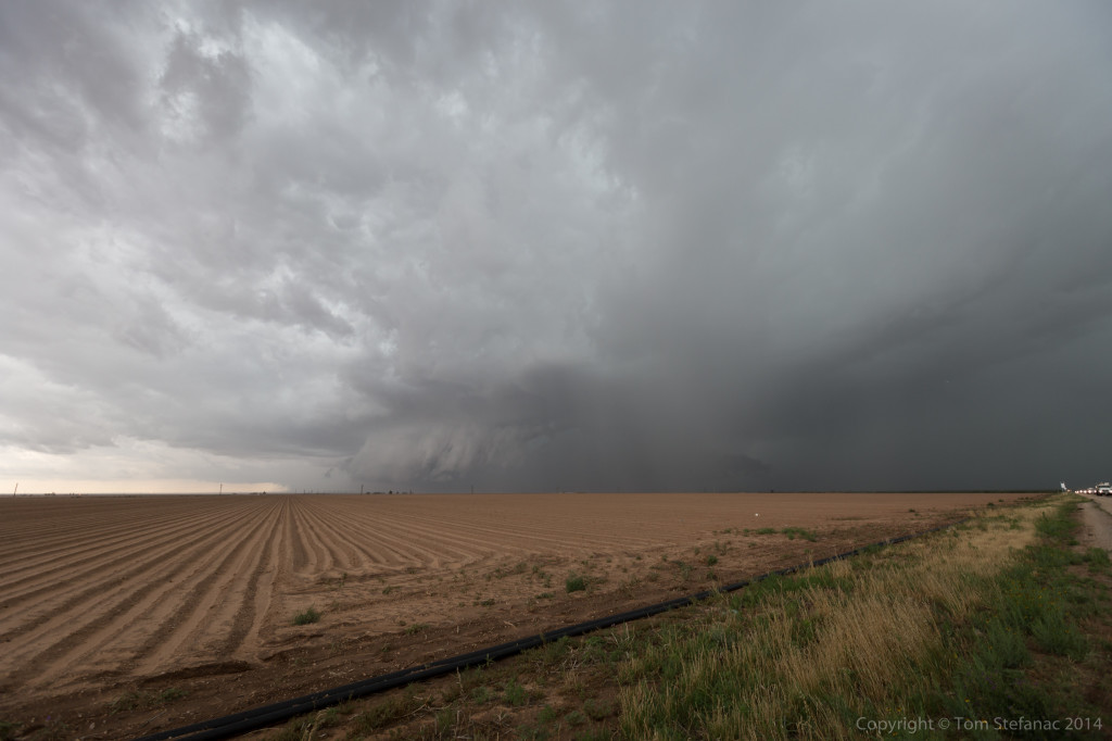
A clear inflow notch was developing on radar and very visible in person underneath the semi-visible vault. By this point, the storm was beginning to pull south hard, drifting towards the town of Big Spring directly. Initially it looked like a clean miss but now the storm was really shearing off and trying hard to go south.
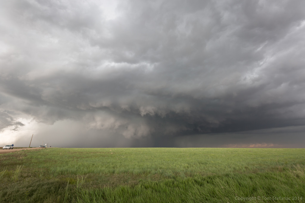
The storm continued to head towards me and I stuck around for as many photos as I could before having to move!
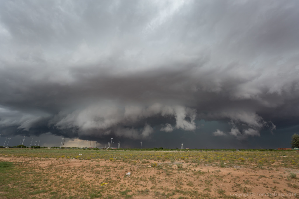
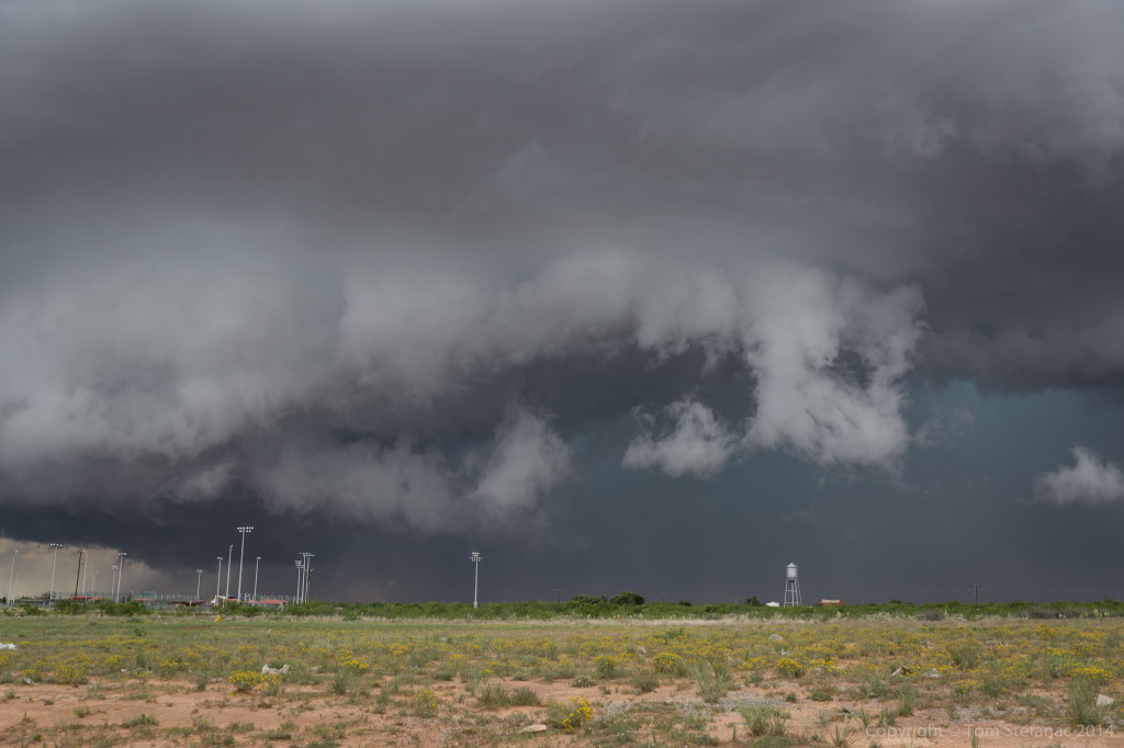
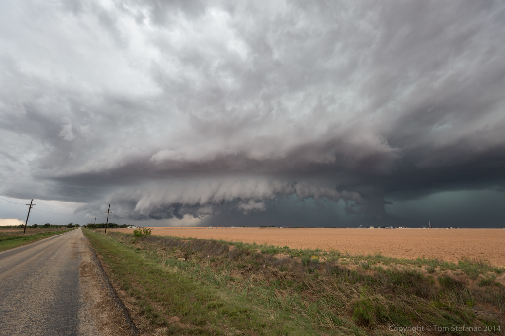
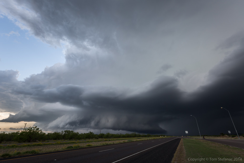
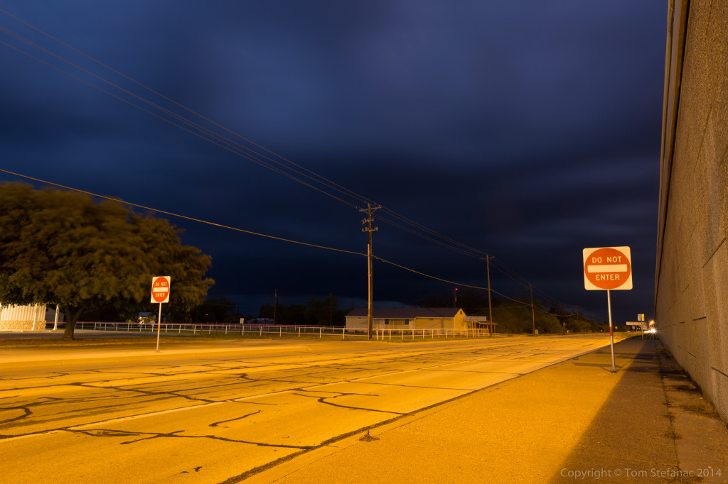
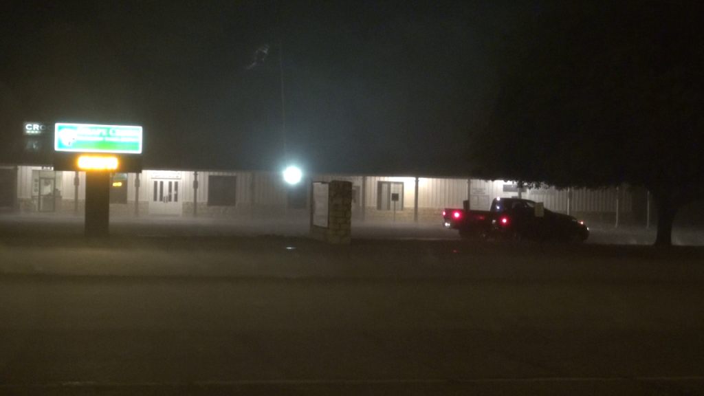
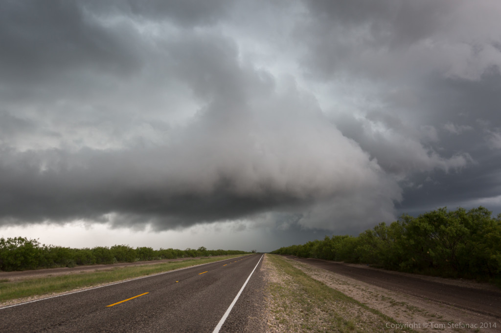
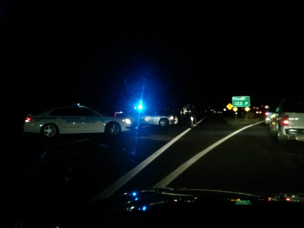
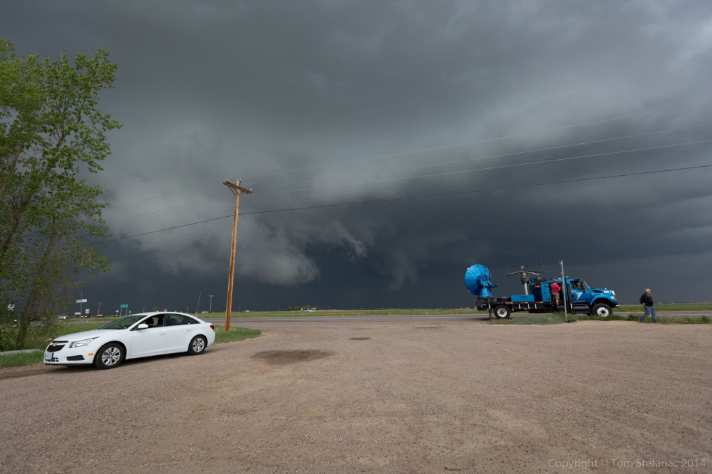
Unfortunately finding a clearing in the town of Big Spring was not easy since it sort of sits in a valley and it is a built up town. The already busy streets were also now deluged with chasers bailing south. I was able to find this view behind a tractor supply company.
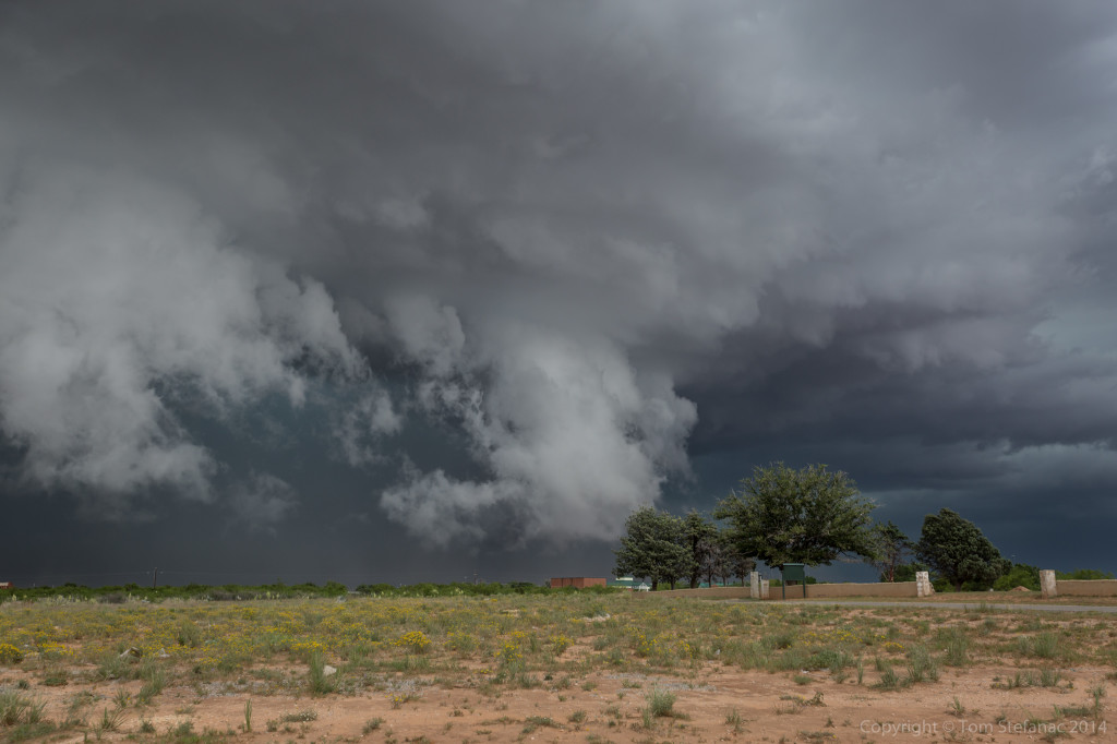
Again, there was incredibly strong inflow into the notch just behind the trees in the above photo. The scud was also rising blazing fast! The storm was absolutely ready to produce a tornado except it was going to be buried in rain.
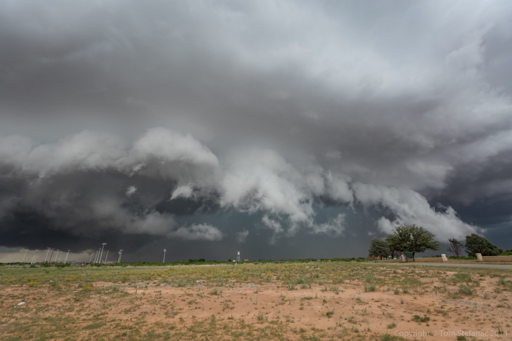
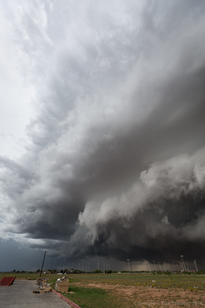
These shots, especially the vertical perspective look gives an idea of how abrupt the synoptic environment, or in this case meso-scale environment transformed into a storm scale environment. Also, this is a super wide angle lens, about as wide as you can get before your into a fish-eye, so despite the storm looking far away, it was actually almost on top of Jen and myself!
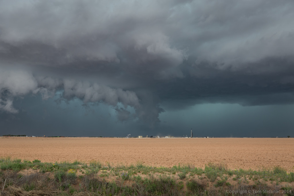
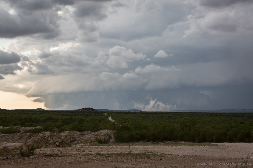
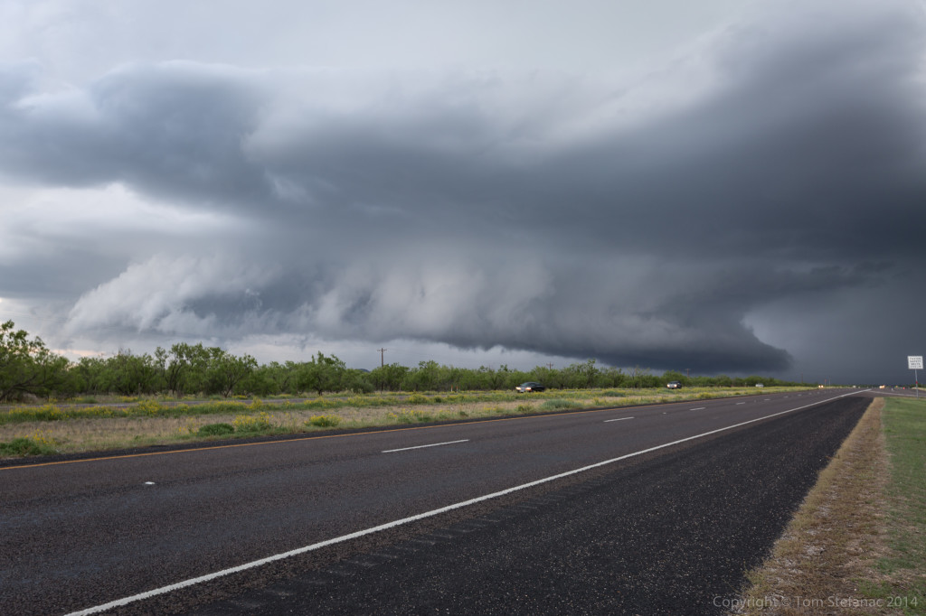
Eventually the original storm, we’ll call it the northern cell, just became to difficult to follow. It crossed the interstate east of Big Spring and produce a rain-wrapped tornado. I’m not a fan of rain-wrapped anything, you have to be way too close to see those tornadoes, I’m picky and tend to go for the text-book cones, but I guess beggars can’t always be choosers!
The entire boundary which gave life to the original storm, was sparking off new storms progressively farther west. I positioned myself for the slow approach of the next storm in the line.
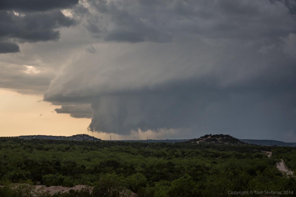
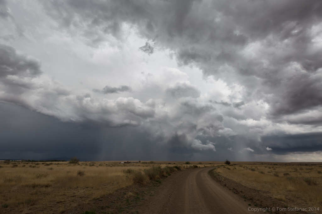
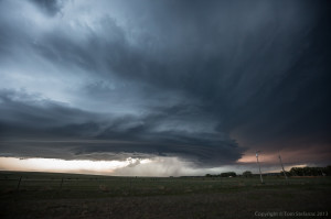
As the storm drew closer, some nice forward flank and rear flank structure came into view.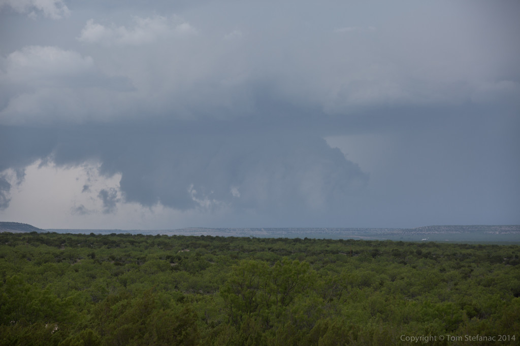
The storm also had a persistent wall cloud.
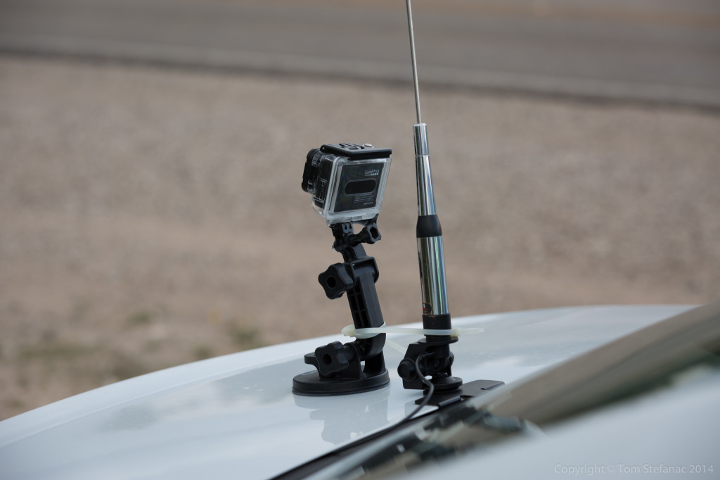
This was my GoPro setup at the time, that way I could get video of the storm as I was running away!
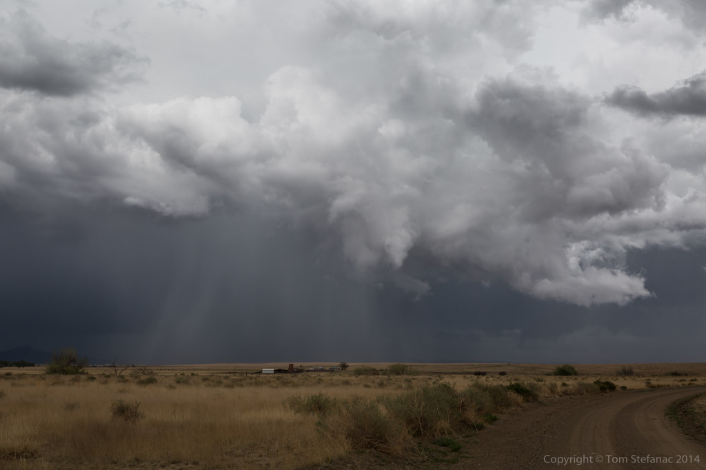
Every now and then the storm would produce a funnel-like cloud but I don’t think it ever produce a true funnel cloud that I could see.
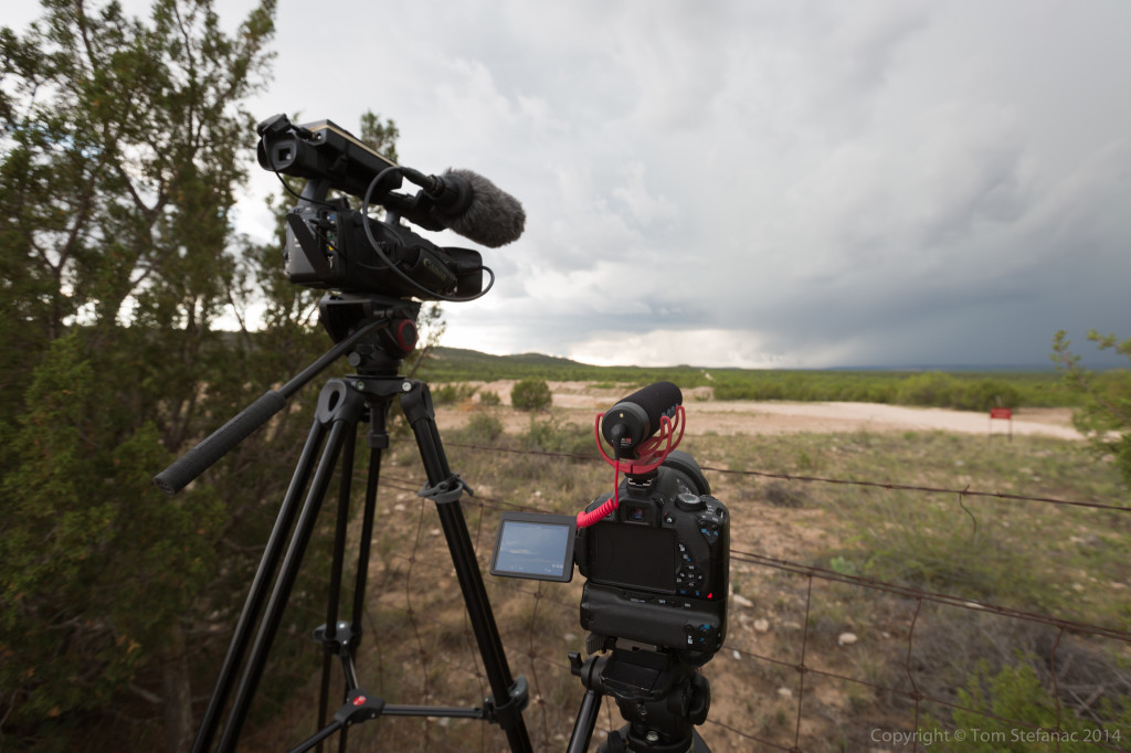
I was shooting both tight video and wide angle stuff. I’ll eventually have to put everything together in a nice timelapse.
I eventually had to re-position again as the storm began to take a bit of a dive south. There was a rest stop near Sterling City, TX which was a great spot! Silver Lining tours were also in the rest area as well as numerous locals.
I know many storm chasers try hard to keep people out of their photos, but I often like to put them in the picture. It’s realistic, and gives life to the environment as it was at the time.
The supercell structure was also awesome! You just don’t ever see stuff like this in Ontario!
Did I mention the storm had a wicked wall cloud?
Eventually the storm passed just to our north, and I mean the core and all missed by 1 mile! Unfortunately for us chasers, it eventually got caught up in the outflow of the earlier storm and died, but for a while it was sure looking crazy!
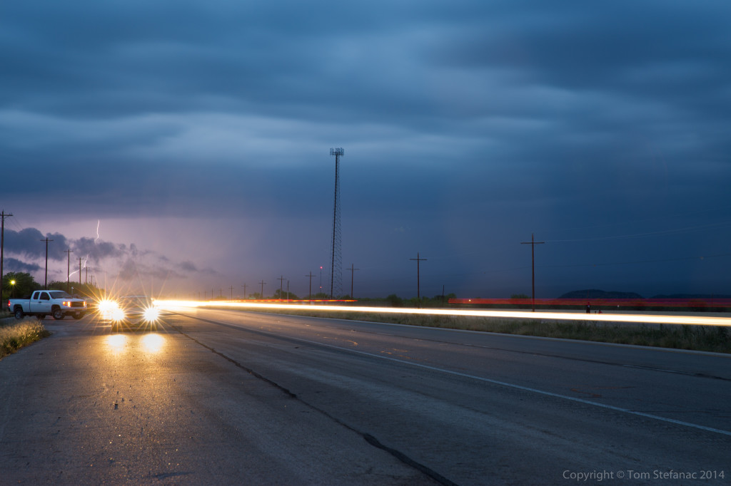
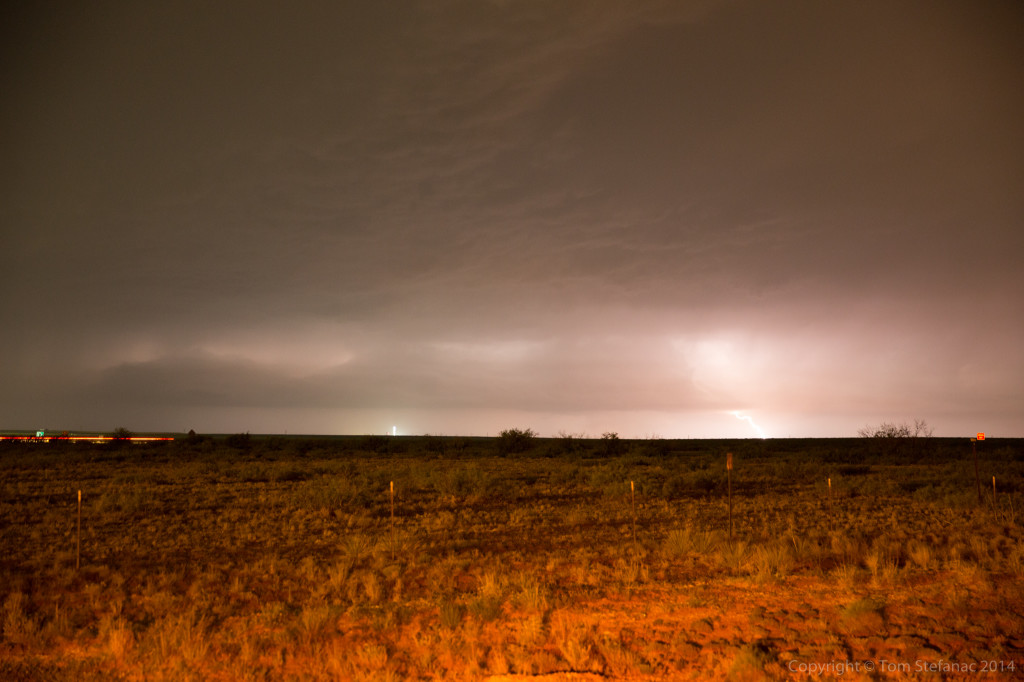
Later in the evening I tried to get lightning shots of yet another supercell but the road network was not all that great, nor were the vantage points or the head lights glaring at me!
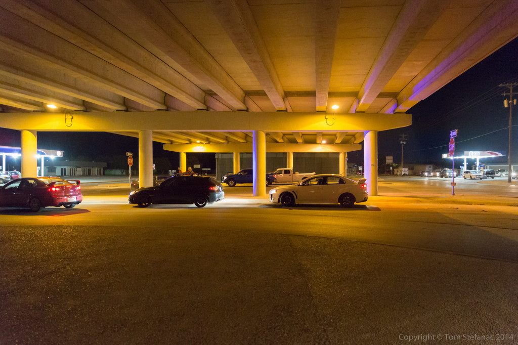
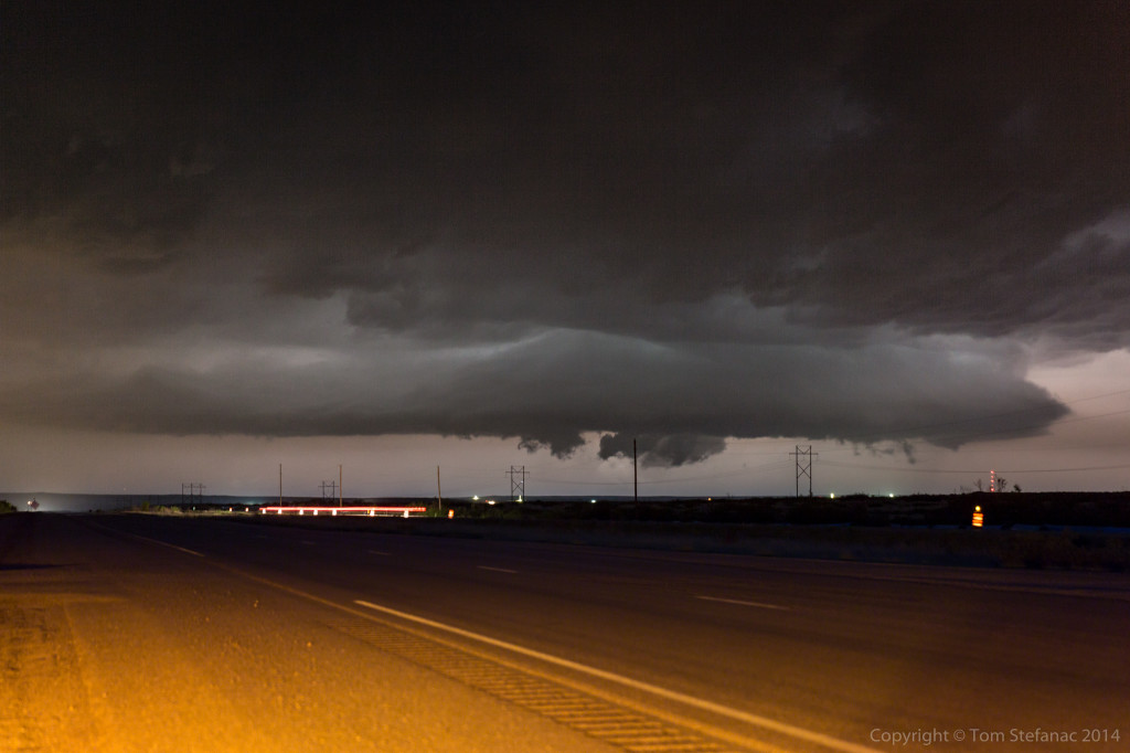
As the third storm of the day drew closer I found an overpass to park under. There was no tornado threat at the time, just hail, and I figured I would ride the storms core out with some mighty concrete protection.
There were numerous locals that began showing up shortly after I was established well off the roadway up against a vertical wall. They however parked on the road and thought they were sheltering from a tornado!
A representative from the local fire department showed up and moved most of them along, but it’s a tough call, I know sheltering under a bridge is not the best idea, but sending people blindly out into the storm is not a great idea either.
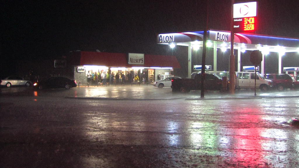
Several vans showed up and another tour group (Cloud 9 I think) showed up the Alon gas station and all got out to see the storm.
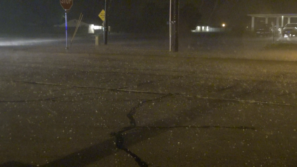
It was a fun core, probably not for the people trapped out in it, but it was not overly crazy, some 1-1.5 inch hail, some 50-60 MPH winds and a blaring tornado sired. The video is pretty cool!
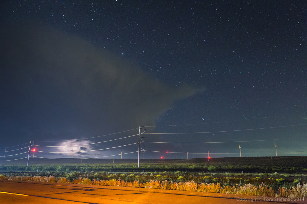
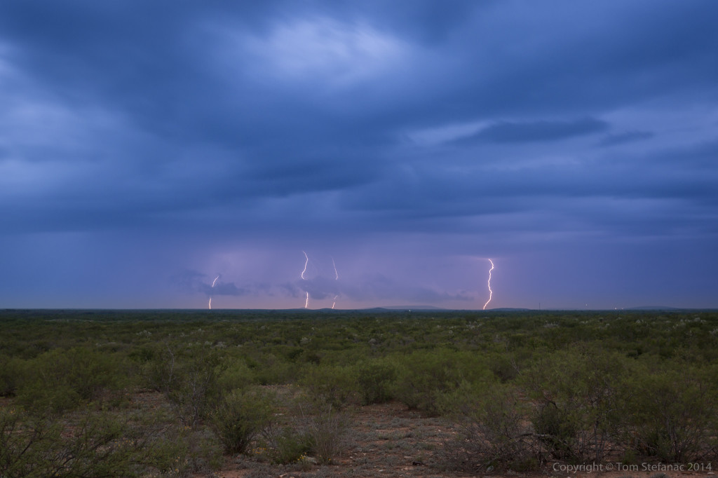
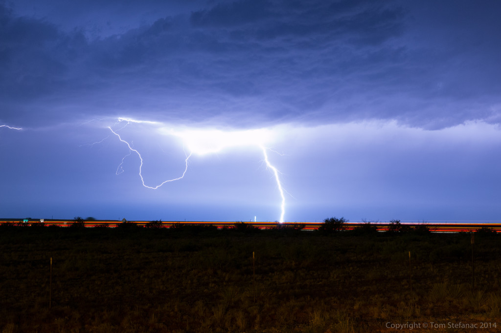
Later that evening as I headed north back to Big Spring to grab one of the few remaining hotel rooms, Jen and I stopped for some lightning photos just south of the town. Against the star filled sky, the storm looked cool. I had hoped for some anvil crawlers but it seemed to all be buried deep in the storm.
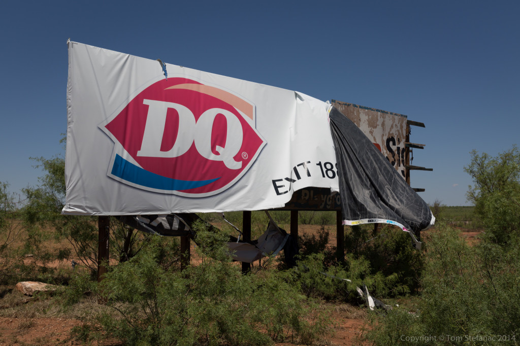
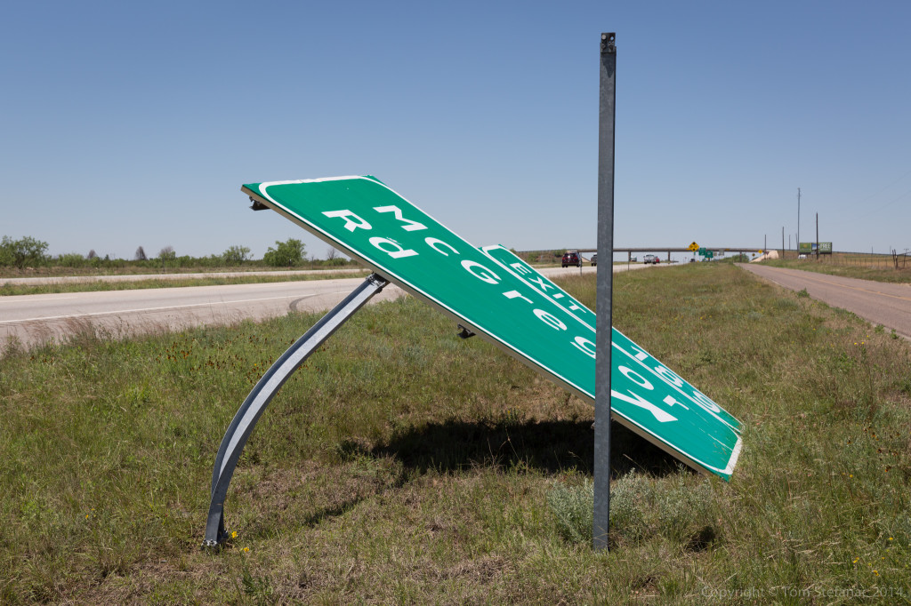
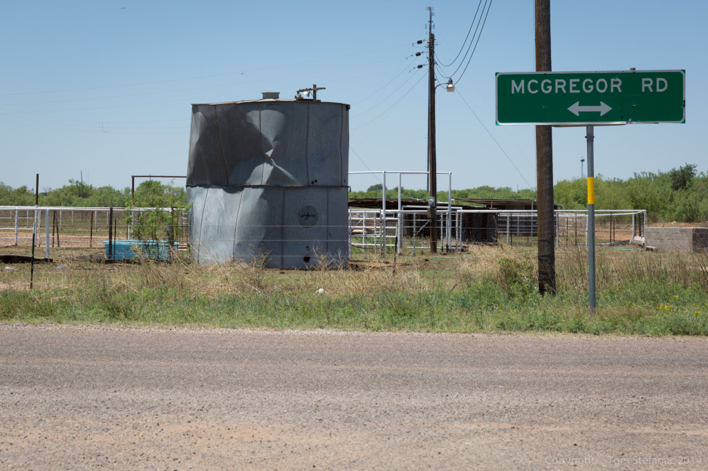
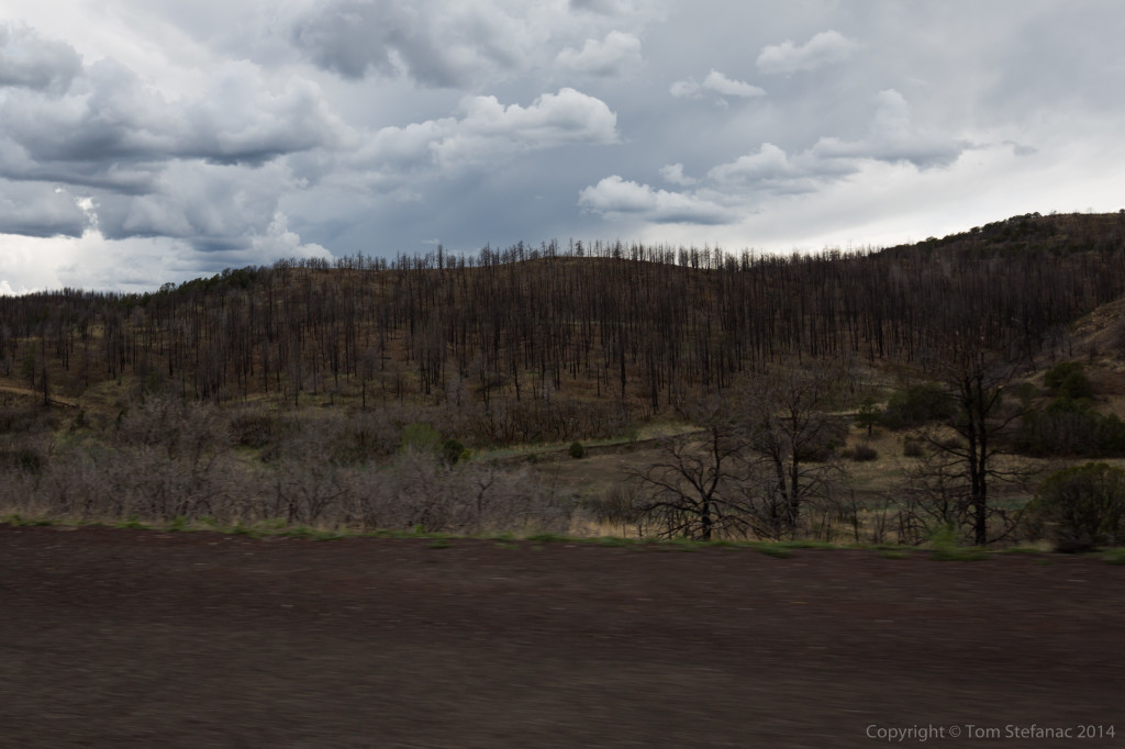
The next day I went out hunting for tornado damage, and found it, just west of Big Spring near exit 189 on I-20.
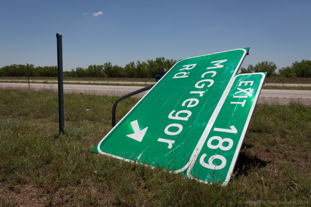
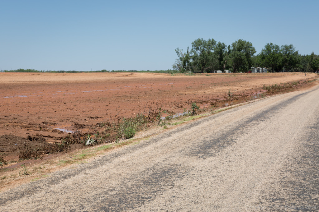
The tornado whipped across this field just missing some houses and “trimming” the trees, before taking out a number of power poles.
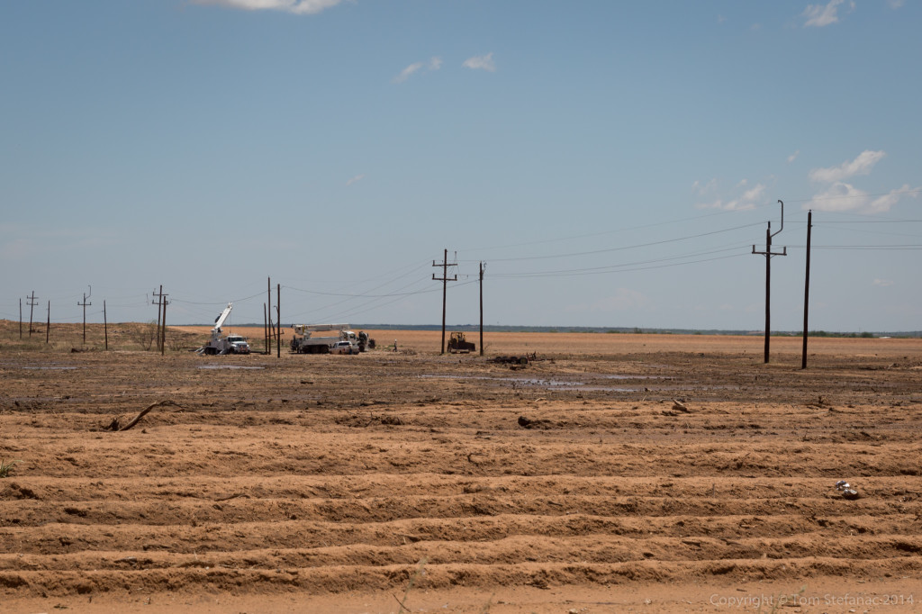
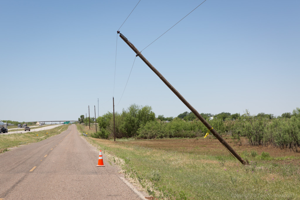
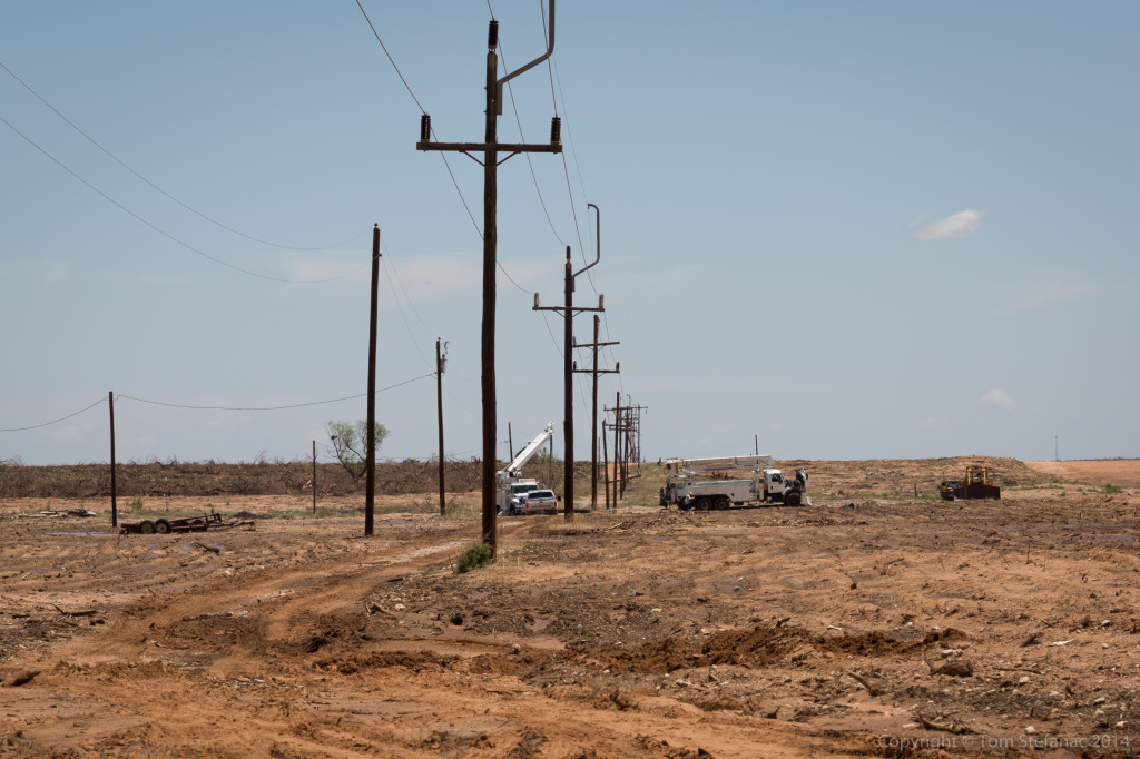 Crews were busy repairing everything but luckily there was no major damage, from the shredded weeds, trees and damage to the odd structures hit, the tornado was probably on the order of 50-60 feet wide and a higher end EF-1 in nature.
May 25th 2014 – Tornado Alley – Day 9
 We started the day in Hobb NM and raced south towards my target of McCamey, I figured convection would initiation along an outflow boundary from the morning convection just over the border in Texas. Around 12:30AM, the first bubbles of lift turned into a storm!
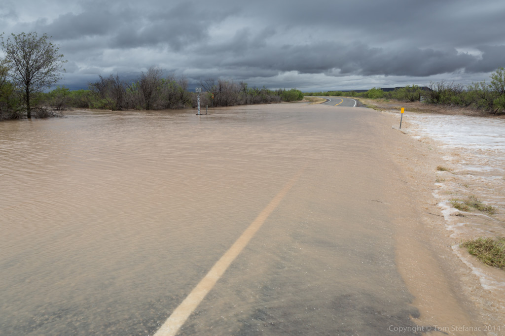
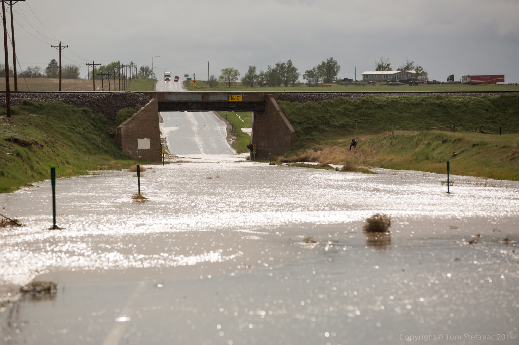
I took a less traveled road to my destination to find it was flooded! This little mishap cost me 30km! Ah well, won’t do that again! The initial storm which was targeted near Sanderson, TX went to poop after it ate too much outflow! Another healthier, outflow free storm was chugging along in Mexcio and that was my new target.
Jen and I raced south to Del Rio TX and watched the storm roll across the border from Mexio to Texas.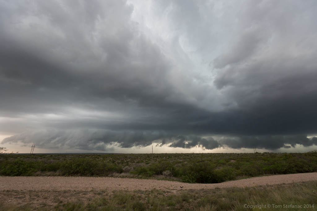
The storm had more a linear appearance to it in reality than what the radar suggested but it was still an energized supercell with plenty of potential. Unfortunately the road network was not all that great for this storms motion!
This was an outflow feature that crossed the road in from of me. Cool, but no threat here.
Eventually I was able to get ahead of the storm but it was becoming a big mess! Instead I opted for some lightning photos.
We’re now spending the night in Uvalde TX, tomorrow it looks like a play in this general part of Texas again.
May 24th 2014 – Tornado Alley – Day 8
My target today did not pan out and I was stuck between heading south into Texas or racing back way north into New Mexico. On top of that my hotel room was booked in Hobb, NM so I was stuck! Then in the evening storm formed rapidly and began to move towards Carlsbad NM. I raced over for some lightning photos.
These dry supercell do produce nice lightning but an elevated cloud deck was sort of obscuring the view.
I was able to see the base of one of the storm cells nicely though and it had some great looking structure! Too bad these storms waited soo long to initialize.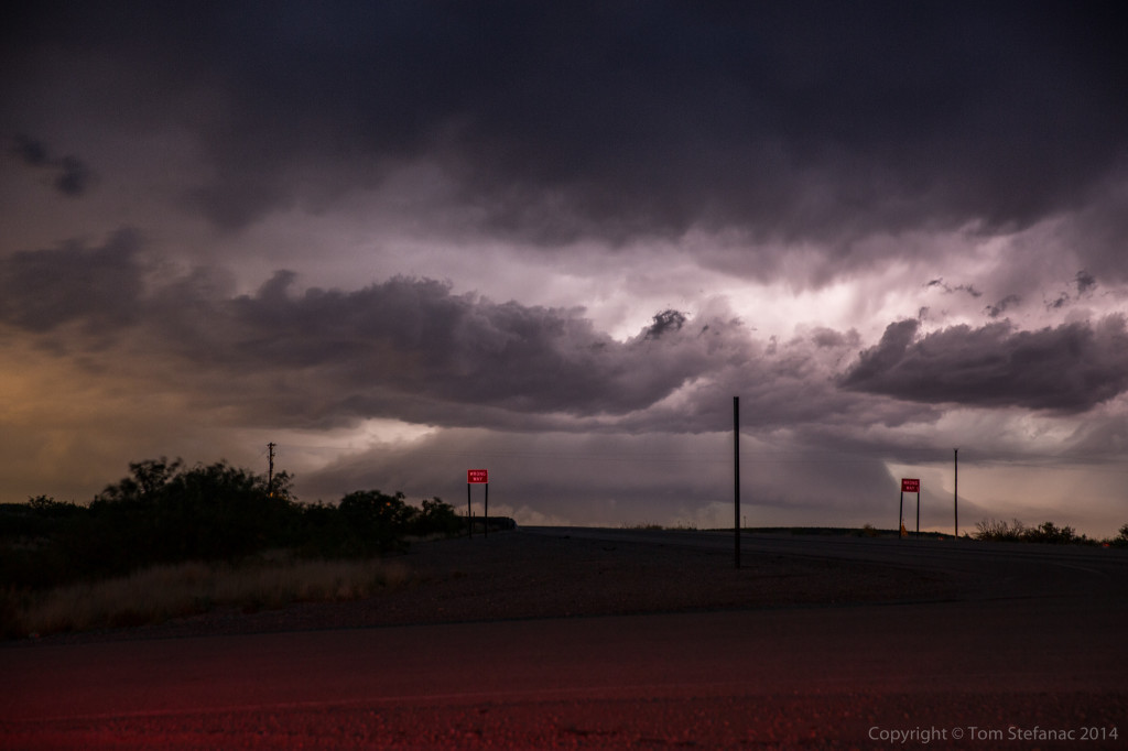
Even in New Mexico, the land of barren desert a pole, tree and other obstacle can find their way into a photo! Actually, it was hard to find good places along the roadway to stop!
May 23rd 2014 – Tornado Alley – Day 7
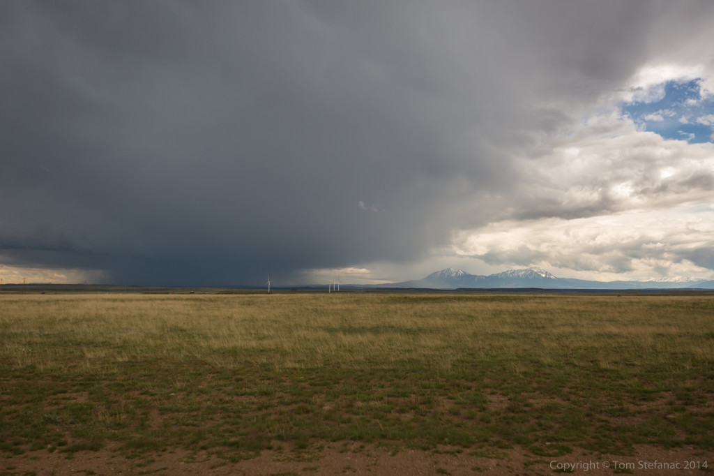
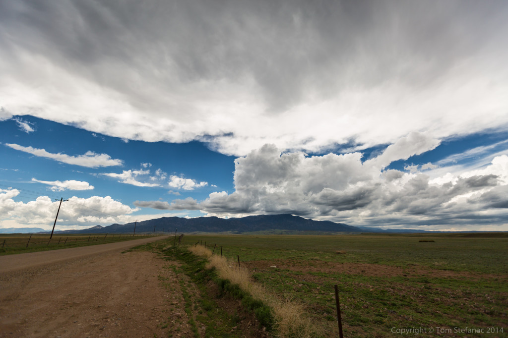
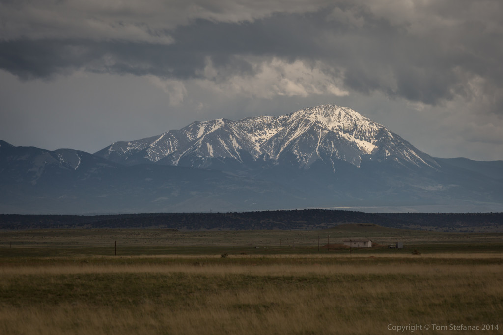
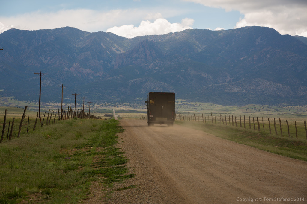
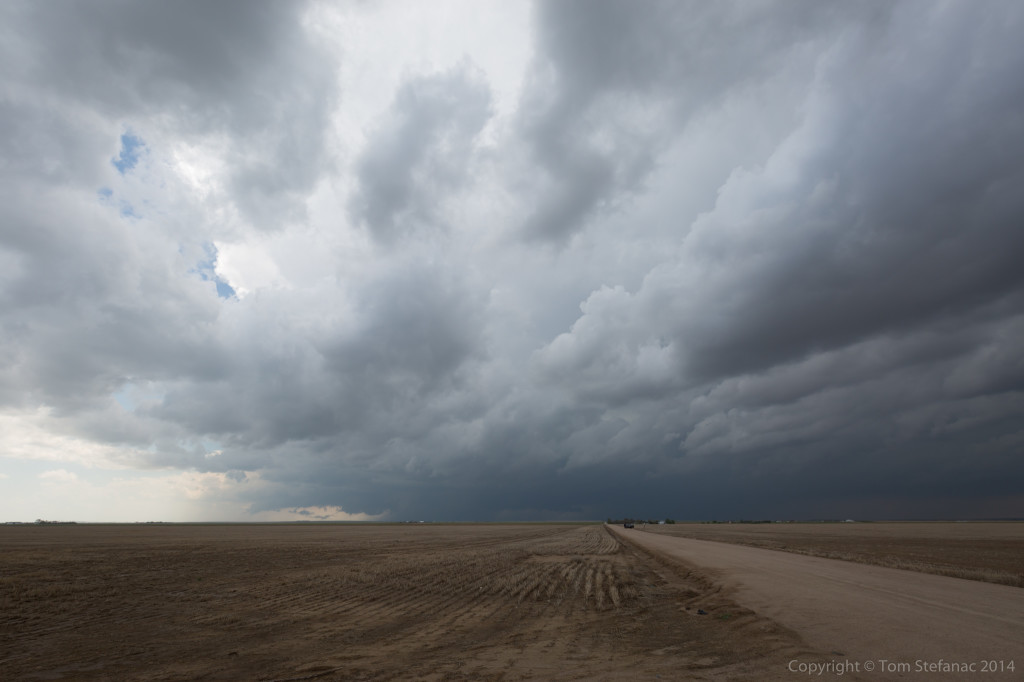
Even more impressive than the storm, was the landscape in extreme Southern Colorado where you can feel the prairie grassland of the front range about to give way to the scrubby desert environment. The storms, couples with the colours and contrasts created by the mountains is beautiful.
I found it fitting that a UPS truck happened to go whizzing past, I guess these couriers really do deliver everywhere!
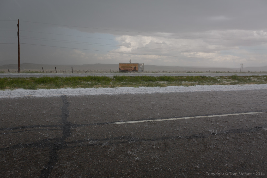
Just outside of town, we punched the backside of the storm and found ourselves pelted with small hail. These storms were super slow moving, and hail was piling into drifts everywhere and flooding out the interstate.
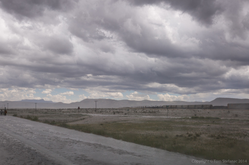
Once past the storm (which was fun to drive through) we stopped to watch it slowly roll out over the open landscape. I saw a couple chasers blast up a dirt road behind it but with the flash flooding and poor road network it was probably better to just let this one go.
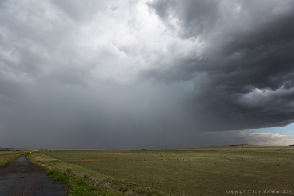
Further down the road, it was amazing to see how the landscape transitioned, literally over the course of a few miles from alpine forest, to a dead drought stricken forest in a rain shadow and then instantly into a sprawling desert environment just over the New Mexico border. I’ll net get used to how quickly these environments change!
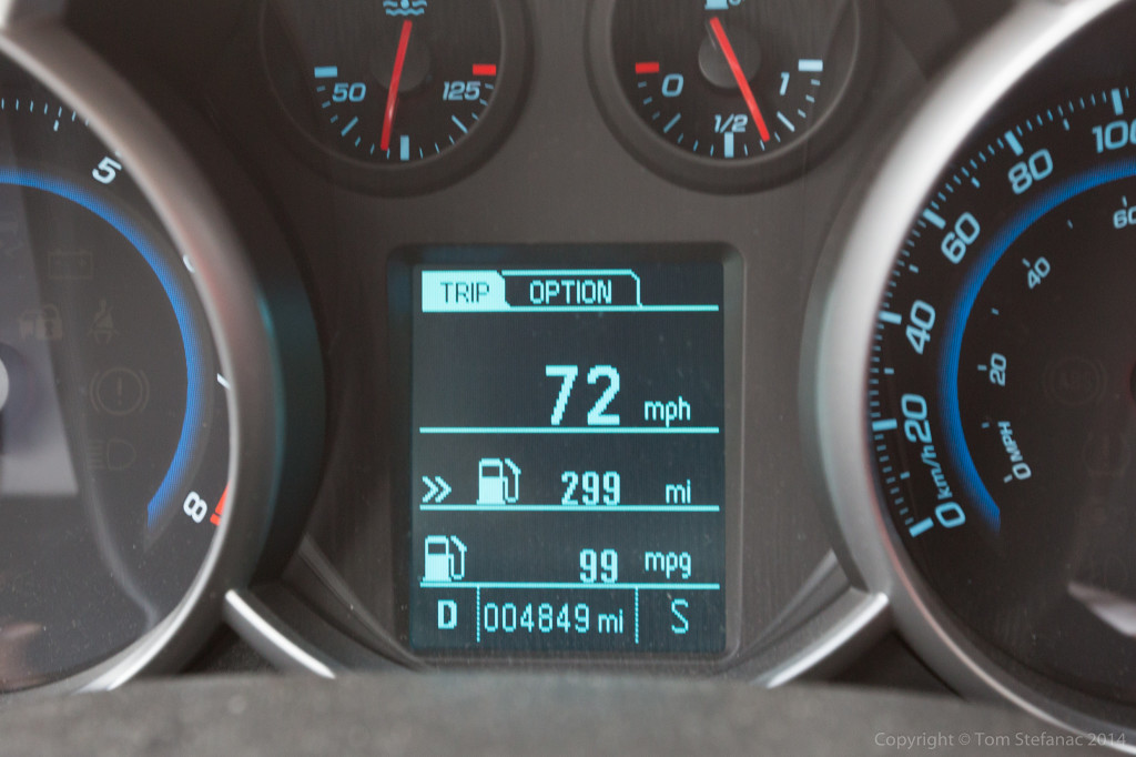
What is nice with the downslope side of mountains/hills and other things is that you get wicked gas mileage. I was probably getting closer to 200 MPG but the computer tops out at 99, I was basically idling as gravity was doing all the work.
 While at a service center a healthy storm literally formed out of nothing to our immediate east near Maxwell, NM. The only real problem was that the road network sucked and we could not get up under the cell.
For a while it looked to gave good potential.
Every now and then a little shear pocket would develop and a small area of scud would tighten up and begin rotating into a funnel like tip and then it would loose the upward energy and that was it. After watching the storm cell for a few hours we let it go and headed into town.
Again, the geography of the landscape is just fascinating to me!
Here is the Maxwell storm cell from the south looking north.
We drove through several small towns, but New Mexico is really a barren state, a little like North Dakota. The distances between civilization can be pretty big at times!
Again, more awesome geography!
 This was the dead zone, all desert, no civilization, no services for 150 miles.
Alright off to bed!
May 22nd 2014 – Tornado Alley – Day 6
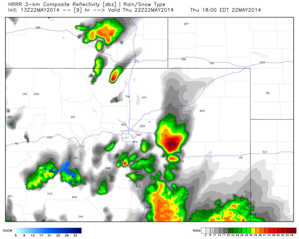
Today was one of those hard to call days! There was definitely potential in the Texas Panhandle, which was a 5 hour drive from Limon, CO but there was also good potential just outside of Denver which was only 45 minutes away.
Meteorologists refer to a phenomenon called the DCVZ, or Denver Convergence Vorticity Zone, basically it the area where the upsloping easterly winds meet the downsloping winds from the mountains along an area known as the Palmer divide.
This naturally occurring orographic phenomenon exists about 33% of the time when thunderstorms are present east of the Denver front range.
The idea was to play this 150 mile area where landspouts and other spinups are common as opposed to the deeper convection in Texas which was far less organized.
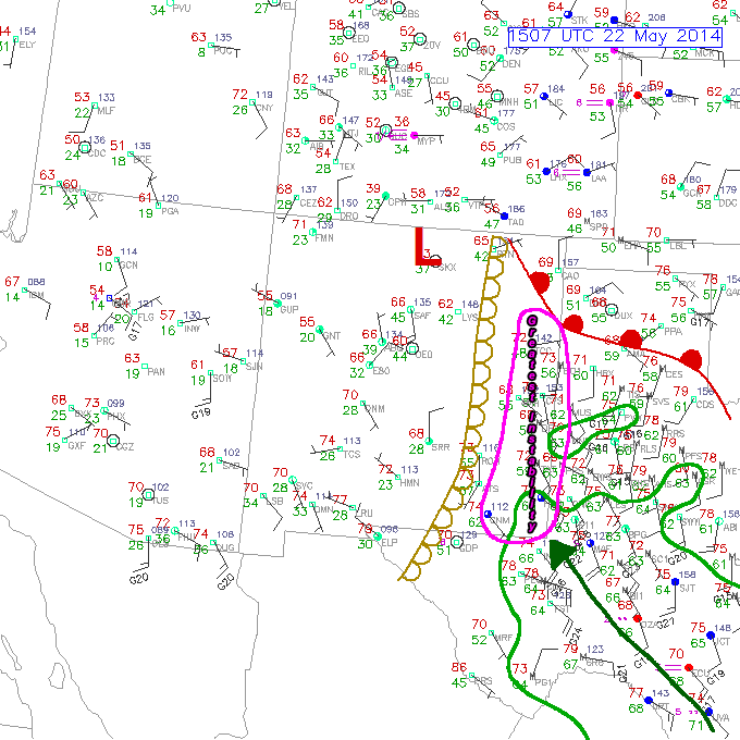 I do miss a good Texas Panhandle storm, sometimes referred to as Cap Rock magic where the same upsloping easterly winds meet the New Mexico dryline in far west Texas and you get monster storms forming. Unlike Colorado however, there is no front range in Texas to so the orographic features don’t exist and that means if the upper dynamics are not present, your just going to have a big messy storm with lots of big hail.
Time, space and probabilities made my decision.
After getting delayed in Limon, CO (visa card scare that was nothing) I headed to Bennett, CO to catch some rapidly developing storms. Initially the weak storms looked poor then burst into action with 2.5 inch hail as a boundary surged north.
Unfortunately, this boundary also led to the storms demise as the shear vectors coupled with the 500mb flow meant the storms just became a big mess.
What was impressive was the flash flooding. I’m not sure why this happens, but all over the plains flash flooding is a real problem and it gets worse as the elevation goes up. I’m not sure if the soil just can’t absorb the water or the little tributaries that litter the landscape in Southern Ontario just don’t exist in the same capacity across the plains?
Whatever the case, this storm was a light sprinkle by Southern Ontario standard, some 20-30mm of rain in an hour, yet flooding was occurring across Colorado.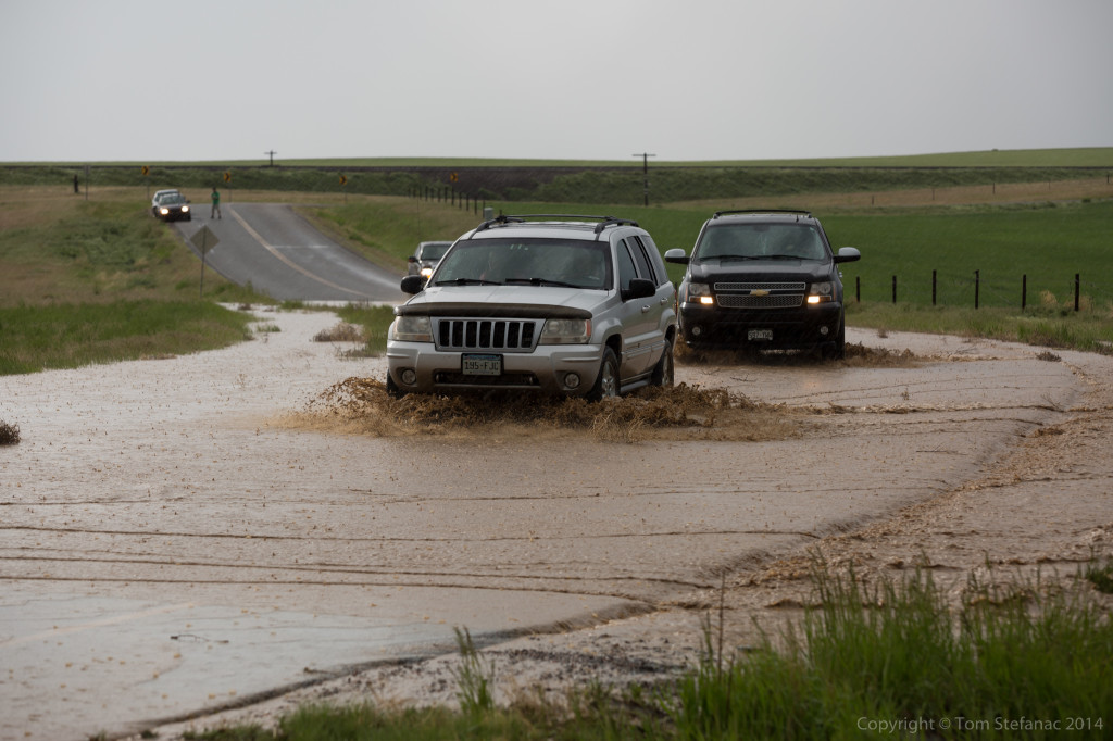
The “Turn Around Don’t Drown” slogan seems to be unheeded much of the time and it’s not just a Colorado thing, it happens everywhere. People seem to always want to test the waters which is fine when you make it across but, you never know how deep the water is and a misguided assumption can become a real problem quickly.
This underpass rain bridge had torrents of water passing through yet some people still attempted to make it across! Insane! Chunks of mud, grass and others things were being washed away with the flash flooding that seemed to come out of nowhere!
Once the storms died down we made our way towards Denver, CO to see the city. On the way over we passed the Denver NWS Radar, Jen snapped this photo at 75 MPH.
Our jont into Metro Denver along I-70 West during the 6PM rush hour was probably not a great idea but I did not mind some traffic slowdowns and Jen suggested we keep going west to see the mountains and I thought, why not? The GPS decided to detour us, through the downtown core! It actually turned out to be a nice scenic drive through the heart of the city. We eventually passed through the core and worked our way back onto I-70 West and into the hills!
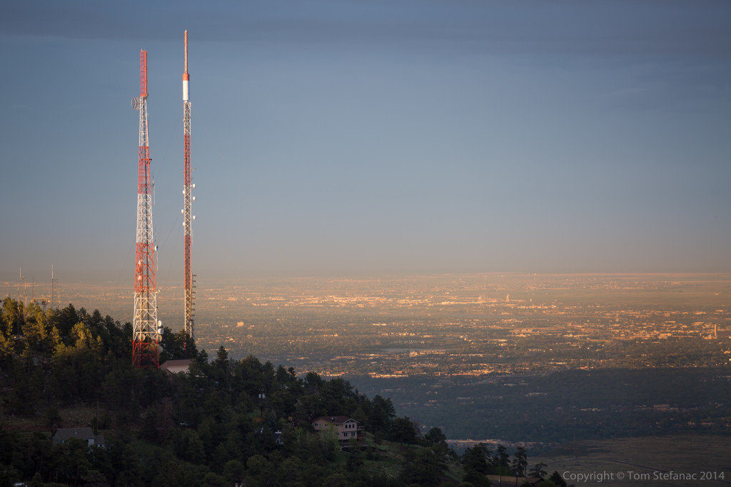
We found ourselves at a scenic lookout called “Lookout Mountain”, it was gorgeous and these “hills” were massive, way bigger than anything in the Appalachians.
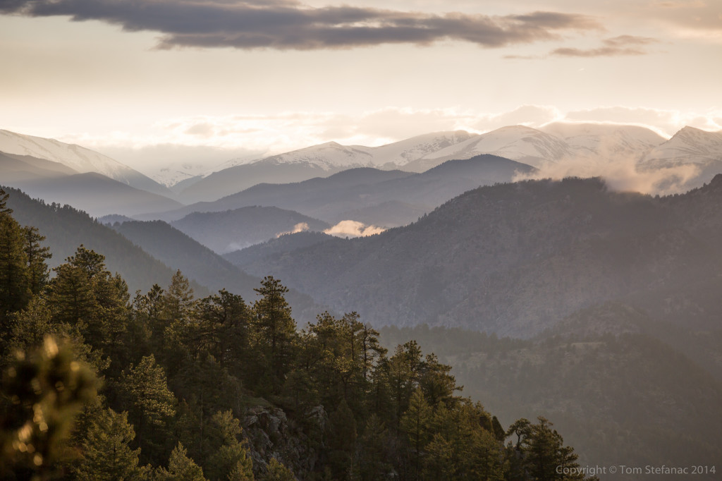
The afternoon sun was initially shrouded by cirrus clouds from the earlier convection and remnants working in from New Mexico, but eventually the even sun was able to sneak out from under the clouds and the landscape was just majestic! Snow capped peaks, sprawling pine forests and clouds creeping over the mountains, amazing.
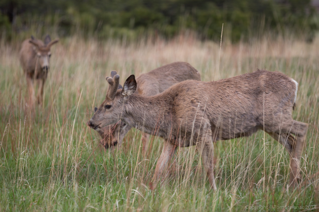
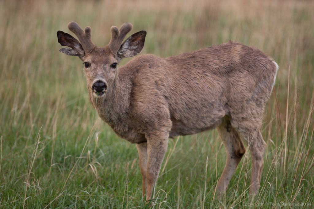
Deer were also plentiful, a little too plentiful for my liking. This herd was just grazing beside the road to the lookout pint and had no fear as I walked up to grab these photos.
We finally worked out way back down towards Denver to start the trip south towards New Mexico. Everything was going well until…
We ran into a fatal collision on 85/87 South in Fountain Valley, near Pikes Peak. Someone on a motorcycle collided with a stopped truck and ugh.. the rest is history. We were stuck in the backlog for an hour, so I decided to call it a night. I had Jen quickly call a hotel in Pueblo, CO which was about 35 km to our south. We had a scenic back road 11PM tour of the countryside and finally landed at the hotel around 11:35PM.
We’re calling it a night and will continue the trip through New Mexico tomorrow into Texas. I’ll let you know if we spot any UFO’s!!
May 21st 2014 – Tornado Alley – Day 5
Today we said goodbye to Nebraska. Based on the upcoming pattern we will likely be more into the southern plains in the coming days so I probably won’t be back this year.
But on the other hand we said hello to Colorado! In this area Kansas, Colorado, Nebraska, Wyoming, Texas and even far western Oklahoma all share very similar geography. On average your 1500 meters of more above sea level and the environment is very dry. Today however with the easterly upslope winds dew points were able to get up to around 55F/13C which might be dry by eastern standards where the terrain is only 200 – 500 metes ASL, but in the high country that’s super wet!
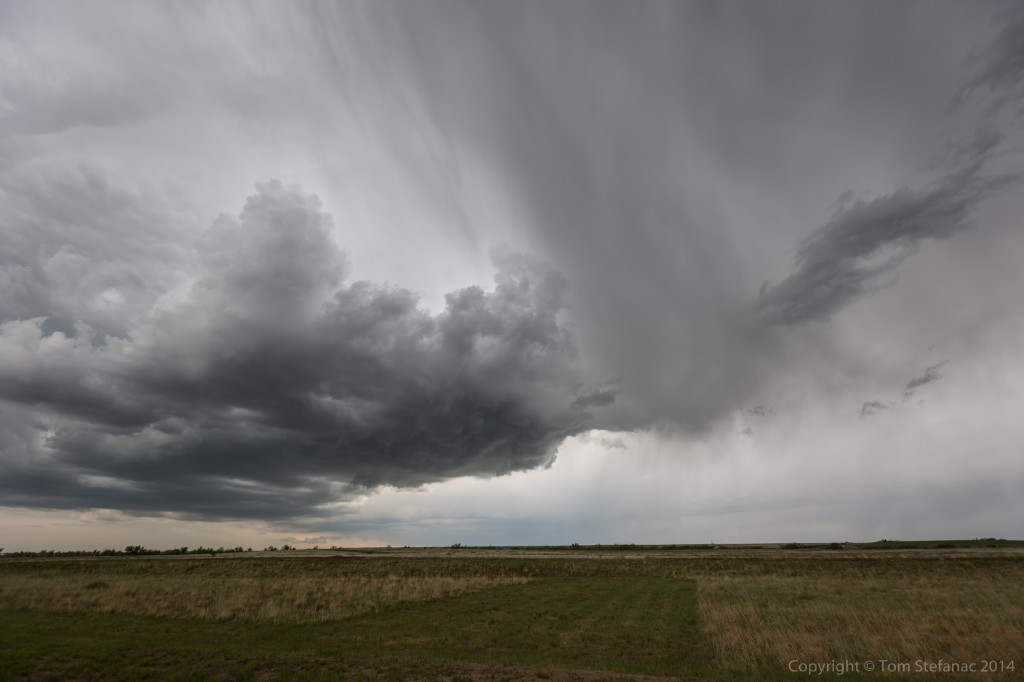
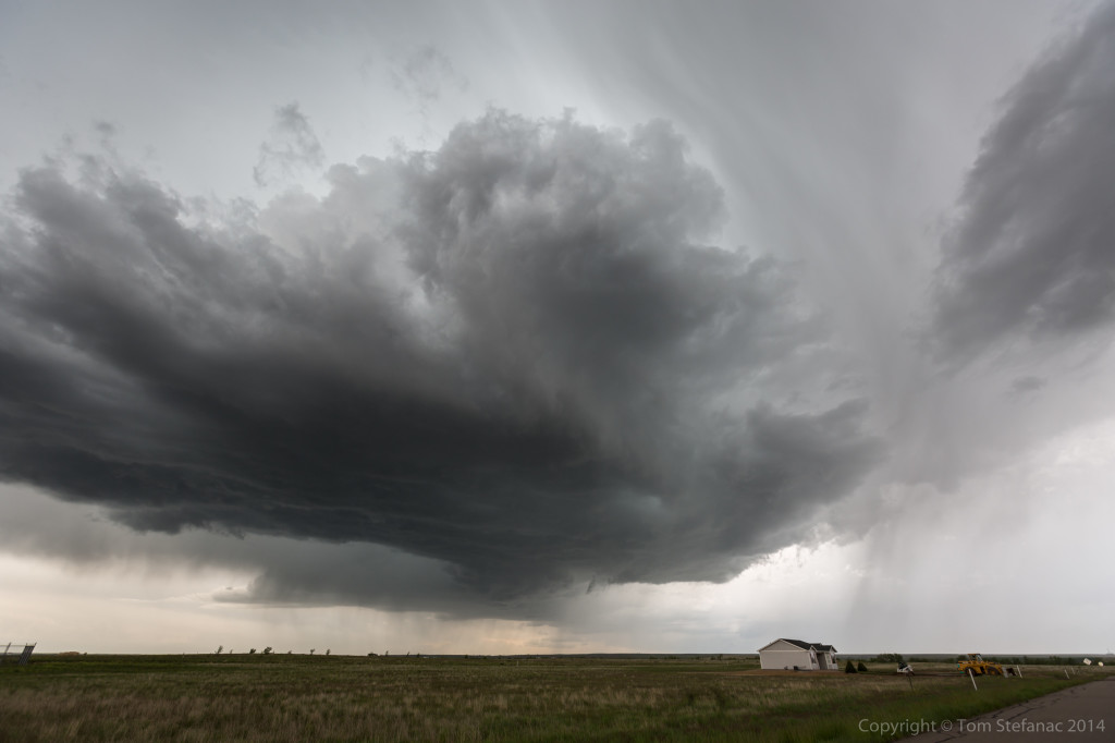
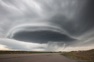
Just as the 4km WRF-NAM and 12Z HRRR had predicted, a supercell storms quickly developed around 2:30PM over top of Denver. The storm rapidly began to rotate and drift east. It quickly produce a menacing wall cloud with rain curtain wrapping from behind. There were all sorts of scud fingers reaching down, some exhibiting rotation. A tornado was reported by a spotter however no one has been able to confirm this.
As the storm continued east, the wall cloud structure rapidly began to tighten up. At one point it looked like the storm was going to produce a tornado. The gate to gate shear over the Denver radar was around 100 knots! It was cranking and slowly drifting towards Jen and I at a snails pace.
The wall cloud eventually began to really hug the ground! Around the time this photos was taken, inflow was racing into the storm at around 30 mph / 48 kph. The wind was just feeding in and thunder bolts were crashing with a low roaring sound every couple seconds. I also ran into Chris Kridler and her chase partner. I’ve been a longtime fan her of her website and it was a pleasure to meet her!
I repositioned to avoid getting cored (hit with the bad part of the storm) and stopped on a relatively quiet country road. Within maybe 5 – 10 minutes it was lined with chasers! Then Mark Robinson and several other chasers which I knew pulled up. I also met Jaclyn Whittal from The Weather Network in person. Talk about a chaser convergence. By this point the storm had lost much of it’s structure and was in the process of replacing it’s mesocyclone.
Our meet and greet was short lived since the storm began to morph again. I raced down the road and back to a main east-west highway. By this point the road was lined with locals, chasers, tour groups, spotters and even scientific research teams. I ran into one of the DOW’s (doppler on wheels). They had 3 trucks, but now they may have 4 or 5, I’m really not sure, but either way I did see one of them and jumped out to take this photo.
After grabbing my photo of the DOW I raced east and pulled over several miles from the storm. I immediately started shooting video. I knew the storm was rapidly intensifying before I even pulled over, wind gusts were buffeting my car and small hordes of tumble weed were rolling across the road towards the storm, a sure sign of strong inflow. The wall cloud now began to rapidly rotate and lower towards the ground. Again at times it appeared to really try to hug the ground. It was pretty amazing to see this type of a hybrid, almost high precipitation storm in such a dry environment.
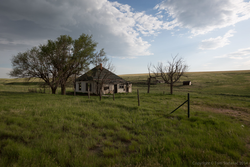
Eventually the storm was eaten by a line of garbage that rolled up from the south (again, exactly as predicted by the HRRR) and our chase was done for the day. We stopped along US 71 in Washington County on our way to Limon and grabbed some photos of this cool abandoned homestead. Once in Limon we were able to grab the very last room (the honeymoon suite ironically) at the Quality Inn. Talk about chasers, I think everyone chasing the storm is in this tiny Colorado Town and we all literally overran the local bar and grill which had wonderful food.
As for tomorrow, we’ll see, I’m looking at a Kansas play and then probably the Texas Panhandle come Friday. The weekend, looks like a classing southern plains day! Looks like 330 miles to any potential target tomorrow in Kansas and then another 350 miles to the Panhandle for Friday.
May 20th 2014 – Tornado Alley – Day 4
We started the day where we left off in Ogallala, NE. I don’t think I’ll ever get tired saying this towns name, Ogallala or as Jen and I have renamed it, Ogallalalala. 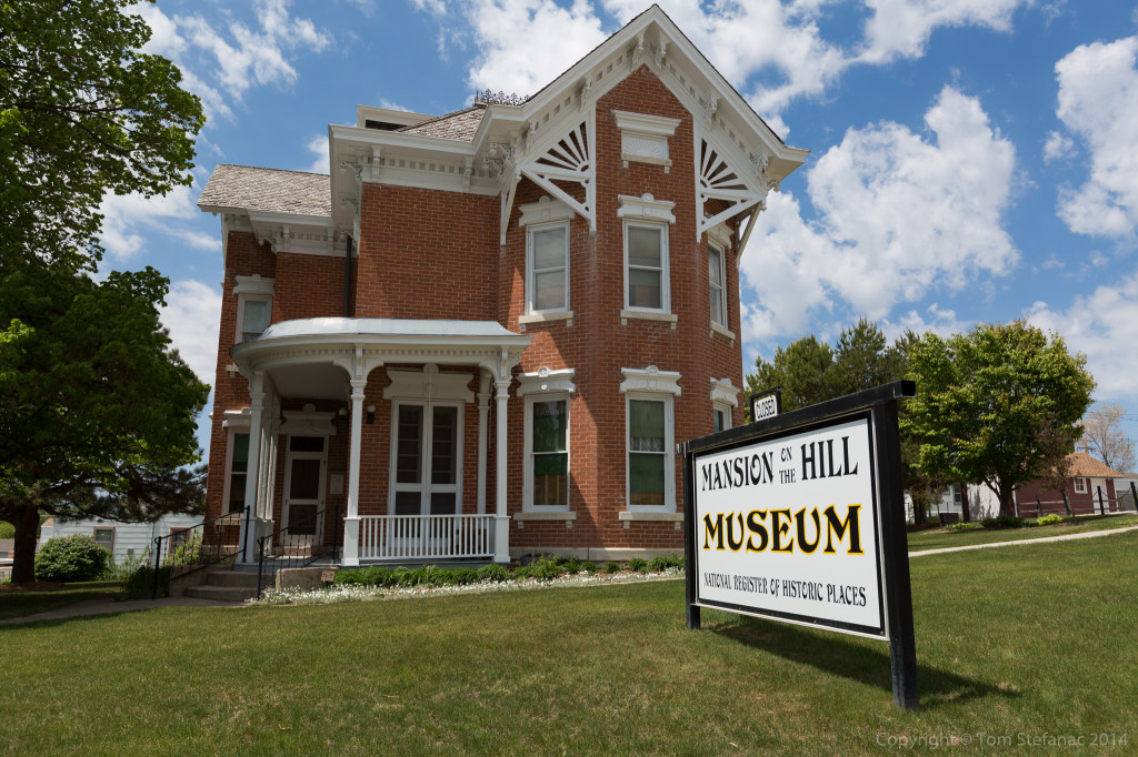 We started off by doing a bit of sight seeing in the town. Our first stop after breakfast was this old Mansion on the Hill Museum. A turn of the century farm house, that was lavishly decorated by 1890’s standards.
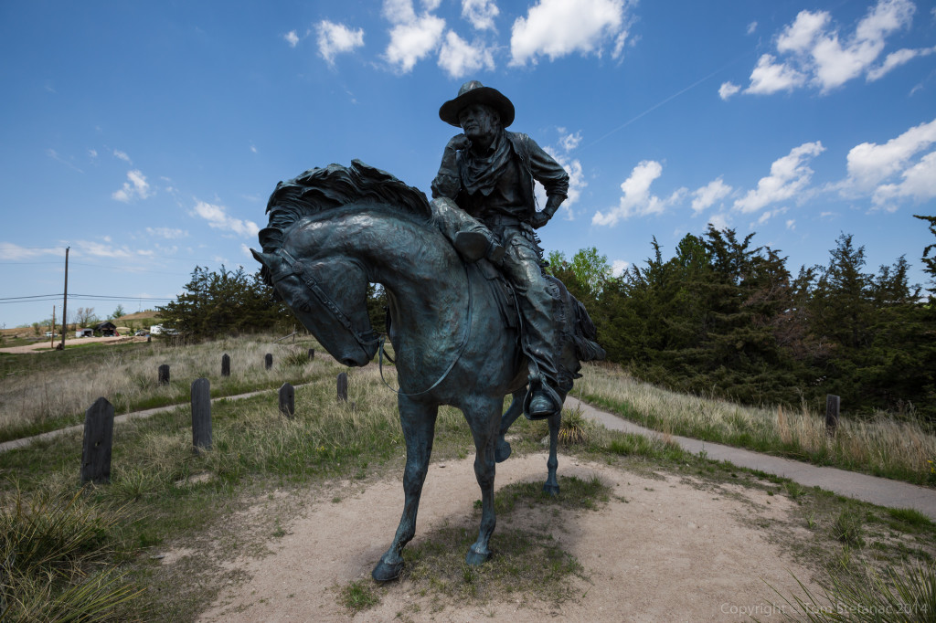
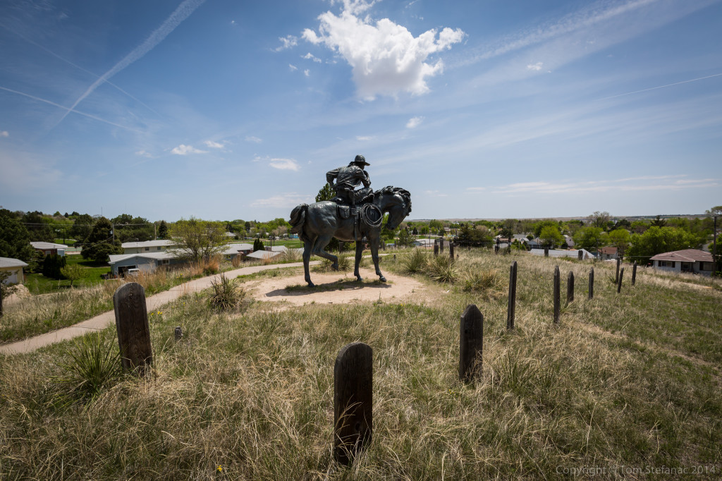 A little further down the road we visited Boot Hill, a cemetery filled with unknown graves. Back in the 1860’s and 1870’s cow hands, bandits, law men and others found themselves on the wrong side the gun and many were buried here in this wild-west cemetery.
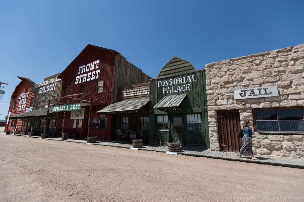
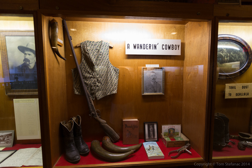
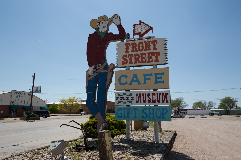 Back in town we visited the Front Street row of business where we ate lunch, visited a museum with some interesting artifacts and planned for our up and coming storm chase! After all, we had lots of time to kill while the atmosphere baked.
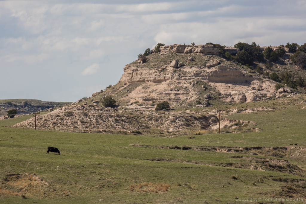
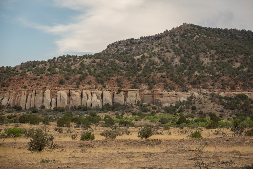
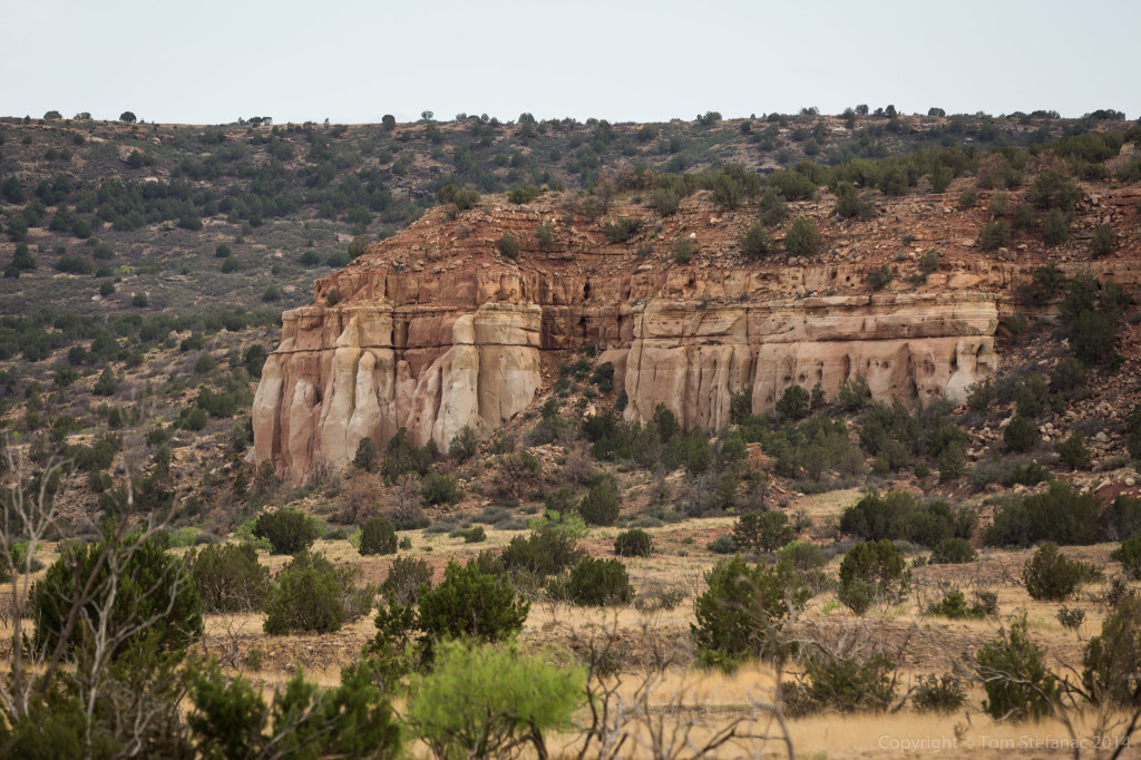
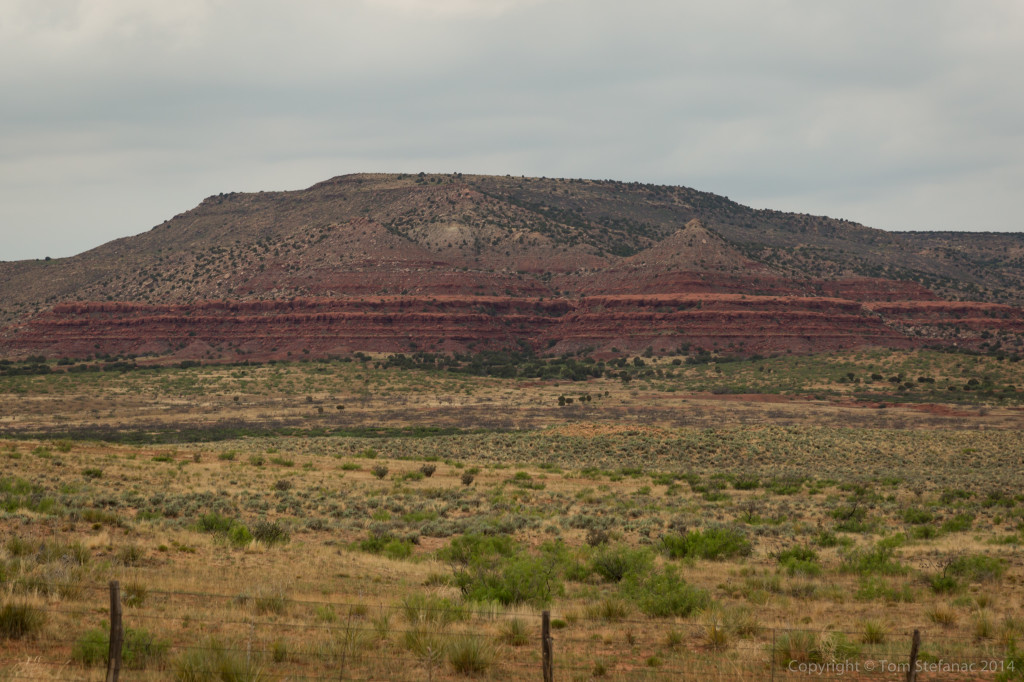
 What’s fascinating about Nebraska, and many other states which sit on the front range, a sort of geographic plateau where the land rises about 1000 – 1500 meters above sea level, is how diverse the geography really is. The front range suddenly rises, then flattens out into gentle rolling hills and large open plains. You can have pancake like flatness as far as the eye can see and then you’ll suddenly run into amazing hills, canyons and gorges with amazing rock formations. I first encountered this diverse landscape in the Texas Panhandle, specifically the Cap Rock, which shares the same type of geography as Colorado, Nebraska and Wyoming. Even while I was actively heading towards the storms, Jen and I had to stop and take some photos of these wonderful rock structures.
 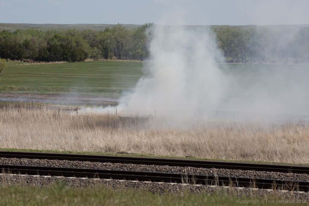 We also passed a controlled burn, but I was pretty sure it was one of those controlled burns, that was becoming a little uncontrolled if you know what I mean.
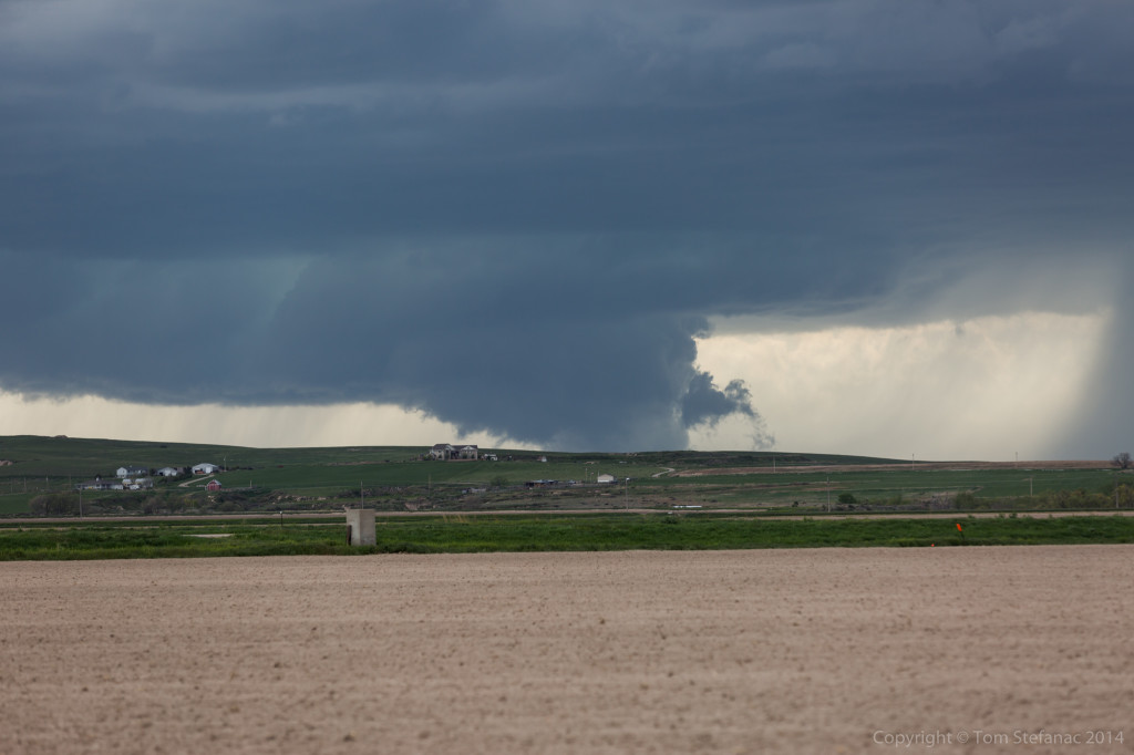
 The pair of supercells crossing the border from Wyoming into Nebraska finally came into view near Scottsbluff. The southern storm has the illusion of a ground hugging wall cloud thanks to a little hill while the northern storm had a very cold and elevated look to it with tons of low level dust being kicked up. Neither storm looked all that threatening and the rotation with both storms remained broad never really tightening up.
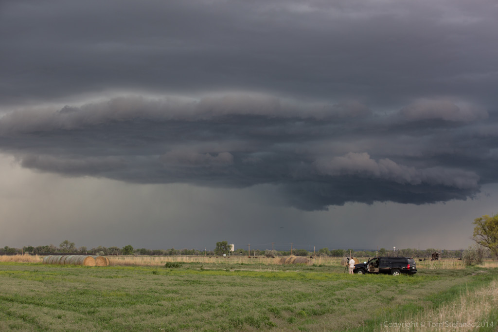
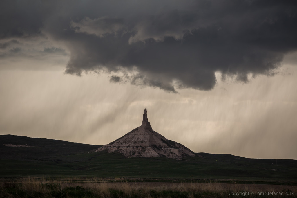
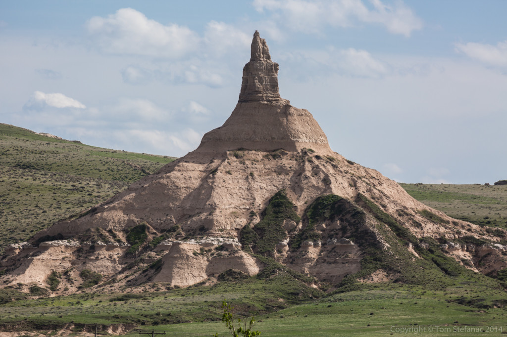
 As both storms tracked east-southeast paralleling U.S Route 92 they passed through Scotts Bluff National Monument Park. The storms, against the towering bluffs made for some impressive high contrast photos, the kind of stuff you don’t normally see! The southern cell also produced a little inflow area with low hanging scud right above the Chimney Rock Monument. Just gorgeous stuff to see!
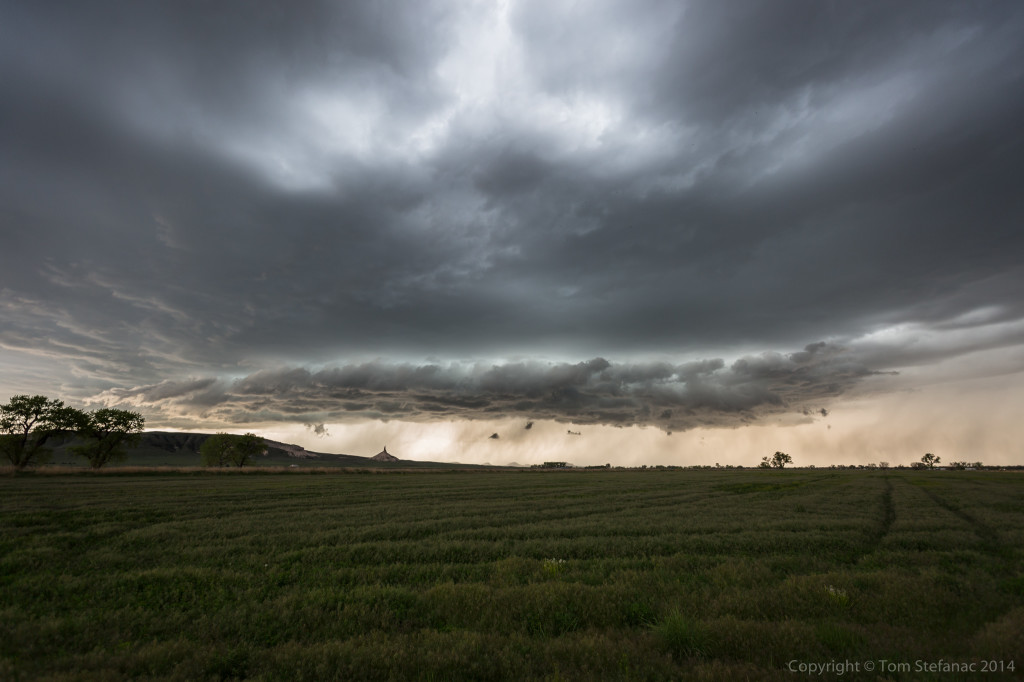
 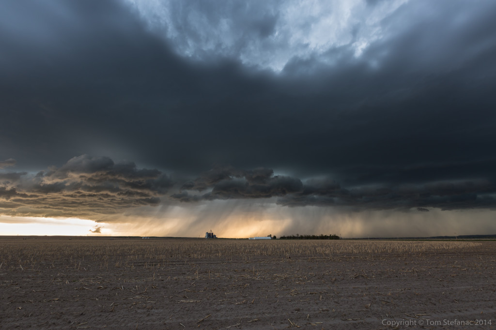 Both storms did hold on for a while but eventually as the evening took over and the airmass cooled they lost their energy. The southern cell became very linear and blew out while the northern cell, shriveled up died. The southern storm cell did produce a very pretty sunset image with a plethora of wispy rain.
 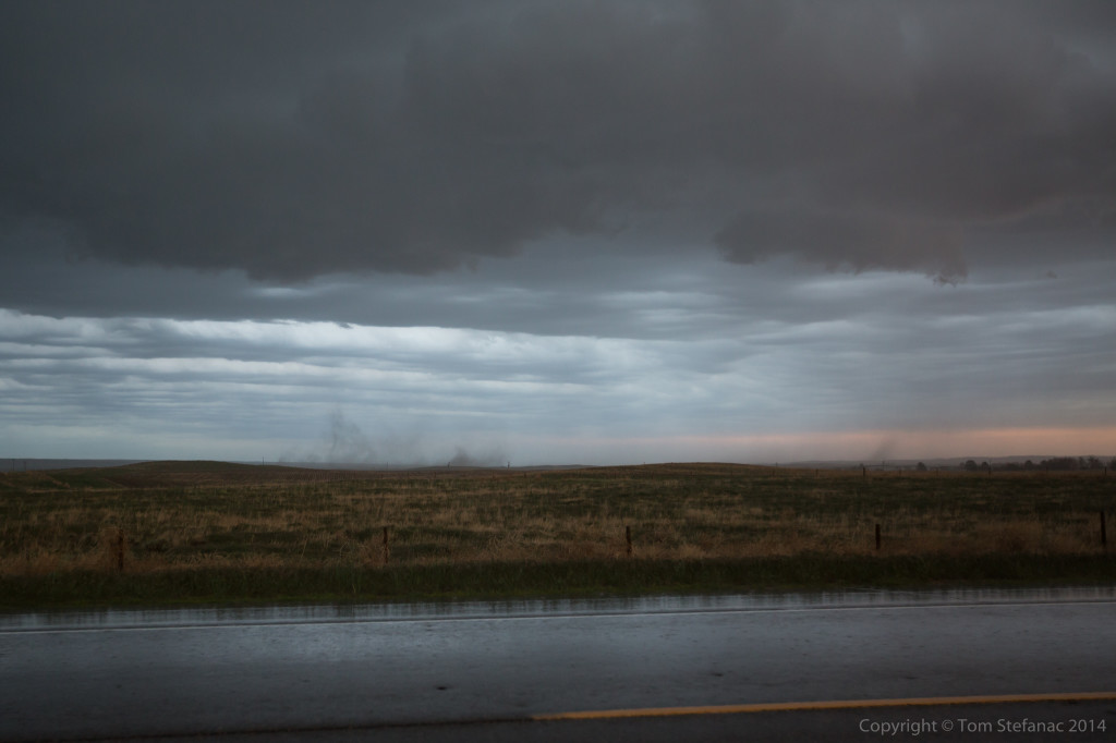 Up under the storm it was packing some 40 MPH winds and kicked up some dust in a field just to my east. I was looking but saw no rotation above, so I would not even call this a gustnado feature.
 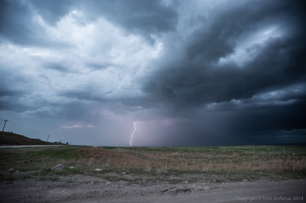 The storm did produce a fair bit of lightning and I was able to grab this evening lightning photo. It’s not easy to shoot lightning when the daylight over powers the flashes but this one turned out! We’re now spending the night in Sidney, NE seeing as tomorrow looks like an interesting day across northeastern Colorado! Stay turned!
May 19th 2014 – Tornado Alley – Day 3
I’m exhausted, but it was great day! Targeted far western Nebraska, and took my time. The forecast was perfect!
Jen and I visited the first Pony Trail station and one of the last remaining structures still standing from this era when the west was still wild.
We also found ourselves in the Ash Hollow State Park which showcased some of the first and last remaining pioneer structures. It also helped to showcase the amazing terrain in this part of the country where vast plains give way to amazing cliffs and hills.
Later in the day, around 5PM the first really organized supercell began to work its way into western Nebraska from Colorado. It was a beautiful storm but high based.
A second more powerful supercell developed in Colorado and tracked into Cheyenne County, Nebraska. This was the storm of the day, it had amazing suface interaction with a wicked 55MPH RFD kicking up dust and hail to the size of gold balls and bigger.
It sure did try and produce a sustained wall cloud like structure but the low levels were still fairly dry. Needless to say, the structure was gorgeous.
 It lasted well into the evening producing a wonderful lightning display! Eventually we tucked into Ogallala, NE for the night.
Tomorrow is a another day and I’ll keep you posted!
May 18th 2014 – Tornado Alley – Day 2
Well, it was another day of driving! We woke up in Peru, IL and started our slow journey west. I knew the storms this afternoon were a long shot, I still targeted them but after stops and eating they were definitely out of range.
Driving across Illinois was quick, but driving across Iowa, it felt like that state would never end. I don’t know what it is, but every single time I have driven across Iowa it has just felt like an endless drive and this was no different!
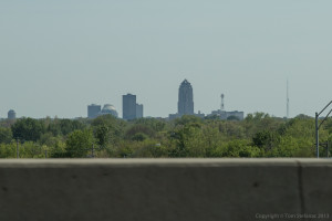
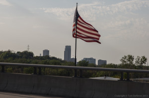
Jen grabbed this shot of Des Moines as we scooted around the city on the beltway and continues along I-80 west.
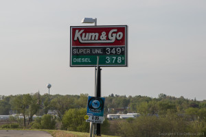
The good thing about going west, aside from the storms, is that gas prices seem to keep falling endlessly. It was initially $3.90 a gallon in Michigan but this turned to $3.70 and eventually $3.49. Now in Nebraska, it’s down to around $3.30 a gallon, which you just can’t beat!
Another interesting tidbit about Iowa and many places in the great plains of the central interior of North America is that the land varies in diversity of plant life and geology greatly. In some areas it’s flat as a pancake, you can see for miles, in other places, you have large gently rolling hills and then of course there are those places where chasing is almost impossible!
While Iowa is certainly good chase territory, for the most part, it’s not flat, it’s pretty much rolling hills straight through, it’s not until you get to Nebraska in the west or Illinois in the east that the terrain really levels out.
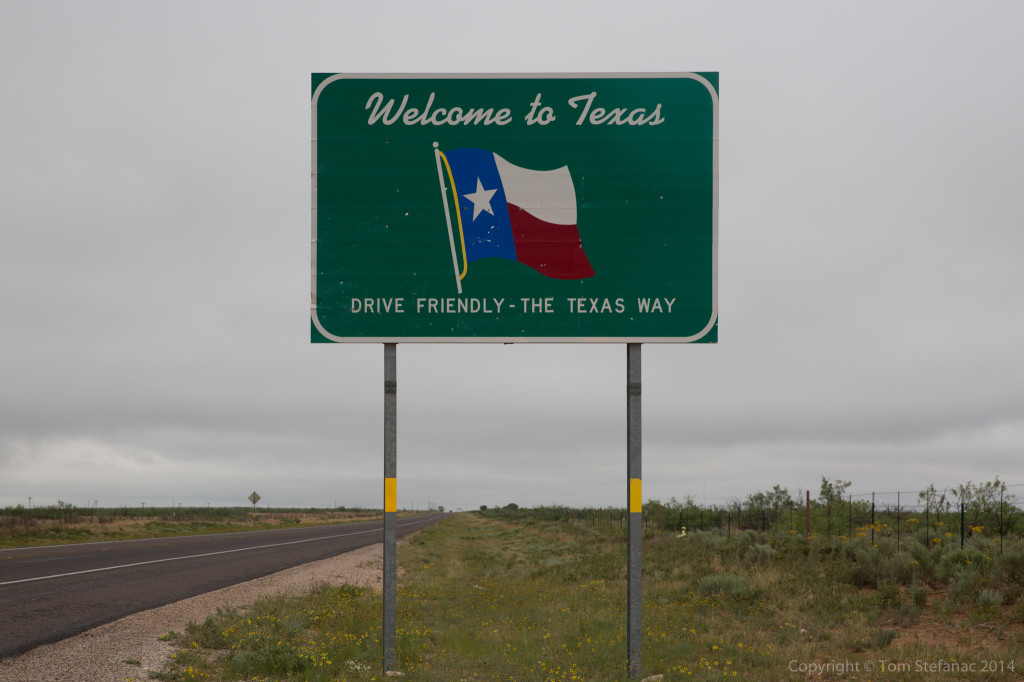
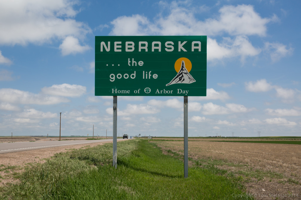
Here’s a quick shot showing Omaha, NE as we zipped by! Jen was busy taking photos to keep herself occupied.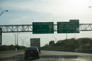 And finally, the welcome to Nebraska sign.
So that’s all tonight, tomorrow it looks like it’ll be a western target again! We’ll probably be somewhere on the Colorado/Wyoming/Nebraska border chasing some big supercells in the high country!
May 8th 2014 – Forecast Outlook
It’s that time of year when the chase trip begins to come into model range. Usually, I like to base my trip on statistics and the last 10 – 15 years have been pretty consistent with the 17th through 30th producing a plethora of severe weather and the week of the 20th through 25th just going bonkers.
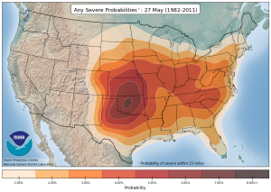
Severe weather peaking over Oklahoma in mid-late May
The climate data for severe weather of any sort peaks during May with the most reports for all sorts of weather coming in between the 10th and 30th and the bulk of the severe weather is concentrated in the southern plains specifically affecting central Oklahoma.
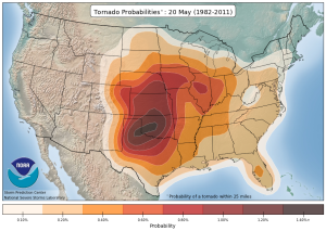
Tornado weather peaking across the Texas panhandle into central Oklahoma though mid – late May.
Similarly, violent tornadoes are statistically prevalent through late April and all of May with the peak occurring between the 10th of May and 31st. This map, which looks at the latter half of the month shows that the peak areas are again the Texas Panhandle stretching back into central Oklahoma.
In all my years of chasing this absolutely holds true with late May never failing to producing at least three of four violent tornado outbreaks before June.
ECMWF Weekly Ensembles
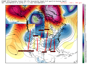
A composite chart showing various times from the 18th through 22nd (Days 10-15).
The problem with using statistics is that they change over time and there is nothing concrete that says just because this has happened 100 times in the past, it’ll happen again this year. Sure, statistically the odds are highly in favour of that type of an outcome but there is never a guarantee.
So I’m always eager to see what the long range models hint at when the storm chase vacation period comes into their reach.
This year, the ECMWF operational which is in good agreement with many of it’s ensemble partners is suggest a relatively active pattern from the 18th onward which looks to reset towards the end of the forecast period (May 22nd) and re-load for another going around on the 23rd or 24th.
It’s always hard to say exactly what that troughing means, all I can say is that the pattern has a number of shortwave and long wave troughs which appear to be associated with deepening and eventually maturing low pressure systems.
How these troughs play out and what type of weather they generate is always a bit of a mystery until it actually happens or at least is within range of the short range models.
The key for me here really is that I’m looking for things I don’t want to see, specifically ridges of high pressure which cap the atmosphere, block the jet stream and provide plenty of boring blue sky. No matter how you slice a ridge, the end result is pretty much the same, so a lack of ridging in essence is far better to see than tons of toughing alone.
Right now, the forecast is very optimistic and it’s look like a very active chase is on tap! I’ll be sure to keep an eye on things as the 15th of May draws closer!
May 4th 2014 – Tornado Alley Preparations
Tornado Alley 2014
The chase is quickly approaching! Another year and another visit to the southern plains is on hand to witness some of natures most awesome displays of power.
With chase preparations stepping into high gear, I’ll be updating this website regularly.
I’ve been adding items to the “chase gear” section, slowly rebuilding sections of the old site with the new format.
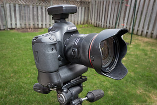
Canon 5D Mark III
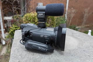
Sony HDR CX700V
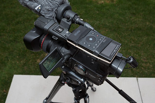
Canon XHA1

Canon T4i/650D
Other News
I’ll be adding information about more of my gear as time permits, expanding the live chase section, adding other components such as widgets, maps and forecasts in addition to live chase-blog section.
Remember, you can also follow me on twitter @vaughanweather
April 13th 2014


