Tornado Alley Blog – 2016
April 30th 2017 – Kansas City, Kansas
What a night. What started with a cold early morning commute, ended with us spinning in circles after chasing a weak line of storms on the IL/MO border. The storms were actually linear in nature but developing in a weak energy environment with favorable low level shear for vorticity. One of the storms produced a brief tornado as we approached from the west, but we were unable get into position in time for it to be visible however several storm reports confirmed it.
Our next target is Woodward Oklahoma for a possible chase Tuesday afternoon near the Panhandle.
April 21st 2017 – Vaughan, Ontario
Well, it’s that time of year again and preparations are underway for this years tornado alley excursion. This trip unlike others which were solo runs with only my fiancée and I will actually include three other chasers. Two fellow chasers from Southern Ontario and one from New Zealand. In addition our trip will run from April 28th to approximately May 20th and will hopefully provide us with an opportunity to explore the beautiful landscapes of the American west and the absolutely stunning skies above.
While still early, the prognosis from the ECMWF weekly ensembles suggest a quick start, followed by intermittent storms that will give way to a major pacific long-wave towards the middle of May. Current climate trends indicate we will see more of a late May type pattern as opposed to a traditional early may pattern.
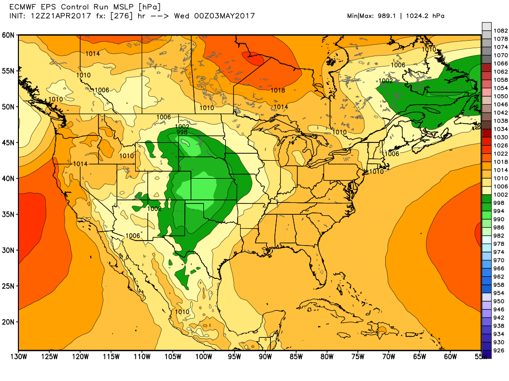
ECMWF MSLP Control Valid 03/05
Unfortunately the smaller mesoscale features which often arise such as front range convection which exists in areas such as DVCZ and near the Palmer Divide are not resolved in the longer range models. So while there is an apparent lull with the larger synoptic meteorology, we do expect there will be storms on apparent off days. Further into the future, the day 15 data which is the end of the observable run suggest a large pacific trough will likely make its way into the plains around May 9th or 10th and possibly trigger a couple high-risk storm days.

ECMWF Weekly – 15D Control 500 hPa
With that said, the forecast at this point will likely change a great deal so be sure to keep checking this blog for updates. I’ll do my best to post daily, nightly and even some rel-time reports once the trip begins.
June 14th 2016 – Vaughan, Ontario
Now that I’ve been back home for a while, I’ve had time to sort though the thousands of photos. This has been, without any question or doubt, the absolute best chase trip to the alley I’ve ever had since I started going down in the 2000’s.
I’ve put together a small gallery with some of my highlights from the trip and hopefully I’ll have all the chase logs up soon before I get too busy with the summer chase season here in Southern Ontario.


May 27th 2016 – Kansas City, Kansas
And the long 2300 km drive home begins! Oh, apparently you need to declare your guns at the border 🙂

Declare Your Guns
May 26th 2016 – Kansas City, Kansas
This was a moderate risk day with fairly high tornado odds. The only problem was that there was simply too much instability and it was a mesoscale nightmare with outflow boundaries, waves and all sorts of stuff all over the place! Convection from the night before really made everything a mess!
Kinsley, Kansas Storm
The storms that did go up quickly turned into a line or a cluster and became outflow dominated quickly. I don’t think anyone had a successful chase anywhere even remotely close to the target areas. It was a yuck day!

Weak storm near Dodge City
After the morning and early afternoon mess, clearing and sunshine allowed a couple of storms to go up in western Kansas and Oklahoma near the dryline. Unfortunately from a chase perspective, this was way west of the best shear vectors and the storms were very linear.
Storm with limited rotation attempting to become a supercell
This storm north of Dodge City Kansas near Jetmore wanted to spin but it just could not pull itself together and the daylight began to fade quickly.
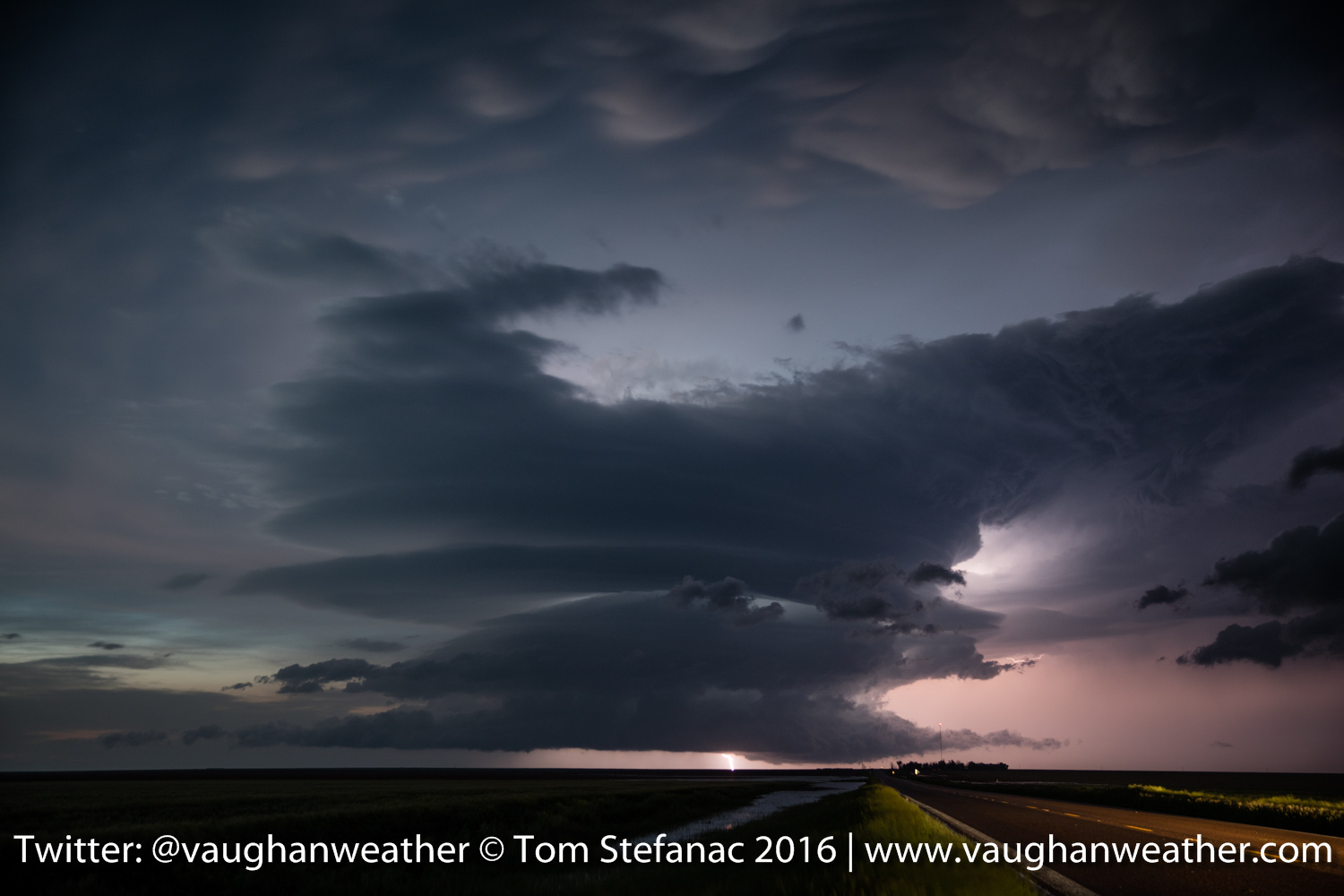
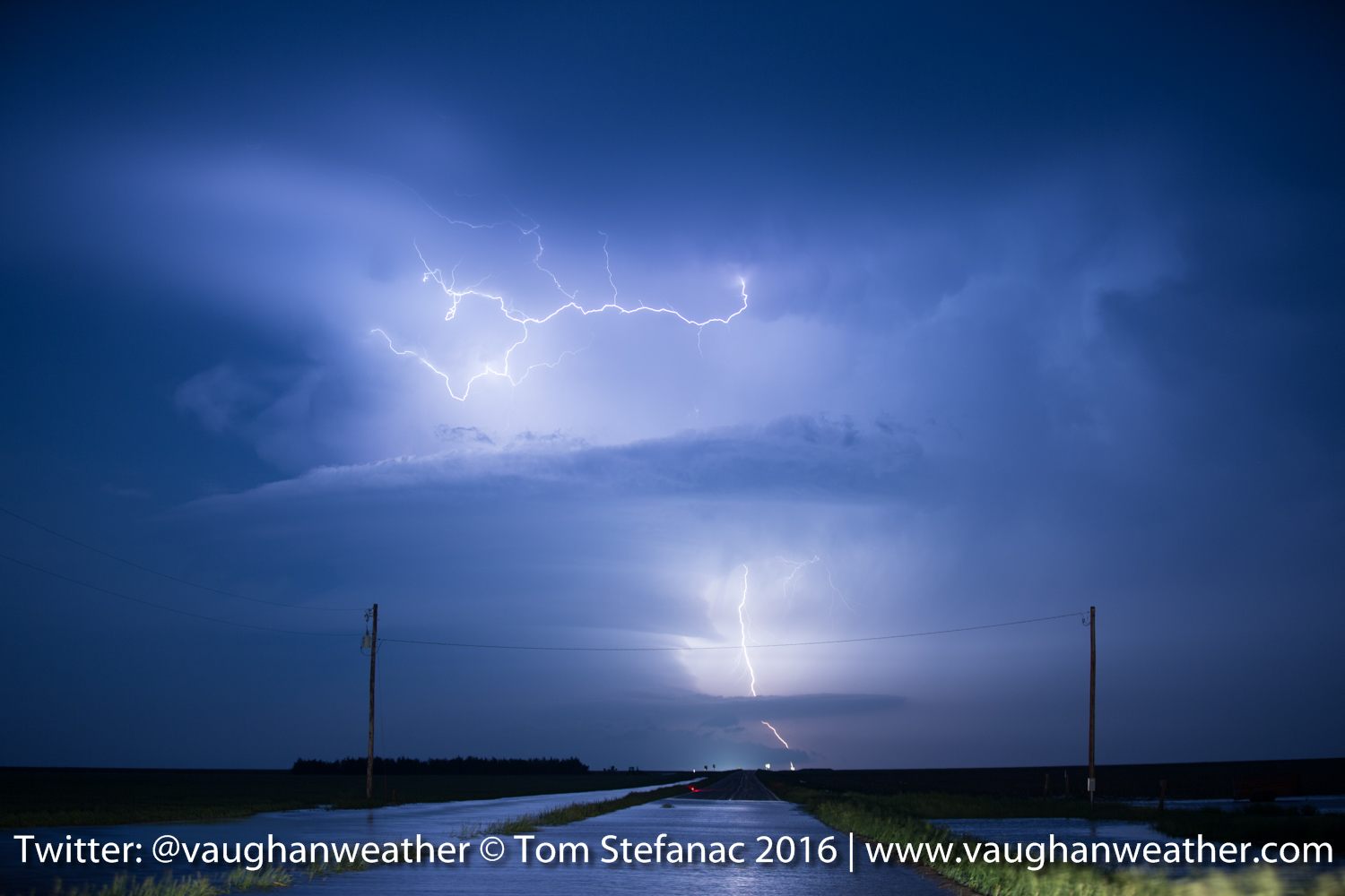
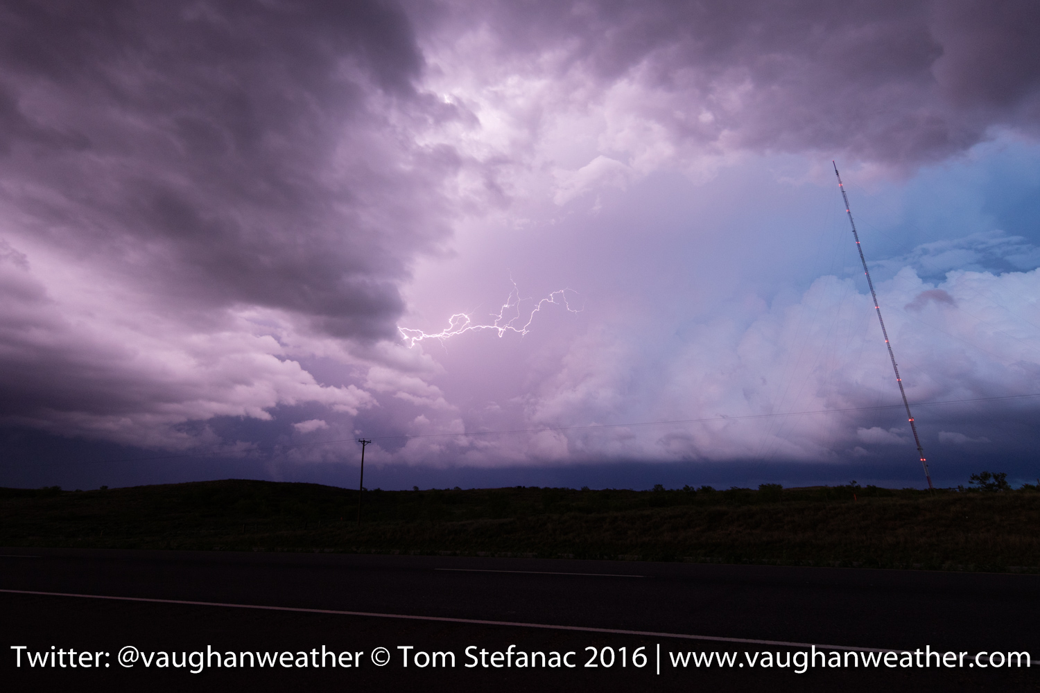
Ellinwood Kansas Lightning
Later that night we had some wonderful lightning along a nocturnal MCS that developed from the western convection and with that, my 2016 trip comes to a close!
May 25th 2016 – Wichita, Kansas
Bahhhhhhh!!! One of those days, I played the dryline and it totally screwed me! Should have stuck with the boundary to the north or bailed sooner. This cell (as forecast) popped up right where it was supposed to.

Storm east of Wichita
But then, just as it began to build, the unthinkable happened.
LP Storm – Pontiac Kansas
It shriveled up into a LP storm and eventually totally dried up and went bye bye. BAHHHH!!! Meanwhile just as this was happening the storm to the north was wrapping up to produce a wedge tornado. A saw a couple closer storms that looked healthy firing up near the Oklahoma border and bailed south.

Vernon Kansas LP Storm
Of course, as I arrived… it too went super LP and started to go bye-bye! What a frustrating day! Congratulations to all the chasers who clearly made the better call and headed north. Wish I had made that call too and bailed sooner. Ah well, I won’t make that mistake twice!
Tomorrow looks like a north central Kansas kind of day. Several boundaries receding and a warm front pushing north, so it’ll be one head of a day to watch the surface observations. Initial data suggests we could see another repeat with large violent tornadoes possible.
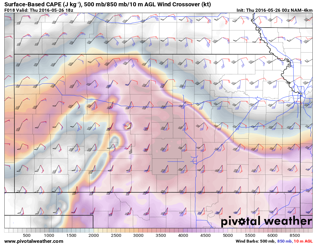
WRF-NAM Crossover
May 25th 2016 – Pratt, Kansas
Just a quick morning update, target today is a little east of Pratt. Still recovering from yesterday! Here are a couple more photos.
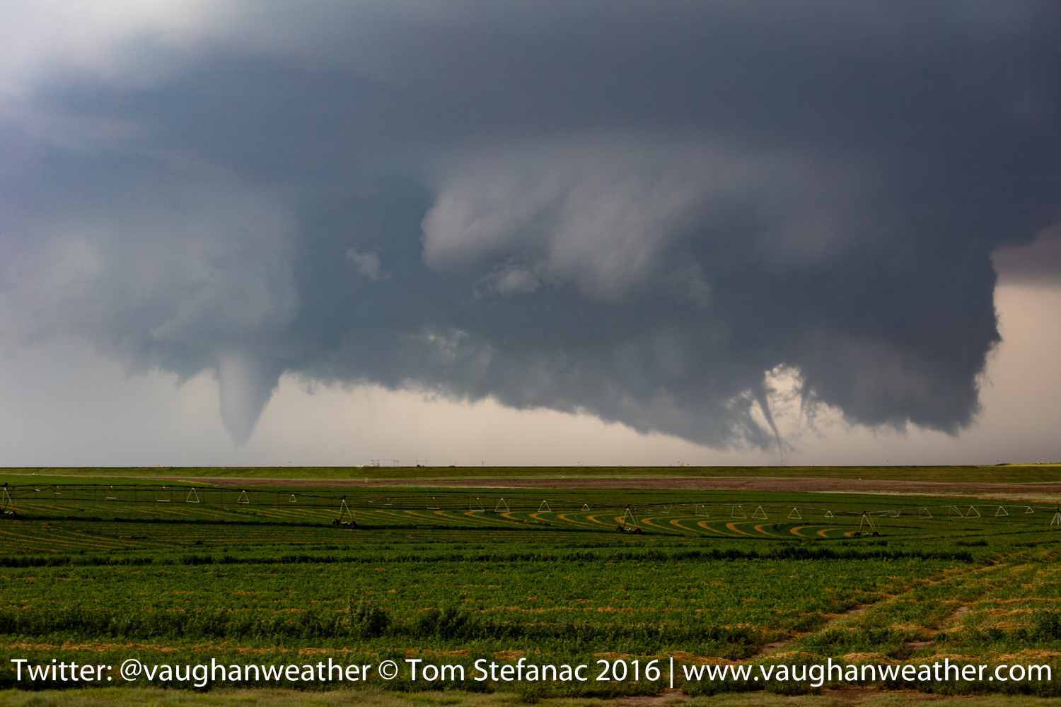
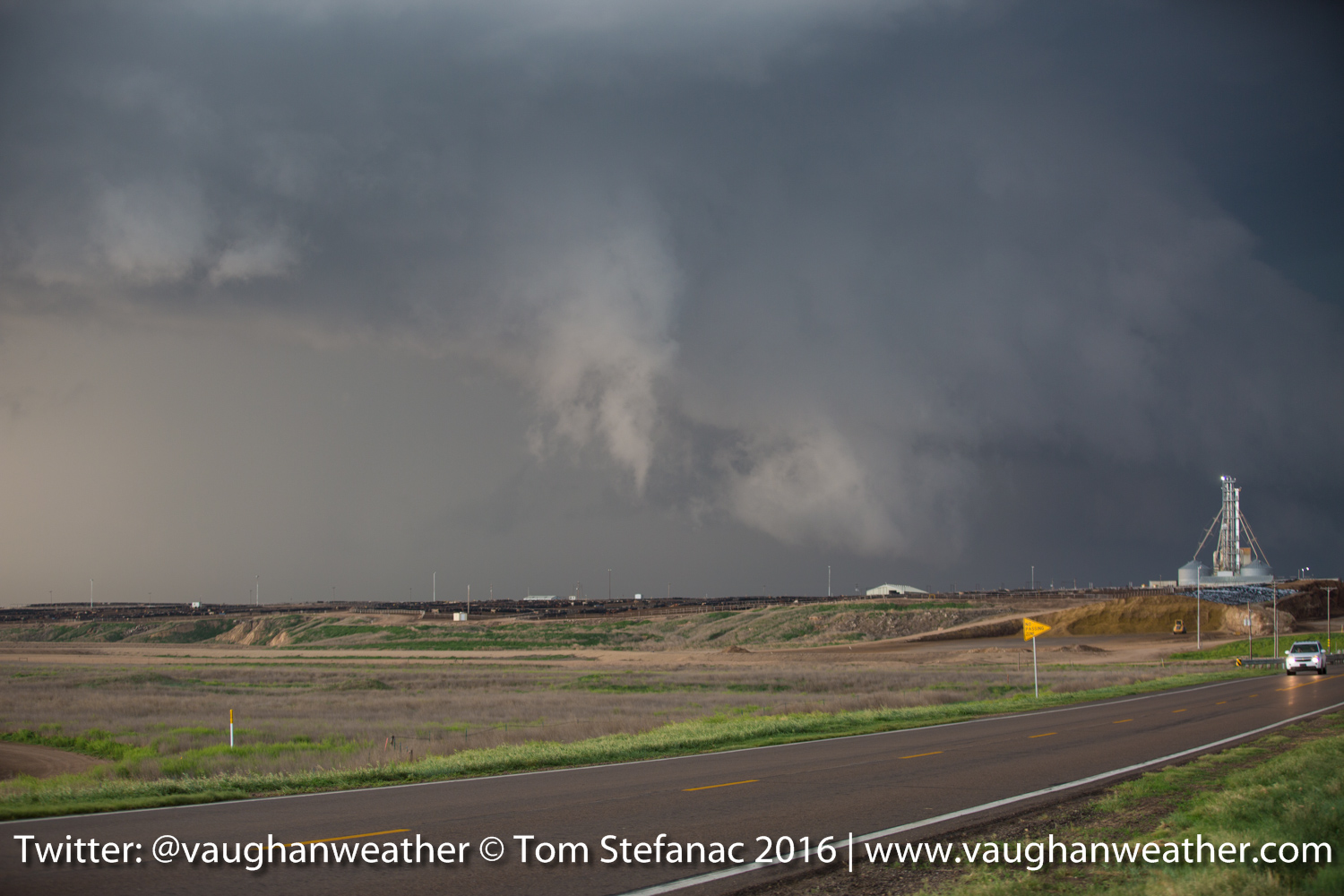
Three Tornadoes – Dodge City Kansas
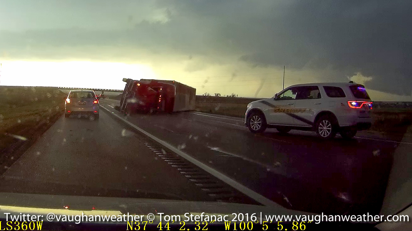
Truck Blown Over & Tornado – Dodge City Kansas
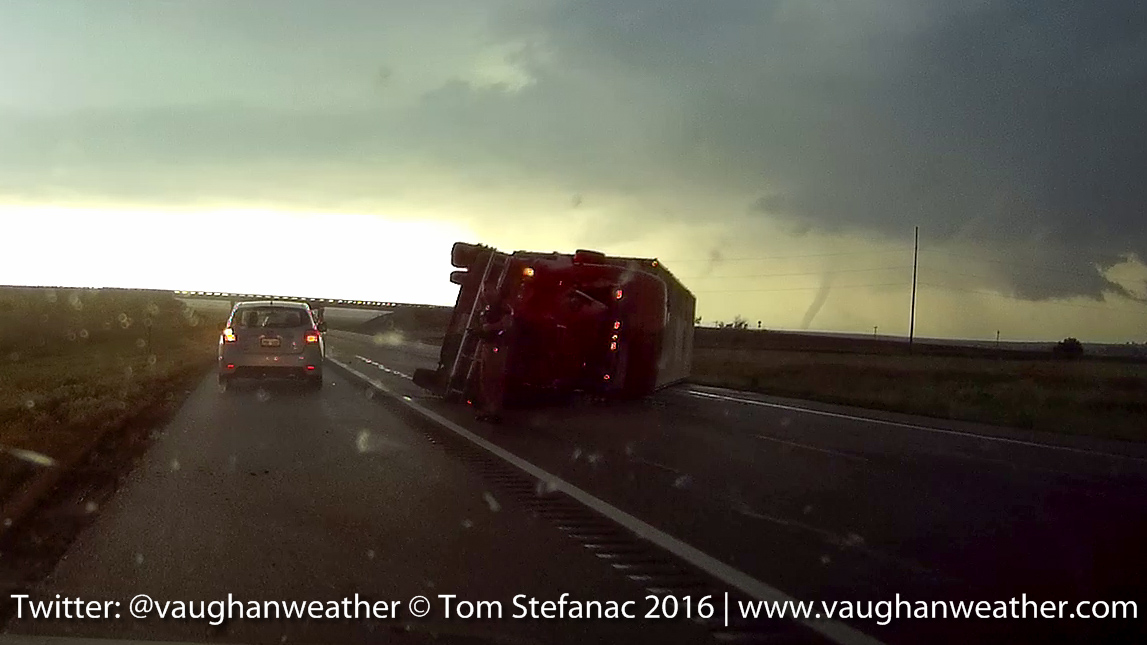
Truck Blown Over – Dodge City Kansas
The driver of the semi-truck was okay and thankfully there not too much damage to structures around the outer perimeter of the city. Of course a few places did take direct hits sadly.
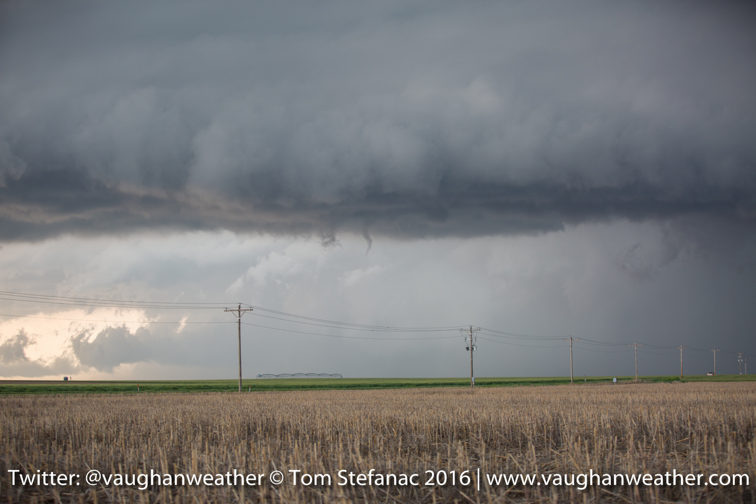
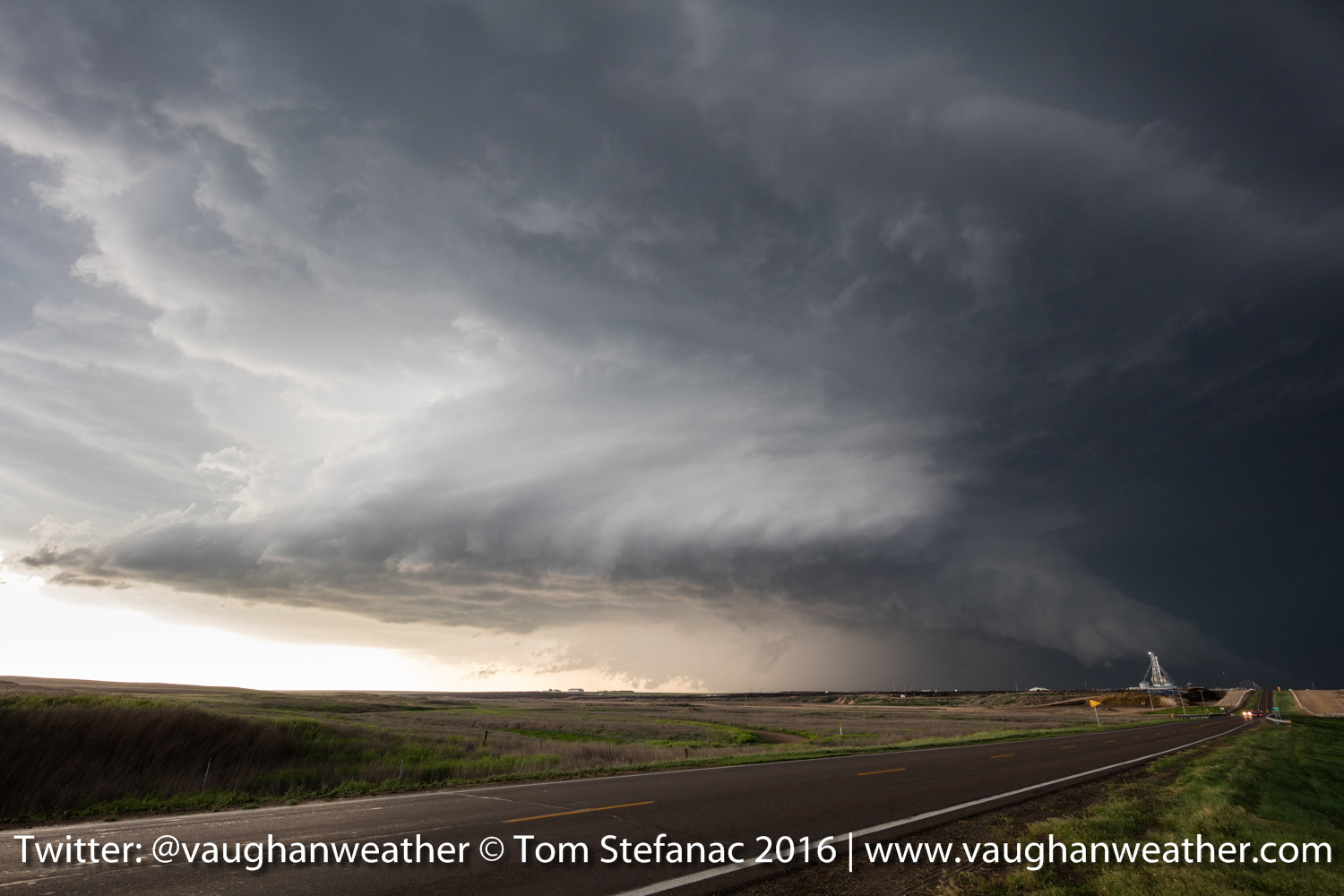
May 24th 2016 – Pratt, Kansas
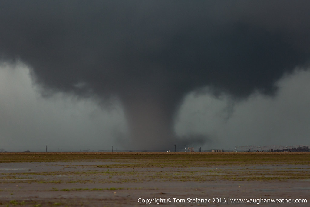
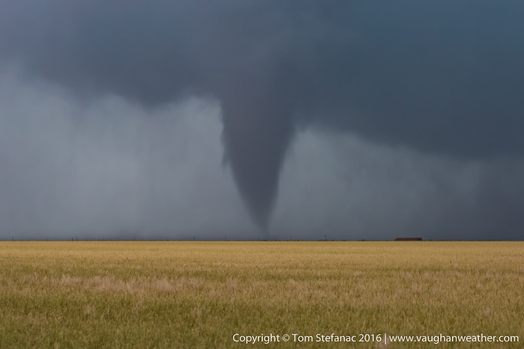
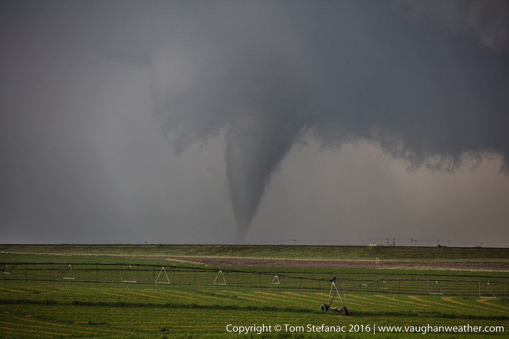
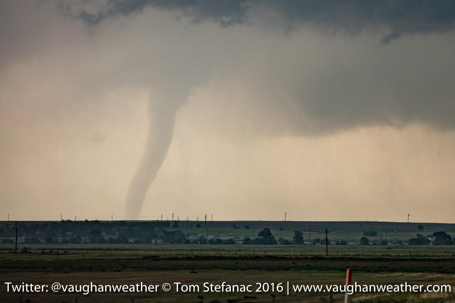
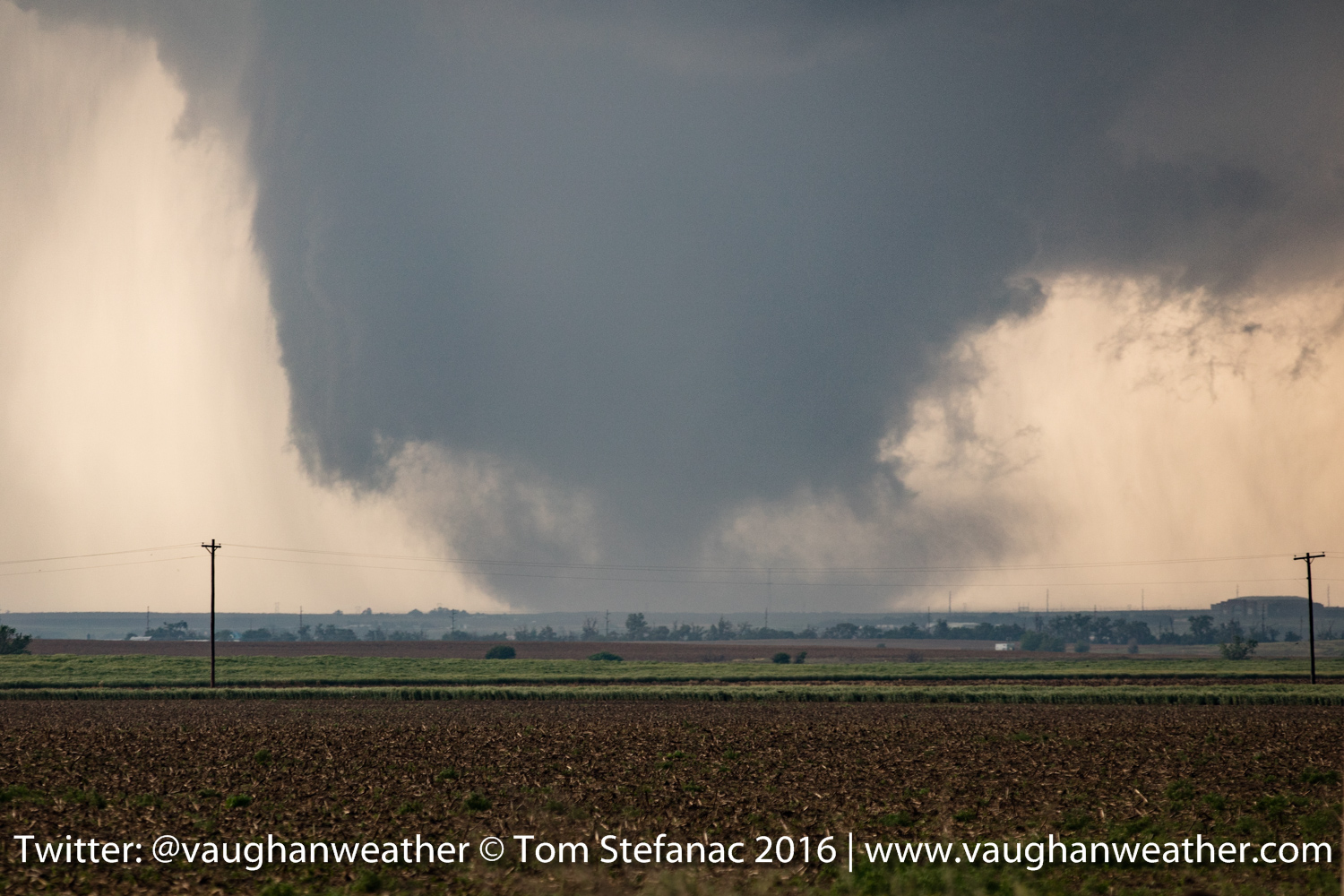
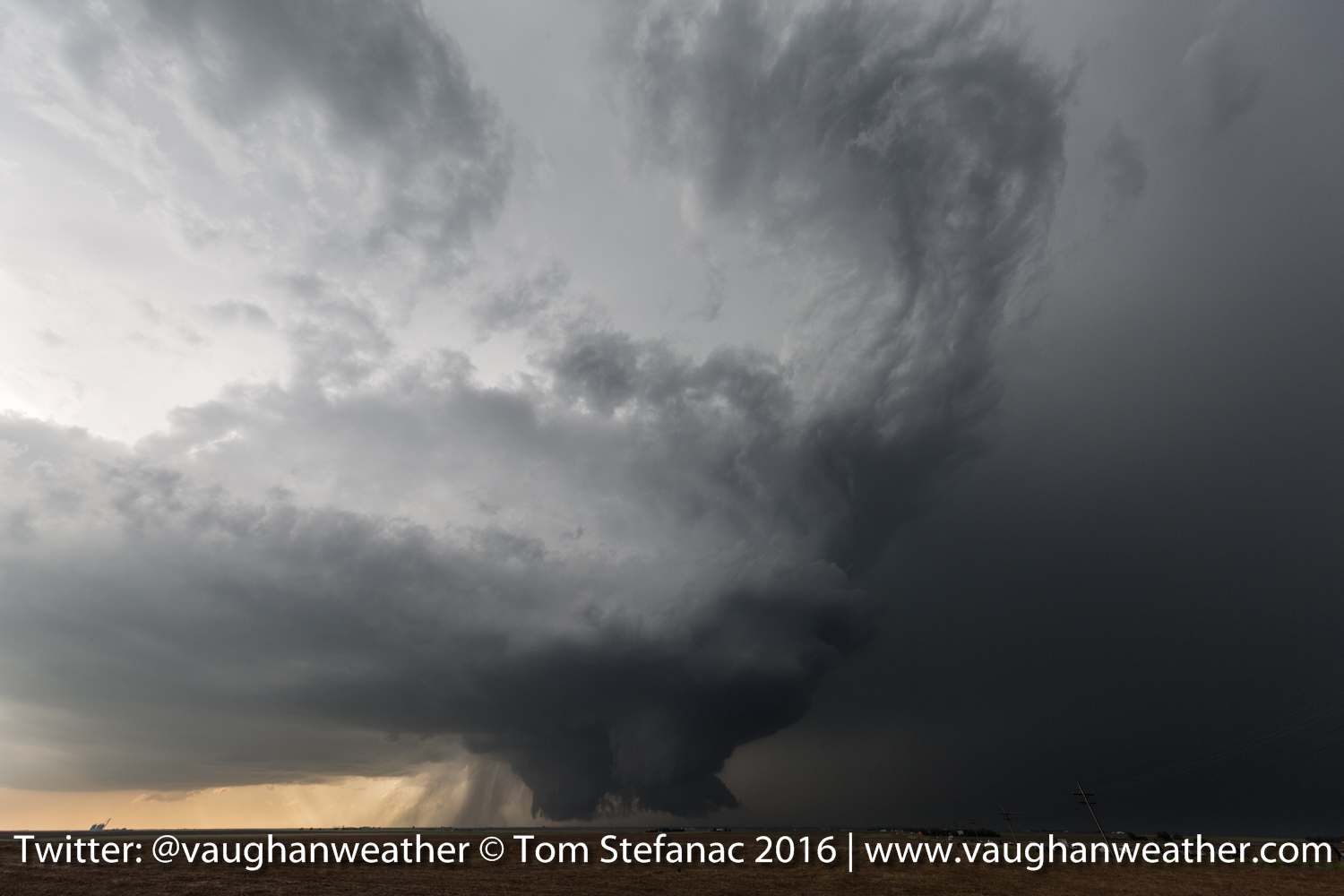
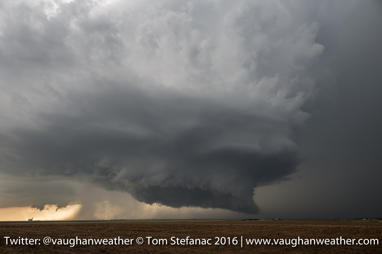
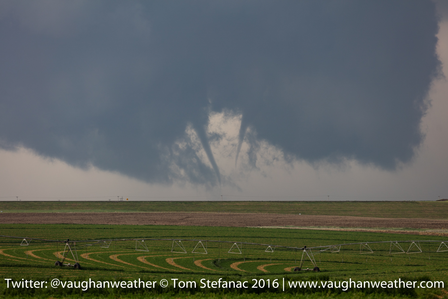
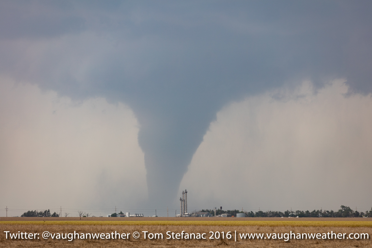
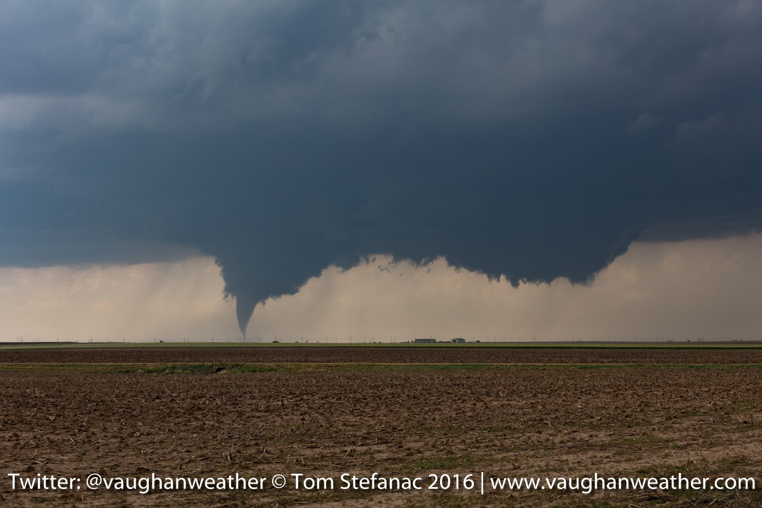
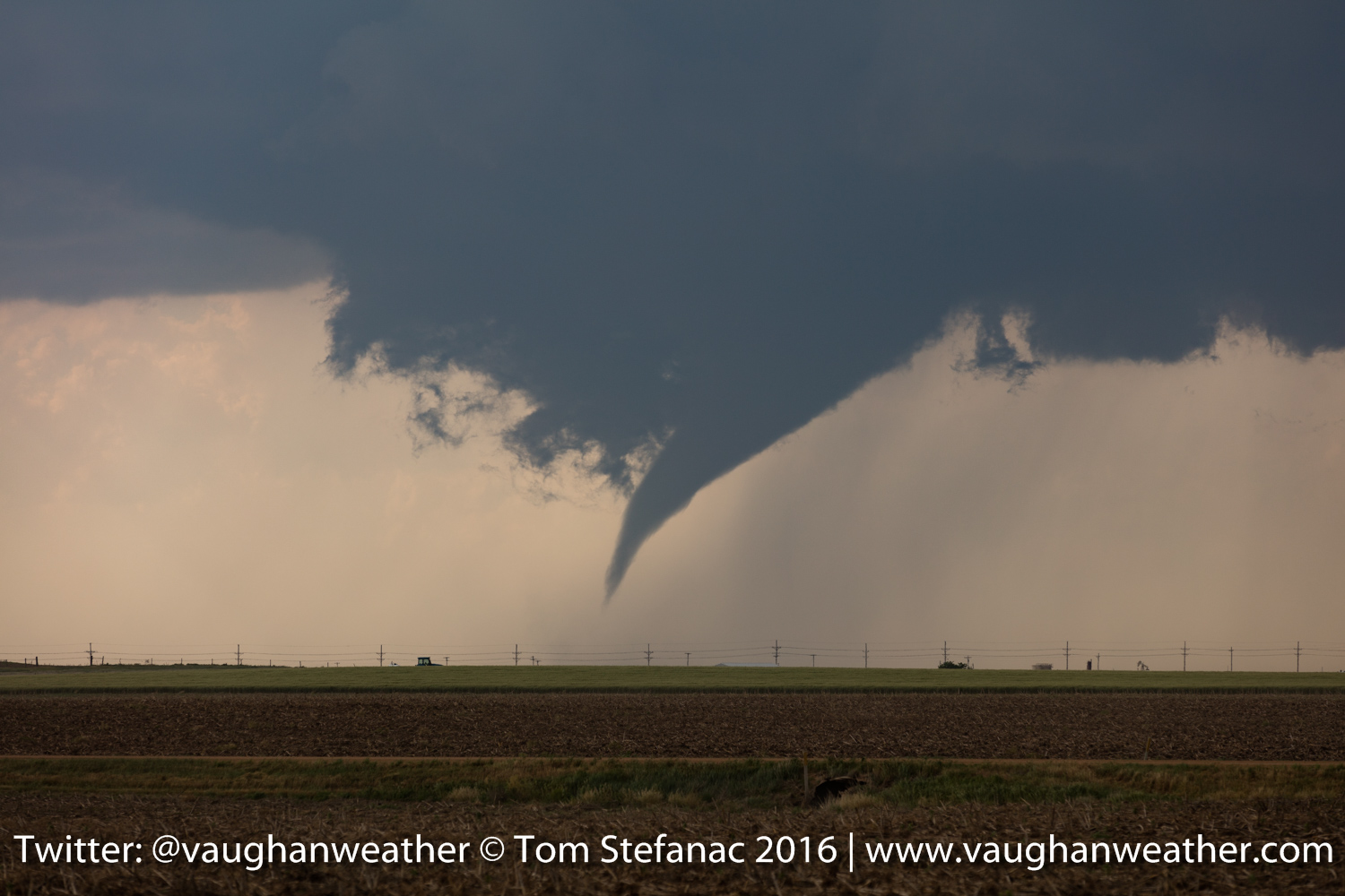
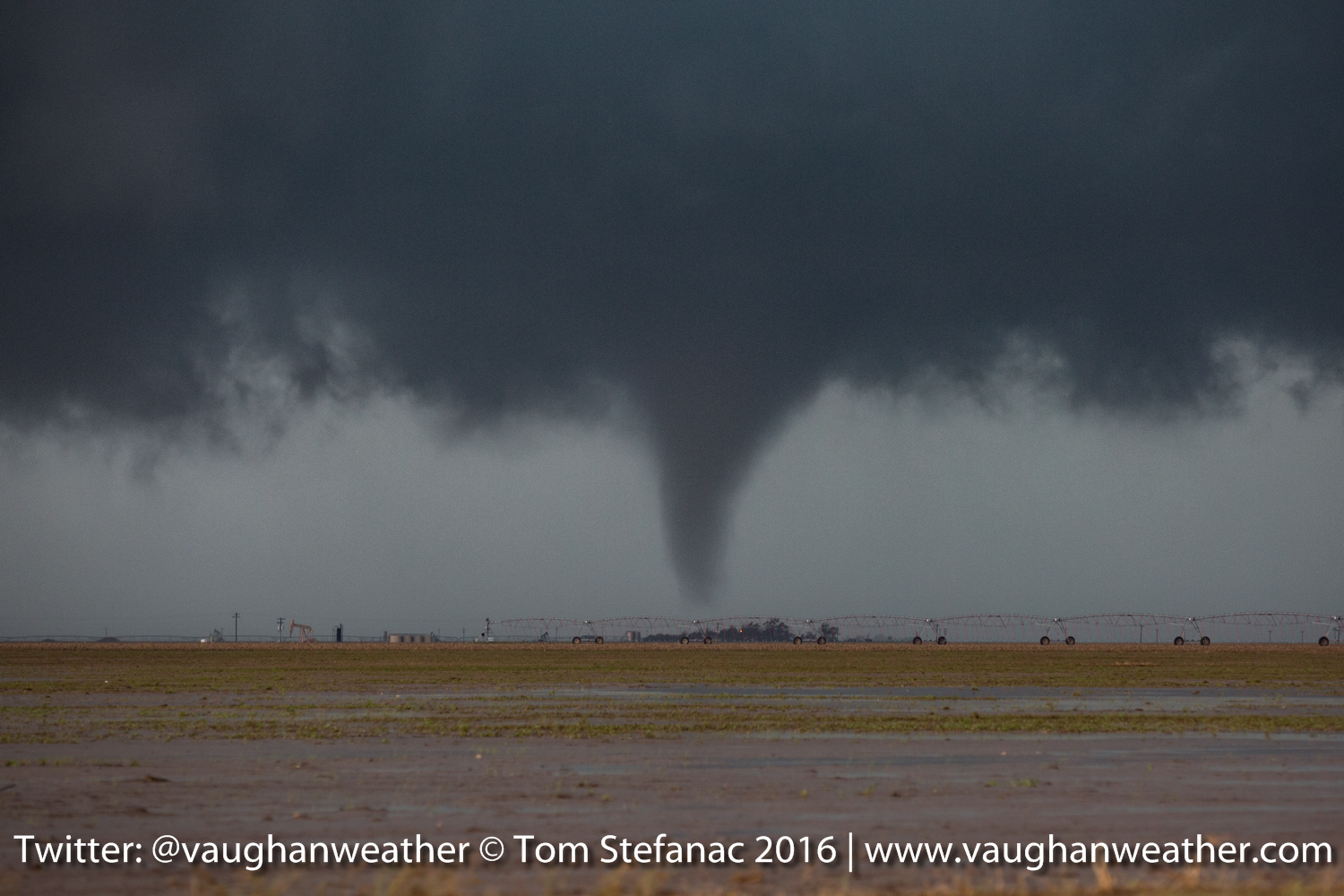
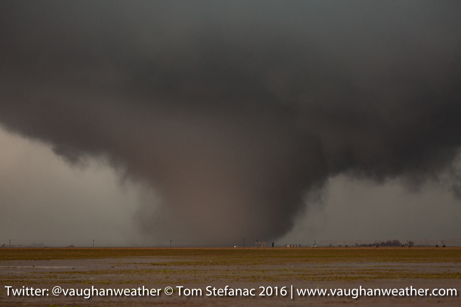
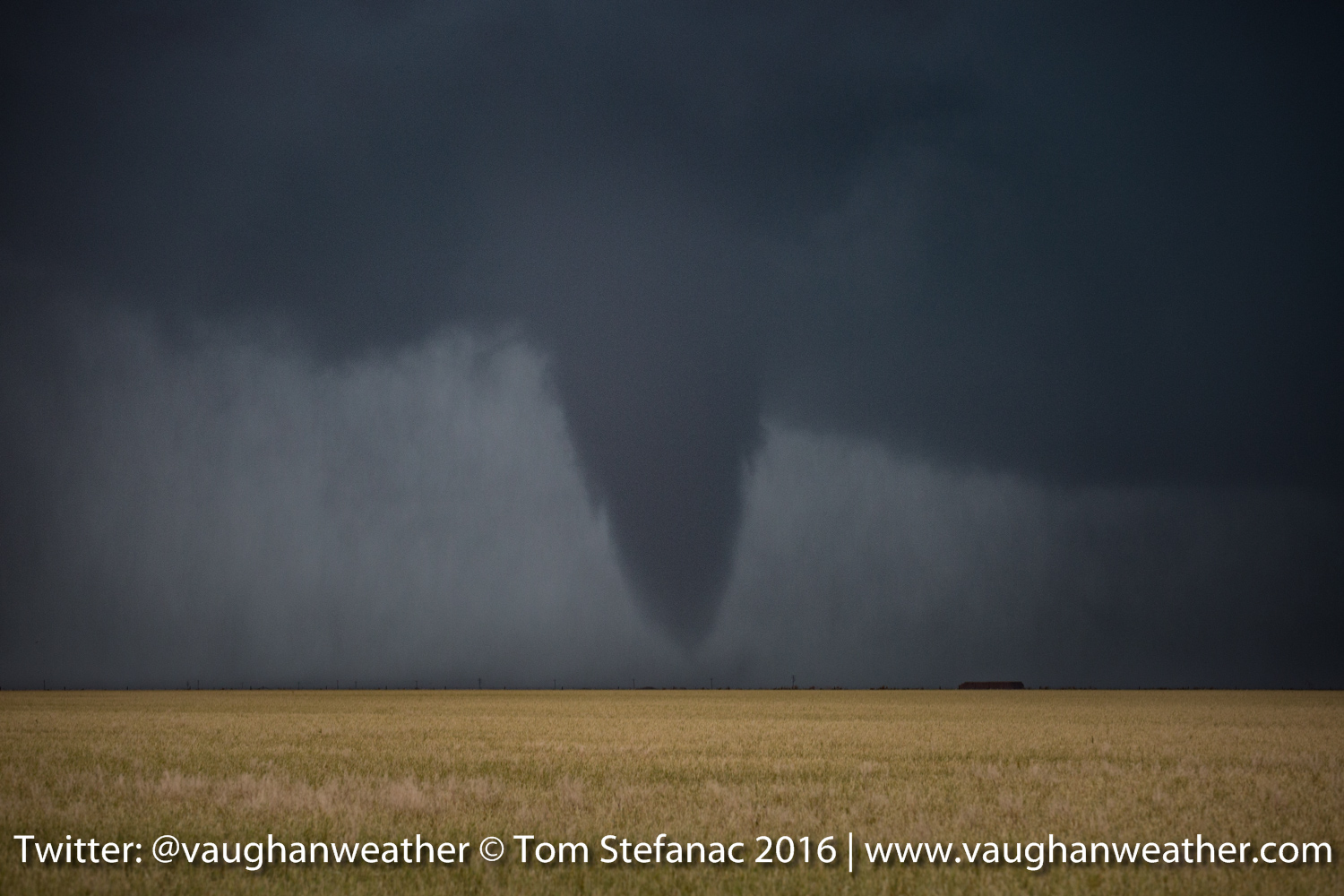
I don’t know where to begin, but this was probably the best chase day I’ve ever had. This morning I was fearful that Dodge City would possibly be in the path of a large tornado and it sure just barely dodged a bullet this afternoon!
It was a long day and I’ve lost count of how many tornadoes there were. The storm which spawned the tornadoes exploded in an area of incredible wind shear and some 40 minutes after initiation it produced its first tornado and then continued cycling & producing funnel after funnel.
Kansas Tornado 9

Kansas Tornado 8
Kansas Tornado 7
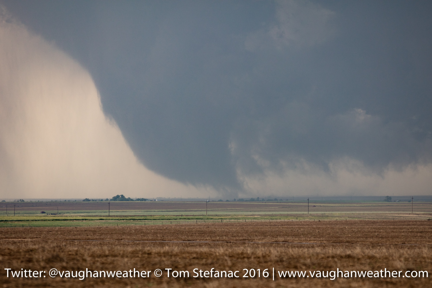
Kansas Tornado 6
Kansas Storm & Wall Cloud
Kansas Wall Cloud

Kansas Tornado 5
Kansas Tornado 4
Kansas Tornado 3
Kansas Tornado 2
Kansas Tornado 1
May 22nd 2016 – Canadian, Texas
How fitting that we;re spending the night in Canadian Texas! What a day! It was a long drive back to the Texas Panhandle from Colby Kansas and after a couple hours of frustration with the storms things finally paid off in spades! I had originally targeted Perryton TX after a very tough forecast call this morning. It was faced with either going north of falling back south and I decided the northern Panhandle was the best shot.
Cone Tornado – Olchitree County Texas
After arriving in Perryton the storm I was targeting was knocked around and beat up by a number of other cells. The road network also gave me some grief since it did not give me a safe viable means to get into the right part of the storm without getting cored. Finally I took the long way around and ended up right in hook of the storm as the higher sheer values from the west migrated through and kicked the storm into high gear! It became a cyclic HP tornado producer quickly.
Large Tornado – Olchitree County Texas
We were in the right spot just as it produced this rather large tornado and several smaller tornadoes!
Moderate Cone Tornado – Olchitree County Texas
Can’t say much more other than it was a chase day that totally panned out after a fair bit of aggravation!
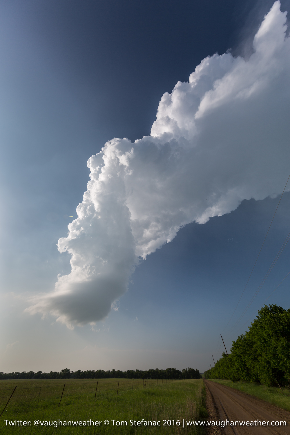
May 21st 2016 – Colby, Kansas
Thunderstorm Anvil – Kansas
We hit the road bright and early ready to drive the 450 kilometers from Amarillo to Lakin which was my forecast target. It was sure a rush to wait ordeal! Finally, at around 4:30PM the dryline inching west from Colorado began to push up storms in Kansas.
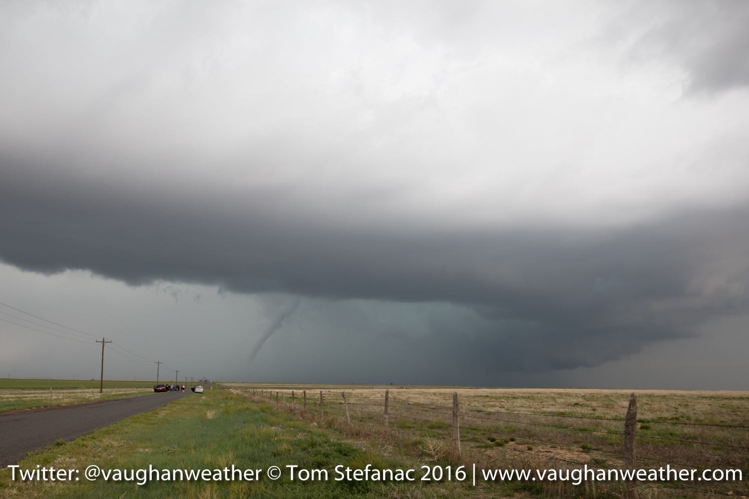
Skinny Funnel Cloud – Logan County Kansas
The storm of the day was actually only 20 miles from my target and the very next town north of Lakin known as Leoti. The supercell did produce a brief tornado and many smaller rope funnel clouds such as the one above.
Supercell Thunderstorm – Logan County Kansas
The storm eventually became a beautifully sculpted supercell, except it was barely moving, the forward motion was something like 2 miles per hour if that. Good for chasing, bad for tornadoes since it was just building a gigantic outflow pool underneath.
Ragged Funnel – Logan County Kansas
Here’s another ragged funnel that was produced but never amounted to anything.

Sculpted Supercell – Leoti KS
As the evening continuing the wind shear profiles in the atmosphere became more pronounced and the storm took on a beautifully sculpted structure!
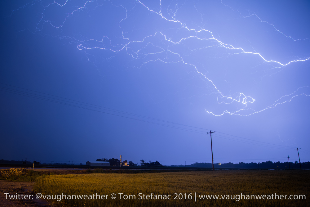
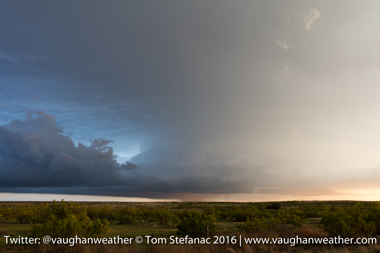
Supercell Lightning -Russel Springs Kansas
As even turned to dusk, I focused on getting as many lightning photos as I could! A new storm exploded to the north near Russel Springs and provided a wonderful light show.
Supercell Lightning & Flash Flooding
I only ran into one little hiccup. While taking these lightning photos, the bridge behind me wash out and the road in front of me flooded! I had to wait a little while for the water to finally recede but it did and we spent the night in Colby Kansas.
May 20th 2016 – Amarillo, Texas
As we were leaving Tucumcari we stopped to look at this hill. I was thinking about venturing a drive to the top but then realized with 4×4 it was not a good idea!

Mountain near Tucumcari NM
We continued on our way east to Amarillo Texas and stopped at the cadillac ranch!
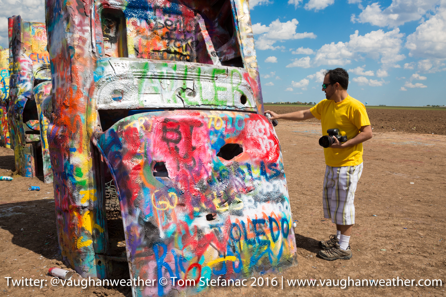
Painting At The Cadillac Ranch
I tried my hand at some very bad painting!

Cadillac Ranch
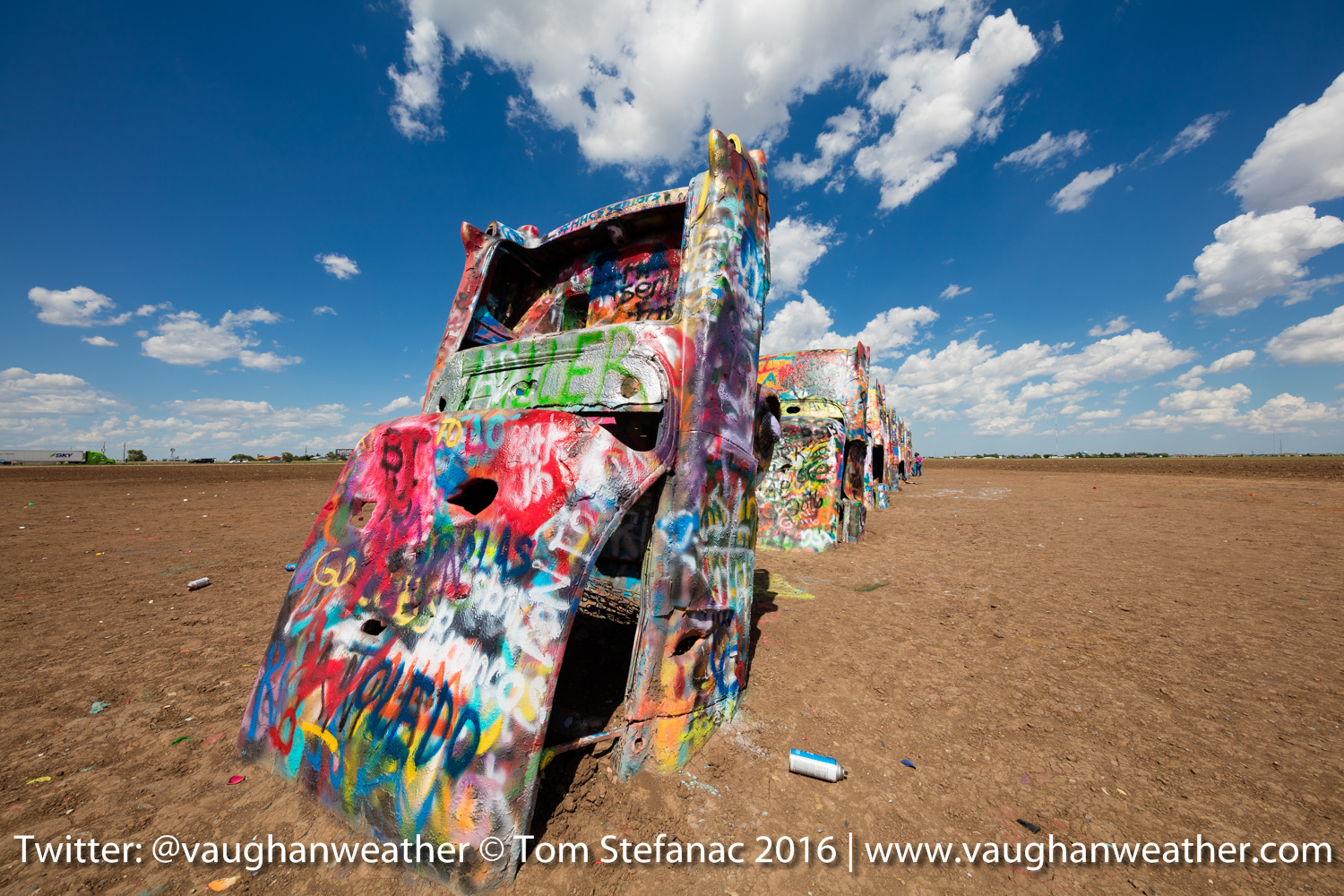
Line of buried Cadillacs

Jen and myself at the ranch
After the ranch we checked into the Days Inn and then headed over to the Big Texas for some steak! I’ll post those photos later!!!
Looking ahead to tomorrow it looks like a potentially serious day across extreme western Kansas. There is incredible run to run consistency between the WRF-NAM and the SREF. Both sets of models continue to show a very high risk for a single discrete storm on a moisture axis with strong forcing and an impinging dryline.

WRF-NAM 00Z Echo Tops
If everything the NAM is showing turns out to be true, it will be a hell of storm in Kanses. Right now SIG TOR and Supercell composite indices are off the chart, the environmentals are just insane. Tomorrow it’s going to be an early morning, lot’s of analysis and 3-4 hours of driving.
May 20th 2016 – Tucumcari, New Mexico
Today looks like the last down day, moisture returns to the high plains Saturday morning and by late afternoon there should be storms, some of which may become supercells along the developing dryline that will surge east out of New Mexico.
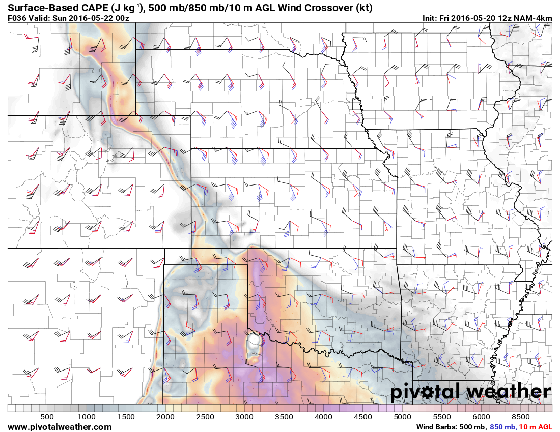
CAPE 850/500 Crossover
The best shear as forecast is expected to be towards the northern periphery of the moisture nose. Unfortunately the dryline runs the risk of undercutting whatever storms form there and then there is the issue of available energy which is quite small in Kansas compared to the Texas Panhandle and Oklahoma.
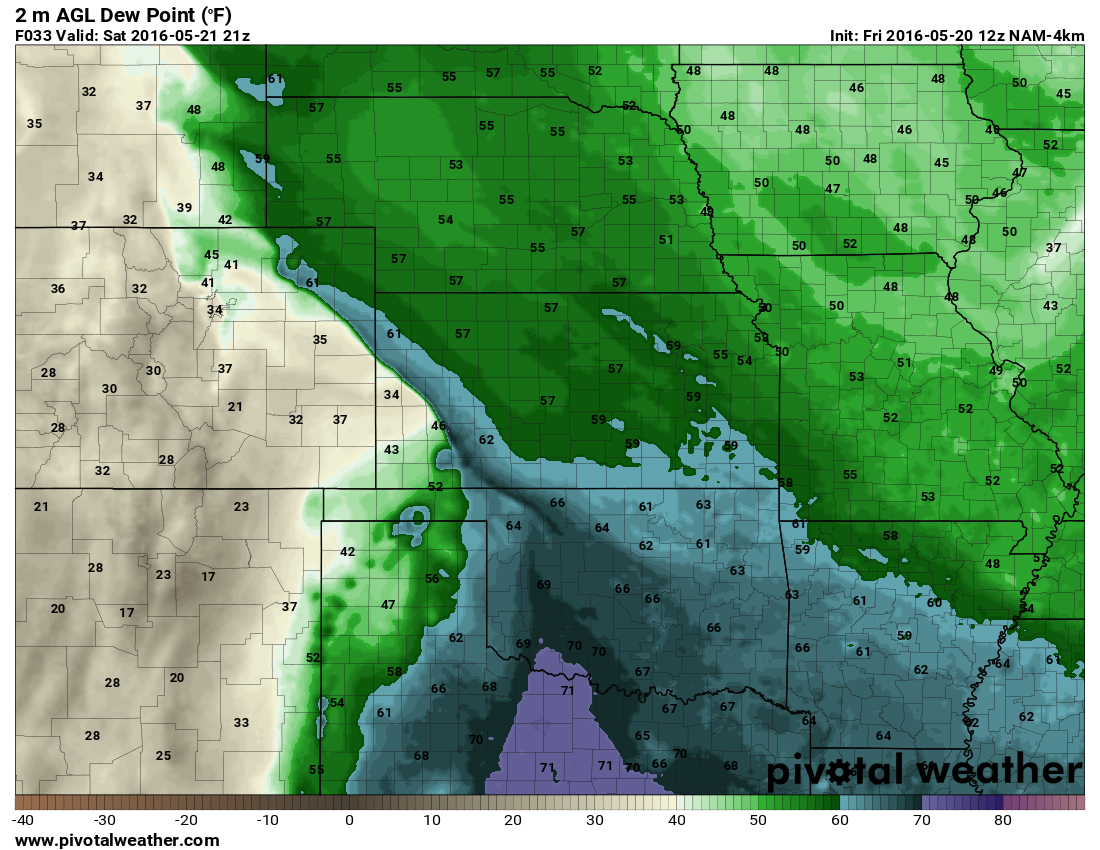
Two Meter Moisture
Here’s another example showing the available moisture in the 2 meter dewpoints. The moisture is more spread out in Texas\Western Oklahoma but rapidly falls-off beyond the moist axis in western Kansas. This means whatever storms do form in Kansas might run into moisture issues, especially if they’re able to get out ahead of the dryline. While any storms ahead of the dryline further south will be running into much better moisture fields and likely hold on longer. The other thing is that expected LCL’s will be lower and more conducive to tornadoes in Oklahoma. However the issue is that the best shear is currently forecast to remain in Kansas so it really is a catch-22 at the moment.
May 19th 2016 – Tucumcari, New Mexico
What do you do when there are no storms???!!!! You visit all the tourist attractions!!! Since we’re in New Mexico and not too far from Roswell it was only right to go alien hunting and visit the infamous town known for the 1947 alleged UFO crash incident.

Welcome to Roswell
I wont lie, I’m not a big believer in the conspiracy theories and I have serious doubts about the validity of the whole incident but it’s still fun to visit.

Roswell Welcome Banner
Wandering around inside the museum I was greeted by 4 alien and had to call some friends to tell them!
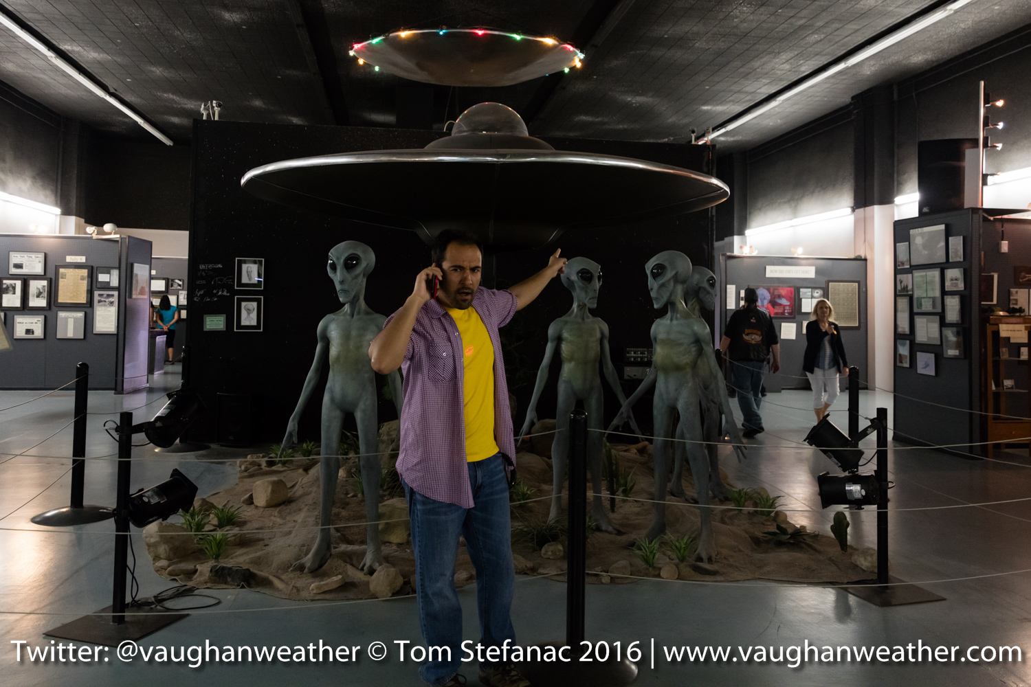
Look aliens!
I would have loved to have visited the Trinity Test Site (first nuclear detonation) but it was some 280 kilometers off course and truth be told there is not much to see. They actually allow you into the blast area a few times a year and I was not sure if I would be allowed in. If not, it would be a distant look at an empty plain which has been long overgrown by shrubs. Apparently, for those who have been at ground zero, there is still plenty of radioactive glass from the melted sand and other neat effects that remain visible in the environment.
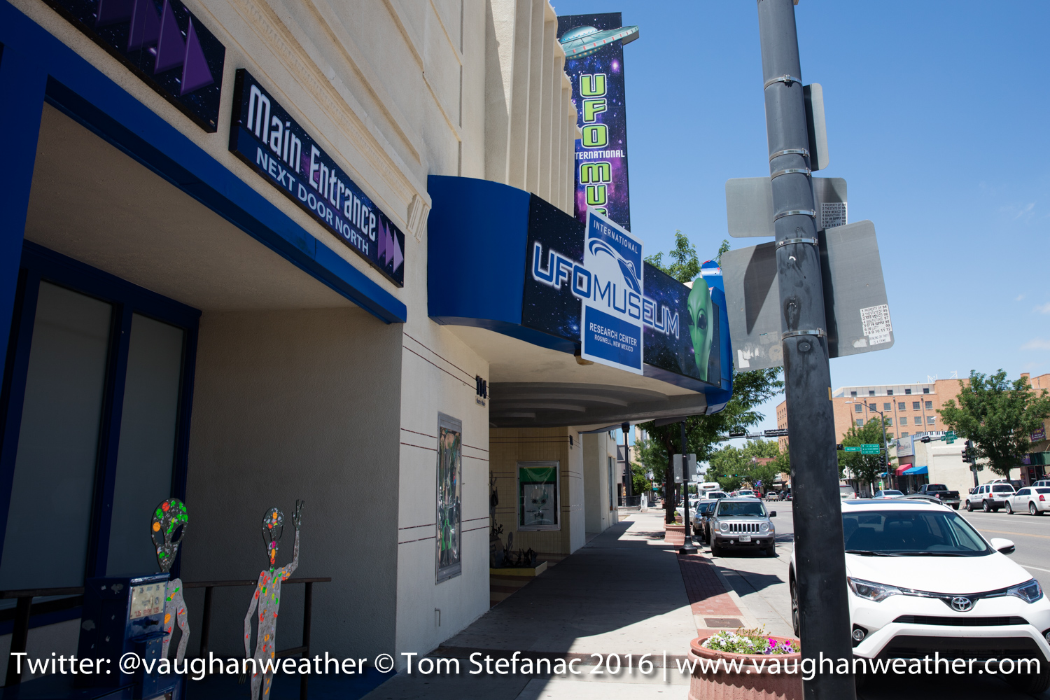
Roswell Museum
May 18th 2016 – Carlsbad, New Mexico
We spent much of the day driving and took our time leaving Texas and ugh… finding an oil filter (long story there).
I attempted to intercept a couple storms that rolled off the high elevation Sierra Madre Oriental mountains in Mexico near the Texas border but there was virtually no boundary layer moisture in the lower elevation land east of the Rio Grande. So whatever storms did form could only survive a short distance before they became only orphan anvils. We decided to head to Carlsbad New Mexico for the night so we can visit Roswell and do some UFO stuff before heading north towards Colorado.
Van Horn Mountains, TX
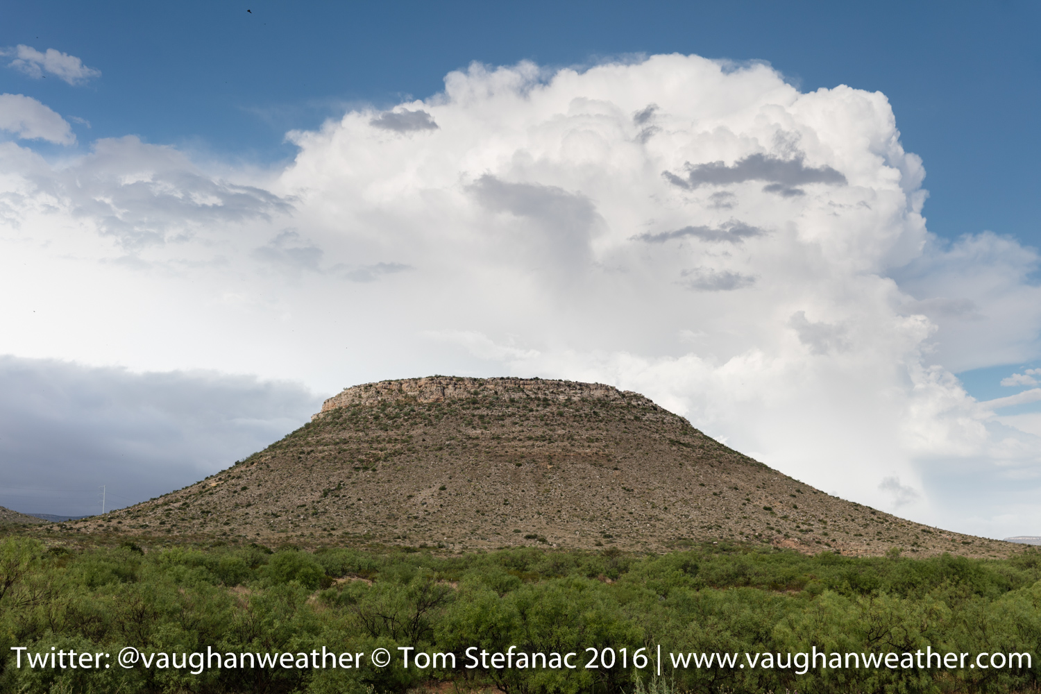
This part of extreme western Texas I hadn’t really visited before so it was very new and I found the geography of the landscape with plateaus, flat top mountains and high elevation deserts very fascinating. We stopped all along the way to Carlsbad to take pictures.
Mountains near Van Horn, TX
The ranches in this area are also huge rivaling New Mexico and Wyoming in sheer size!
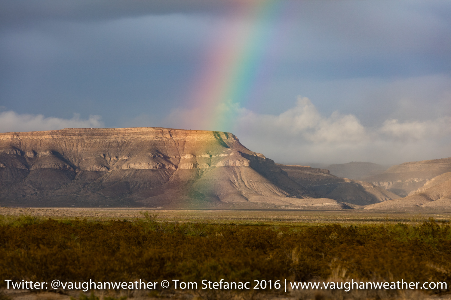
Rainbow somewhere in Culberson County, TX
We were also treated to a rainbow and an orphan anvil / remnant storm passing over Guadalupe Peak near Pine Springs.
Guadalupe Peak, Texas
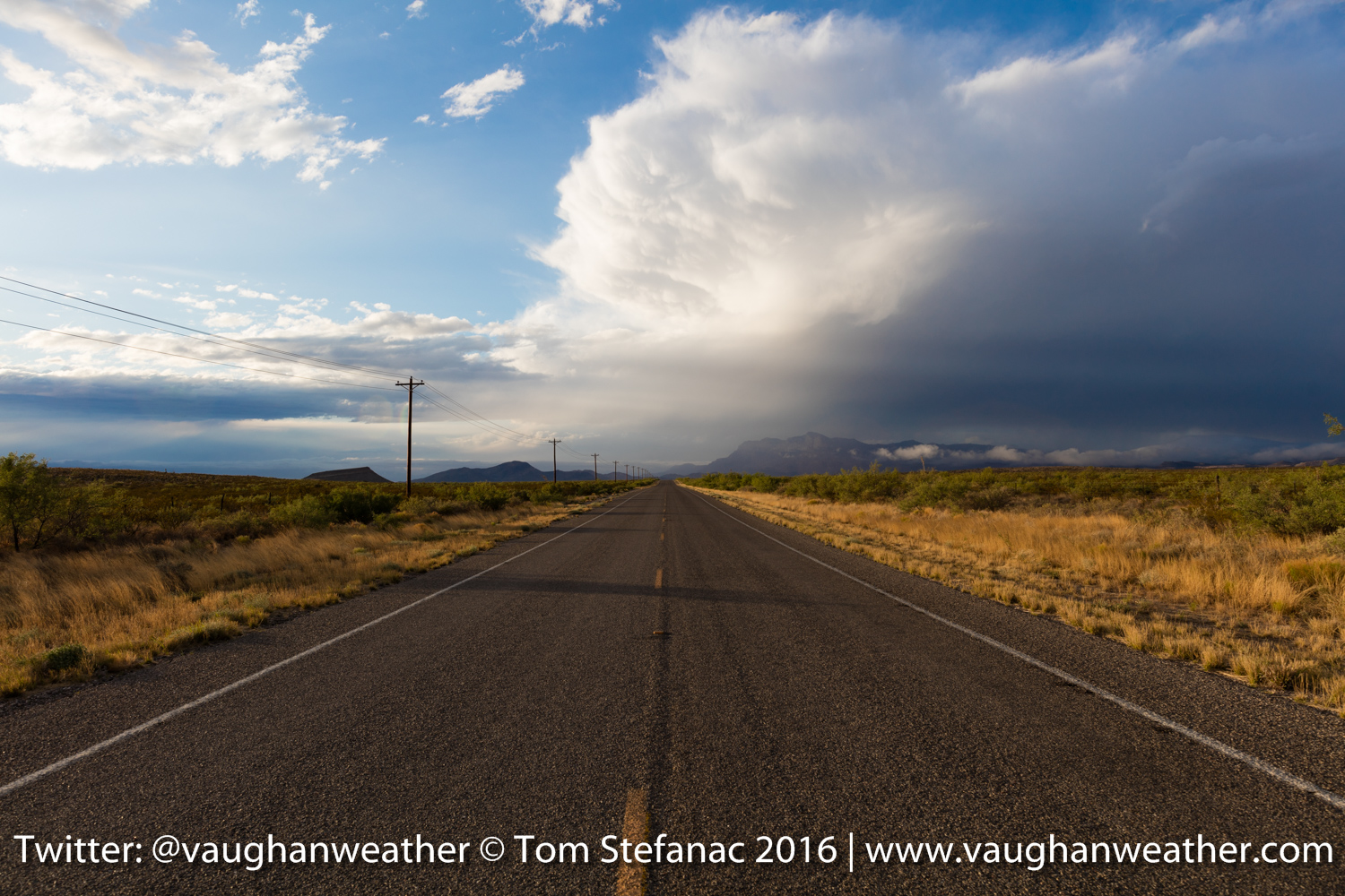
Perhaps the coolest thing of the entire day was the rolling cloud bank from the saturated airmass as the storm rolled over head of Pine Springs.
Rolling cloud bank near Pine Springs, TX
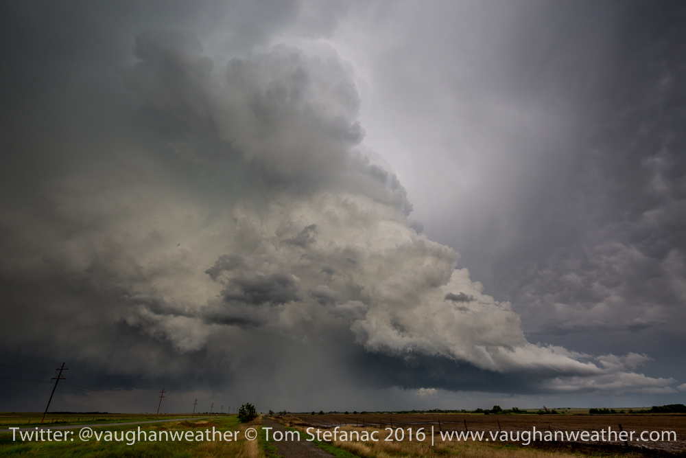
May 17th 2016 – Sonora, Texas (evening)
Long day, lot’s of storms, no tornadoes thank to a major lack of upper dynamics but some pretty supercells.

Mammatus clouds in Sonora Texas
Supercell behind a flattop rock in McCamey, Texas
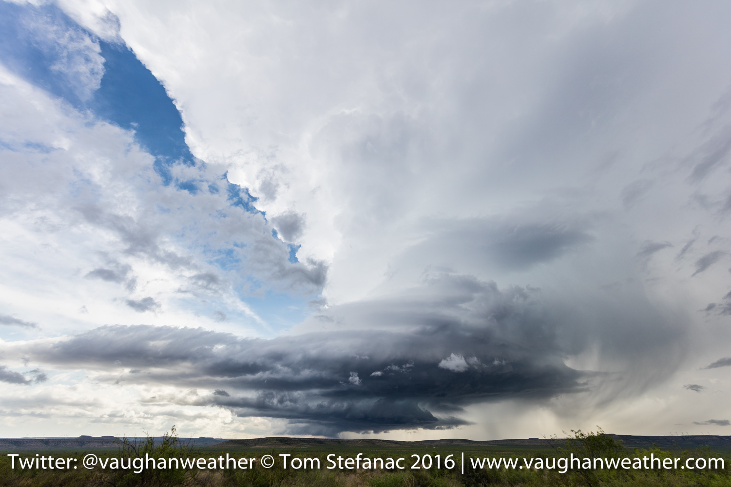
Beautiful supercell near McCamey Texas
May 17th 2016 – Amarillo, Texas
Brrrr, it is freezing here in the Texas Panhandle! Looks like we have a 4 1/2 hour drive south to escape the cold pool, and remnant outflow from yesterdays convection here in Amarillo.

Current surface analysis 10Z
So the target today is going to be somewhere around San Angelo, the cold front should slow down and the regressing outflow boundary will eventually be overtaken. There is enough shear for a tornado or two.
HRRR 21Z
May 16th 2016 – Amarillo, Texas
What a day! Ended up on a supercell near Felt Oklahoma which is basically a stones throw from New Mexico and Texas. The storm produced a beautiful stovepipe tornado on the back side!

Felt Oklahoma Tornado
The tornado lasted about 10-15 minutes before roping out! It was amazing to watch the tornado come out of the rain into good visibility. I can’t complain, Oklahoma is a state that always has and continues to produce funnels for me.

Felt Oklahoma Rope Tornado
Felt Oklahoma Tornado & Parent Storm
After the tornado, we intercepted a second growing supercell to the west which produced a funnel cloud near Perico Texas. The storm was spinning and really wrapping up but outflow from the storm which produced the earlier Felt tornado proved just too much to overcome.

Perico Texas funnel cloud

Perico Funnel Cloud
We intercepted several more storms and we’re treated to some large hail and a wonderful light show in the evening! Great first day of action!
Masterson TX Supercell

Moore County TX Storm

Big Hail South of Masterson TX
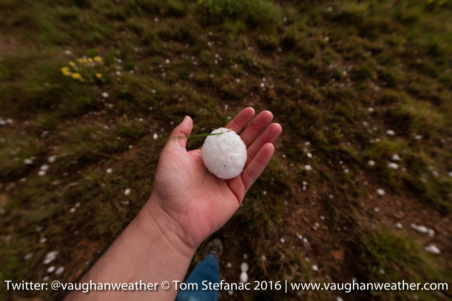
Big Hail South of Masterson TX 2
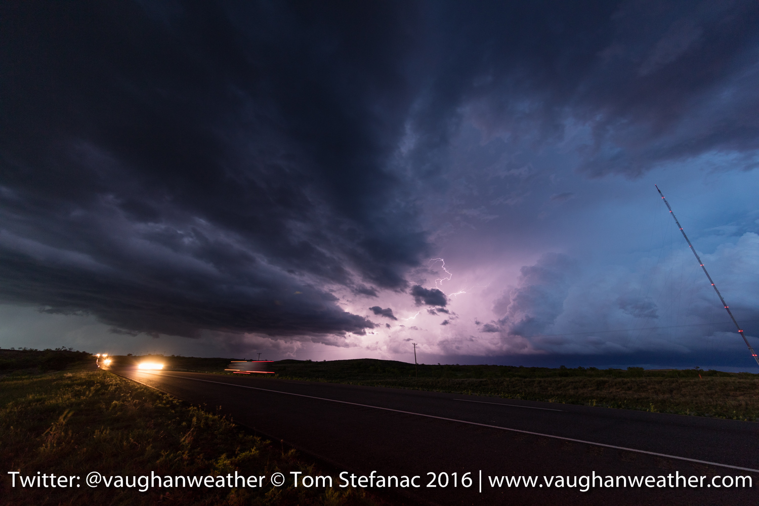
Potter County Lightning 1
Potter County Lightning 2
We’re now calling in a night in Amarillo.
May 16th 2016 – Elk City, Oklahoma (morning)
Quick morning analysis reveals a complicated setup, looks like the dryline is still questionable and convection from the NW may overrun closer the triple point. The current target is halfway between Elk City and Amarillo to keep a north, west and southern route open.
May 15th 2016 – Elk City, Oklahoma
Well after a long drive we’re ready and in position for the first severe weather episode. We’re spending the night in Elk City Oklahoma in anticipation of possible dryline supercell storms Monday afternoon.
I’ve uploaded this brief video discussing the potential setup.
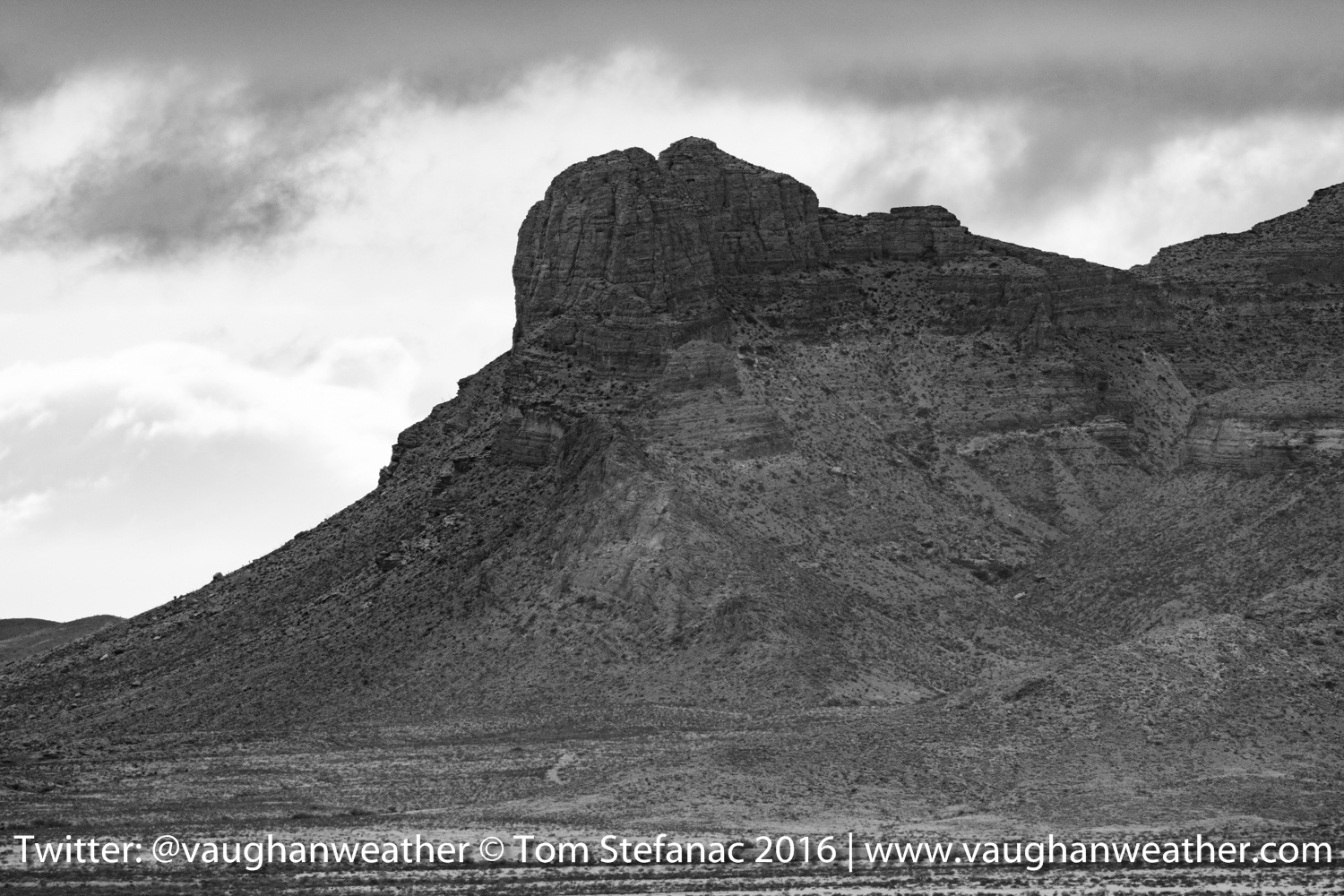
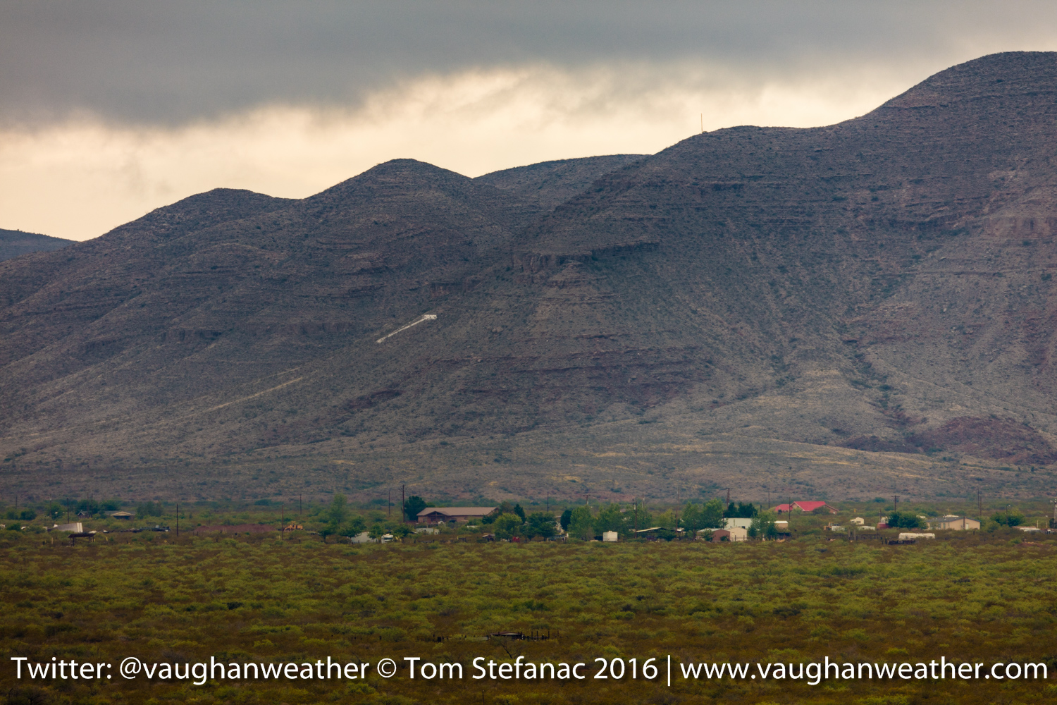
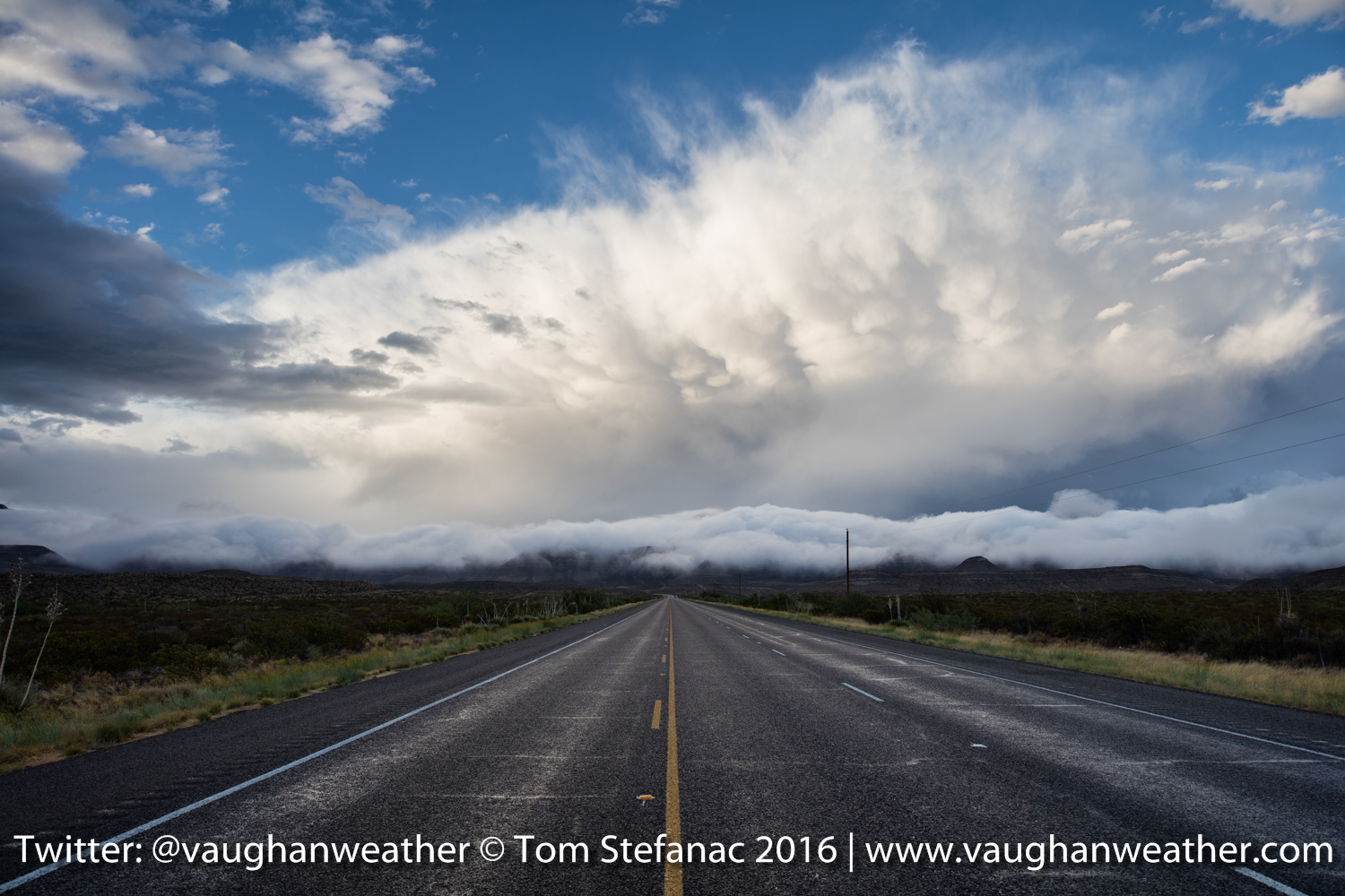
Outside of storms I also took a few moments to capture some of the neat geography found in Western Oklahoma
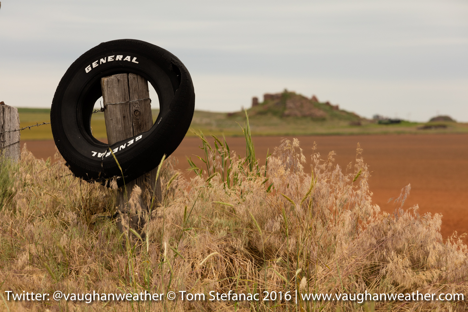
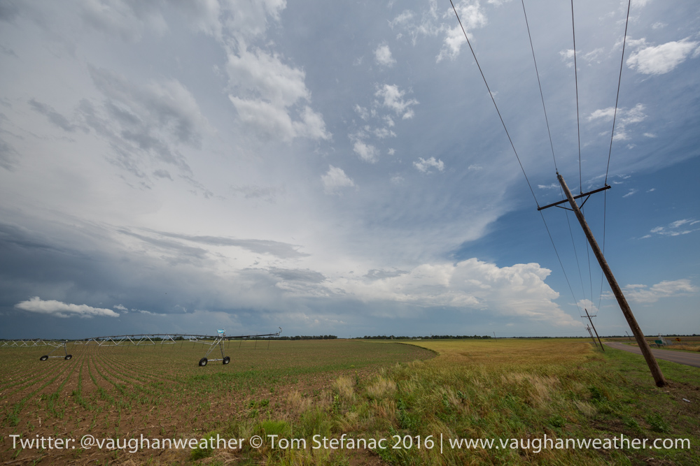
Caddo County Farm
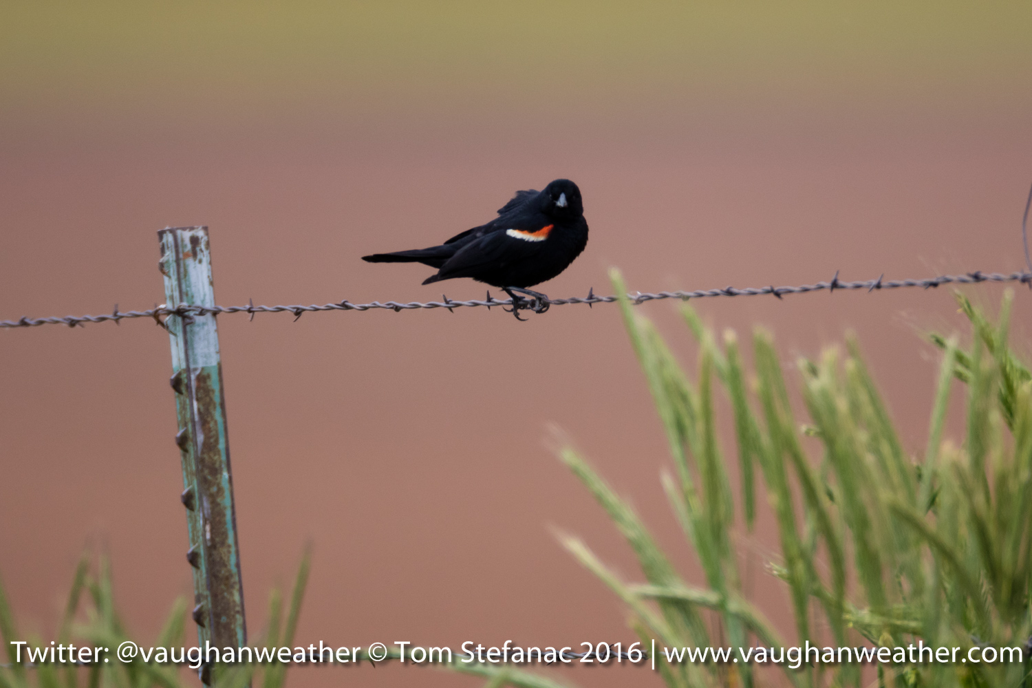
Bird on a wire
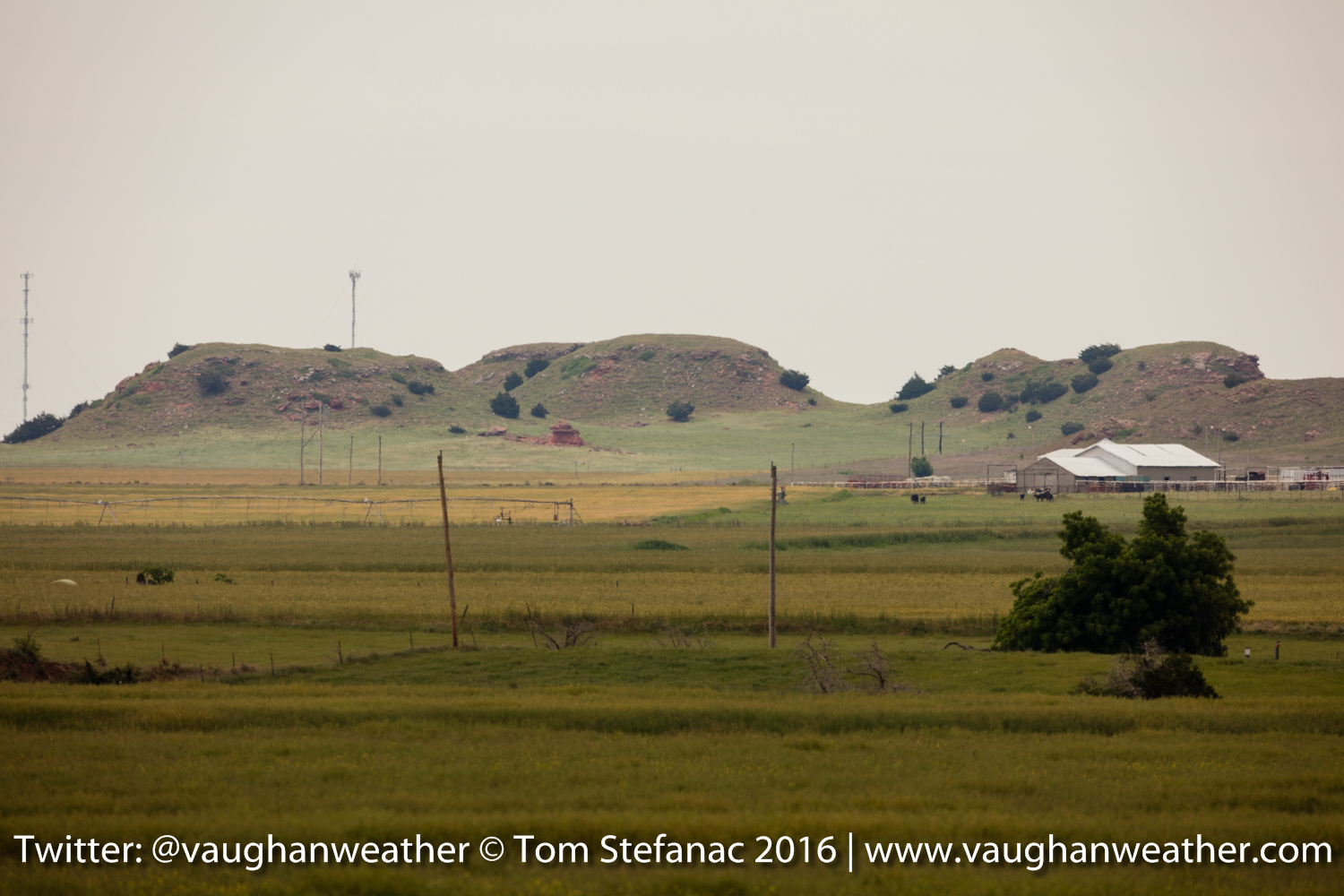
Caddo County Hills
Remember to visit the live link for real-time twitter updates and streaming video. Off to bed… zzzzzzz