Posts in Category: 2013 Storm Chases

May 15th 2013
On July 19, 2016
- 2013 Storm Chases
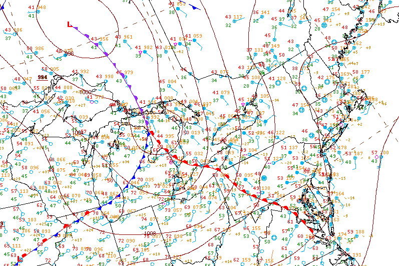
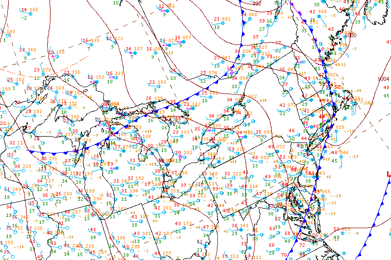
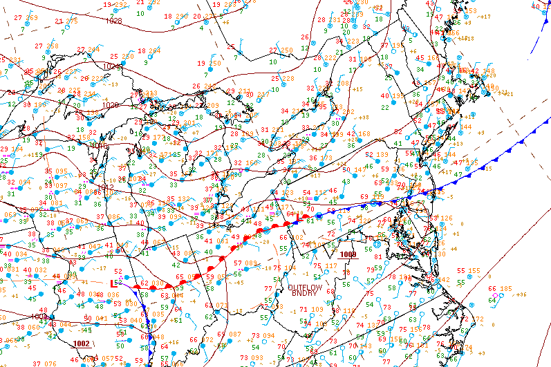
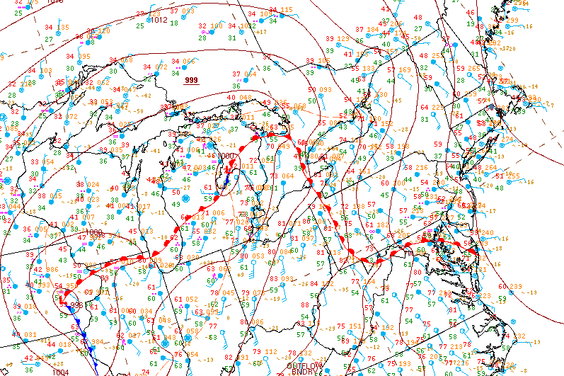
Surface analysis 12Z Wed May 15 2013

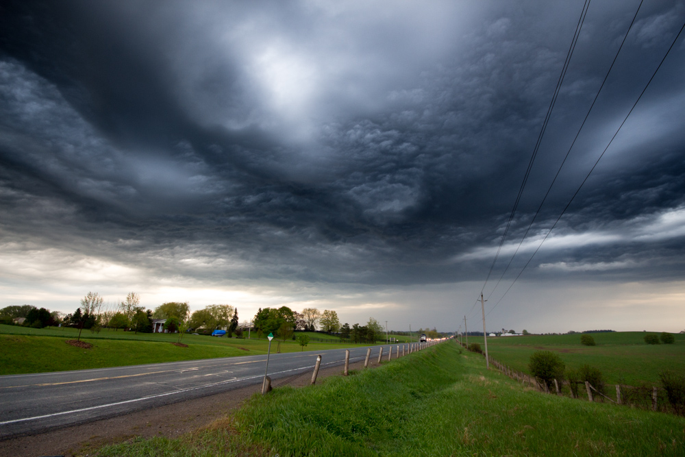
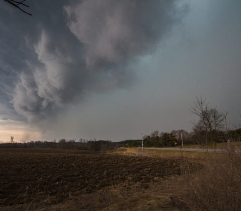
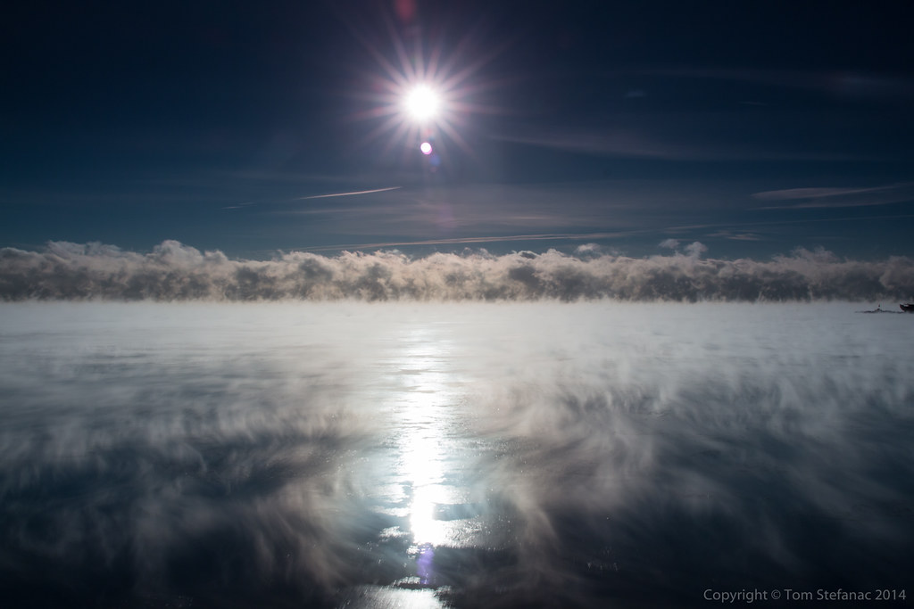
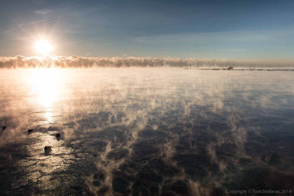
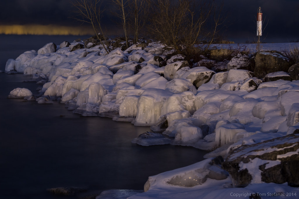
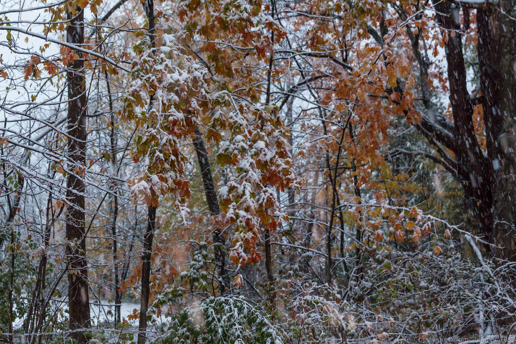
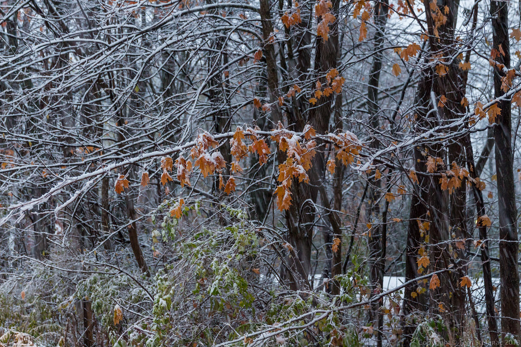
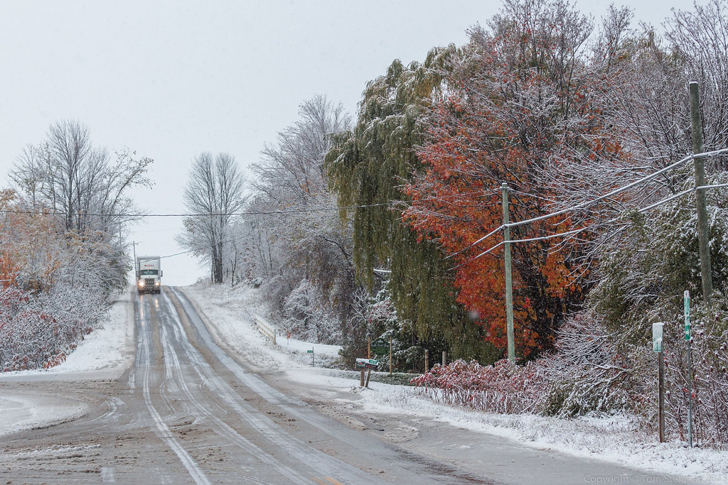
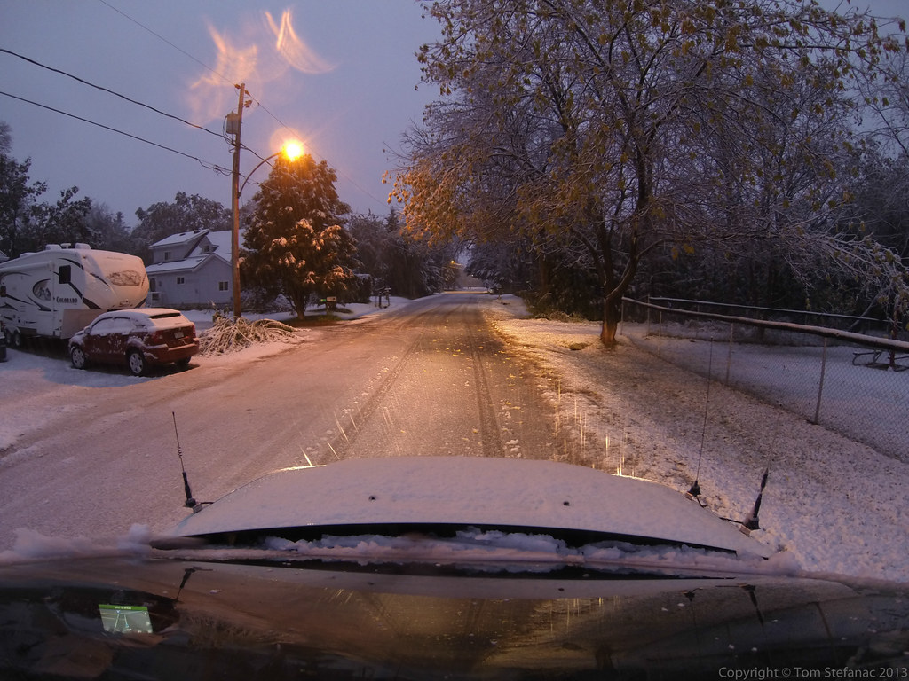
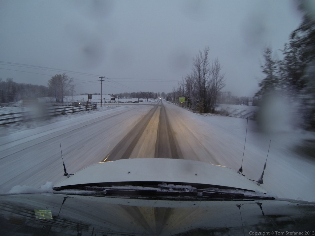
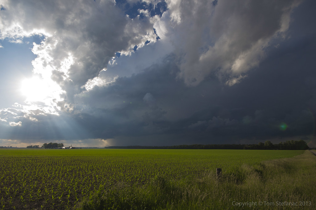
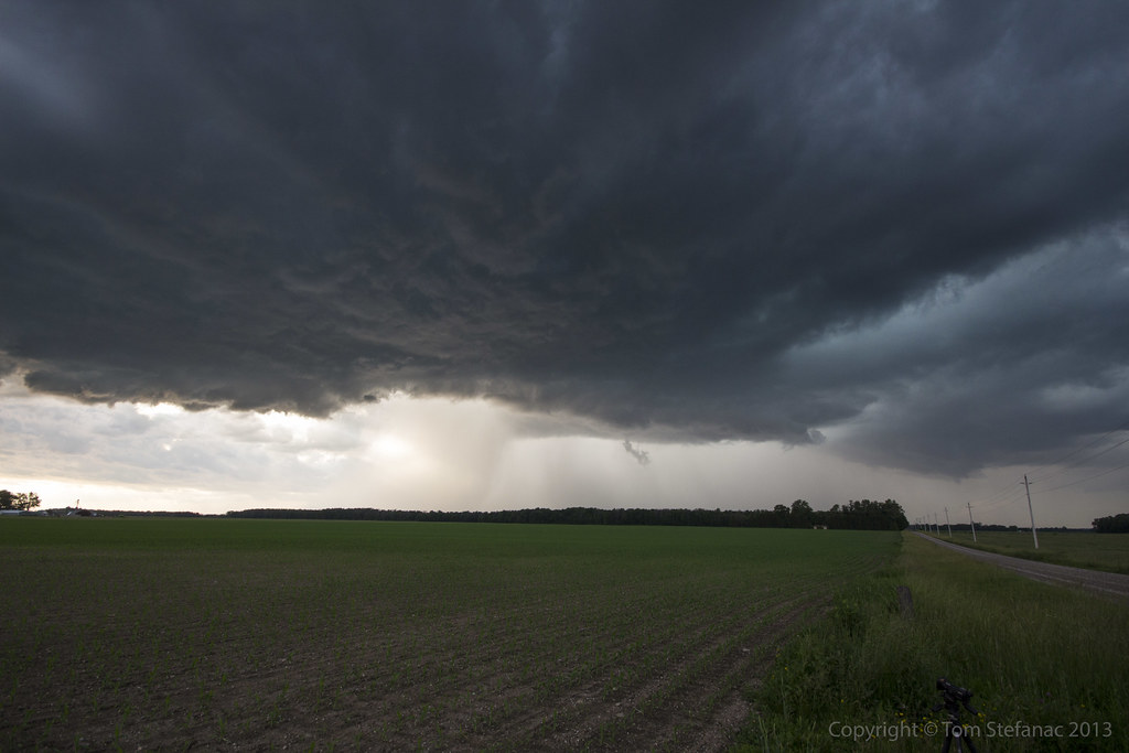
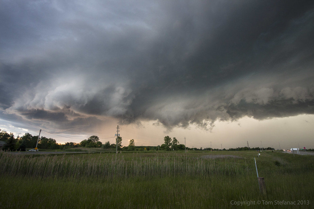
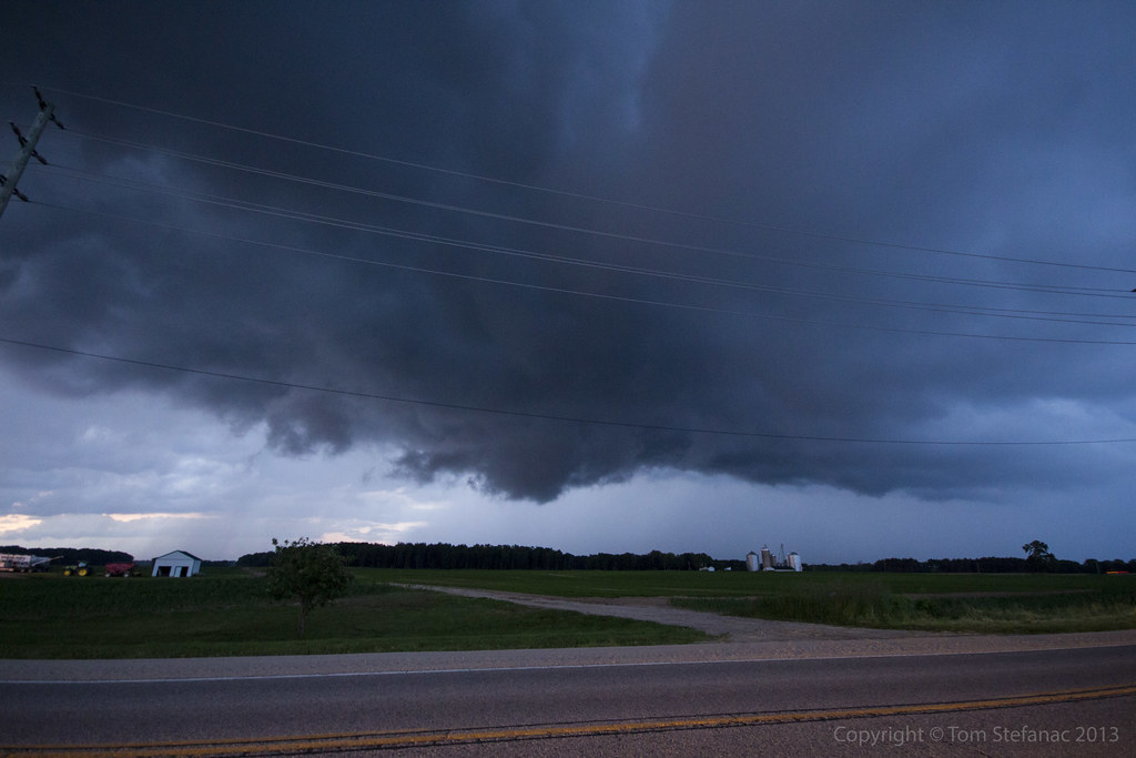
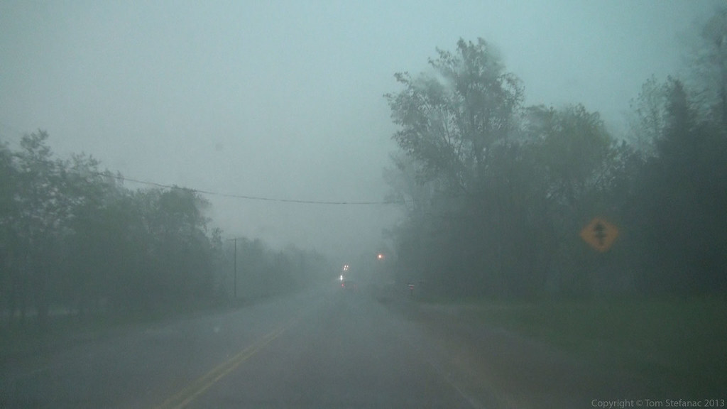
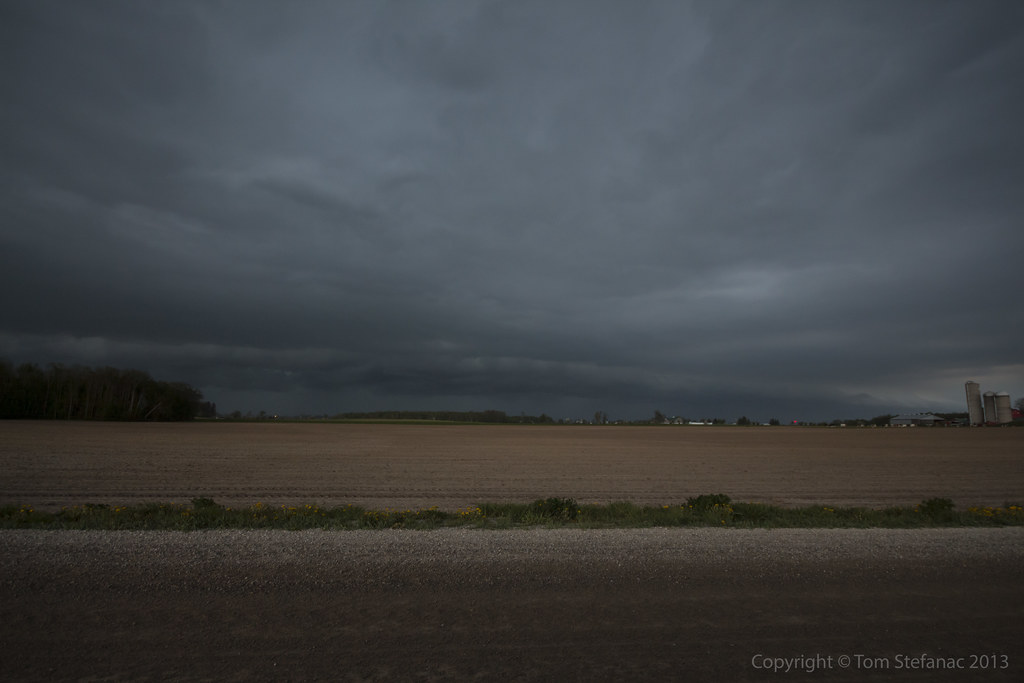
As night turns to day slowly, the morning rays of sunshine reveal showers produced by elevated thunderstorms moving in along a warm front.

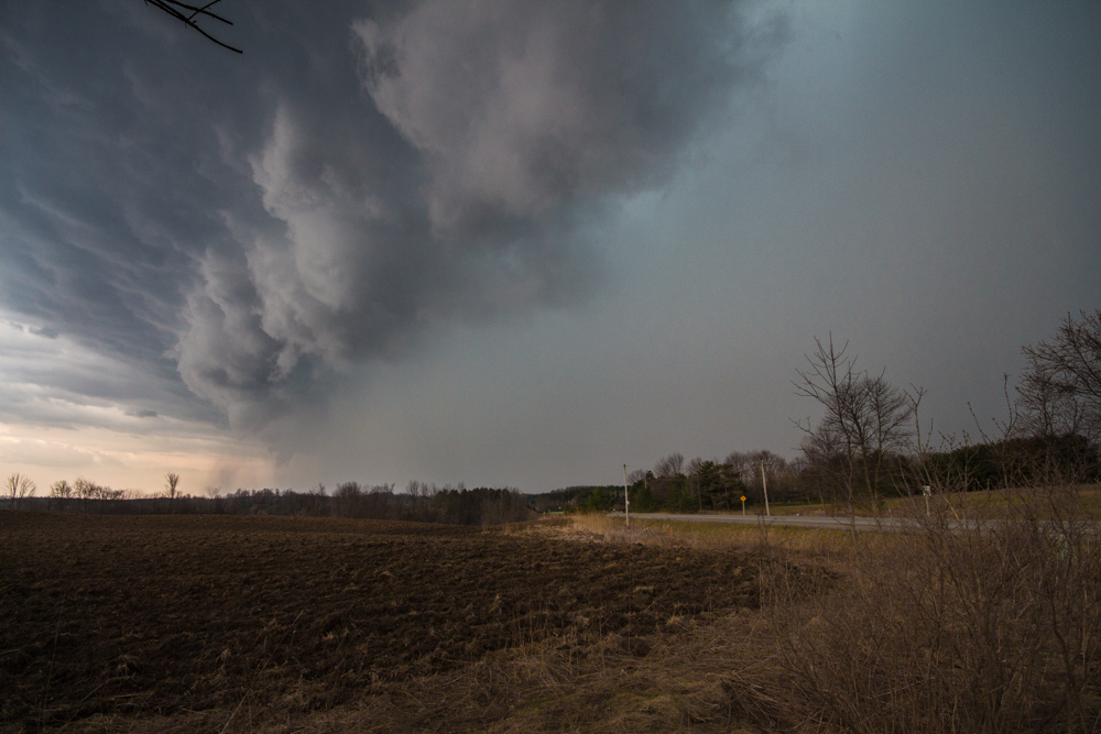
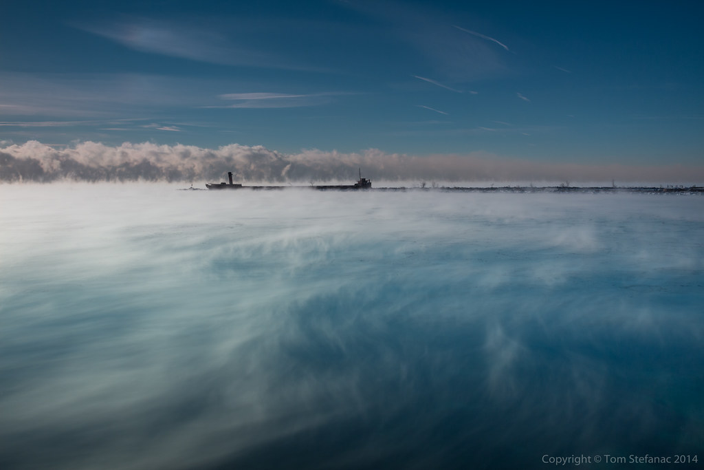
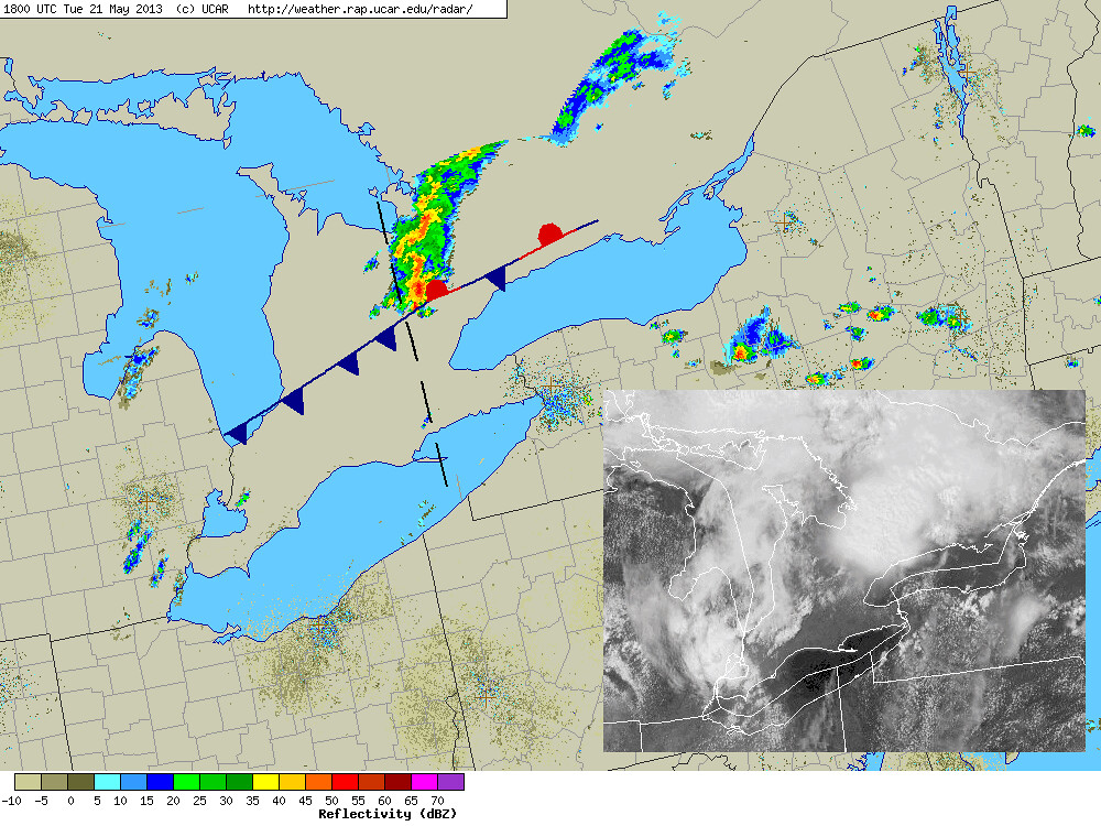
Here's a radar shot showing the first target storm as it tracked southeast from Shelburne.
You can see it is the dominant storm cell in the line. At around this time I'm making my way east on the 407 to head north on the 404 for an intercept.

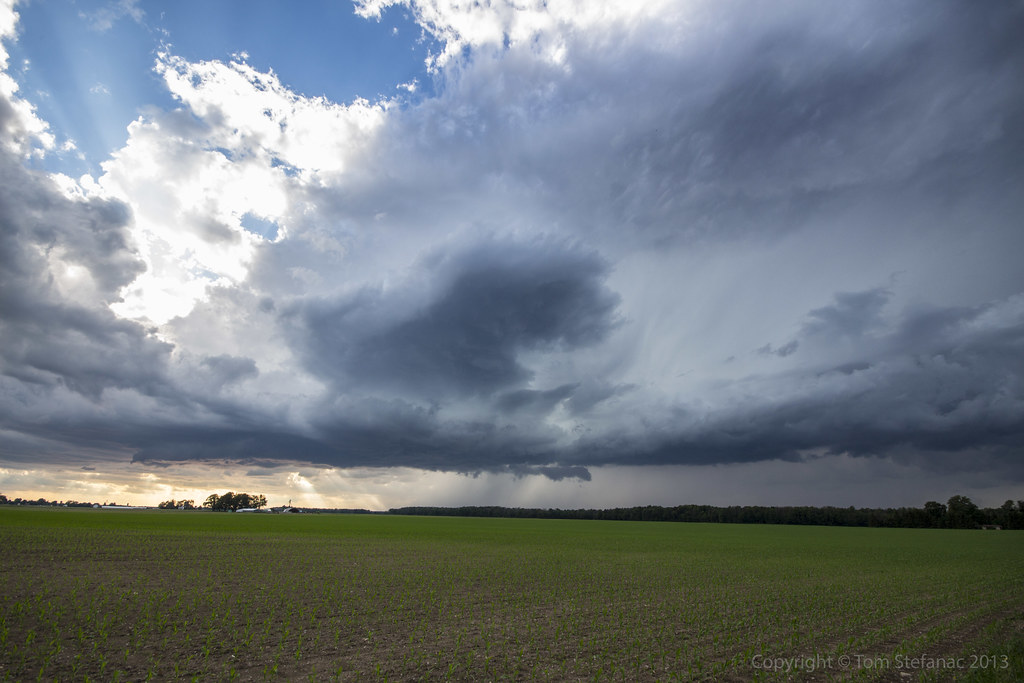
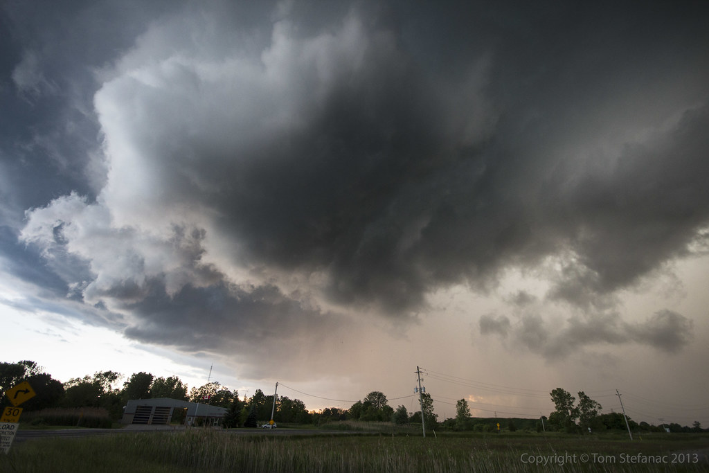
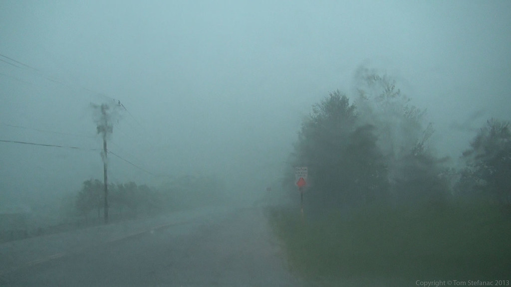
This was one of the few dominant storm cells approaching me from the west.
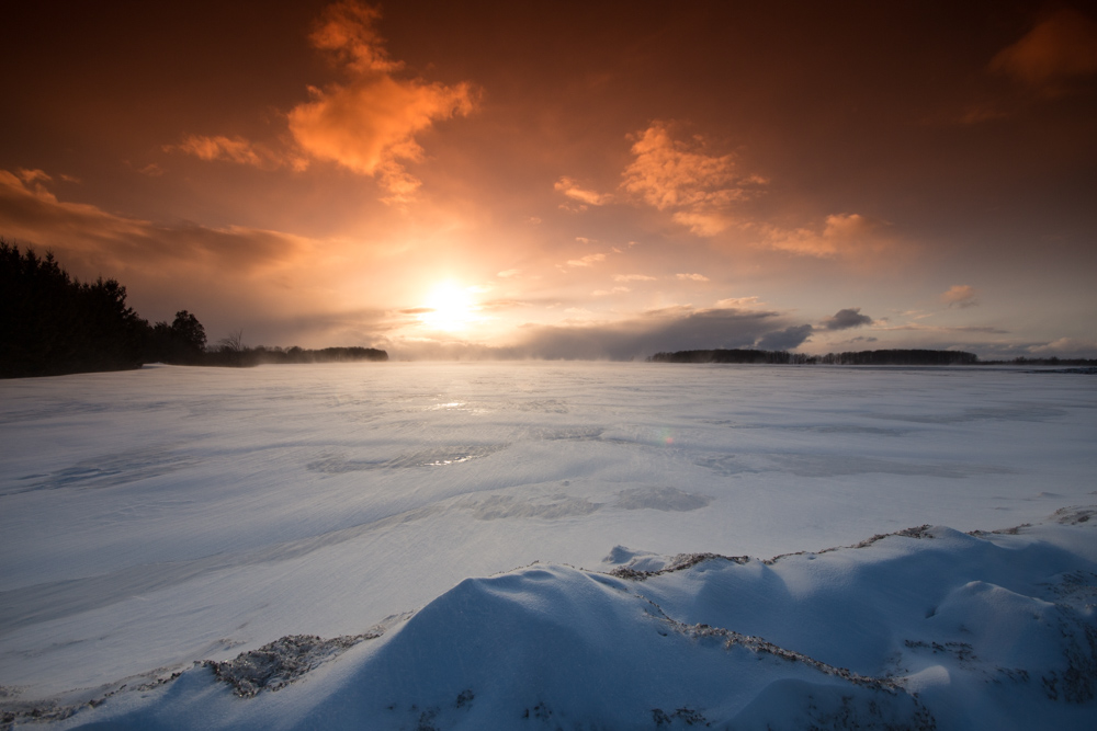
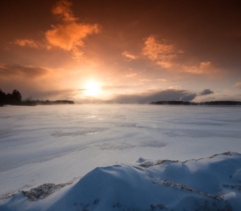
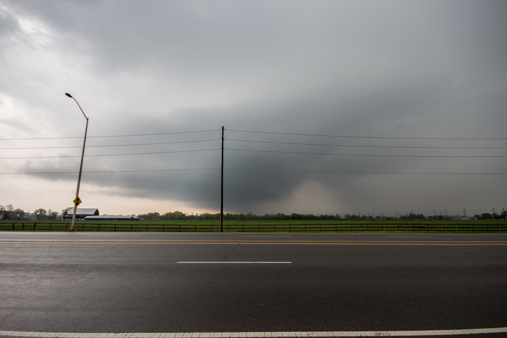
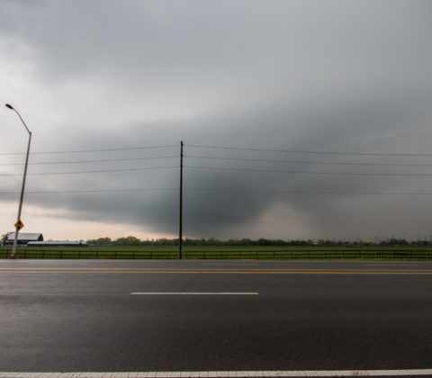
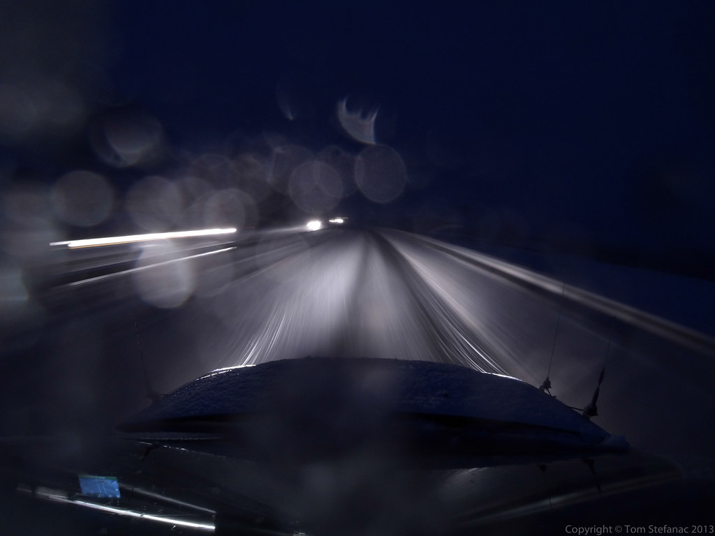
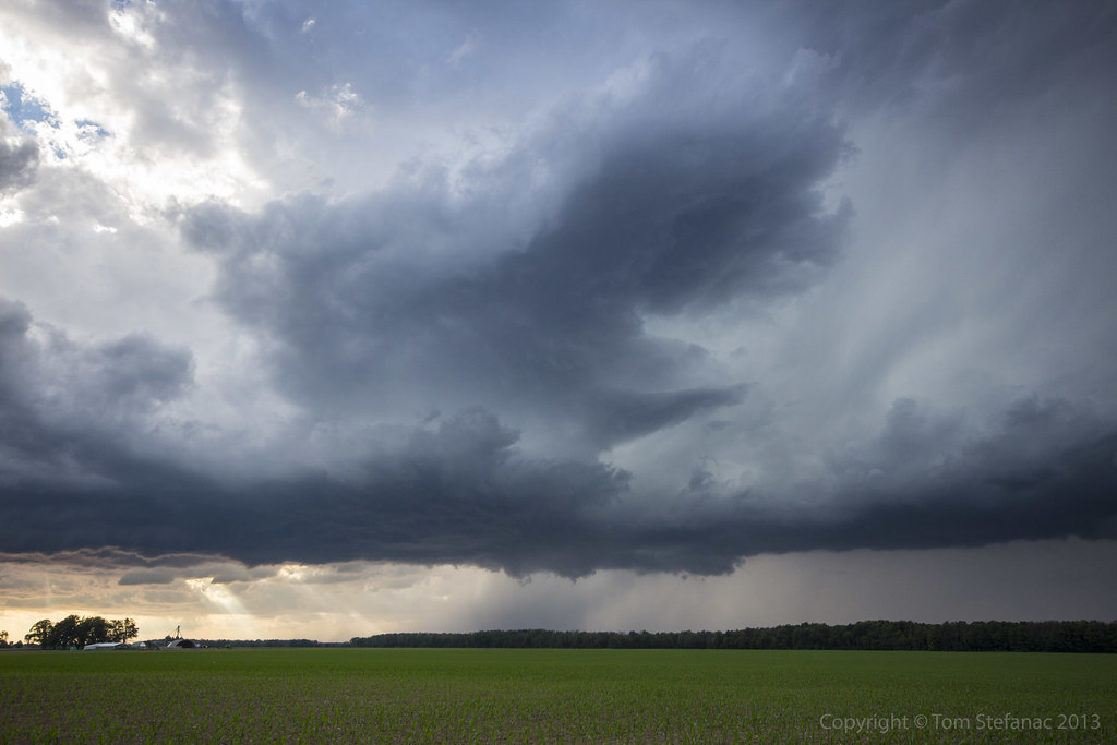
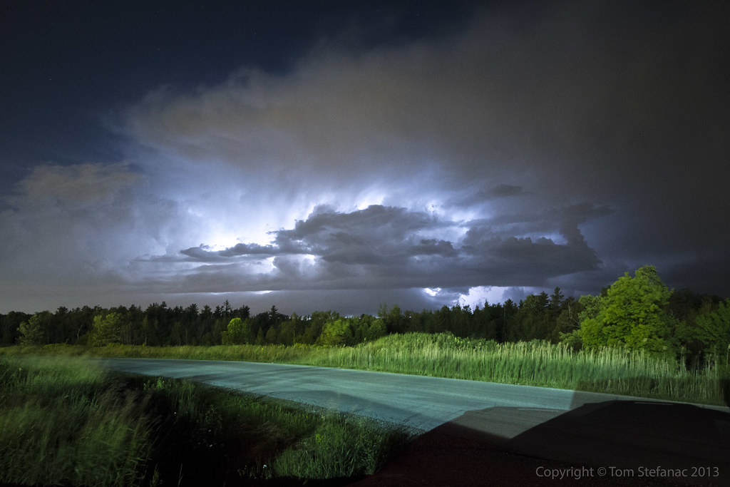
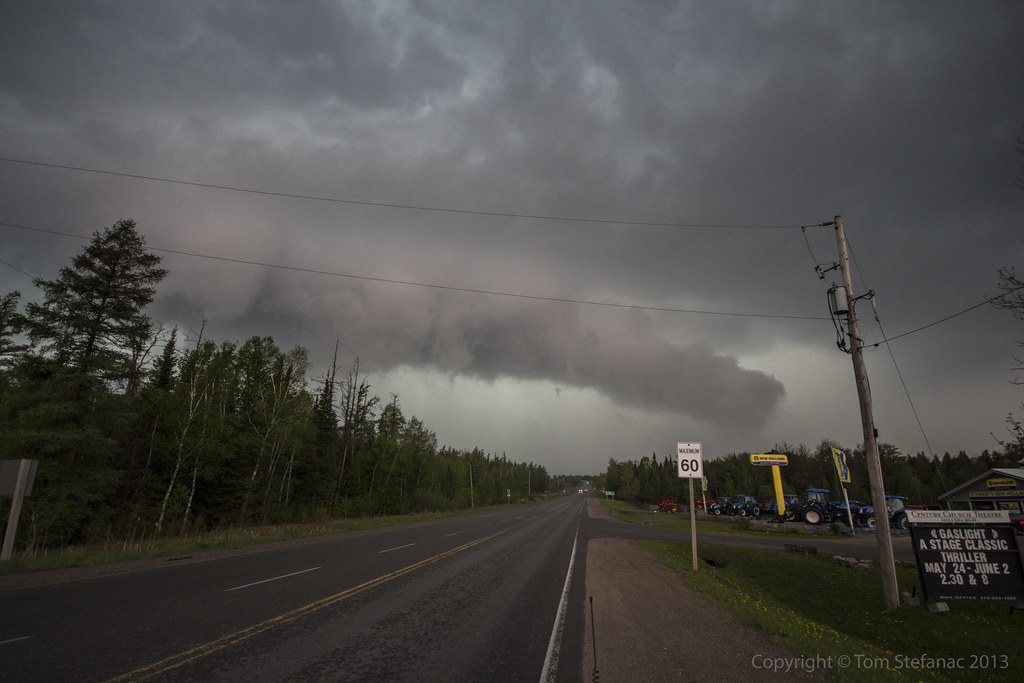
I raced north along highway 404 and stopped on Stouffville Rd just east of the highway. The thunder and lightning was nearly continuous as the storm moved ever closer. It seemed far more intense than it really was.

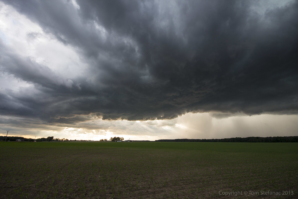
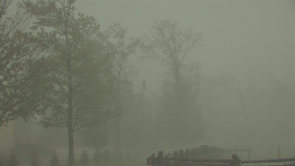
The storm cell was still highly elevated, it produced some small pea sized hail and heavy rain. There was virtually no wind at the surface.
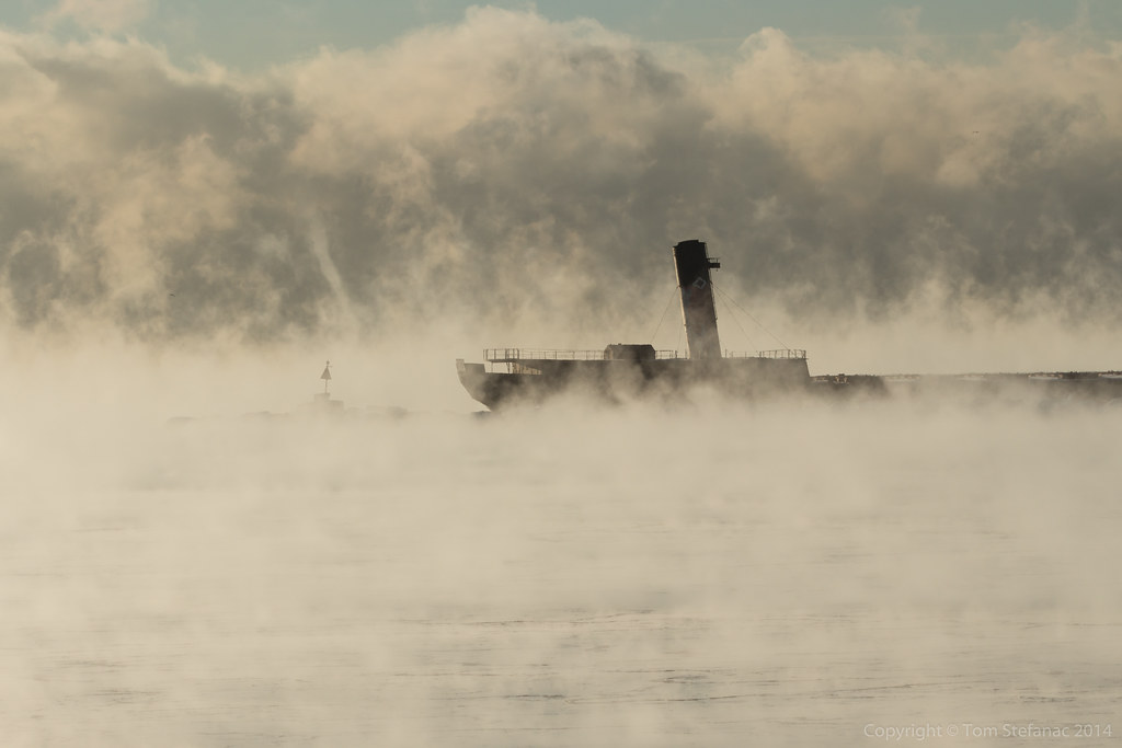
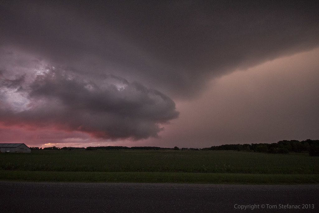
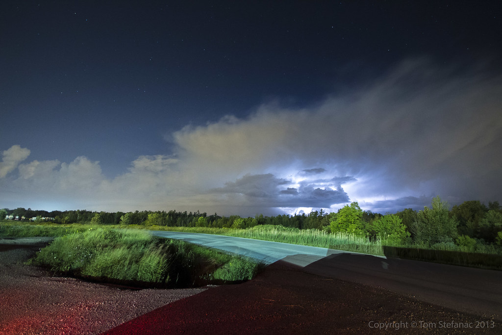
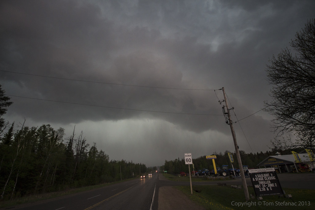
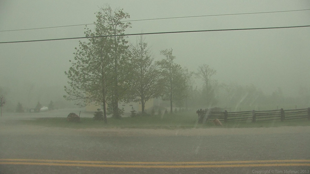
You can see the back side of the storm as it passes, this particular shot was taken looking Southeast.

Here's my position relative to the storm to give you a better idea of what I was seeing.

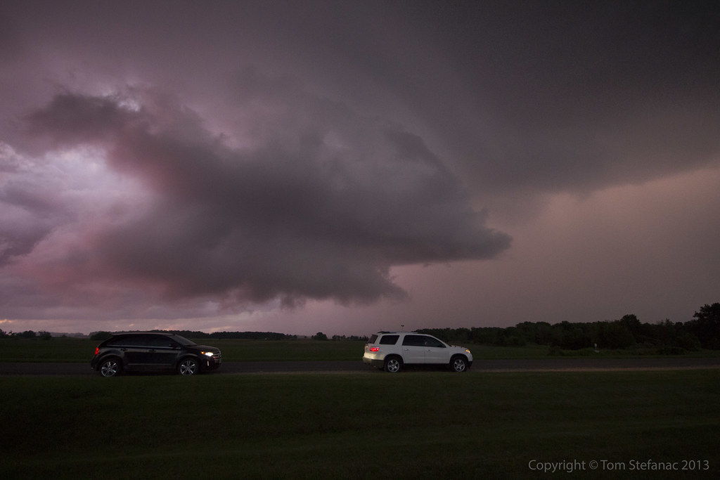
Fresh towering cumulus going up to my immediate west along a turbulent zone of convergence and mixing aloft near the leading edge of the prior convection.

This was the second storm cell which later spiked on radar.
When this photo was taken it was still in its infancy but at this point the surface warm front was getting closer and it was later in the day so boundary layer mixing was increasing. This allowed the storm to mix down further and at least appear to be getting closer to the ground.

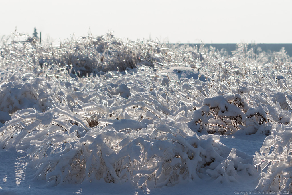
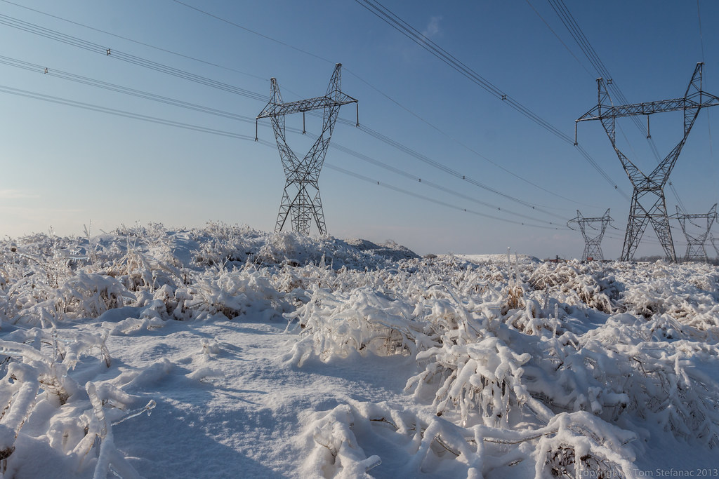
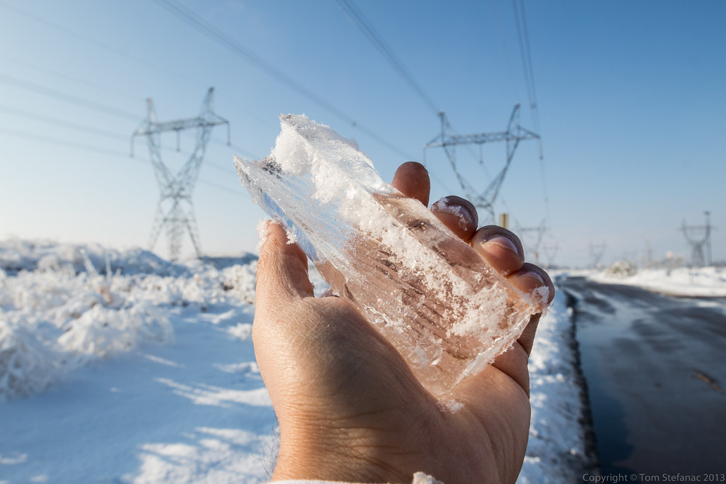
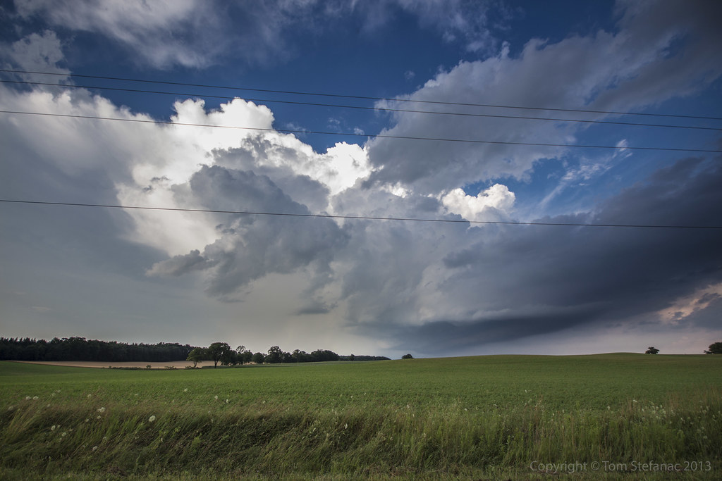
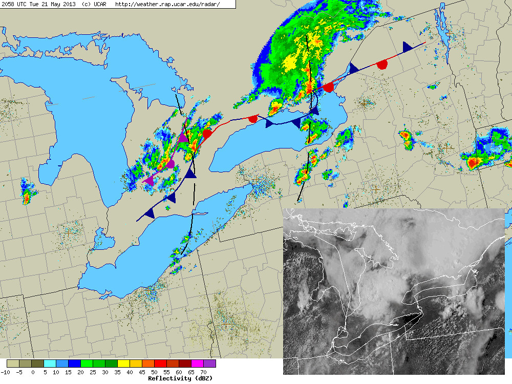
A little while later the same storm seen in the previous image is now east of me and beginning to hit 65dbz on the radar. You can see the rain shafts from the storm directly in front of the power lines.

Here's the radar showing how intense the storm actually appeared on radar despite its benign appearance visually.

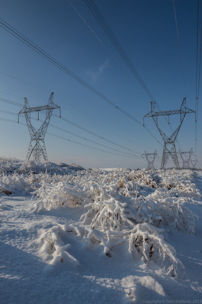
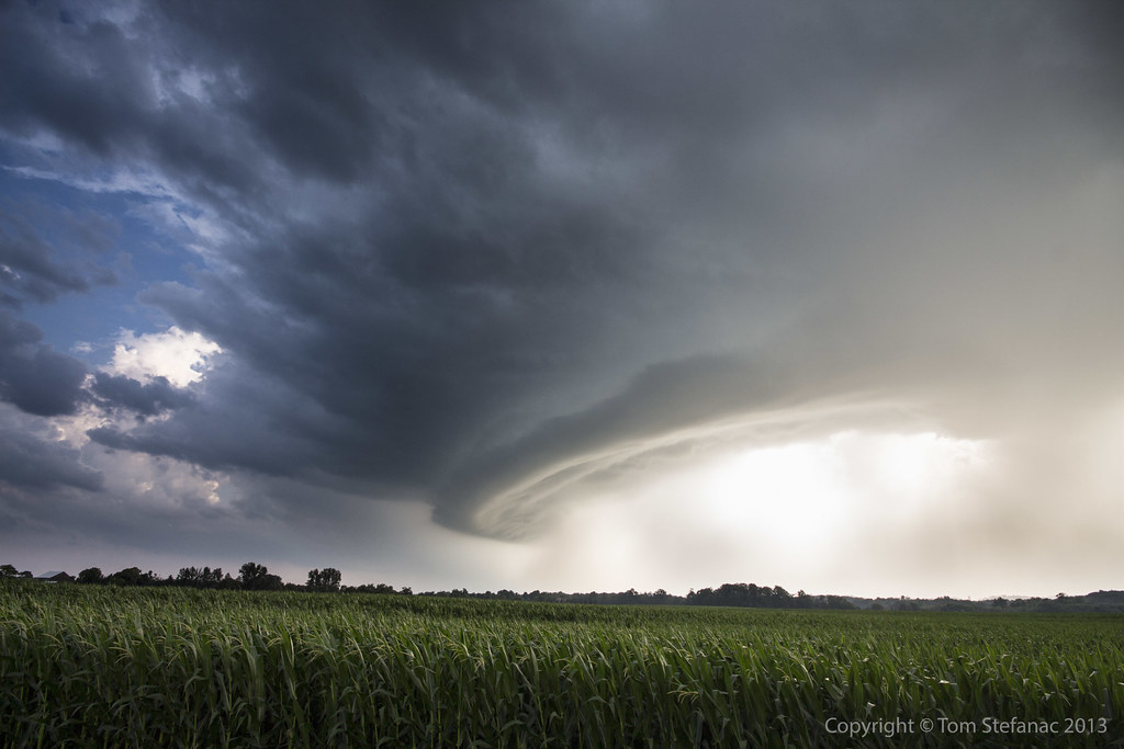
This is a stylized image of the storm as it continues eastward. I've used a graduated neutral density filter to darken the sky and create this vibrant image. At this point the storm was hitting 68 dBz and producing some small hail. A warning for Durham Region was issued, and this storm eventually made its way out over Lake Ontario.
I tried to keep pace with the storm but gave up, it was moving at well over 80 km/h.

Here's a quick analysis of the surface showing the warm front and the storms well ahead of it near the green line.
FYI - I know the occluded front is backwards, I drew as if it was a cold front by mistake
April 1st 2013
On July 19, 2016
- 2013 Storm Chases
Surface analysis 21Z Mon Apr 1 2013

Looking at this photo it sure does not look like April 1st, and no this is not an April fool's joke I've concocted, it's a not a joke at all!
Mother nature decided that we've not had enough winter this year and it seems even with balmy days between they are simply teasers.
(There has been no Photoshop work done to this photo, it was taken purely using a Cokin graduated tobacco coloured filter)

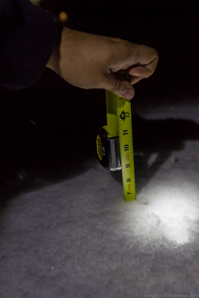
My car (not visible but right of the frame) was actually partially blocking a lane. It was all fine and dandy since there was no traffic and this snow was low drifting stuff.
Then just as a few cars came into view the wind started blasting and the drifting snow became a low visible wall of white a few feet tall. It was more than tall enough to shroud my car from any unsuspecting drivers so I made haste and got out of here as quickly as I could!

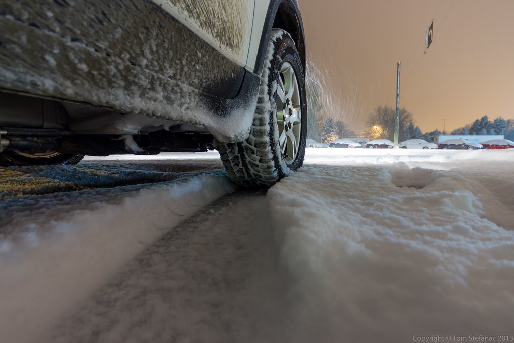
I'm not sure if the municipalities or province for that matter still has any salt in reserves. Whatever the case, this highway was just glazed over! I almost wiped out just stepping foot outside of my car!
April 1st huh? Sure feels like I'm north of the Arctic Circle, not north of Orangeville.

This is the 0 visibility stuff blowing where I was parked.
Yeah, not a good idea!

There were tons of little snow devils (vorticity pockets known correctly as eddies) dancing around in the fields. Unfortunately, what looked cool to my eye looked like crap to my camera.
But for the record, you can see the winds and squalls made things nasty in these exposed places.

Here are some of the cellular convective snow squalls heading southeast into the Greater Toronto Area (I'm looking southwest).
Some of the tops on these squalls must have been pretty high but I did not see any lightning returns on any of my services.
(Again no Photoshop, just that Cokin Tobacco filter)

Yeah, the car was clean! I decided after the fact this was a bad idea, seeing as I was actually getting dirty!
Note to self, don't unnecessarily go out of the way to drive through snow squalls when the car is clean!

No rainbows here, but the convective lake effect snow bands were so cellular in nature that you could literally be under a clear sky above while all around you snow is pouring down.

Just to illustrate the point.

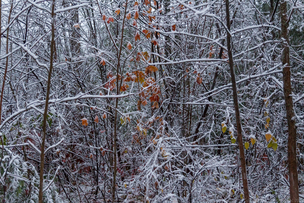
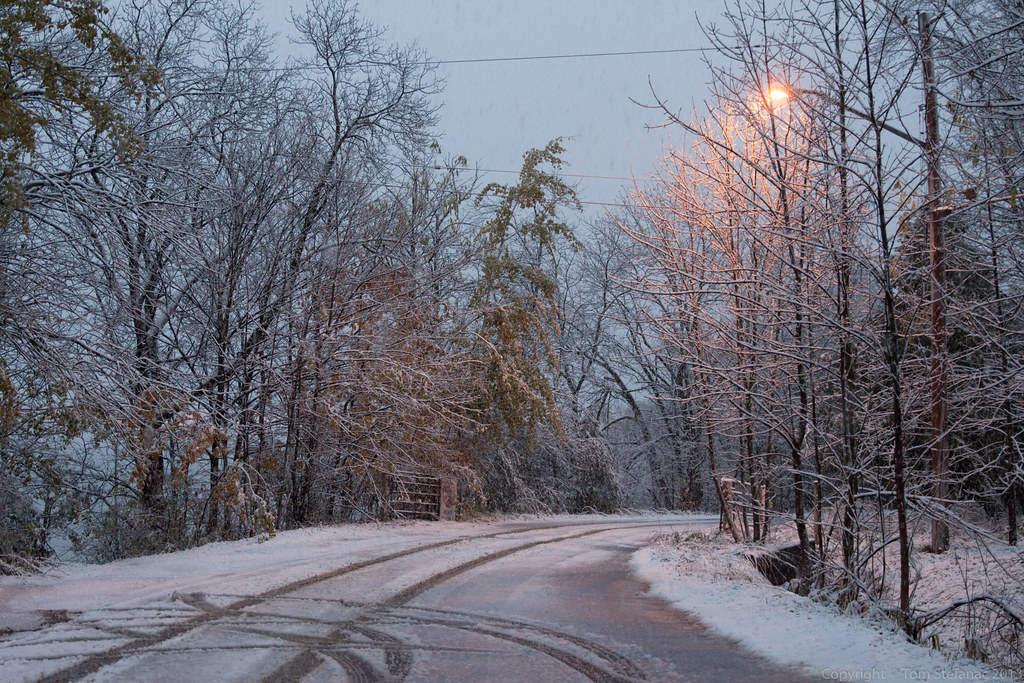
This was highway 10 just north of Mono, as you can see this looks it typically does in the period between late November and early March.
It sure is cruel to have it look like this in April, it's simply not funny!
May 10th 2013
On July 19, 2016
- 2013 Storm Chases
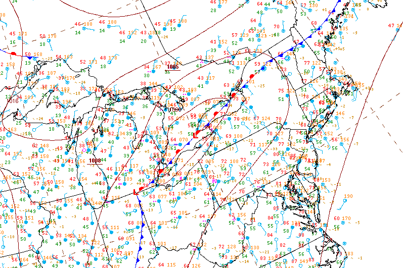
Surface analysis 21Z Fri May 10 2013

The setup for storms was driven by a low scooting just north of Lake Erie and Ontario, the supercells in Southcentral and Southeastern Ontario formed along the warm front where a marine / lake breeze boundary interacted with the surface warm front and trigger storms

A weak elevated supercell in a low energy but moderate shear environment approaches Milton

The storm is now passing through Milton, you can see mid level clouds flowing into the storm from the Southeast (image looking west). It also presents a bit of a vaulted type structure with the usual lateral tilt of the updraft. Slight clearing between the "hail" region of the core and the heavier rain is visible just to the right of center.
The biggest problem with this storm if any is the fact that it remained elevated with limited boundary layer interaction and hence produce virtually nothing as far as wind at the surface.

Inflow / outflow and rain as the storm passes overhead and looses some of its structure

Here a screenshot from PYKL3 (Android radar software) showing my location and a weak couplet appearing on the NWS Buffalo Nexrad radar.

Here's the Meso Analysis sounding for a point nearest the storm at the given time. You'll notice the storm is entirely elevated with very little cape and very low topped since the LFC/CCL EL is ~7km.
lon=-79.813855 lat=43.555635

The hodograph data shows little in the way of dynamic shear, all the veering in this ground relative hodoraph is below any of the convective instability.

The storm relative hodograph shows a very different story, veering winds with supportive inflow exist well above the ground into the mid levels allowing the storm to still rotate (although very slowly) despite being elevated.
This explains why this storm took on a supercellular structure.
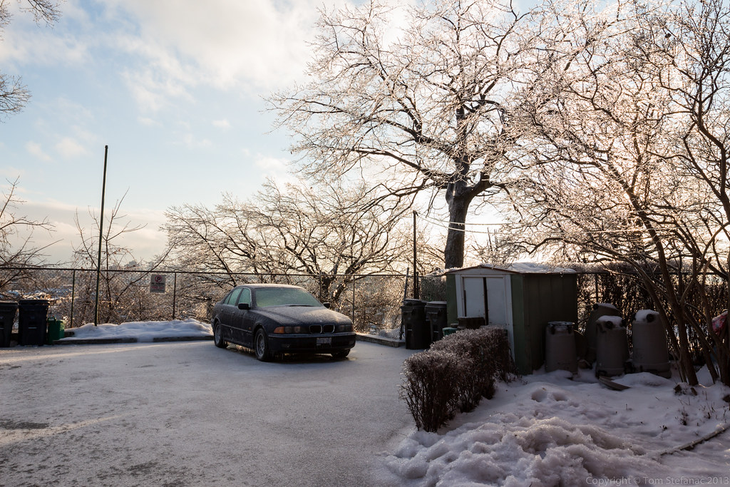
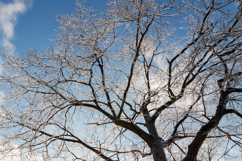
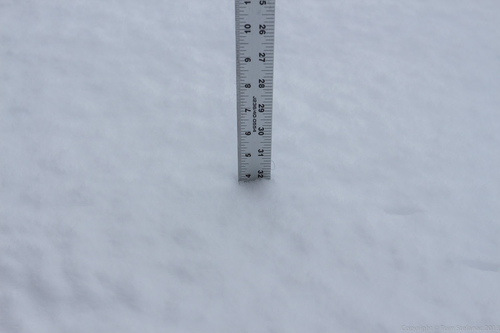
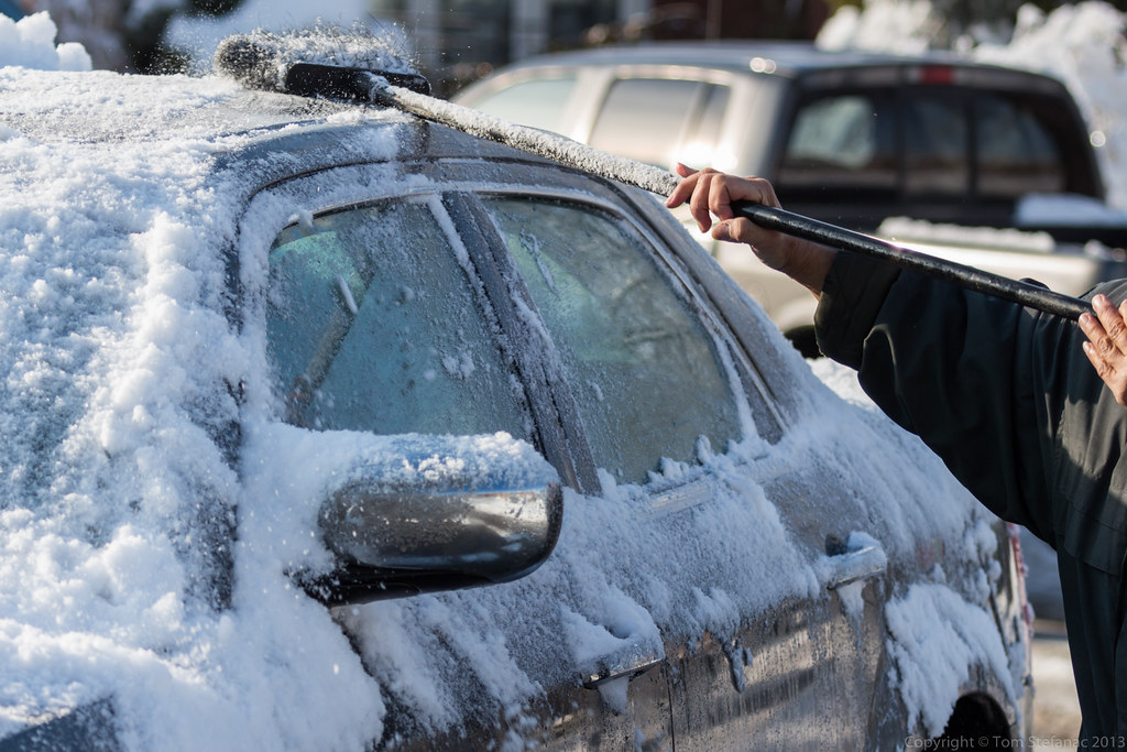
April 11th 2013 Ice Storm
On July 19, 2016
- 2013 Storm Chases
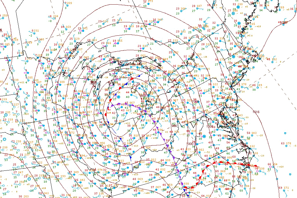
Surface analysis 15Z Thu Apr 11 2013

A smattering of ice pellets cover the roof of a home in Leaside, Toronto as the first wave of precipitation from the impending storm moves in

The low elevation of Leaside in Toronto allowed the snow up north to instead fall as ice pellets down in the city. The expected change over to rain was stunted as more cold air flooded in and mixing began to occur aloft.

Commuters in Brampton near hwy 50 & Queen St get on a Zoom bus as heavy wet snow falls.
The snow was not expected, a combination of colder air flooding in and additional mixing aloft meant that the precipitation, which was supposed to remain as ice pellets eventually changing to rain fell almost entirely as snow with the first wave of precipitation.

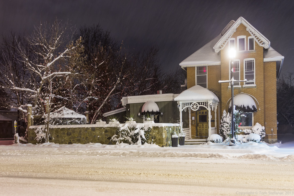
A "surprise" winter storm blankets Langstaff Rd just west of hwy 27 with a coating of wet snow.
This unusual late season storm left many municipalities unprepared to treat the icy road surfaces and commence plowing operations.
The snow also created an additional forecast element not forseen, with a fresh blanket on the ground it meant that temperatures were able to remain cooler longer and this would aid in the freezing rain process which would begin with the second wave of precipitation much later in the day towards evening.

Normally at this time of the year the first spring sprouts are shooting out of the ground, but that seems unlikely given the fresh coating of snow.

This was the radar image at the time showing just where the snow, ice pellets, freezing rain and normal rain sat. You can see the blues and purples (snow) effecting the GTA and areas eastward while much of the Hamilton, Halton and western portions of Mississauga were seeing a good mix of ice pellets (orange). Further south, along the QEW on the south shore of Lake Ontario most of the precipitation was falling as rain (green) and to the west a pocket of freezing rain (pink) had developed over Kitchener, Waterloo, Guelph and other surrounding communities due to cold air damming at the surface.

As I started my missing late at nigh to find freezing rain as the second wave of precipitation moved in ice accretion was rapidly building.
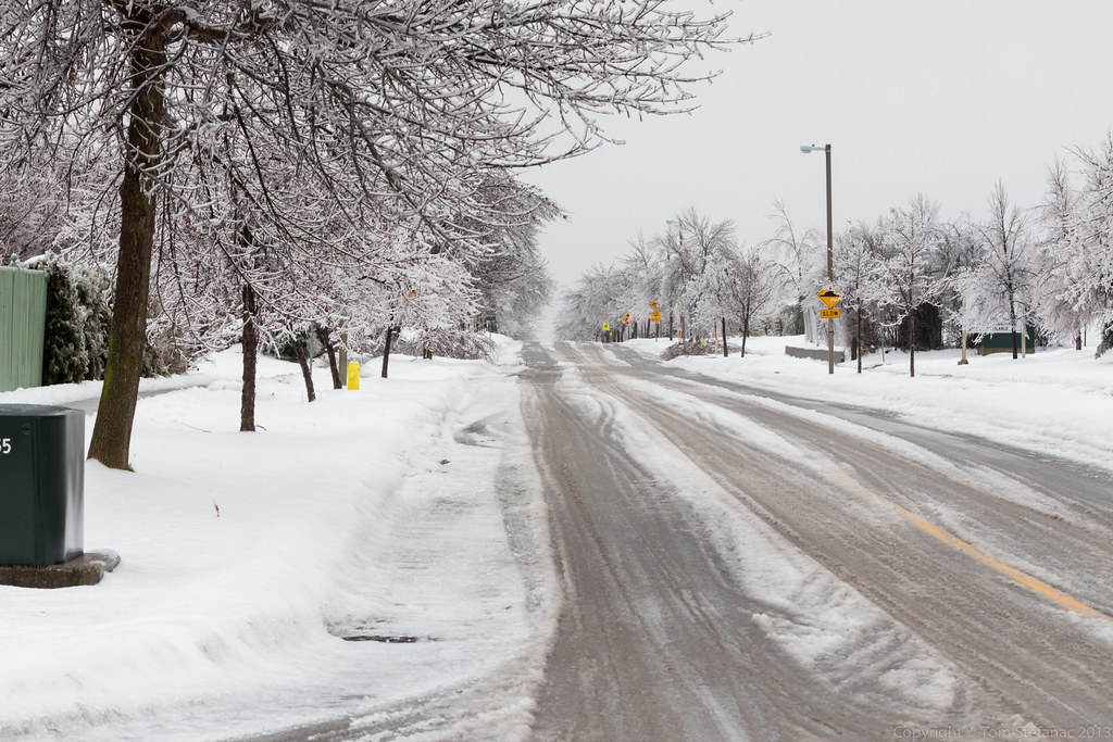
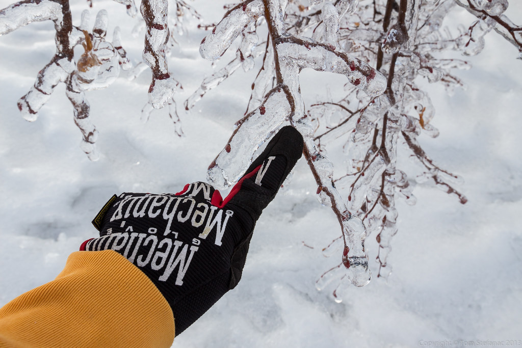
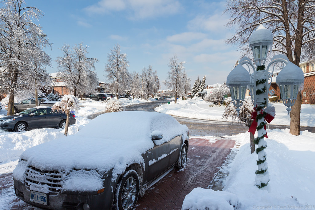
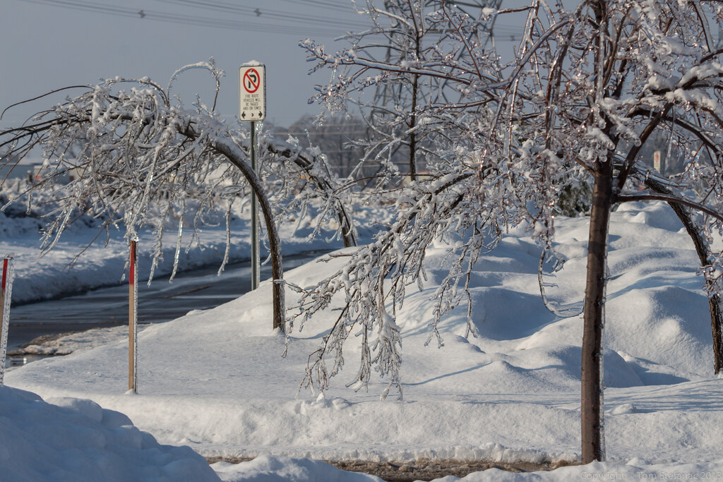
Here, a road sign stands frozen near Caledon.

The streets of Orangeville required a pair of well sharpened skates.

A driver heads west along an ice covered Broadway in downtown Orangeville

Glazed city streets

Temporary signs posted outside of a new subdivision in King City give a good idea of how icy conditions were becoming in areas that were relatively close to the big city.

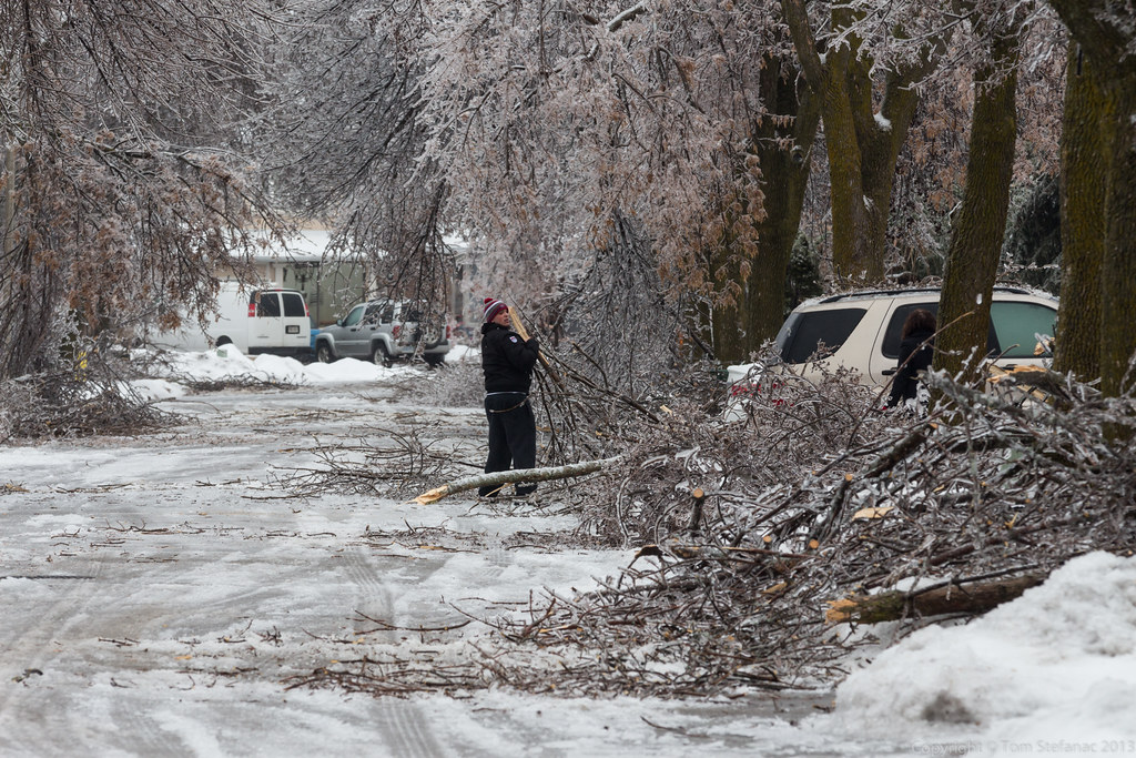
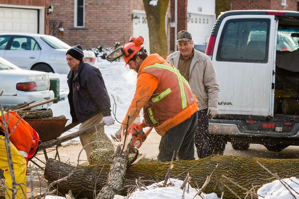
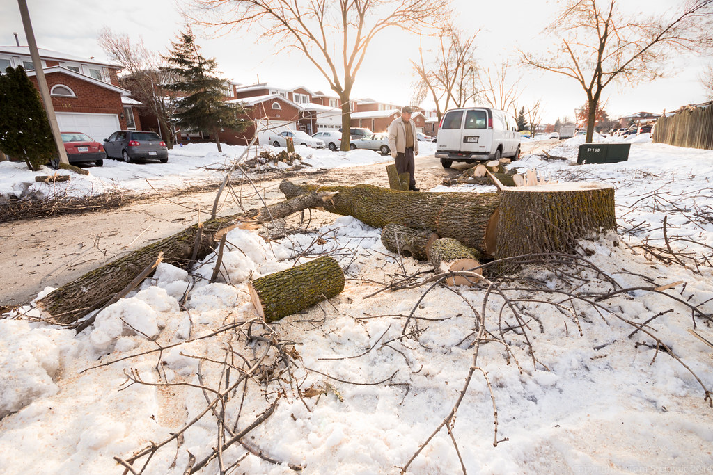
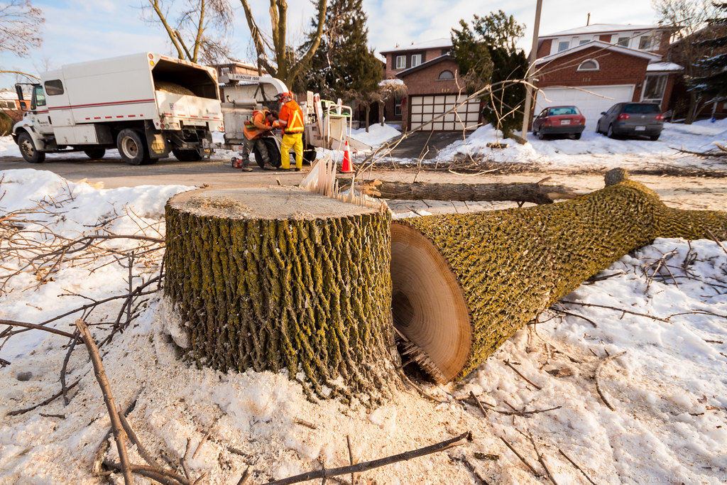
The icy roads led to a less than quick morning rush hour commute. This unfortunate driver lost control and took down a traffic signal on Dufferin just south of Steeles in Toronto (Downsview).

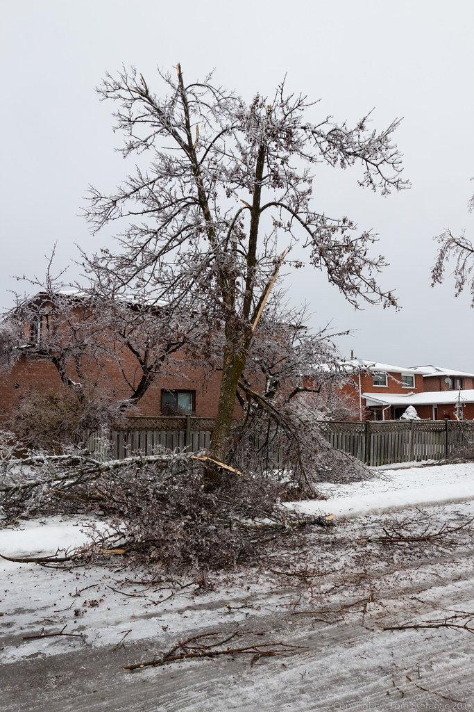
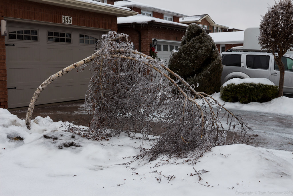
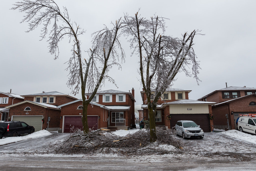
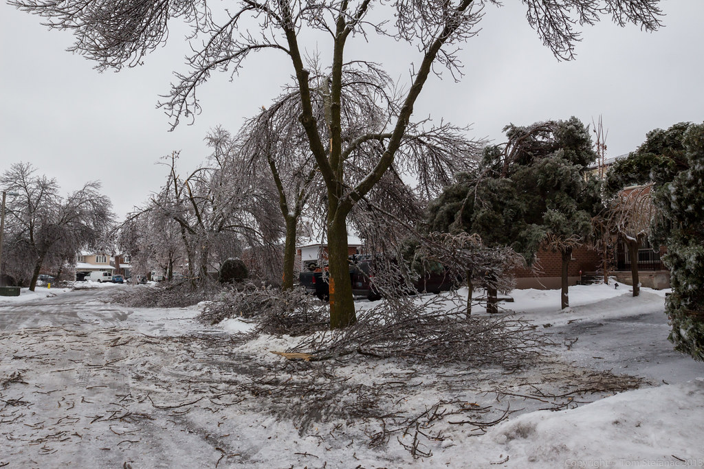
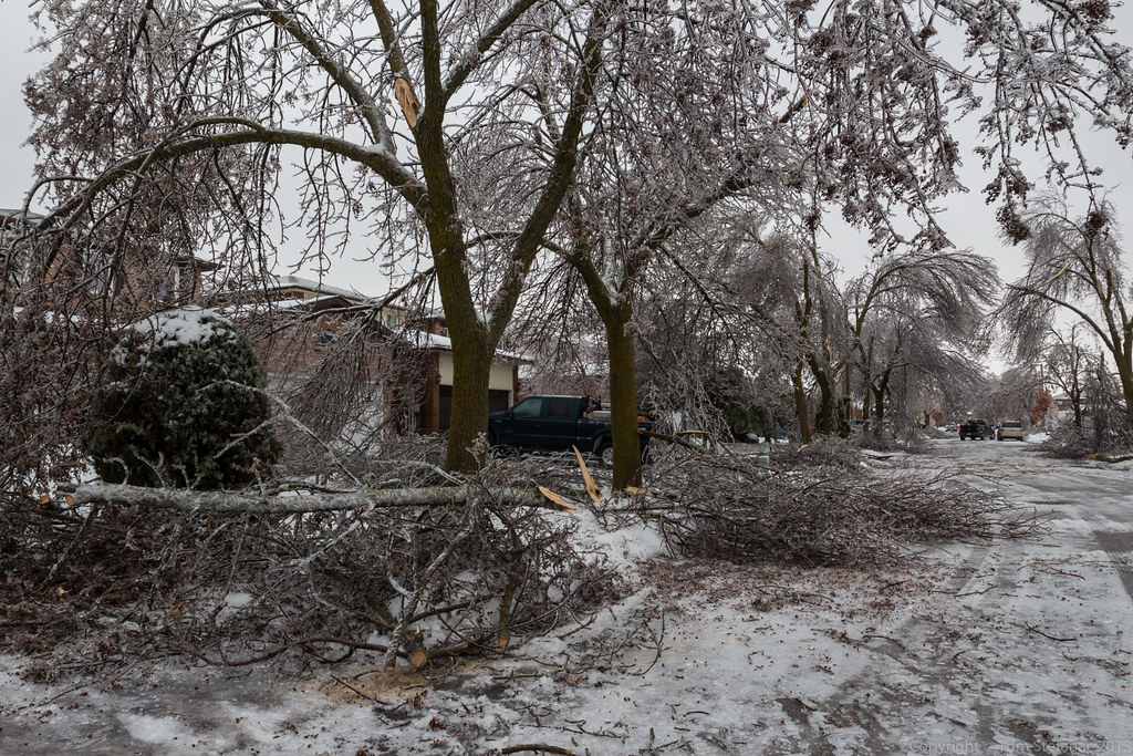
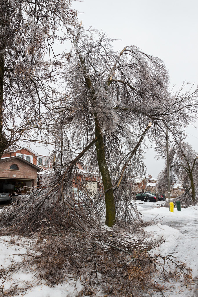
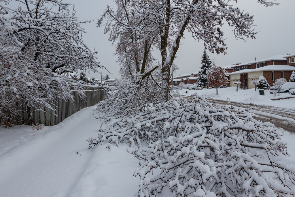
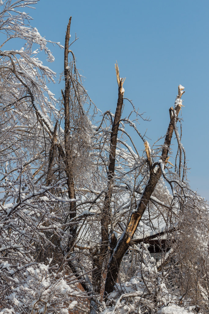
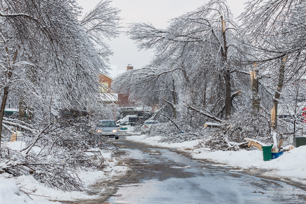
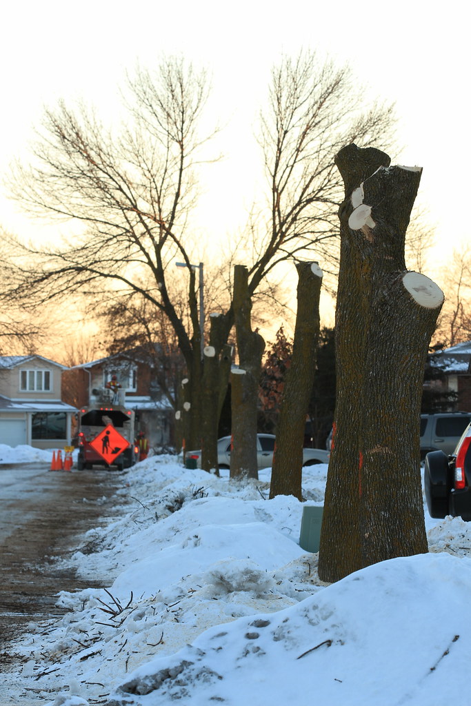
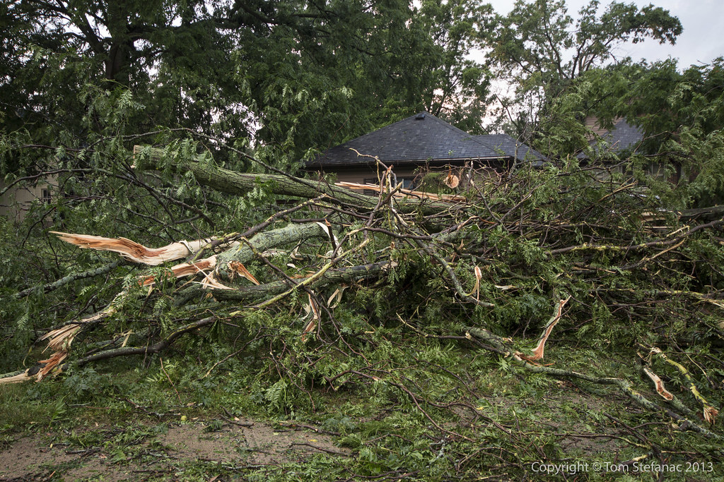
The wet soil, strong easterly winds and additional load from the ice were too much for this tree to bare.
Eventually it come toppling down near Kipling and The Westway in Toronto (Etobicoke).

Icy geometry at its finest


This winter-wonderland photo is the highway 400 northbound on ramp from Rutherford Rd
It was very icy!

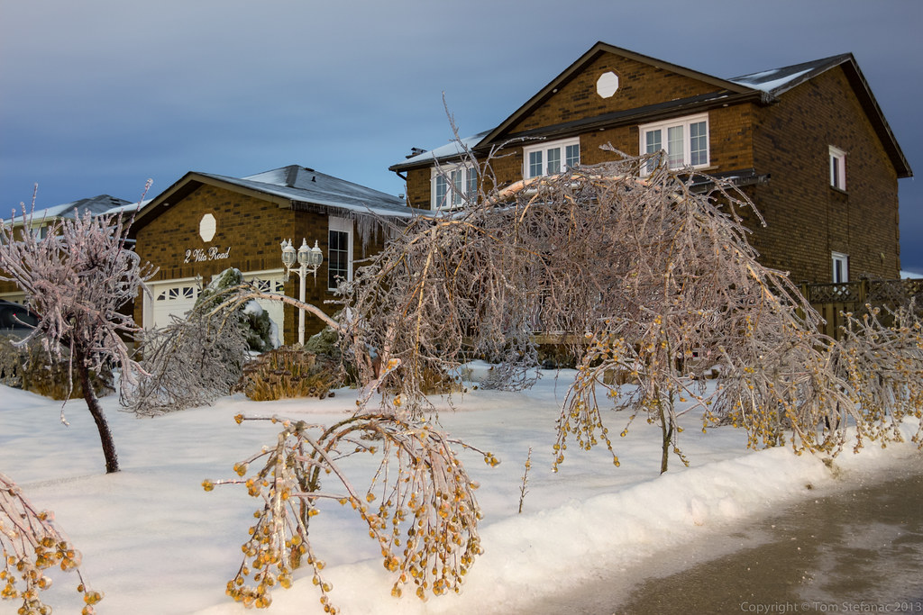
Kettleby, like King City had significant ice accretion on most objects.


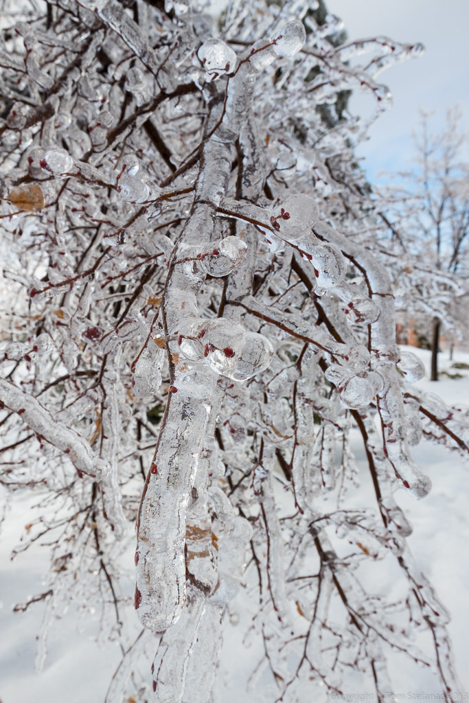
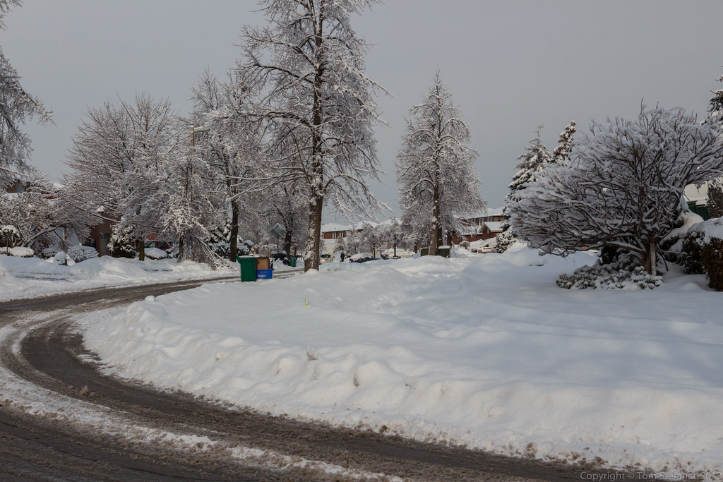
Between the still semi frozen ground and the soaking rains that have been persistent for nearly 5 full days, many fields slowly turned into small lakes. So not only was the freezing rain a nuisance for drivers and utility companies but it also added to the growing flooding situation in some places.

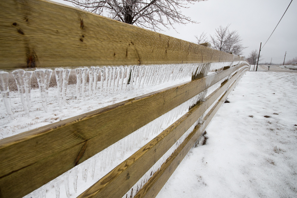
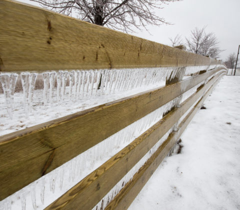
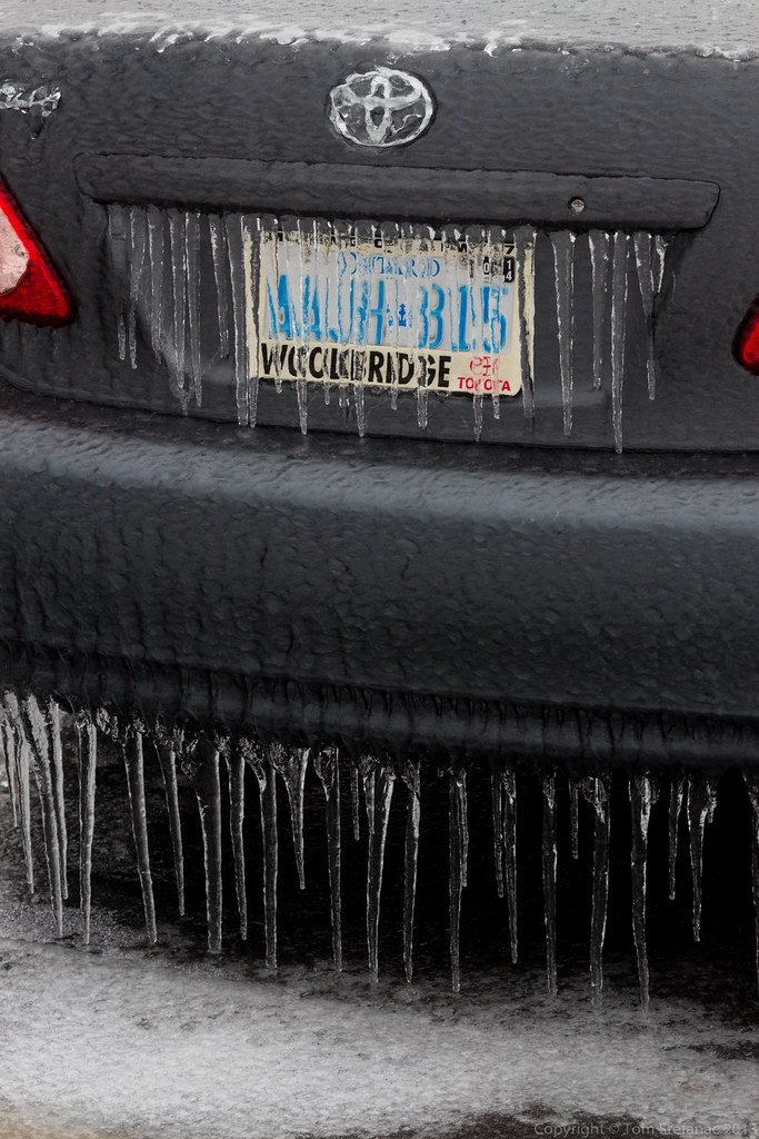
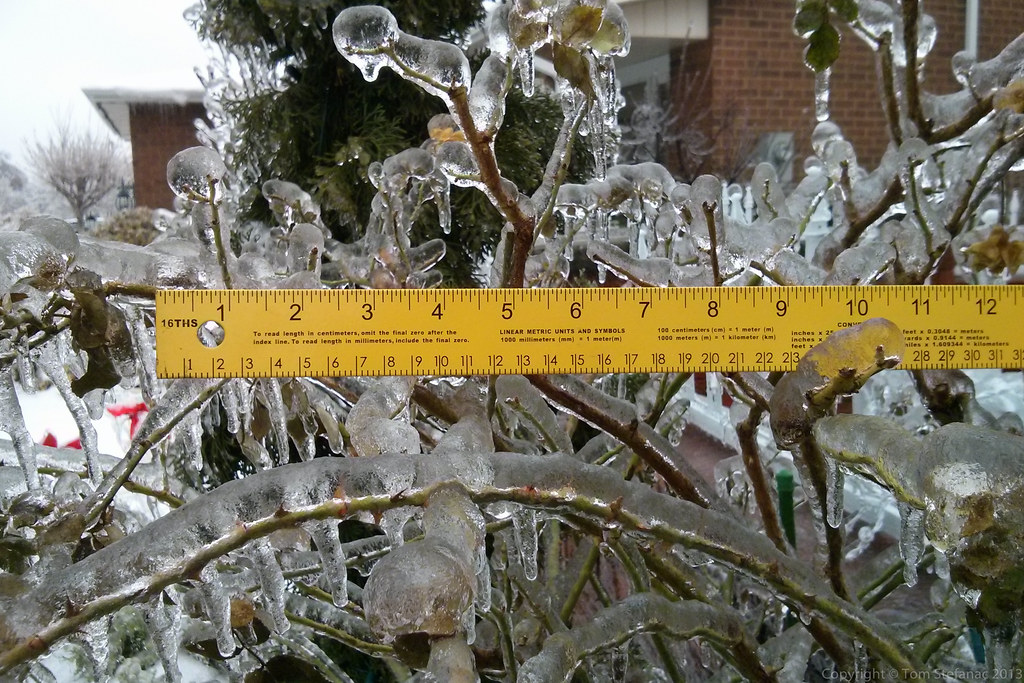
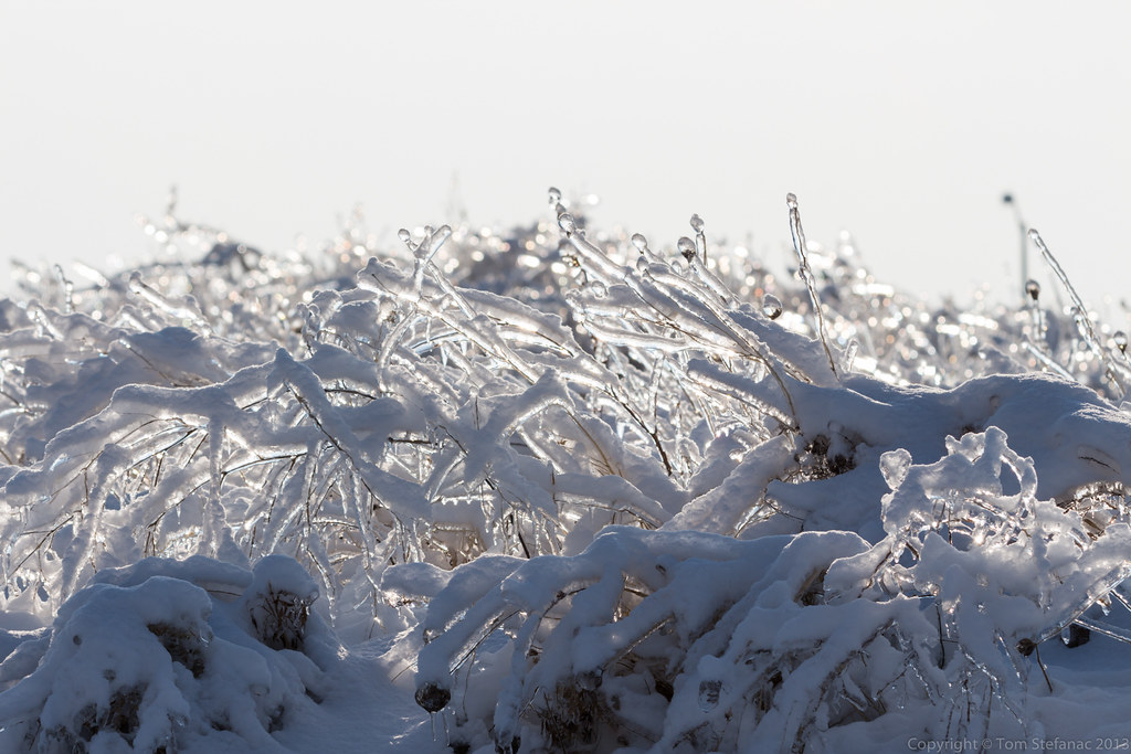
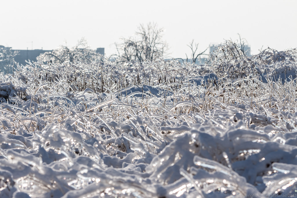
A ranch fence is covered with icicles, this is a great example of just how much rain was really coming down.

A ranch fence is covered with icicles

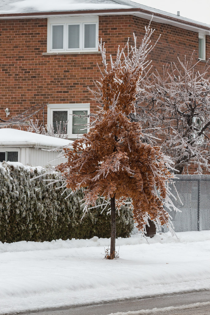
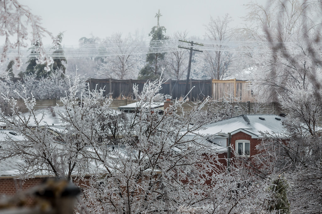
A beautiful snow and ice covered farm in Nobleton

Covered in ice

Don't take it too fast!

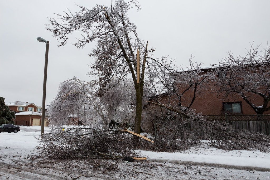
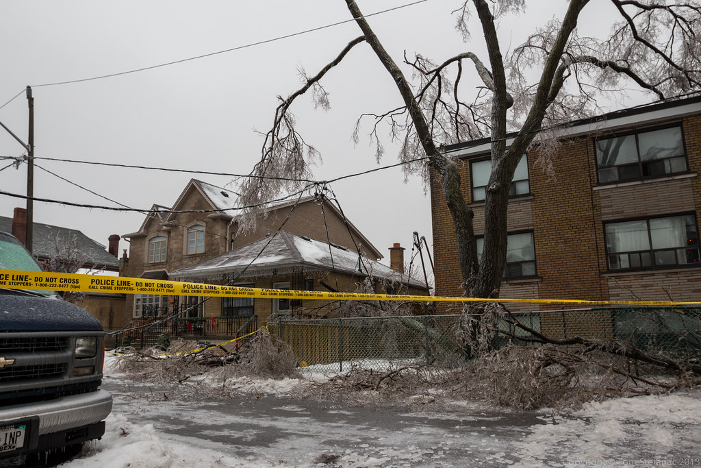
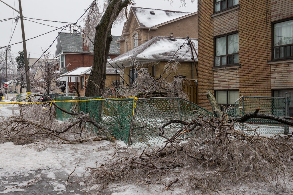
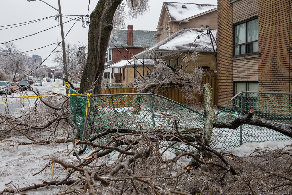
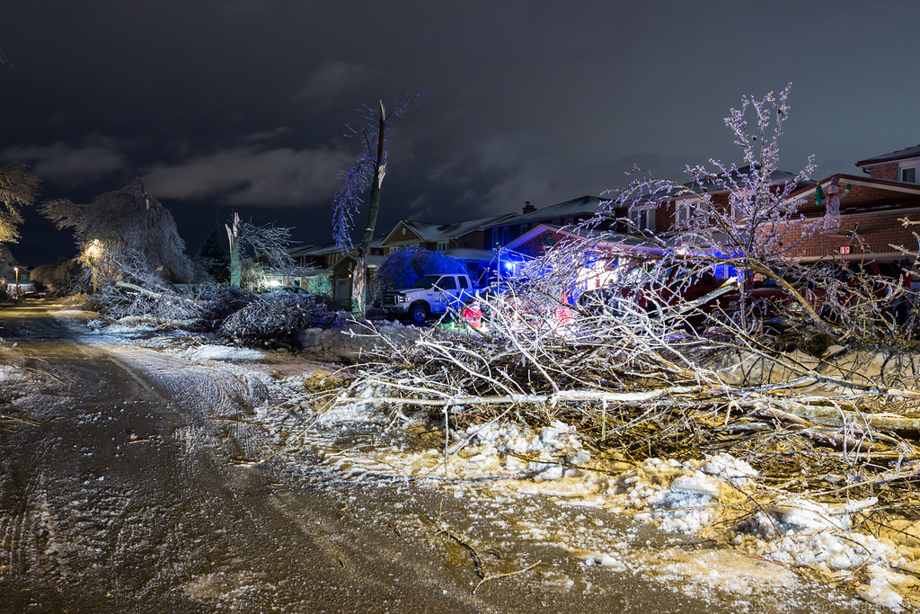
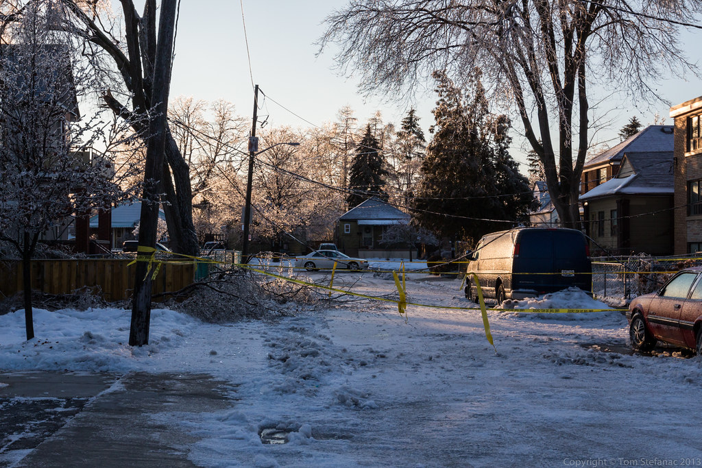
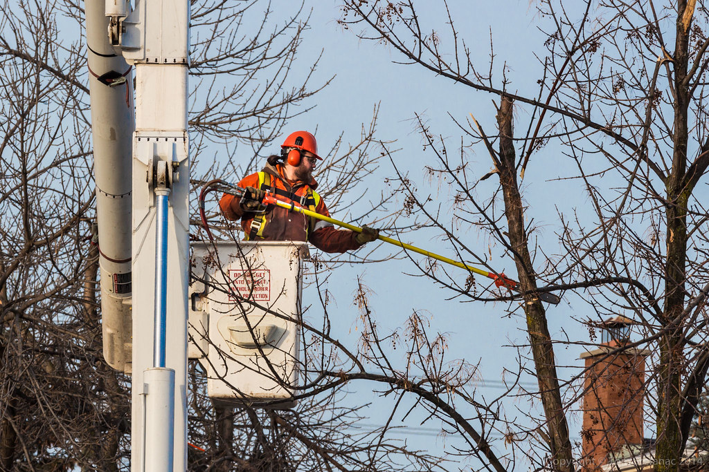
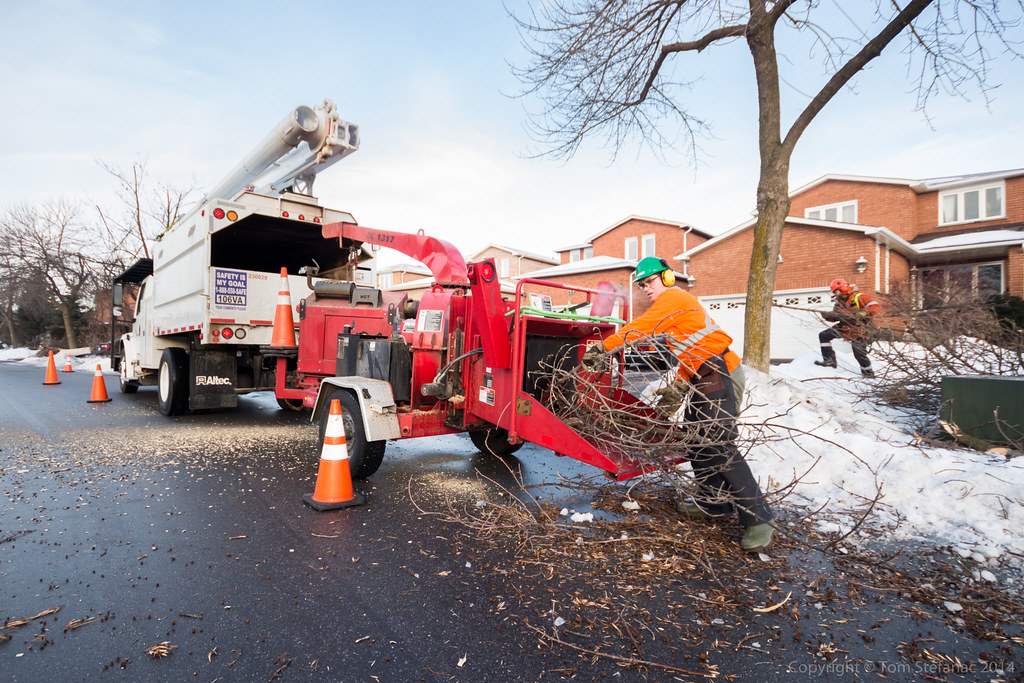
This tree not only bends down right to the road, but also stretches out across a power line. It's a good thing this particular line is fully insulated otherwise there would have been arcing and fire most likely.

This is a perfect illustration of how & why most power outages occur.
This feeder line is fortunately insulated to prevent arcing but the weight of the branch alone in many situations is enough to bring down wires and disrupt electrical service.


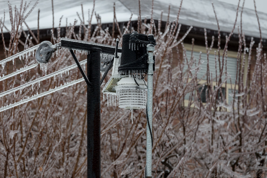
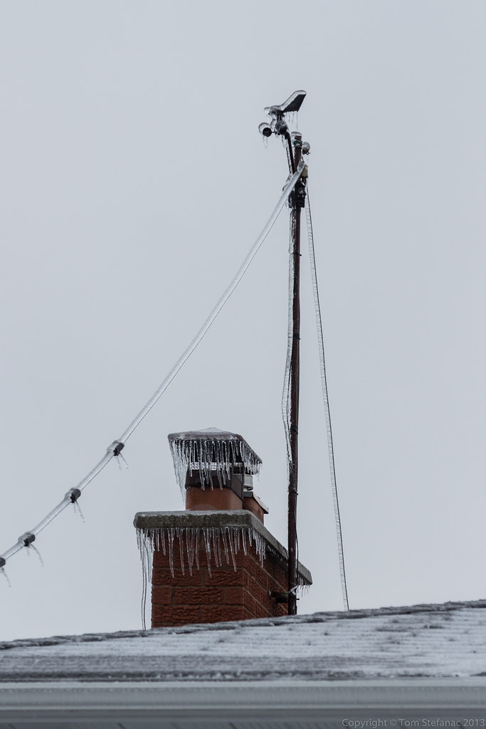
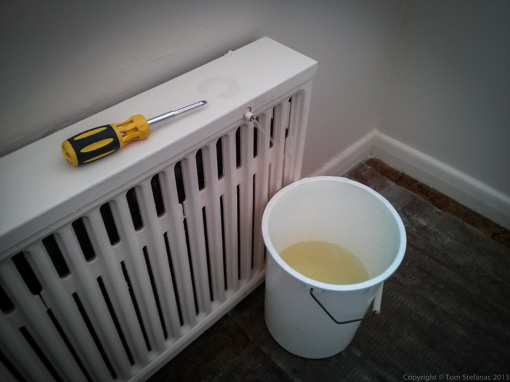
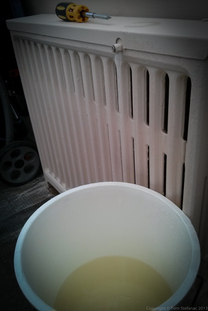
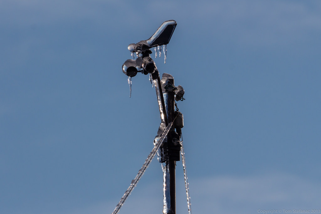
My weather station stopped providing wind data, this picture explains why.
Even in the in the 50km/h easterly winds the ice was still strong enough to overcome the spinning wind cups and freeze the unit solid.

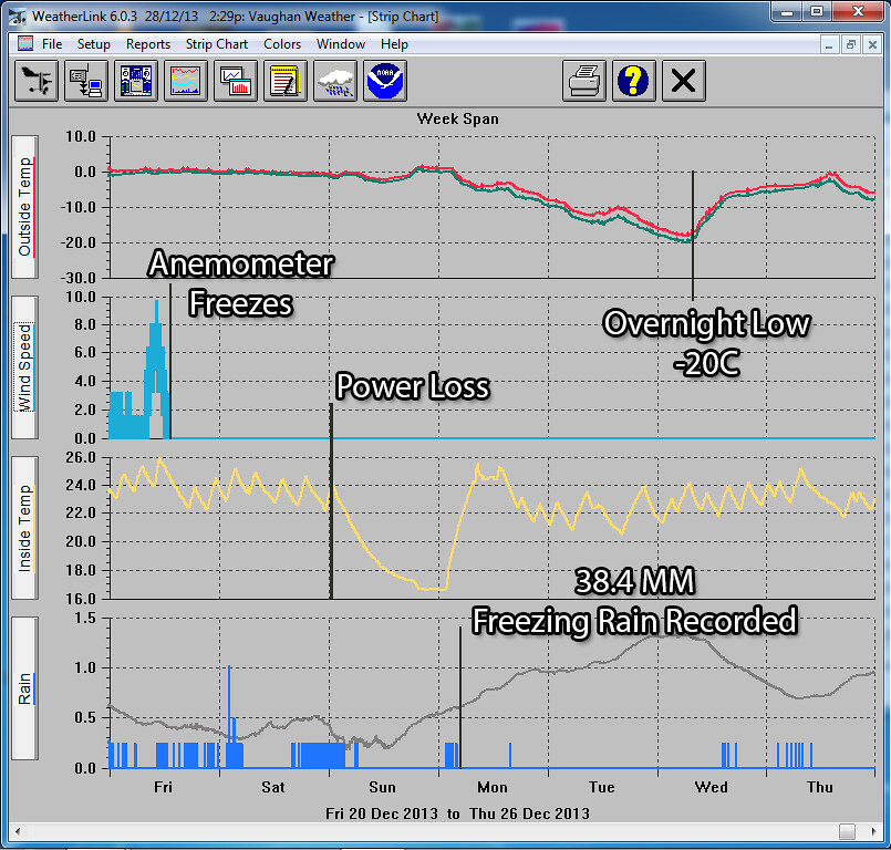
This is what the data from my weather station looked like. The chart starts at midnight on April 11th, temperatures early on remain relative warm until about 7AM which the first precipitation falls and evaporative cooling takes hold. From that point on temperatures continue to remain around the freezing mark but there is a lull in the precipitation shortly after midday. Then the second wave starts around 11PM and by 4AM on April 12th my anemometer just freezes solid. From that point on rain continues to fall and freeze until almost noon when finally the wind cups start spinning.

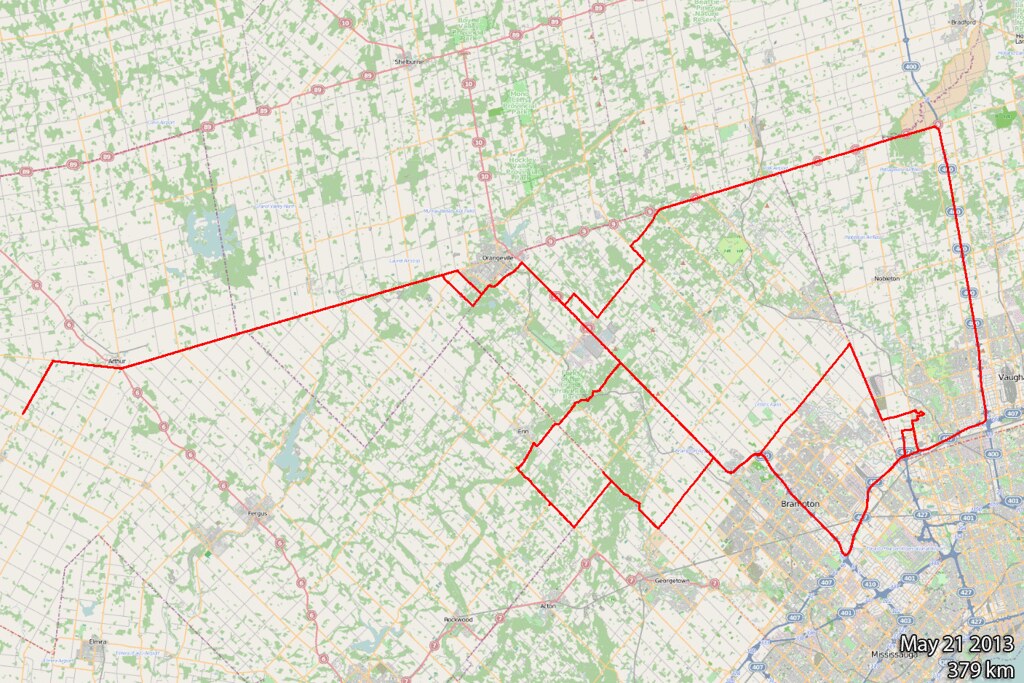
Here's the trip log, a whopping 341km and I didn't even really go that far!
It was an intense 11 hours of news gathering with taking photos on the side.

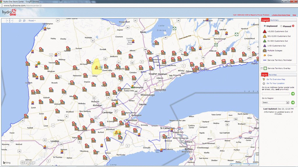
This map does not even account for the local utility companies, this is just the provincial agency that handles rural areas and primary lines. You can see there are plenty of outages!

Here's a zoomed in image showing power outages in Southwestern Ontario. What a mess!

Here's a zoomed in image showing power outages in Eastern Ontario. It's an even bigger mess!

This image is showing one of the earlier REG-GEM (Regional GEM) forecasts. The model had an excellent grip on the scope of the storm and freezing rain area even though it was a full 48 hours away at the time.

Courtesy of SpotWx here's the GEM forecast just north of my house in Vaughan.
April 18th 2013
On July 19, 2016
- 2013 Storm Chases
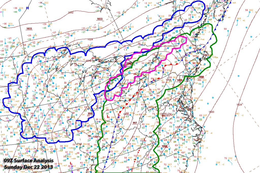
Surface analysis 18Z Thu Apr 18 2013


Hard to believe that less than a week after the ice storm I was out chasing a large ragged bowing squall line with temperatures around 25 Celsius. April is really a month of extremes!


Storm motion with this bowing segment was 59 degrees (Northeast) at 57 knots (105 km/h)
You'll see how the storm progressively bows as it progresses north along the line

Here's a quick screen grab from my tablet showing the radar at the end of my storm chase day. You'll notice the a large bowing segment heading off towards Uxbridge, that there is the storm which bowed out right over my head in Bolton/Caledon.


December 20th 2013 – The Historic Ice Storm
On December 22, 2014
- 2013 Storm Chases, Major Events


The December ice storm of 2013 can be described with one simple word, hard.
It shattered records, cut power and through the heart of the storm I was battling a personal tragedy, the loss of our beloved Beagle Junior.
The storm was bad, my loss painful and combined it was just a hard week.

Ice storms are probably some of the hardest events to forecast because a subtle change in temperature, wind flow or almost anything can tremendously change things.
For two weeks the EMCWF weather model eventually followed by the Canadian and finally American models hinted at a large storm before Christmas. The uncertainty slowly became not whether a storm would hit, but what kind of weather it would bring?
Would it bring a mix of snow and ice pellets or rain turning to freezing rain? No one really knew, it was such a borderline event any shift in track or even a small change in conditions would have a drastic impact.
Above all else, I was dealing with a sick dog, a sick furry child that needed surgery and was headed in Friday morning for what I was reassured would be a quick, simple, extensive but complication free surgery.
I had no idea at the time, but two very different storms were barreling towards me.

As the forecast date drew closer it became more and more apparent that a large freezing rain event was possible, then probable, then likely.

It was really a two punch storm, the first wave of freezing wave would arrive very late Thursday night and continue through Friday morning with a larger second wave arriving Saturday evening into Sunday morning.

The storm arrived in the Toronto area Friday morning just after midnight as warm air was ushered in with the first of the two systems. The precipitation began as snow but quickly changed over to mix of ice pellets and eventually freezing drizzle.
Roads quickly became icy and this unfortunate driver in Toronto lost control striking a utility pole. This power outage was number 1. It would be the first of many.

Sanders, salters and trucks sparying brine began to appear and they were out in force battling a relentless enemy falling from the sky.

By 10AM Friday morning many places in the GTA were either slightly above or just at the freezing mark. The sublimation process and evaporative cooling helped the drizzle freeze in the ever so slightly above freezing weather.

Christmas is always such a busy time! Juggling personal life, work and everything else can be overwhelming! This was the last data I looked at before the world came crashing down. It was ominous, almost an inch of liquid was forecast.

The storm continued through the day Friday with the ice ever increasing slowly due to a mix of spotty showers and rainy mist.
Then it happened... the vet called, it was 6:30PM and she said "you better come, Junior (our dog) isn't doing well". My girlfriend and I rushed down to the vet clinic, it was a complete shock. Earlier we had been told he was fine, the surgery went well and he was doing fine. Then hours later everything was upside down!
We stayed there all night Friday and soon the darkness turned into daylight as it became Saturday morning. Junior was doing better, he was conscious and acknowledging us. Then shortly after noon, everything went south, he was struggling to breathe, his organs were failing. He was sick, he was going to die and there was nothing anyone could do to save him.
He passed away around 12:35 that afternoon.
We were devastated, Jen was sick with grief and there I was, barely holding my composure, it was a mix of destitute anger towards the vet, grief from the loss and a bill that balloon into the $8000 range.
Junior was our child, he may have had 4 legs but we took him everywhere, even scheding vacations around him and Jen may as well have been his biological mother seeing the way she treated him.
Between grief and pure exhaustion, when Jen and I arrived home, we just collapsed. I was not heading out into the ice storm, checking data or doing anything weather related, I simply did not care.
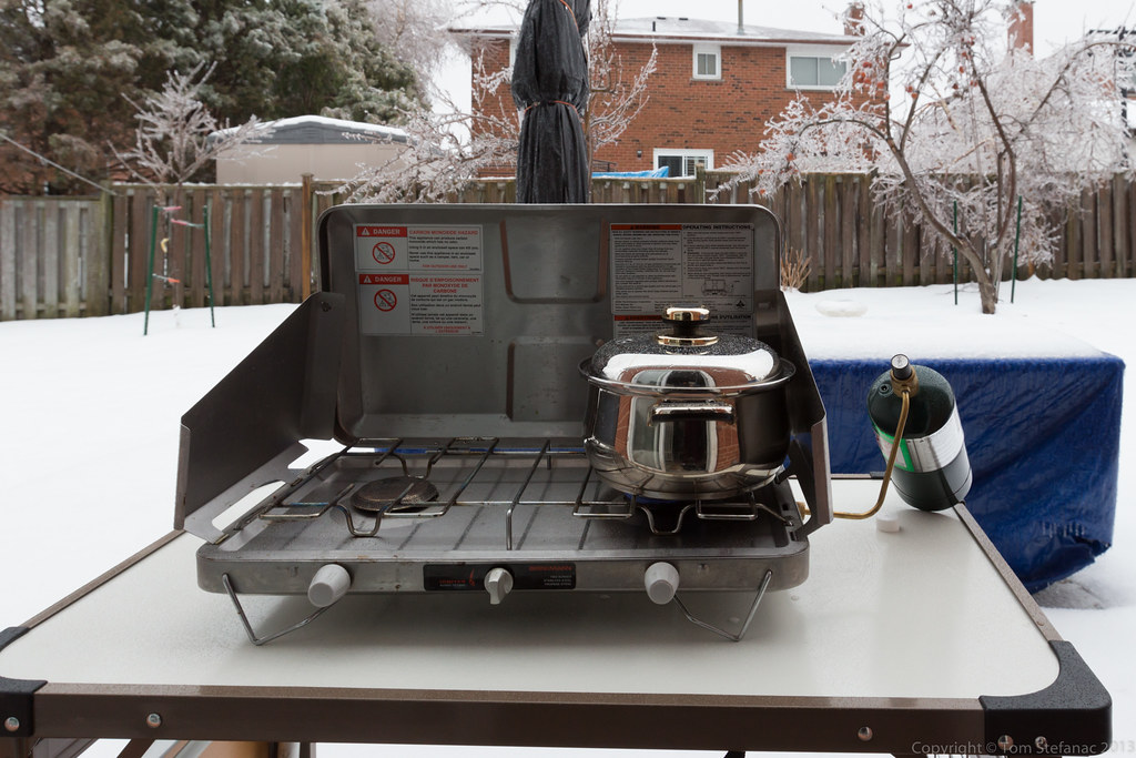
I briefly somehow pulled my mind away from everything to take this photo and some distant transformers exploded. Just before I pressed the shutter button we lost power in the house.

Without power my internet modem would not work so my cell phone was my only data bridge. I was curious to see the outage data and a little alarmed at how bad it was getting out there since most of the power lines in the suburbs are underground. This meant primary feed lines were going down, not only residential lines!!!


December 22nd 2013
On April 6, 2014
- 2013 Storm Chases

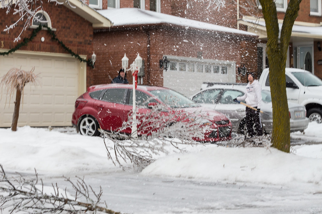
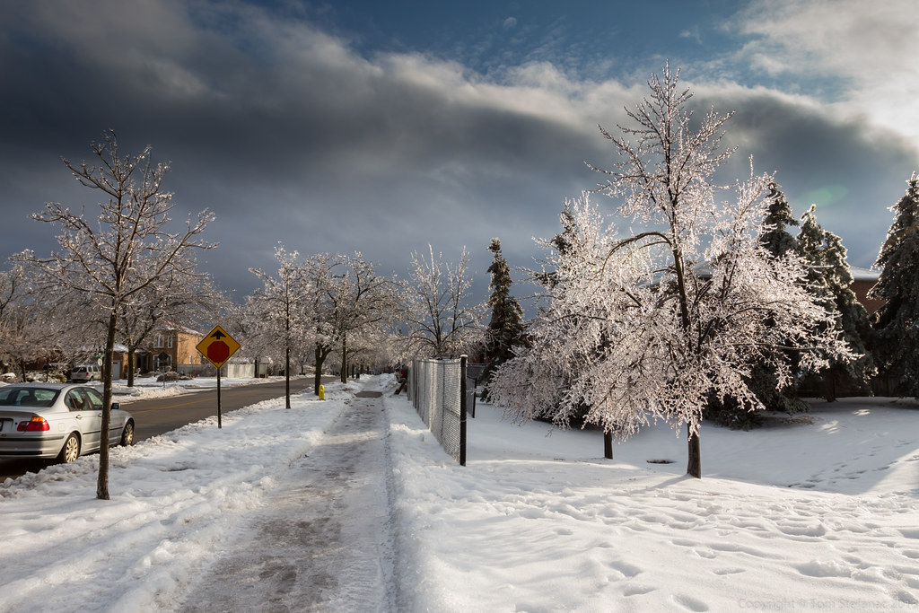
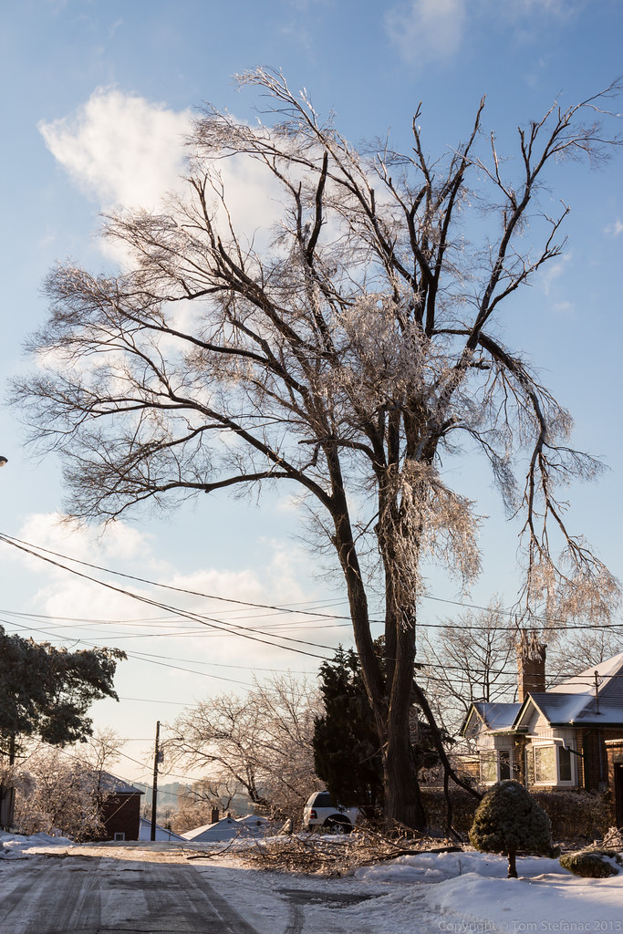
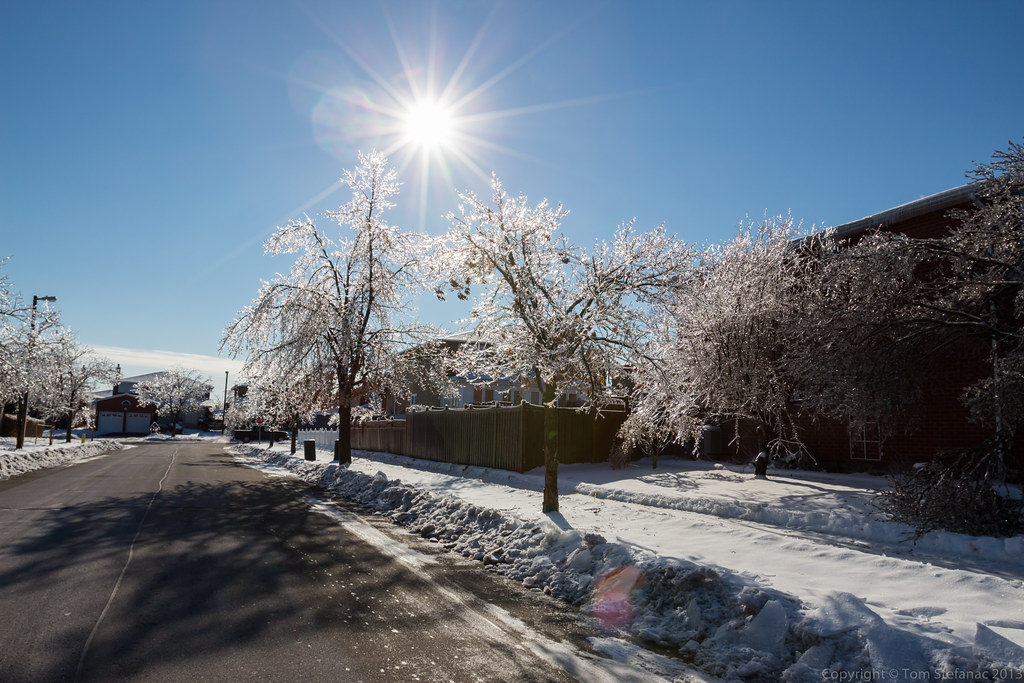
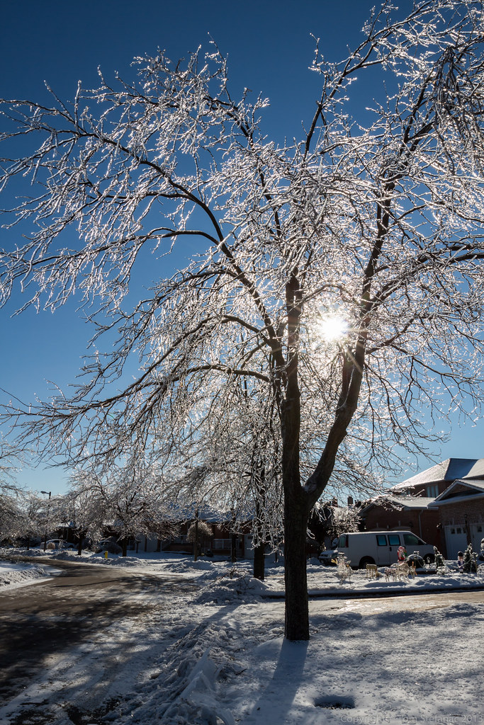
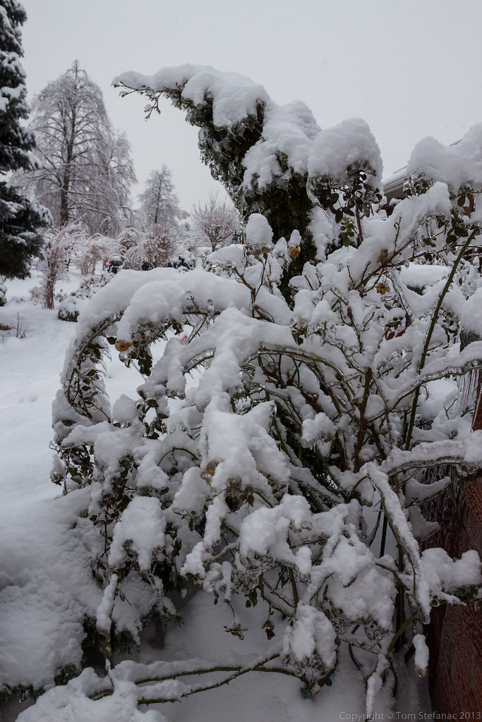
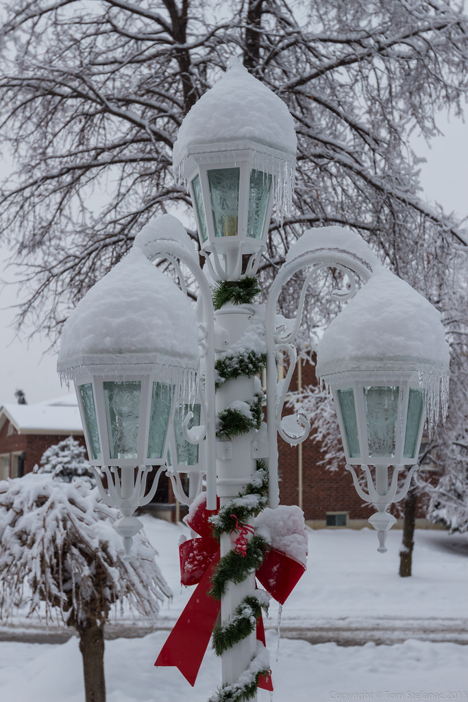
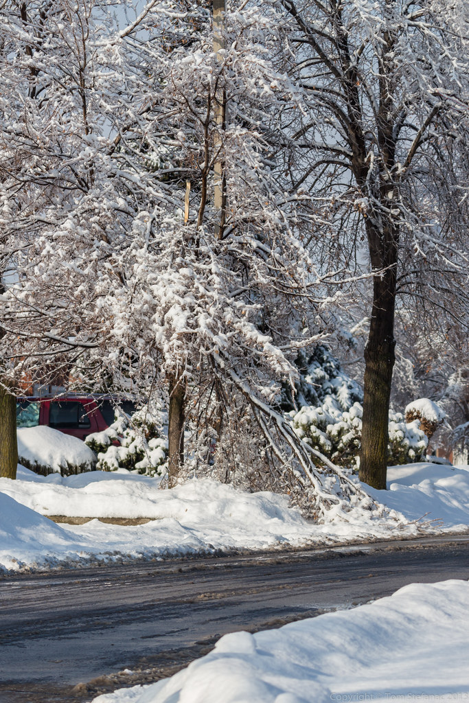
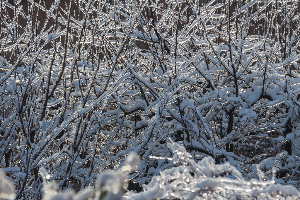
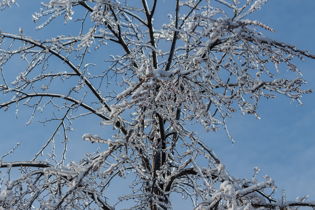
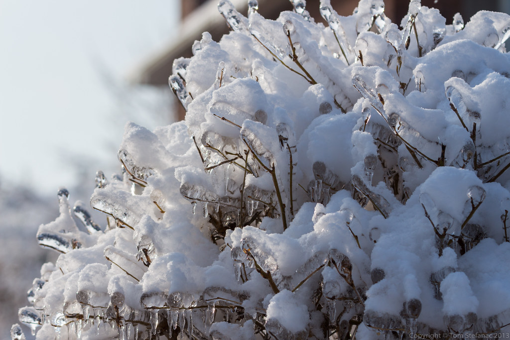
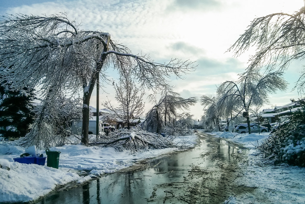
I started to try and compose "pretty" shots because while the ice was incredibly destructive, it was also beautiful.

Damage to the left, a sea of beauty to the right.

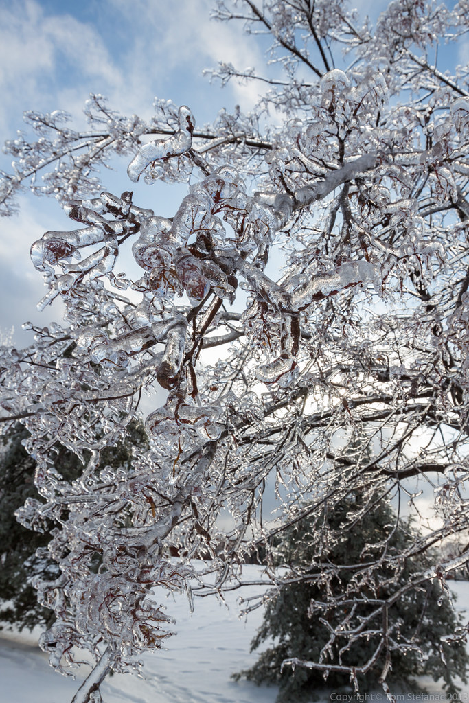
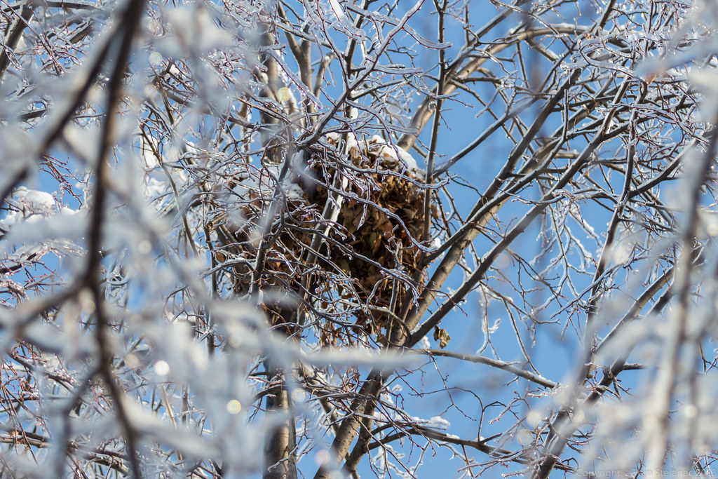
Of all the trees, it was the pine trees which seemed to weather the storm the best of all despite seeming to collect the most ice.

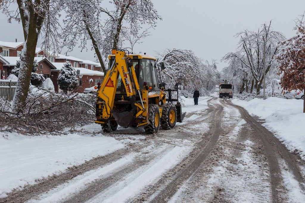
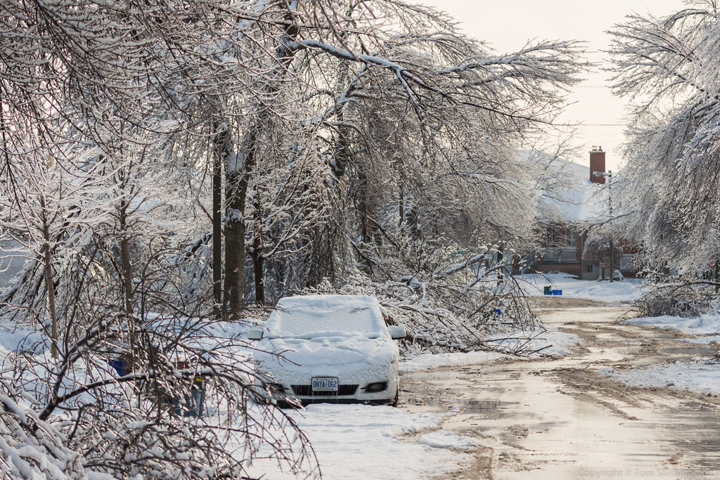
A stroll down the street was not all that easy with the ice storm.

No words.

Beautiful yet horrifying.

Navigating the mess of low leaning trees and downed branches

Bending with the ice to save itself from snapping.

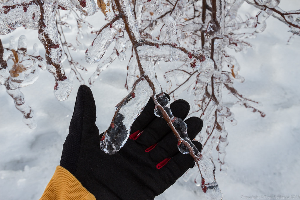
Ice laden shrubs

Seeing the forecast warm up was not on the way there was a big problem looming. Temperatures were forecast to plummet as the ridge over Northwestern Ontario sunk south.


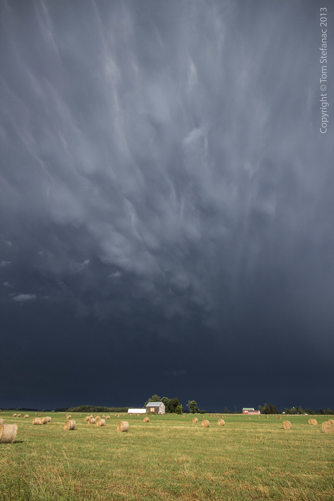
September 11th 2013
On April 6, 2014
- 2013 Storm Chases

Intercepting the leading edge of the first storm near Zorra

I recorded a brief 85 km/h gust in the storm core

Winds continue to how while changing direction a full 180 degrees

Fresh storm towers explode along an outflow boundary

Leaving Ingersoll and heading towards fresh development in London with Richard leading the way


September is an unusual month to chase in, usually all the trees are green and alive, but you'll still find patches of colour here and there. So that made it unusual and on top of that, you typically don't have storms this nice in Ontario so late in the season! Definitely a surprise for September.


June 17th 2013
On April 6, 2014
- 2013 Storm Chases

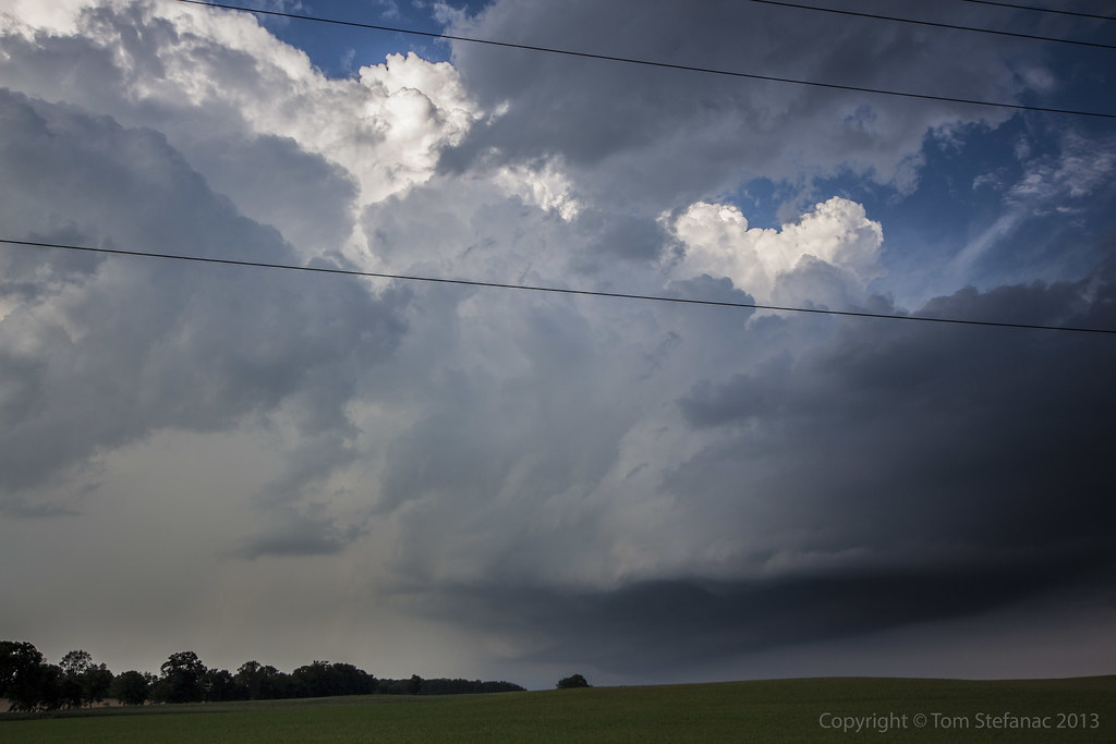
This supercell wandered over from Michigan and really matured as it neared Chatham.

Beautiful structure, you can also see dust getting kicked up near the ground.

Fellow storm chasers Dave Patrick and Mark Robinson (left side) point towards the storm as a wall of dust, rain and crap blow towards us with a giant whales mouth above.

After chasing the first storm to the lake a second supercell developed and tracked over the exact same areas as the first.

The storm looked far more linear than the first one did and the radar indicated meso signature was only a 30 knot gate-gate shear couplet but it was persistent.

The setting sun was perfect, the colours were beautiful and these photos just don't do the storm justice! If only I could have caught all the lightning crawling around..

Can't describe it, just awesome!

As the storm neared it developed this double and then triple stacked shelf cloud. The core was getting mean looking, it was green but had been turned yellow by the reddish setting sun behind the storm. COOL!

Well I've run out of a way to describe what's happening here. I was shooting video on three cameras, taking stills with 2 cameras and loosing my mind with the beauty!

This was one of the last photos I blasted off, at this point I was trying to not leave but I had to.
The growling was mix with a waterfall like sound as wind and rain started to beat down in the fields getting ever closer. When the wires above my head started to begin to whistle I knew I had to run into "drive and record" mode.


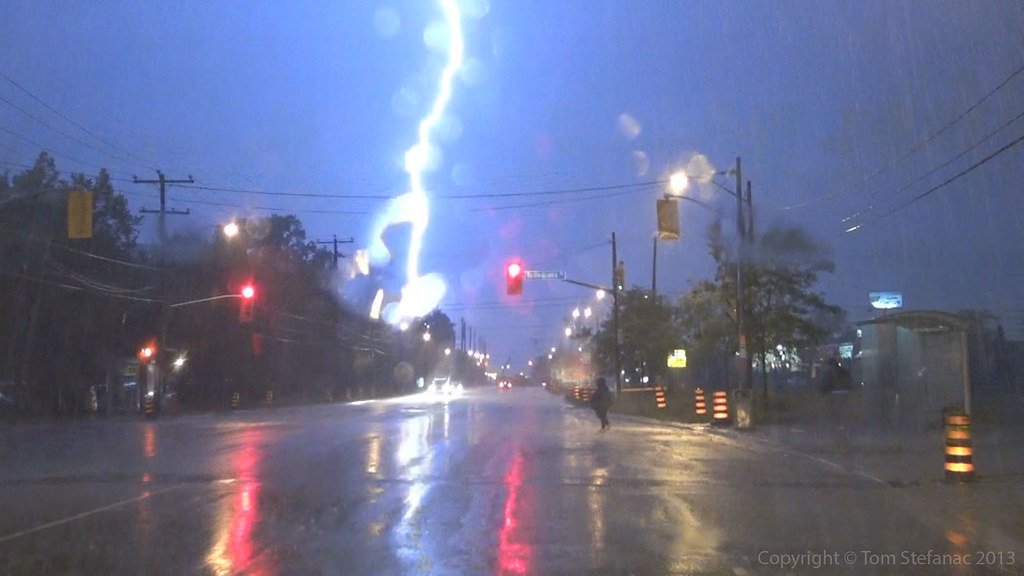
May 28th 2013
On April 6, 2014
- 2013 Storm Chases

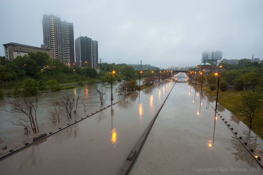
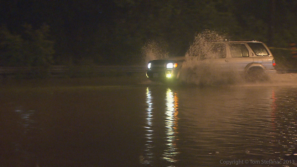
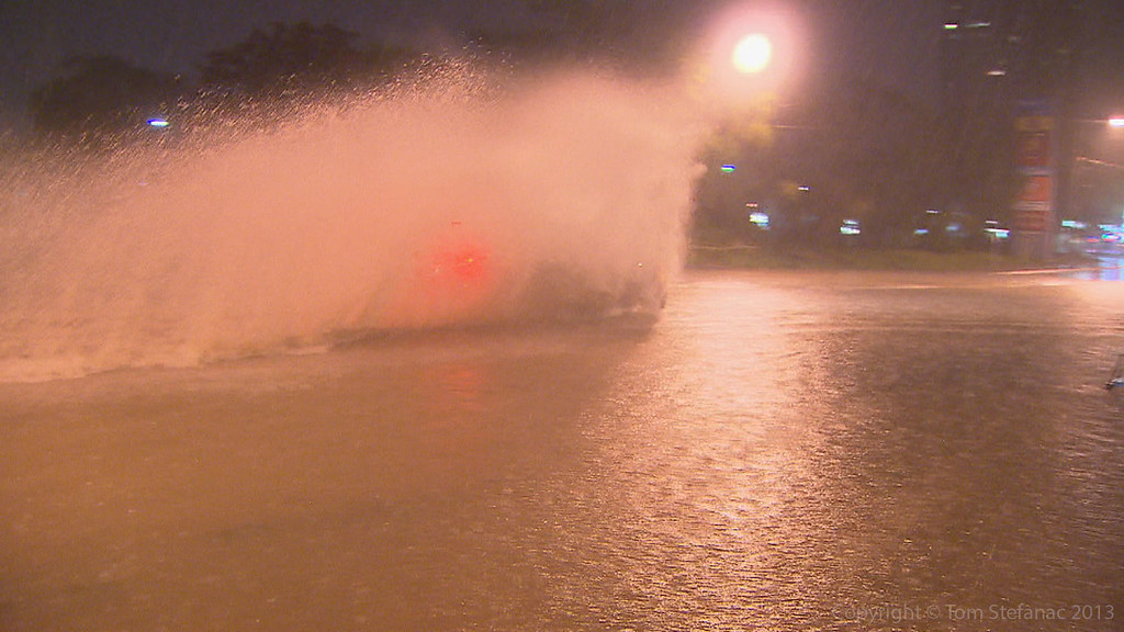
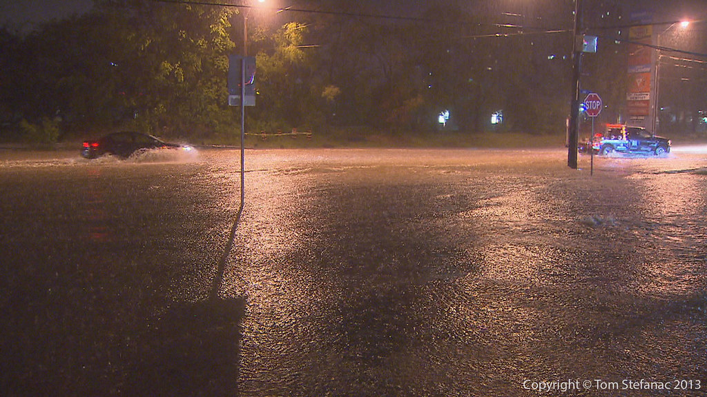
I think the car in the left half of the image is a Chevy Cobalt, this poor guy was one of the last cars to attempt to cross the flooded roadway before police could fully close the road.

Like I said, the water was around a blind corner

The northbound lanes of the Don Valley Parkway were less flooded than the southbound but cars we more susceptible to problems and hydroplaning since the water was around a blind corner.

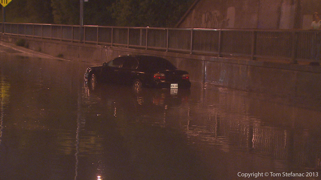
The first casualty of the Don River was this poor guy who needed to literally be pushed out of the road turned river

This suburban overtook the BMW which was having serious electrical issues after hitting the water too quickly.

This is a photo I love to pause and stare at, it's one of those shots where you just imagine yourself in this guys place or at least in the passenger seat beside him. What would be going through your mind and what was probably going through his mind?
It really is one of those "oh $#!^" moments when you realize your the only person doing whatever it is your doing and then look up to find about a hundred other people staring at you with a dazed look.

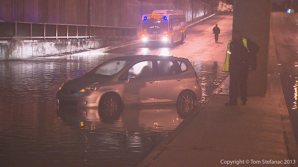
To put this into perspective, the Don Valley Parkway was closed for a solid hour, maybe more?
How this guy got onto the freeway is a mystery to me, but he should have wondered when he was the only car on the road for at least a few kilometers why that was the case?
Then of course when he came to the flooding he decided to try and cross, bad idea right? I don't know if he could hear, but a few trouble makes, myself included started yelling "swim swim swim".
I was more curious to see if he was going to try and keep going, you'll note how deep the water is ahead where it is completely overrunning the crash barrier on the left side of the image.

The Dundas ramp and all lanes of the Northbound DVP were obviously closed, you can see just how high the water was even at this point which is pretty far from the river.

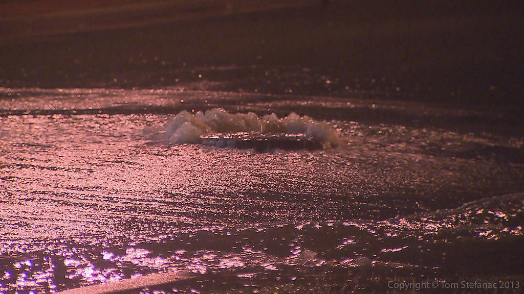
This is interesting, earlier in the night a couple cars which stalled out began floating around the center of the image (fourth light down from the top right corner) and that was at least an hour or more prior to this image, so at this point only the largest of trucks could have made it through.

Title says it all.

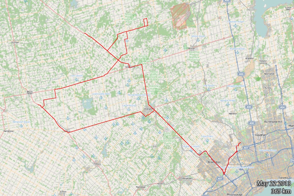
May 22nd 2013
On April 6, 2014
- 2013 Storm Chases

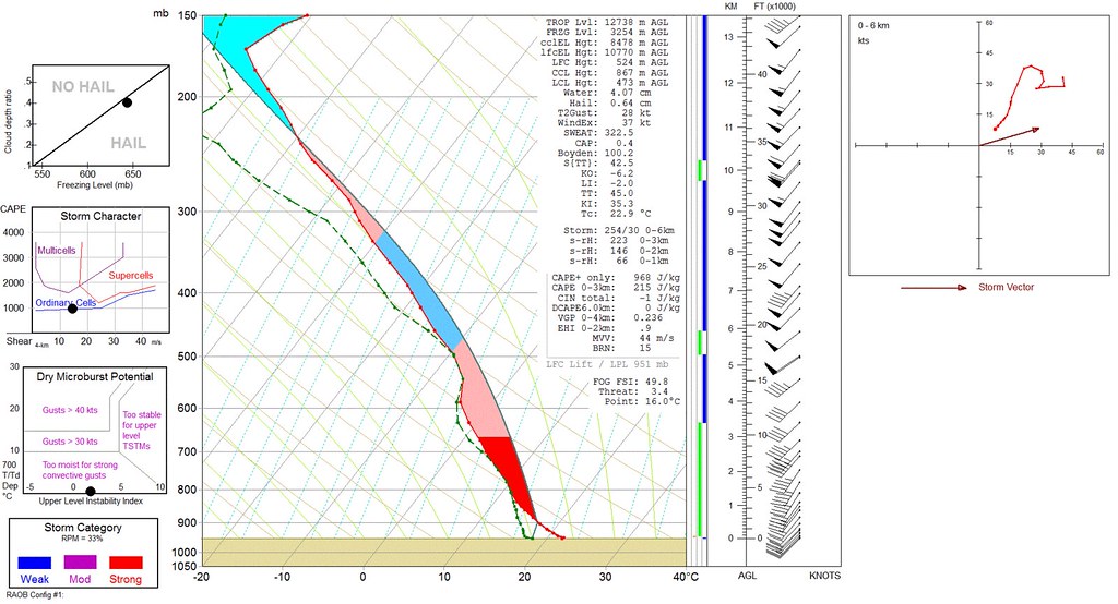
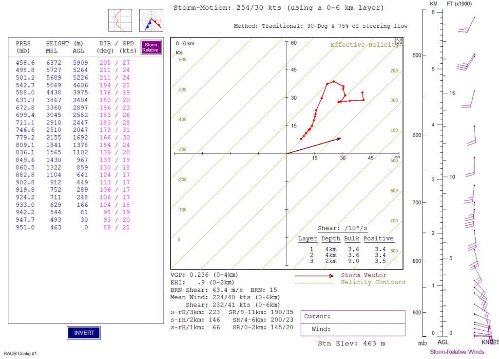
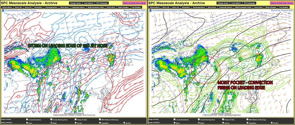
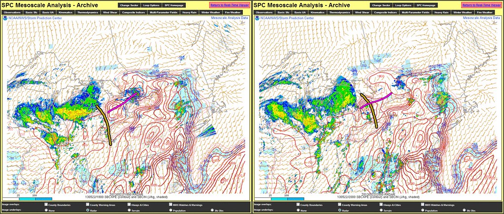
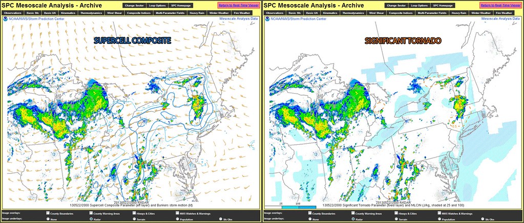
Today was one of those days, the morning was cloudy, foggy and cool, the forecast was for thunderstorms and depending on which model you wanted to believe it was bang or bust.
The surface observations and meso-analysis data suggested a good amount of shear, low cloud levels thanks to the ample moisture, good visibility but limited energy.
The whole forecast was basically based on surface observations and satellite data augmented by the meso scale RAP RTMA data which I like to use to sort of fill in the blanks. At the end of this set I'll get into some technical discussion about what made this storm special and why it did or did not do whatever it did.
Anyway, the target was somewhere around Arthur and this storm fired up near Grand Bend along a surface trof riding under a mid level moisture plume. The storm quickly developed and tracked north but really looked like crap on radar, and I mean just CRAP!
Dave Patrick and I who met up just north of Aurther raced north on hwy 6 as the storm came into view and were greeted by this rapidly developing wall cloud.

This was really one of those "wow, it going to probably drop a tornado soon, I feel like I'm in Oklahoma" moments. Usually structure this good in Southern Ontario means batten down the hatches and this was really a ground scraping wall cloud!

As the storm continued on, the strong 20km/h southerly inflow quickly turned to a gusty westerly flow as the rear flank downdraft kicked down and around. Look at the way the grass is leaning towards the bottom of the picture, it's leaning towards the right (east) since the photo was taken looking north.
Dave was so impressed he was almost wandering around aimlessly in awe, video camera in hand forgetting to record!

The first really great chase day of the May season!
I like to make photos interesting, and perspective is key! Just as Dave was pointing up at some of the rotating scud getting sucked in near the rear of the wall cloud I was able to snap this photo of him pointing!
This was definitely one of the more awe inspiring weather moments I've had in Southern Ontario!

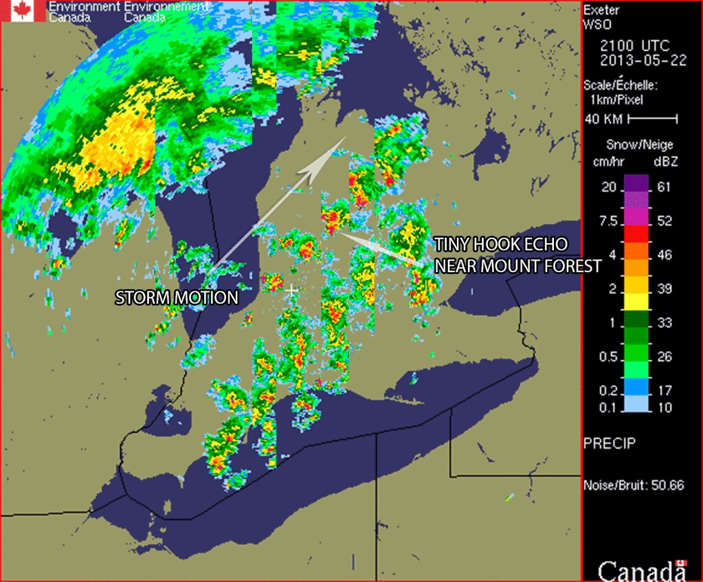
As the storm chugged along northeast from Mount Forest towards Shelburne it began to undercut itself since the RFD kick was so intense.

Despite this undercutting, the storm was actively cycling and working to produce a new wall cloud and again present another opportunity to produce an elusive Southern Ontario tornado.

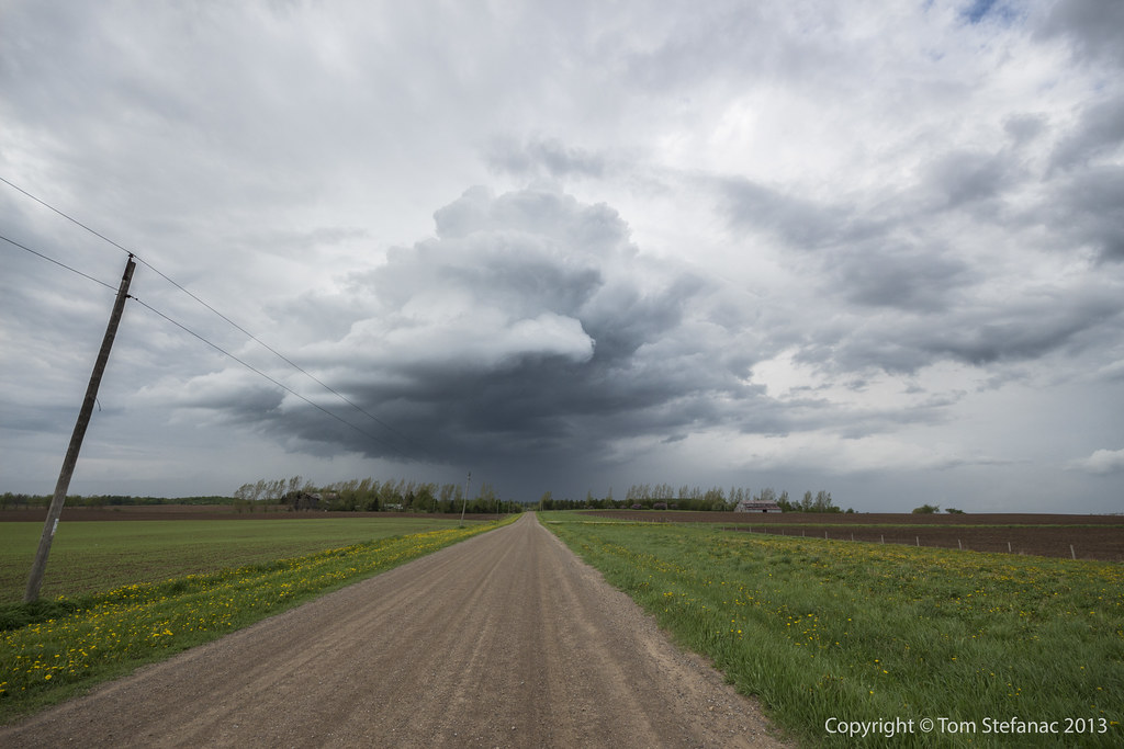
Positioning ahead of the storm once again, this time just west of Shelburne in the wind farm area it was amazing to see the storm sucking up moisture and continuing to produce dangly things.

Getting closer to the storm it was doing some crazy stuff, it was neat to see the storm pull in and directly ingest what appeared to be fog from the surface.
This really let's you see how a parcel of air get's into the storm and the path it takes. You can see how on the way up the air is twisting and coming in from an angle instead of going straight in and up.

Sadly, the storm was moving quickly and getting into a less chaser friendly area as it neared the edge of the Niagara Escarpment. A couple neat things happened, a combination of tree scud and pooled moisture that was overrun by the warm boundary or forced up the escarpment allowing up slope cooling created dense pools of fog which get sucked into the storm making for some cool skies. (no pun intended)
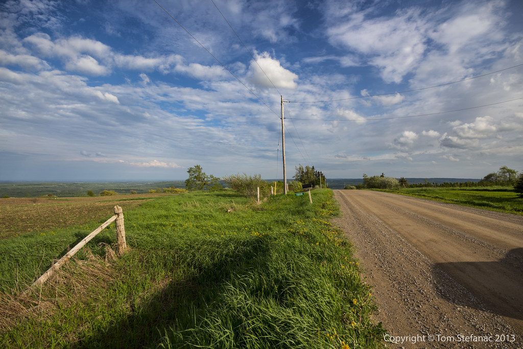
Secondly, while out in what was essentially the middle of nowhere Dave and I ran into Todd Rittinger, or well we were parked and he ran into us! This is the second time I've run into another storm chaser in the field in Southern Ontario this year. It was a brief encounter but nice to meet Todd finally!

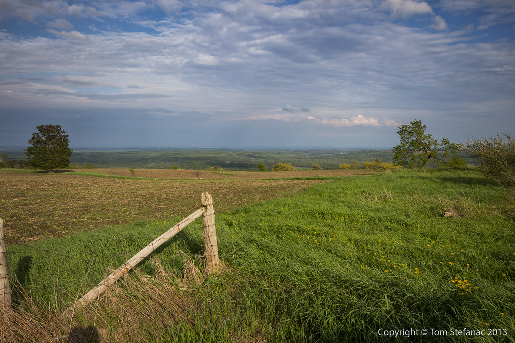
While we gave up and storm and watched it wander into the area north of Barrie (and eventually cottage country) I was intrigued by this weak "stuff" moving in from the west.
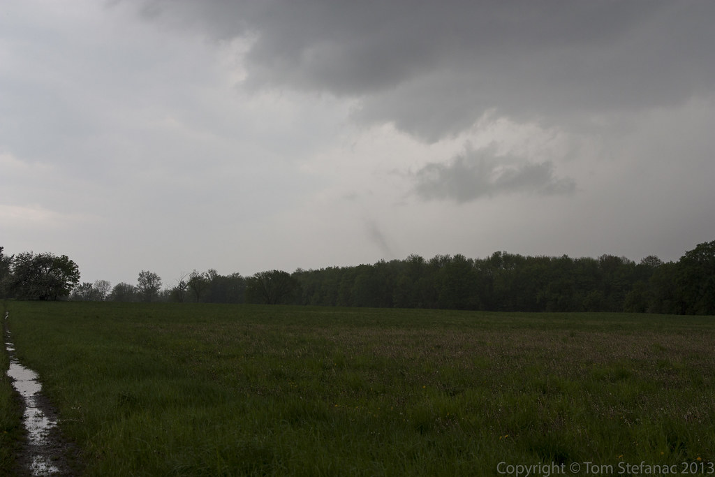
May 21st 2013
On April 6, 2014
- 2013 Storm Chases

By 7:30AM it was already 18 degrees with a humidity of 94% making it feel like 20C with the humidex.
Tower cumulus were already bubbling up in places as conditions only got hotter with the sun beating down.

Convection started going up early, two waves were forecast to move in from Michigan by both the Regional GEM and later the HRRR. Morning visible satellite images and even the radar data agreed well with the forecast showing both these waves very well in the visible satellite imagery.
Also visible was a pre existing stationary boundary that was literally running right along highway 9 and eventually meeting with the Lake Ontario breeze. This boundary was in place since at least May 19th when weak storms fired off the leading edge and it was not washed out by the squall line May 20th since during the early morning hours of the 21st nocturnal convection fired along this same boundary.
So by 12PM I was on the road and heading west towards Arthur to intercept the rapidly developing storms.

I rolled some video around Grand Valley. The sky was getting dark and it was hot out, damn hot! The air was super sticky and muggy, there was a fairly strong southerly flow and the day had that Oklahoma feel to it, the feeling you get just as your waiting for a supercell to come into view.
Of course, this was no supercell and the skies looked ominous but it was not like I was expecting anything crazy, which is very different from Oklahoma! I guess, the anticipation is really the feeling I'm describing.

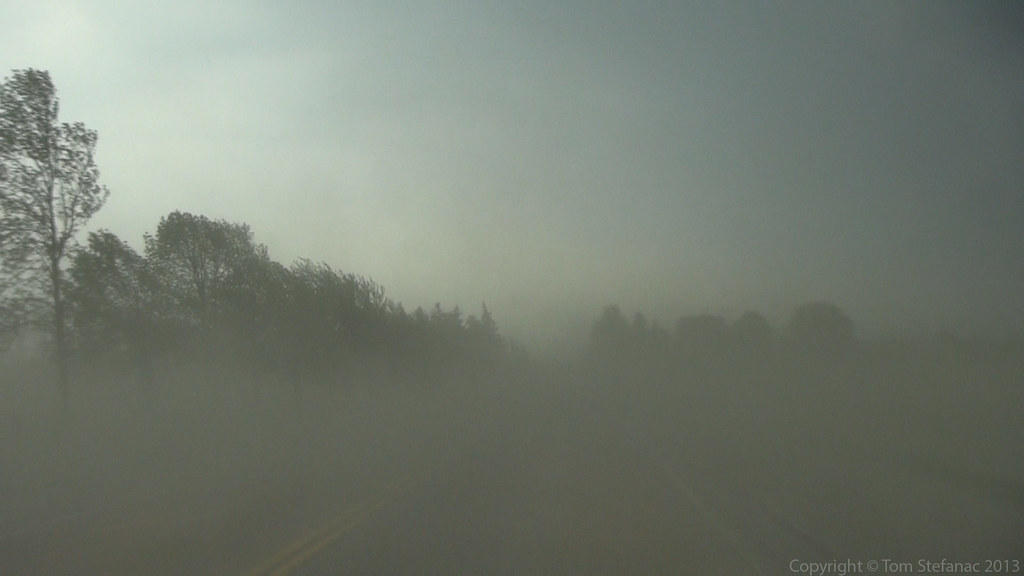
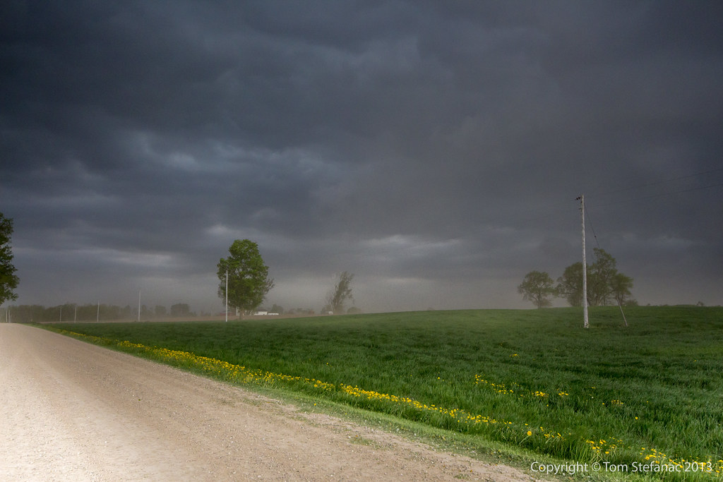
As I was just going to punch through the first storms, things were getting a little messy, there was a lot of convection going up ahead of the main storm cell I was interested in. My gut told me to stop driving and wait, but the radar was screaming at me to keep going west so I listened to the radar.

So yeah, it started to pour, not overly hard and there was no wind or anything so the rain was more of a visibility hindrance I found then anything to worry about.

Just as I was outside of Arthur I saw a green flow directly in front of my and then a wall of scud quickly rising as it was being pushed up by outflow. I was not nearing one of the first stronger cells in the cluster ahead of the main storm.
When I drove into it, the rain hit like a wall! There was some wind in the 50km/h range but it looked more severe than it was due to the rain falling so hard and banding into sheets. I heard a few dings from pea sized hail.

I kept pushing and punched into the main storm I was interested in intercepting. Just as I started to get into the core the storm blew itself out. The winds began to really gust hitting about 63 km/h at times but that was it, the highest gust was actually 63.7 km/h with the average around 50 - 55 km/h.
You can see how the rain was just howling up the road towards me but again, it was not severe. It just looked more intense than it really was.

Again, anytime things are rocking and rolling video always takes presidence over still photos. Maybe I just have this opinion because I'm actually a videographer by trade?

Yep, the rain was just rolling through the fields!

After getting my fill of video and outflow wind I decided to keep driving towards the storms southern flank. I was getting dinged by random pieces of pea sized hail and then I had a couple dime sized stones hit me but they were few and far between.
It felt like it was taking me forever to reach the southern flank of the storm but then suddenly clearing appeared ahead and I could see the definite boundary coming into view.


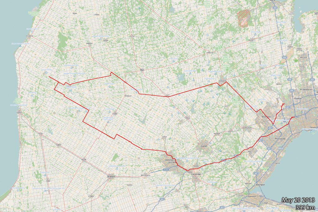
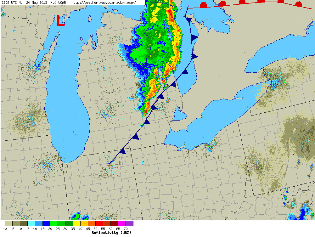
May 20th 2013
On April 6, 2014
- 2013 Storm Chases

Today was one of those wait and see and hope and wish and drive type days. All the moisture, energy and instability was contained to southern and central Michigan as a warm front lifted north across much of the Northeast U.S and Southeastern Canada.
Earlier in the week models had shown storms erupting across southwestern and southcentral Ontario around the dinner hour but as the forecast day drew closer, the incoming trough aloft slowed down and ushered in more capped air in the mid levels leaving the cooler less stable air farther west.
This meant that here in Southern Ontario we were widely out of luck, but the HRRR did have one interesting card up its sleve. It showed the stuff in Michigan to eventually go linear and turn into an MCS (this was widely supported by the the mid and upper level wind fields). The MCS was then supposed to rapidly begin accelerating east across Lake Huron and blast into Southern Ontario with the nose of the forecast bow-echo to land somewhere around Teeswater which agreed well with the actual surface observations and radar data.
My biggest fear was that the stable marine air over Lake Huron would kill the line of storms long before they had a chance to hit Canadian soil as is sometimes the case. I was concerned because they were going to be outpacing the more unstable air and moving into a more and more capped atmosphere.
I tried to take a nap because I was tired and had to work overnight after the chase but the tornado action in Oklahoma kept me awake and then I watched as Moore was taken off the map again much like it had been on May 3rd 1999. It was horrific to watch but at the same time kept me glued to the live streams.
After getting virtually no sleep, the HRRR forecast began to validate as the storms in Michgan began to line out and blast eastward. I jumped in the truck and took off.
I spoke to fellow chaser Dave Patrick on the phone, he was farther west than I was and in good position. Looking at the radar I figured I had another hour or so before I would be into the squall line since it was only over central Lake Huron at about the time I was entering the Town of Lucknow. I immediately called Dave to see what was going on in front of me and he said it was blasting him with dirt and gustnadoes.
I was sort of stunned since the storms were still so far away on radar, or at least that's where the precipitation was. I didn't notice it at the time, but if you look near the horizon you'll see a brown wall of dust just above it! I was so busy getting the graduated ND on the camera and aligning everything so perfectly I did not realize that the interior of my car was going to get pretty dusty soon.

The storm looked okay, it was far from producing anything impressive and the colours were pretty bland but I was still excited to see if there were any good winds on the leading edge. I was absolutely dieing to test a new Inspeed anemometer that I had purchased just for purposes like this!

As soon as the storm came within a good close view, I grabbed my video camera and began getting video. This is one of those things that makes far better video than it does a still photo. With the video you have motion, action and sound, with the still photo, all you really have is just a moment in time, which sometimes does little to illustrate what happens or is about to happen next.
So video from this point on took priority!

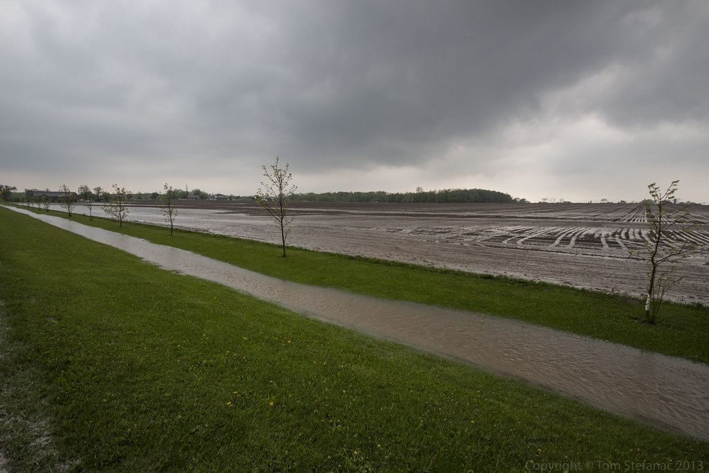
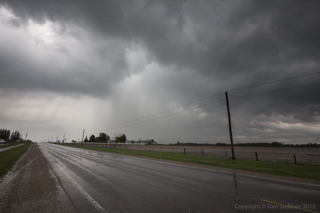
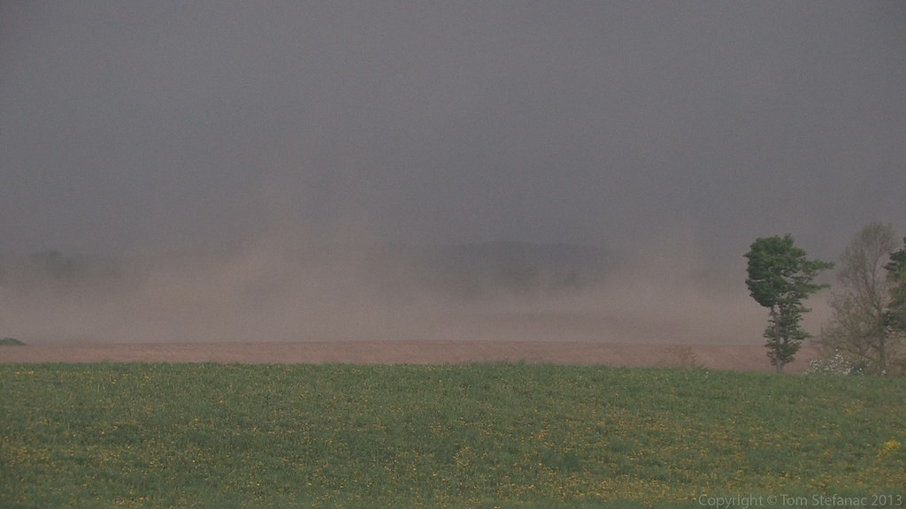
This is just the coolest things! It was incredibly dry across much of Southern Ontario for a good part of May and a late planting season saw many farmers tilling their fields just days prior to this storm rolling in. The barren and dusty fields created an amazing display, it's not like seeing strong straight line winds or a tornado, it's more like a feeling of "that's just cool!" without actually shouting that out.

At about this time somewhere in the back of my mind I was thinking "it's getting close, that's a lot of dust, should I stay out and get hit, what about the camera and lens? Wait, my truck windows are rolled down!"

I managed to jump into the truck and get the windows and doors closed just as the wall of dust hit. I kept shooting video through the windshield with both the Canon XH-A1 and on my Sony Handycam I have mounted on the dash.

Like I said, this was the first time I had the ability to actually put the Inspeed Anemometer to the test, I was hoping and probably expecting stronger winds but the absolute highest gust I measured while on the hill, outside of Lucknow was 50.3 km/h, hardly a severe gust! Heck, you'd be lucky if that tipped over your trash can.

Now knowing the storms outflow was only moving at around 50km/h peak I knew I could keep pace and get back out in front of the storm for a second round.
I actually had my camera at this point mounted to my window and was able to snap this shot while looking for somewhere to stop. The contrast was pretty cool!

The gustfront was spinning up all sorts of eddies glorified as gustnadoes. COOL!

The dust made visibility in places poor.


May 15th 2013
On April 6, 2014
- 2013 Storm Chases
As night turns to day slowly, the morning rays of sunshine reveal showers produced by elevated thunderstorms moving in along a warm front.
Here's a radar shot showing the first target storm as it tracked southeast from Shelburne.
You can see it is the dominant storm cell in the line. At around this time I'm making my way east on the 407 to head north on the 404 for an intercept.
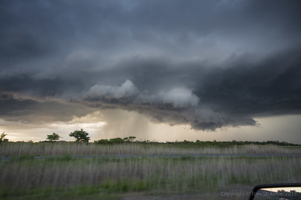
This was one of the few dominant storm cells approaching me from the west.
I raced north along highway 404 and stopped on Stouffville Rd just east of the highway. The thunder and lightning was nearly continuous as the storm moved ever closer. It seemed far more intense than it really was.
The storm cell was still highly elevated, it produced some small pea sized hail and heavy rain. There was virtually no wind at the surface.
You can see the back side of the storm as it passes, this particular shot was taken looking Southeast.
Here's my position relative to the storm to give you a better idea of what I was seeing.
Fresh towering cumulus going up to my immediate west along a turbulent zone of convergence and mixing aloft near the leading edge of the prior convection.
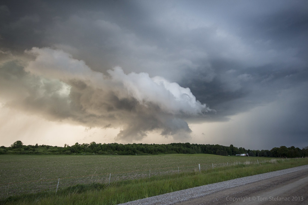
This was the second storm cell which later spiked on radar.
When this photo was taken it was still in its infancy but at this point the surface warm front was getting closer and it was later in the day so boundary layer mixing was increasing. This allowed the storm to mix down further and at least appear to be getting closer to the ground.
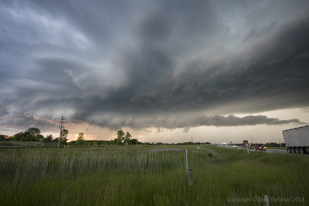
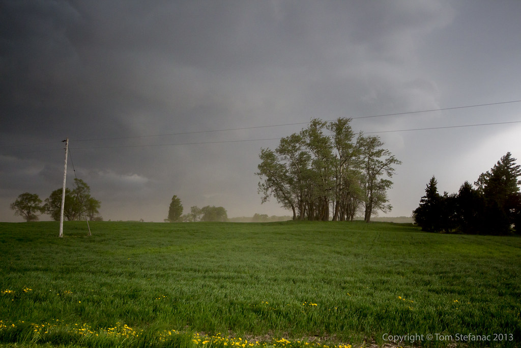
A little while later the same storm seen in the previous image is now east of me and beginning to hit 65dbz on the radar. You can see the rain shafts from the storm directly in front of the power lines.
Here's the radar showing how intense the storm actually appeared on radar despite its benign appearance visually.
This is a stylized image of the storm as it continues eastward. I've used a graduated neutral density filter to darken the sky and create this vibrant image. At this point the storm was hitting 68 dBz and producing some small hail. A warning for Durham Region was issued, and this storm eventually made its way out over Lake Ontario.
I tried to keep pace with the storm but gave up, it was moving at well over 80 km/h.
May 10th 2013
On April 6, 2014
- 2013 Storm Chases
The setup for storms was driven by a low scooting just north of Lake Erie and Ontario, the supercells in Southcentral and Southeastern Ontario formed along the warm front where a marine / lake breeze boundary interacted with the surface warm front and trigger storms
A weak elevated supercell in a low energy but moderate shear environment approaches Milton
The storm is now passing through Milton, you can see mid level clouds flowing into the storm from the Southeast (image looking west). It also presents a bit of a vaulted type structure with the usual lateral tilt of the updraft. Slight clearing between the "hail" region of the core and the heavier rain is visible just to the right of center.
The biggest problem with this storm if any is the fact that it remained elevated with limited boundary layer interaction and hence produce virtually nothing as far as wind at the surface.
Inflow / outflow and rain as the storm passes overhead and looses some of its structure
Here a screenshot from PYKL3 (Android radar software) showing my location and a weak couplet appearing on the NWS Buffalo Nexrad radar.
Here's the Meso Analysis sounding for a point nearest the storm at the given time. You'll notice the storm is entirely elevated with very little cape and very low topped since the LFC/CCL EL is ~7km.
lon=-79.813855 lat=43.555635
The hodograph data shows little in the way of dynamic shear, all the veering in this ground relative hodoraph is below any of the convective instability.
The storm relative hodograph shows a very different story, veering winds with supportive inflow exist well above the ground into the mid levels allowing the storm to still rotate (although very slowly) despite being elevated.
This explains why this storm took on a supercellular structure.
April 18th 2013
On April 6, 2014
- 2013 Storm Chases
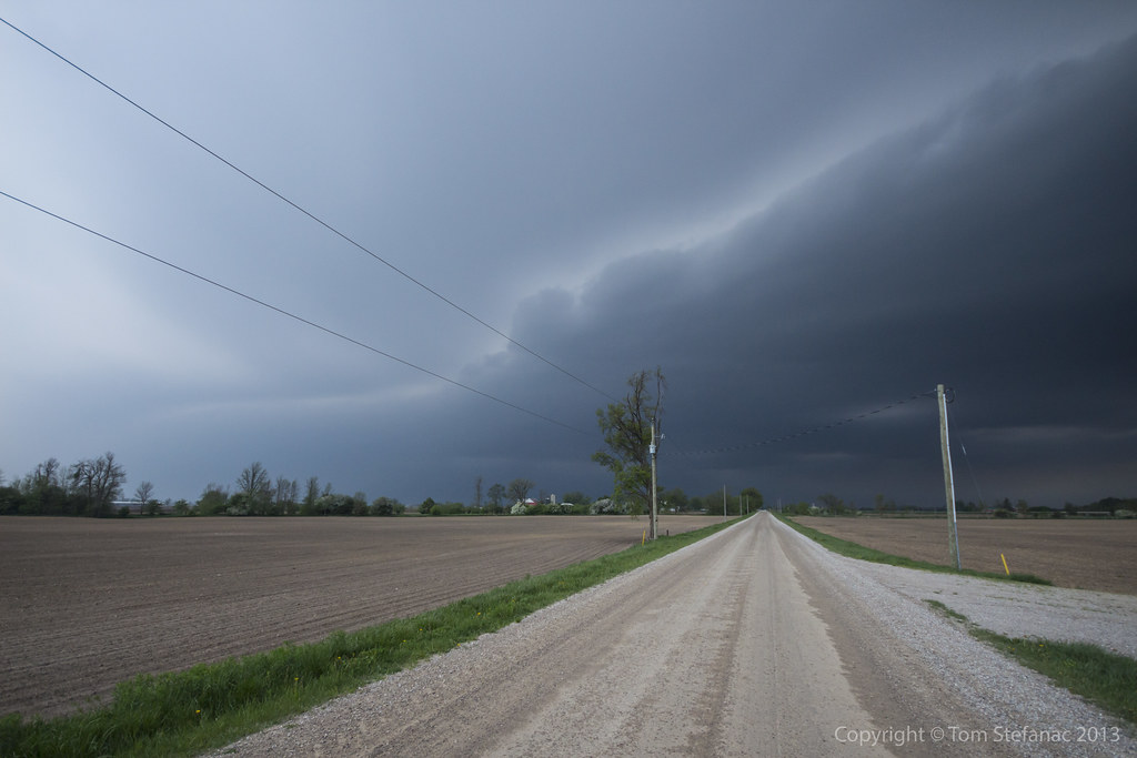
Hard to believe that less than a week after the ice storm I was out chasing a large ragged bowing squall line with temperatures around 25 Celsius. April is really a month of extremes!
Storm motion with this bowing segment was 59 degrees (Northeast) at 57 knots (105 km/h)
You'll see how the storm progressively bows as it progresses north along the line
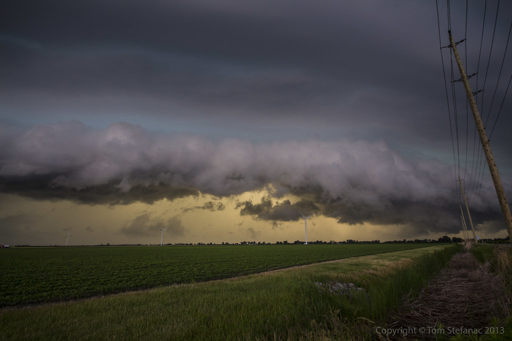
Here's a quick screen grab from my tablet showing the radar at the end of my storm chase day. You'll notice the a large bowing segment heading off towards Uxbridge, that there is the storm which bowed out right over my head in Bolton/Caledon.
April 11th 2013
On April 6, 2014
- 2013 Storm Chases
My weather station stopped providing wind data, this picture explains why.
Even in the in the 50km/h easterly winds the ice was still strong enough to overcome the spinning wind cups and freeze the unit solid.
This is what the data from my weather station looked like. The chart starts at midnight on April 11th, temperatures early on remain relative warm until about 7AM which the first precipitation falls and evaporative cooling takes hold. From that point on temperatures continue to remain around the freezing mark but there is a lull in the precipitation shortly after midday. Then the second wave starts around 11PM and by 4AM on April 12th my anemometer just freezes solid. From that point on rain continues to fall and freeze until almost noon when finally the wind cups start spinning.
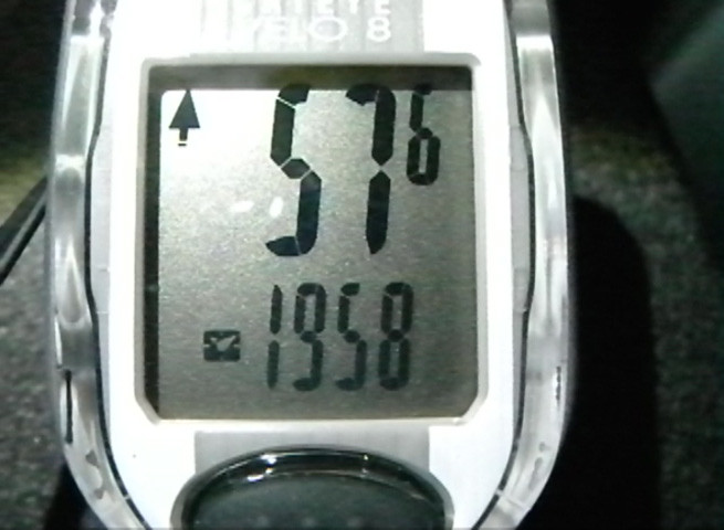
Here's the trip log, a whopping 341km and I didn't even really go that far!
It was an intense 11 hours of news gathering with taking photos on the side.
This map does not even account for the local utility companies, this is just the provincial agency that handles rural areas and primary lines. You can see there are plenty of outages!
Here's a zoomed in image showing power outages in Southwestern Ontario. What a mess!
Here's a zoomed in image showing power outages in Eastern Ontario. It's an even bigger mess!
This image is showing one of the earlier REG-GEM (Regional GEM) forecasts. The model had an excellent grip on the scope of the storm and freezing rain area even though it was a full 48 hours away at the time.
Courtesy of SpotWx here's the GEM forecast just north of my house in Vaughan.
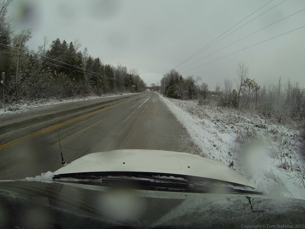
April 1st 2013
On April 6, 2014
- 2013 Storm Chases
Looking at this photo it sure does not look like April 1st, and no this is not an April fool's joke I've concocted, it's a not a joke at all!
Mother nature decided that we've not had enough winter this year and it seems even with balmy days between they are simply teasers.
(There has been no Photoshop work done to this photo, it was taken purely using a Cokin graduated tobacco coloured filter)
My car (not visible but right of the frame) was actually partially blocking a lane. It was all fine and dandy since there was no traffic and this snow was low drifting stuff.
Then just as a few cars came into view the wind started blasting and the drifting snow became a low visible wall of white a few feet tall. It was more than tall enough to shroud my car from any unsuspecting drivers so I made haste and got out of here as quickly as I could!
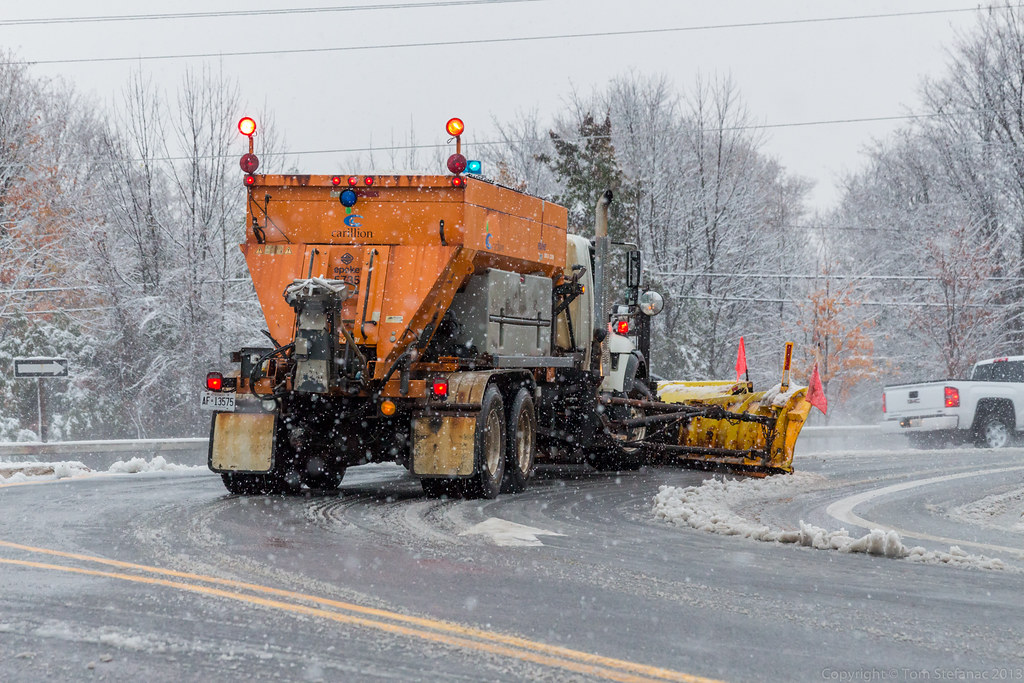
I'm not sure if the municipalities or province for that matter still has any salt in reserves. Whatever the case, this highway was just glazed over! I almost wiped out just stepping foot outside of my car!
April 1st huh? Sure feels like I'm north of the Arctic Circle, not north of Orangeville.
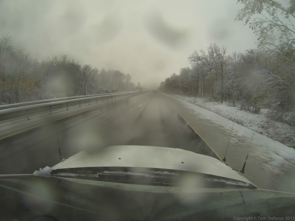
This is the 0 visibility stuff blowing where I was parked.
Yeah, not a good idea!
There were tons of little snow devils (vorticity pockets known correctly as eddies) dancing around in the fields. Unfortunately, what looked cool to my eye looked like crap to my camera.
But for the record, you can see the winds and squalls made things nasty in these exposed places.
Here are some of the cellular convective snow squalls heading southeast into the Greater Toronto Area (I'm looking southwest).
Some of the tops on these squalls must have been pretty high but I did not see any lightning returns on any of my services.
(Again no Photoshop, just that Cokin Tobacco filter)
Yeah, the car was clean! I decided after the fact this was a bad idea, seeing as I was actually getting dirty!
Note to self, don't unnecessarily go out of the way to drive through snow squalls when the car is clean!
No rainbows here, but the convective lake effect snow bands were so cellular in nature that you could literally be under a clear sky above while all around you snow is pouring down.
Just to illustrate the point.
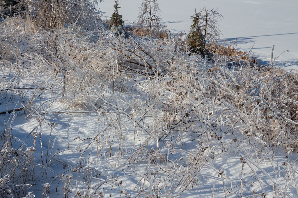
This was highway 10 just north of Mono, as you can see this looks it typically does in the period between late November and early March.
It sure is cruel to have it look like this in April, it's simply not funny!