Where to begin?
We’ll Joplin had been virtually wiped off the map barely 18 hours prior, I was feeling the effects of sleep exhaustion between driving, forecasting, late nights and relatively early mornings.
Today by all accounts was going to be a good chase day with dryline driven storms and a warm front pushing north.
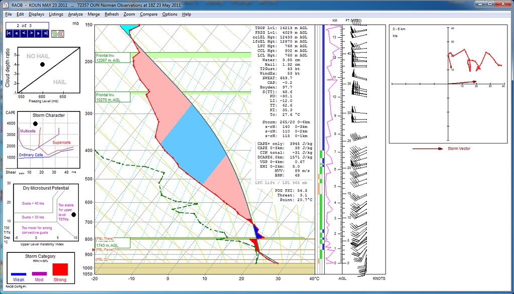
The shear environment was good, not perfect, but very good. The energy values were again off the chart!
With Joplin so fresh on my mind and most chasers retreating west for today’s Oklahoma storms I think another Joplin scenario was hanging over everyone’s heads as a possibility.
There were real concerns that today could be the day Oklahoma City was the target!

The SPC was initially downplaying the risk of severe weather across much of Oklahoma.
That changed with the 1300Z outlook and again was rehashed to be even more ominous with the 1600Z outlook.

We started off by blasting into Southwestern Oklahoma with a whole heap load of other chasers around midday.
A round of early storms fired directly on the dryline and even produced a mid-level funnel.
But it was not meant to be, the storms were rapidly undercut as the dryline began to march east.
I figured since the best energy and moisture were still several hours away that playing this particular portion of the dryline near a developing bulge was the best bet and soon a second super low precipitation storm began to form.
Even in infancy it already exhibited a curved updraft structure.
Interesting to note is that the dryline is not like other boundaries that have a fixed progression. A cold front will keep going until it simply boils away, a warm front will keep pushing north until it eventually get's undercut by a cold front and occlusion occurs.
Drylines are not like any traditional synoptic boundaries. They form from the pooling of dry desert air which is almost entirely a product of westerly winds rising over the higher terrain of the Rockies and then downsloping to the east. This up and down dries out the air while it becomes super heated.
Often the dryline will be several degrees warmer than the moist air to the east of the dryline, so the temperature will often rise with the passage of the dryline.
The dryline is also both progressive and retrogressive, it will linger in the morning, surge east in the afternoon during maximum daytime heating, stall out in the evening and then retreat westward overnight. In fact it's not uncommon to have to the dryline pass a single spot up to four times in less than 24 hours as it surges, bulges and retreats with the cycle of the sun and the natural synoptic flow of the environment.

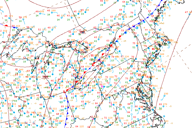
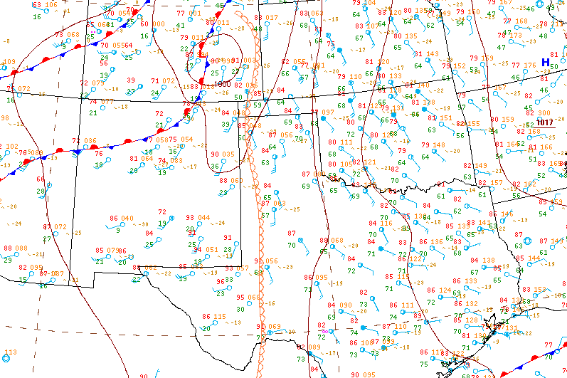
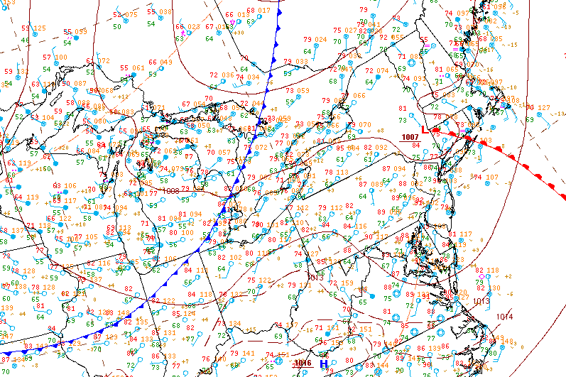
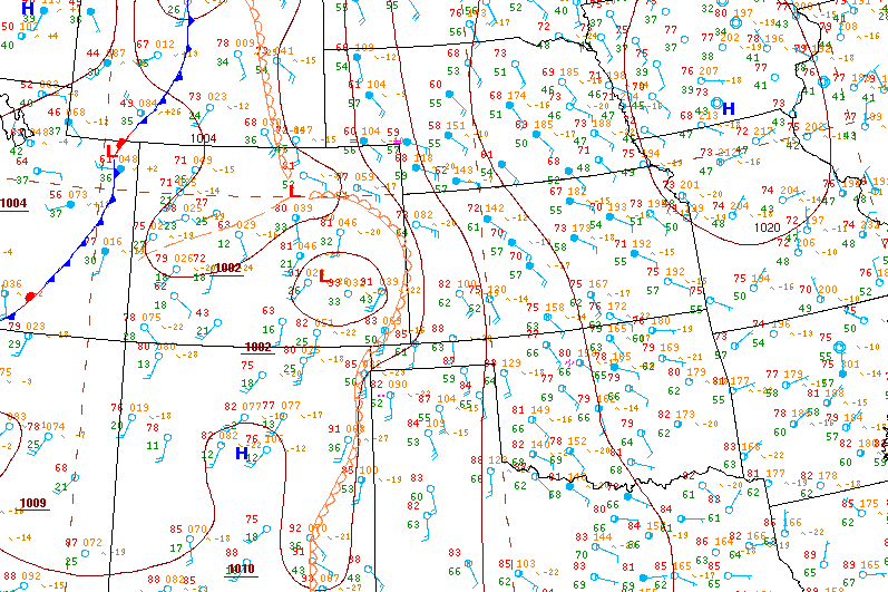
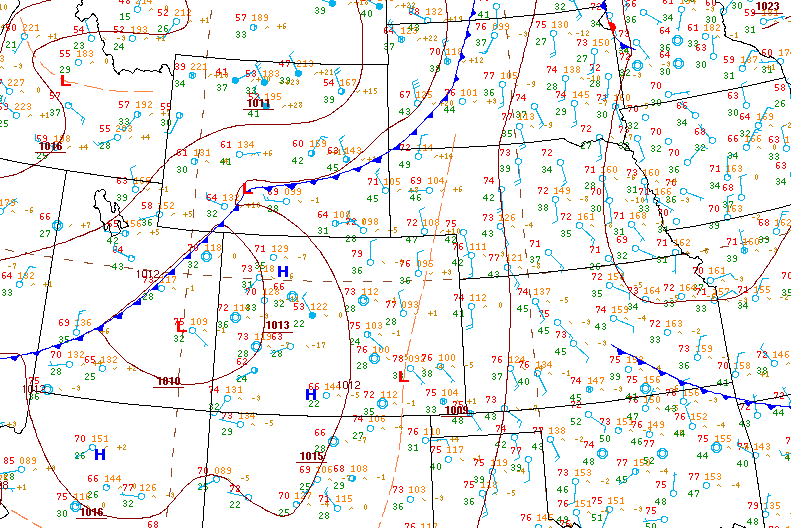
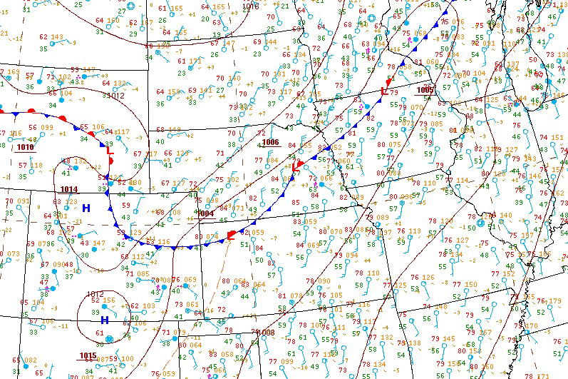
This was the afternoon surface analysis. A well defined moisture axis developed over eastern Texas stretching north into central Oklahoma.
The dryline was still pushing in from western Oklahoma and a cold front was behind the dryline. Interesting to note is the 102F / 39C temperature in Childress, Texas (KCDS) behind the dryline vs the 88F / 31C in Vernon, Texas (KF05) ahead of the dryline.
We punched the dryline a couple times prior and the temperature on the dash spiked to 40C, it was so hot we rolled up the windows and turned on the AC! It actually felt cooler on the moist humid side of the dryline where it was 34C! We thought rolling down the windows to save gas was a good idea and that the dryline would be refreshing. Apparently, we were wrong!
Now I'm not sure why, but there was a clear warm front pushing north that was not plotted on the surface map, either way this was a critical factor in how storms would develop as the day went on.

The low precipitation storm still bubbling away on the dryline looked to be struggling at this point.
All the other chasers in the area had taken off north after storms started to develop on the warm front.
I figured this was still our best best for an isolated storm since everything to the north was going to be messy and clustered.

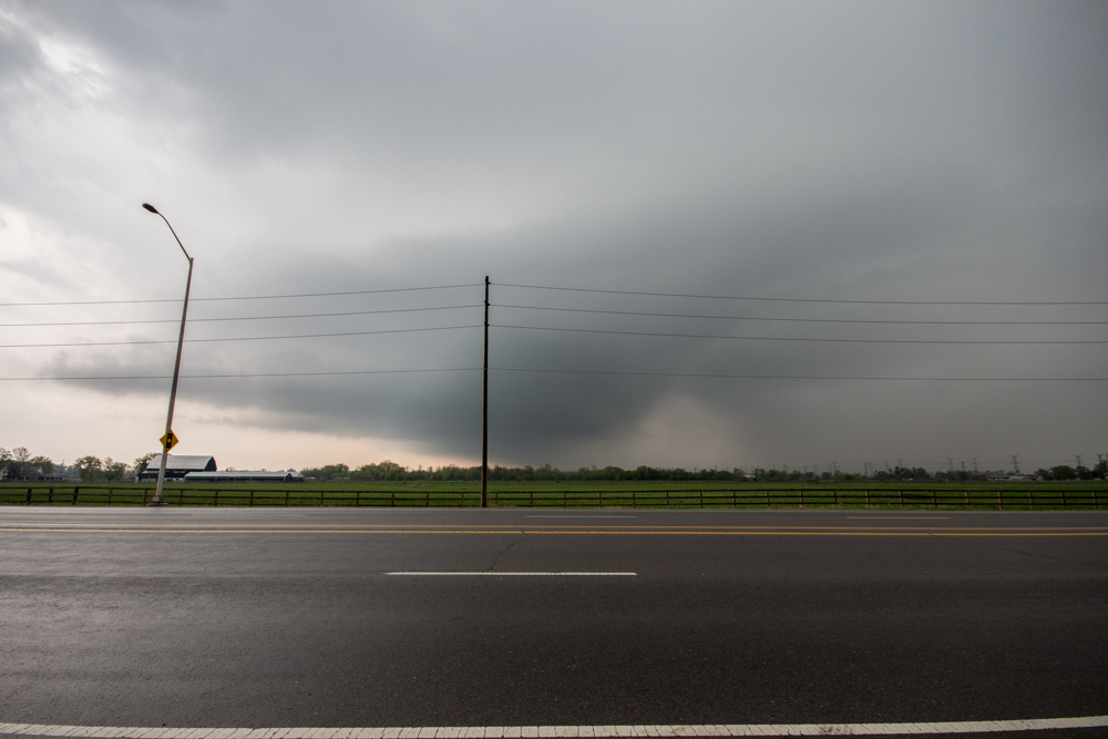
Suddenly the wind began to really pickup and inflow to the storm grew quickly.
In a few minutes there were several massive pushes of cloud growth upwards. The storm on radar, still barely breaking 15dBz with no appreciable precipitation started to register tops of over 40,000ft.
It was at this point I knew this particular cell which had been bubbling away all day was going to get its act together.
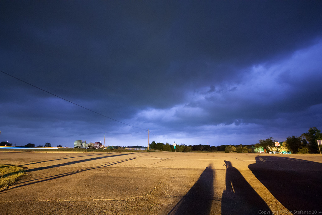
We all quickly piled into the car and bailed south to get into a better position.

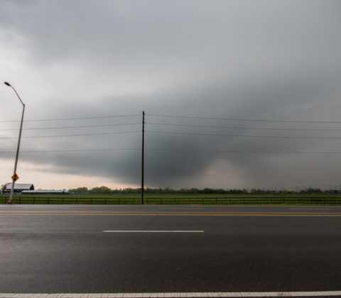
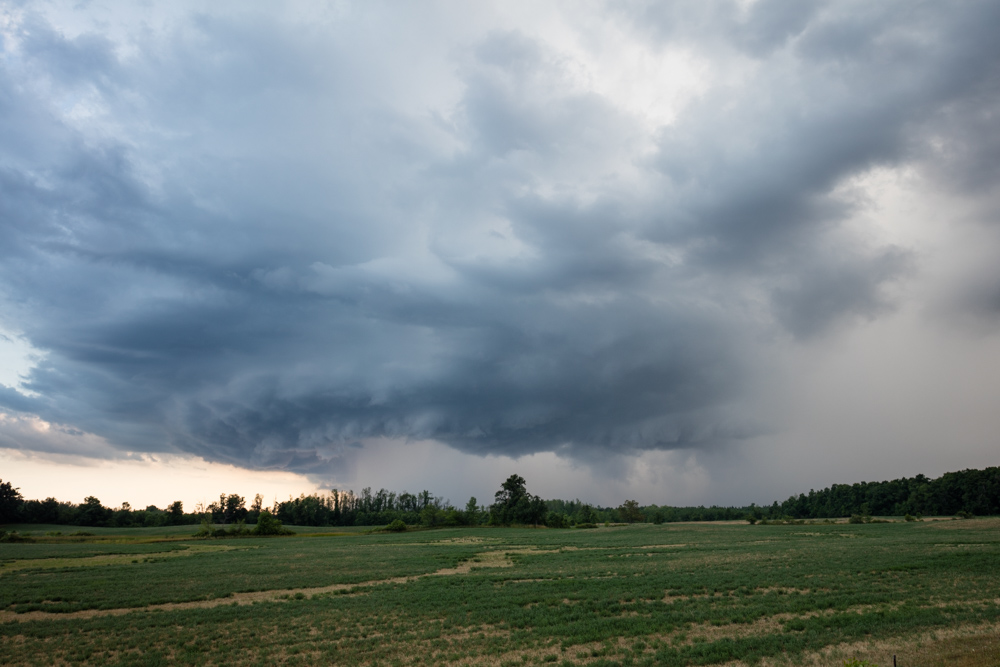
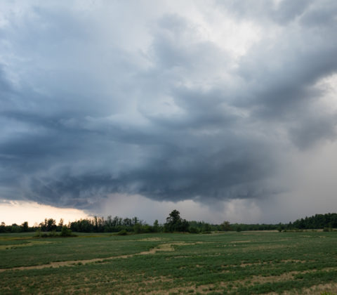
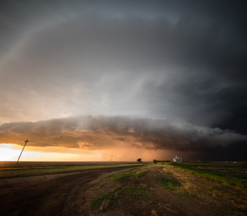
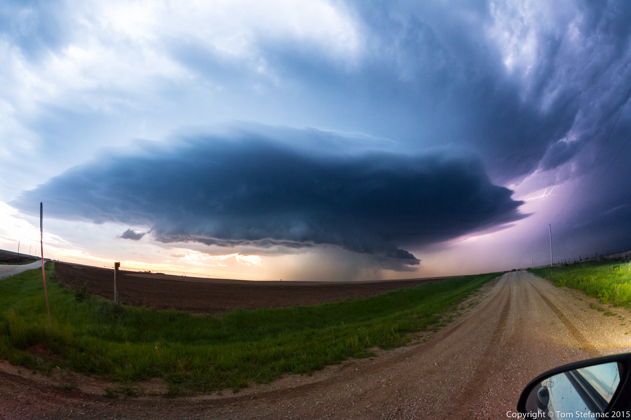
Racing south, I stopped for a moment to jump out and take this photo! We were right under the edge of the storm, it was billowing up to 55,000ft and a massive barber pole updraft had formed.
I was pretty convinced this storm was going to be the storm of the day!

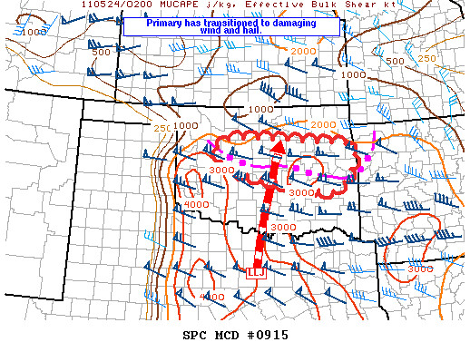
The SPC took the developing severe risk associated with the dryline supercells very seriously and issued the first MCD of the day for Oklahoma.
MESOSCALE DISCUSSION 0910
NWS STORM PREDICTION CENTER NORMAN OK
0651 PM CDT MON MAY 23 2011
AREAS AFFECTED...W-CNTRL AND CNTRL OK INTO NWRN TX.
CONCERNING...TORNADO WATCH 345...
VALID 232351Z - 240115Z
THE SEVERE WEATHER THREAT FOR TORNADO WATCH 345 CONTINUES.
THE THREAT FOR LARGE HAIL...ISOLATED TORNADOES AND LOCALLY DAMAGING
WIND SHOULD PERSIST THROUGH ABOUT MID EVENING FROM W-CNTRL THROUGH
CNTRL OK INTO NWRN TX.
DISCRETE SUPERCELLS THAT INITIATED EARLIER ALONG DRYLINE CONTINUE
SLOWLY EWD THROUGH W-CNTRL OK INTO NWRN TX. THE ATMOSPHERE REMAINS
STRONGLY UNSTABLE WITH 3000-3500 J/KG MLCAPE. LOW LEVEL
HODOGRAPHS...WHILE NOT EXCEPTIONALLY LARGE WITH 0-1 KM STORM
RELATIVE HELICITY FROM 150-200 M2/S2...WILL FURTHER INCREASE IN SIZE
AS LLJ STRENGTHENS. THIS SUGGESTS A WINDOW REMAINS FOR ISOLATED
TORNADOES BEFORE THE BOUNDARY LAYER COOLS AND INCREASING CONVECTIVE
INHIBITION OVERWHELMS THE UPDRAFTS.
STORMS IN NWRN OK APPEAR TO BE CONSOLIDATING INTO A SMALL
CLUSTER...AND THIS ACTIVITY MIGHT EVENTUALLY EVOLVE INTO A FORWARD
PROPAGATING BOW ECHO AND CONTINUE SEWD ALONG PRE-EXISTING OUTFLOW
BOUNDARY.

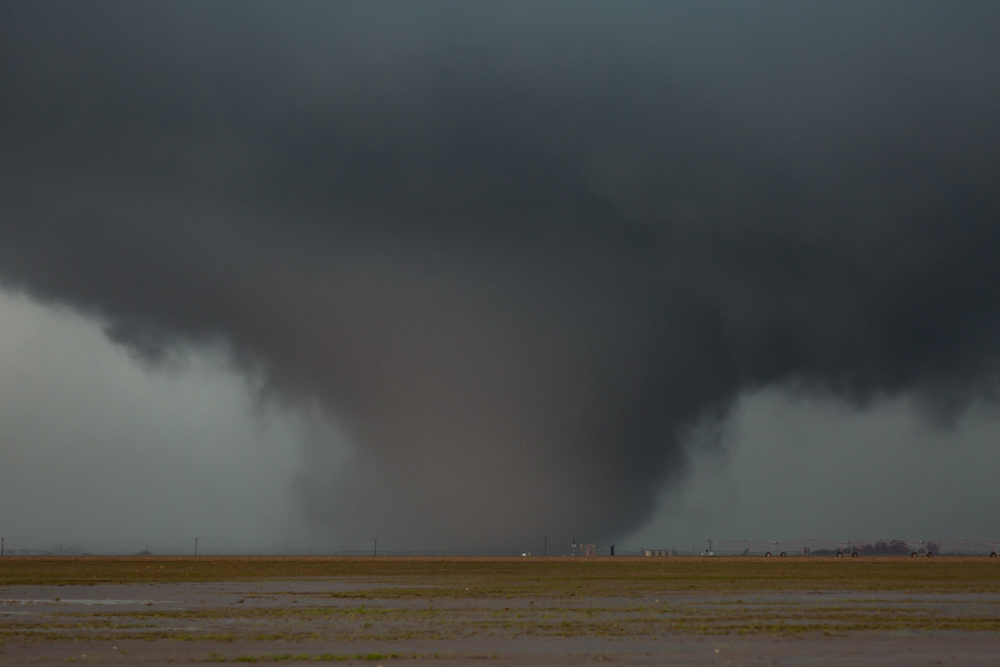
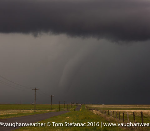
The radar couplet as it appeared when I took the barber pole photo. Words cannot describe the intensity of the situation at the time.
This meso here is a solid 60 knot inbound and outbound signature for a gate to gate shear reading of around 120 knots. It was cooking!
I think every meteorology student, every forecaster and TV weather specialist should experience both radar and real world simultaneously at least once in their life.
Experiencing a storm gives physical meaning to the observed radar data, it completes the picture that many struggle to understand and observe.

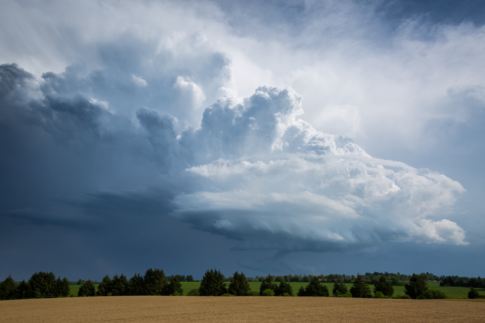
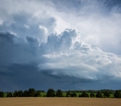
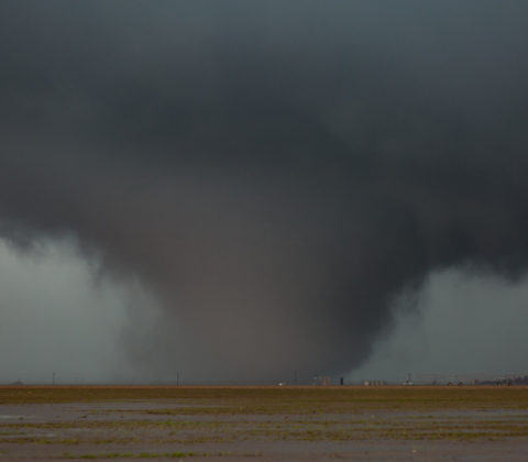
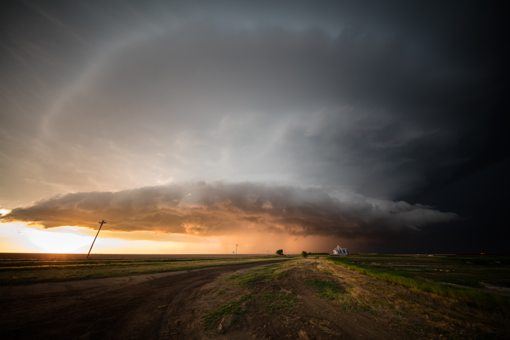
This really is a classic supercell. Any textbook which has a section on supercells, will often display a picture exactly like this one.
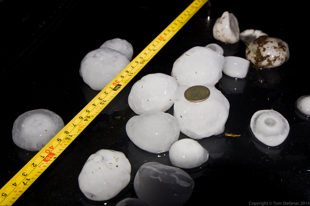
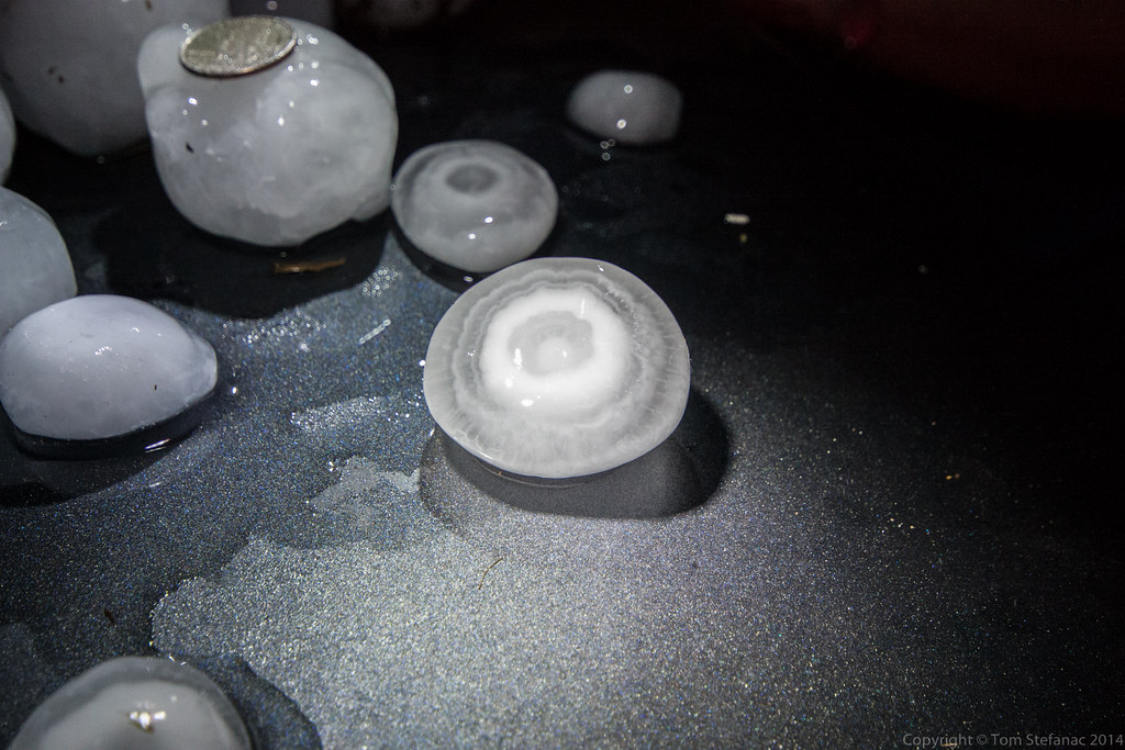
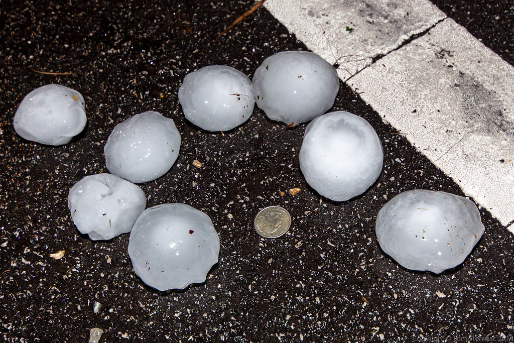
By this point, It was now neither an entirely LP storm nor was it an HP system. It was producing returns on radar of near 70 dBz and observed hail reports of 3+ inches.
Yet, all the updraft structure was perfectly revealed.
When storm chasers talk about how important the dryline is, this storm is a perfect example.
Here we have an isolated storm, in the southeastern quadrant of a mid-latitude low pressure system, where anywhere else on earth there would be no trigger, but here a dryline exists to create a trigger where nature otherwise does not allow storms to form because the shear is always too perfect.
This is natures perfect mistake!

The radar signature was that of a beautiful classic supercell.
Everything about this storm was textbook in nature.