Posts in Category: 2013 Storm Chases
May 15th 2013
On July 19, 2016
- 2013 Storm Chases
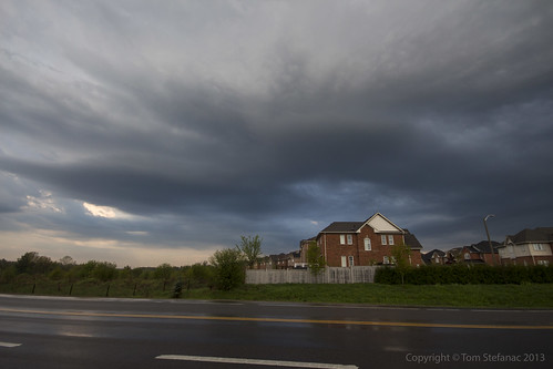
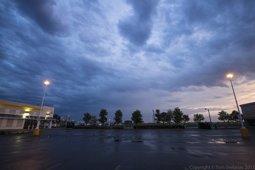
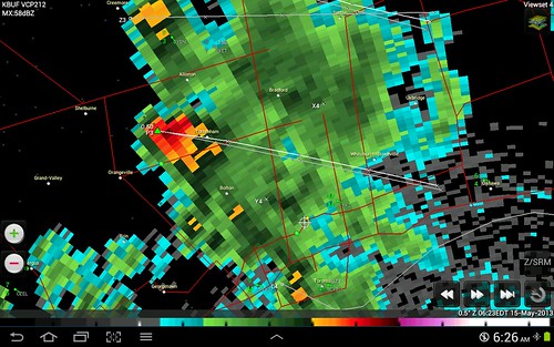
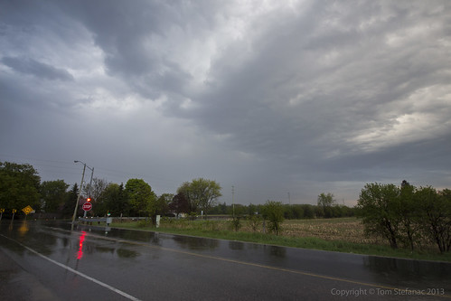
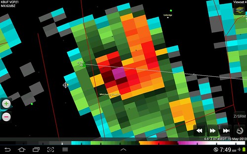
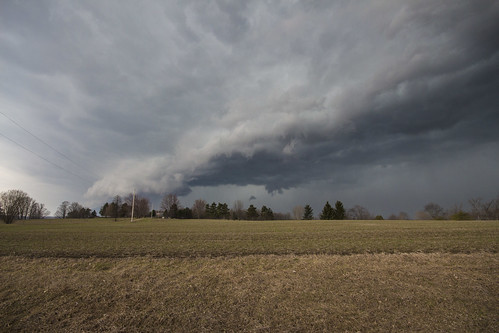
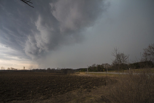
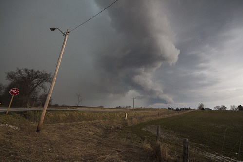
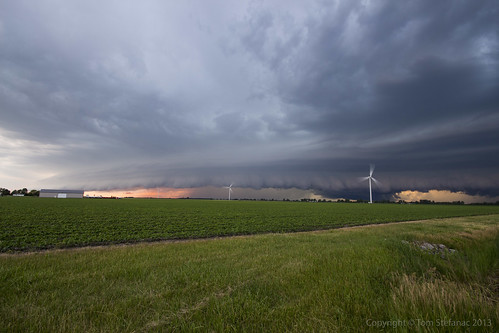
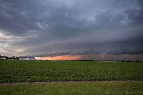
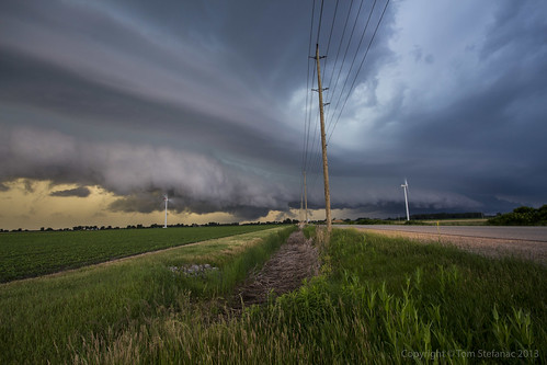
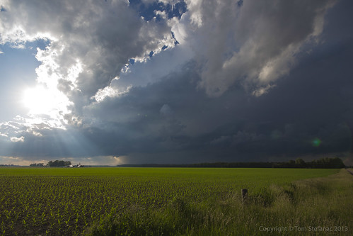
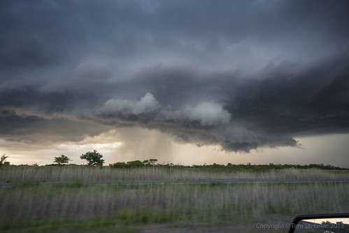
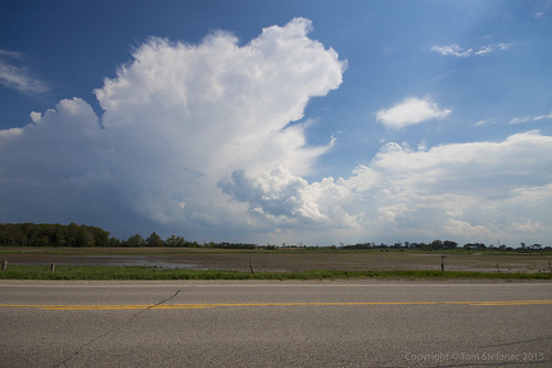
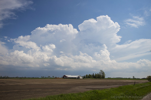
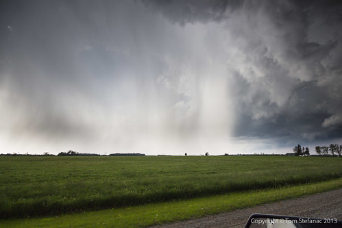
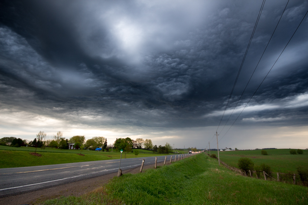
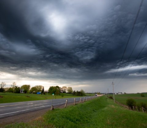
This was the second storm cell which later spiked on radar.
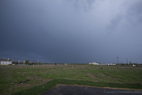
When this photo was taken it was still in its infancy but at this point the surface warm front was getting closer and it was later in the day so boundary layer mixing was increasing. This allowed the storm to mix down further and at least appear to be getting closer to the ground.
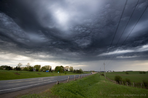
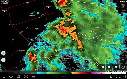
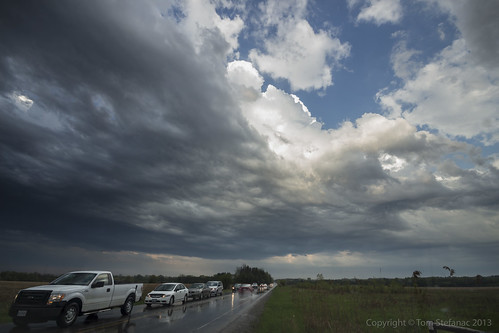
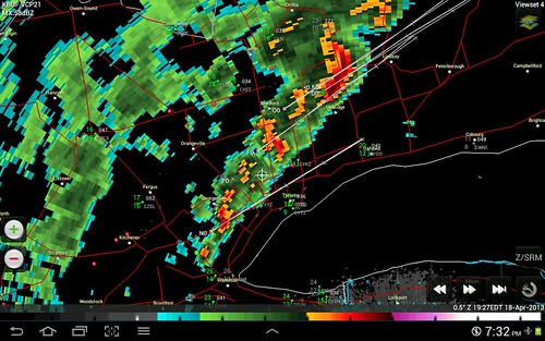
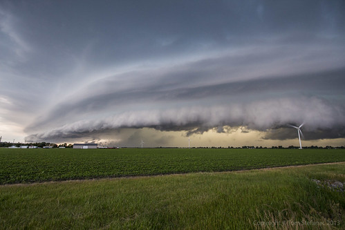
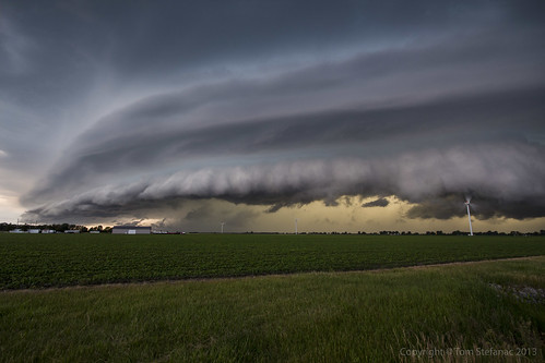
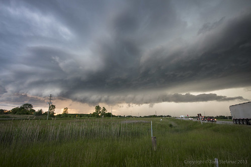
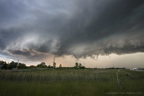
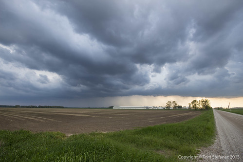
This is a stylized image of the storm as it continues eastward. I've used a graduated neutral density filter to darken the sky and create this vibrant image. At this point the storm was hitting 68 dBz and producing some small hail. A warning for Durham Region was issued, and this storm eventually made its way out over Lake Ontario.
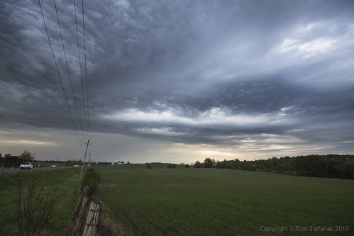
I tried to keep pace with the storm but gave up, it was moving at well over 80 km/h.


April 1st 2013
On July 19, 2016
- 2013 Storm Chases

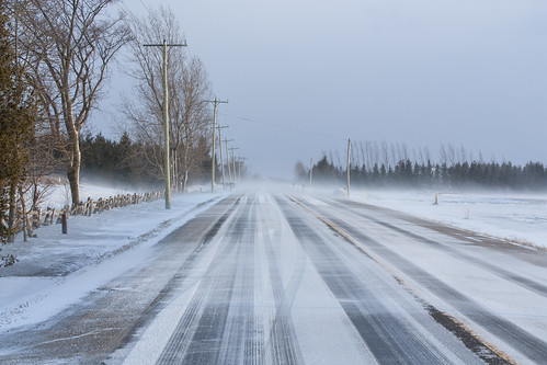
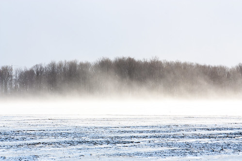
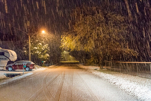
Looking at this photo it sure does not look like April 1st, and no this is not an April fool's joke I've concocted, it's a not a joke at all!
Mother nature decided that we've not had enough winter this year and it seems even with balmy days between they are simply teasers.
(There has been no Photoshop work done to this photo, it was taken purely using a Cokin graduated tobacco coloured filter)

My car (not visible but right of the frame) was actually partially blocking a lane. It was all fine and dandy since there was no traffic and this snow was low drifting stuff.
Then just as a few cars came into view the wind started blasting and the drifting snow became a low visible wall of white a few feet tall. It was more than tall enough to shroud my car from any unsuspecting drivers so I made haste and got out of here as quickly as I could!
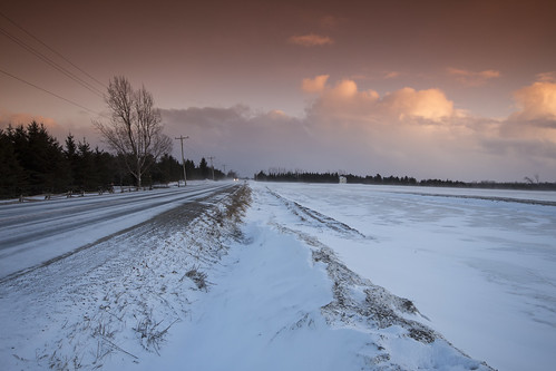
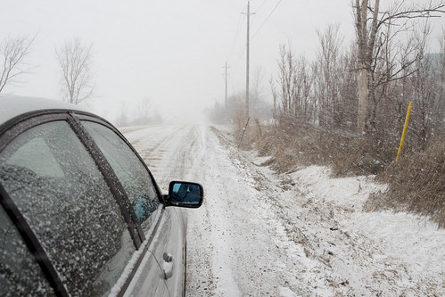
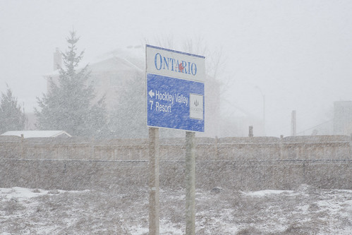
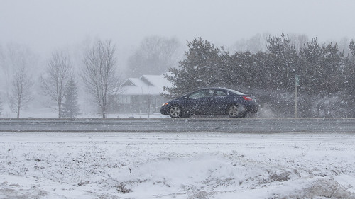
Here are some of the cellular convective snow squalls heading southeast into the Greater Toronto Area (I'm looking southwest).
Some of the tops on these squalls must have been pretty high but I did not see any lightning returns on any of my services.
(Again no Photoshop, just that Cokin Tobacco filter)
May 10th 2013
On July 19, 2016
- 2013 Storm Chases
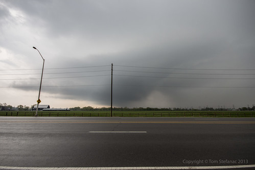
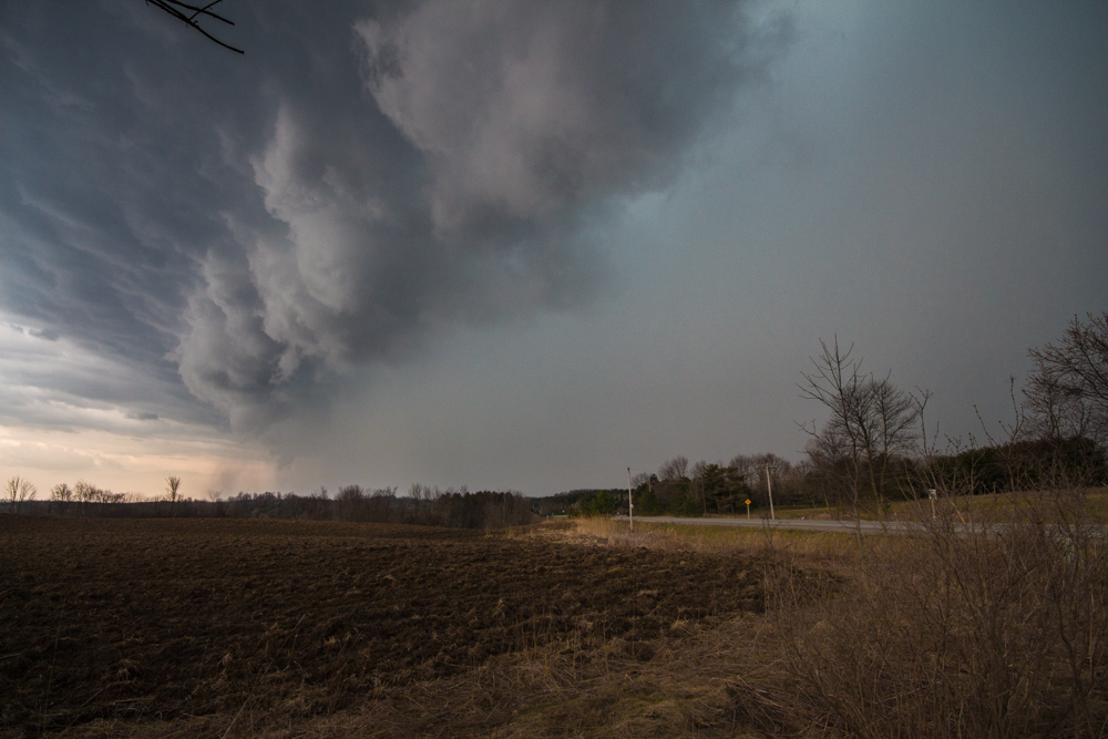
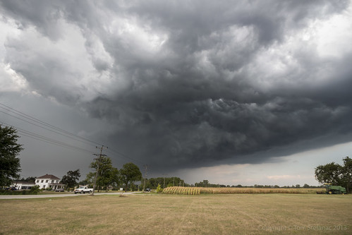
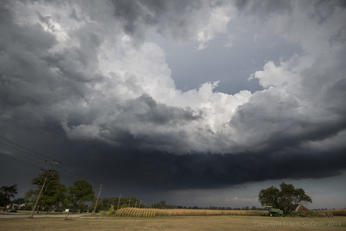
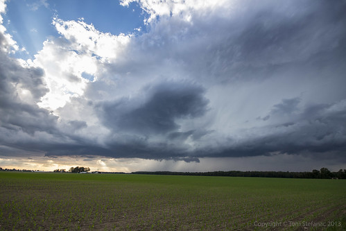
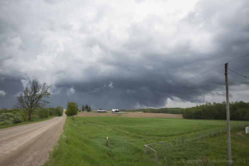
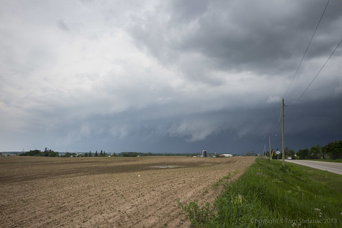
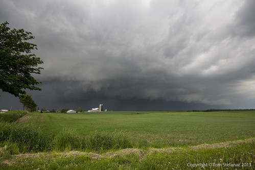
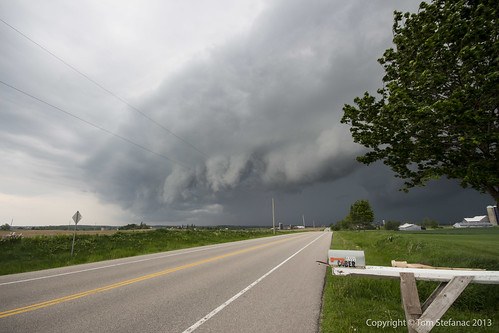
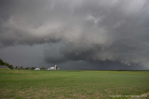
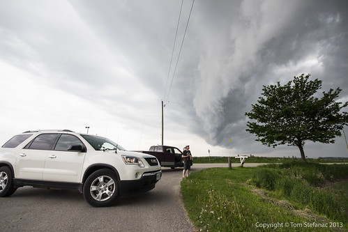
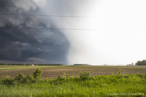
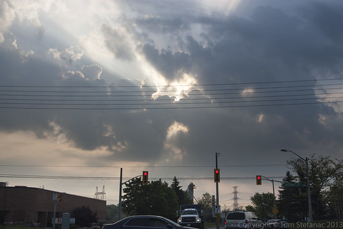
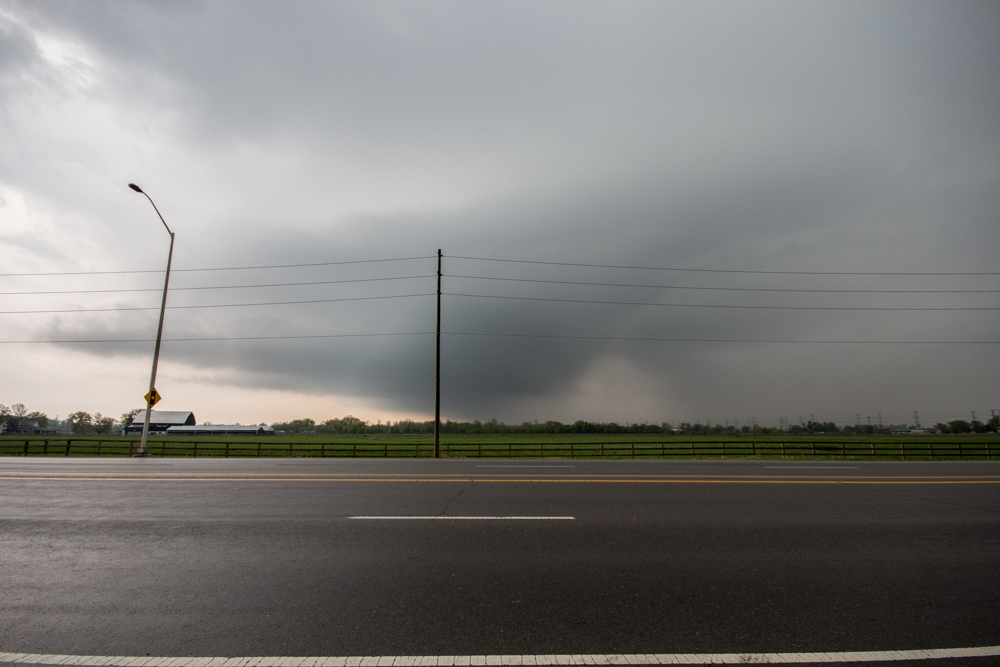
The storm is now passing through Milton, you can see mid level clouds flowing into the storm from the Southeast (image looking west). It also presents a bit of a vaulted type structure with the usual lateral tilt of the updraft. Slight clearing between the "hail" region of the core and the heavier rain is visible just to the right of center.
The biggest problem with this storm if any is the fact that it remained elevated with limited boundary layer interaction and hence produce virtually nothing as far as wind at the surface.
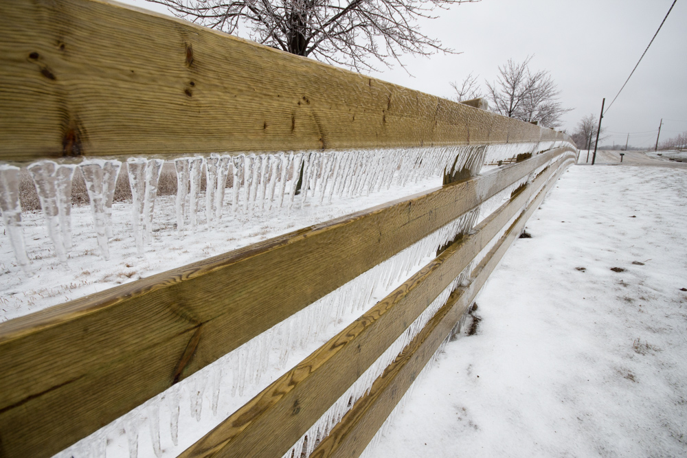

April 11th 2013 Ice Storm
On July 19, 2016
- 2013 Storm Chases

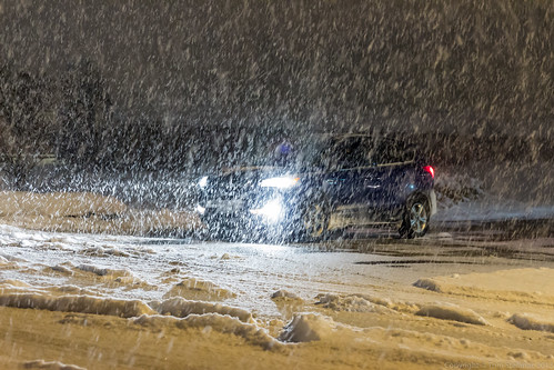
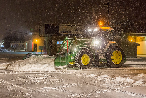
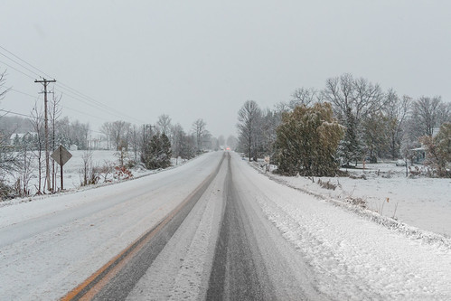
Commuters in Brampton near hwy 50 & Queen St get on a Zoom bus as heavy wet snow falls.
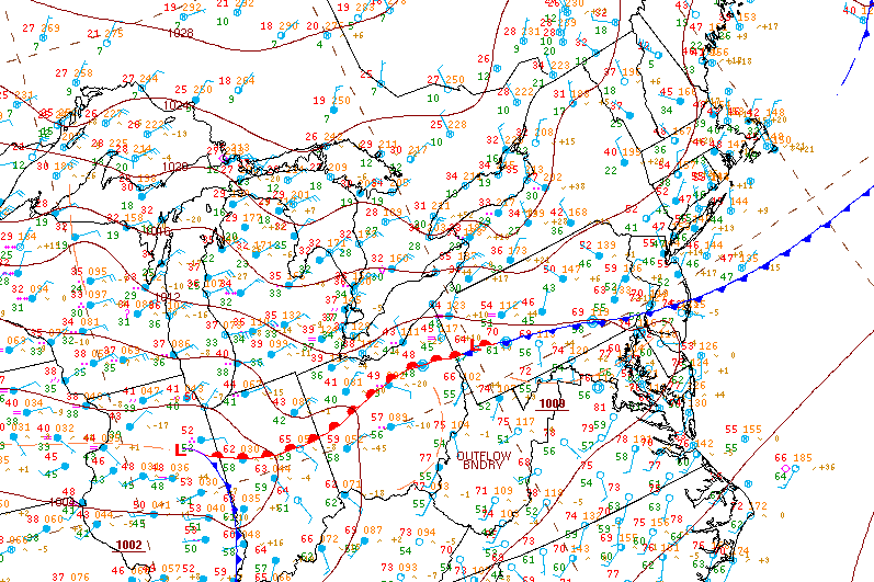
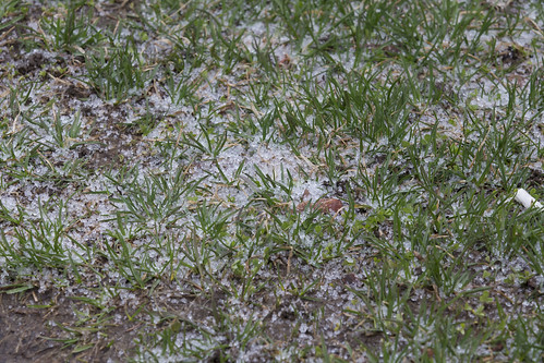
The snow was not expected, a combination of colder air flooding in and additional mixing aloft meant that the precipitation, which was supposed to remain as ice pellets eventually changing to rain fell almost entirely as snow with the first wave of precipitation.
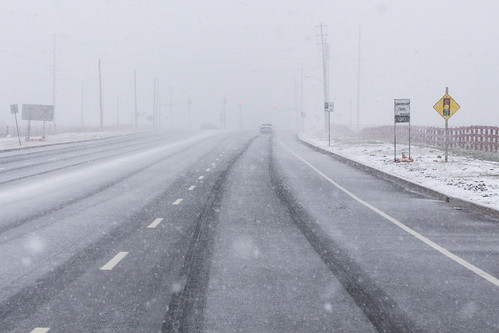
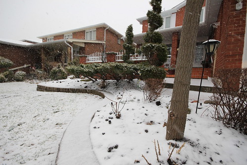
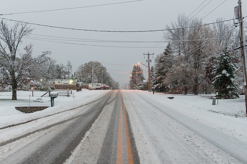
A "surprise" winter storm blankets Langstaff Rd just west of hwy 27 with a coating of wet snow.
This unusual late season storm left many municipalities unprepared to treat the icy road surfaces and commence plowing operations.
The snow also created an additional forecast element not forseen, with a fresh blanket on the ground it meant that temperatures were able to remain cooler longer and this would aid in the freezing rain process which would begin with the second wave of precipitation much later in the day towards evening.
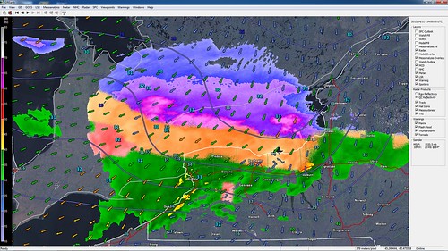
This was the radar image at the time showing just where the snow, ice pellets, freezing rain and normal rain sat. You can see the blues and purples (snow) effecting the GTA and areas eastward while much of the Hamilton, Halton and western portions of Mississauga were seeing a good mix of ice pellets (orange). Further south, along the QEW on the south shore of Lake Ontario most of the precipitation was falling as rain (green) and to the west a pocket of freezing rain (pink) had developed over Kitchener, Waterloo, Guelph and other surrounding communities due to cold air damming at the surface.
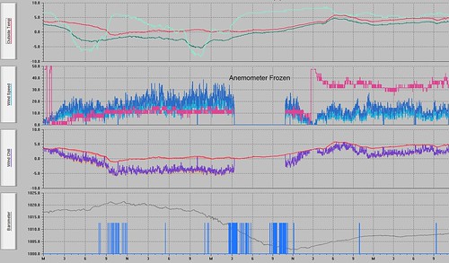
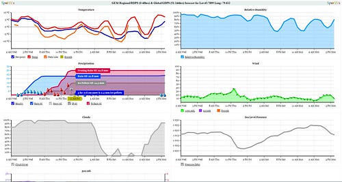
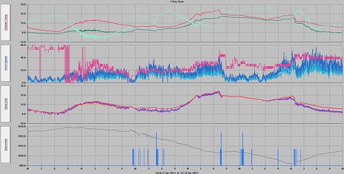
This is what the data from my weather station looked like. The chart starts at midnight on April 11th, temperatures early on remain relative warm until about 7AM which the first precipitation falls and evaporative cooling takes hold. From that point on temperatures continue to remain around the freezing mark but there is a lull in the precipitation shortly after midday. Then the second wave starts around 11PM and by 4AM on April 12th my anemometer just freezes solid. From that point on rain continues to fall and freeze until almost noon when finally the wind cups start spinning.
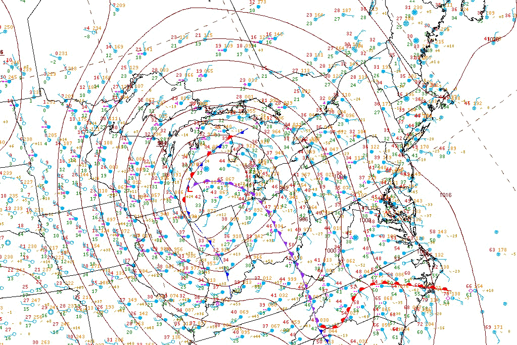

December 20th 2013 – The Historic Ice Storm
On December 22, 2014
- 2013 Storm Chases, Major Events

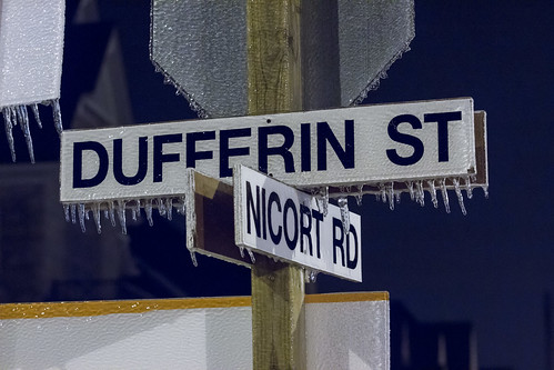
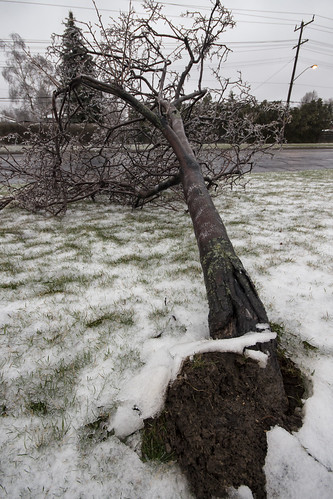
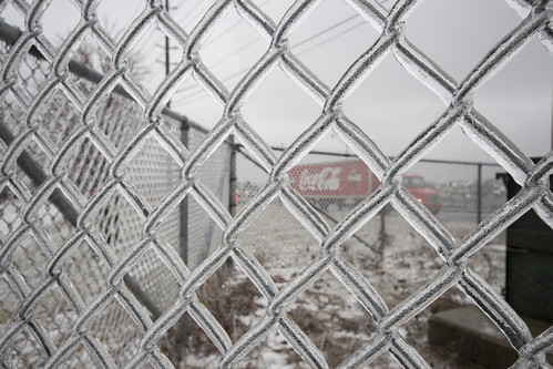
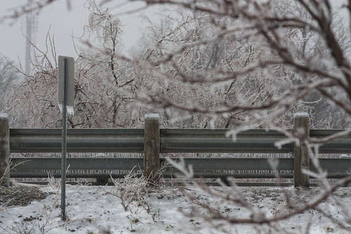
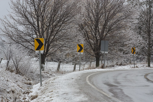
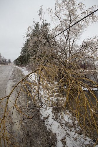
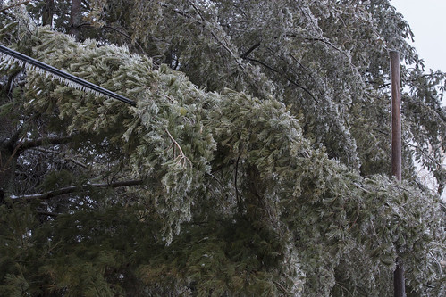
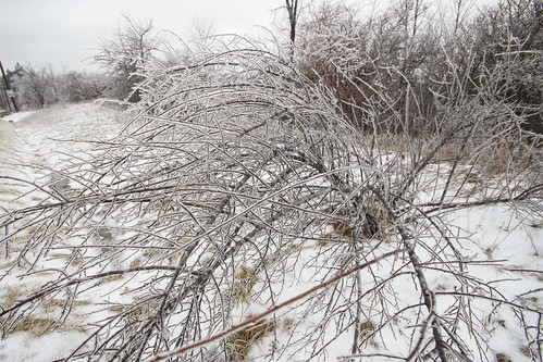
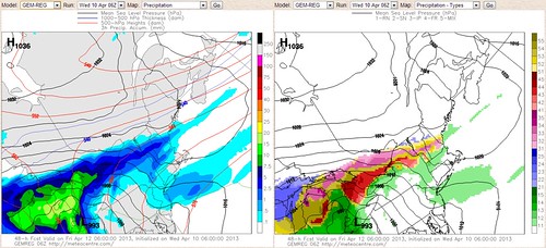
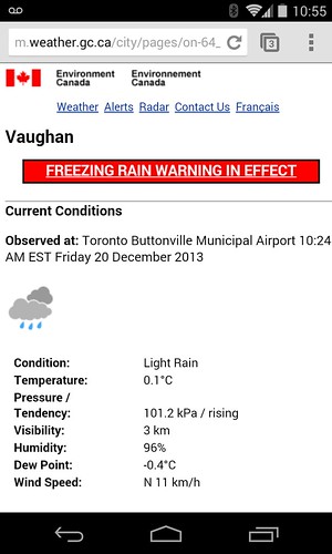
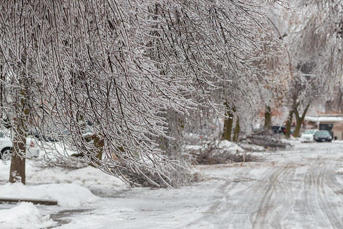
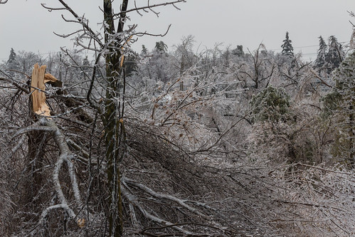
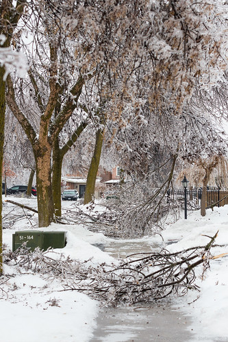
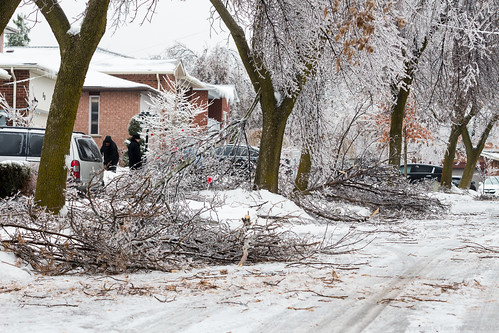
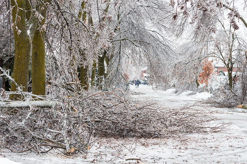
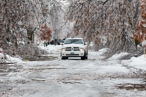
Ice storms are probably some of the hardest events to forecast because a subtle change in temperature, wind flow or almost anything can tremendously change things.
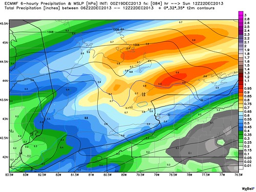
For two weeks the EMCWF weather model eventually followed by the Canadian and finally American models hinted at a large storm before Christmas. The uncertainty slowly became not whether a storm would hit, but what kind of weather it would bring?
Would it bring a mix of snow and ice pellets or rain turning to freezing rain? No one really knew, it was such a borderline event any shift in track or even a small change in conditions would have a drastic impact.
Above all else, I was dealing with a sick dog, a sick furry child that needed surgery and was headed in Friday morning for what I was reassured would be a quick, simple, extensive but complication free surgery.
I had no idea at the time, but two very different storms were barreling towards me.
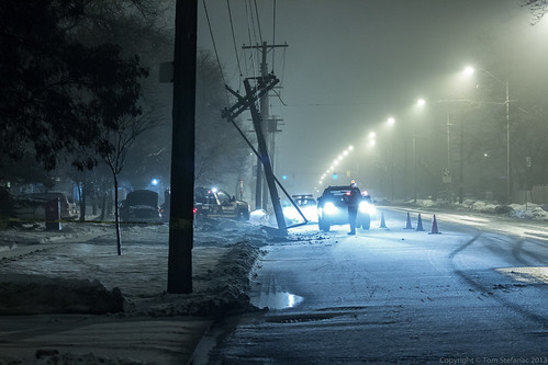
The storm arrived in the Toronto area Friday morning just after midnight as warm air was ushered in with the first of the two systems. The precipitation began as snow but quickly changed over to mix of ice pellets and eventually freezing drizzle.
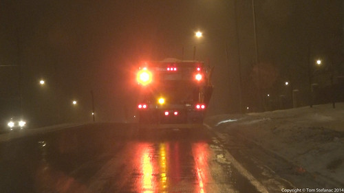
Roads quickly became icy and this unfortunate driver in Toronto lost control striking a utility pole. This power outage was number 1. It would be the first of many.
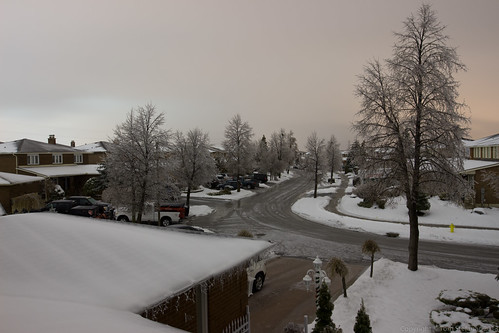
The storm continued through the day Friday with the ice ever increasing slowly due to a mix of spotty showers and rainy mist.
Then it happened... the vet called, it was 6:30PM and she said "you better come, Junior (our dog) isn't doing well". My girlfriend and I rushed down to the vet clinic, it was a complete shock. Earlier we had been told he was fine, the surgery went well and he was doing fine. Then hours later everything was upside down!
We stayed there all night Friday and soon the darkness turned into daylight as it became Saturday morning. Junior was doing better, he was conscious and acknowledging us. Then shortly after noon, everything went south, he was struggling to breathe, his organs were failing. He was sick, he was going to die and there was nothing anyone could do to save him.
He passed away around 12:35 that afternoon.
We were devastated, Jen was sick with grief and there I was, barely holding my composure, it was a mix of destitute anger towards the vet, grief from the loss and a bill that balloon into the $8000 range.
Junior was our child, he may have had 4 legs but we took him everywhere, even scheding vacations around him and Jen may as well have been his biological mother seeing the way she treated him.
Between grief and pure exhaustion, when Jen and I arrived home, we just collapsed. I was not heading out into the ice storm, checking data or doing anything weather related, I simply did not care.
I briefly somehow pulled my mind away from everything to take this photo and some distant transformers exploded. Just before I pressed the shutter button we lost power in the house.
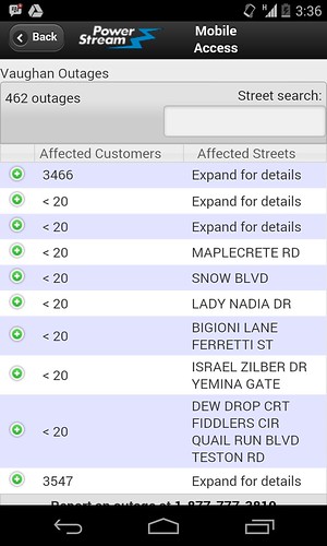
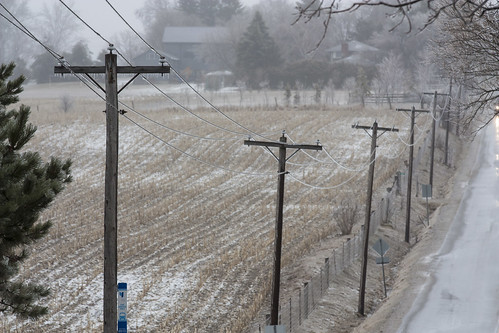
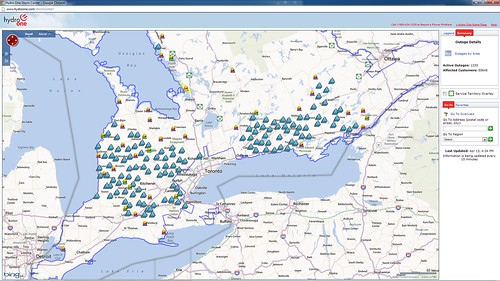
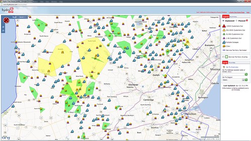
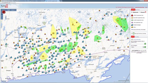
Without power my internet modem would not work so my cell phone was my only data bridge. I was curious to see the outage data and a little alarmed at how bad it was getting out there since most of the power lines in the suburbs are underground. This meant primary feed lines were going down, not only residential lines!!!
June 17th 2013
On April 6, 2014
- 2013 Storm Chases
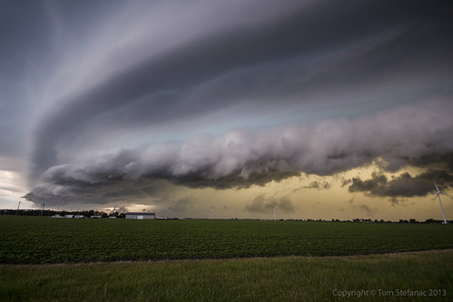
This was one of the last photos I blasted off, at this point I was trying to not leave but I had to.
The growling was mix with a waterfall like sound as wind and rain started to beat down in the fields getting ever closer. When the wires above my head started to begin to whistle I knew I had to run into "drive and record" mode.
May 28th 2013
On April 6, 2014
- 2013 Storm Chases

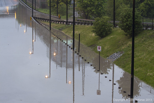
This is a photo I love to pause and stare at, it's one of those shots where you just imagine yourself in this guys place or at least in the passenger seat beside him. What would be going through your mind and what was probably going through his mind?
It really is one of those "oh $#!^" moments when you realize your the only person doing whatever it is your doing and then look up to find about a hundred other people staring at you with a dazed look.
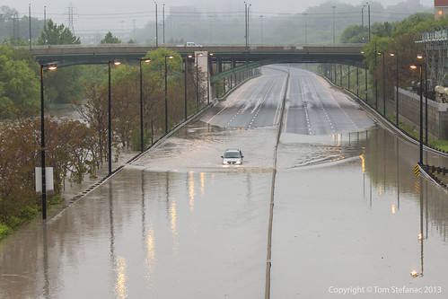
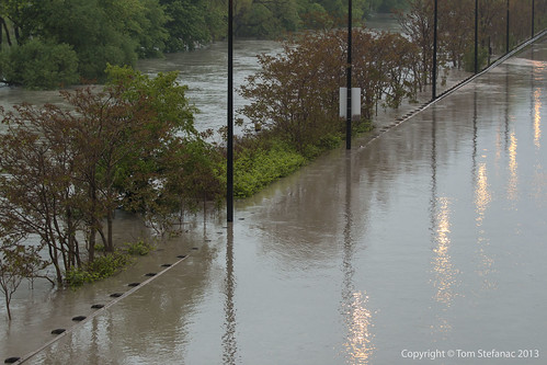
To put this into perspective, the Don Valley Parkway was closed for a solid hour, maybe more?
How this guy got onto the freeway is a mystery to me, but he should have wondered when he was the only car on the road for at least a few kilometers why that was the case?
Then of course when he came to the flooding he decided to try and cross, bad idea right? I don't know if he could hear, but a few trouble makes, myself included started yelling "swim swim swim".
I was more curious to see if he was going to try and keep going, you'll note how deep the water is ahead where it is completely overrunning the crash barrier on the left side of the image.
May 22nd 2013
On April 6, 2014
- 2013 Storm Chases
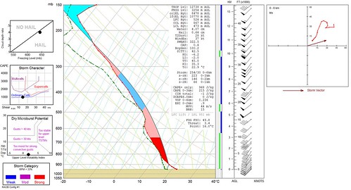
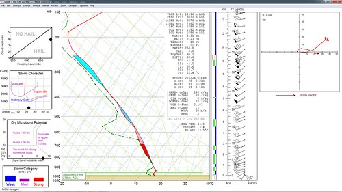
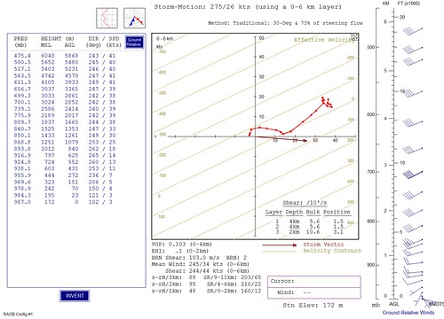
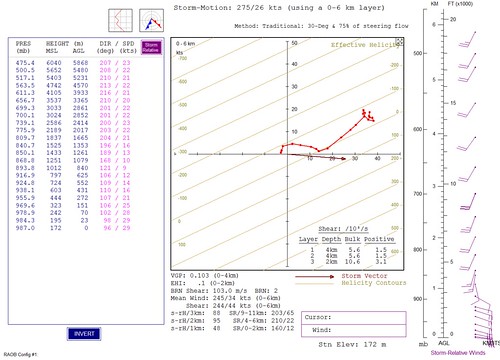
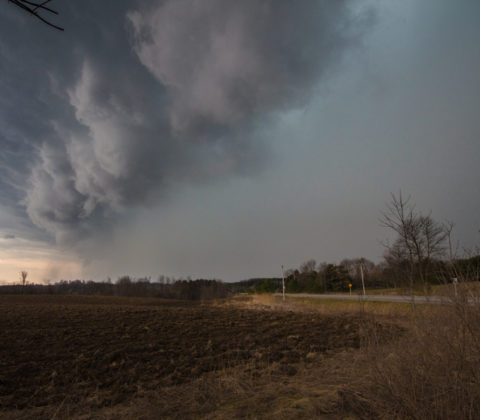
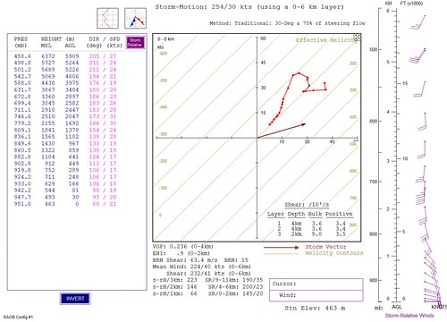
This is the technical stuff I promised. You can see the real world cape is only marginal at less than 1000 j/kg and the storm would only top out at 8.5km or about 35,000 feet which is not very high considering that these storms usually hit 50,000 feet or more.
Furthermore while the max UVV hit 44 m/s overall, surface based LI's are only -2 which in the grand scheme of things suggest sluggish upward motion.
While this type of setup does not constitute cold core convection it's indicative of mini low topped supercells.
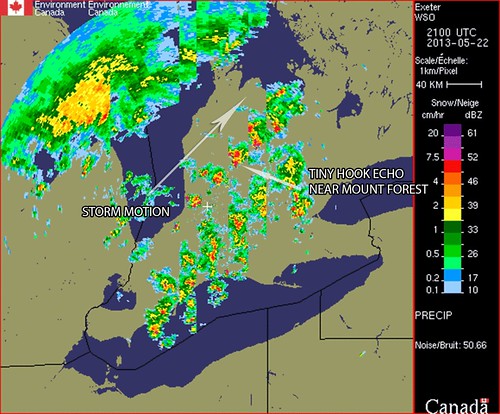
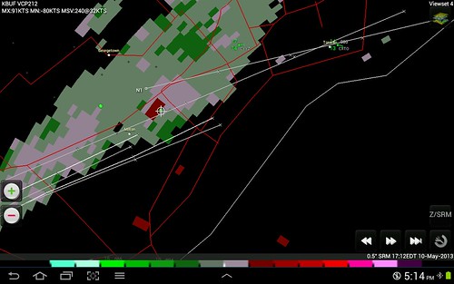
These are 30 minute radar cuts showing the mini supercell and it's evolution from grand Bend onward. I'm using the data in snow mode to exemplify the structure, the standard rain mode produces returns that are too soft/weak.
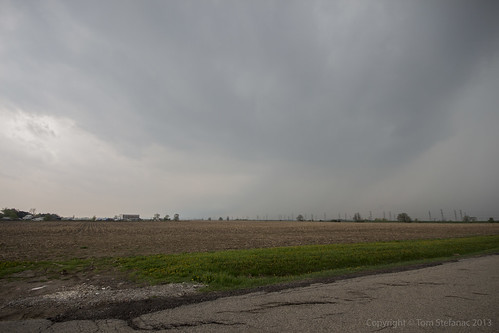
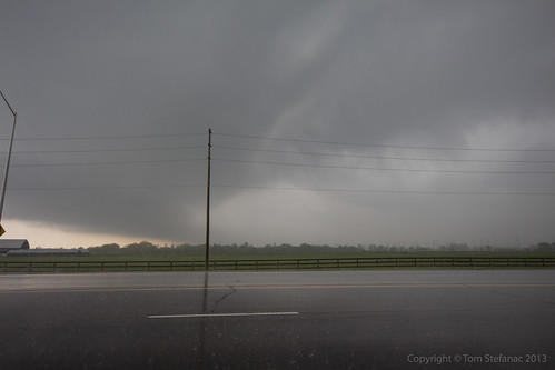
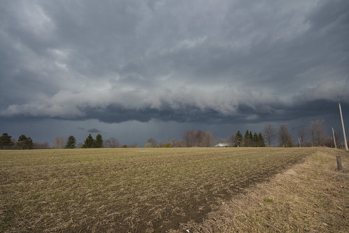
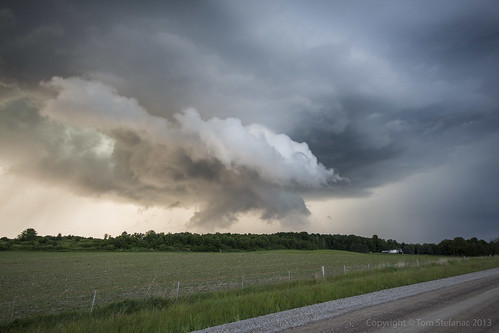
You'll see a distinctive hook echo like structure near Mount Forest just as the storm was producing that beautiful wall cloud.
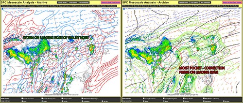
Despite a lack of energy but good storm relative shear, the storm for a brief time was perfectly positioned right along the 500mb jet nose allowing extremely good ventilation. Again, this would have been when the storm was producing the wall cloud near Mount Forest.
Unfortunately as it continued to move northward it moves into less favorable low level winds.
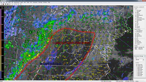
The storm was also riding along the edge of a 700mb moisture plume which was providing clear skies and strong daytime heating south of the storm cell. This allowed the southerly inflow to remain warm and moist at not only the surface but especially in the mid levels.
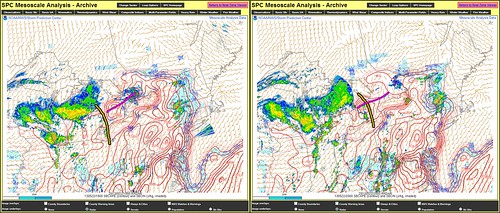
This is probably the tell tale sign of why the storm did not produce anything more than pretty clouds. One thing to note is that the SPC Meso Analysis always over estimates CAPE values so don't take the numbers at face value, just understand that there is more and less energy in certain places.
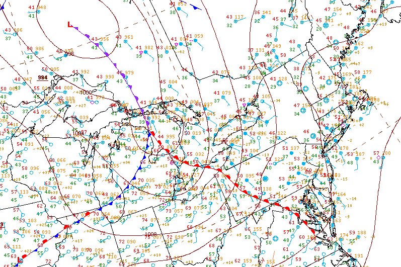
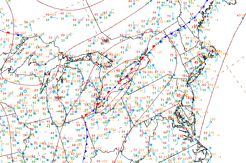
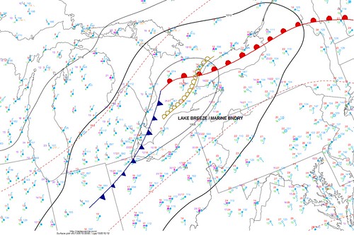
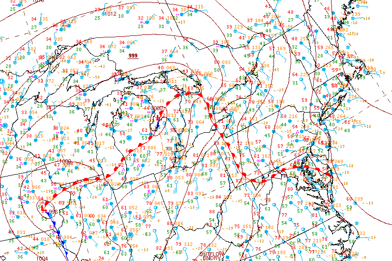
The storm fired off the boundary wave pushing northeast from Michigan and was supported by the 700mb moisture plume seen previously, this is delineated using the yellow line. At the surface ahead of the wave a warm front was pushing north which is delineated by a pink line.
The maximum shear values were attained directly along this front due to enhanced forcing at the surface.
Initially models showed the storms to fire about 1 hour later than they actually did. What this meant is that the supercell entered the Mount Forest area at 4:30PM as opposed to 5:30PM and as a result the surface front which was lifting north was barely ahead of the storm.
This meant that there was less available energy than forecast, it also put the storm in a position where it was riding and potentially lifting (becoming slightly elevated) as it rode north of the boundary on the 500mb jet nose and eventually fully outpaced the forward motion of the surface warm front.
This explains why the storm was ingesting so much crap by the time it was closing in on Barrie, it was basically either sitting directly on or actually ahead of the surface front by that point.
So ultimately the storm fired one hour too soon and did not have enough environmental energy or run time so to speak to spit out a funnel.
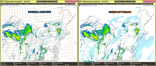
Last image, and maybe the most interesting, note the storms position relative to the supercell composite parameter and significant tornado parameter.
This just goes to shore, severe weather and tornadoes can be highly localized due to localized parameters, this is especially true in places such as Southern Ontario where boundaries are often plentiful and play huge roles in the development of severe storms.
May 21st 2013
On April 6, 2014
- 2013 Storm Chases
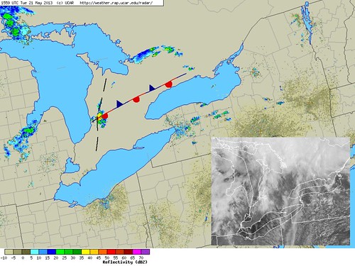
Convection started going up early, two waves were forecast to move in from Michigan by both the Regional GEM and later the HRRR. Morning visible satellite images and even the radar data agreed well with the forecast showing both these waves very well in the visible satellite imagery.
Also visible was a pre existing stationary boundary that was literally running right along highway 9 and eventually meeting with the Lake Ontario breeze. This boundary was in place since at least May 19th when weak storms fired off the leading edge and it was not washed out by the squall line May 20th since during the early morning hours of the 21st nocturnal convection fired along this same boundary.
So by 12PM I was on the road and heading west towards Arthur to intercept the rapidly developing storms.
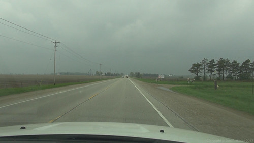
I rolled some video around Grand Valley. The sky was getting dark and it was hot out, damn hot! The air was super sticky and muggy, there was a fairly strong southerly flow and the day had that Oklahoma feel to it, the feeling you get just as your waiting for a supercell to come into view.
Of course, this was no supercell and the skies looked ominous but it was not like I was expecting anything crazy, which is very different from Oklahoma! I guess, the anticipation is really the feeling I'm describing.
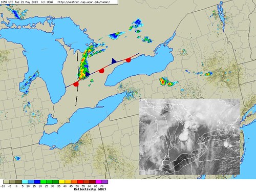
As I was just going to punch through the first storms, things were getting a little messy, there was a lot of convection going up ahead of the main storm cell I was interested in. My gut told me to stop driving and wait, but the radar was screaming at me to keep going west so I listened to the radar.
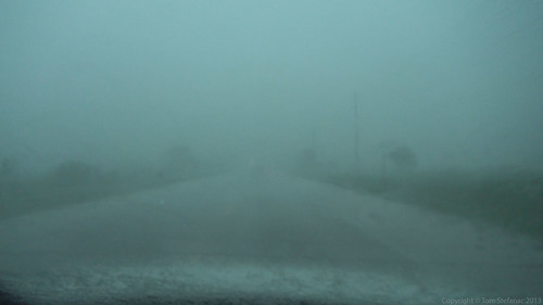
Just as I was outside of Arthur I saw a green flow directly in front of my and then a wall of scud quickly rising as it was being pushed up by outflow. I was not nearing one of the first stronger cells in the cluster ahead of the main storm.
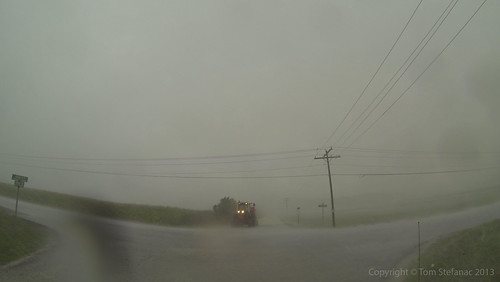
When I drove into it, the rain hit like a wall! There was some wind in the 50km/h range but it looked more severe than it was due to the rain falling so hard and banding into sheets. I heard a few dings from pea sized hail.
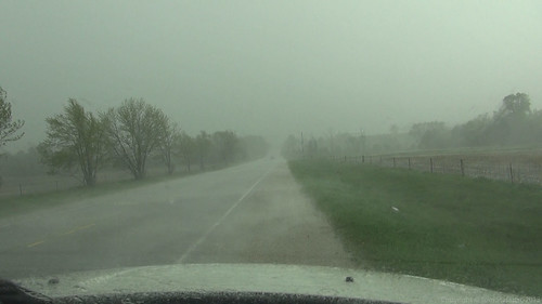
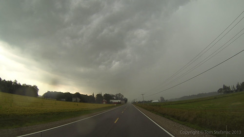
I kept pushing and punched into the main storm I was interested in intercepting. Just as I started to get into the core the storm blew itself out. The winds began to really gust hitting about 63 km/h at times but that was it, the highest gust was actually 63.7 km/h with the average around 50 - 55 km/h.
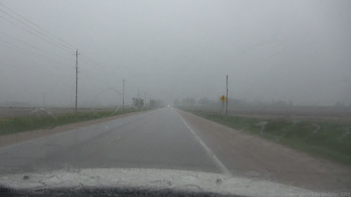
You can see how the rain was just howling up the road towards me but again, it was not severe. It just looked more intense than it really was.
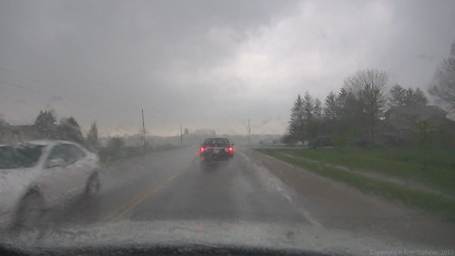
After getting my fill of video and outflow wind I decided to keep driving towards the storms southern flank. I was getting dinged by random pieces of pea sized hail and then I had a couple dime sized stones hit me but they were few and far between.
It felt like it was taking me forever to reach the southern flank of the storm but then suddenly clearing appeared ahead and I could see the definite boundary coming into view.
May 20th 2013
On April 6, 2014
- 2013 Storm Chases
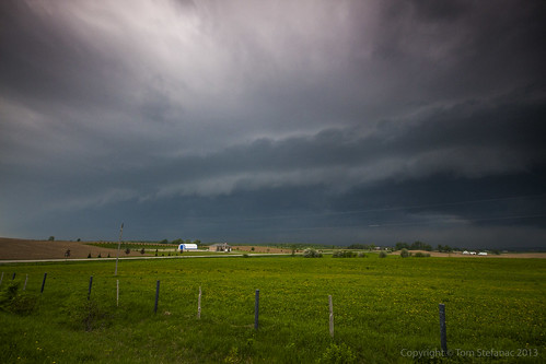
Today was one of those wait and see and hope and wish and drive type days. All the moisture, energy and instability was contained to southern and central Michigan as a warm front lifted north across much of the Northeast U.S and Southeastern Canada.
Earlier in the week models had shown storms erupting across southwestern and southcentral Ontario around the dinner hour but as the forecast day drew closer, the incoming trough aloft slowed down and ushered in more capped air in the mid levels leaving the cooler less stable air farther west.
This meant that here in Southern Ontario we were widely out of luck, but the HRRR did have one interesting card up its sleve. It showed the stuff in Michigan to eventually go linear and turn into an MCS (this was widely supported by the the mid and upper level wind fields). The MCS was then supposed to rapidly begin accelerating east across Lake Huron and blast into Southern Ontario with the nose of the forecast bow-echo to land somewhere around Teeswater which agreed well with the actual surface observations and radar data.
My biggest fear was that the stable marine air over Lake Huron would kill the line of storms long before they had a chance to hit Canadian soil as is sometimes the case. I was concerned because they were going to be outpacing the more unstable air and moving into a more and more capped atmosphere.
I tried to take a nap because I was tired and had to work overnight after the chase but the tornado action in Oklahoma kept me awake and then I watched as Moore was taken off the map again much like it had been on May 3rd 1999. It was horrific to watch but at the same time kept me glued to the live streams.
After getting virtually no sleep, the HRRR forecast began to validate as the storms in Michgan began to line out and blast eastward. I jumped in the truck and took off.
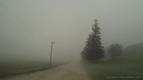
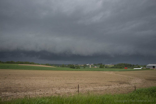
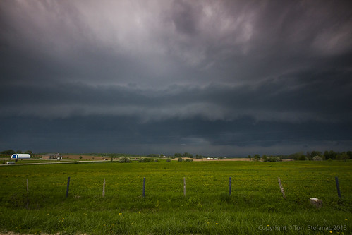
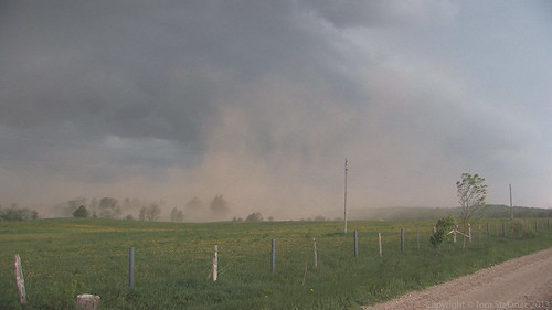
I spoke to fellow chaser Dave Patrick on the phone, he was farther west than I was and in good position. Looking at the radar I figured I had another hour or so before I would be into the squall line since it was only over central Lake Huron at about the time I was entering the Town of Lucknow. I immediately called Dave to see what was going on in front of me and he said it was blasting him with dirt and gustnadoes.
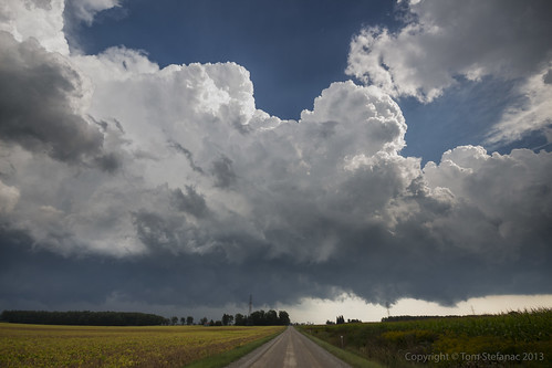
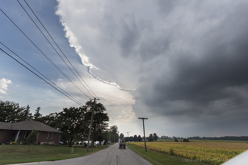
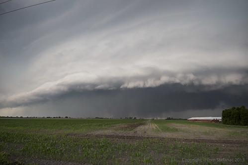
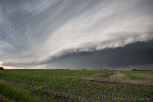
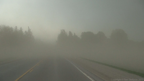
I was sort of stunned since the storms were still so far away on radar, or at least that's where the precipitation was. I didn't notice it at the time, but if you look near the horizon you'll see a brown wall of dust just above it! I was so busy getting the graduated ND on the camera and aligning everything so perfectly I did not realize that the interior of my car was going to get pretty dusty soon.
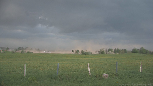
As soon as the storm came within a good close view, I grabbed my video camera and began getting video. This is one of those things that makes far better video than it does a still photo. With the video you have motion, action and sound, with the still photo, all you really have is just a moment in time, which sometimes does little to illustrate what happens or is about to happen next.
So video from this point on took priority!
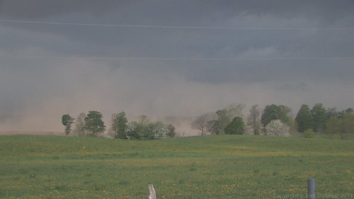
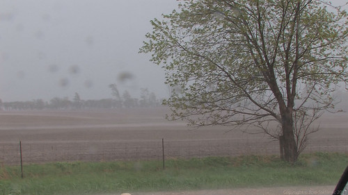
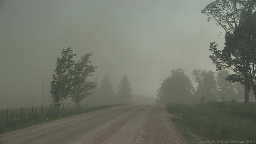
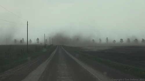
This is just the coolest things! It was incredibly dry across much of Southern Ontario for a good part of May and a late planting season saw many farmers tilling their fields just days prior to this storm rolling in. The barren and dusty fields created an amazing display, it's not like seeing strong straight line winds or a tornado, it's more like a feeling of "that's just cool!" without actually shouting that out.
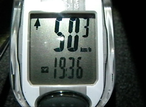
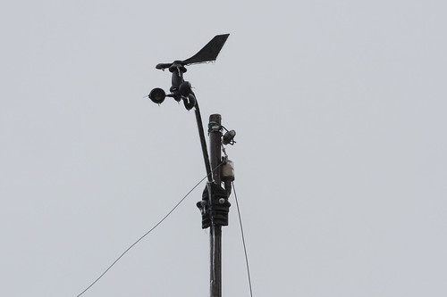
Like I said, this was the first time I had the ability to actually put the Inspeed Anemometer to the test, I was hoping and probably expecting stronger winds but the absolute highest gust I measured while on the hill, outside of Lucknow was 50.3 km/h, hardly a severe gust! Heck, you'd be lucky if that tipped over your trash can.
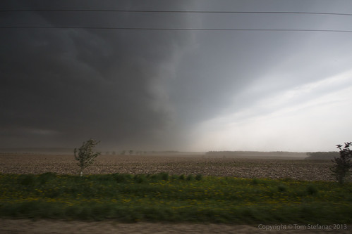
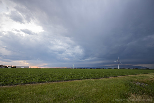
Now knowing the storms outflow was only moving at around 50km/h peak I knew I could keep pace and get back out in front of the storm for a second round.
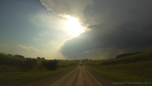
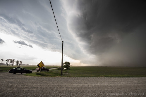
I actually had my camera at this point mounted to my window and was able to snap this shot while looking for somewhere to stop. The contrast was pretty cool!
May 15th 2013
On April 6, 2014
- 2013 Storm Chases

This was the second storm cell which later spiked on radar.
When this photo was taken it was still in its infancy but at this point the surface warm front was getting closer and it was later in the day so boundary layer mixing was increasing. This allowed the storm to mix down further and at least appear to be getting closer to the ground.

This is a stylized image of the storm as it continues eastward. I've used a graduated neutral density filter to darken the sky and create this vibrant image. At this point the storm was hitting 68 dBz and producing some small hail. A warning for Durham Region was issued, and this storm eventually made its way out over Lake Ontario.
I tried to keep pace with the storm but gave up, it was moving at well over 80 km/h.
May 10th 2013
On April 6, 2014
- 2013 Storm Chases

The storm is now passing through Milton, you can see mid level clouds flowing into the storm from the Southeast (image looking west). It also presents a bit of a vaulted type structure with the usual lateral tilt of the updraft. Slight clearing between the "hail" region of the core and the heavier rain is visible just to the right of center.
The biggest problem with this storm if any is the fact that it remained elevated with limited boundary layer interaction and hence produce virtually nothing as far as wind at the surface.
April 11th 2013
On April 6, 2014
- 2013 Storm Chases

Commuters in Brampton near hwy 50 & Queen St get on a Zoom bus as heavy wet snow falls.
The snow was not expected, a combination of colder air flooding in and additional mixing aloft meant that the precipitation, which was supposed to remain as ice pellets eventually changing to rain fell almost entirely as snow with the first wave of precipitation.

A "surprise" winter storm blankets Langstaff Rd just west of hwy 27 with a coating of wet snow.
This unusual late season storm left many municipalities unprepared to treat the icy road surfaces and commence plowing operations.
The snow also created an additional forecast element not forseen, with a fresh blanket on the ground it meant that temperatures were able to remain cooler longer and this would aid in the freezing rain process which would begin with the second wave of precipitation much later in the day towards evening.

This was the radar image at the time showing just where the snow, ice pellets, freezing rain and normal rain sat. You can see the blues and purples (snow) effecting the GTA and areas eastward while much of the Hamilton, Halton and western portions of Mississauga were seeing a good mix of ice pellets (orange). Further south, along the QEW on the south shore of Lake Ontario most of the precipitation was falling as rain (green) and to the west a pocket of freezing rain (pink) had developed over Kitchener, Waterloo, Guelph and other surrounding communities due to cold air damming at the surface.
April 1st 2013
On April 6, 2014
- 2013 Storm Chases

Looking at this photo it sure does not look like April 1st, and no this is not an April fool's joke I've concocted, it's a not a joke at all!
Mother nature decided that we've not had enough winter this year and it seems even with balmy days between they are simply teasers.
(There has been no Photoshop work done to this photo, it was taken purely using a Cokin graduated tobacco coloured filter)

My car (not visible but right of the frame) was actually partially blocking a lane. It was all fine and dandy since there was no traffic and this snow was low drifting stuff.
Then just as a few cars came into view the wind started blasting and the drifting snow became a low visible wall of white a few feet tall. It was more than tall enough to shroud my car from any unsuspecting drivers so I made haste and got out of here as quickly as I could!

Here are some of the cellular convective snow squalls heading southeast into the Greater Toronto Area (I'm looking southwest).
Some of the tops on these squalls must have been pretty high but I did not see any lightning returns on any of my services.
(Again no Photoshop, just that Cokin Tobacco filter)
