Posts By Tom
July 14th 2016
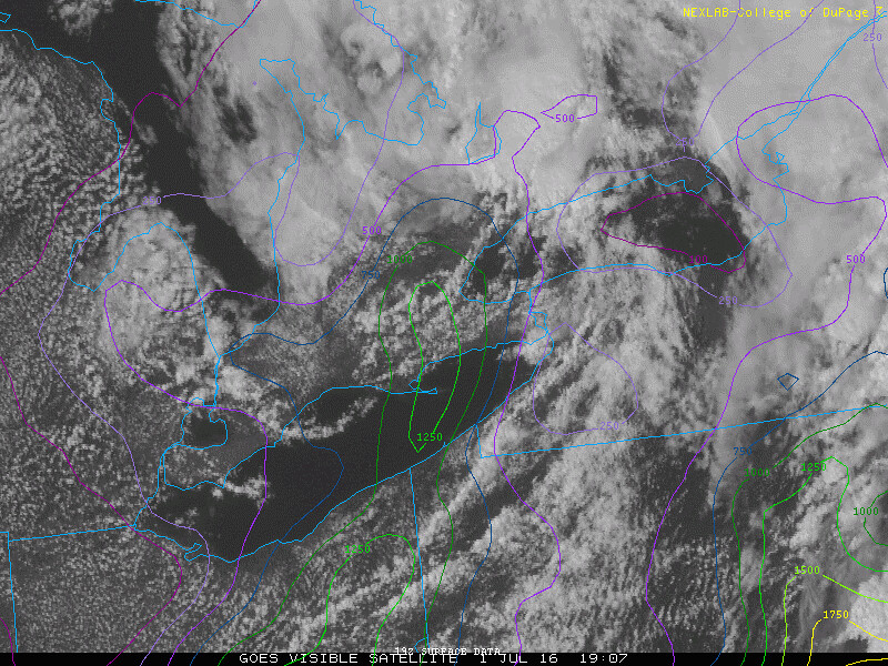
Surface analysis 00Z Fri Jul 15 2016


May 16th 2016
What a great first chase day! It’s amazing how variable the weather can be. Just the day before it was cold, miserable and downright chilly, but all that changed a great deal in the Texas and Okalhoma panhandle where a system swinging through set the stage for some cold deep convection. Video is at the bottom of the post. Enjoy!
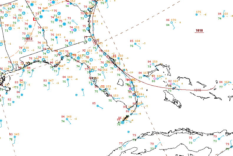
Surface analysis 21Z Mon May 16 2016


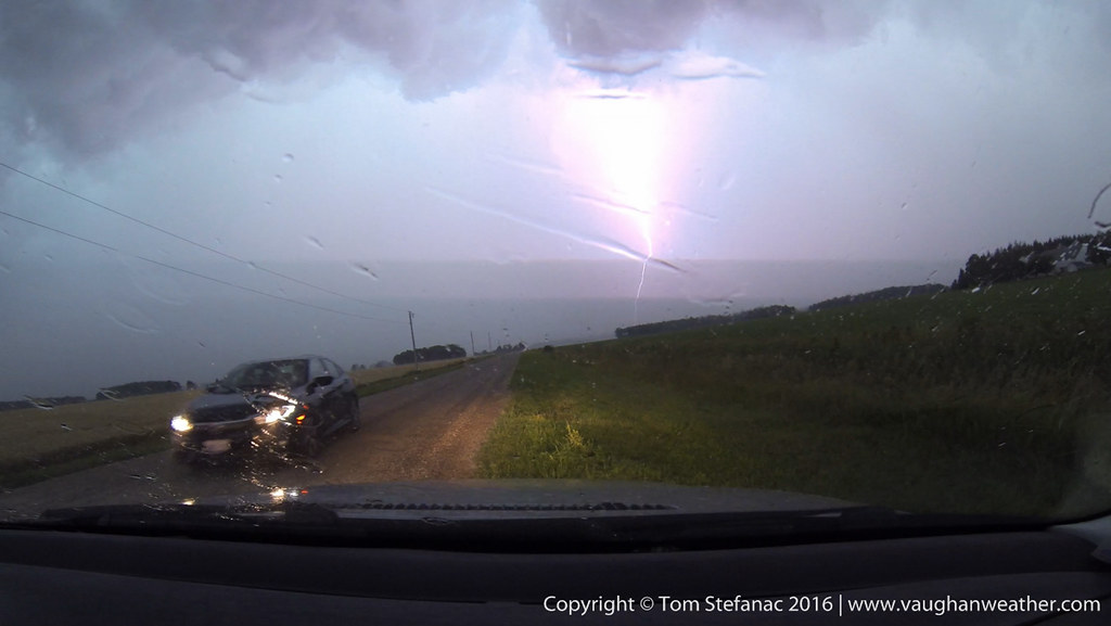
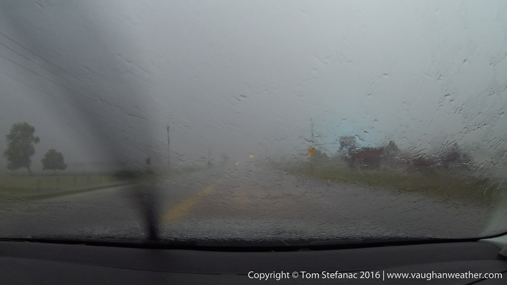
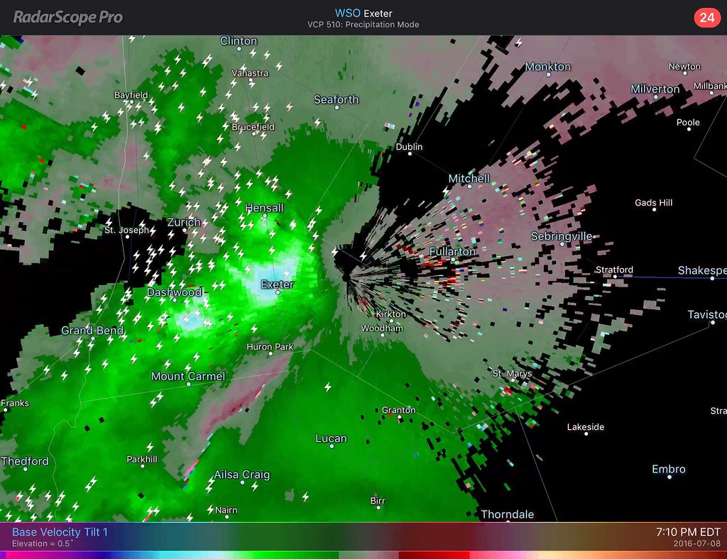
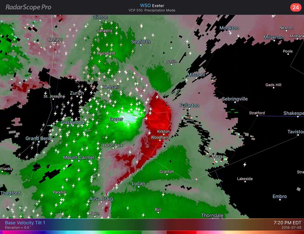
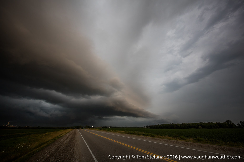
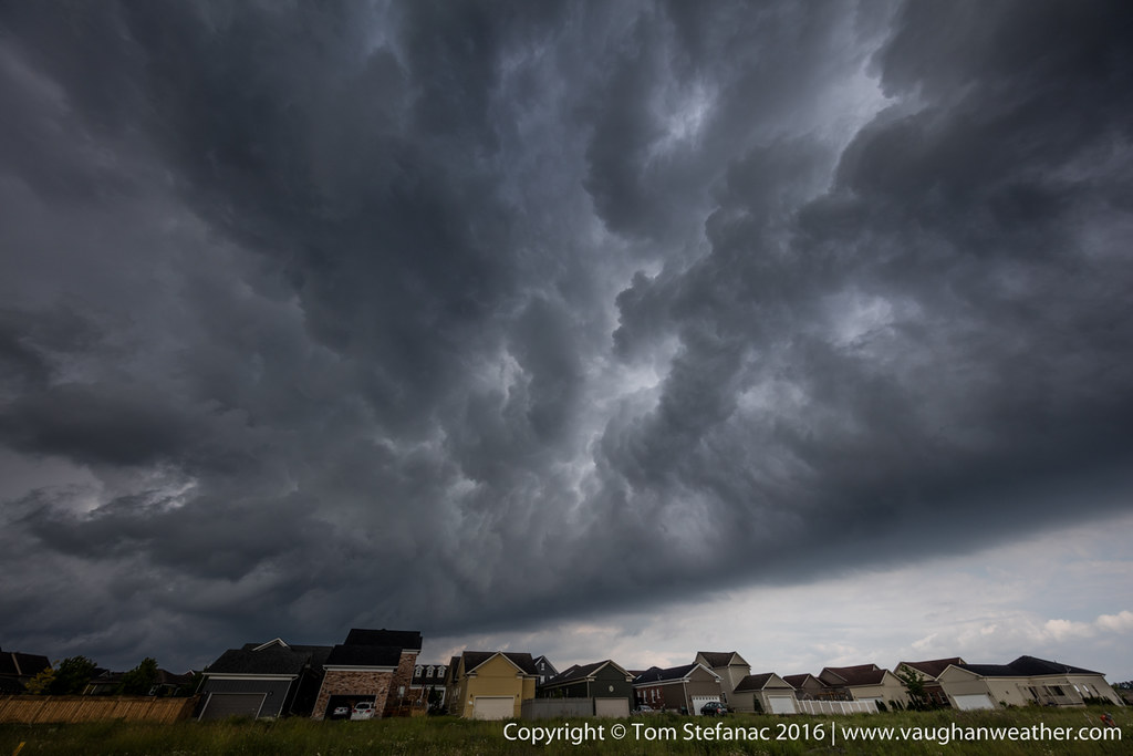
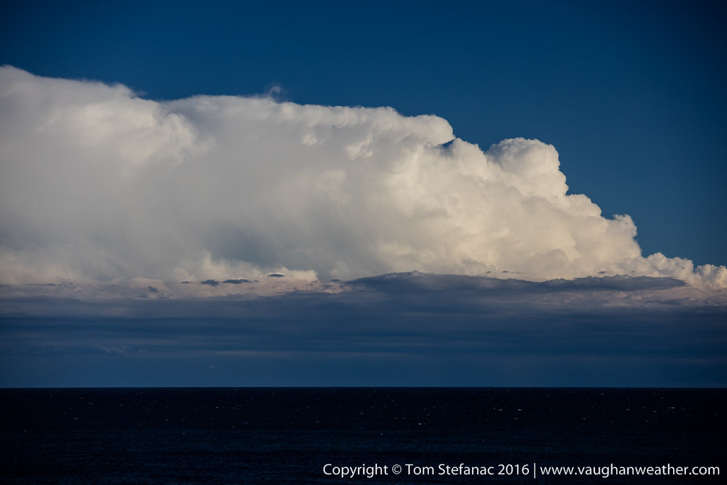
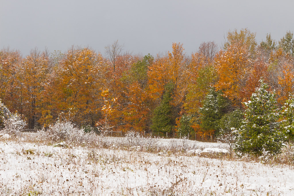
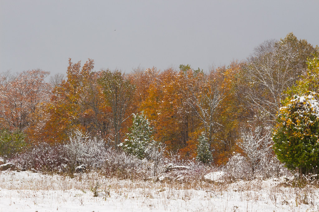
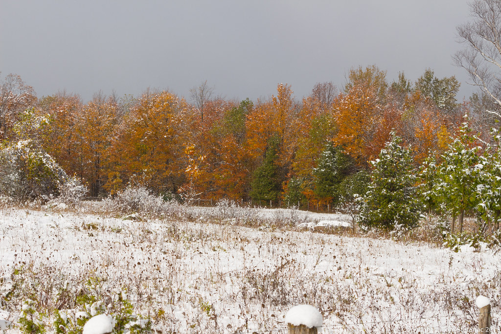
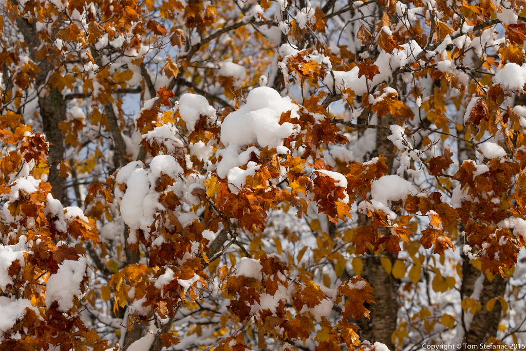
July 8th 2016
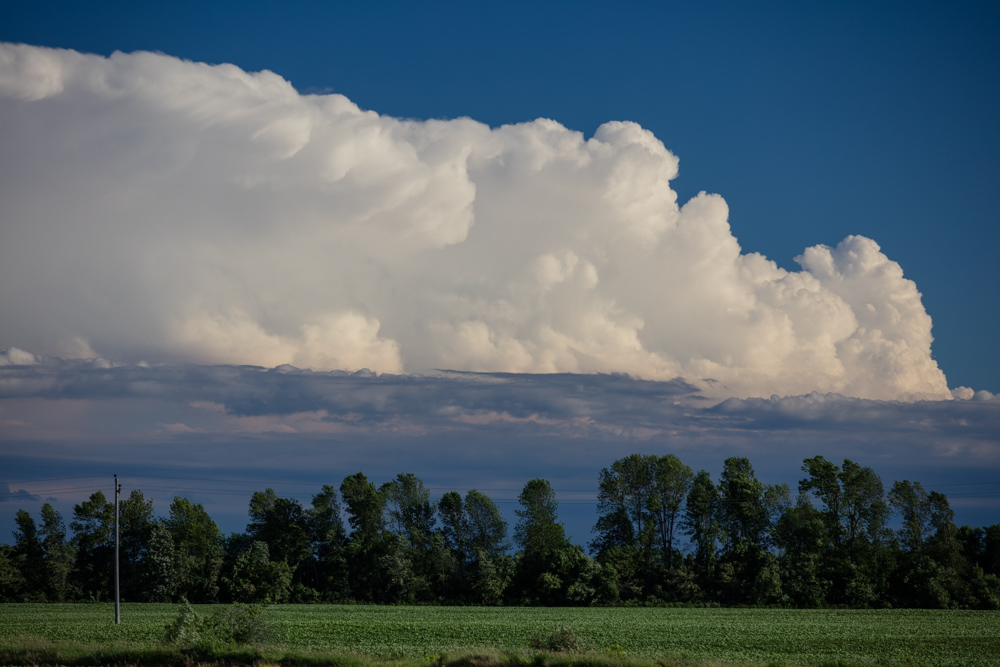
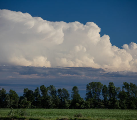
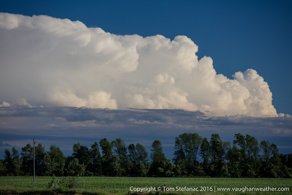
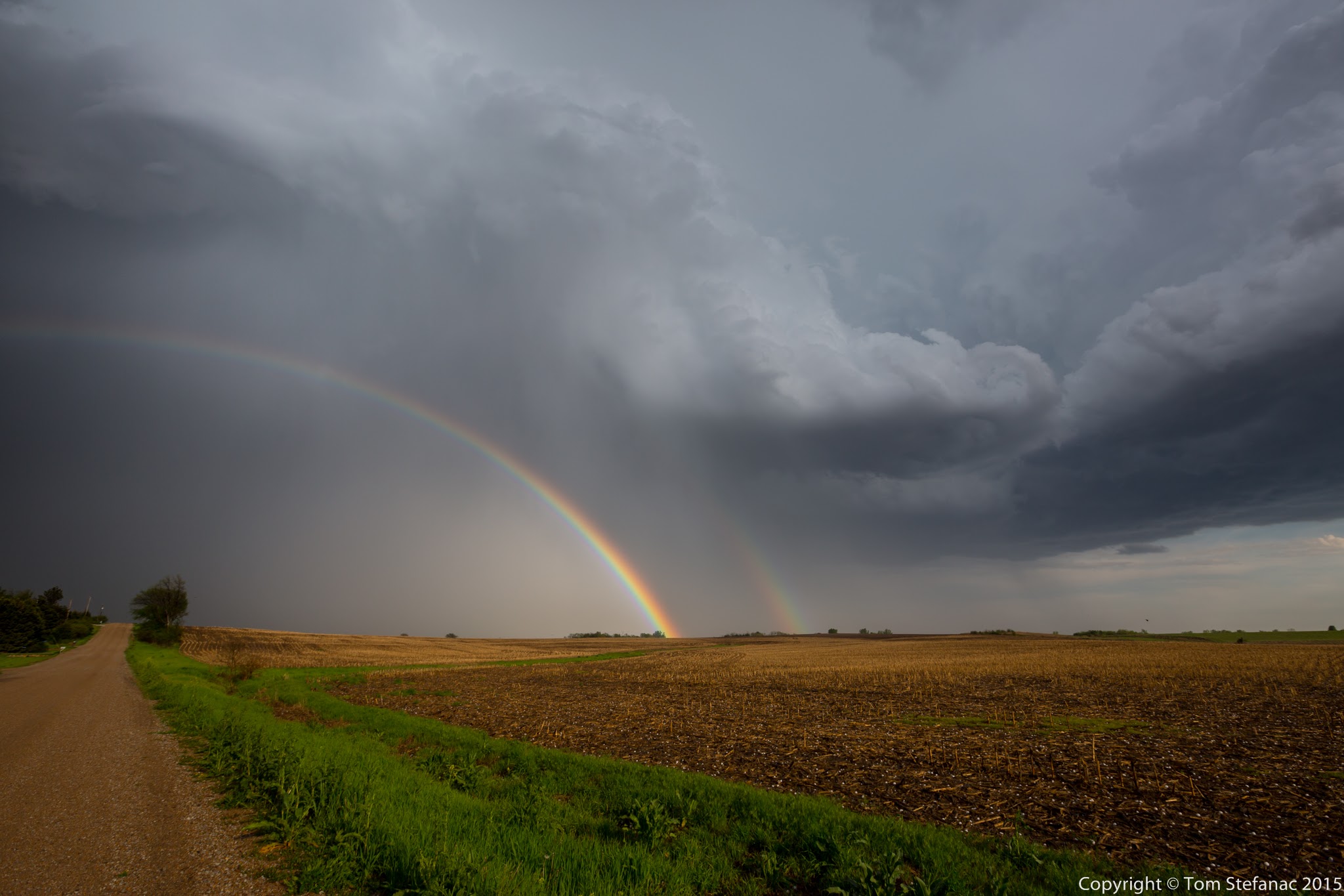
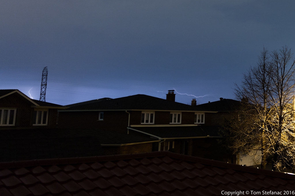
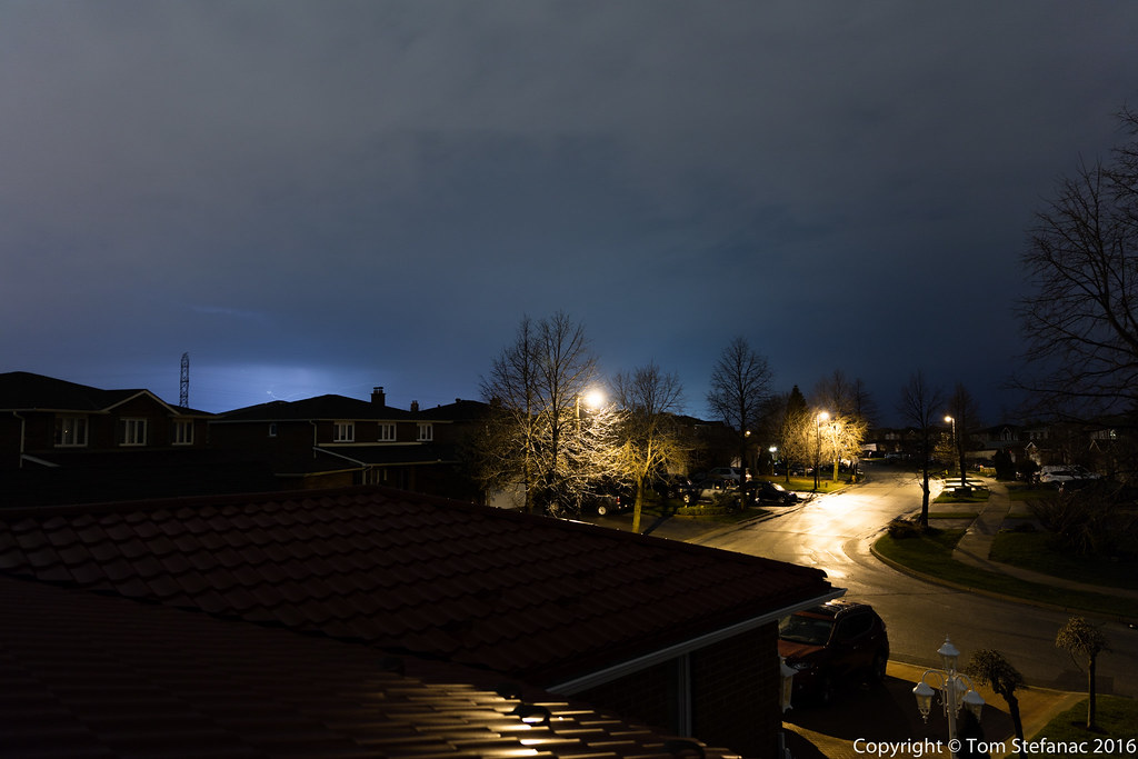
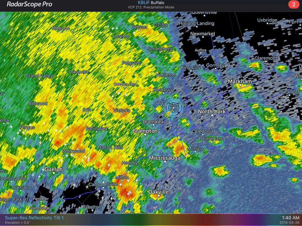
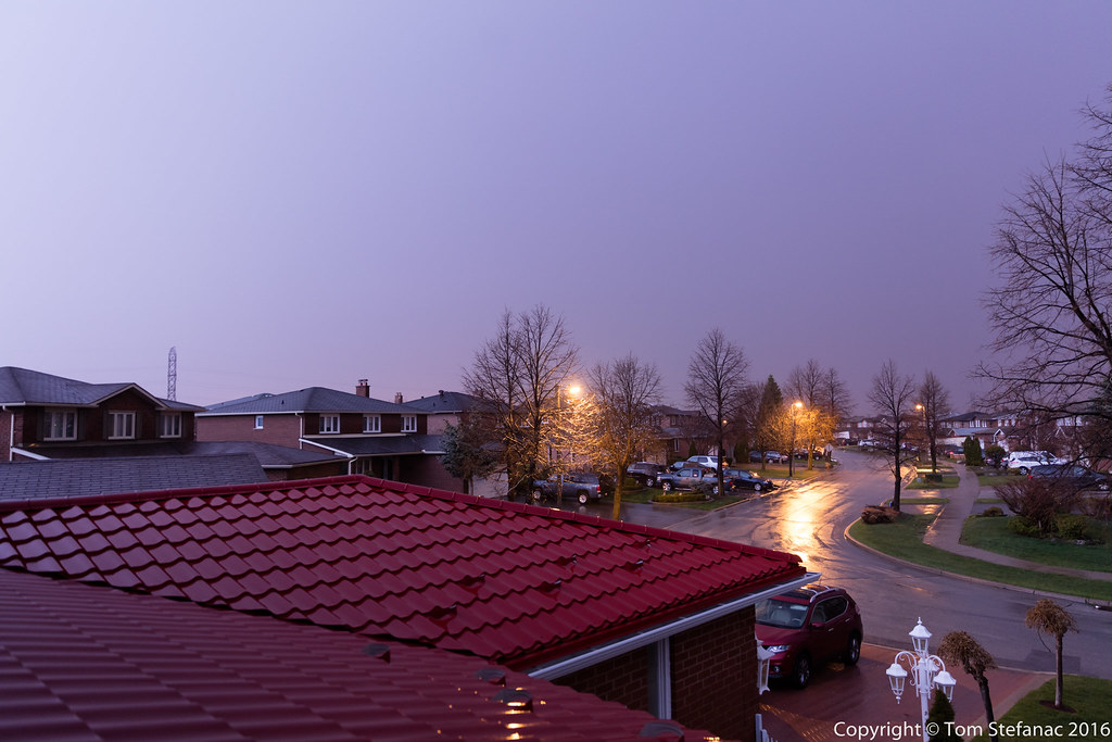
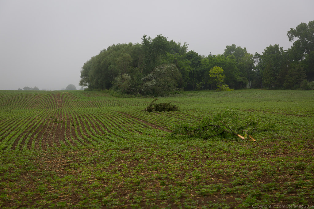
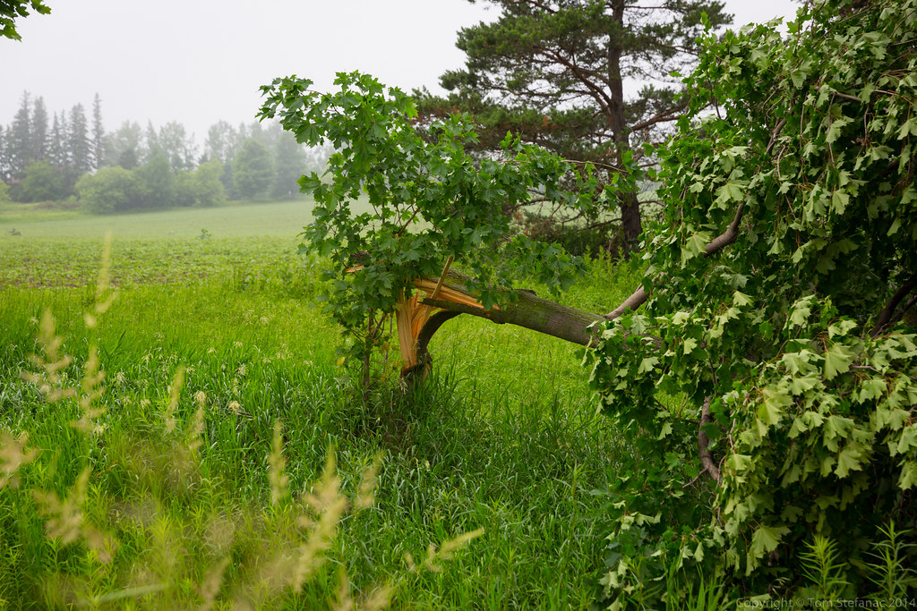
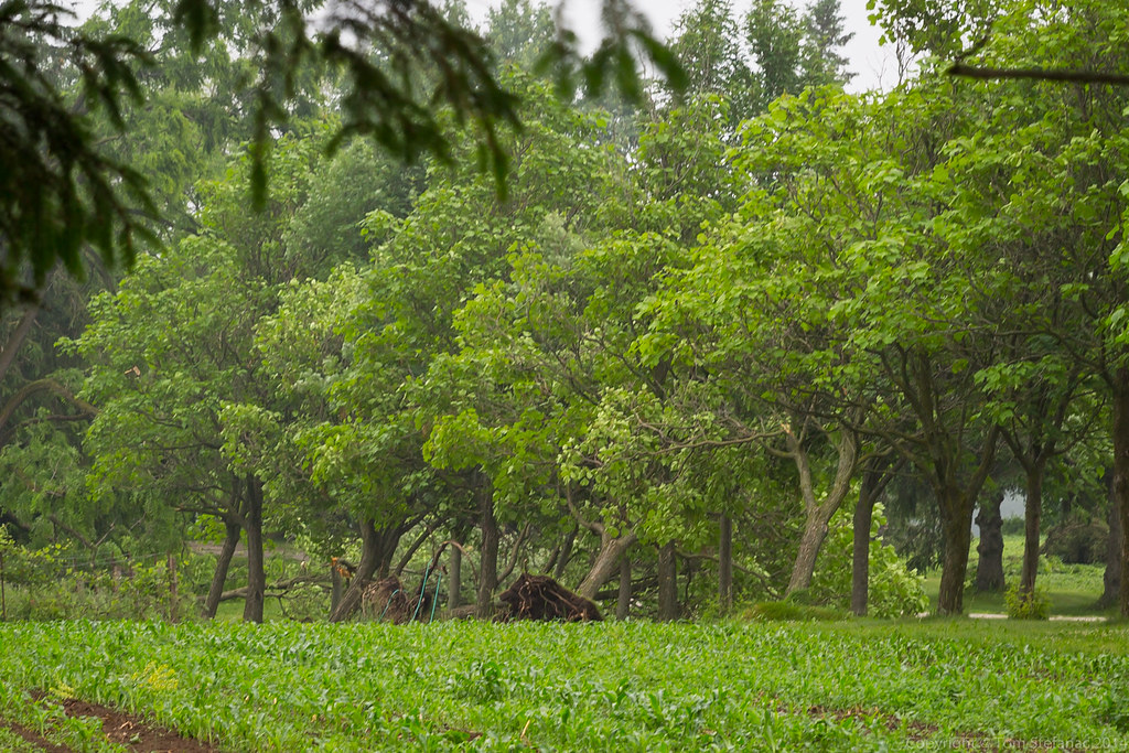
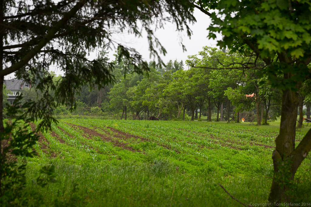
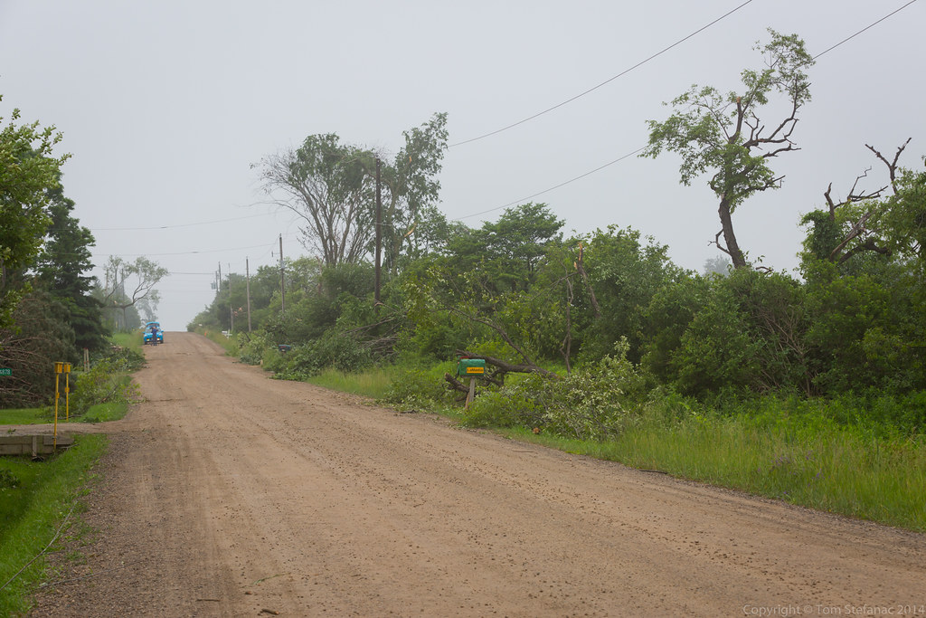
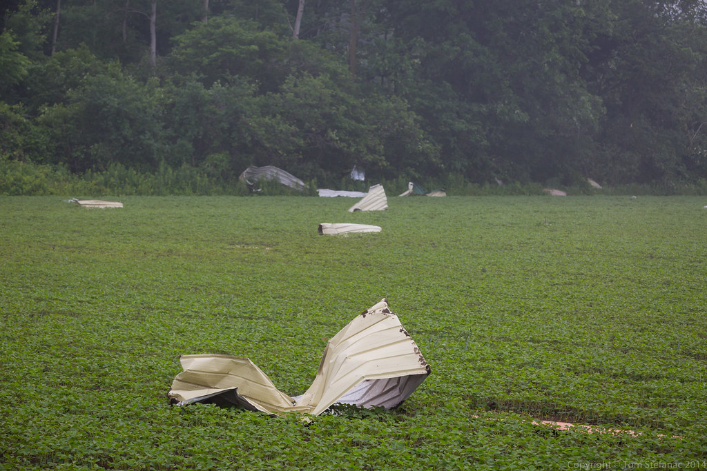
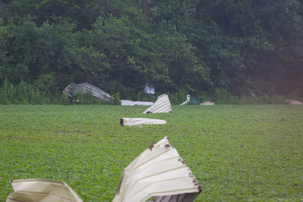
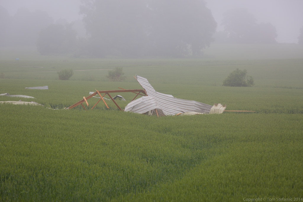
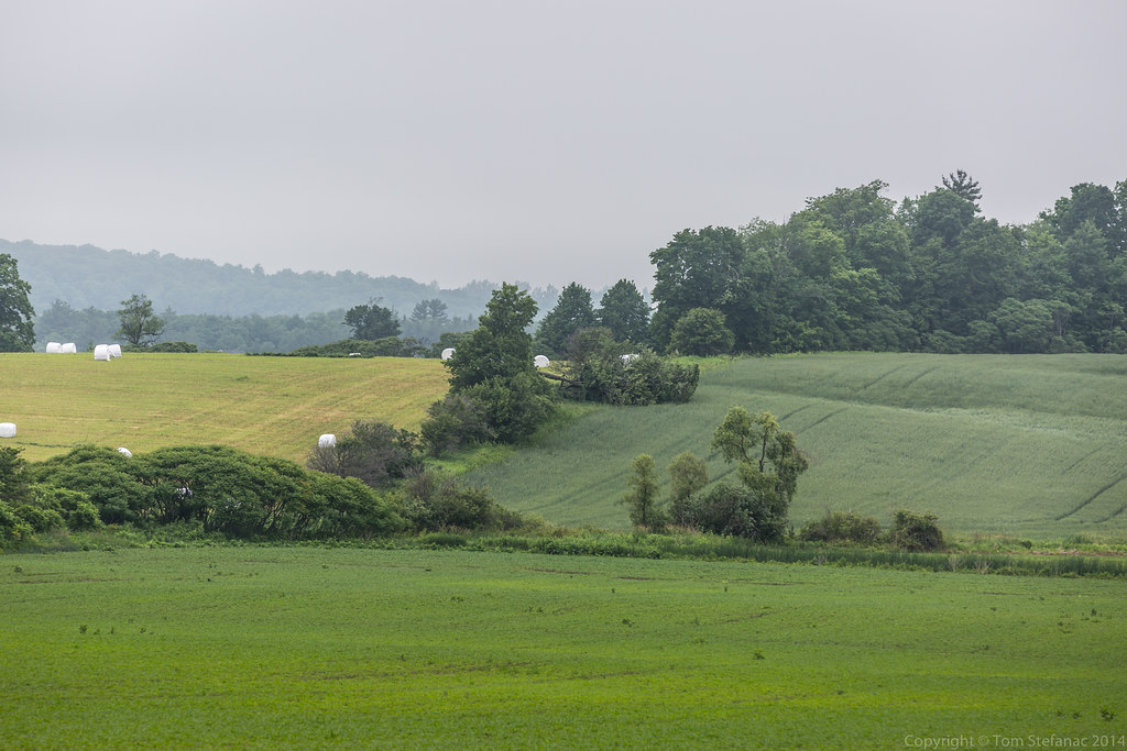
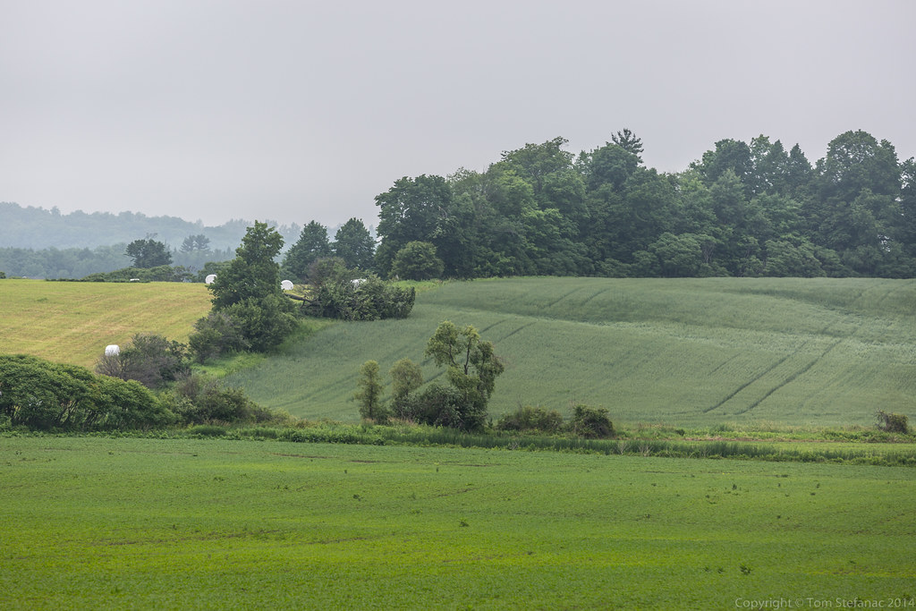
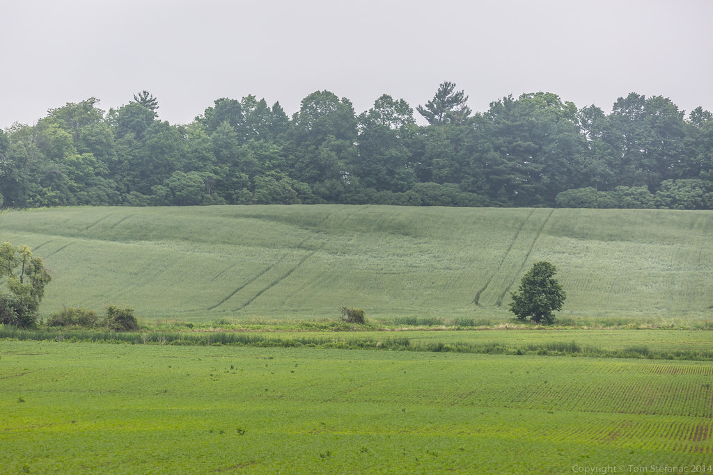
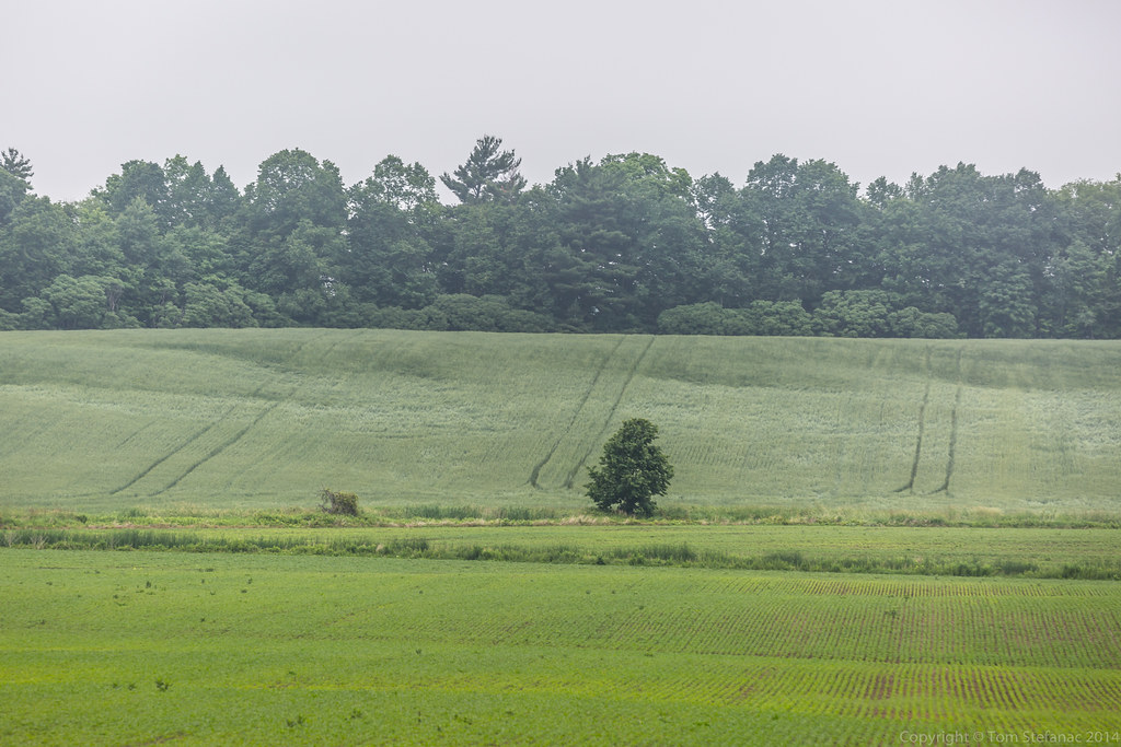
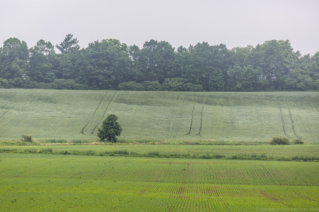
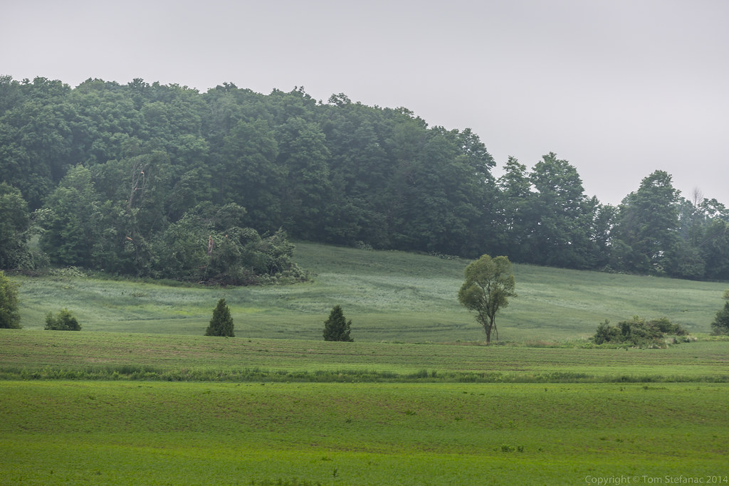
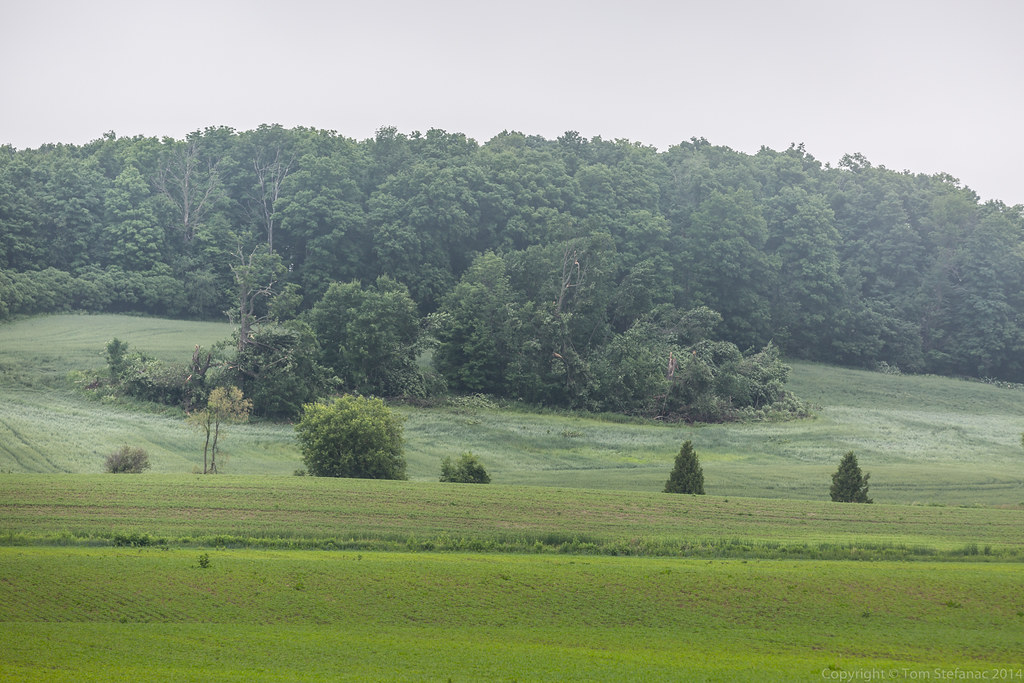
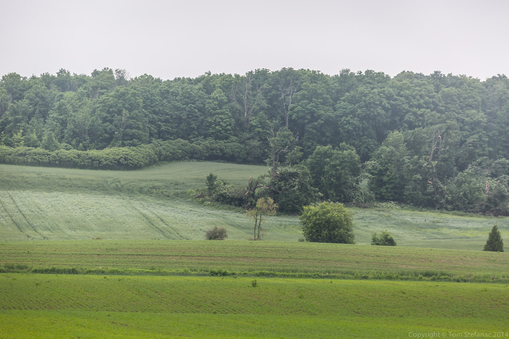
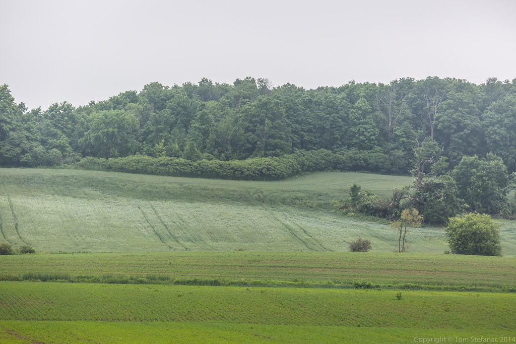
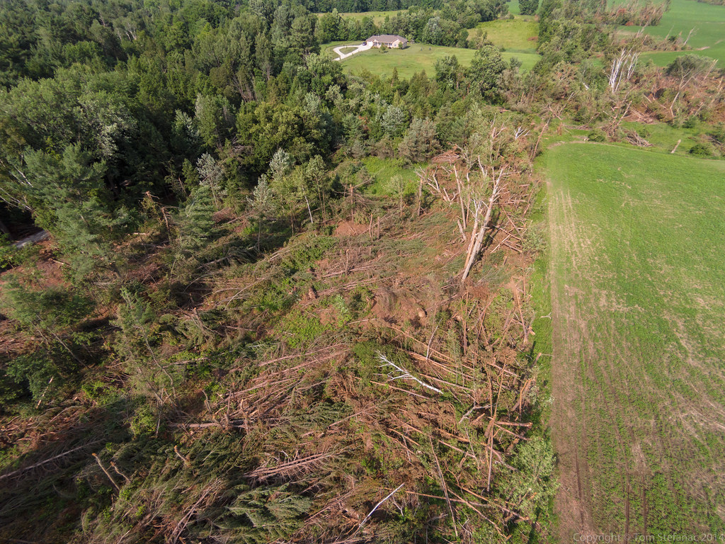
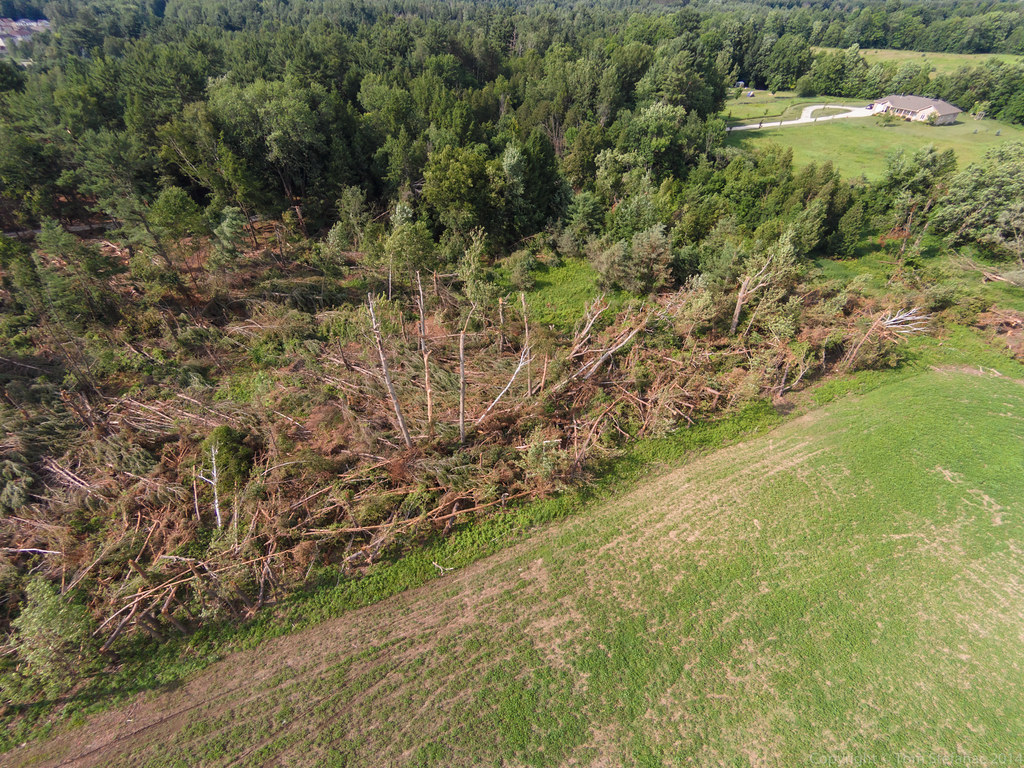
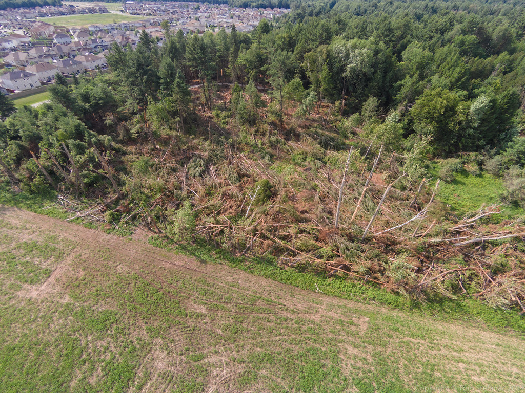
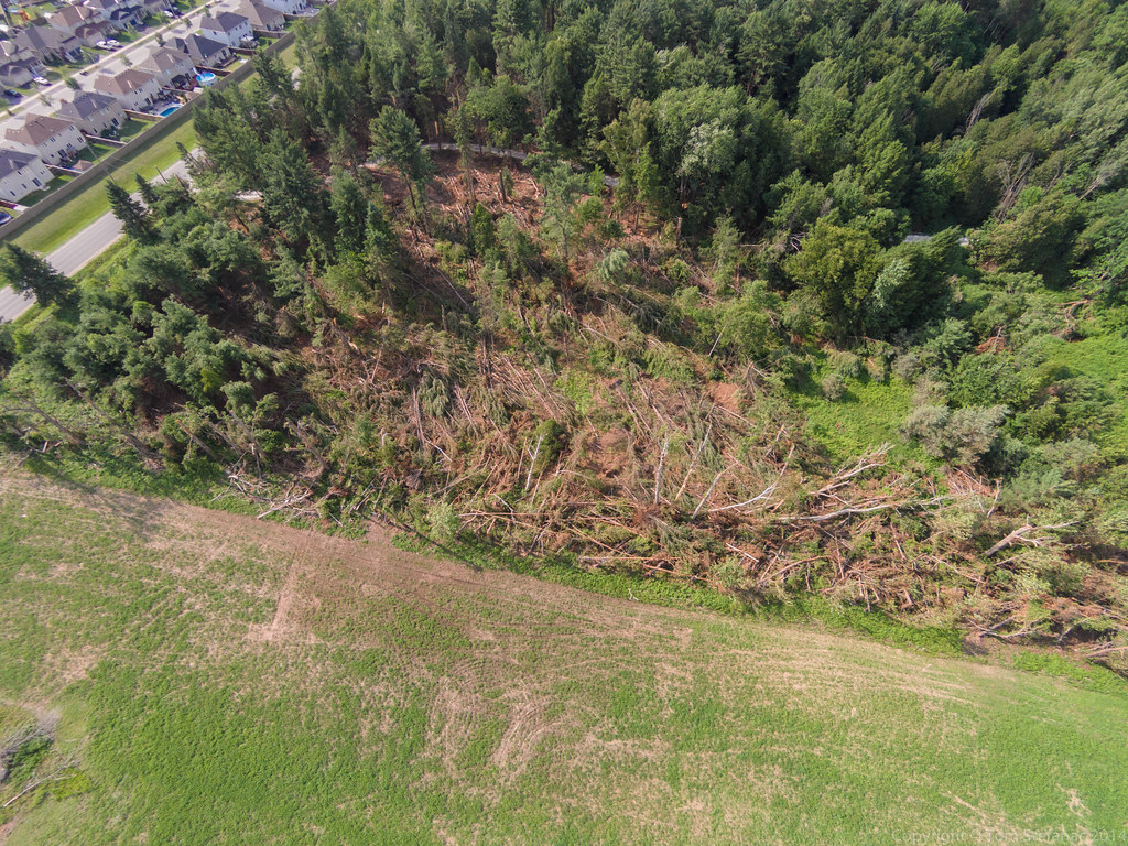
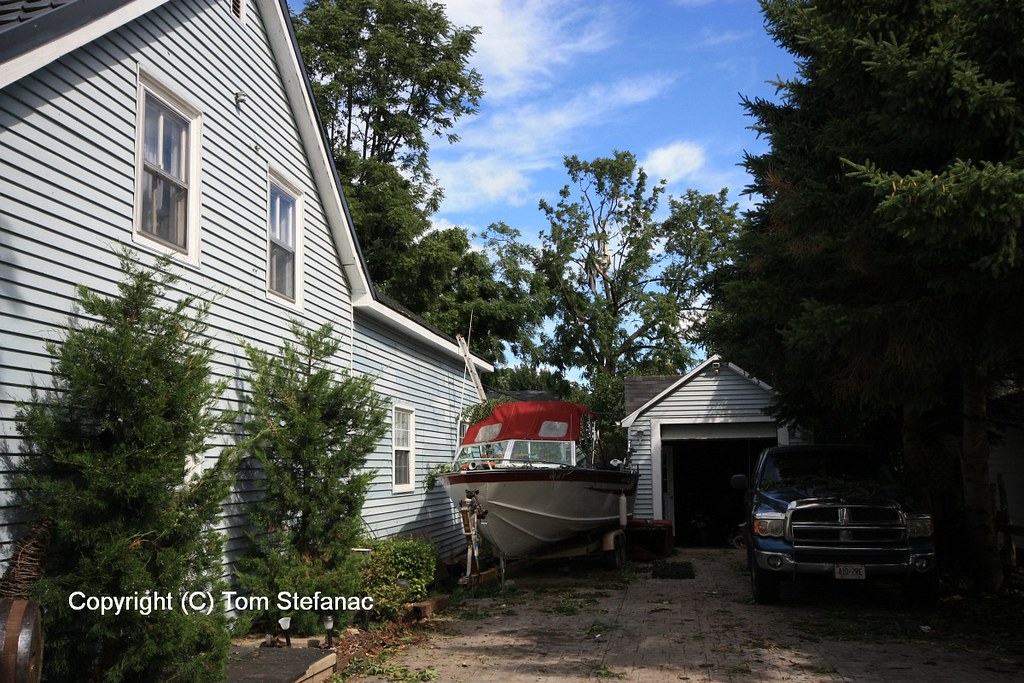
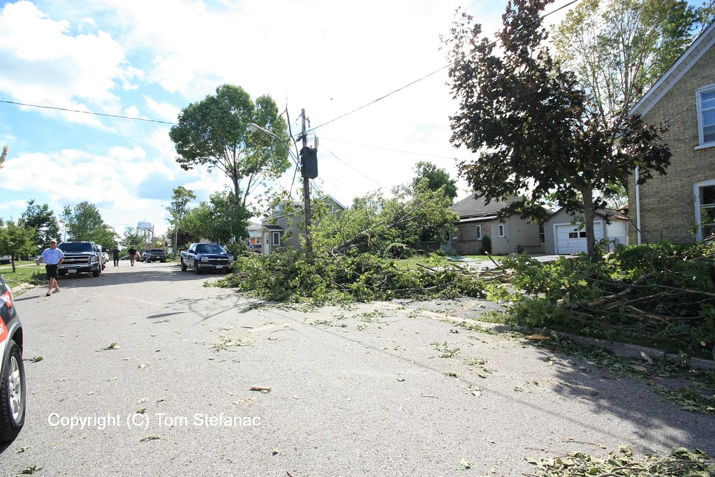
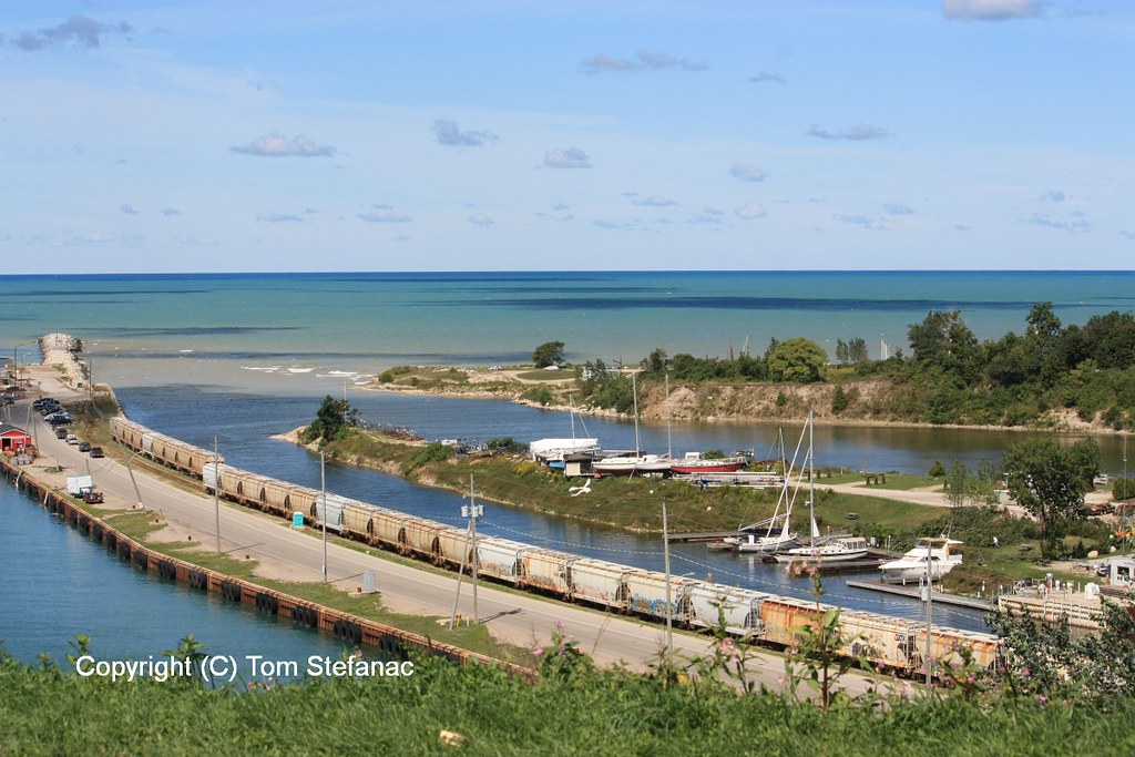
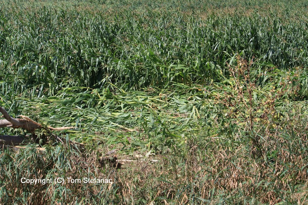
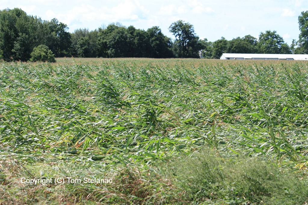
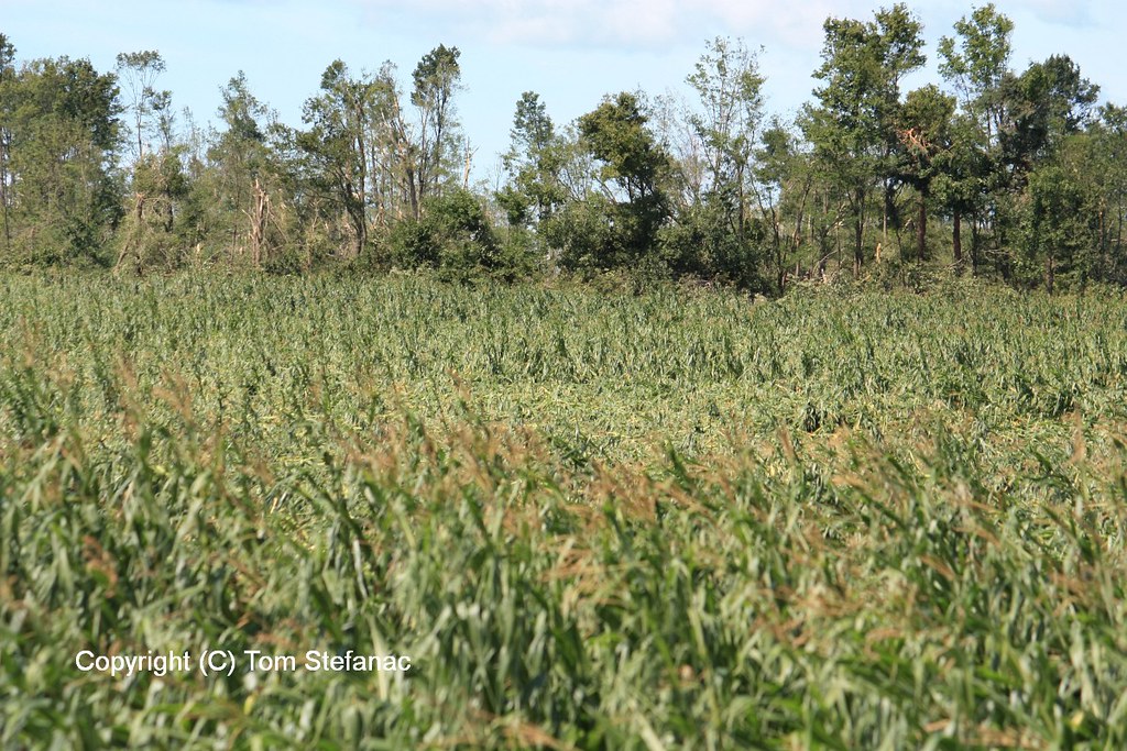
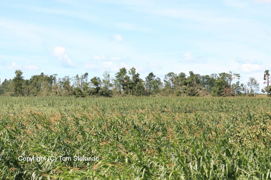
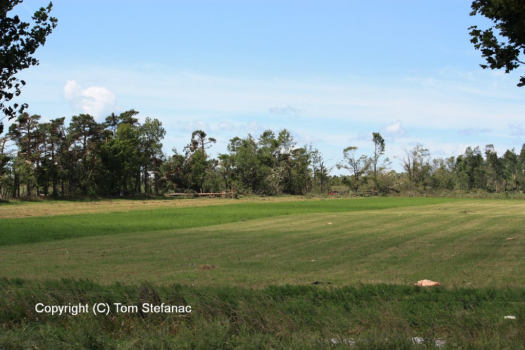
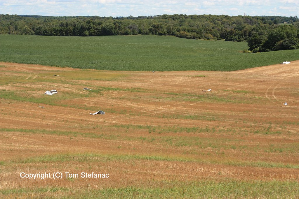
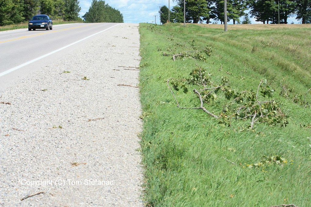
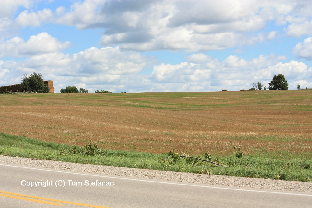
The first really active chase day of the year for Southern Ontario that was not a bust with widespread convection and severe weather ranging to hail to wind and even some local flooding. The entire day basically focus around an incoming low pressure system from Michigan with a trailing cold front that was crashing into very hot and humid air as a 500mb shortwave scooted past to the north.
After a quiet May and June, the storms were welcomed and helped to ease the drought conditions imparted across much of Southern Ontario thanks to a very dry and storm free spring and early summer.
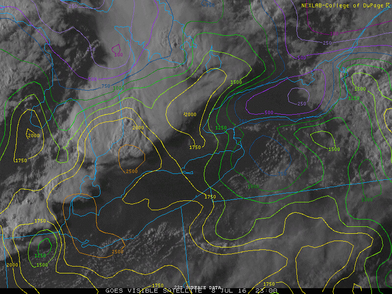
Surface analysis 21Z Fri Jul 8 2016
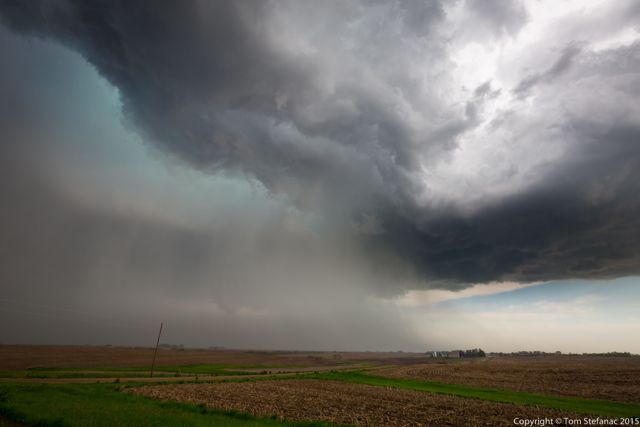
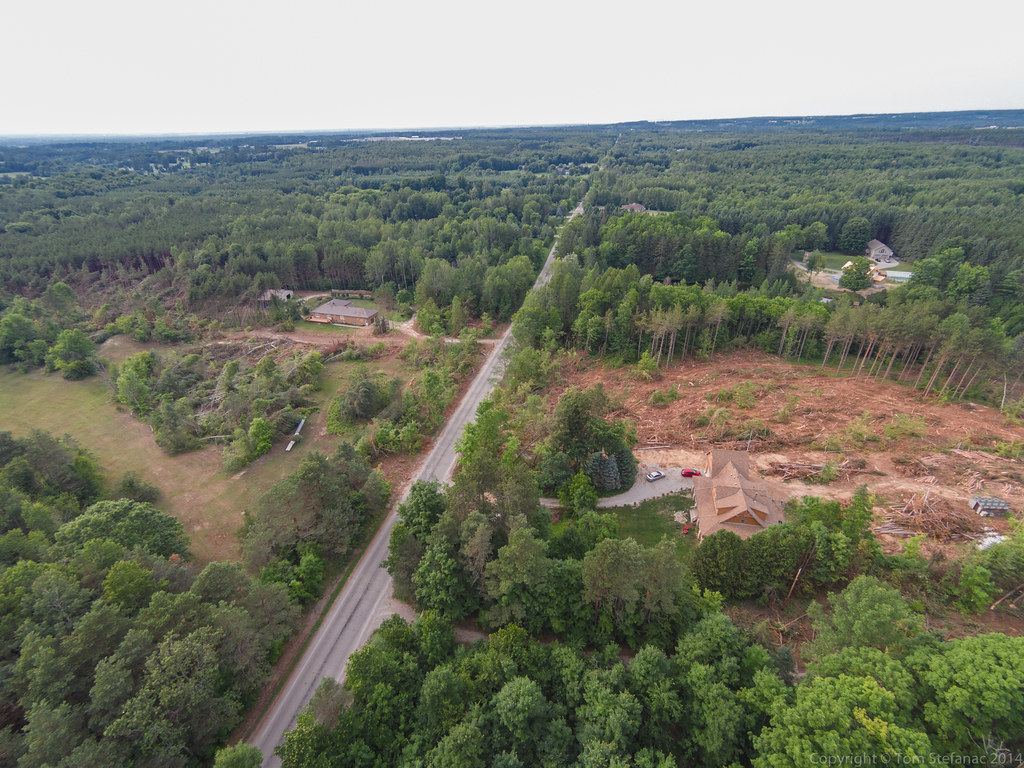
I started the chase day in Woodstock Ontario around 2PM as I focused on two possible targets eventually narrowing it down to the area around Goderich. As with every storm chase, looking at the surface observations and being in position early rather than late is always important and critical! Playing catchup or being unaware of the atmospheres potential is never a good thing and can really make or break a chase day.


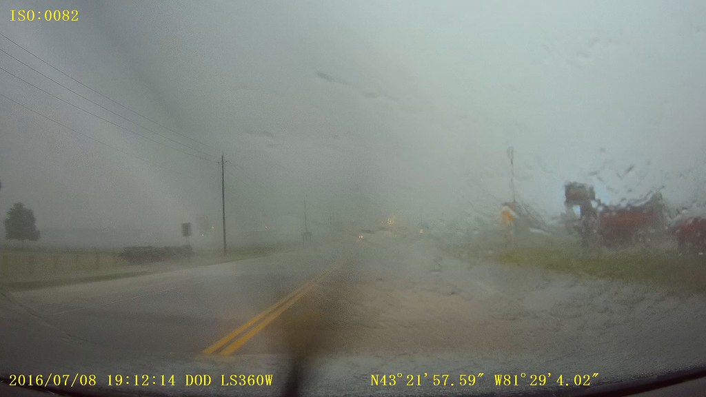
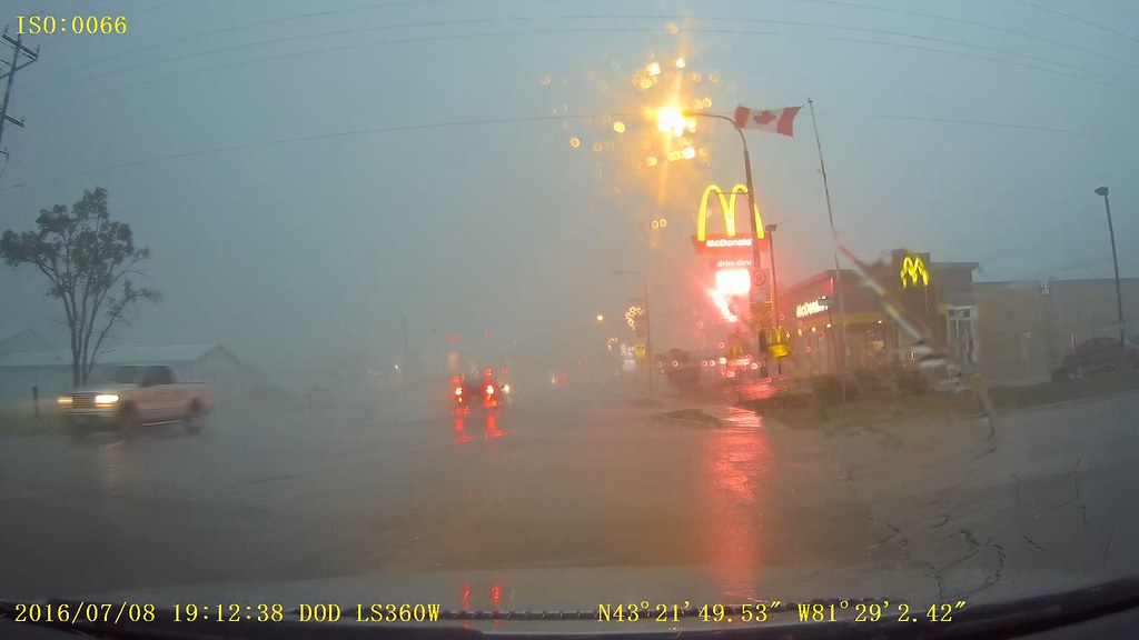
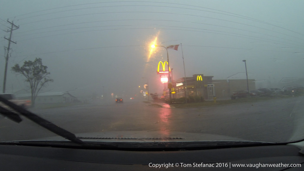

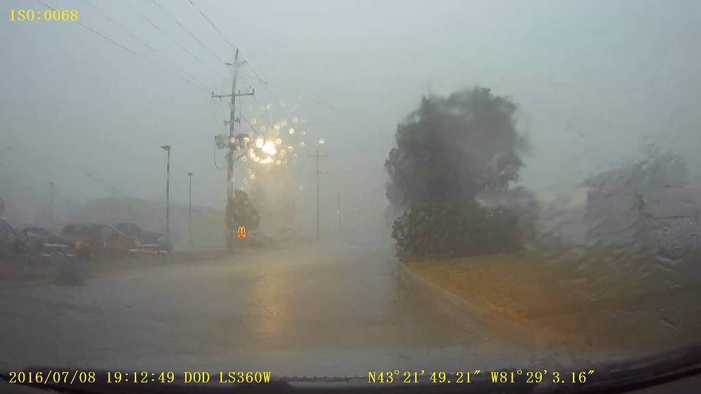
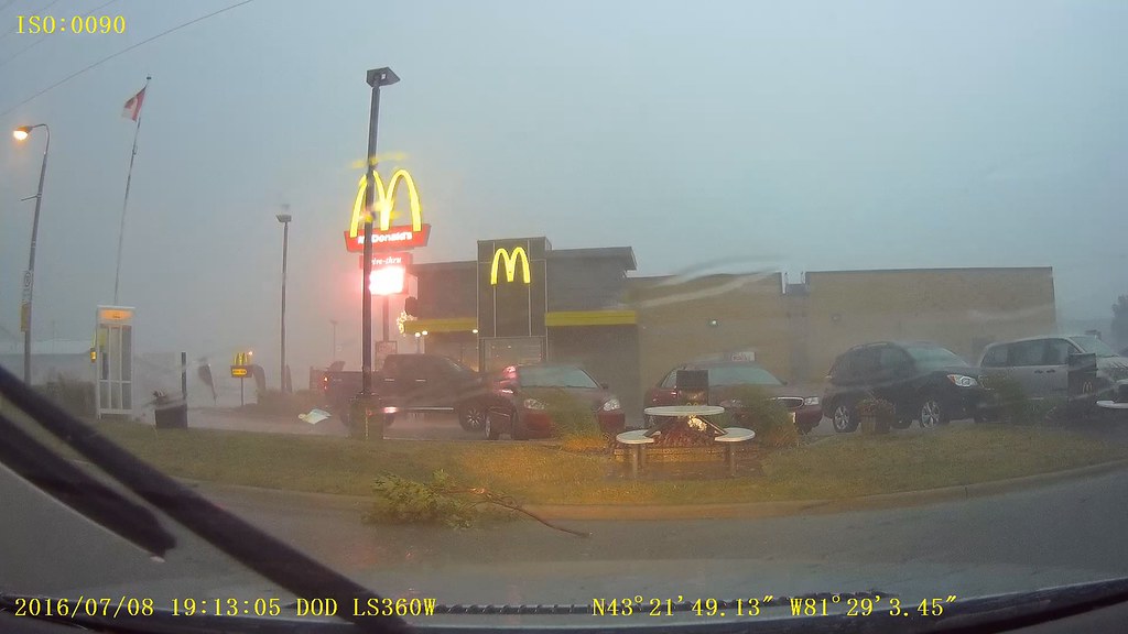

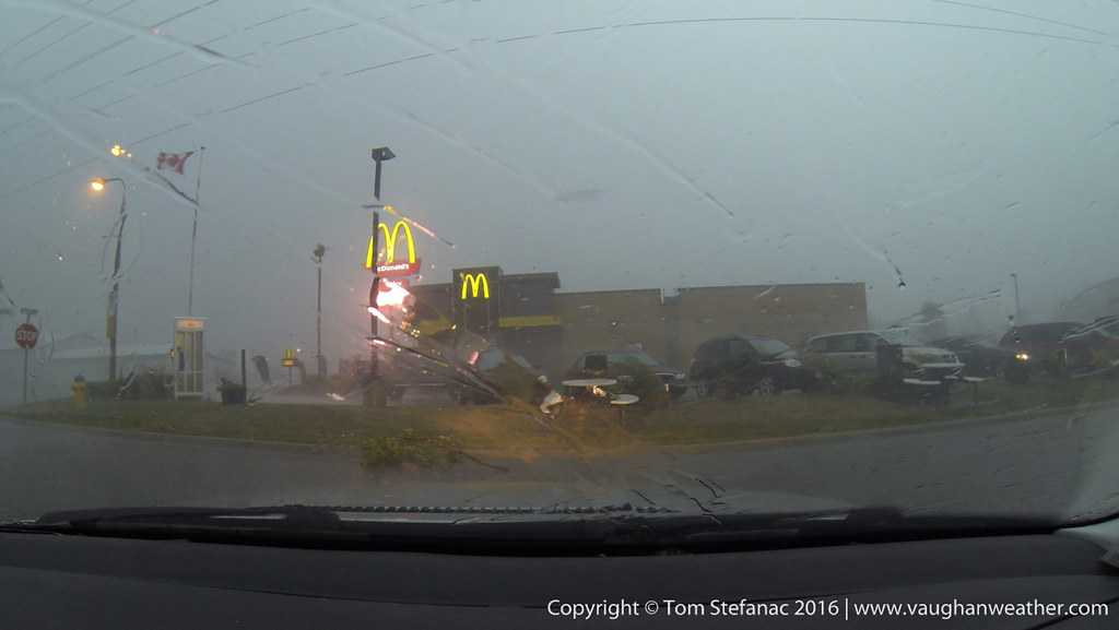
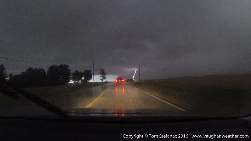
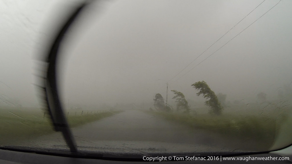
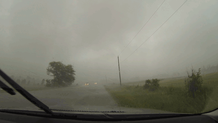
Dashcam Video from Exeter with strong winds blasting in.
July 1st 2016


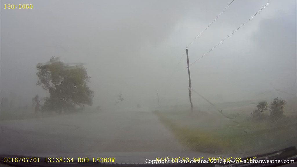
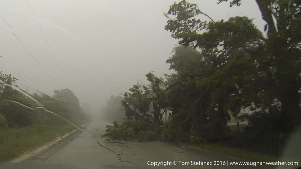

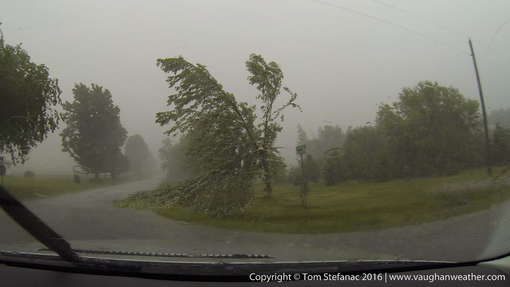


Here’s a gif loop showing the tornado crossing the road.
Two videos showing the tornado crossing the road.
Photographic Accessories
In addition to the DSLR bodies themselves, I have an array of filters, polarizers, plate holders and trigger / remote systems.
Having a good quality, responsive SLR is the first step in taking great weather photos, the next is having the tools that can take your camera to the next level.
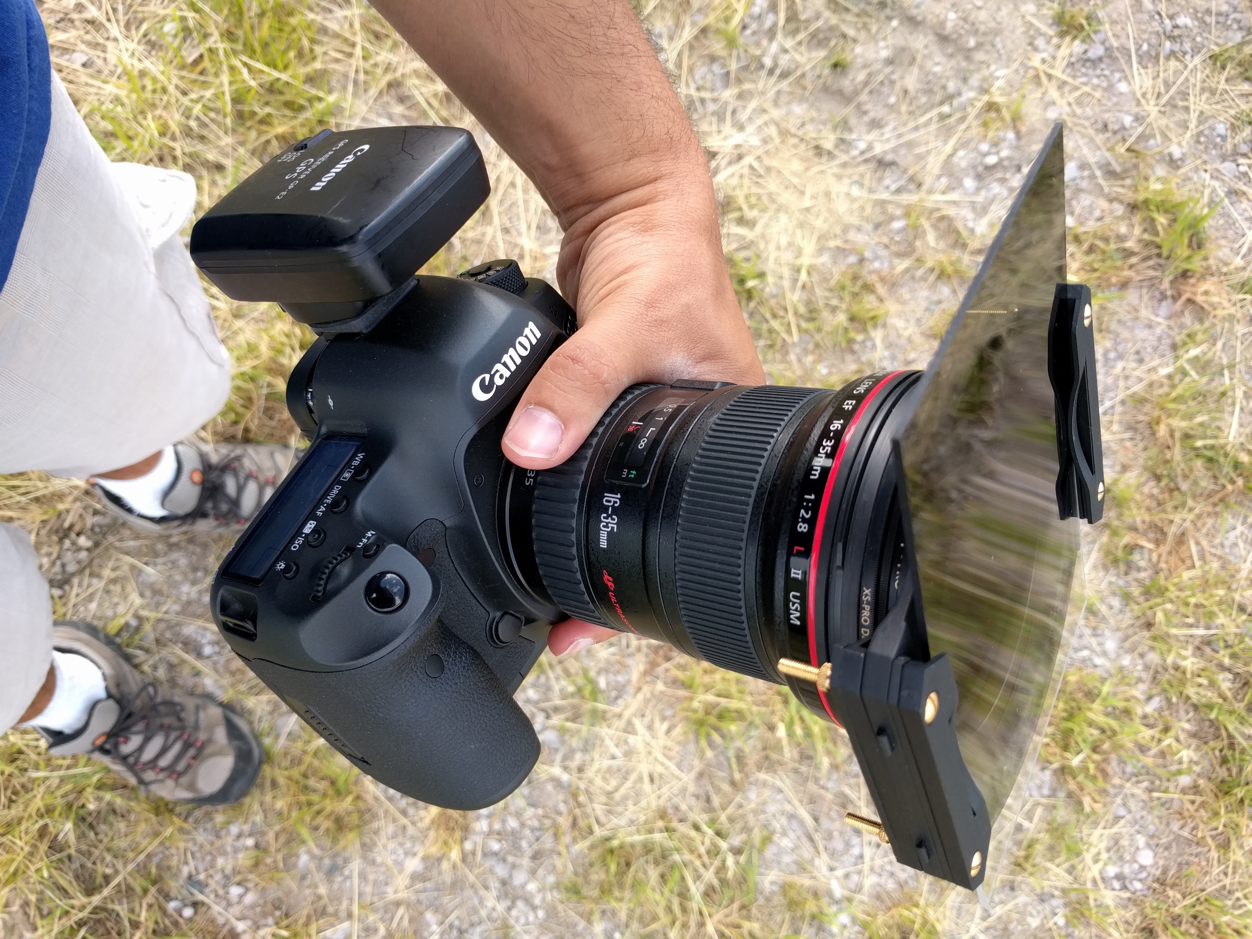
Canon 5DSr with a Cokin Z-Pro Filter Holder, ND8 Grad, B+W C-Pol on a 16-35mm f2.8 lens with the GP-E2 GPS attached to the hot shoe.
Photographing storms is never a quick easy process, yet storms by their very nature require you to be a fast, accurate and confident photographer. You need your camera to be focused correctly, the exposure to be accurate, white balance acceptable or faithful and a steady hand or tripod to prevent motion blur/jitter. Only after all these factors are correct can you start taking photos and make adjustments to composition, and other elements.
Once you’ve mastered the basics, and learned how to use your lenses effectively, then you can add things to them such as circular polarizers to deepen the blues in the sky and make the clouds pop out.
You can also add graduated filters to help balance the bright clouds against the darker foreground. If you’re really brave, you can combine polarizers, neutral density grads and even coloured filters to make things pop or create hyper-realistic art.
I say art because the instant you push your photo beyond a faithful true to reality representation, it’s no longer realistic to what was there but a form of pseudo realism. Think about it like this, if I use a filter to make the sky pink and the pink sky somehow balances perfectly with a big white thunderstorm against a field full of yellow sunflowers, it’s acceptable as a cool photo, but it’s no longer realistic. I’ve tricked your eyes into believing something that’s probably impossible and further to that point, manipulated reality to create something that I feel looks better. The photo is partially representative of what was there since I did not remove elements but it’s not faithful to the reality of the moment since I added false colour to the sky.
So remember, tools like filters and grad to help you turn your photos into art, or make them more representative and faithful to what was there. It all depends how you use them.
Tornado Alley Blog – 2016
April 30th 2017 – Kansas City, Kansas
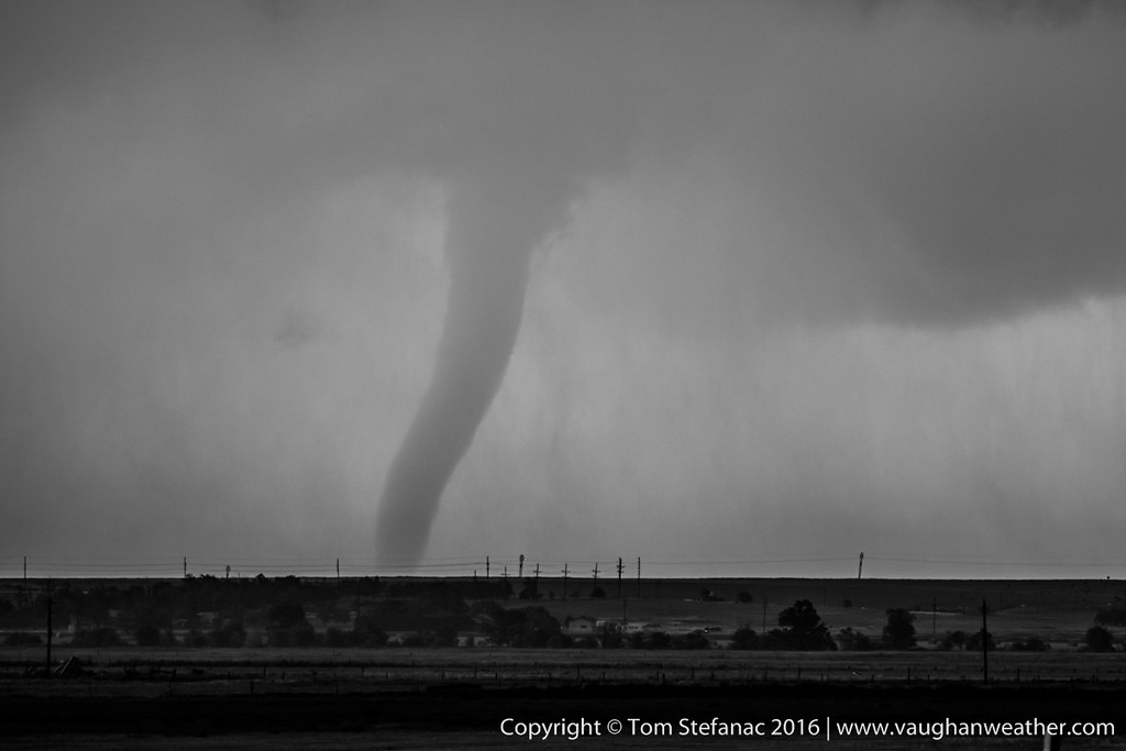
What a night. What started with a cold early morning commute, ended with us spinning in circles after chasing a weak line of storms on the IL/MO border. The storms were actually linear in nature but developing in a weak energy environment with favorable low level shear for vorticity. One of the storms produced a brief tornado as we approached from the west, but we were unable get into position in time for it to be visible however several storm reports confirmed it.
Our next target is Woodward Oklahoma for a possible chase Tuesday afternoon near the Panhandle.
April 21st 2017 – Vaughan, Ontario
Well, it’s that time of year again and preparations are underway for this years tornado alley excursion. This trip unlike others which were solo runs with only my fiancée and I will actually include three other chasers. Two fellow chasers from Southern Ontario and one from New Zealand. In addition our trip will run from April 28th to approximately May 20th and will hopefully provide us with an opportunity to explore the beautiful landscapes of the American west and the absolutely stunning skies above.
While still early, the prognosis from the ECMWF weekly ensembles suggest a quick start, followed by intermittent storms that will give way to a major pacific long-wave towards the middle of May. Current climate trends indicate we will see more of a late May type pattern as opposed to a traditional early may pattern.
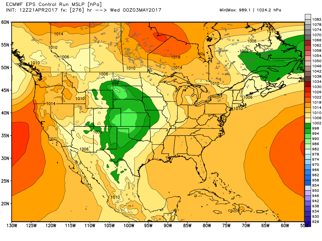
ECMWF MSLP Control Valid 03/05
Unfortunately the smaller mesoscale features which often arise such as front range convection which exists in areas such as DVCZ and near the Palmer Divide are not resolved in the longer range models. So while there is an apparent lull with the larger synoptic meteorology, we do expect there will be storms on apparent off days. Further into the future, the day 15 data which is the end of the observable run suggest a large pacific trough will likely make its way into the plains around May 9th or 10th and possibly trigger a couple high-risk storm days.

ECMWF Weekly – 15D Control 500 hPa
With that said, the forecast at this point will likely change a great deal so be sure to keep checking this blog for updates. I’ll do my best to post daily, nightly and even some rel-time reports once the trip begins.
June 14th 2016 – Vaughan, Ontario
Now that I’ve been back home for a while, I’ve had time to sort though the thousands of photos. This has been, without any question or doubt, the absolute best chase trip to the alley I’ve ever had since I started going down in the 2000’s.
I’ve put together a small gallery with some of my highlights from the trip and hopefully I’ll have all the chase logs up soon before I get too busy with the summer chase season here in Southern Ontario.


May 27th 2016 – Kansas City, Kansas
And the long 2300 km drive home begins! Oh, apparently you need to declare your guns at the border 🙂

Declare Your Guns
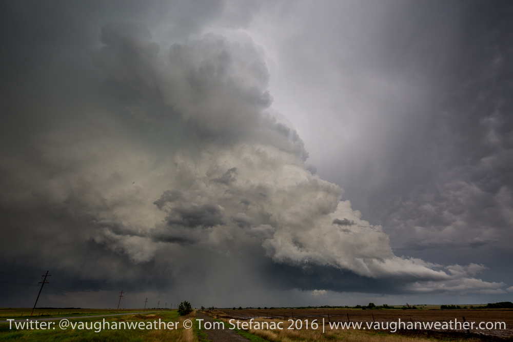
May 26th 2016 – Kansas City, Kansas
This was a moderate risk day with fairly high tornado odds. The only problem was that there was simply too much instability and it was a mesoscale nightmare with outflow boundaries, waves and all sorts of stuff all over the place! Convection from the night before really made everything a mess!
Kinsley, Kansas Storm
The storms that did go up quickly turned into a line or a cluster and became outflow dominated quickly. I don’t think anyone had a successful chase anywhere even remotely close to the target areas. It was a yuck day!

Weak storm near Dodge City
After the morning and early afternoon mess, clearing and sunshine allowed a couple of storms to go up in western Kansas and Oklahoma near the dryline. Unfortunately from a chase perspective, this was way west of the best shear vectors and the storms were very linear.
Storm with limited rotation attempting to become a supercell
This storm north of Dodge City Kansas near Jetmore wanted to spin but it just could not pull itself together and the daylight began to fade quickly.
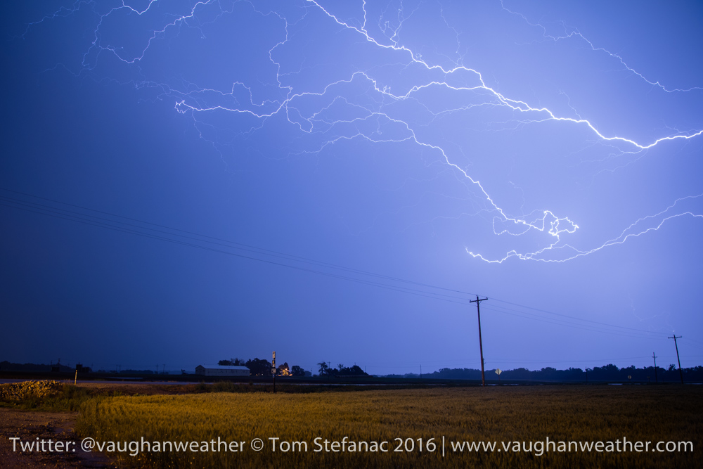
Ellinwood Kansas Lightning
Later that night we had some wonderful lightning along a nocturnal MCS that developed from the western convection and with that, my 2016 trip comes to a close!
May 25th 2016 – Wichita, Kansas
Bahhhhhhh!!! One of those days, I played the dryline and it totally screwed me! Should have stuck with the boundary to the north or bailed sooner. This cell (as forecast) popped up right where it was supposed to.

Storm east of Wichita
But then, just as it began to build, the unthinkable happened.
LP Storm – Pontiac Kansas
It shriveled up into a LP storm and eventually totally dried up and went bye bye. BAHHHH!!! Meanwhile just as this was happening the storm to the north was wrapping up to produce a wedge tornado. A saw a couple closer storms that looked healthy firing up near the Oklahoma border and bailed south.

Vernon Kansas LP Storm
Of course, as I arrived… it too went super LP and started to go bye-bye! What a frustrating day! Congratulations to all the chasers who clearly made the better call and headed north. Wish I had made that call too and bailed sooner. Ah well, I won’t make that mistake twice!
Tomorrow looks like a north central Kansas kind of day. Several boundaries receding and a warm front pushing north, so it’ll be one head of a day to watch the surface observations. Initial data suggests we could see another repeat with large violent tornadoes possible.
WRF-NAM Crossover
May 25th 2016 – Pratt, Kansas
Just a quick morning update, target today is a little east of Pratt. Still recovering from yesterday! Here are a couple more photos.
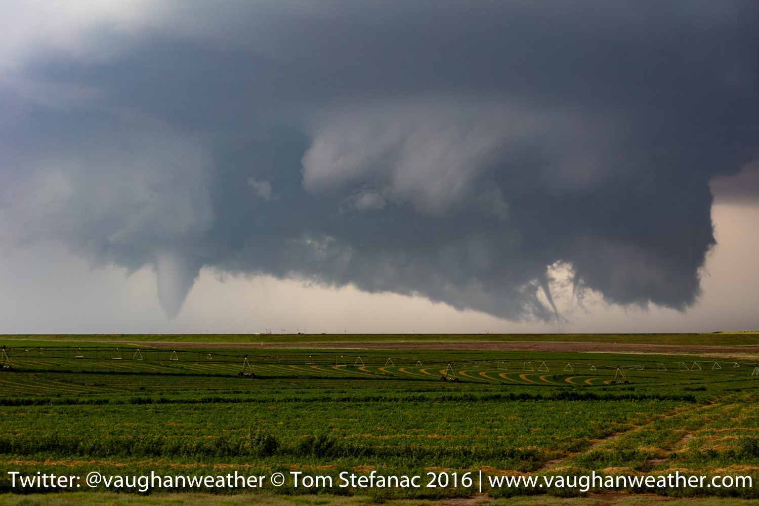
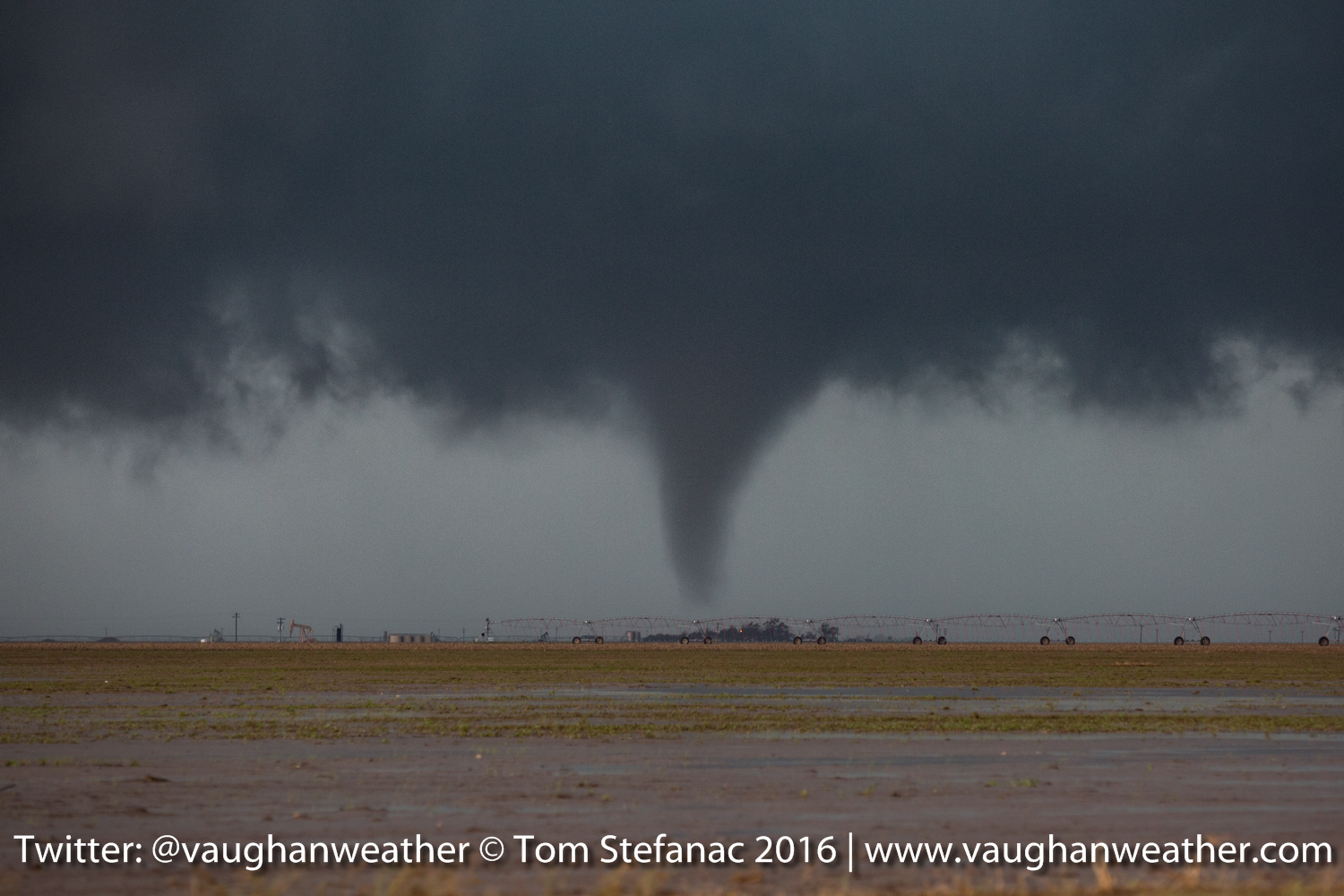
Three Tornadoes – Dodge City Kansas
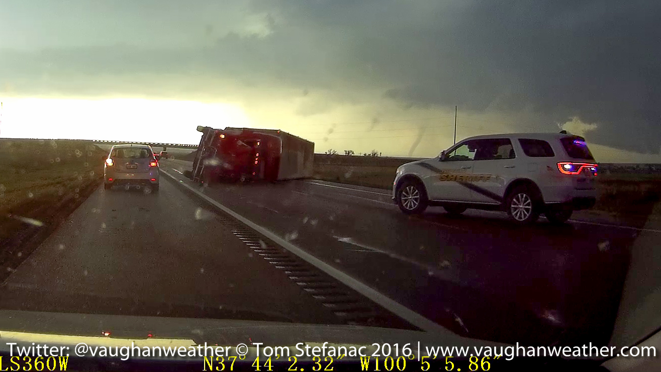
Truck Blown Over & Tornado – Dodge City Kansas
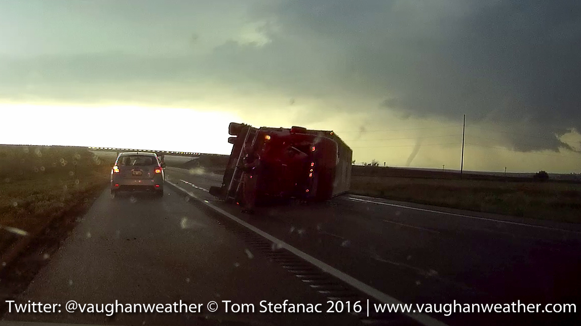
Truck Blown Over – Dodge City Kansas
The driver of the semi-truck was okay and thankfully there not too much damage to structures around the outer perimeter of the city. Of course a few places did take direct hits sadly.
May 24th 2016 – Pratt, Kansas
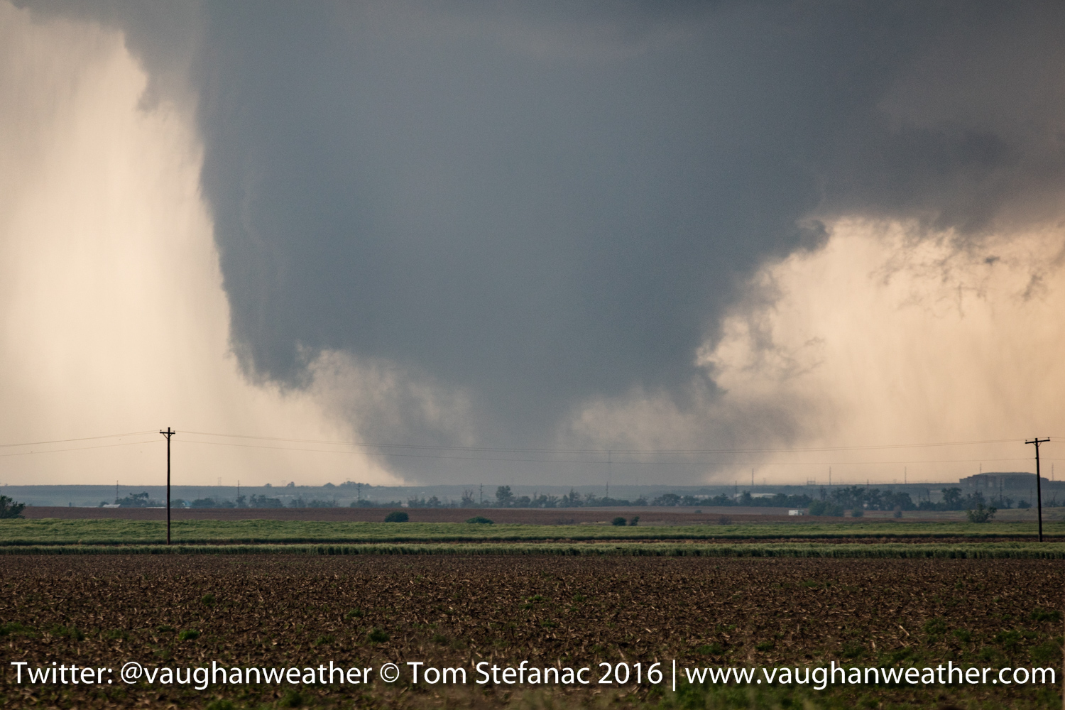
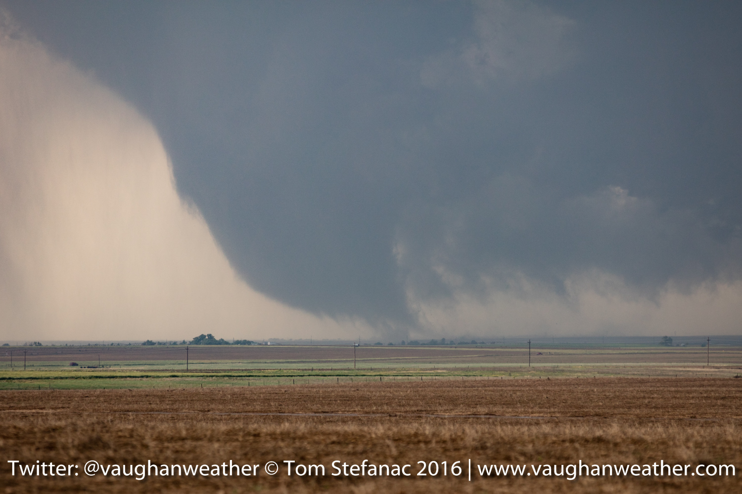
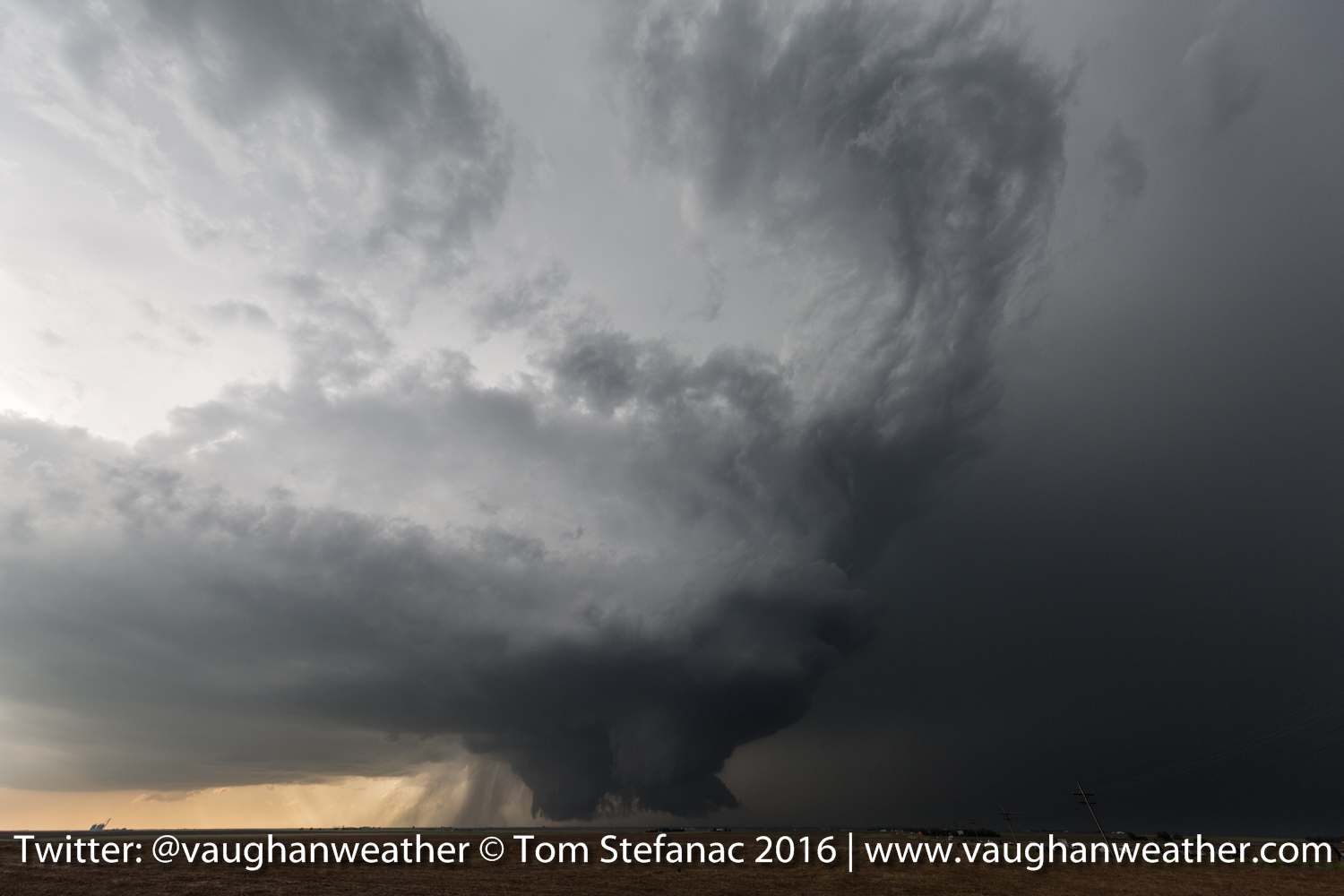
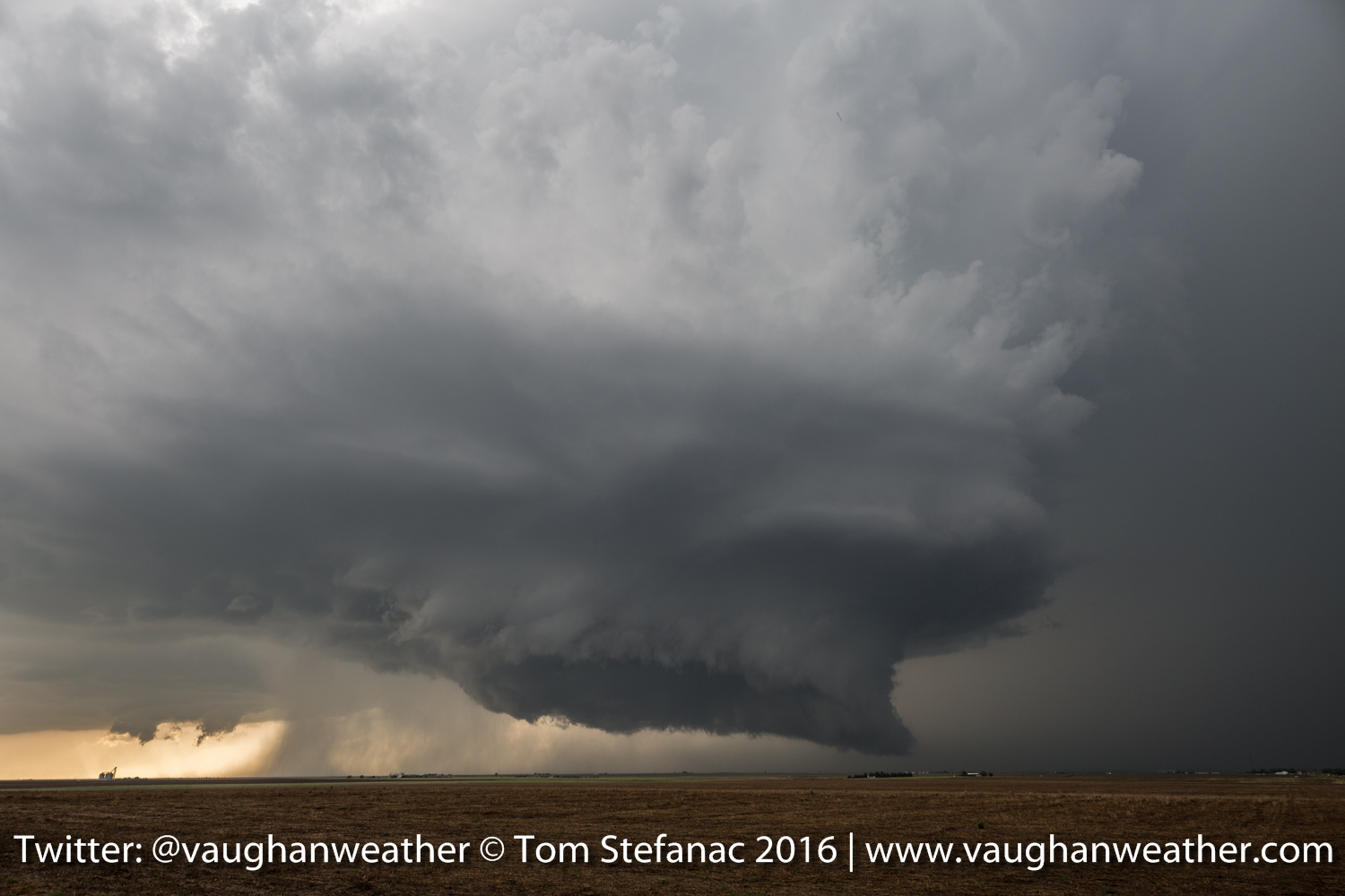
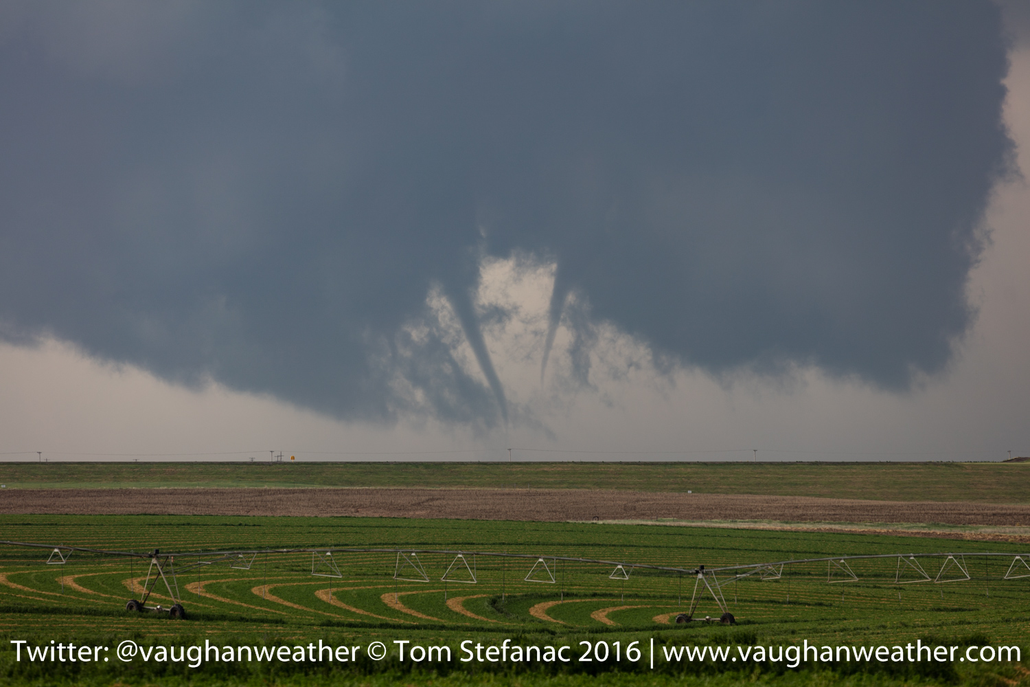
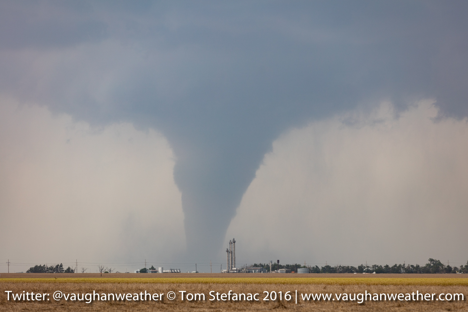
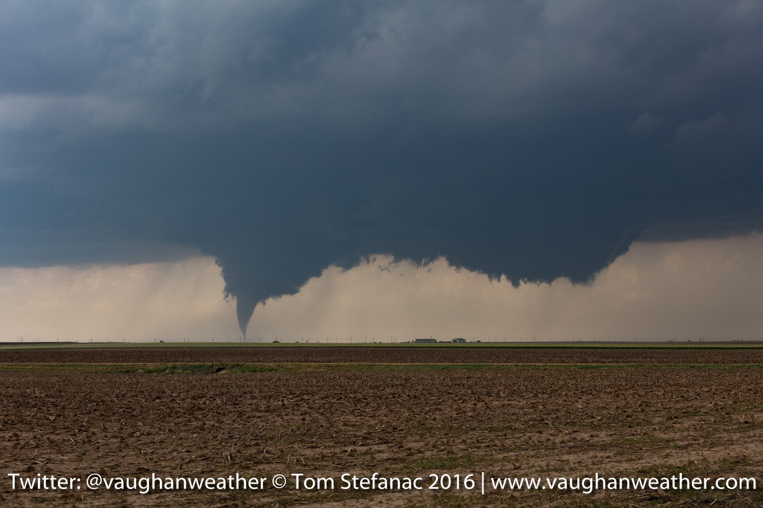
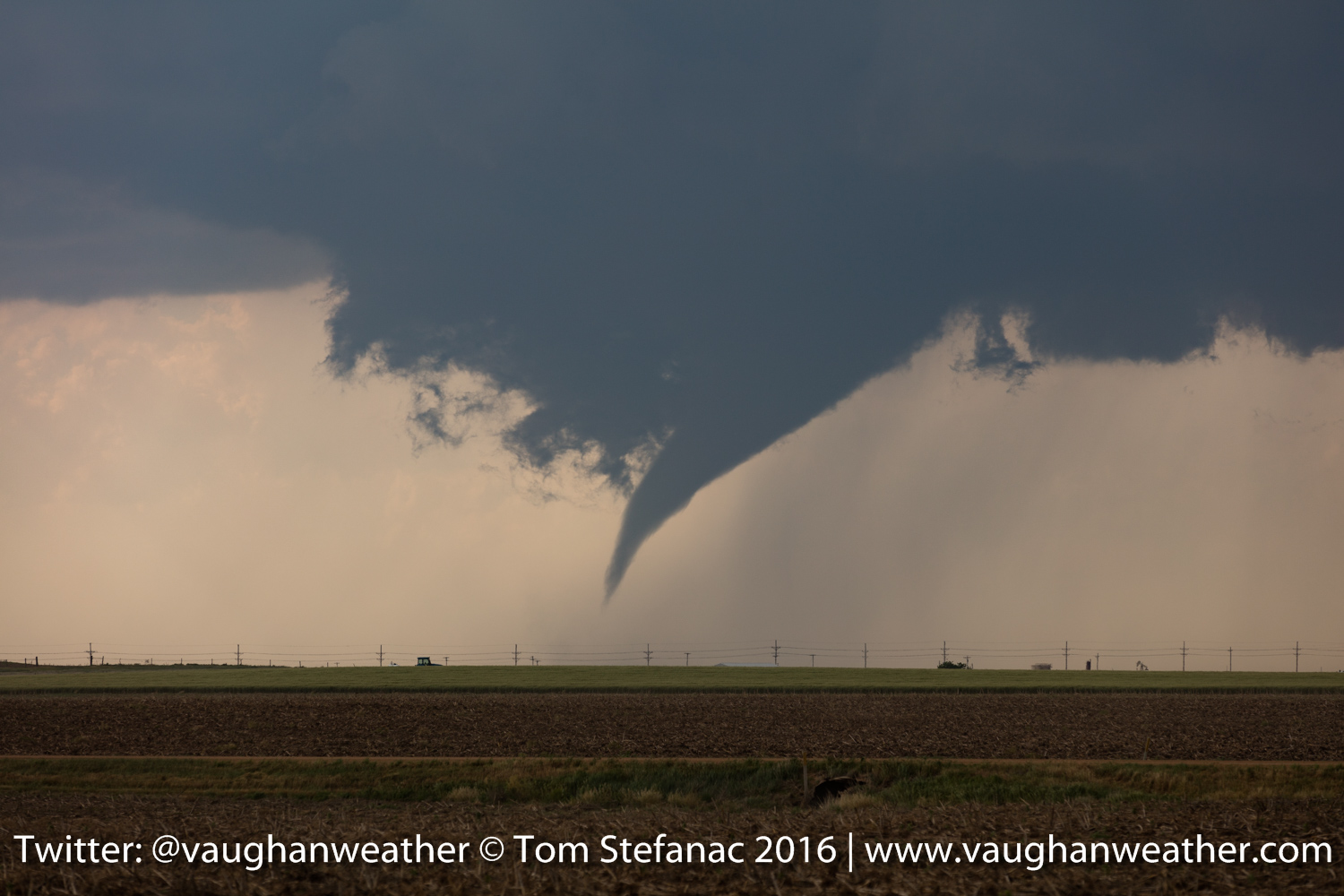
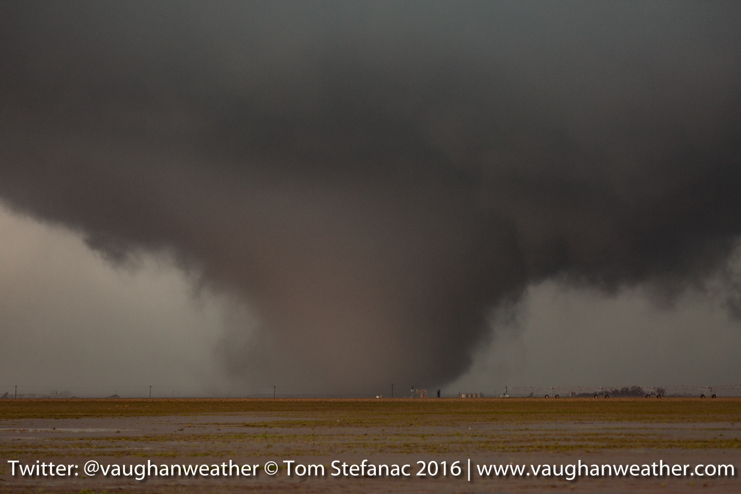
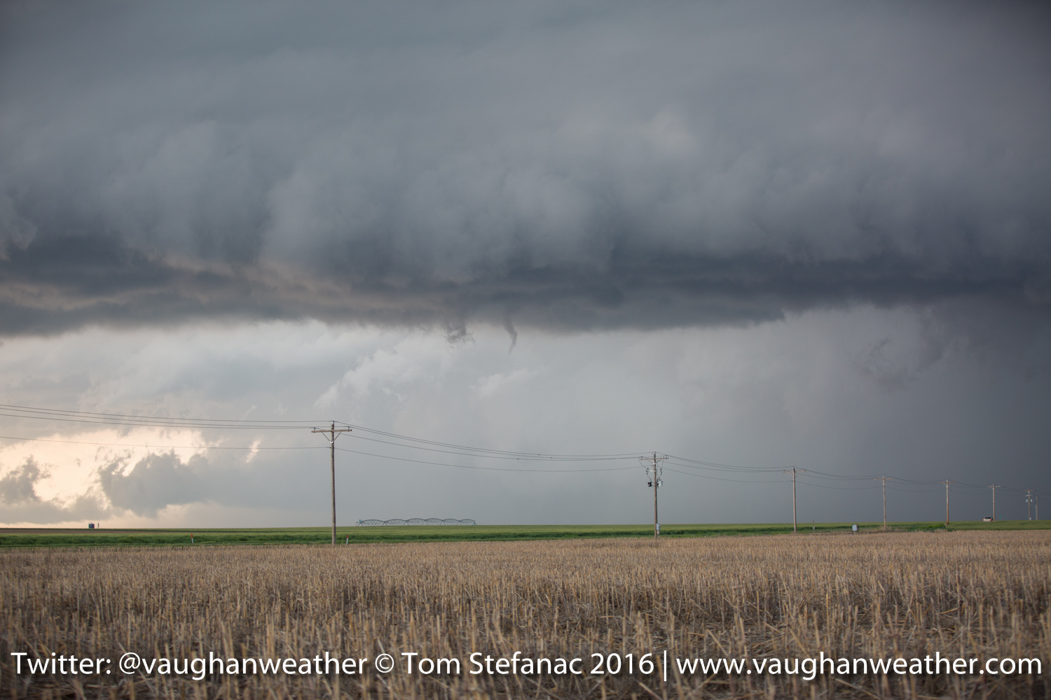
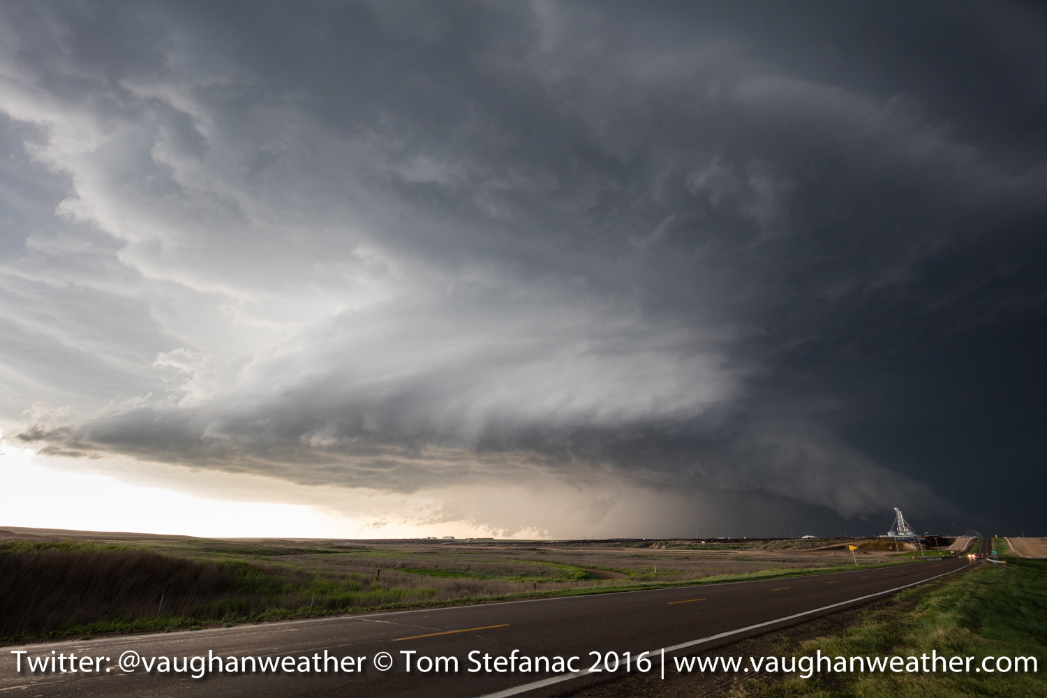
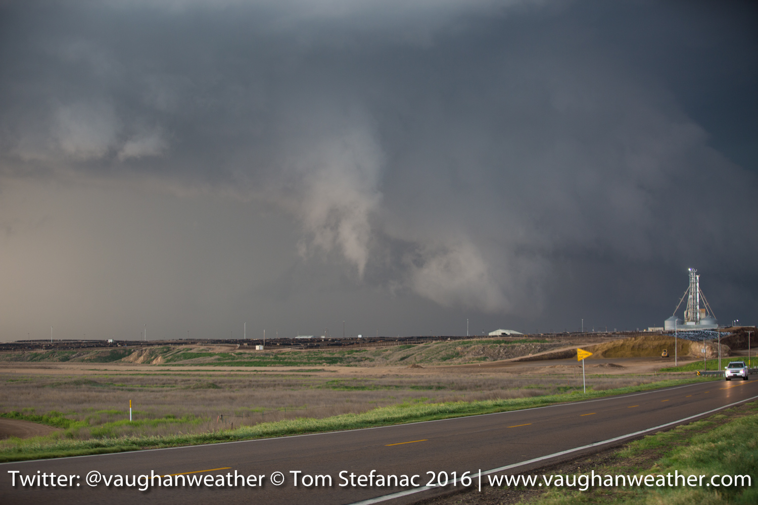
I don’t know where to begin, but this was probably the best chase day I’ve ever had. This morning I was fearful that Dodge City would possibly be in the path of a large tornado and it sure just barely dodged a bullet this afternoon!
It was a long day and I’ve lost count of how many tornadoes there were. The storm which spawned the tornadoes exploded in an area of incredible wind shear and some 40 minutes after initiation it produced its first tornado and then continued cycling & producing funnel after funnel.
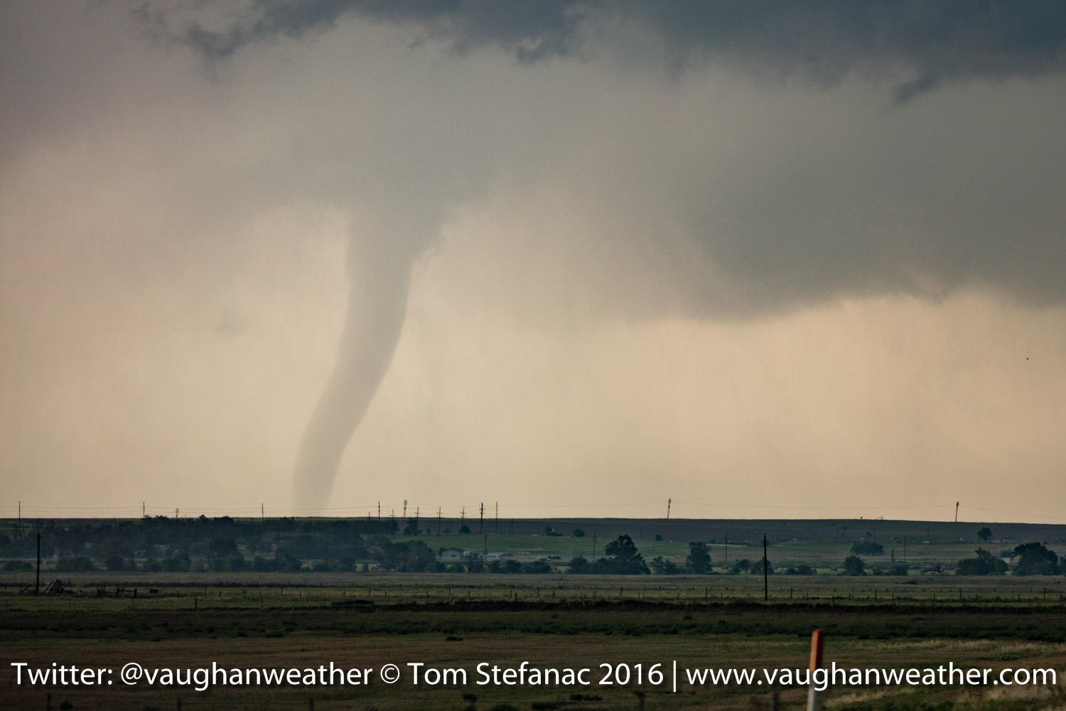
Kansas Tornado 9

Kansas Tornado 8
Kansas Tornado 7
Kansas Tornado 6
Kansas Storm & Wall Cloud
Kansas Wall Cloud

Kansas Tornado 5
Kansas Tornado 4
Kansas Tornado 3
Kansas Tornado 2
Kansas Tornado 1
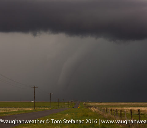
May 22nd 2016 – Canadian, Texas
How fitting that we;re spending the night in Canadian Texas! What a day! It was a long drive back to the Texas Panhandle from Colby Kansas and after a couple hours of frustration with the storms things finally paid off in spades! I had originally targeted Perryton TX after a very tough forecast call this morning. It was faced with either going north of falling back south and I decided the northern Panhandle was the best shot.
Cone Tornado – Olchitree County Texas
After arriving in Perryton the storm I was targeting was knocked around and beat up by a number of other cells. The road network also gave me some grief since it did not give me a safe viable means to get into the right part of the storm without getting cored. Finally I took the long way around and ended up right in hook of the storm as the higher sheer values from the west migrated through and kicked the storm into high gear! It became a cyclic HP tornado producer quickly.
Large Tornado – Olchitree County Texas
We were in the right spot just as it produced this rather large tornado and several smaller tornadoes!
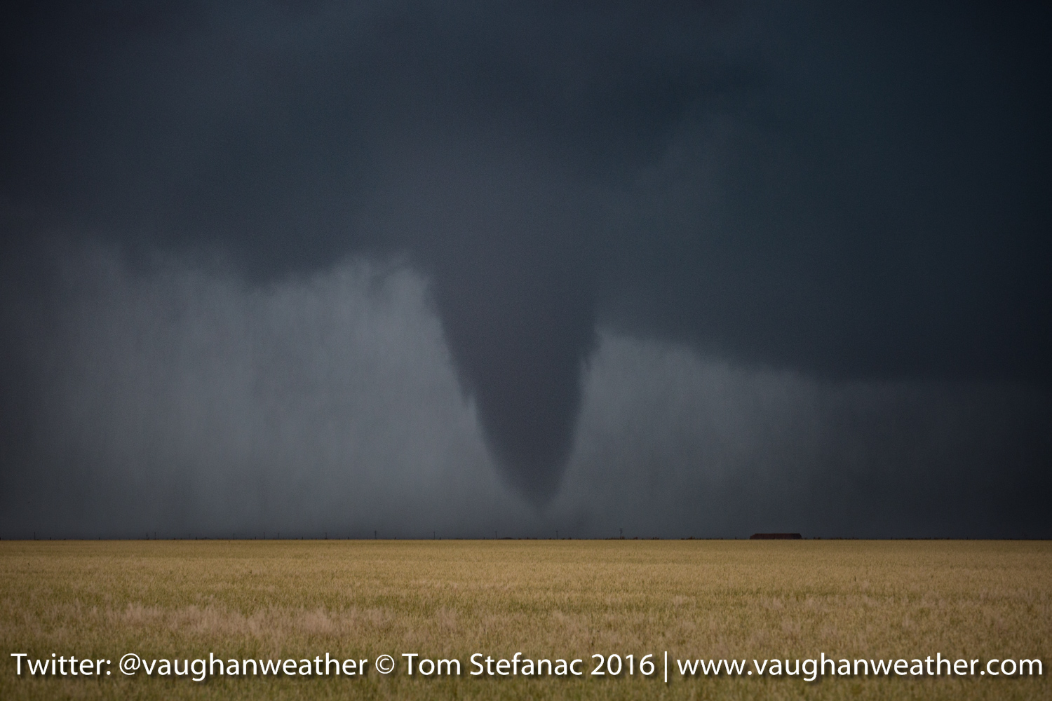
Moderate Cone Tornado – Olchitree County Texas
Can’t say much more other than it was a chase day that totally panned out after a fair bit of aggravation!
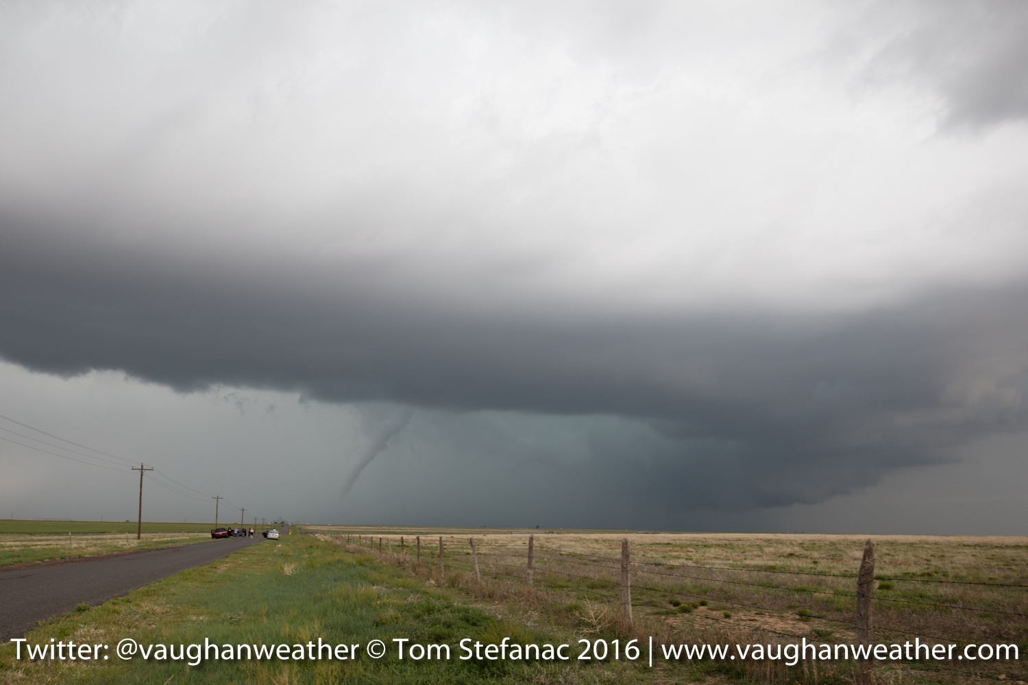
May 21st 2016 – Colby, Kansas
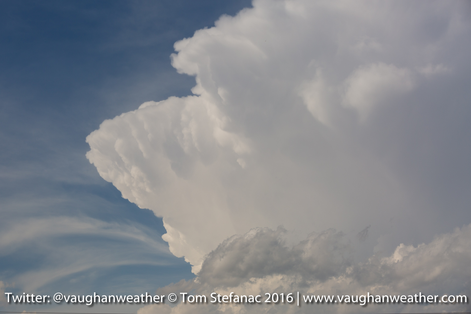
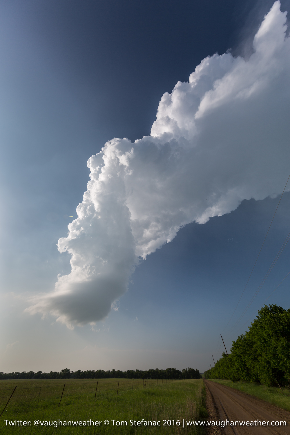
Thunderstorm Anvil – Kansas
We hit the road bright and early ready to drive the 450 kilometers from Amarillo to Lakin which was my forecast target. It was sure a rush to wait ordeal! Finally, at around 4:30PM the dryline inching west from Colorado began to push up storms in Kansas.
Skinny Funnel Cloud – Logan County Kansas
The storm of the day was actually only 20 miles from my target and the very next town north of Lakin known as Leoti. The supercell did produce a brief tornado and many smaller rope funnel clouds such as the one above.
Supercell Thunderstorm – Logan County Kansas
The storm eventually became a beautifully sculpted supercell, except it was barely moving, the forward motion was something like 2 miles per hour if that. Good for chasing, bad for tornadoes since it was just building a gigantic outflow pool underneath.
Ragged Funnel – Logan County Kansas
Here’s another ragged funnel that was produced but never amounted to anything.

Sculpted Supercell – Leoti KS
As the evening continuing the wind shear profiles in the atmosphere became more pronounced and the storm took on a beautifully sculpted structure!
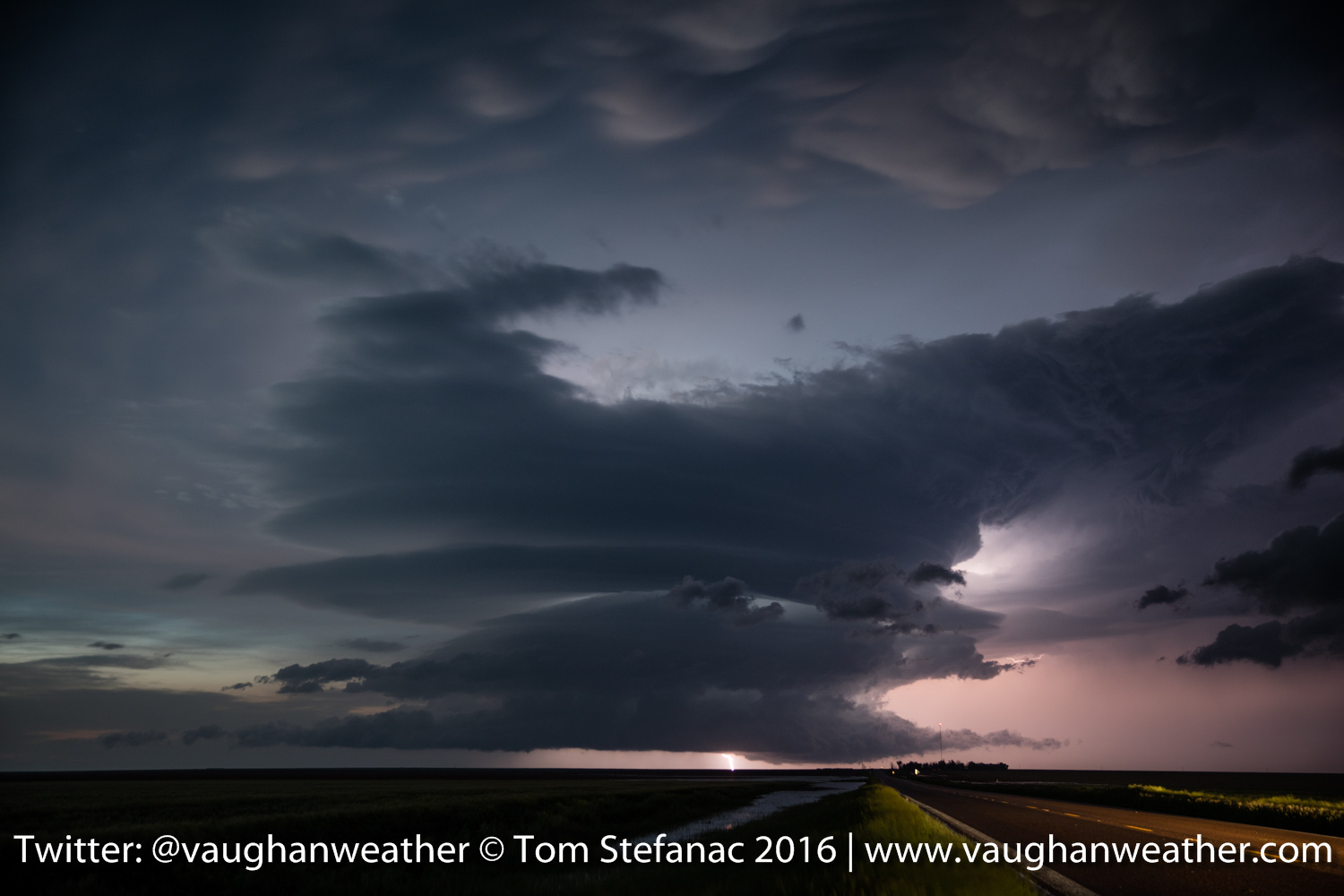
Supercell Lightning -Russel Springs Kansas
As even turned to dusk, I focused on getting as many lightning photos as I could! A new storm exploded to the north near Russel Springs and provided a wonderful light show.
Supercell Lightning & Flash Flooding
I only ran into one little hiccup. While taking these lightning photos, the bridge behind me wash out and the road in front of me flooded! I had to wait a little while for the water to finally recede but it did and we spent the night in Colby Kansas.
May 20th 2016 – Amarillo, Texas
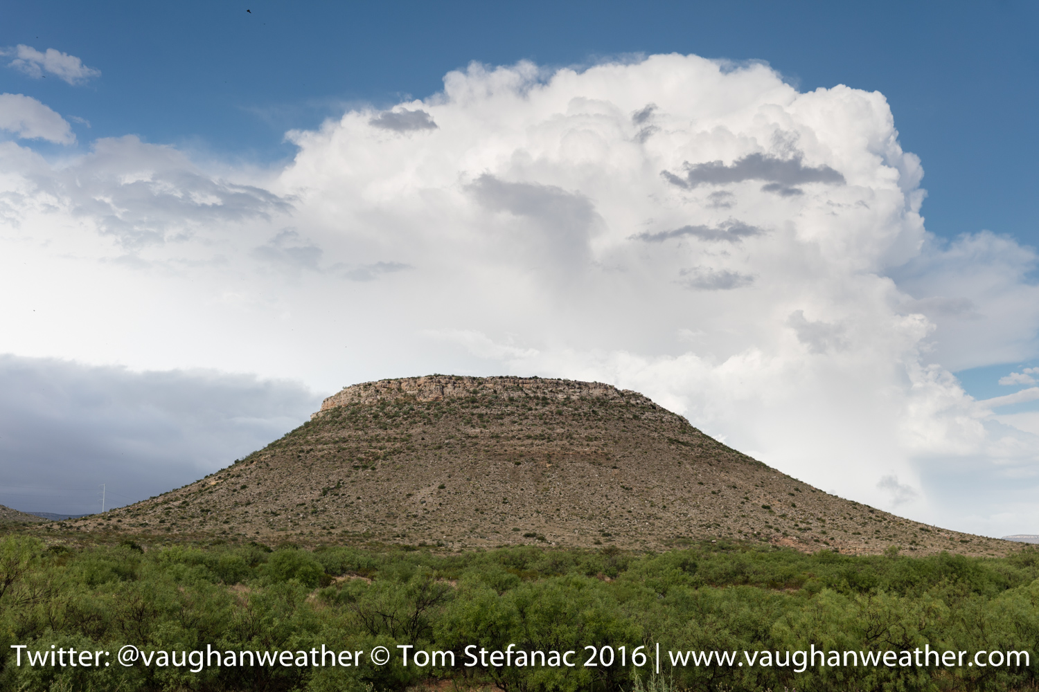
As we were leaving Tucumcari we stopped to look at this hill. I was thinking about venturing a drive to the top but then realized with 4×4 it was not a good idea!

Mountain near Tucumcari NM
We continued on our way east to Amarillo Texas and stopped at the cadillac ranch!
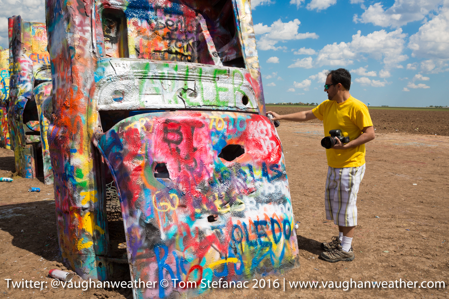
Painting At The Cadillac Ranch
I tried my hand at some very bad painting!

Cadillac Ranch
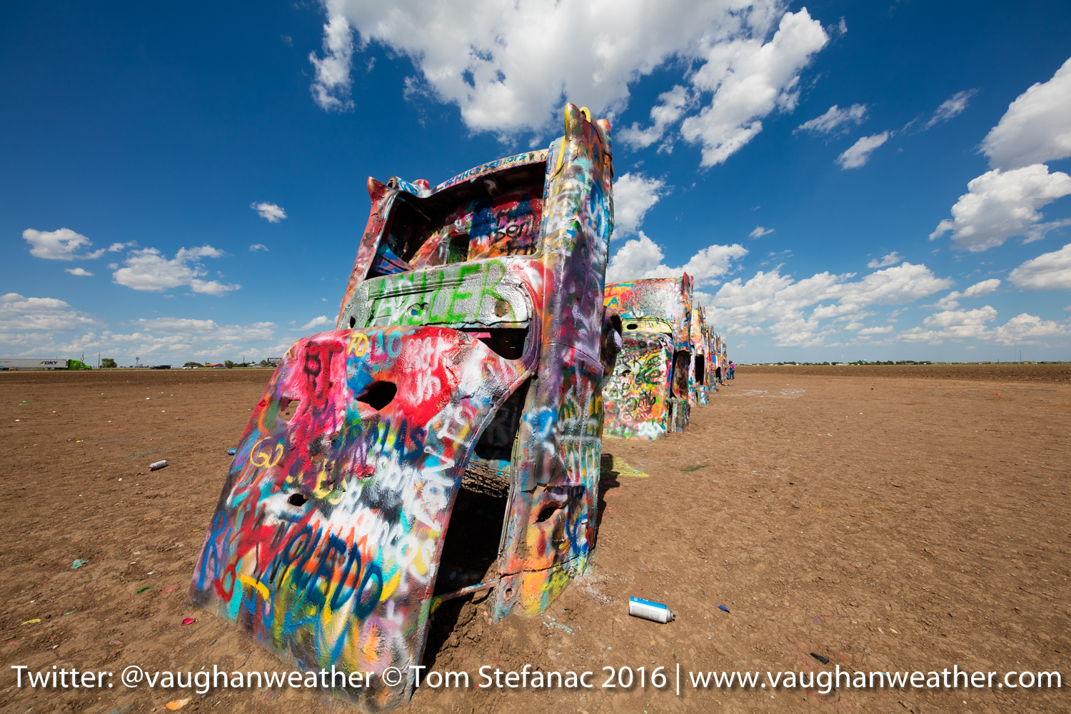
Line of buried Cadillacs

Jen and myself at the ranch
After the ranch we checked into the Days Inn and then headed over to the Big Texas for some steak! I’ll post those photos later!!!
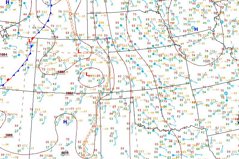
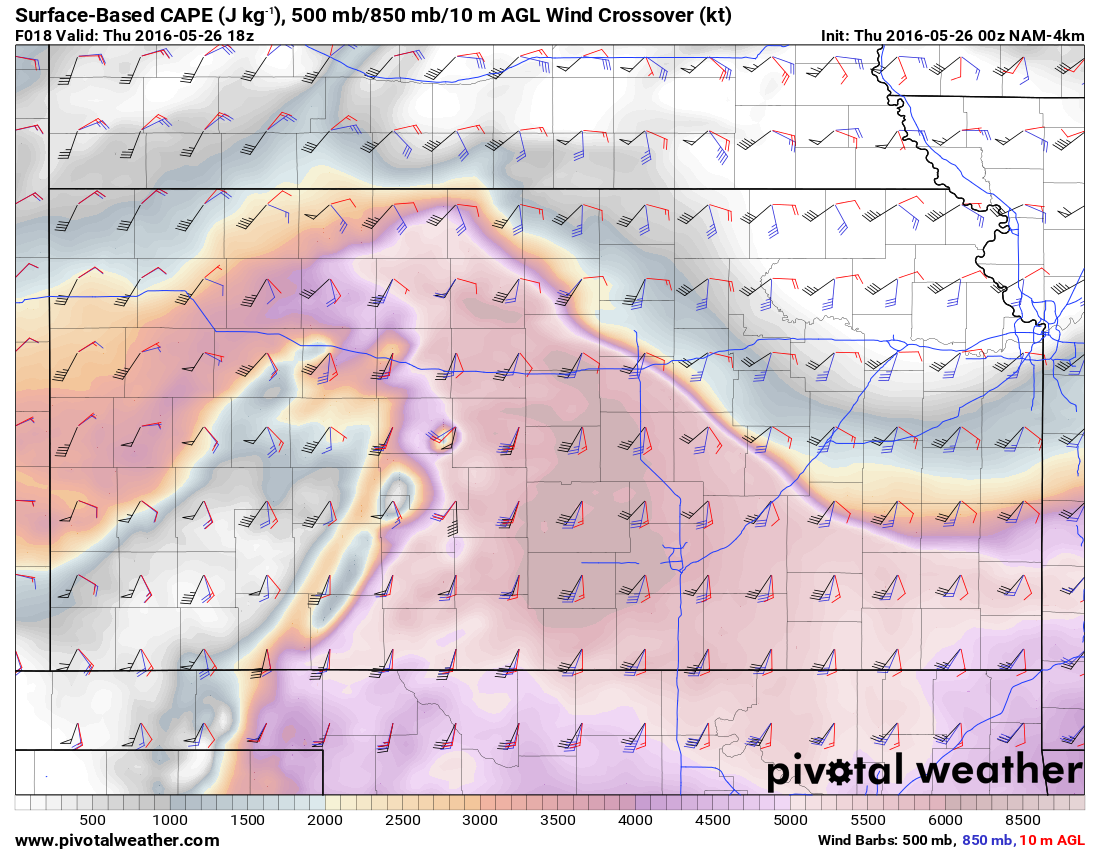
Looking ahead to tomorrow it looks like a potentially serious day across extreme western Kansas. There is incredible run to run consistency between the WRF-NAM and the SREF. Both sets of models continue to show a very high risk for a single discrete storm on a moisture axis with strong forcing and an impinging dryline.

WRF-NAM 00Z Echo Tops
If everything the NAM is showing turns out to be true, it will be a hell of storm in Kanses. Right now SIG TOR and Supercell composite indices are off the chart, the environmentals are just insane. Tomorrow it’s going to be an early morning, lot’s of analysis and 3-4 hours of driving.
May 20th 2016 – Tucumcari, New Mexico
Today looks like the last down day, moisture returns to the high plains Saturday morning and by late afternoon there should be storms, some of which may become supercells along the developing dryline that will surge east out of New Mexico.
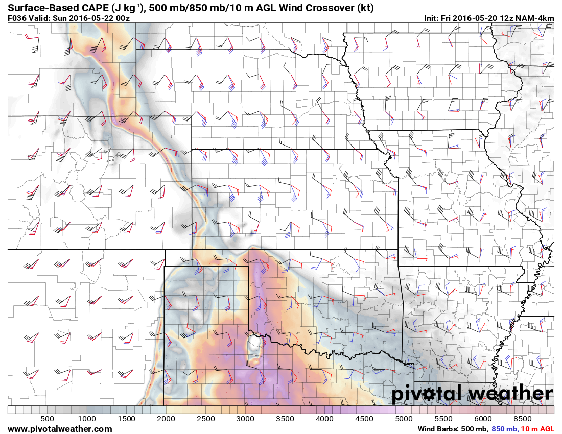
CAPE 850/500 Crossover
The best shear as forecast is expected to be towards the northern periphery of the moisture nose. Unfortunately the dryline runs the risk of undercutting whatever storms form there and then there is the issue of available energy which is quite small in Kansas compared to the Texas Panhandle and Oklahoma.
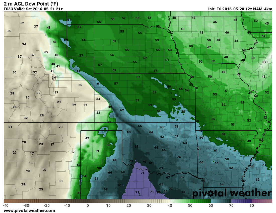
Two Meter Moisture
Here’s another example showing the available moisture in the 2 meter dewpoints. The moisture is more spread out in Texas\Western Oklahoma but rapidly falls-off beyond the moist axis in western Kansas. This means whatever storms do form in Kansas might run into moisture issues, especially if they’re able to get out ahead of the dryline. While any storms ahead of the dryline further south will be running into much better moisture fields and likely hold on longer. The other thing is that expected LCL’s will be lower and more conducive to tornadoes in Oklahoma. However the issue is that the best shear is currently forecast to remain in Kansas so it really is a catch-22 at the moment.
May 19th 2016 – Tucumcari, New Mexico
What do you do when there are no storms???!!!! You visit all the tourist attractions!!! Since we’re in New Mexico and not too far from Roswell it was only right to go alien hunting and visit the infamous town known for the 1947 alleged UFO crash incident.

Welcome to Roswell
I wont lie, I’m not a big believer in the conspiracy theories and I have serious doubts about the validity of the whole incident but it’s still fun to visit.

Roswell Welcome Banner
Wandering around inside the museum I was greeted by 4 alien and had to call some friends to tell them!
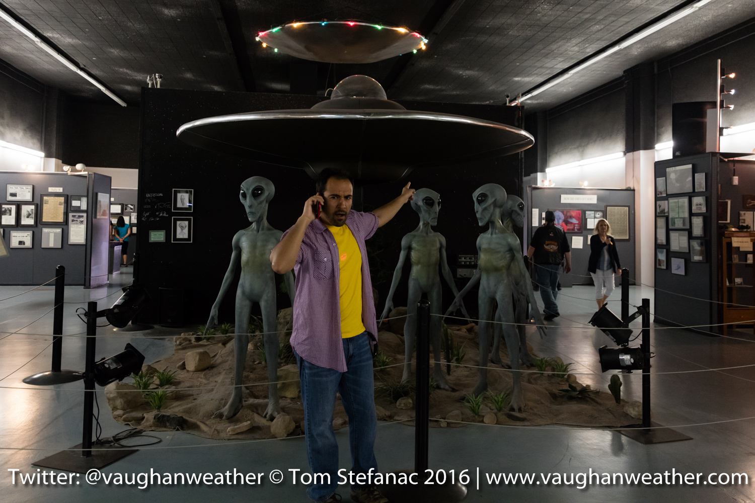
Look aliens!
I would have loved to have visited the Trinity Test Site (first nuclear detonation) but it was some 280 kilometers off course and truth be told there is not much to see. They actually allow you into the blast area a few times a year and I was not sure if I would be allowed in. If not, it would be a distant look at an empty plain which has been long overgrown by shrubs. Apparently, for those who have been at ground zero, there is still plenty of radioactive glass from the melted sand and other neat effects that remain visible in the environment.
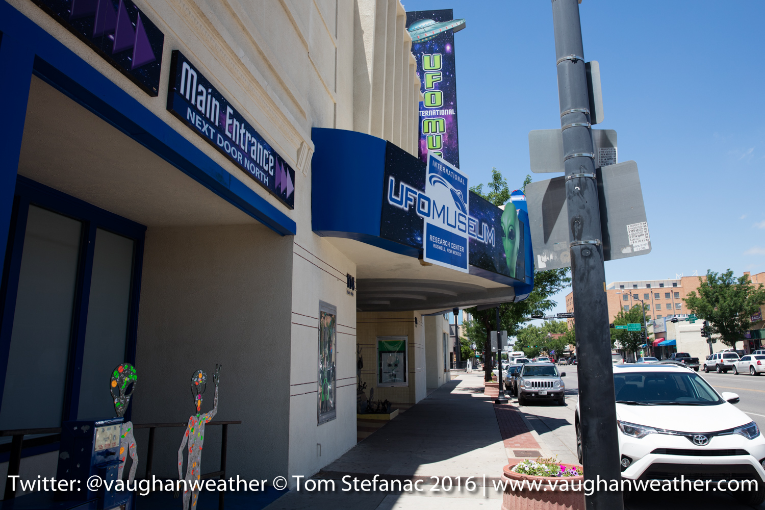
Roswell Museum
May 18th 2016 – Carlsbad, New Mexico
We spent much of the day driving and took our time leaving Texas and ugh… finding an oil filter (long story there).
I attempted to intercept a couple storms that rolled off the high elevation Sierra Madre Oriental mountains in Mexico near the Texas border but there was virtually no boundary layer moisture in the lower elevation land east of the Rio Grande. So whatever storms did form could only survive a short distance before they became only orphan anvils. We decided to head to Carlsbad New Mexico for the night so we can visit Roswell and do some UFO stuff before heading north towards Colorado.
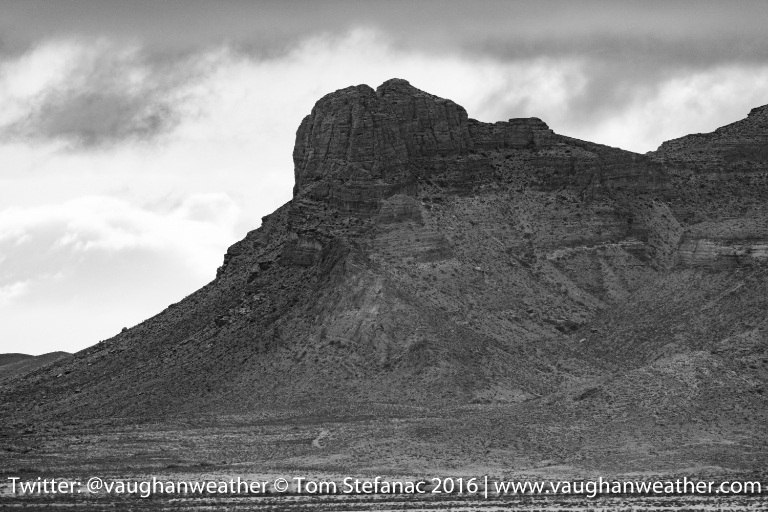
Van Horn Mountains, TX
This part of extreme western Texas I hadn’t really visited before so it was very new and I found the geography of the landscape with plateaus, flat top mountains and high elevation deserts very fascinating. We stopped all along the way to Carlsbad to take pictures.
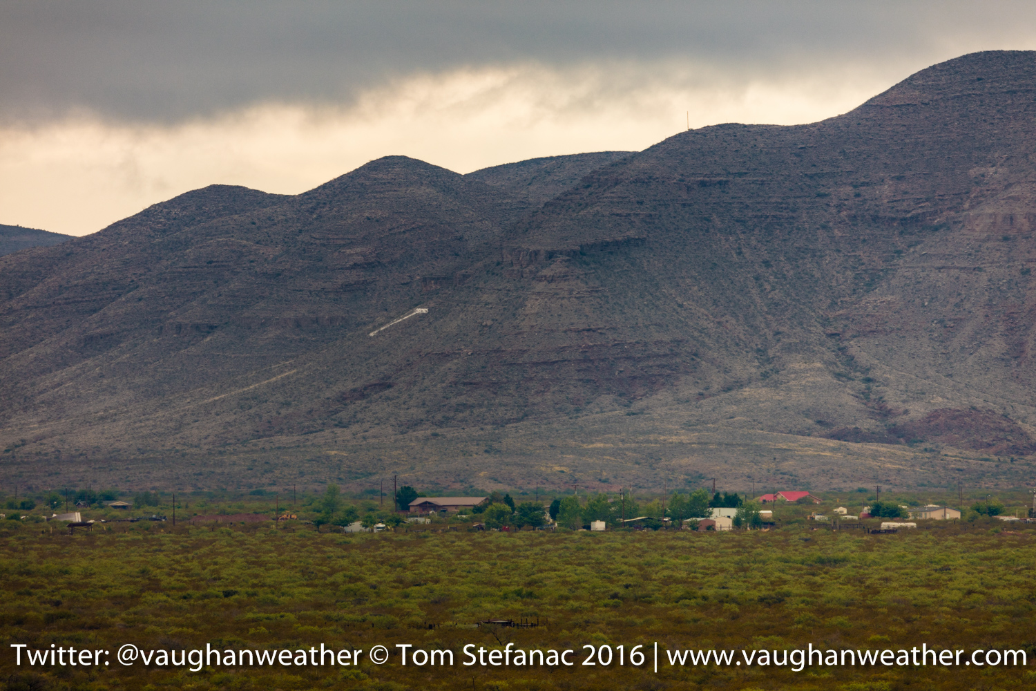
Mountains near Van Horn, TX
The ranches in this area are also huge rivaling New Mexico and Wyoming in sheer size!
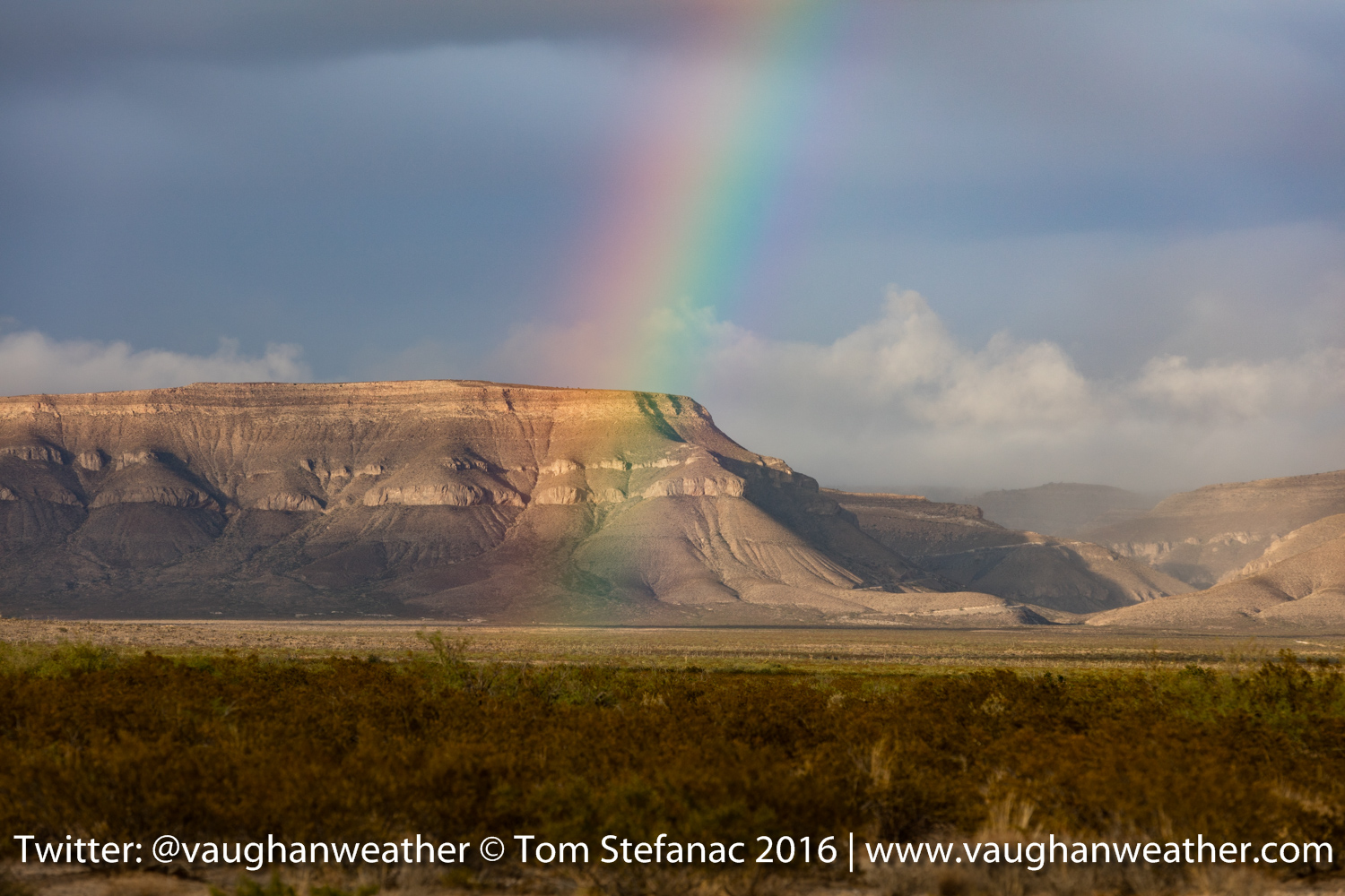
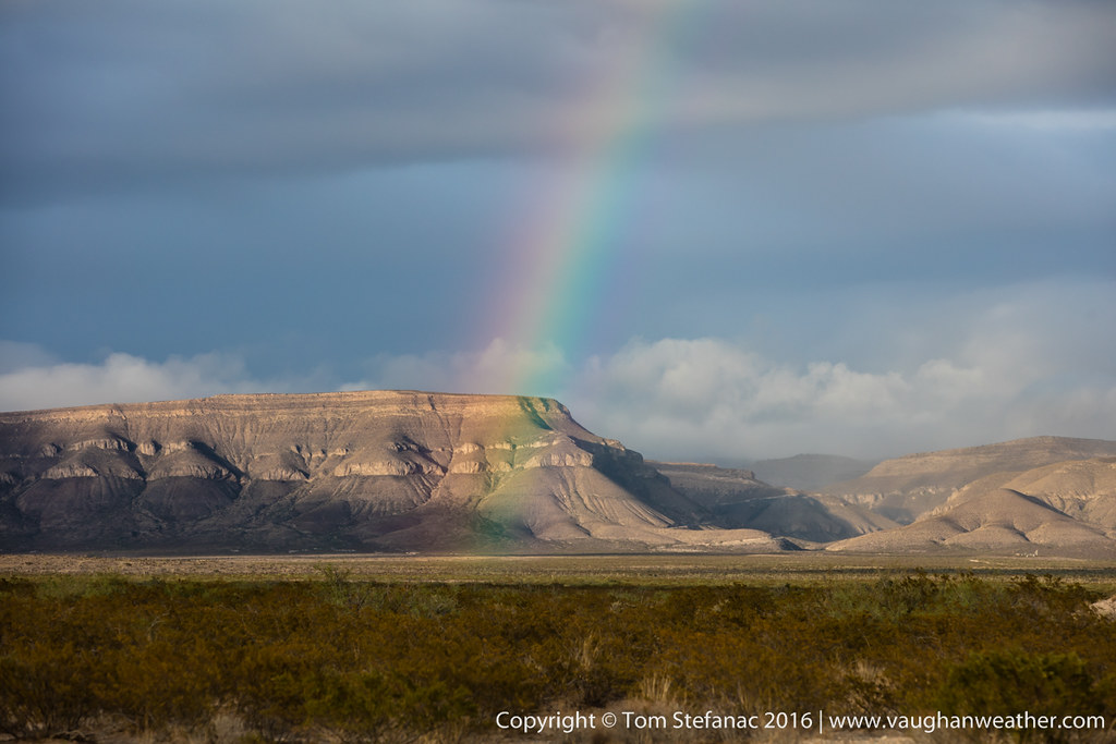
Rainbow somewhere in Culberson County, TX
We were also treated to a rainbow and an orphan anvil / remnant storm passing over Guadalupe Peak near Pine Springs.
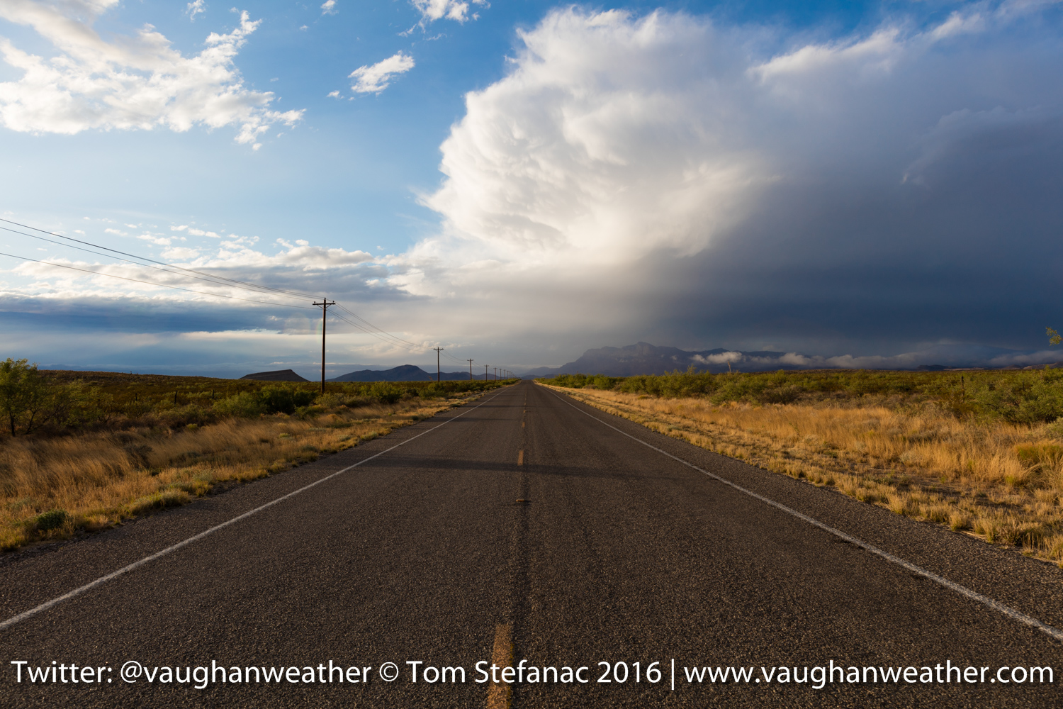
Guadalupe Peak, Texas
Perhaps the coolest thing of the entire day was the rolling cloud bank from the saturated airmass as the storm rolled over head of Pine Springs.
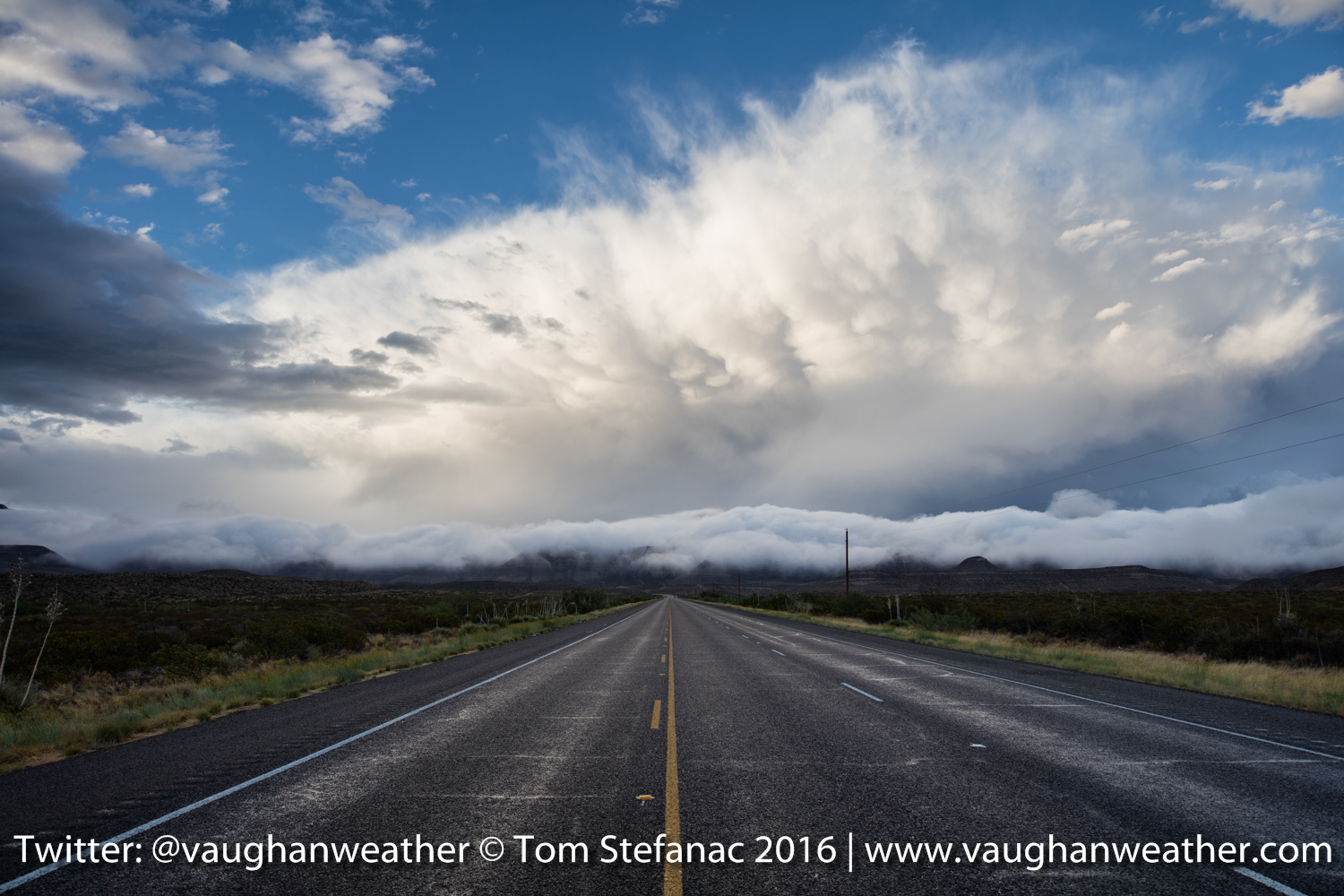
Rolling cloud bank near Pine Springs, TX
May 17th 2016 – Sonora, Texas (evening)
Long day, lot’s of storms, no tornadoes thank to a major lack of upper dynamics but some pretty supercells.

Mammatus clouds in Sonora Texas
Supercell behind a flattop rock in McCamey, Texas
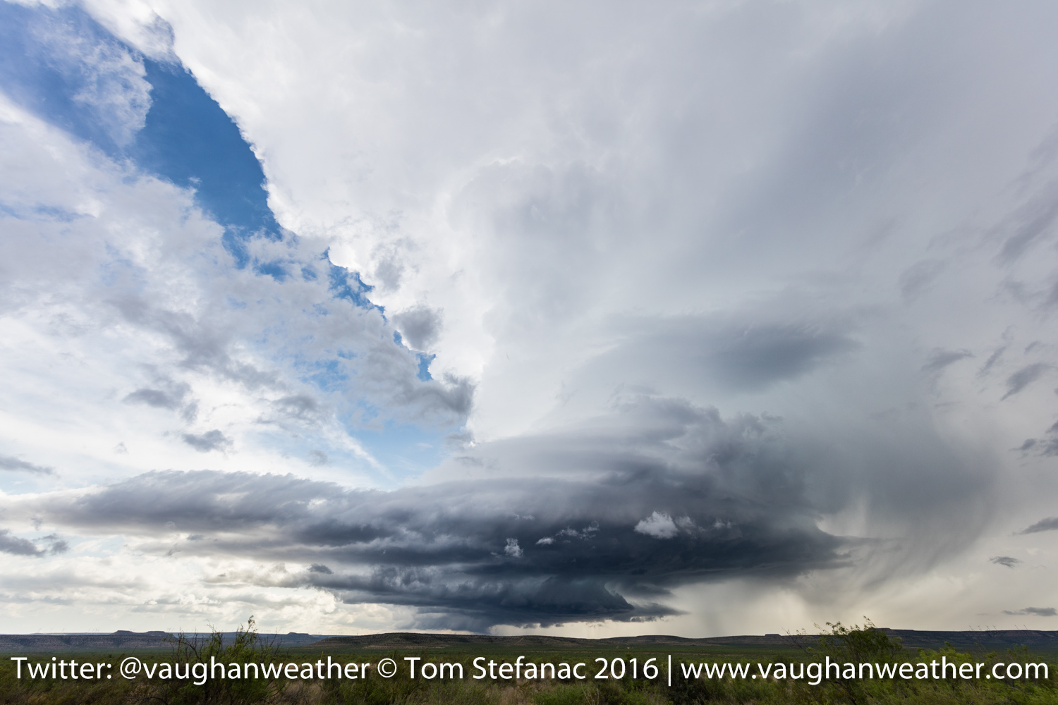
Beautiful supercell near McCamey Texas
May 17th 2016 – Amarillo, Texas
Brrrr, it is freezing here in the Texas Panhandle! Looks like we have a 4 1/2 hour drive south to escape the cold pool, and remnant outflow from yesterdays convection here in Amarillo.

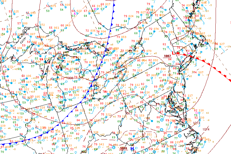
Current surface analysis 10Z
So the target today is going to be somewhere around San Angelo, the cold front should slow down and the regressing outflow boundary will eventually be overtaken. There is enough shear for a tornado or two.
HRRR 21Z
May 16th 2016 – Amarillo, Texas
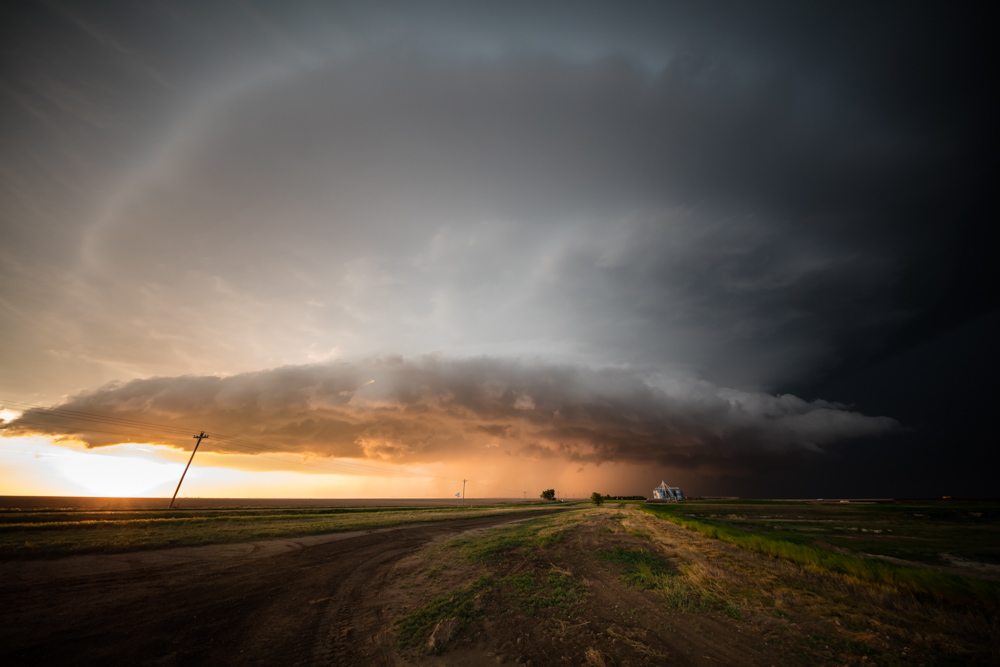
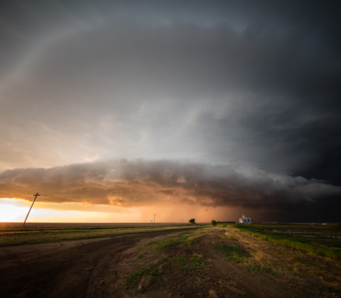
What a day! Ended up on a supercell near Felt Oklahoma which is basically a stones throw from New Mexico and Texas. The storm produced a beautiful stovepipe tornado on the back side!
Felt Oklahoma Tornado
The tornado lasted about 10-15 minutes before roping out! It was amazing to watch the tornado come out of the rain into good visibility. I can’t complain, Oklahoma is a state that always has and continues to produce funnels for me.

Felt Oklahoma Rope Tornado
Felt Oklahoma Tornado & Parent Storm
After the tornado, we intercepted a second growing supercell to the west which produced a funnel cloud near Perico Texas. The storm was spinning and really wrapping up but outflow from the storm which produced the earlier Felt tornado proved just too much to overcome.

Perico Texas funnel cloud

Perico Funnel Cloud
We intercepted several more storms and we’re treated to some large hail and a wonderful light show in the evening! Great first day of action!
Masterson TX Supercell

Moore County TX Storm

Big Hail South of Masterson TX
Big Hail South of Masterson TX 2
Potter County Lightning 1
Potter County Lightning 2
We’re now calling in a night in Amarillo.
May 16th 2016 – Elk City, Oklahoma (morning)
Quick morning analysis reveals a complicated setup, looks like the dryline is still questionable and convection from the NW may overrun closer the triple point. The current target is halfway between Elk City and Amarillo to keep a north, west and southern route open.
May 15th 2016 – Elk City, Oklahoma
Well after a long drive we’re ready and in position for the first severe weather episode. We’re spending the night in Elk City Oklahoma in anticipation of possible dryline supercell storms Monday afternoon.
I’ve uploaded this brief video discussing the potential setup.
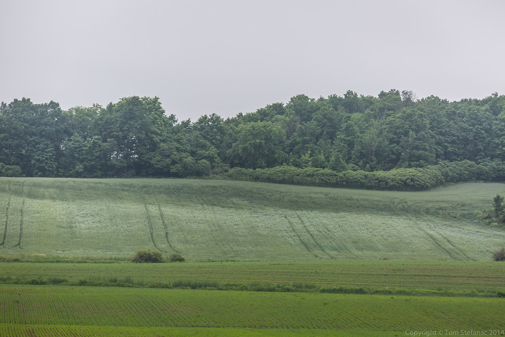
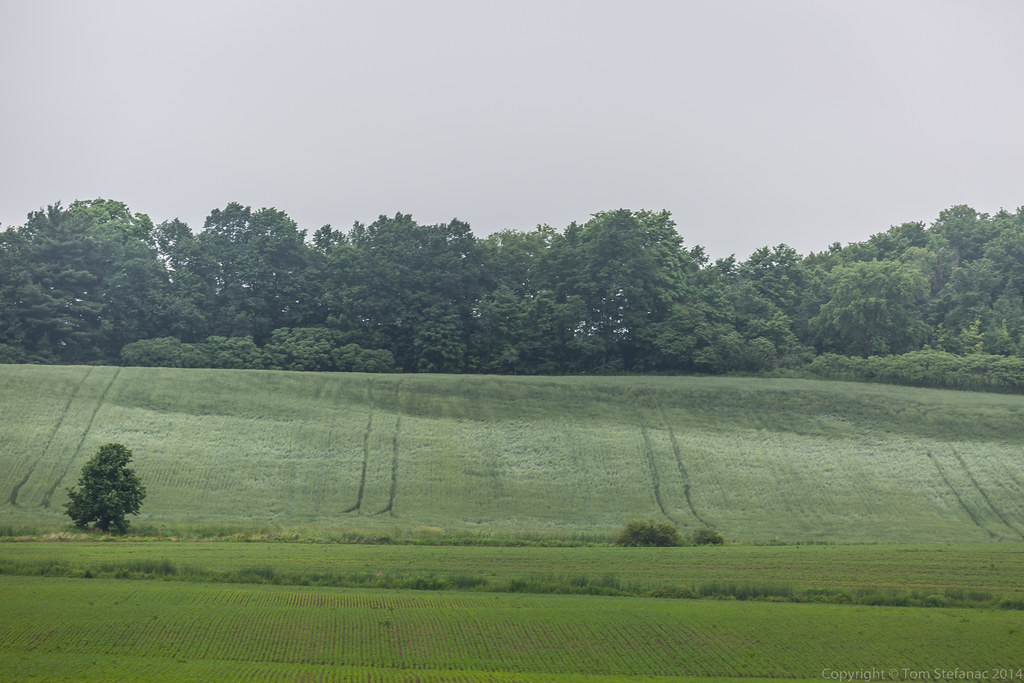
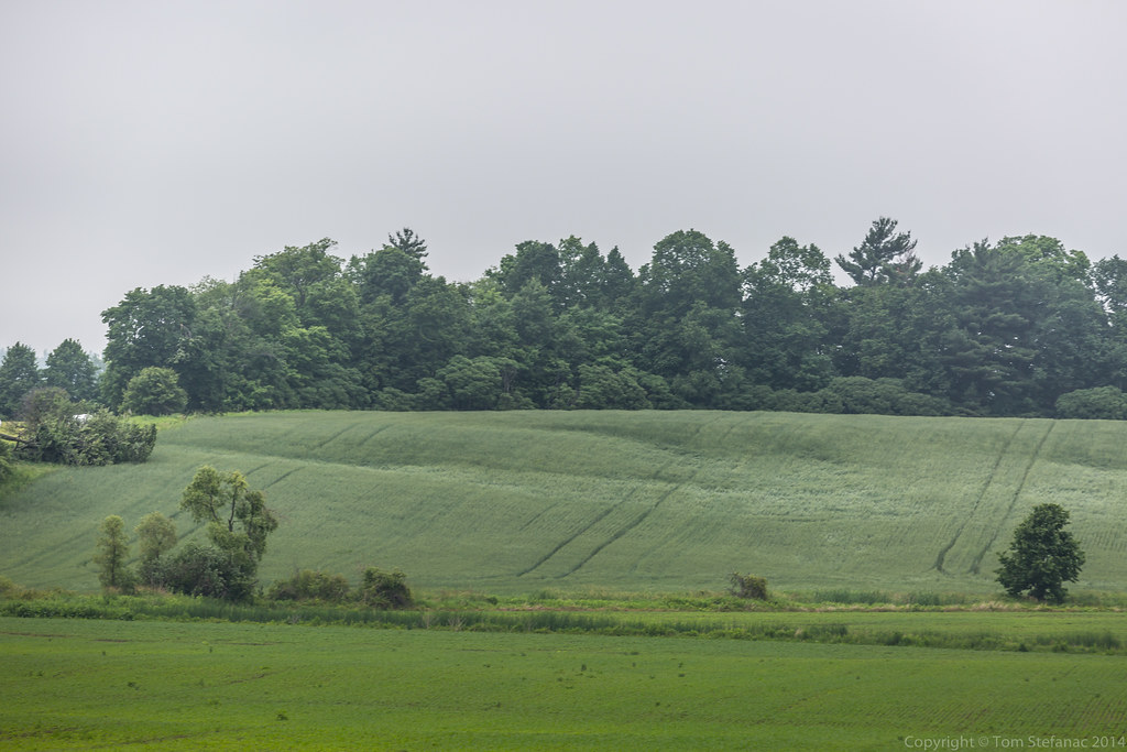
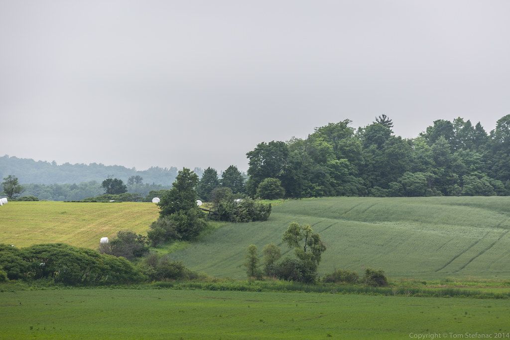
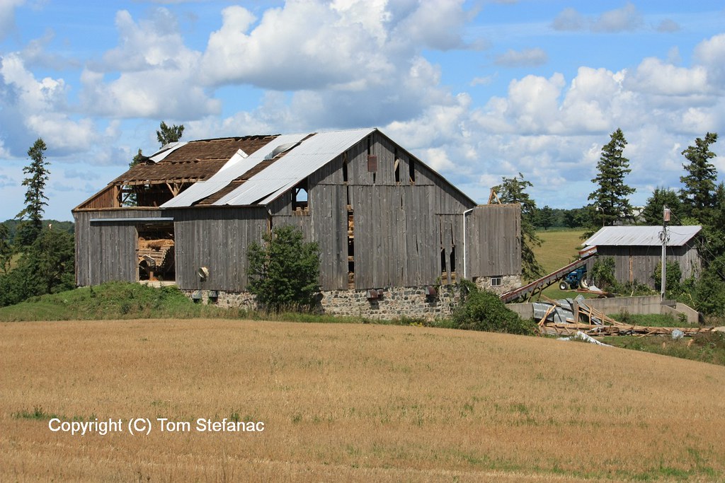
Outside of storms I also took a few moments to capture some of the neat geography found in Western Oklahoma
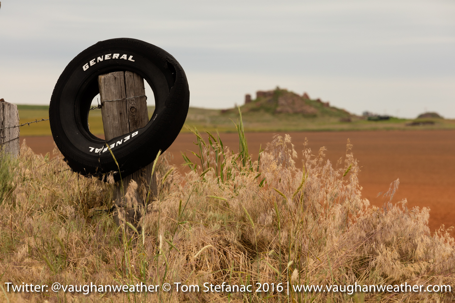
Caddo County Farm
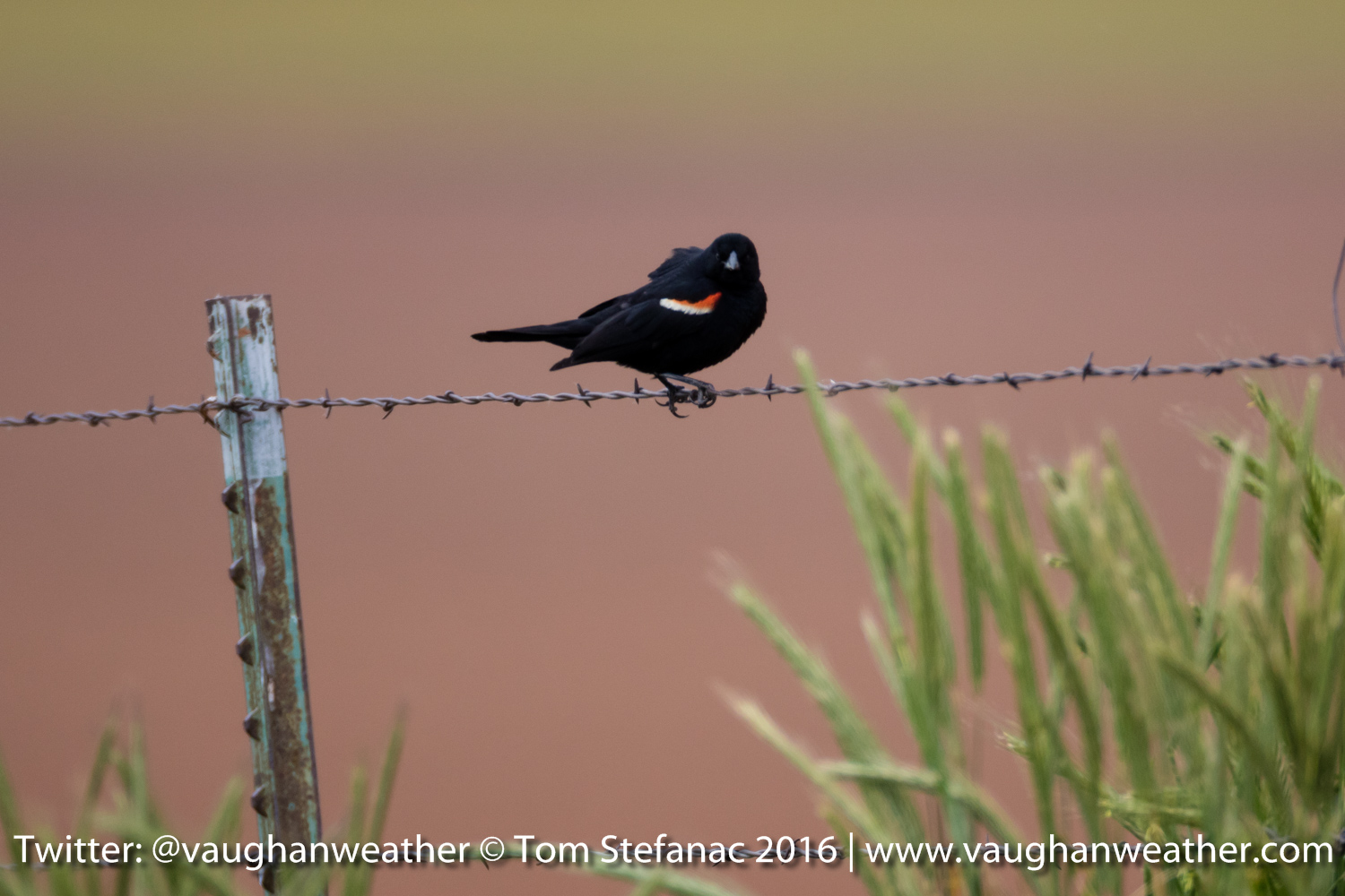
Bird on a wire
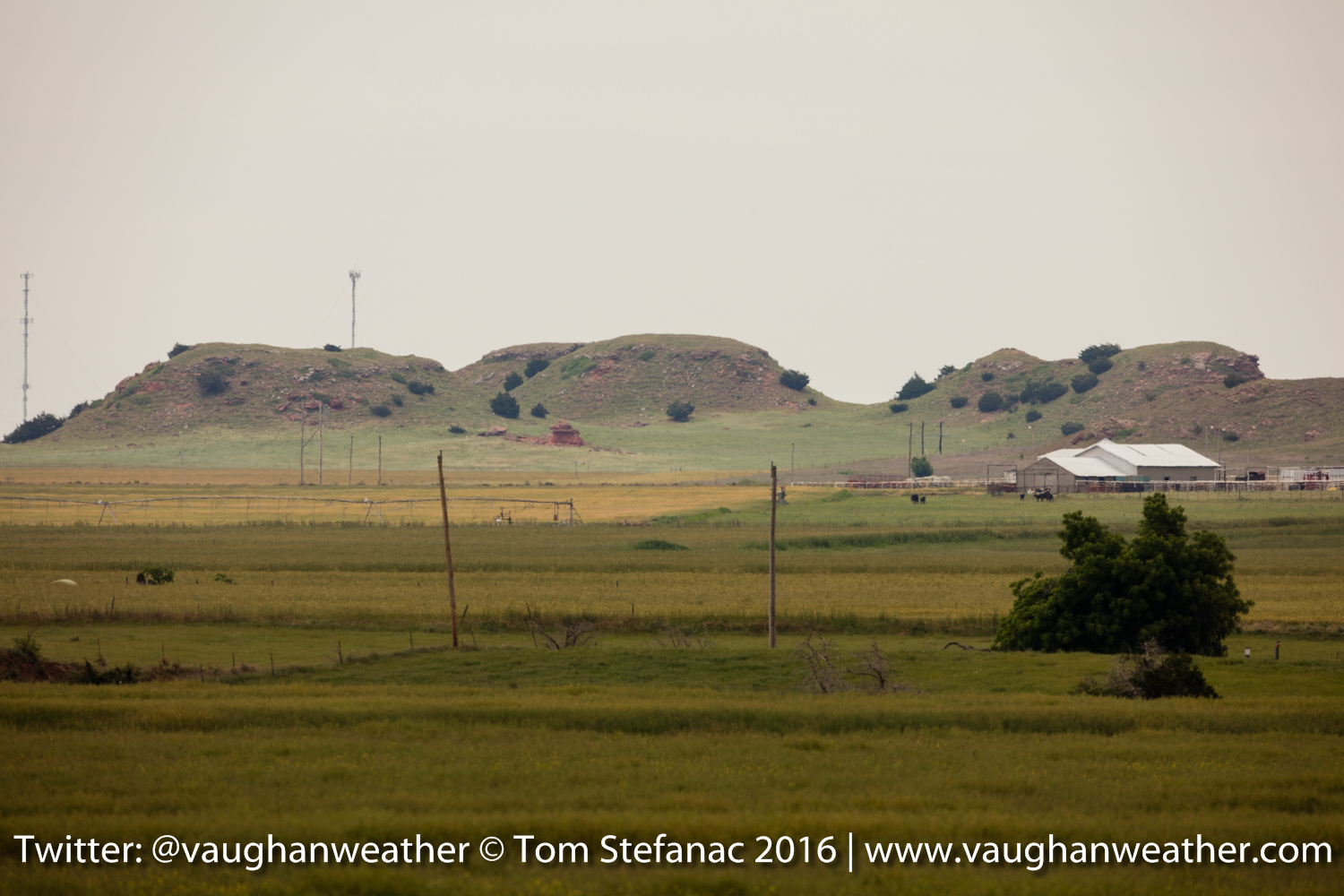
Caddo County Hills
Remember to visit the live link for real-time twitter updates and streaming video. Off to bed… zzzzzzz
Hail Storms – An Educational Primer
Before I dive into the topic of hail and hail storms, I would like to clarify that there is not a singular storm type known as a hail storm. Hail is a product of convection and vertical growth cloud just as lightning, tornadoes, heavy rain and other thunderstorm phenomenon are part thereof. Storms which are called “hail storms” by the media, literature and other sources are noted for their production of large quantities of hail in addition to other things such as rain and lightning. So remember that hail is a part of a parent thunderstorm and not a storm in and of itself.
Now you might be asking yourself how bad can it possibly get inside the storms core?
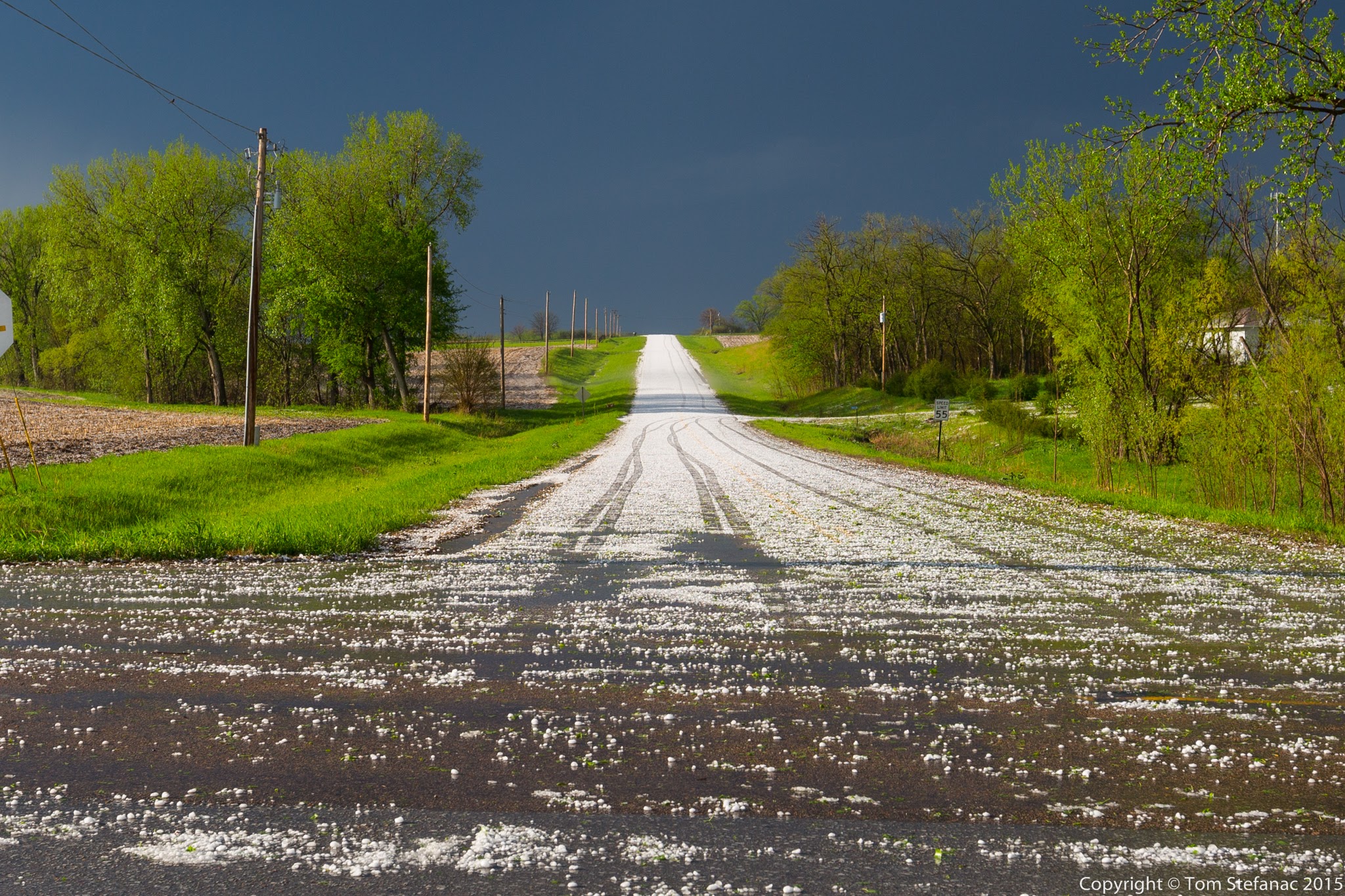
Hail Covered Road
Well that really depends on where you are, the type of storm and the atmosphere. In Southern Ontario thunderstorms tend to grow in moisture rich environments with high humidity. Storms that are typically found in moist air masses will produce less hail and more rain. There are a number of working theories but for one, moist air tends to be deeper and retain warmth so the effects of evaporative cooling aloft are diminished. Secondly, the updrafts become moisture-full sooner and the upward velocities are diminished limiting overall lifting power. Third, moist storms tend to begin dropping precipitating sooner, if not almost immediately compared to drier storms limiting the time for hail growth.

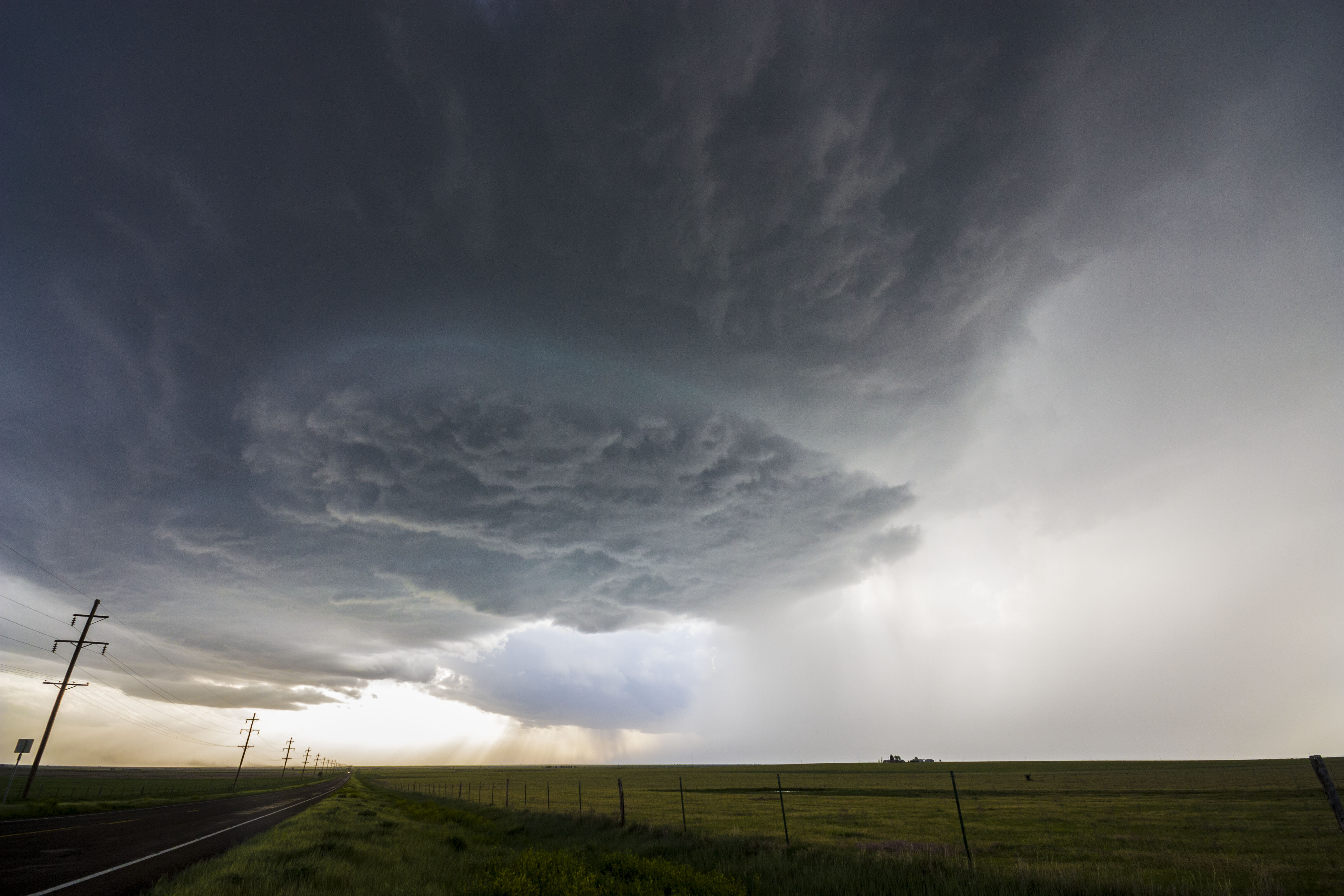
Classic Okalhoma Dryline Supercell with 4+ inch hail in the clearing / vaulted region just right of center
What has been observed generally is that dry environments and especially those with high elevations and low freezing levels produce more hail than moist environments with high freezing levels. In addition there are many theories around cloud microphysics that suggest atmospheres with less dust or particulate matter contain less nuclei for rain to form on and hail tends to be favoured.

Dry supercell storm with golf ball to baseball sized hail in Western Nebraska – hail shaft centre left with really big hail towards clearing on the left
Hail growth itself revolves around three primary theories. The first theory suggests hail rises and falls within a storm several times before falling to the ground. This up and down theory is supported by smooth stones and through the observed concentric rings of ice growth within a hail stone suggesting cycles of melting and freezing. The second theory is the suspension theory, where a hail stone sort of floats in an updraft gradually becoming heavier as it grows and eventually descending, then falling to the surface while banging into other lighter stones on the way down. These smaller stones and supercooled rain drops may stick to the larger hail stones creating a spiked appearance. The last theory is that a hail stone begins its growth low in the updraft while being thrown upwards rapidly and experiences rapid growth in the supercooled sub-freezing zone before eventually getting ejected out with downdraft and other precipitation. Stones that have a very cold soft white appearance and feel “soft” or graupel like support this theory.
Powerful dryline Panhandle Texas Supercell Storm – gigantic 3 inch hail just to the center right of the image
Unfortunately not one of these theories has been proven because hail is extremely hard to observe and there’s simply no easy, safe or conclusive means to “watch” hail growth in a storm. We can use radar to see a hail region develop but it’s hardly conclusive evidence when it comes to the actual formation process since the cloud microphysics in relation to the updraft structure and environment are critically important. I would argue that all three theories are likely correct and probably occur concurrently with one another in a storm through its life cycle.
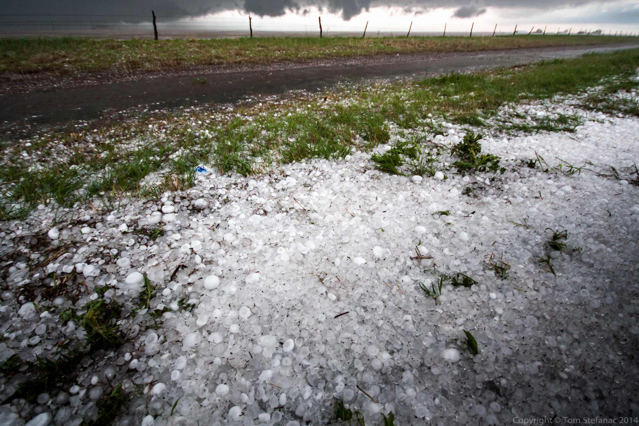
Golf ball to baseball sized hail coated the roadside near Dumas Texas
There are also a number of geographic nuances we deal with here in Southern Ontario that places such as a the high plains of the U.S don’t deal with. The elevation across all of Southern Ontario is much lower ranging from 80 meters above sea level near the Southern Great Lakes to about 500 meters peak elevation in the Dufferin Highlands. Elevation changes around the bulk of the land mass lies in the 200-400 meter range. The average elevation of the plains in Colorado is around 1500 meters above sea level, that’s a whole 1km higher than the highest part of Southern Ontario and some parts of Colorado that are “flat” are actually +1700 meters ASL. The forecast implications of this high geography is immense since the 850mb level in Colorado is basically the ground, while here in Southern Ontario it’s 1.5km above the ground. Because of the elevation in Colorado the ground is much closer to the freezing level and hail has a far better chance of reaching the ground than it does in other places.

Golf Ball to Tennis Ball Sized Hail in Oklahoma – May 2011
When you consider all the above factors, the largest hail you will typically see in Southern Ontario is 1cm or less with 2.5cm (quarter sized) hail occurring on occasion. Golf ball sized hail which is 4.5cm in diameter is possible and does occur a few times each year but only with the most powerful storms. The largest photographically documented hail in Southern Ontario fell on the afternoon of July 8th 2007. Fellow storm chaser Dave Patrick of www.ontarioweather.com was chasing a violent supercell which had produced several tornadoes and came across shredded trees between Mildmay and Listowel. When he ventured out to have a better look he found baseball sized hail which had cratered the ground. The hail was sitting for 20-40 minutes before he arrived and the largest stones were likely 3.25 inches / 8.3cm (teacup sized) before melting. His full chase log is online here.
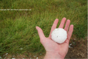
Storm Chaser Dave Patrick holds a baseball sized hailstone near Mildmay Ontario
It’s also important to remember big hail does not necessarily need a powerful supercell storm if the right elements come together. June 16th 2008 was a perfect example, the surface dew points were low so the air was pretty dry and the atmosphere above was super dry, very cold and the lapse rates were steep thanks to strong daytime heating! One storm popped up along a lake breeze boundary and began to rumble south into Vaughan. The storm produced tons of spiked 2-3cm hail denting cars and damaging crops. This storm formed in an environment that was far more reminiscent of the high plain and and so too was the resulting weather.
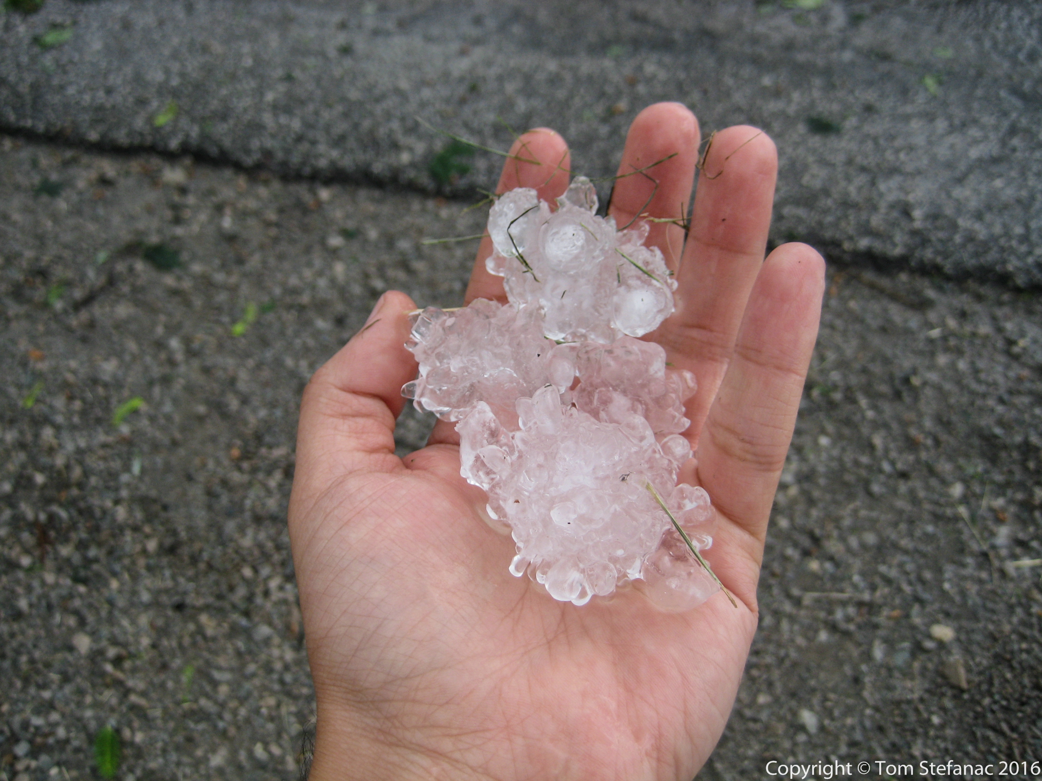
Ping Pong to Golf Ball Sized Hail in northern Vaughan – June 16th 2008
So you might be wondering where do you find hail in a storm?
If it’s a squall line, the hail will likely blow in quickly on the leading edge with the heaviest rain and then quickly taper off. Single cell storms may produce heavy rain followed by a brief burst of hail which will diminish. Multicell storms will have various pockets of heavy rain/hail and vary a great deal. Supercell storms produce the biggest hail just to the north of the updraft core at the rear of the storm. A general rule of thumb is that the largest hail is going to be between the highest towers of the storms and the dark rain core.
Hail bow – large hail center and larger hail to the right of center
How do you spot hail from a distance?
Typically hail will show up as a bright, band or streak in a darker rain core closer to the towering updrafts. This bright zone is referred to as a hail shaft. As a rule of thumb, the brighter the hail streak the larger the hail. Once a hail streak becomes invisible watch out! The general rule is that as hail size goes up, the visibility of the hail zone also increases because there is less diffraction of light. The spacing between the stones also increases further helping visibility get better. This is somewhat dangerous because unsuspecting motorists, chasers and others may wander into this clear zone when trying to escape the storms heavy rain core only to get pummelled by big hail. Another consideration is that anytime you’re sitting under the flanking line, especially when you’re closer to the area where the flanking line and parent storms begins precipitating then you’re at risk of getting hail, even if the sky appears to be clearing.
Largest hail center right towards blue sky – Golf Balls falling in that zone

Nebraska Supercell Storm Radar Signature – purple area is very heavy rain and hail
April 25th 2016


April 4th 2016


March 28th 2016


March 16th 2016


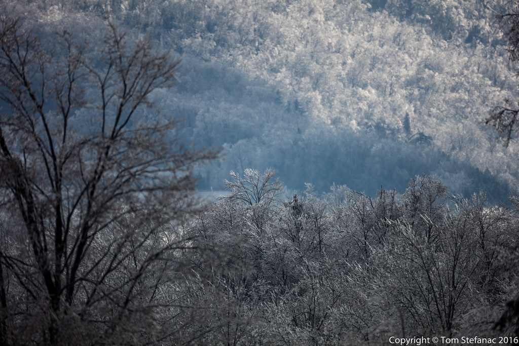
March 24th 2016
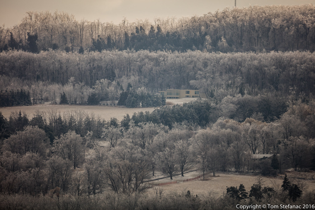
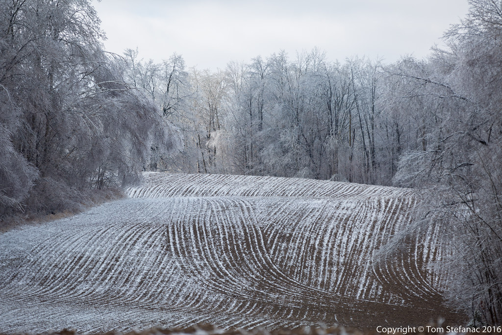
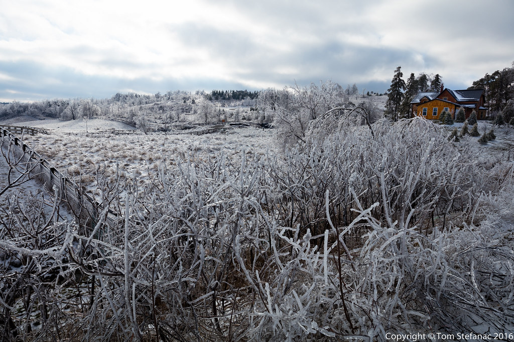
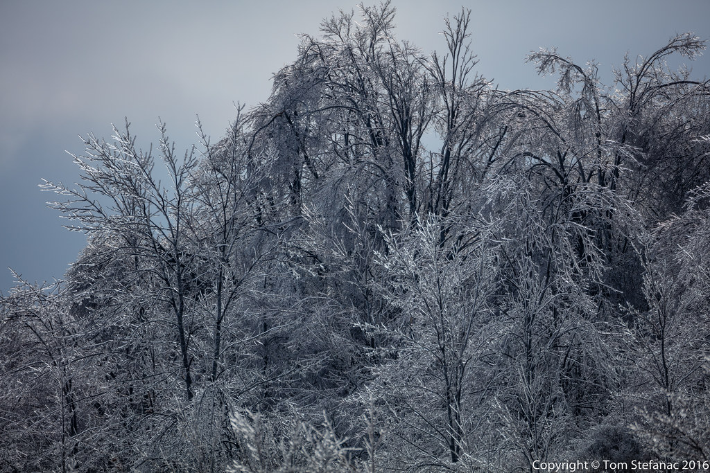
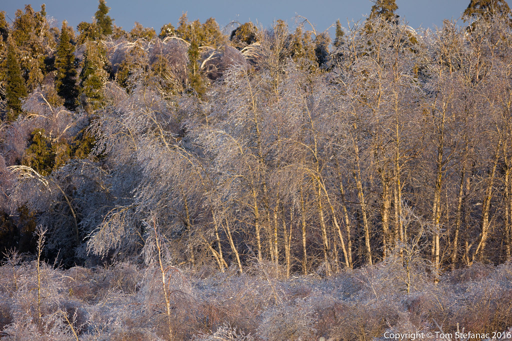
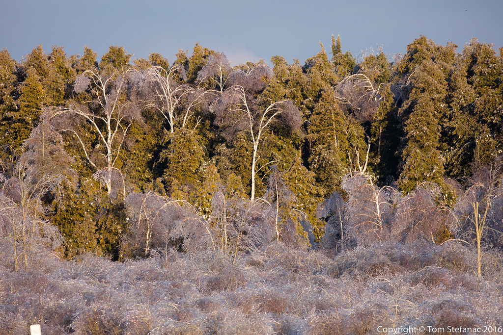
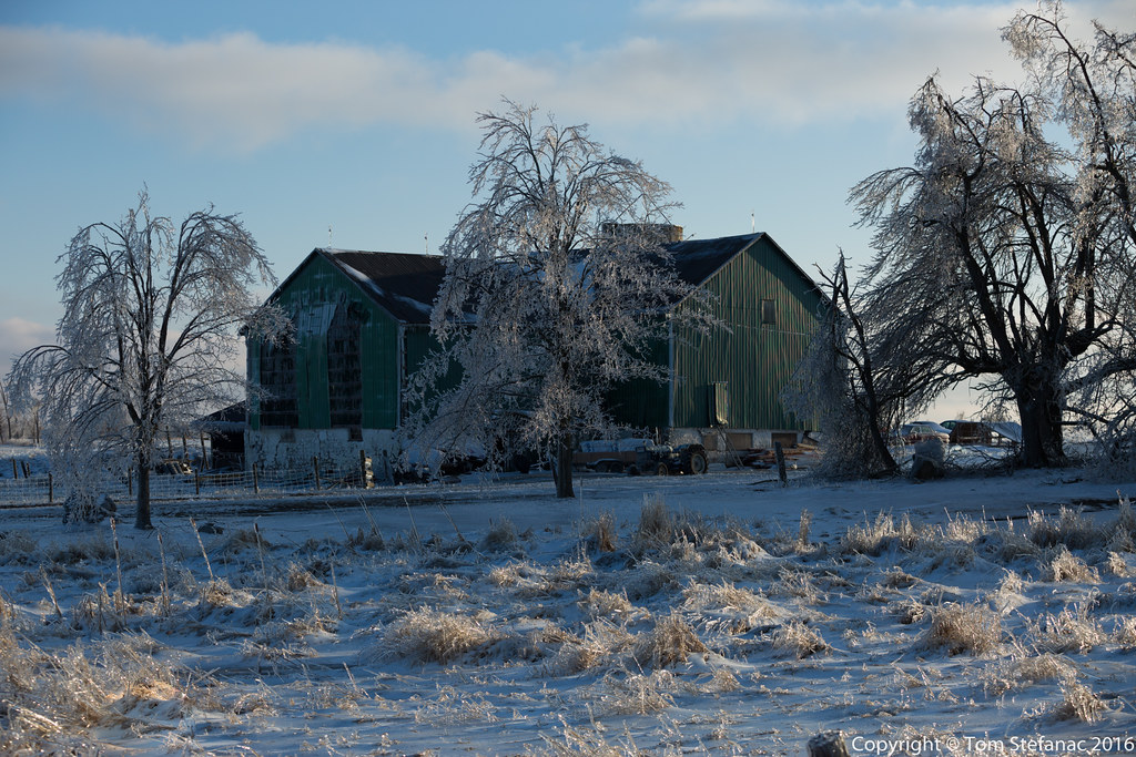
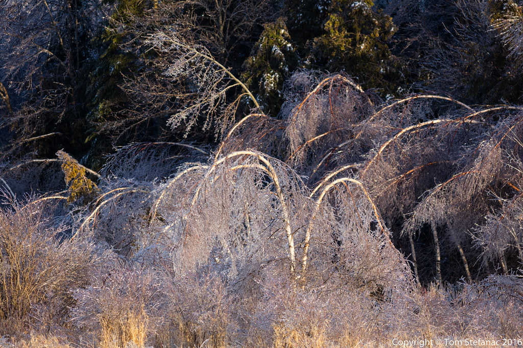
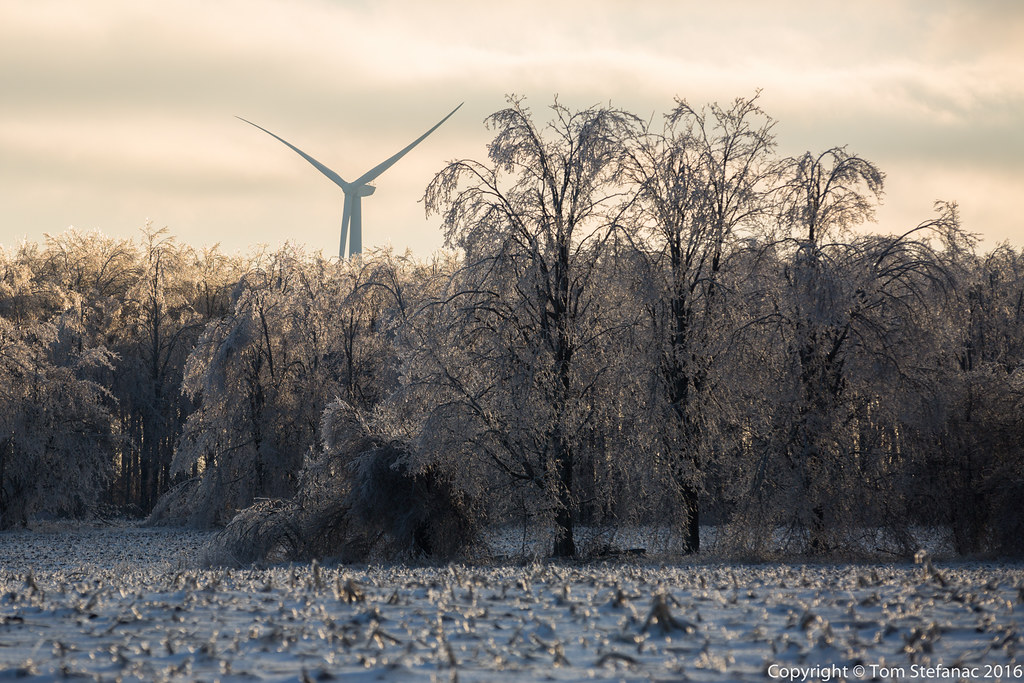
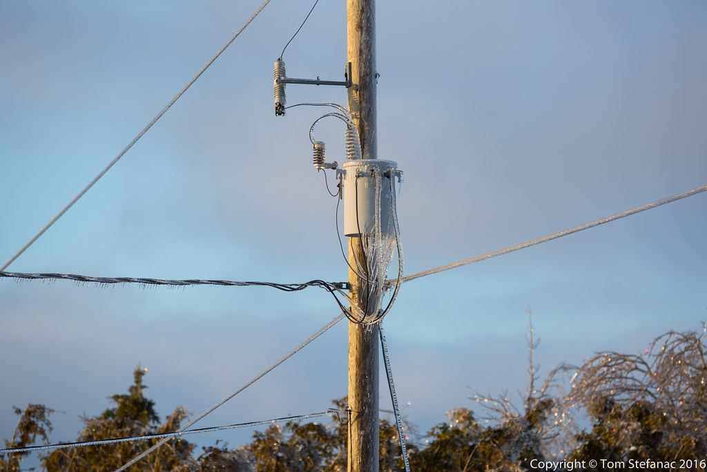
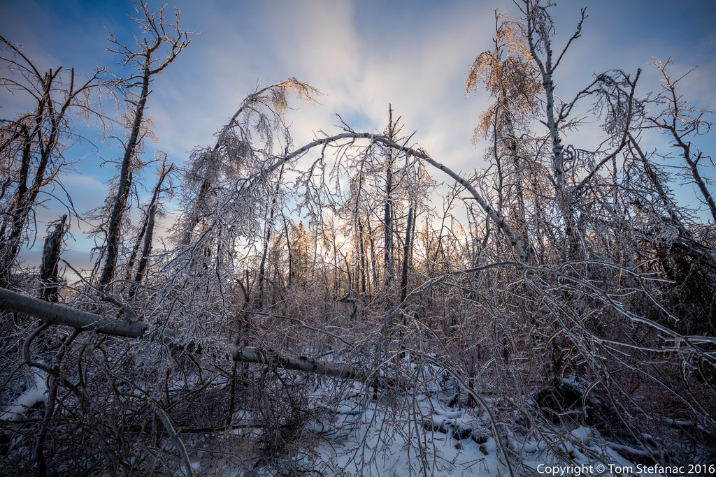
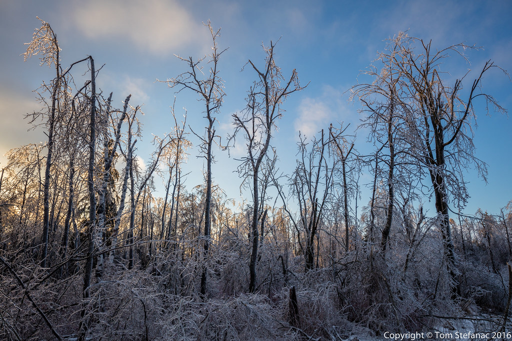
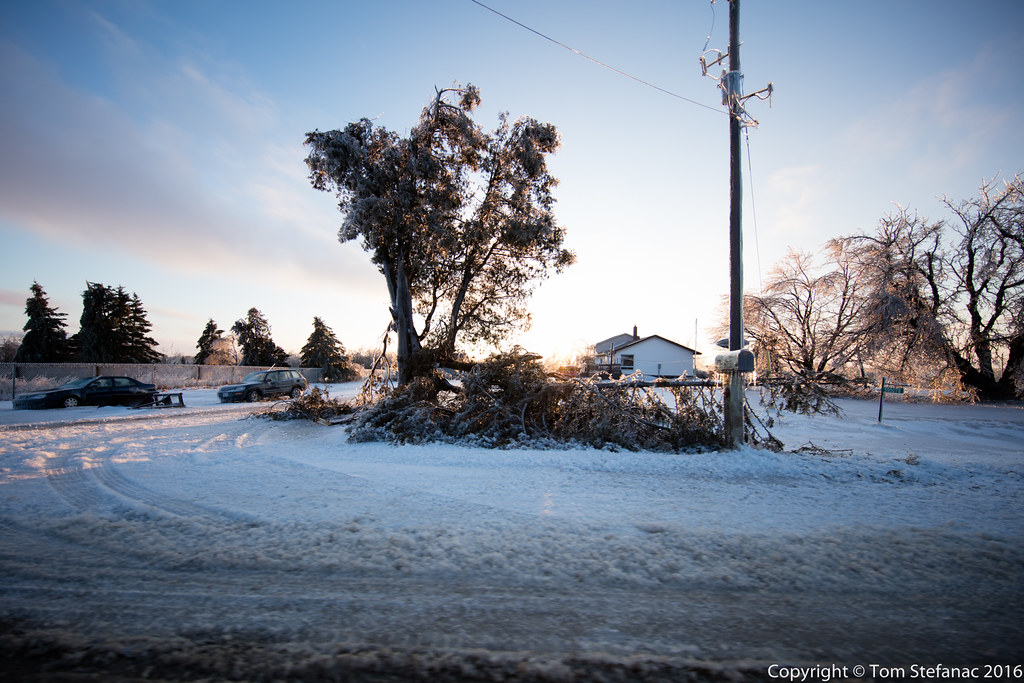
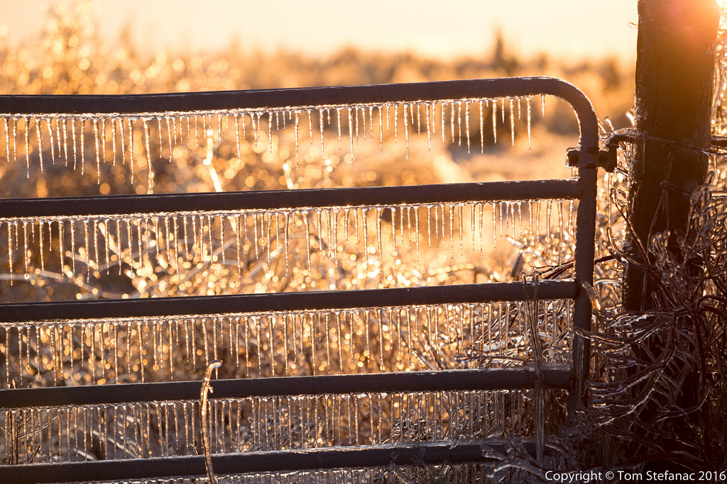
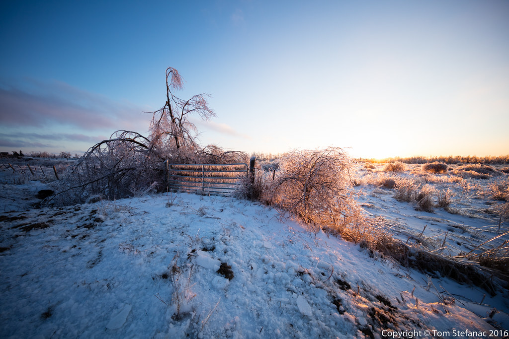
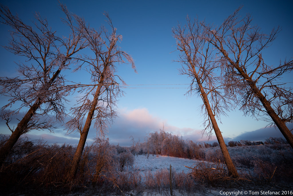
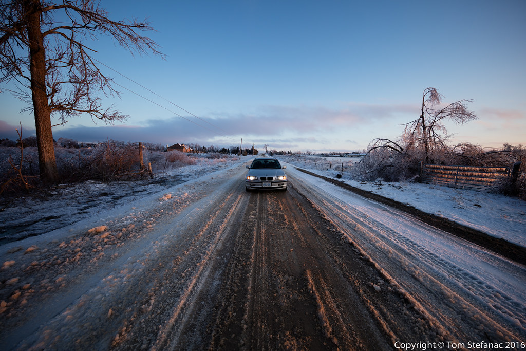
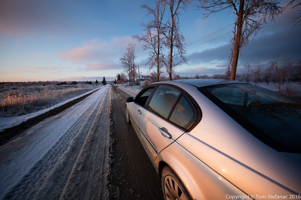
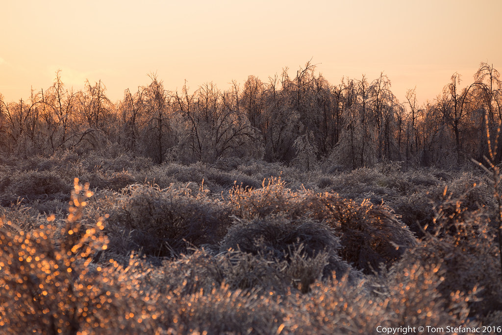
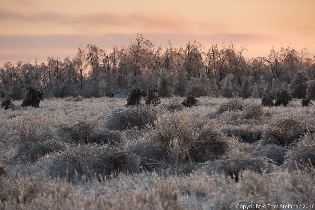
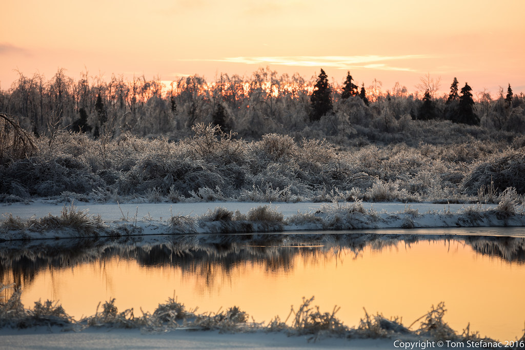
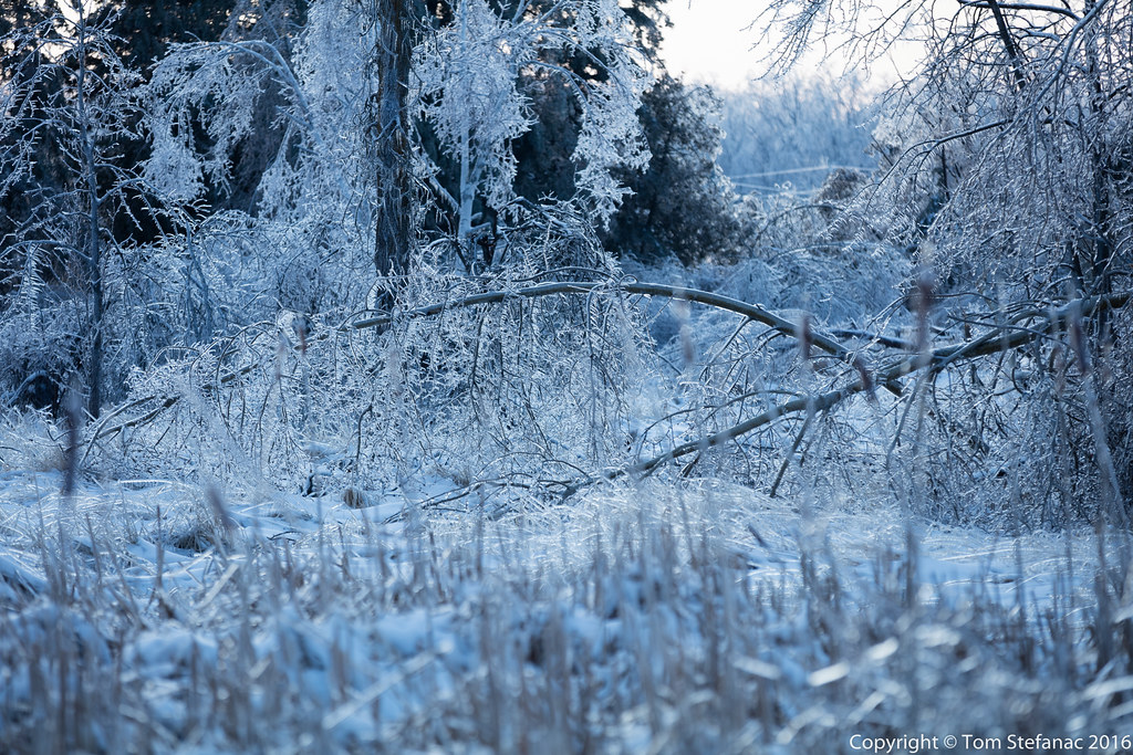
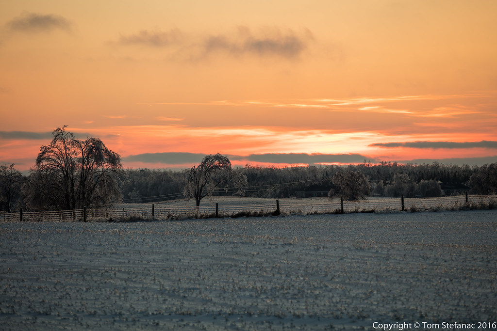
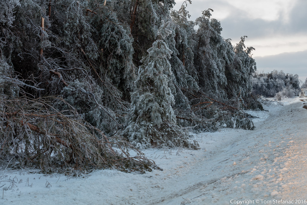
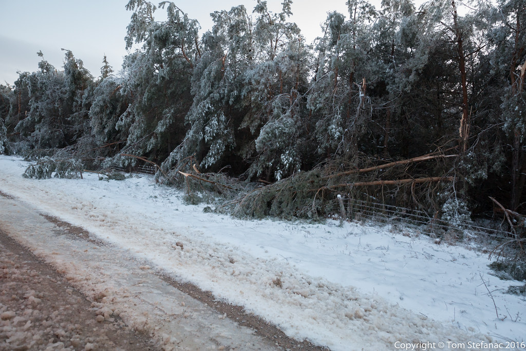
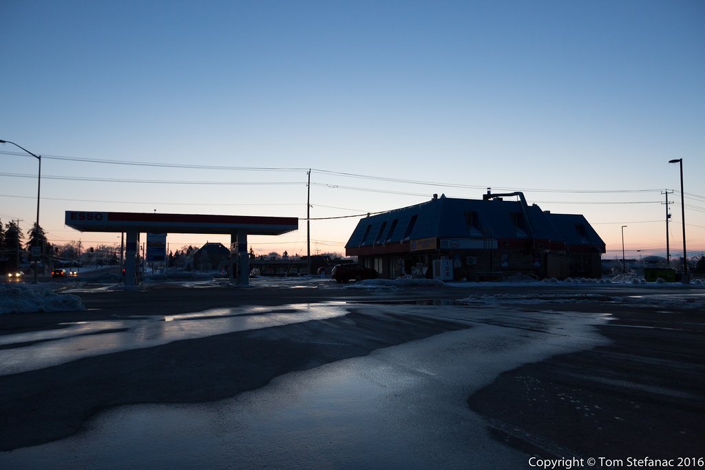
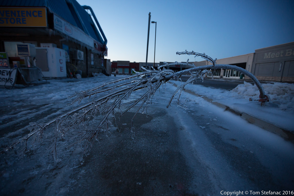
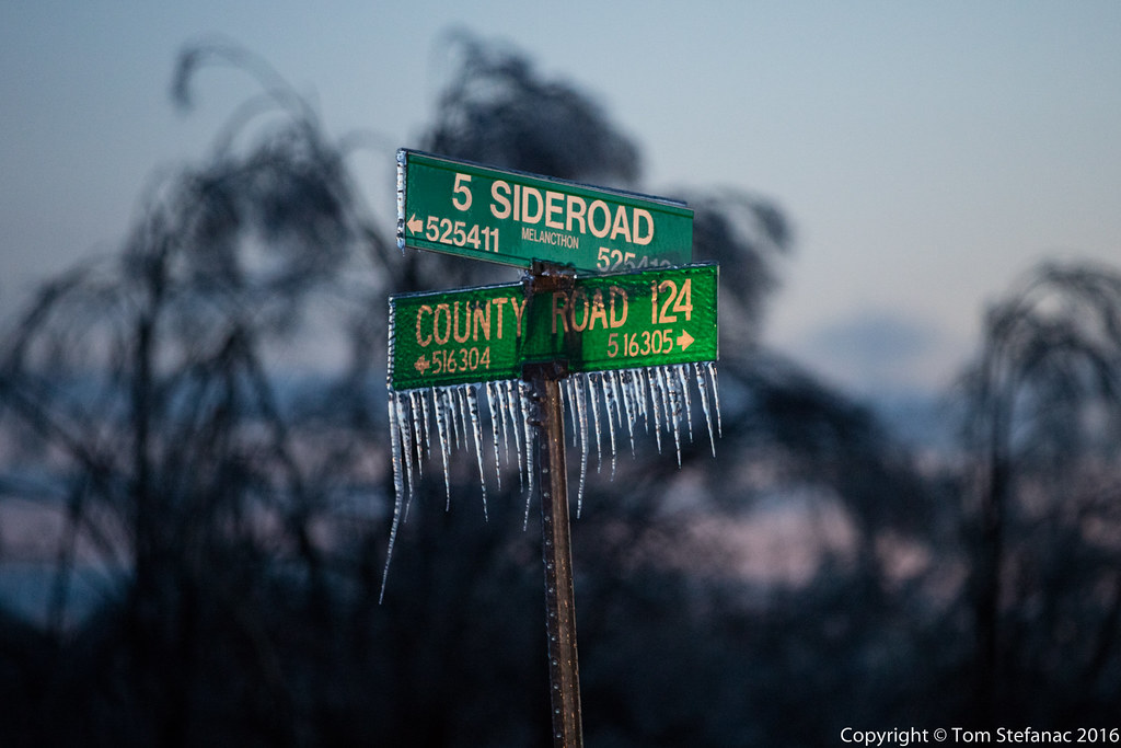
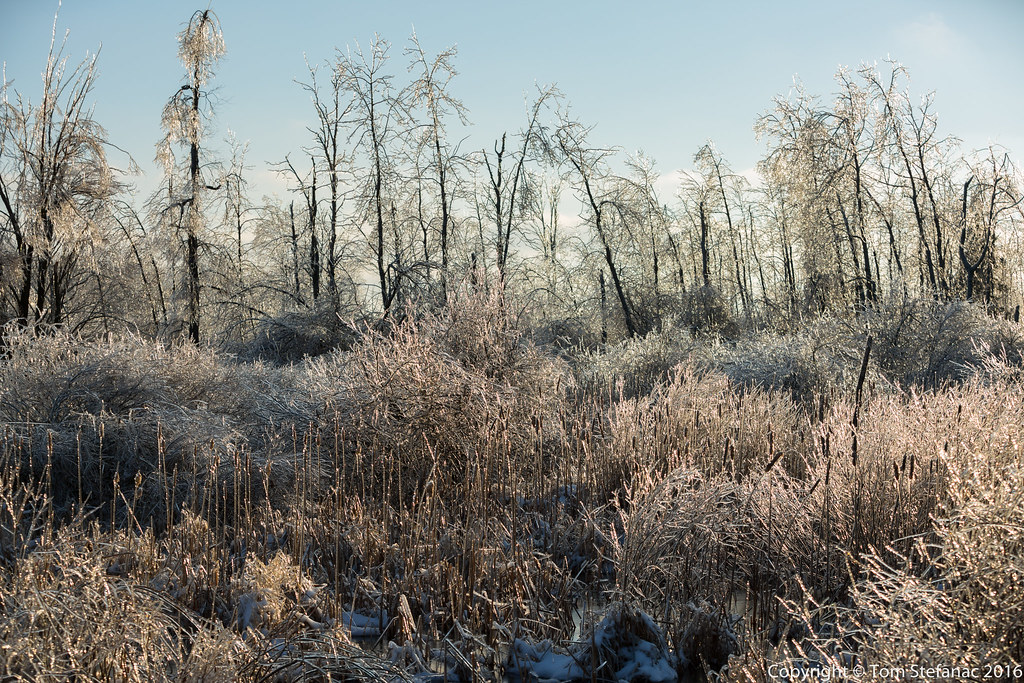
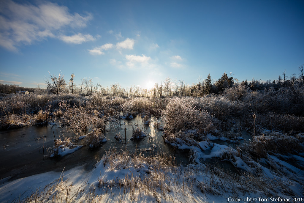
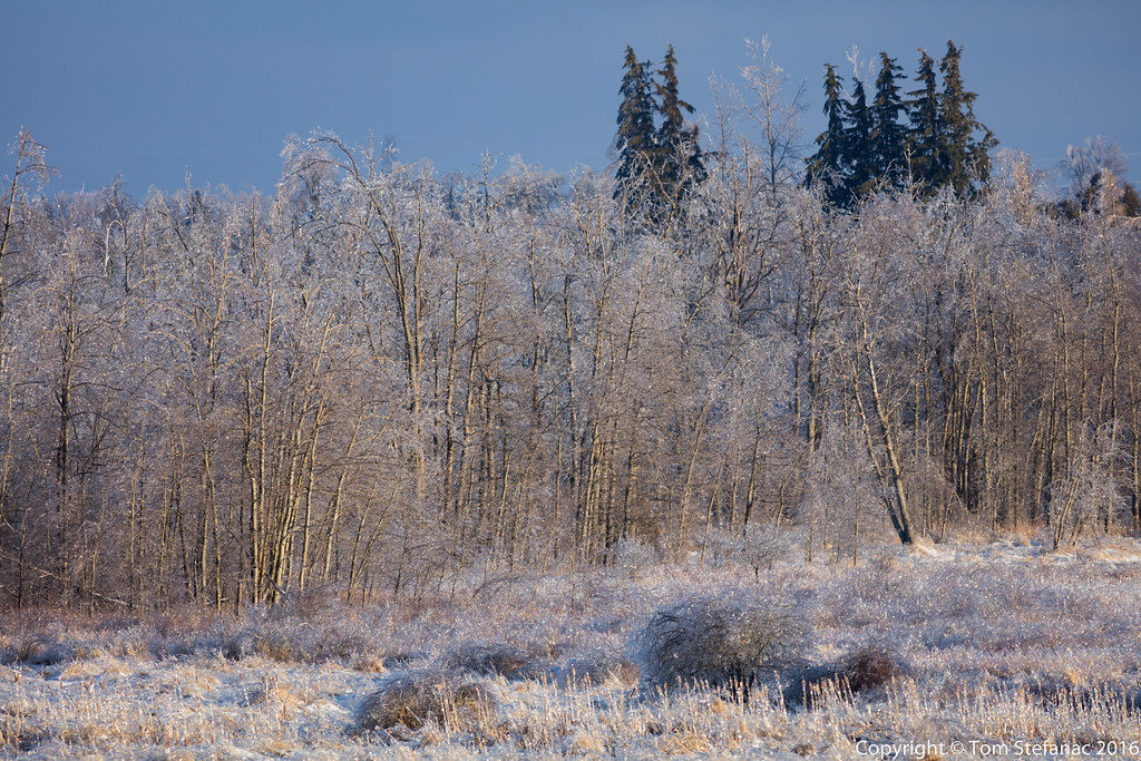
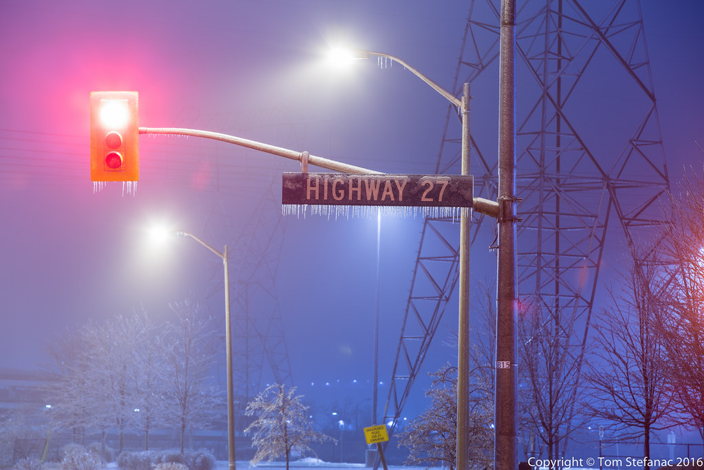
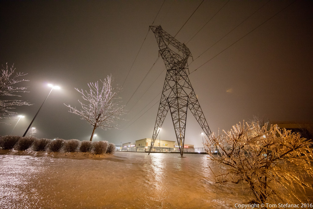
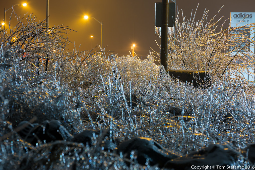
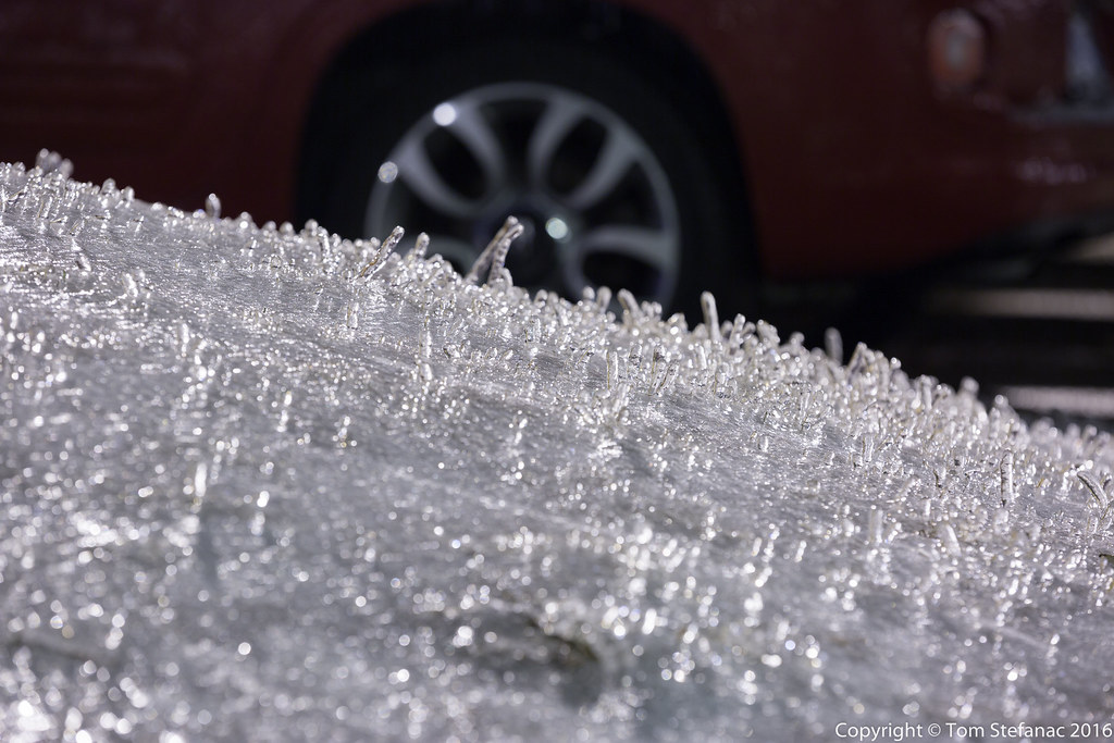
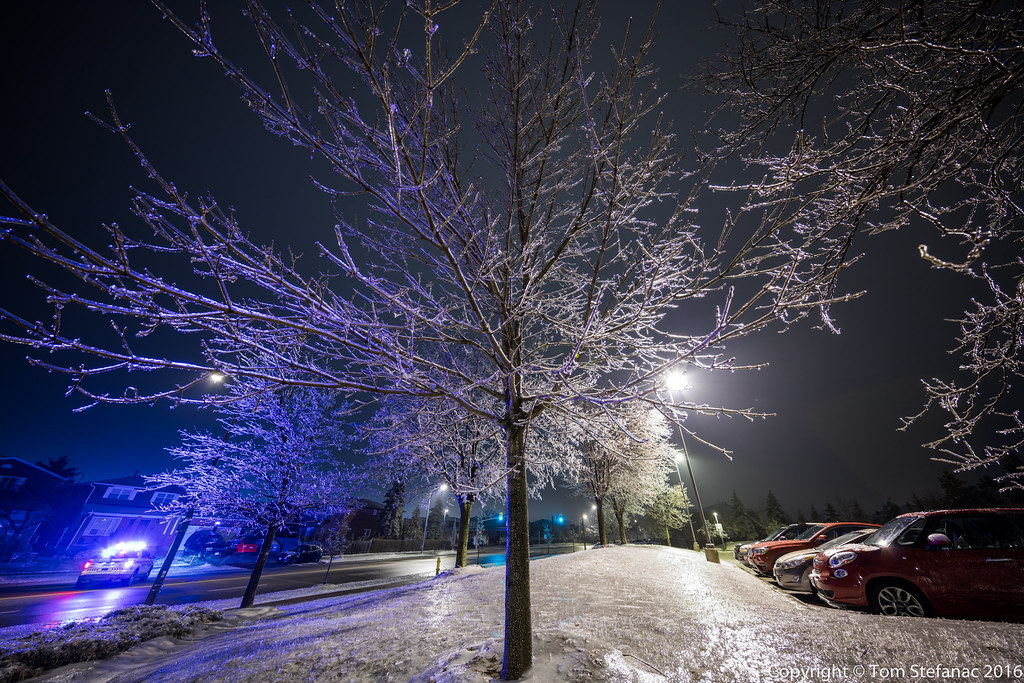
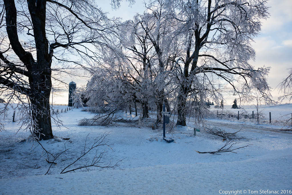
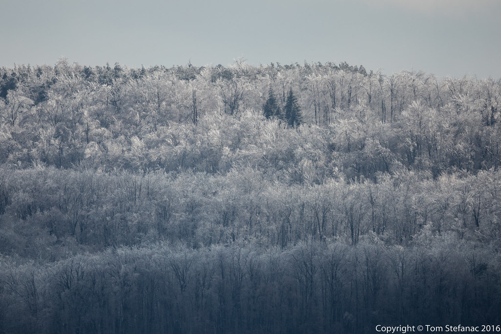
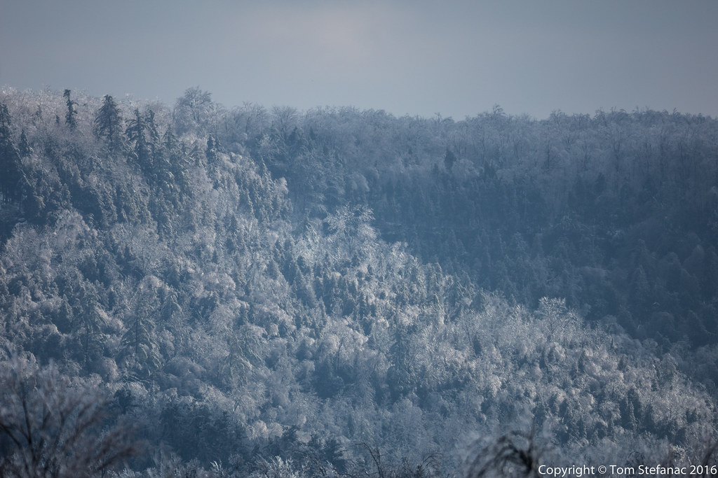
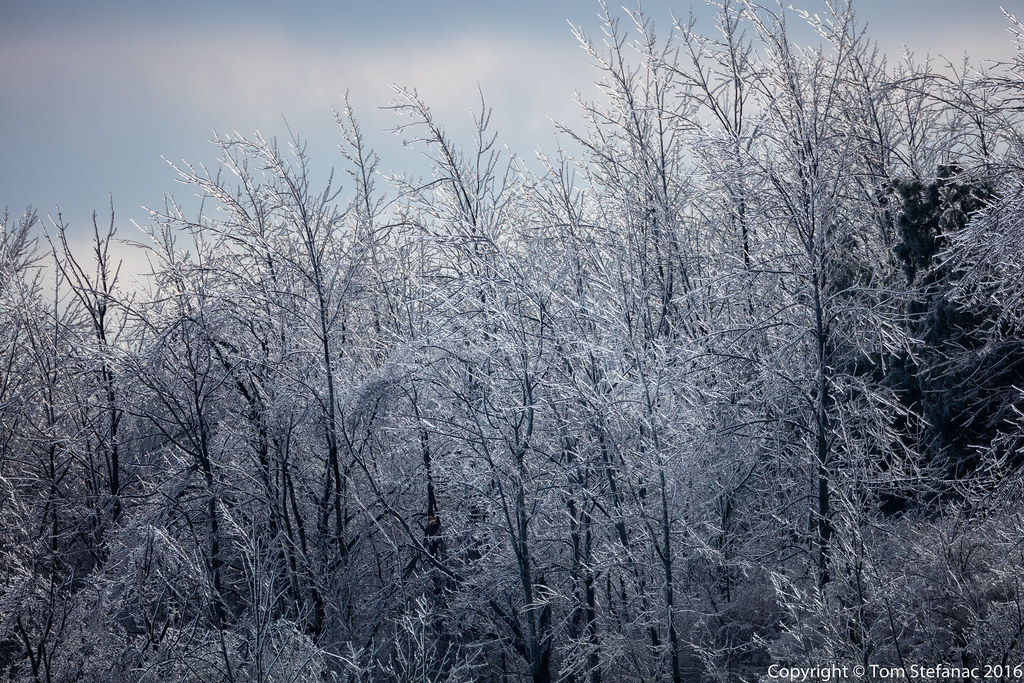
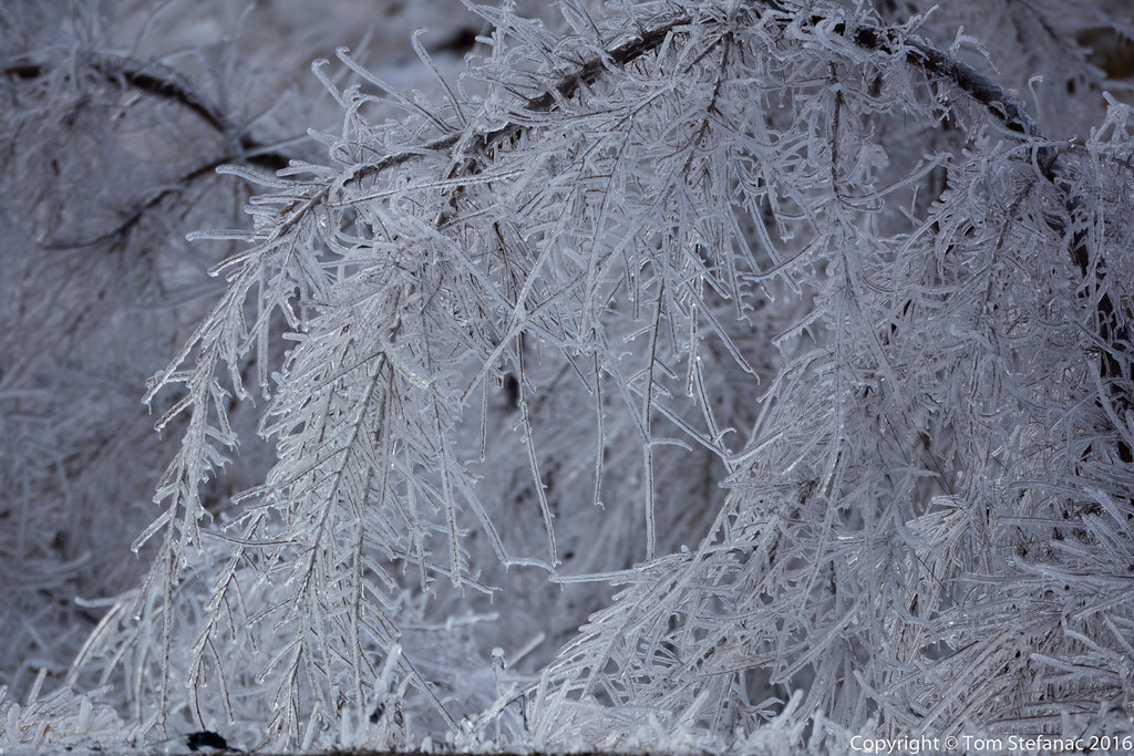
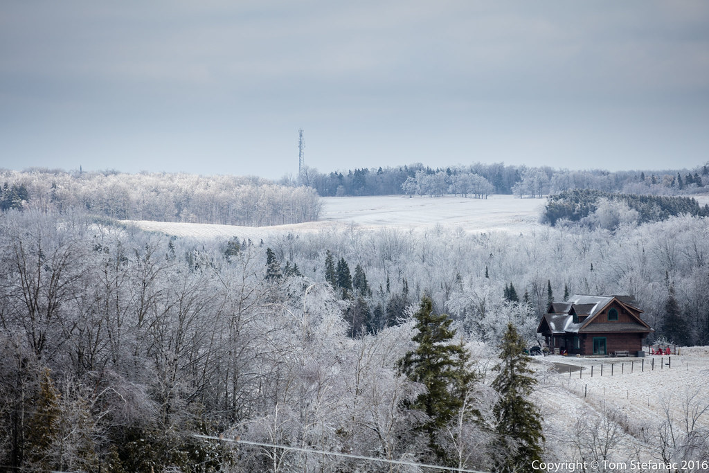
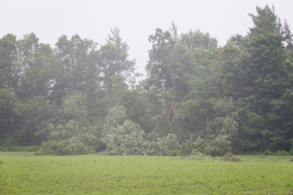
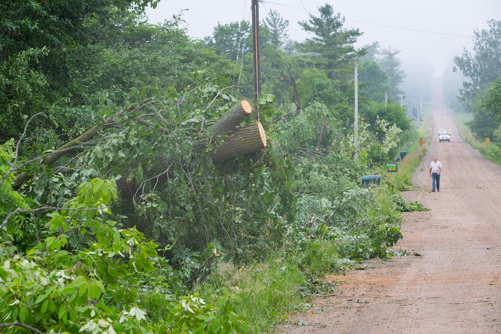
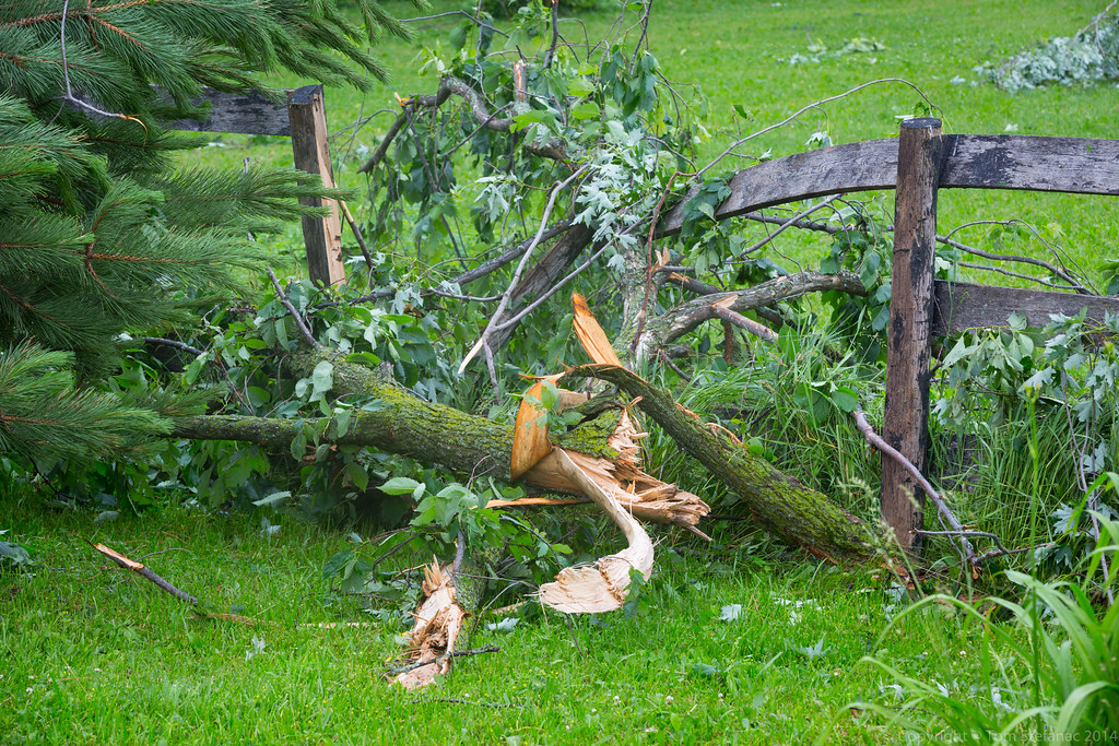
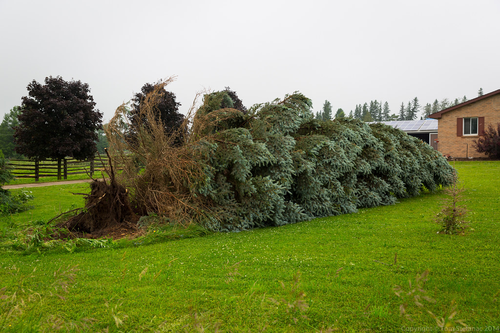
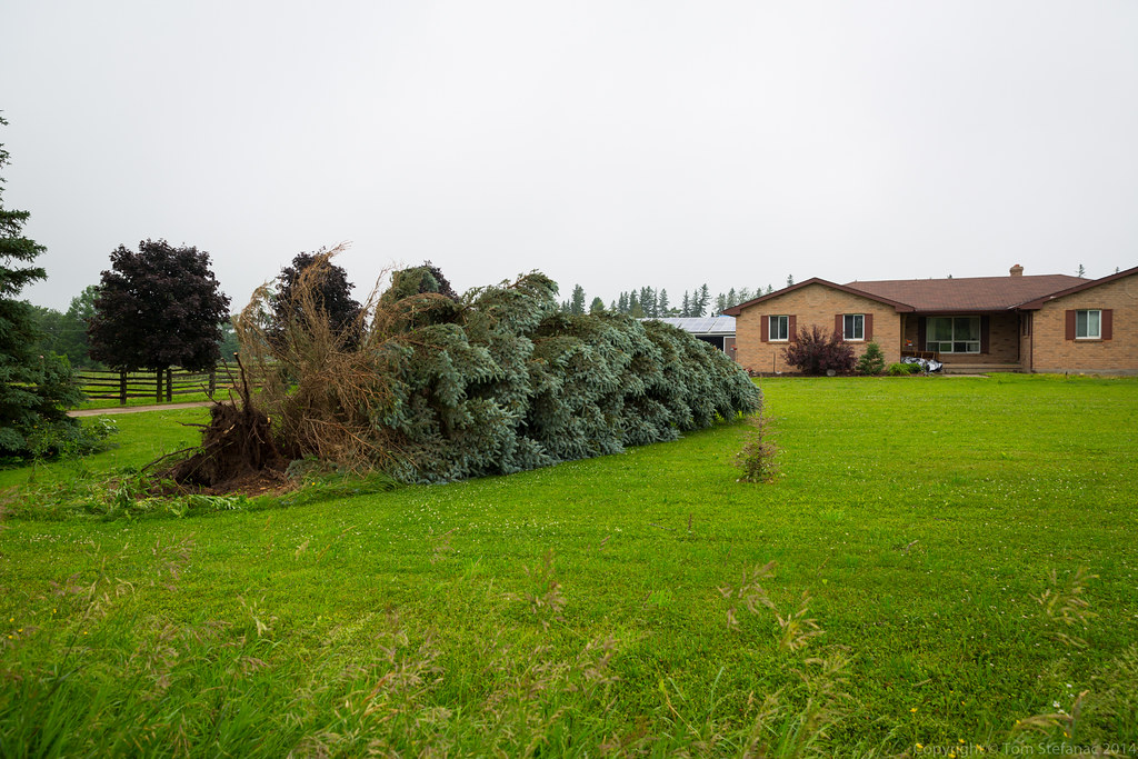
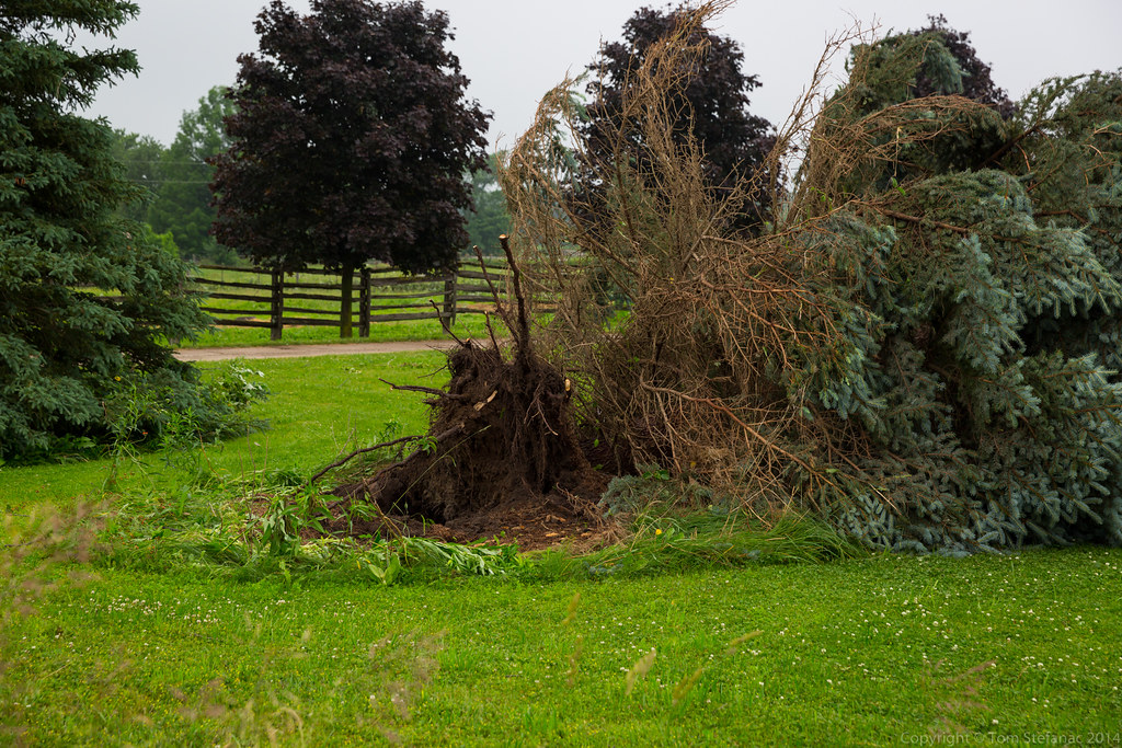
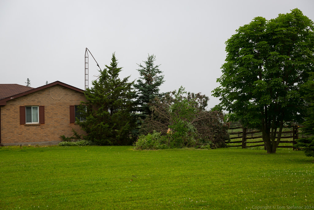
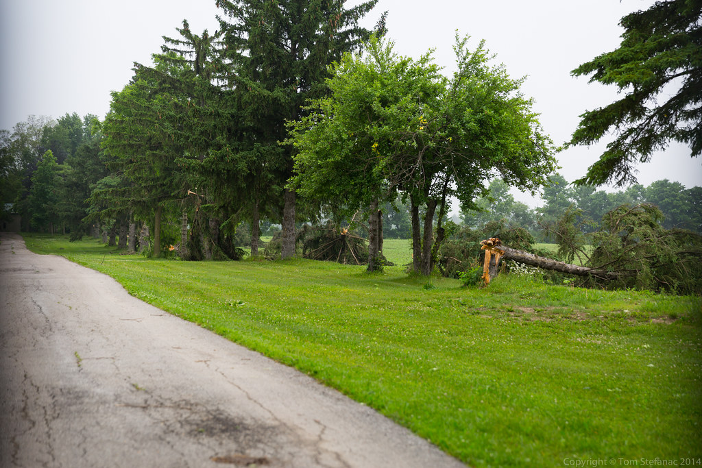
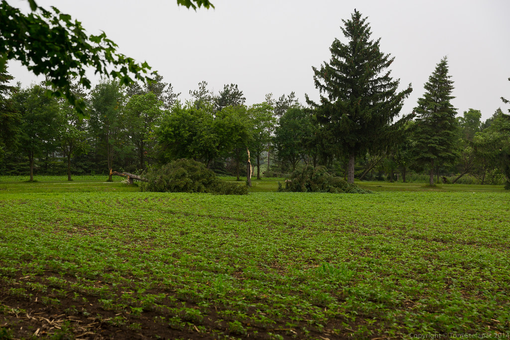
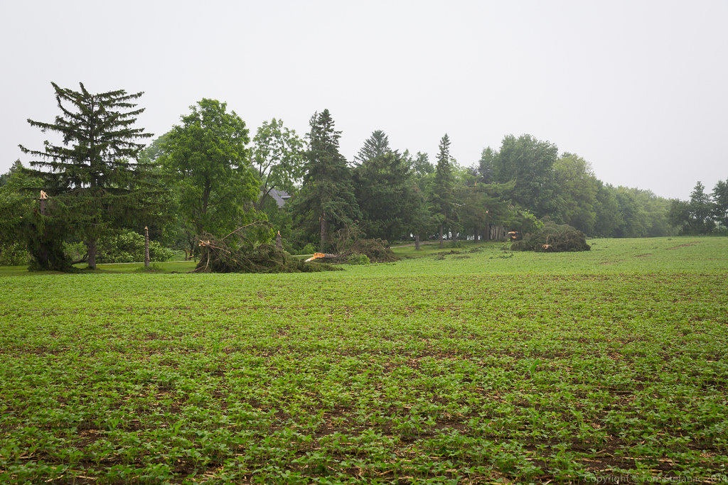
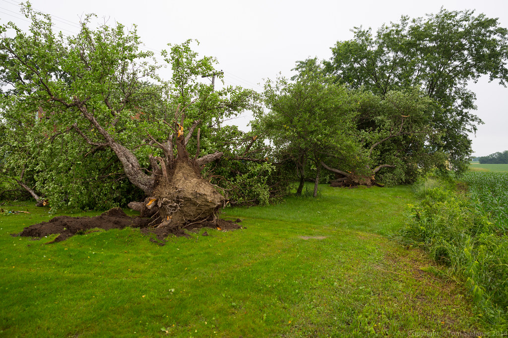
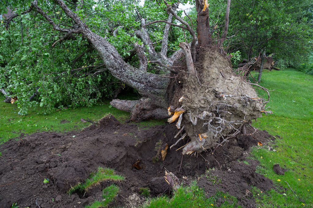
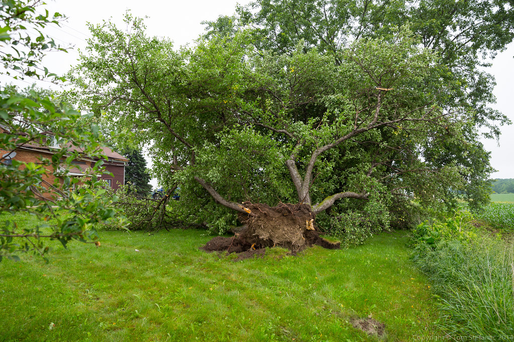
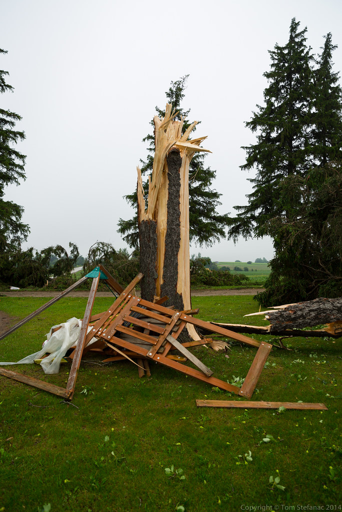
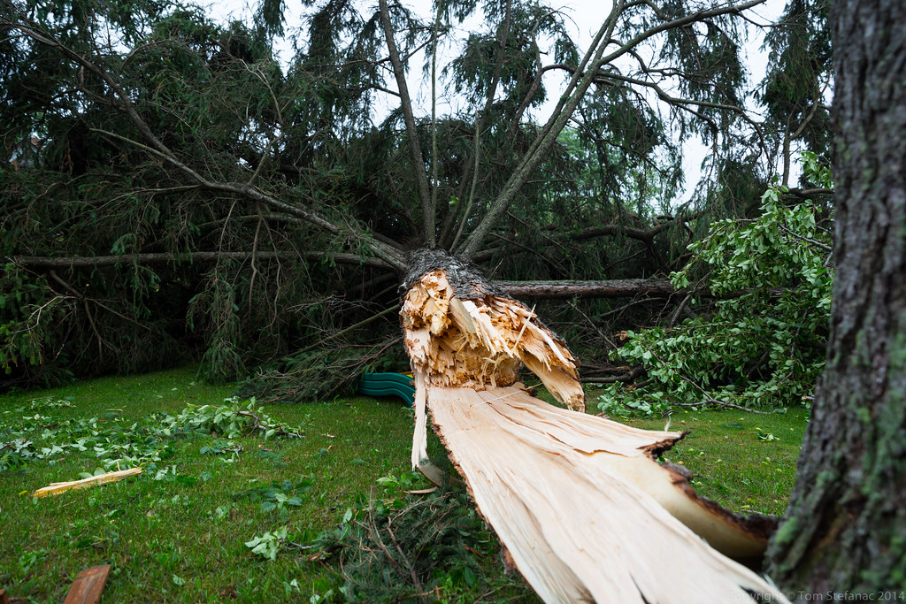
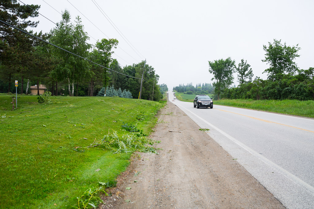
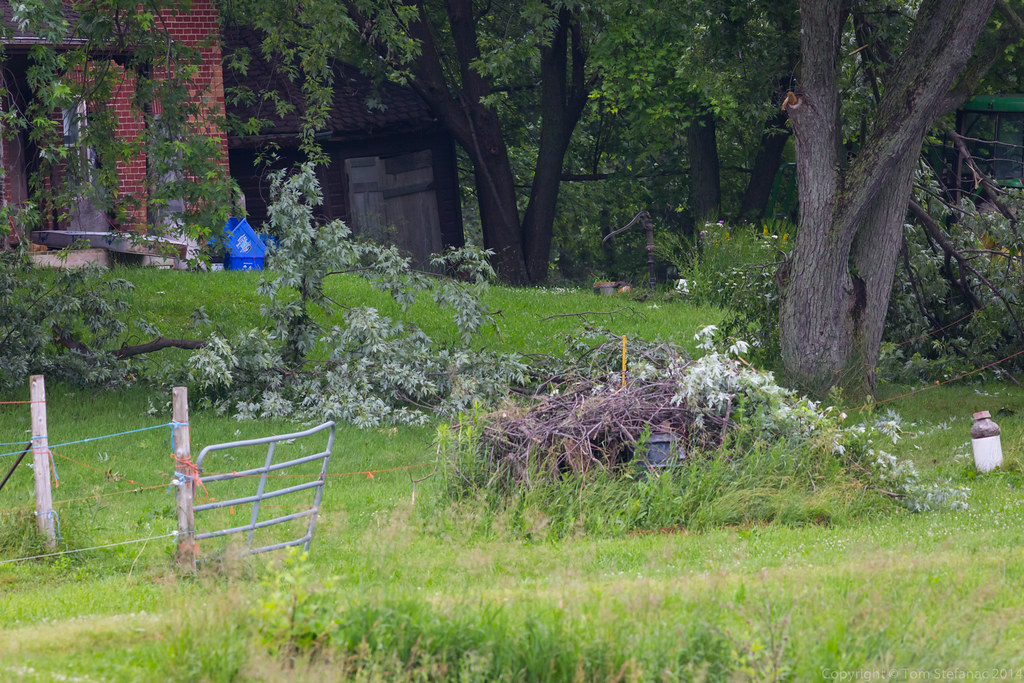
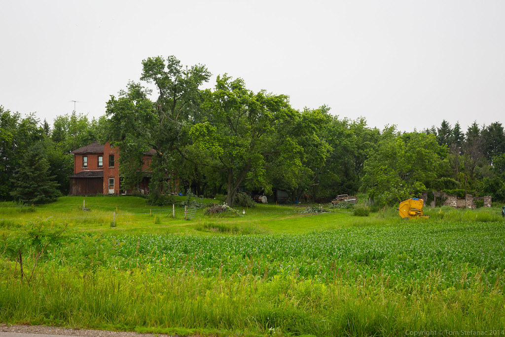
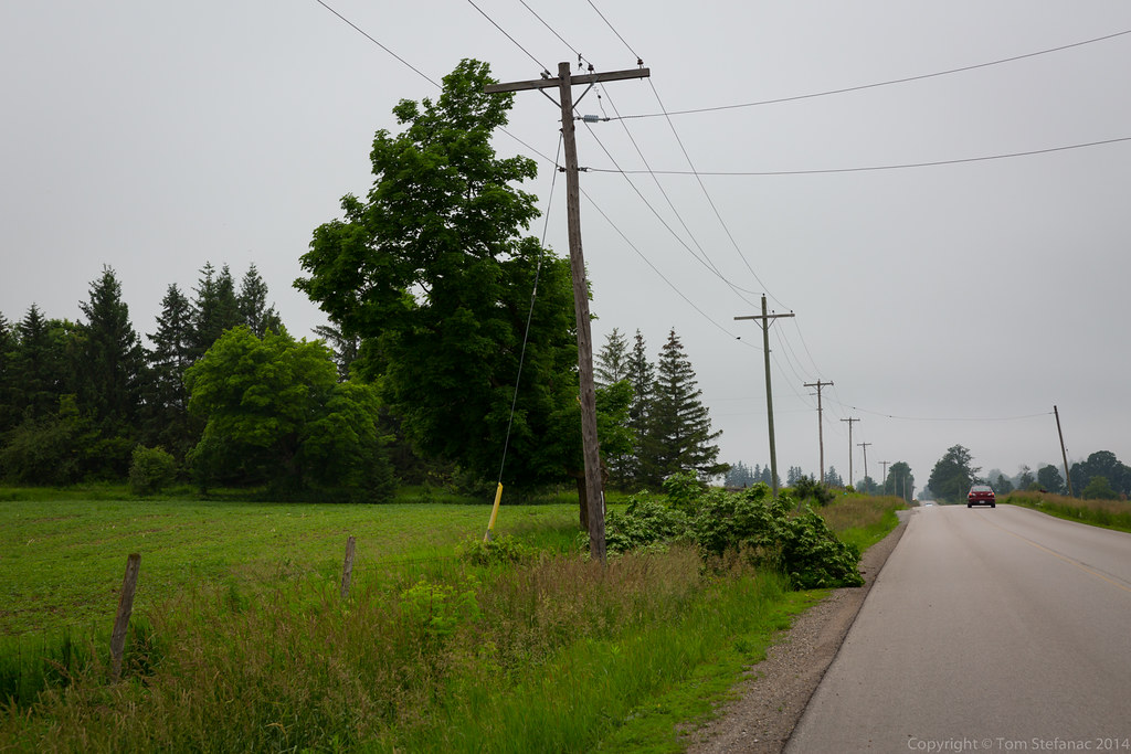
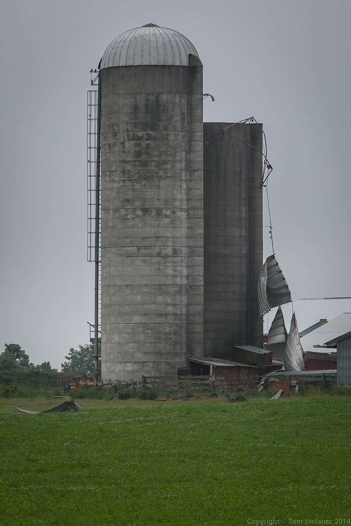
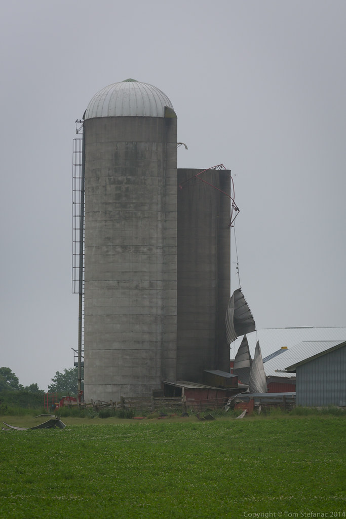
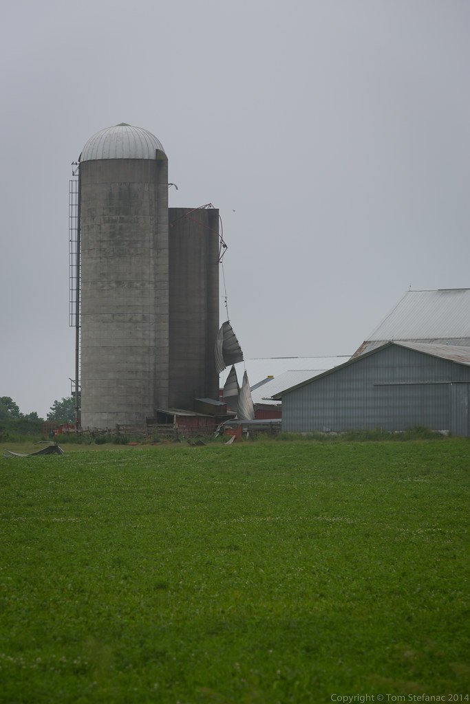
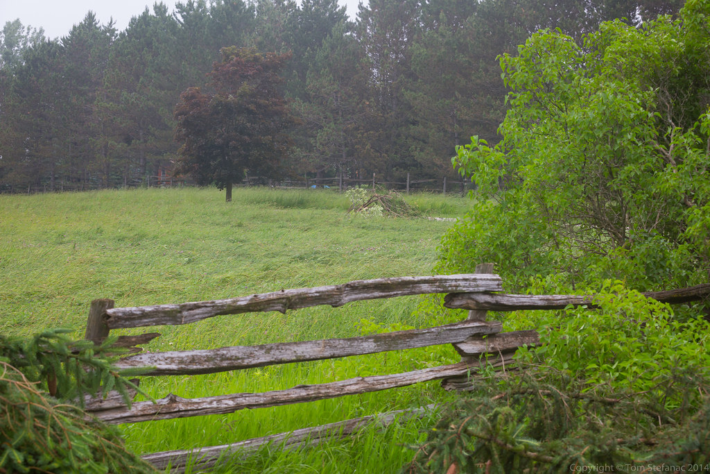
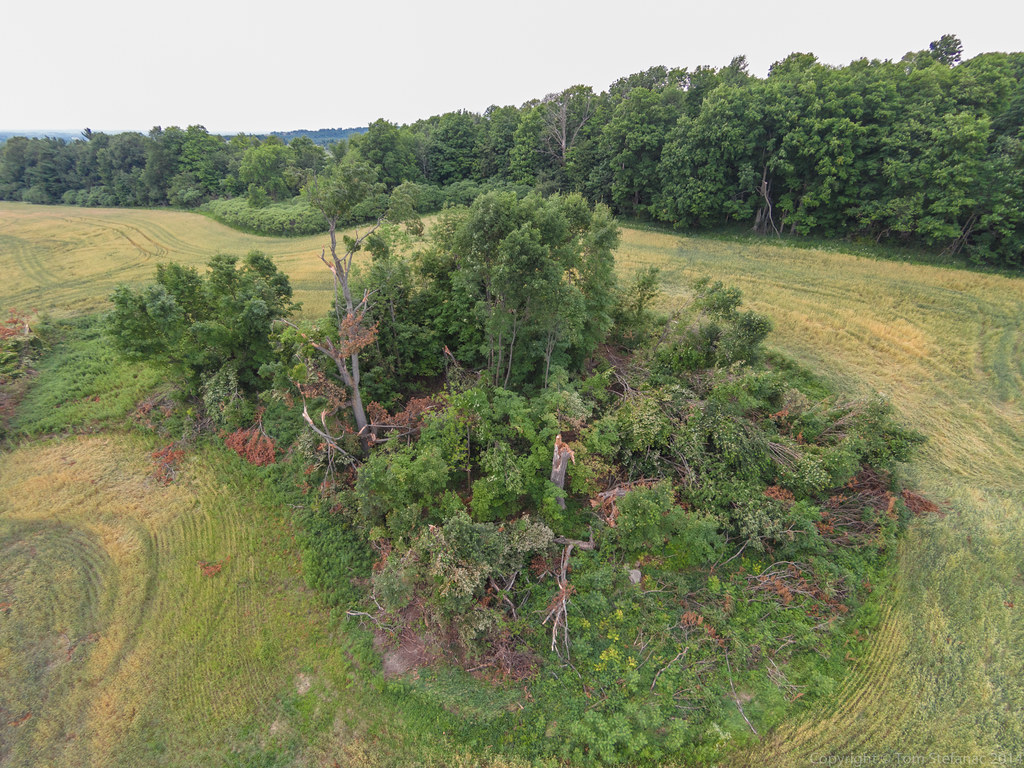
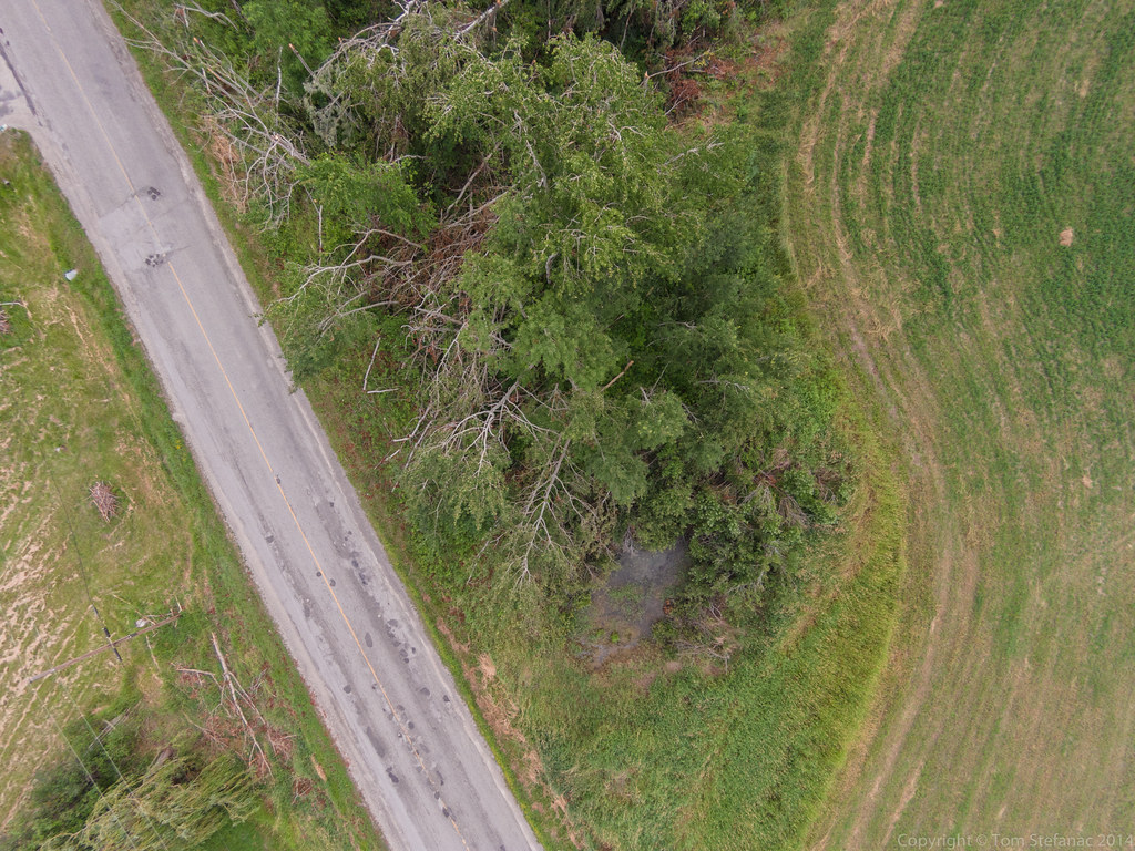
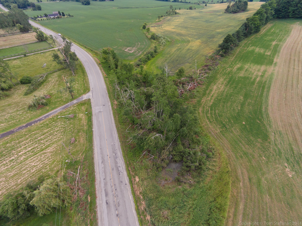
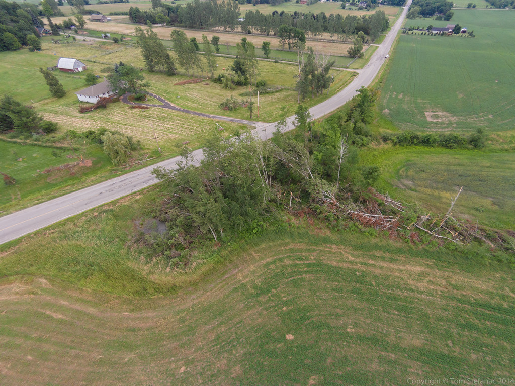
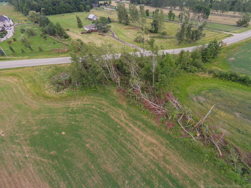
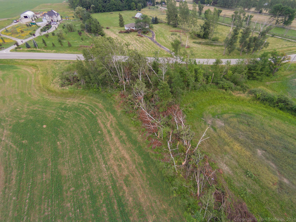
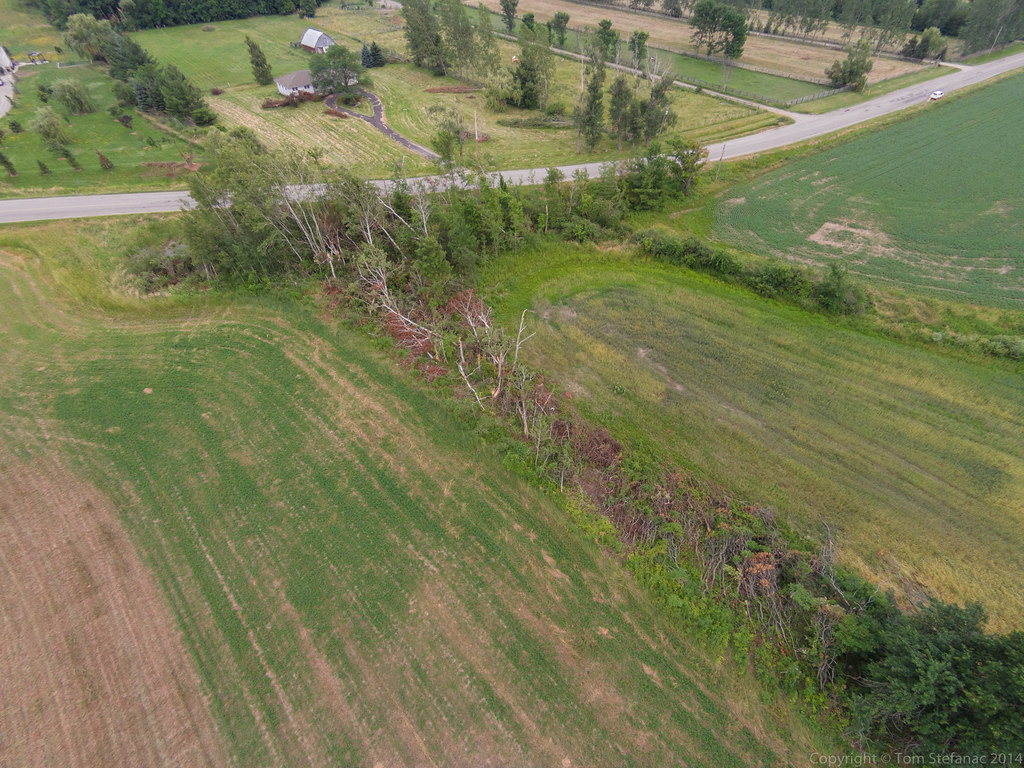
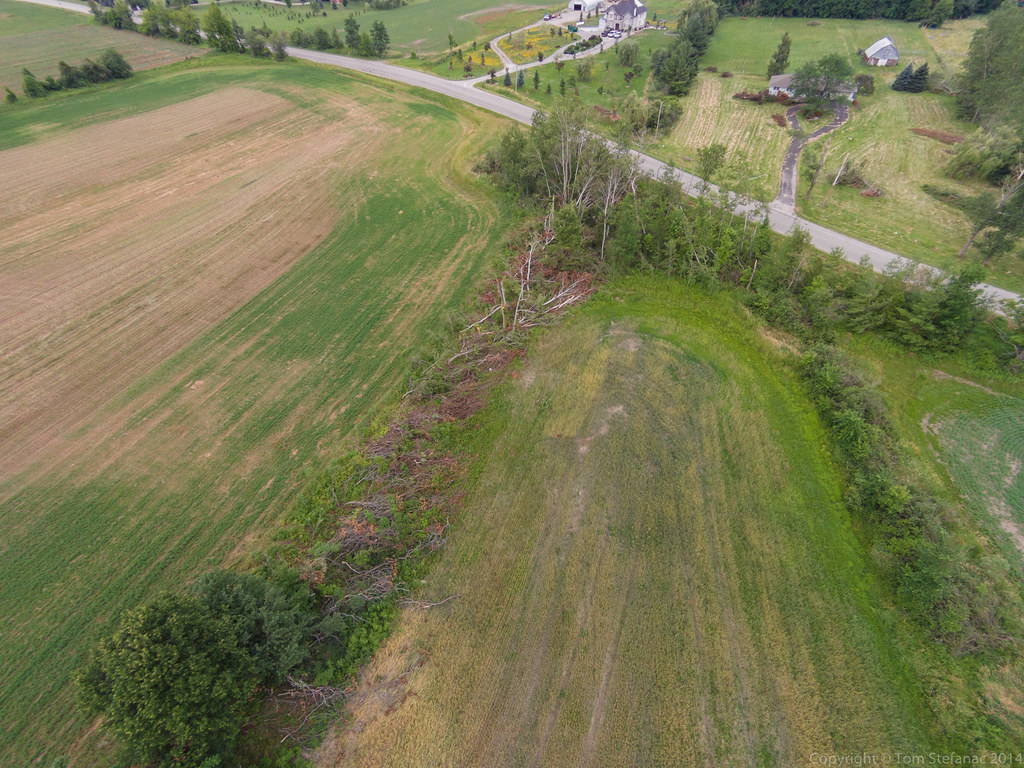
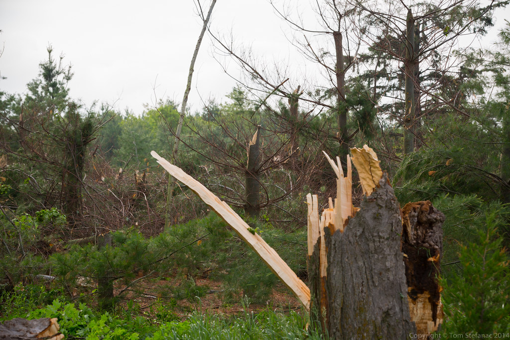
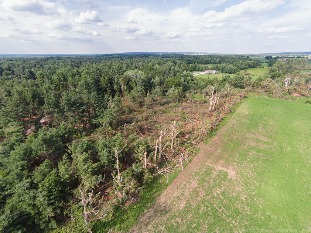
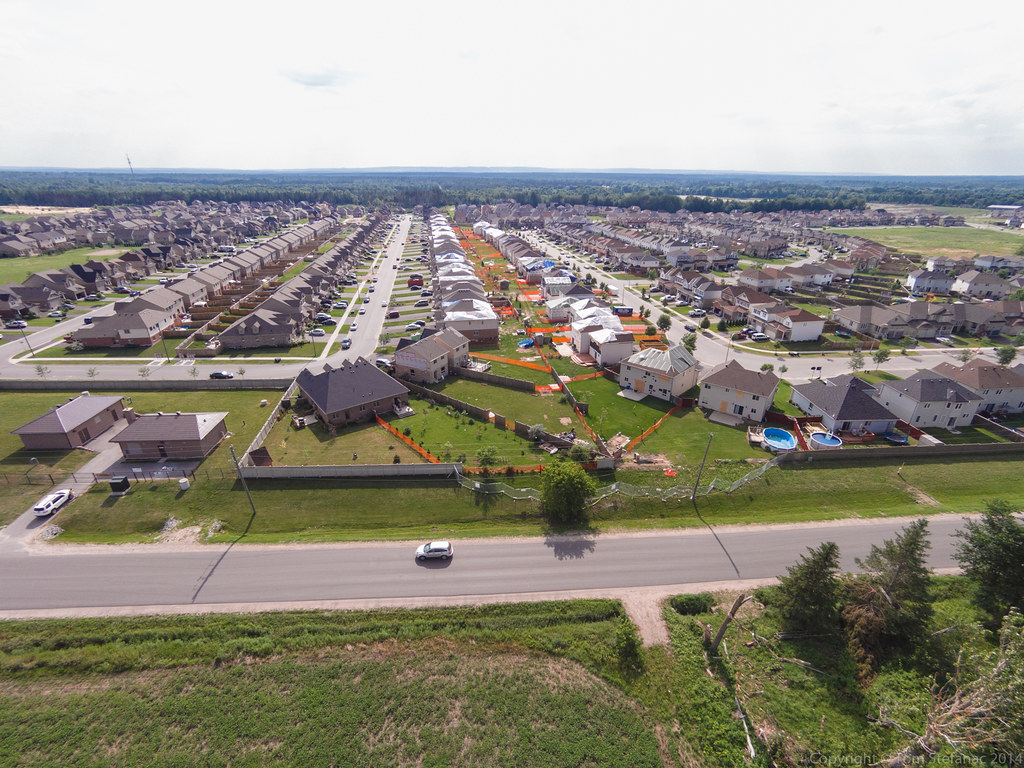
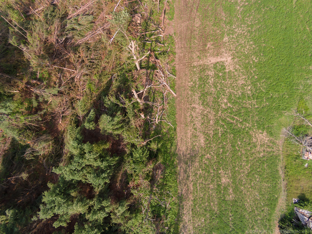
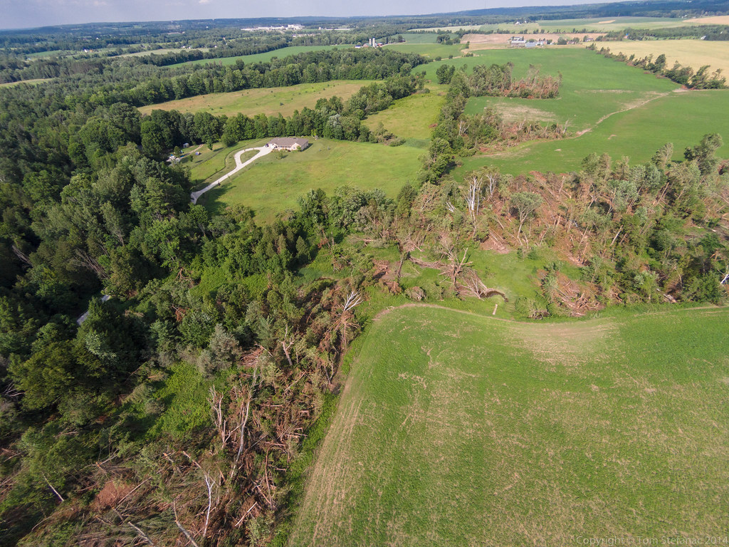
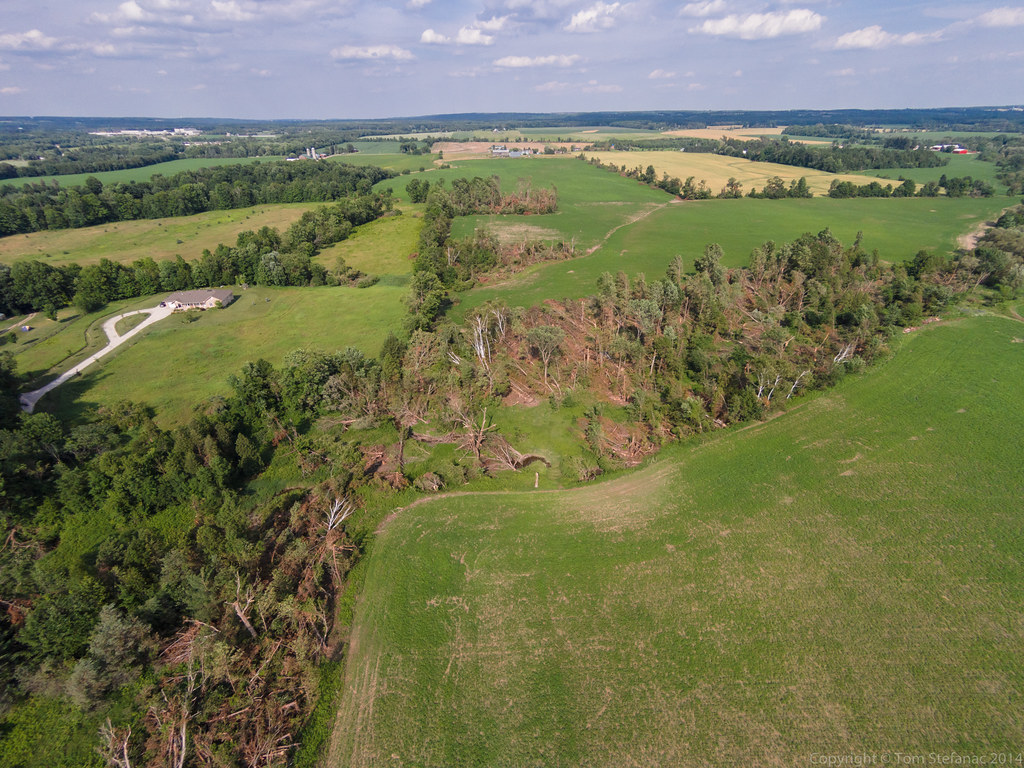
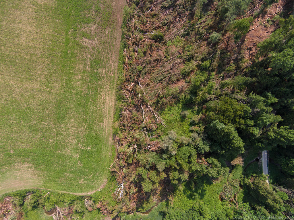
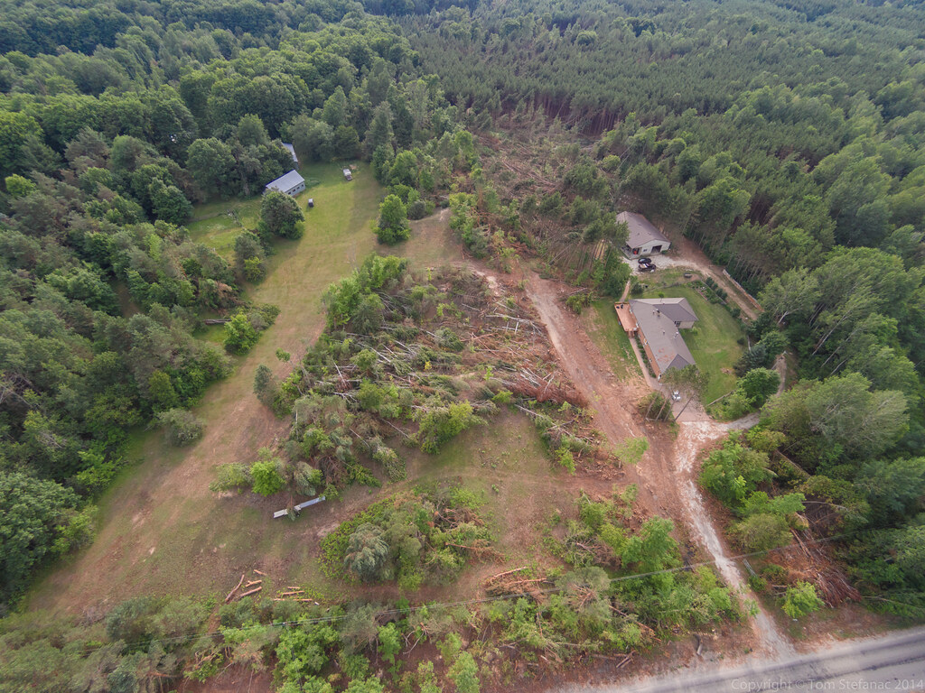
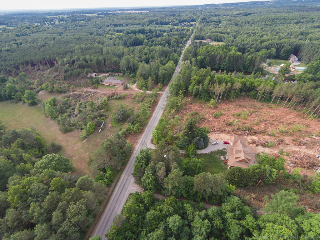
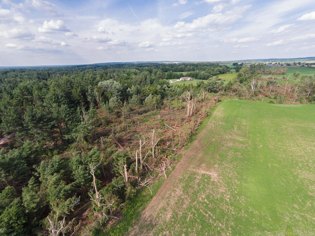
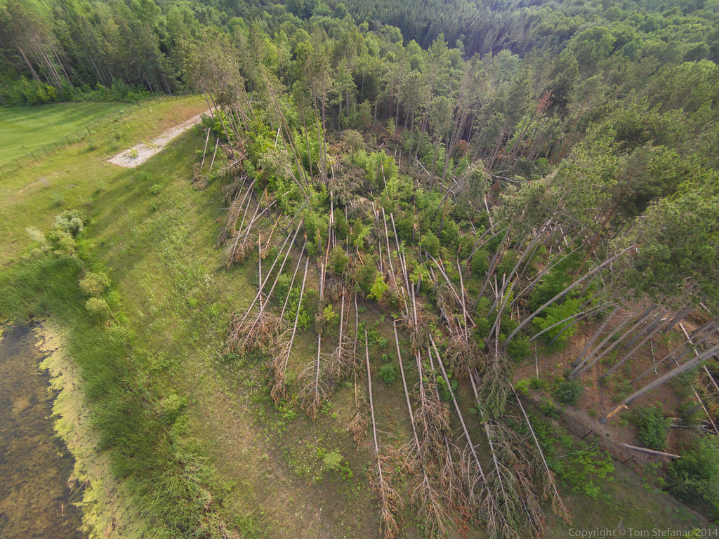
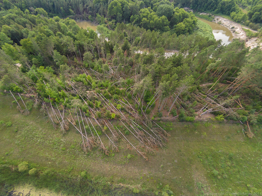
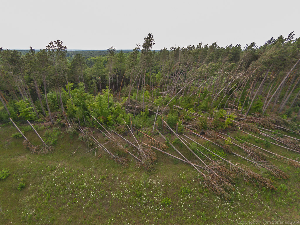
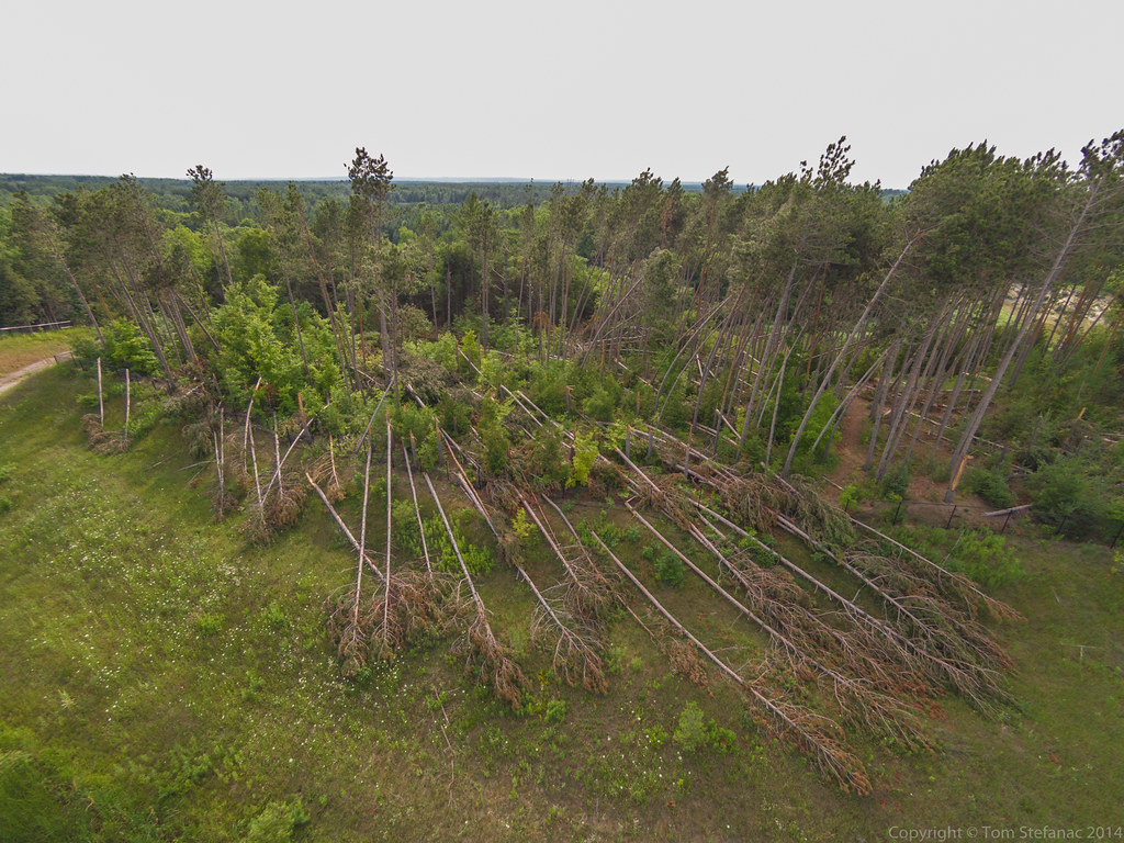
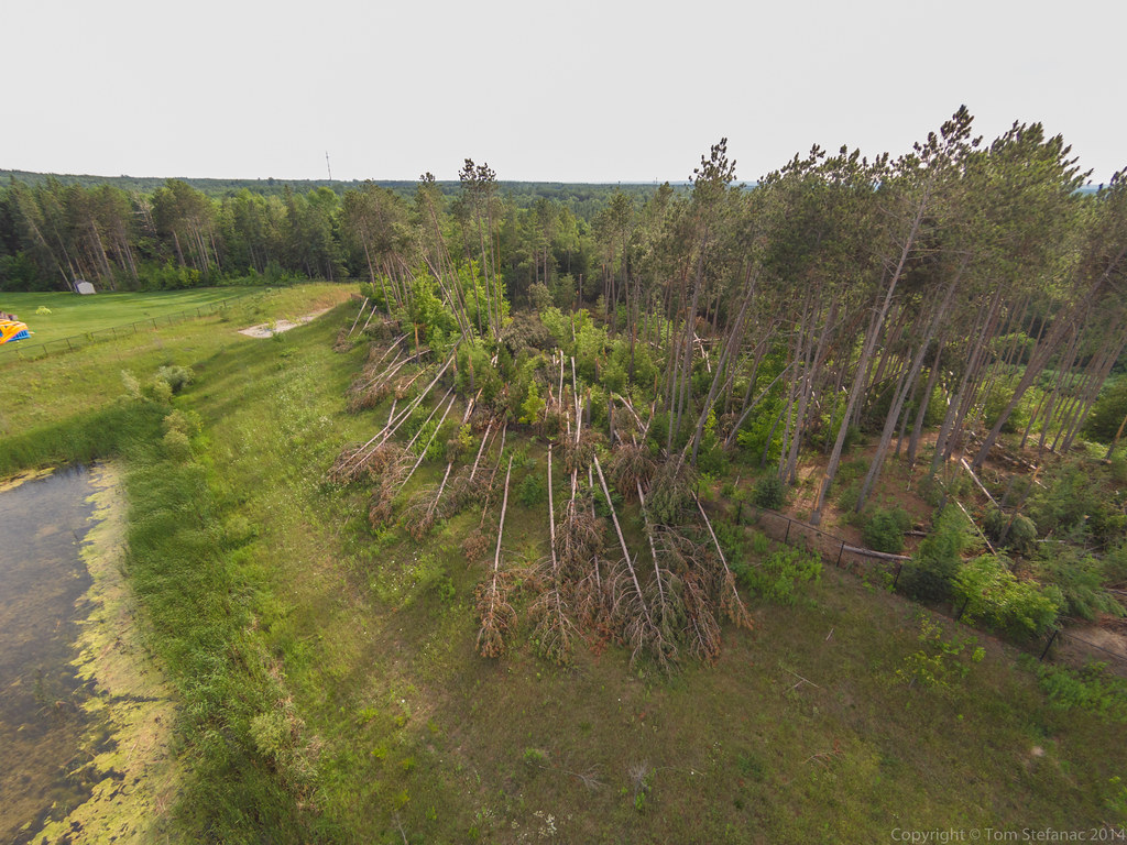
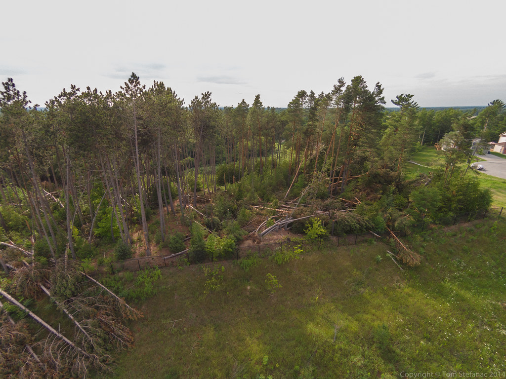
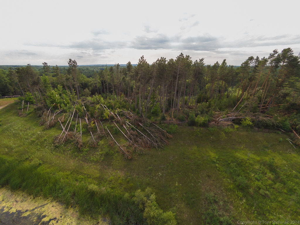
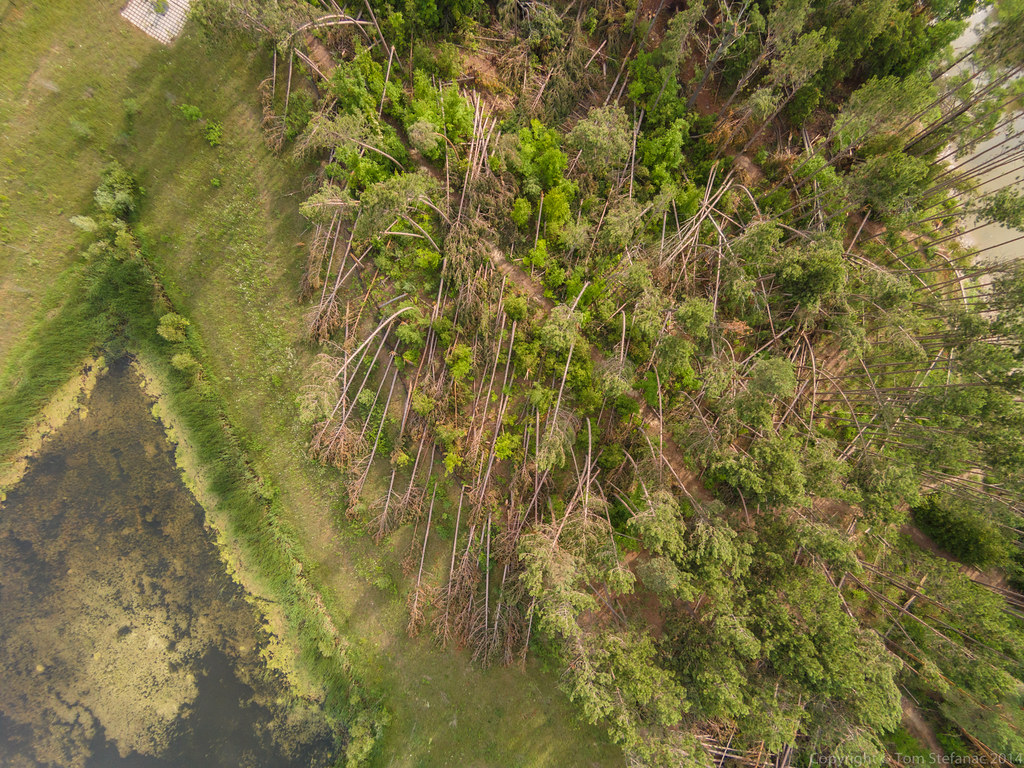
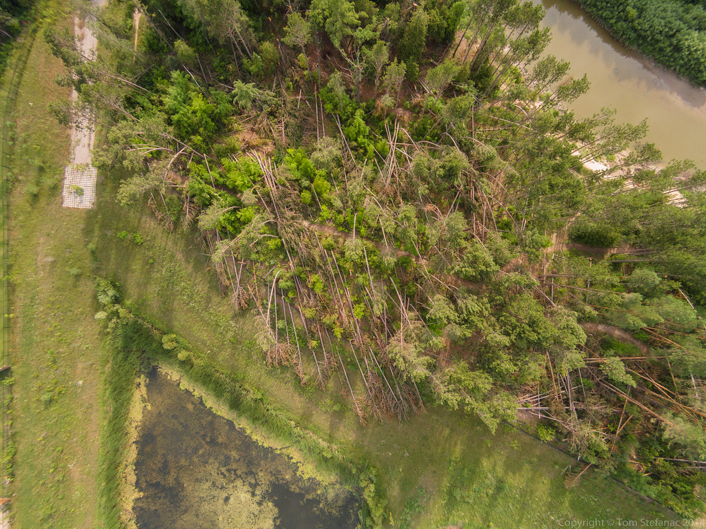
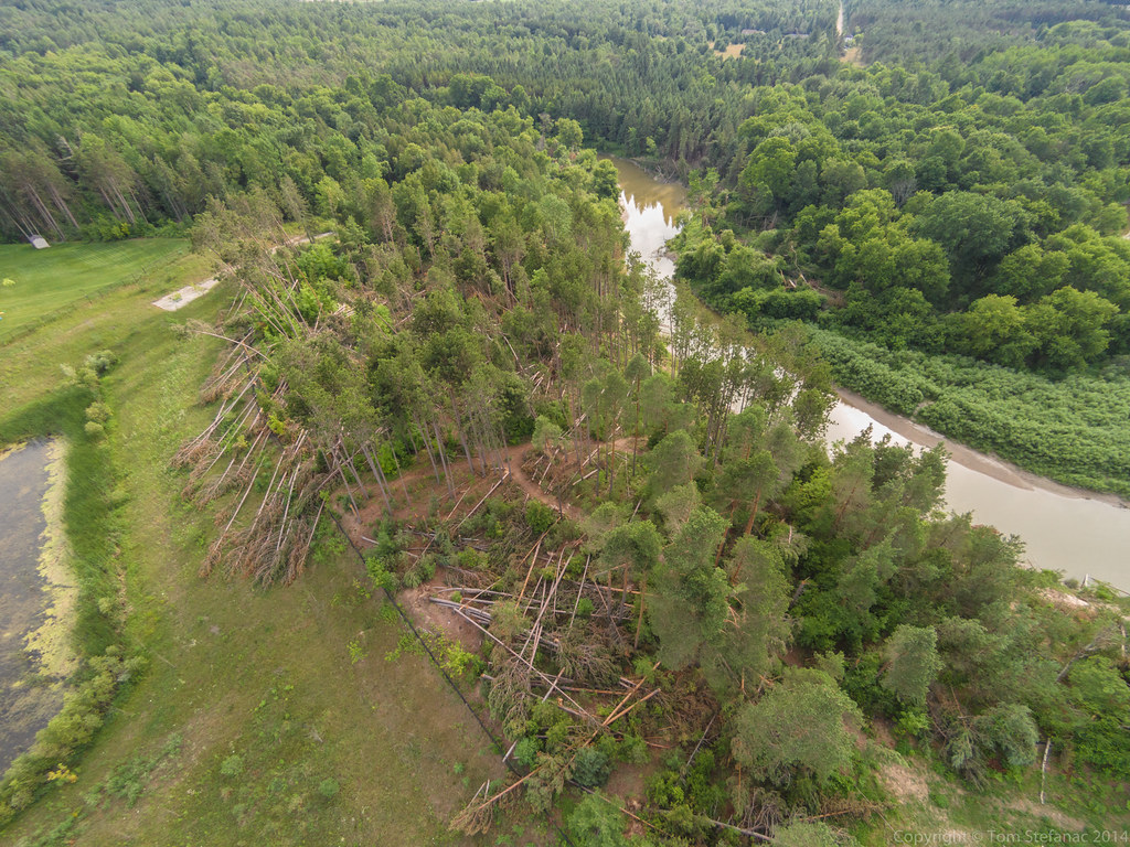
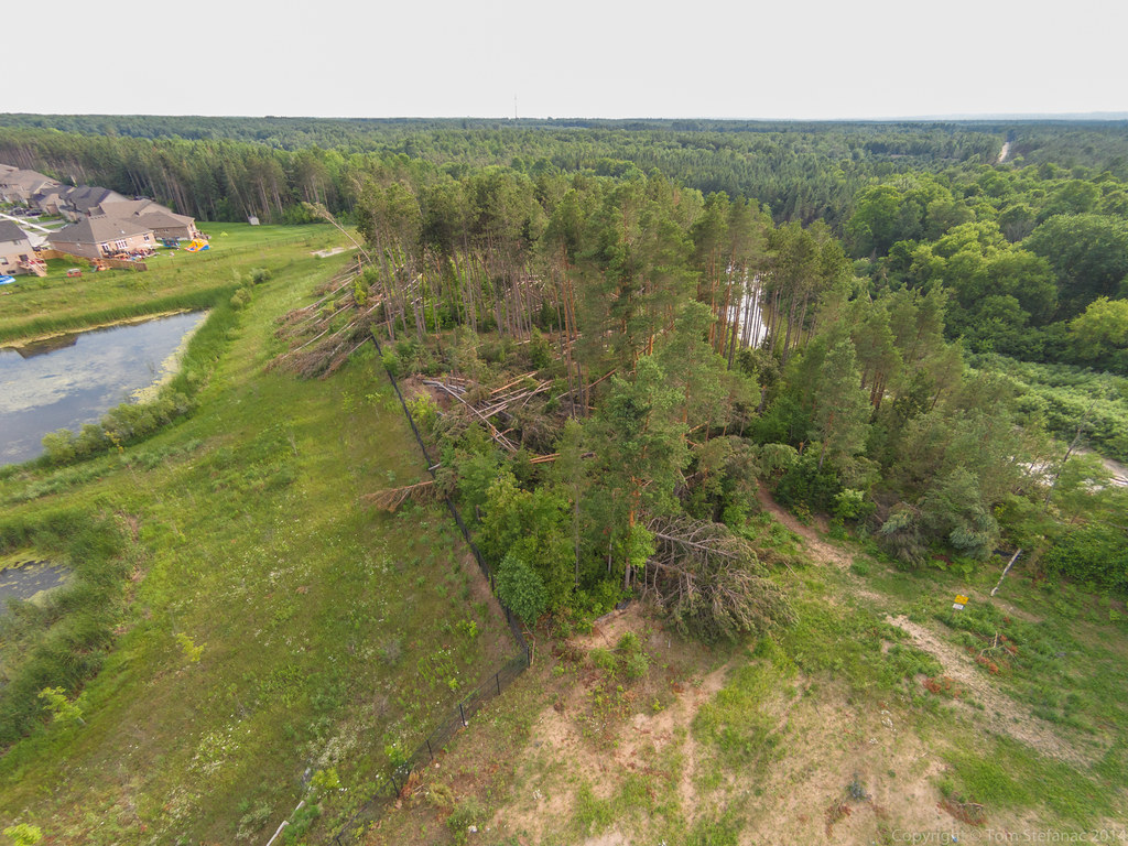
A day and night of freezing rain coated trees, homes and roads with 40-45mm of ice. The storm was a product of an Oklahoma low with a potent surface warm front that simply stalled out and could not overcome the dominant sub-freezing easterly flow just north of the great lakes. This created a perfect storm so to speak where the heaviest rain sat right on an axis of rotation and pummelled some areas just north of Toronto for excess of 24 hours. The result was significant ice accretion leading to substantial tree and infrastructure damage.
|
|
|

The storm while destructive was also very much a rare beast of beauty! As the low departed on good Friday and gaveway to a strong ridge of high pressure, bright sunshine broke through illuminating the glazed icy landscape north of Toronto. I headed out on a photographic journey to explore the beauty and the simultaneous destruction that nature delivered.


Vaavud Sleipnir
I’m one for gadgets and the Vaavud Sleipnir is the perfect gadget for any weather nerd! I was familiar with the whole crowd funding program around Vaavud and their original wind meter but it was not until I wandered into Fogh Marine in Toronto that I saw the Sleipnir sitting in a cabinet.
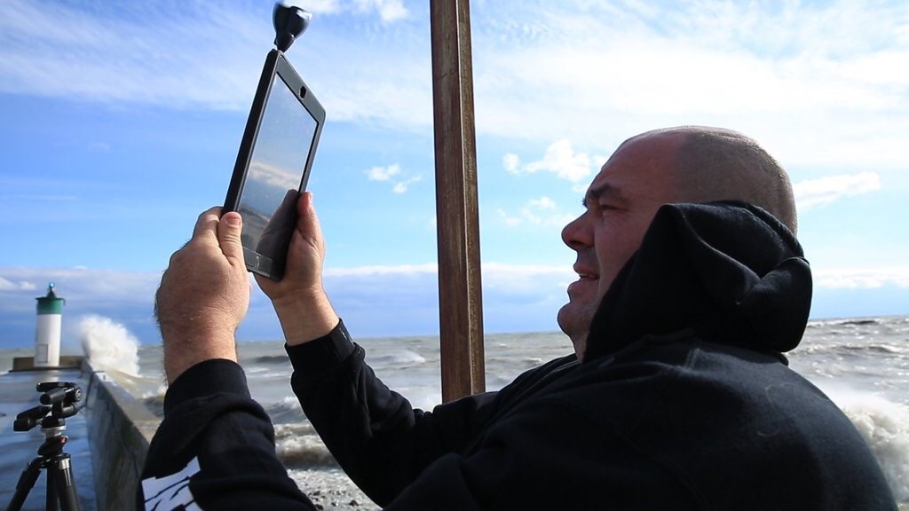
Fellow storm chaser Colin Williamson holding an iPad with a Vaavud Sleipnir
I had a choice of three hand-held anemometers ranging from a standard Kestrel to a Davis ultrasonic device but the Vaavud unit was the cheapest of the three and had one major benefit, it could store and share the wind data. The Vaavud needs a compatible phone to make the unit work since it basically uses the microphone/stereo/trrs jack to send data to an app that turns it into usable information.
During my initial testing of the Sleipnir I was very impressed with the directional accuracy and velocity data resolution. I compared it against a few more expensive anemometers I have including my Davis Vantage Vue and a brand new Vortex Inspeed unit, and the Vaavud was basically on par with both units but additionally able to catch some of the more subtle micro gusts.
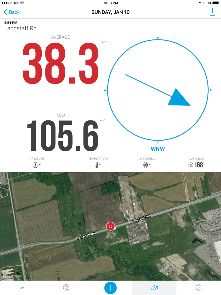
Vaavud application running on an iPad Air 2
The unit as a whole is super responsive and seems to take measurements several times a second catching all the smaller gusts. This data can then be graphed in the program, shared to a larger map and database or even automatically uploaded to DropBox. It’s a great device to keep in your pocket, or somewhere in your car. The one detriment is that it seems to eat up your phones battery and while most all iPhones seem to work fine with it, my Android devices are hit and miss. Plus, if you’re using it in really wet conditions then you have the issue of water getting into your phone by leaking down the pin into the audio port and damaging the internal electronics. Obviously you have to use it with care and caution or for shorter periods in rainy weather.
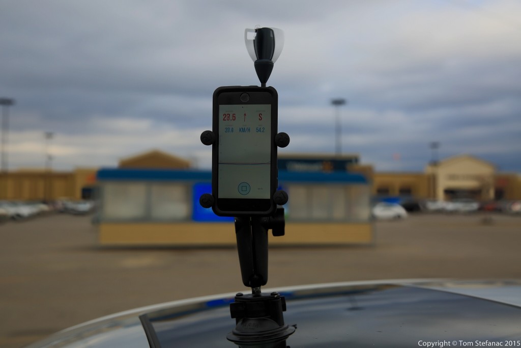
Vaavud vehicle mounted without TRRS extension cable
For my storm chasing and weather needs I developed a vehicle mounted solution. Originally I had simply stuck my iPhone and all to the roof of the car by using a suction mount and RAM X grip. While it works perfectly, the phone is still exposed to any elements and not easily accessible. Plus I accidentally drove away a few times with the phone up there and had the mount failed I would have been out of a phone and $600!

StarTech 2 meter / 6 foot TRRS extension cable used with the Vaavud Sleipnir
The solution was to purchase a 2 meter long StarTech TRRS cable from Amazon.ca and keep my phone/tablet inside the vehicle while leaving the Vaavud unit mounted outside. My initial testing reveals that the Sleipnir operates just fine with the extension cable. I have yet to really test how waterproof or weather/dust resistant the anemometer is but at last I can now mitigate any risk to my phone/tablet. This is especially important when your inside of a powerful thunderstorm.
The one draw back is that the digital compass data is lost when inside the vehicle. This means the directional wind component of the Vaavud becomes useless. But overall that’s a small price to pay for having recorded and geotagged wind data that will catch all those smaller but important gusts.
I’ll continue testing the vehicle mounted unit and update the blog with my findings. Once the weather is warmer I intend to build a small 30cm tall post to get the anemometer as far away from the vehicle body as possible to increase accuracy.
You’ll find a short video below showing fellow storm chase Colin using the Vaavud in 80 km/h winds.
Vaavud Shop – https://vaavud.com/shop
Fogh Marine – http://www.foghmarine.com/
StarTech – TRRS Extension Cable
September 9th 2015
 Not a storm chase per say. While on vacation in Florida this tropical thunderstorm about 70km away lit up the horizon with awesome lightning!


October 17th 2015


Amateur Radio
Communication is a key part of storm chasing and this is especially true if there are a few people in a group chasing together. There are many communication tools in today’s world ranging from cell phones to unlicensed FRS walkie-talkies but the best means of communication for storm chasing is ham radio because it works when cell phones don’t and the quality and range of communication is far superior to FRS/GMRS and CB.

All amateur radio operators across the globe require a license. In Canada, a basic license will get you privileges above 30 MHz, that means you’ll be able to use all the standard VHF/UHF equipment. I have both my basic+advanced with full privileges except morse code, so I’m able to operate in any of the allocated HAM radio bands.

For storm chasing, all my HAM radio gear is considered mobile equipment. This means, these are radios that are specifically designed to be mounted in a vehicle and operate off the vehicles battery power which is typically in the 11.5 to 14.4 voltage range. Mobile radios typically also have quick keys and features on the microphone and radio face plate which makes operating them easier than a normal base station radio would be.

Most storm chasing communication occurs in the 2-meter VHF spectrum between 144 and 148 MHZ. In North America 146.550 is often the primary FM simplex channel used, with 146.490 and 146.580 being two other alternative channels. Another channel, 146.520 is the FM calling frequency, this is reserved for making contact or calling out for someone to respond. After contact is made it’s standard practice to move to another frequency/channel.
The reason 2-meters is considered the band of choice for mobile communication in rural environments is because vehicle mounted antennas don’t have to be overly large to work efficiently, the noise floor is relative low and you don’t need a very good ground plane to “ground” or anchor the antenna. As you get lower in frequency the noise floor rises, antennas get bigger and the ground plane becomes more and more important. As you get higher in frequency the radio waves become smaller requiring smaller antennas, and the noise floor drops but there is a trade-off. For one, high-frequency radio waves (1.8MHz – 30 MHz) typically have better ground propagation than very high frequency waves meaning that a signal on 50Mhz will in theory travel further through hilly terrain and trees than a signal of the same strength at 145MHz and an ultra high frequency signal at 450MHz will preform even more poorly.
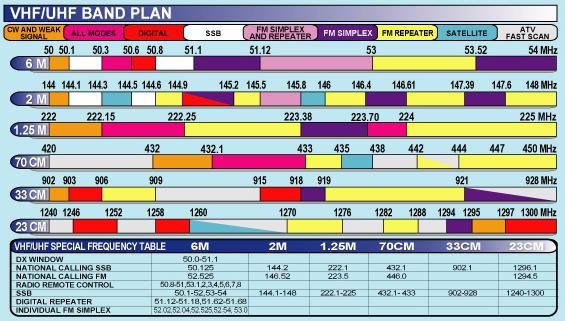
This is all in theory of course. The problem is that a 10 meter or 6 meter radio wave requires a big vehicle mounted antenna. A quarter-wave antenna on 10-meters / 29MHz needs to be ~3.5 meters tall, and for 6-meters / 52 MHz you need a ~1.5 meter tall antenna. Yet, for 2-meters / 146MHz a 1.5 meter tall antenna is 5/8th of the radio wave, so your almost at full size which increases your ability to pull in and receive a signal. When you factor all these real world variables, 2 meters is easily the ideal band which will get you the most range and signal clarity in a rural mobile environment.
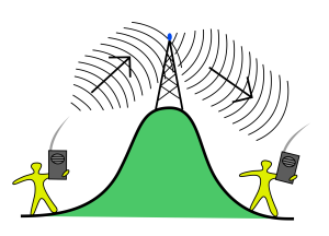
One other aspect of HAM radio which makes it perfect for storm chasing is the use of repeaters. Repeaters are basically half-duplex radio systems mounted high up on towers, buildings and even mountains for maximum range. A repeater receives a signal on one frequency and immediately repeats it on another frequency. So if I only had 10 km of range on simplex with a repeater I might be able to get 40 to 100 kilometers of range or more through a repeater.
This is why Canwarn and Skywarn nets are hosted on repeaters which cover large areas. These nets are activated during severe weather and allow spotters and chasers to relay important information to the net control station who can then directly send it to the proper weather office so a watch or warning can be issued, etc.
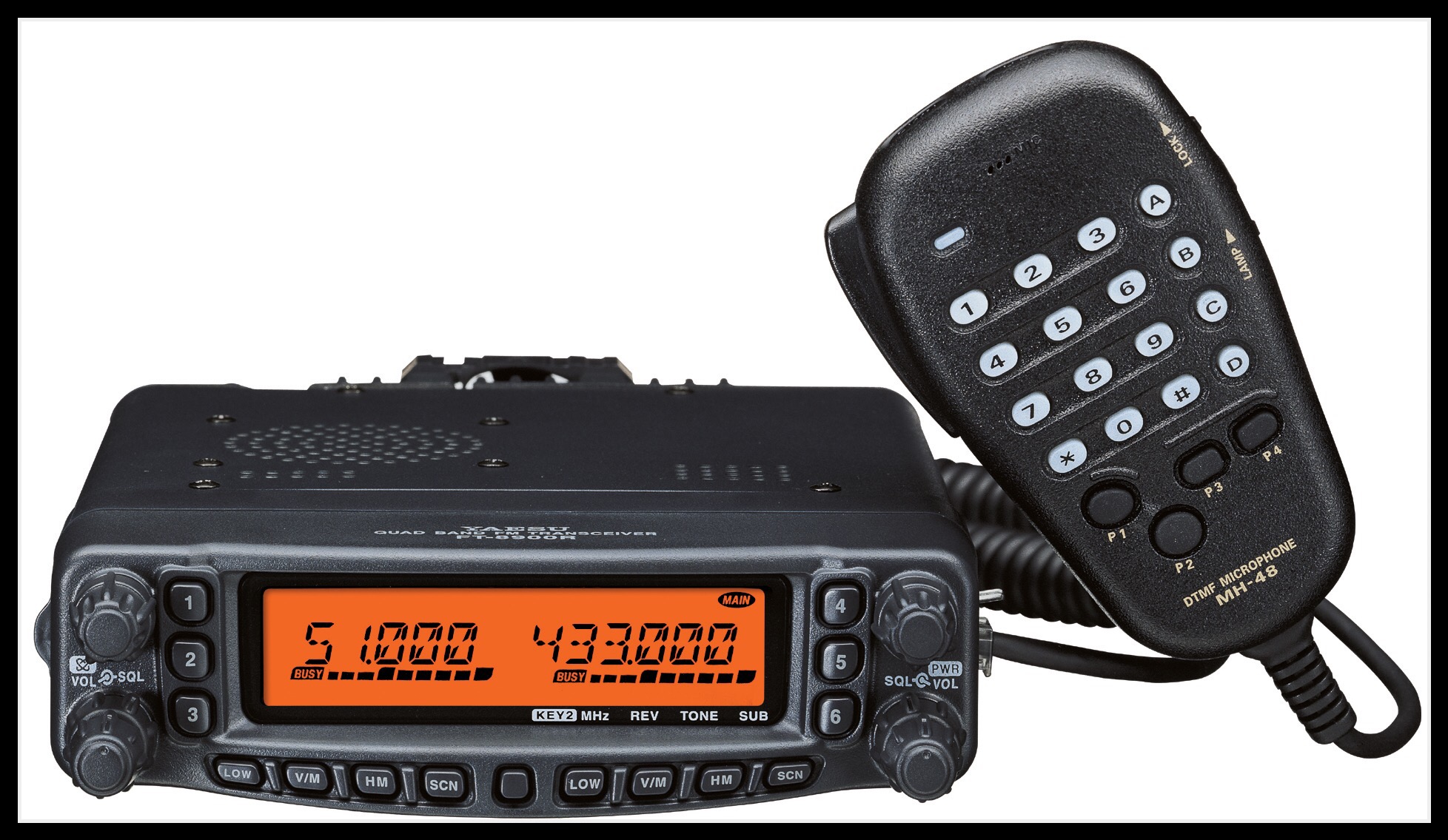
In my vehice I have two radios, the first of which is a Yaesu FT-9800R. This radio is a quad-band unit covering 10, 6, 2 and 70 centimeters which basically gives me access to all the parts of the HAM radio spectrum where FM is used. It also has crossband repeat, dual-receive and transmit plus 700 memory channels. I’ve put every repeater for the province of Ontario in this radio and have state zones I load in while storm chasing in the U.S and other places. It’s basically my core radio for repeaters and whatever else I might need. However I don’t typically use it for simplex communication.

My second radio is the real workhorse which I use religiously for chaser to chaser communication. It’s the Icom V8000 which boasts a whopping 75 watts of power and is tuned to minimize noise. It’s a mono-band radio meaning it only supports 1 band (VHF 2-meters) but that’s fine, with a good high gain antenna this radio can go the distance and the audio is super clean. Despite supporting a whopping 75 watts it also has low power modes and I’ll often only need to use it with a meager 2.5 watts running into a high-gain 5/8th whip antenna to get the job done. That said, when I do need 75 watts, it delivers without hesitation powering through whatever.
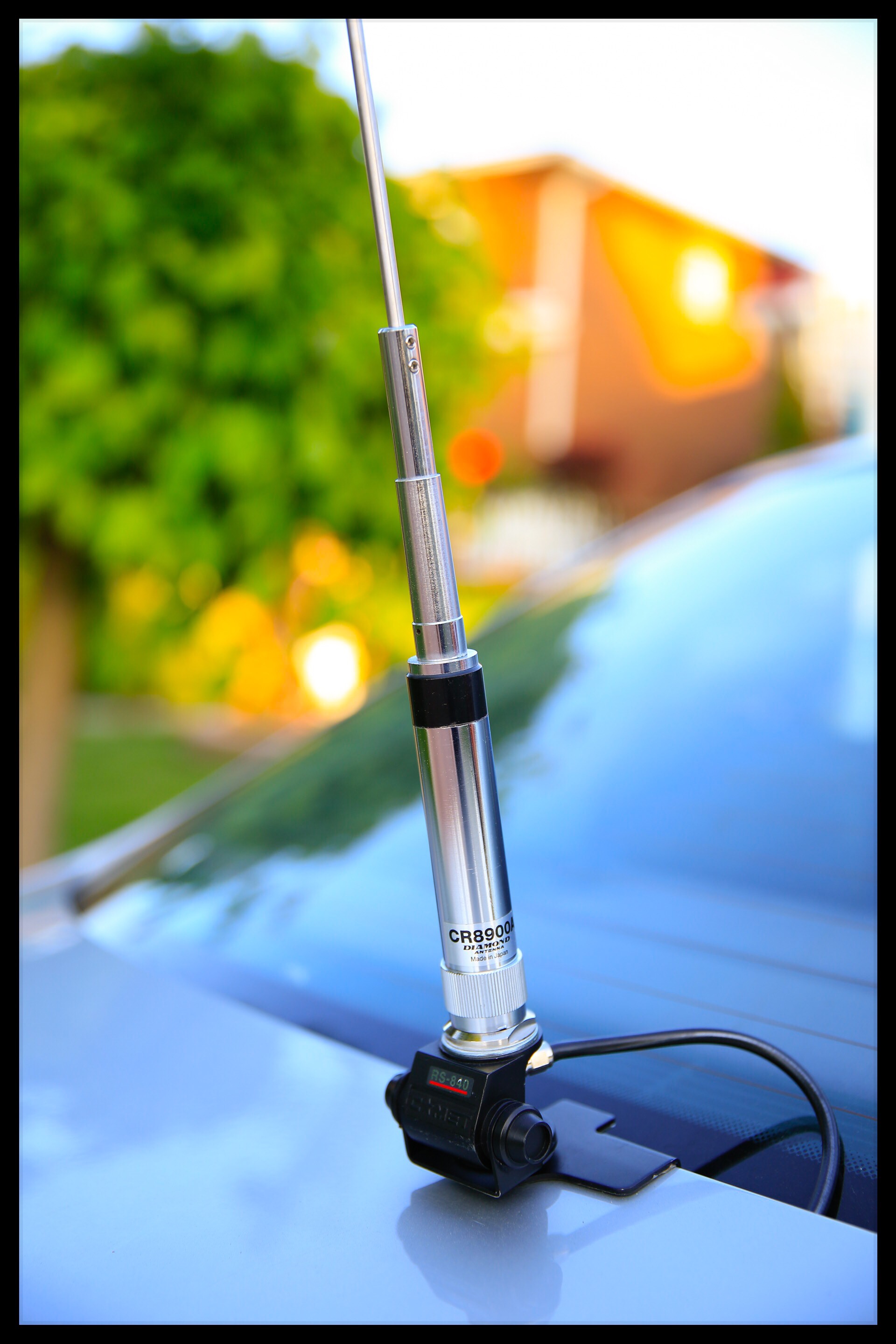
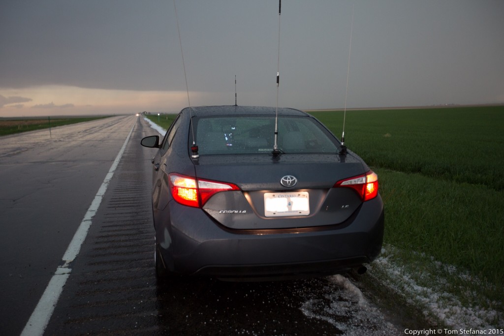
All my antennas are trunk-lip body mounts. I would use magnetic mount antennas in the past but they would sometimes blow off in high winds, scratch the paint or create other problems. Often they were not sealed well and rain would creep in destroying the coupling system. With trunk-lip mounts the antennas are always firmly in place, well grounded and I’ve not had any corrosion issues. For the FT-9800 I use a quad band antenna called the CR-9800 made by Diamond and for the Icom V8000 I use a Comet 5/8th whip which I’ve cut and tuned. When chasing in tornado alley I also sport a CB radio and put on a trunk-lip mounted K40 antenna to use with it.
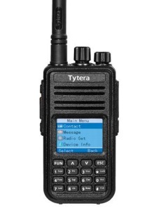
My most recent acquisitions have been a portable DMR radio, TYT-MD380, and two D-star Icom units, ID-51A Plus and Icom 5100A. There is currently a shift occurring in amateur radio where traditional FM signals are being replaced by a growing number of digital voice modes.
Digital-voice radios are nothing new, in fact they’ve been around for years (think cell phones) and many amateur radio enthusiasts have been using them. The first widespread non-cellular digital systems were commercial iDEN networks followed by NXDN, Apco-P25 and many others. All of these systems were commercial in nature and meant amateurs were usually buying used commercial gear.
Digital voice radio is just like FM, except instead of an analog signal being sent out where noise such as static and natural artifacts interfere, digital modes use codecs like MP3’s or other digital mediums to store information. The radio receives this digital signal and puts it back together into something audible. All digital radio codecs are lossy in that they lose information as radio signals become weak, noisy and degrade but the microprocessor in the radio uses error correction logarithms and the like to put the audio signal back together.
In some cases digital voice signals can be received much farther away than FM signals with near perfect audio quality thanks to amazing error correcting technology.
Today D-Star (ambe codec) is the primary digital voice radio system used in amateur radio followed by DMR/MotoTrbo. D-star is really geared for amateur use but unfortunately only Icom is the current major manufacturer. DMR radio is a commercial digital system, but you need to buy a commercial radio to use it and it can’t be easily programmed on the fly. In the not too distant future FM will likely be completely replaced with digital-voice modes and one mode will likely dominate but until then I have capability in all the modes to remain compatible with everyone and everything!
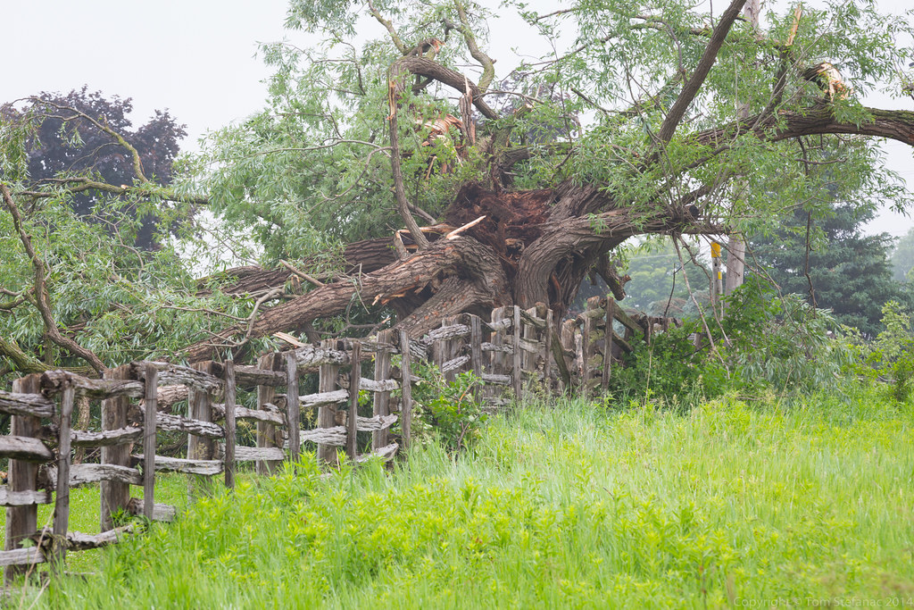
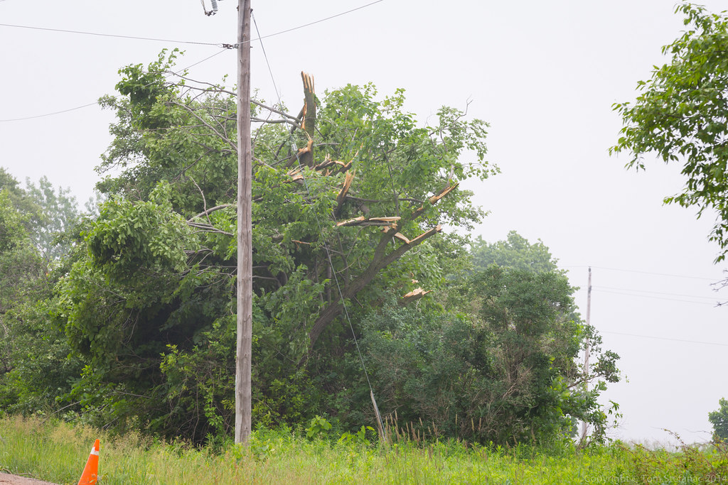
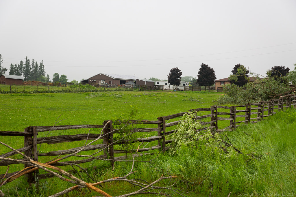
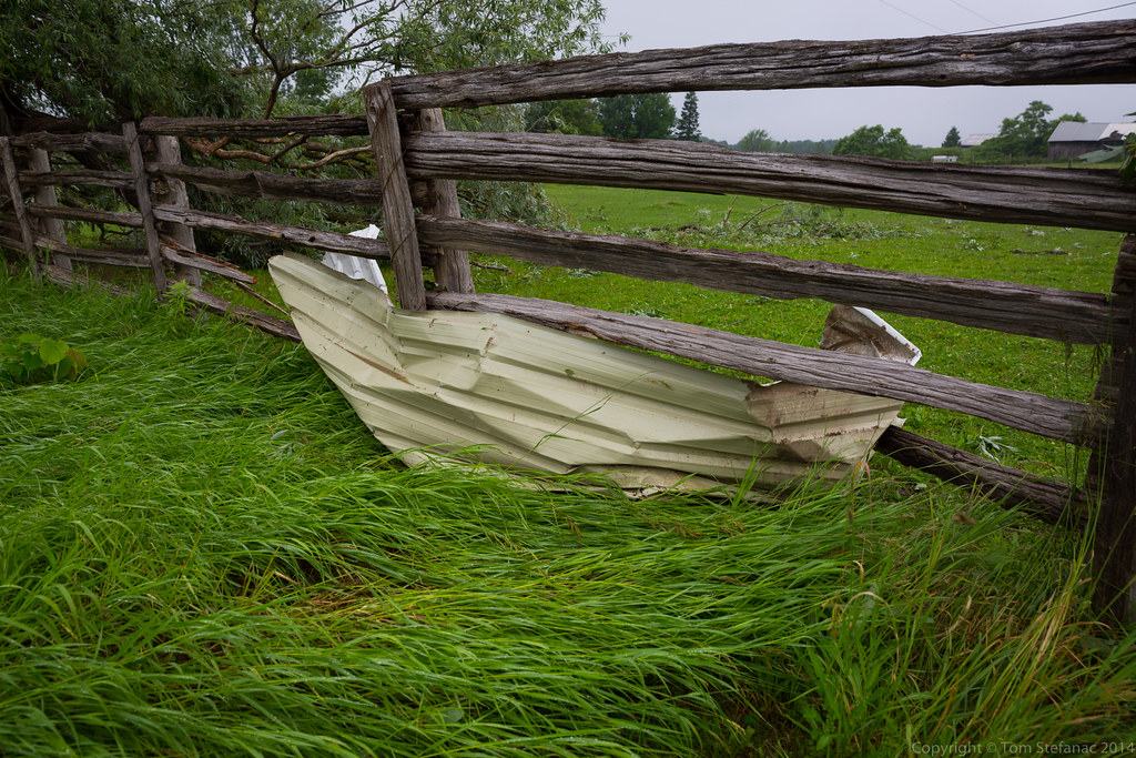
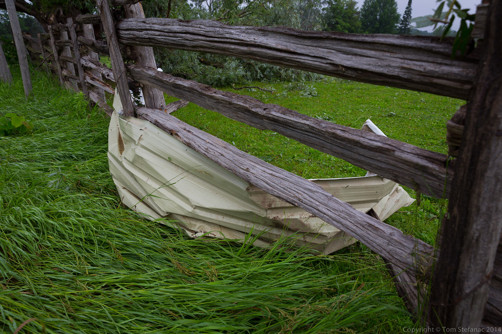
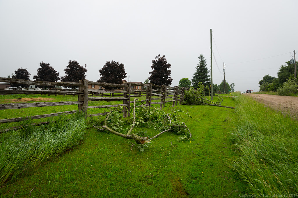
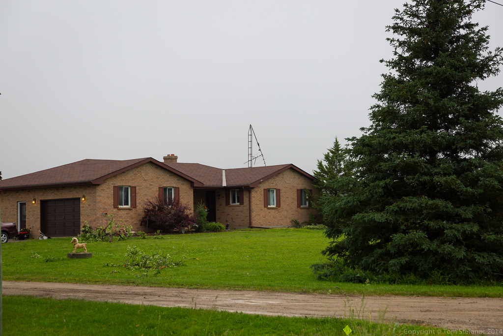
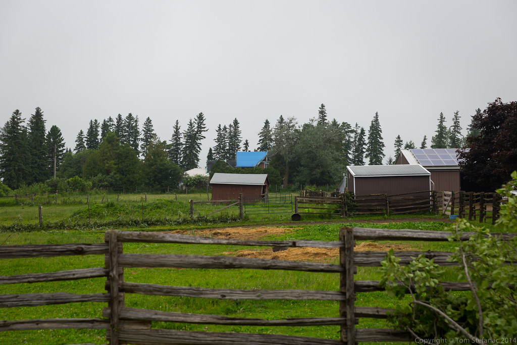
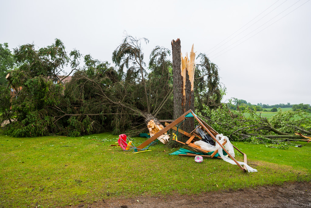
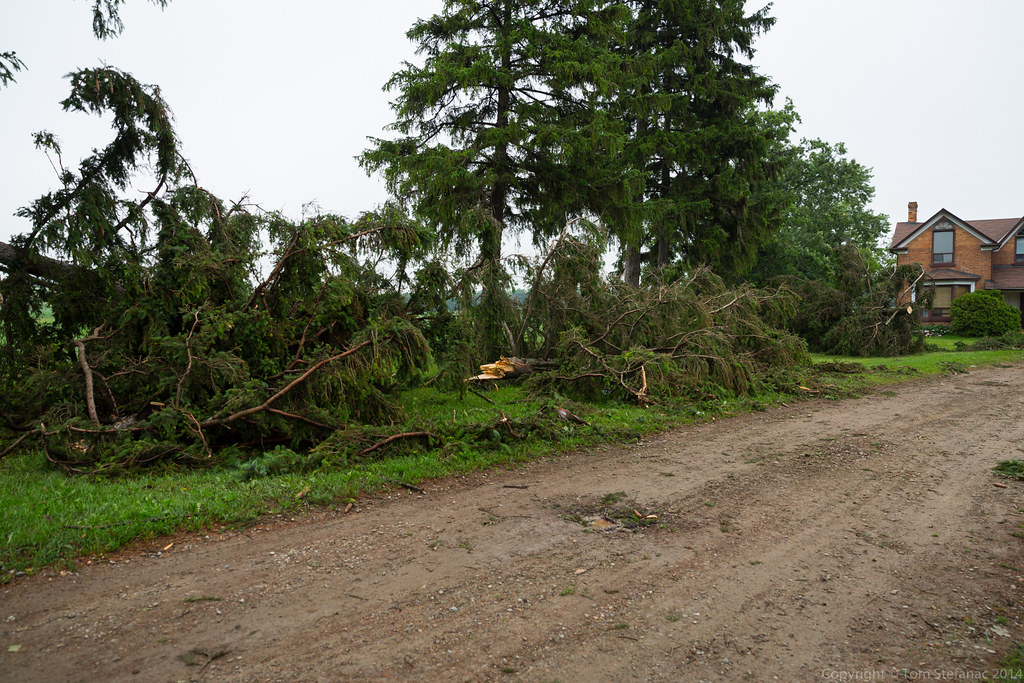
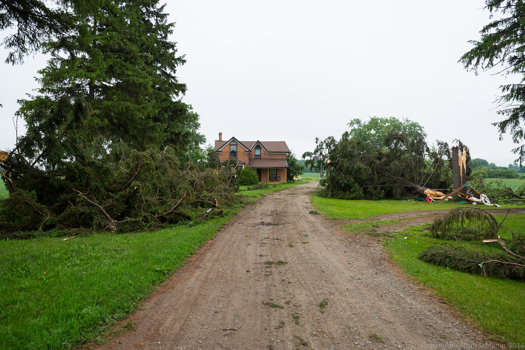
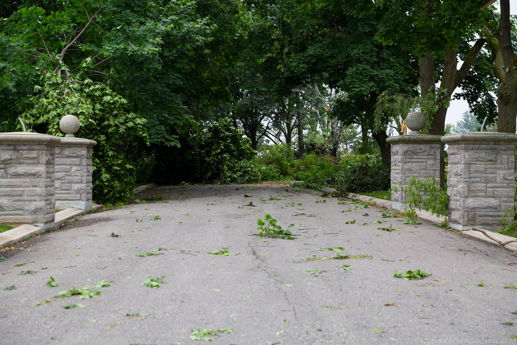
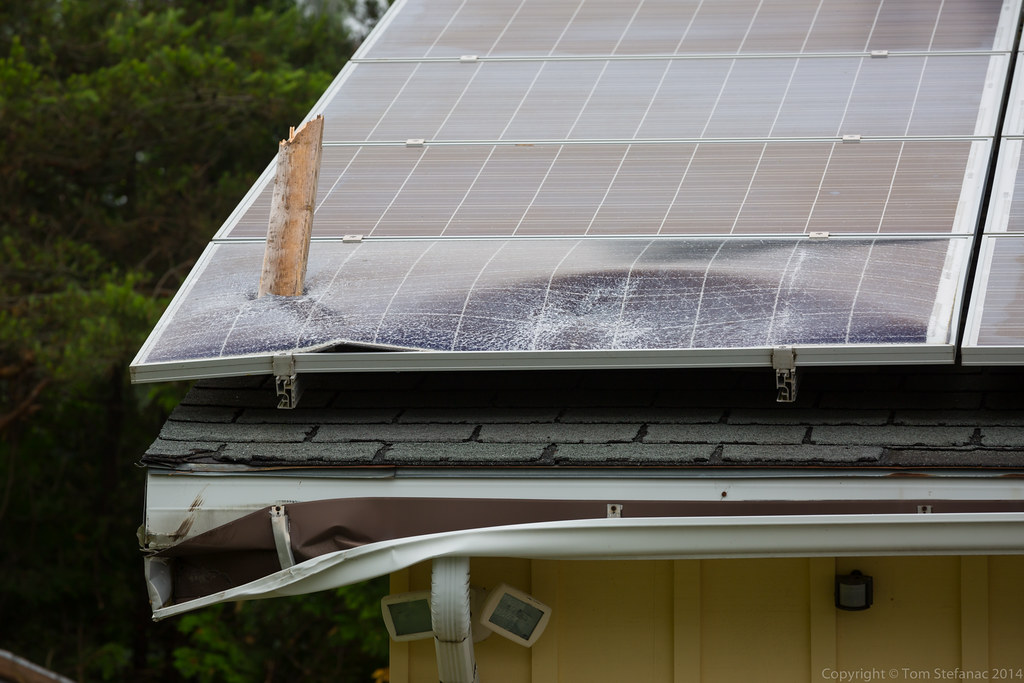
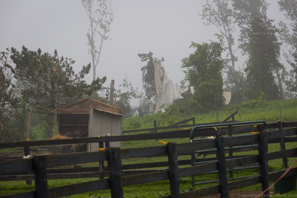
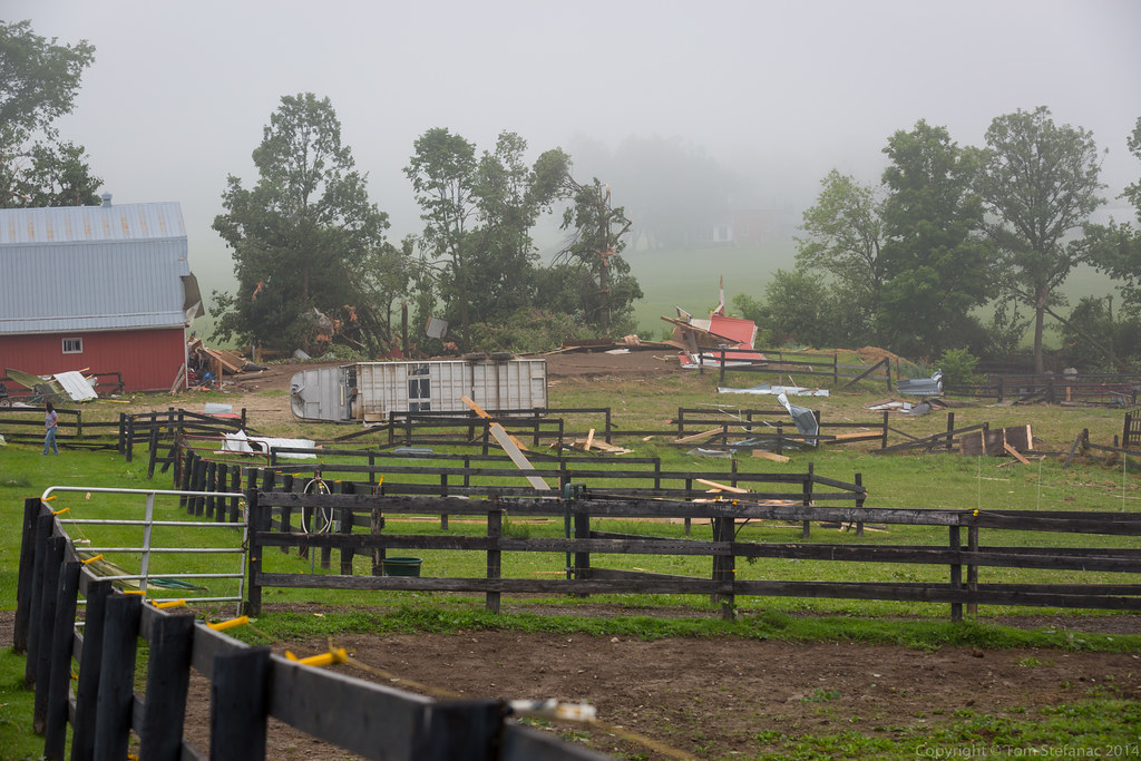
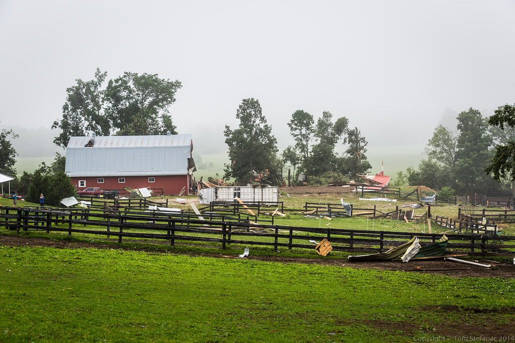
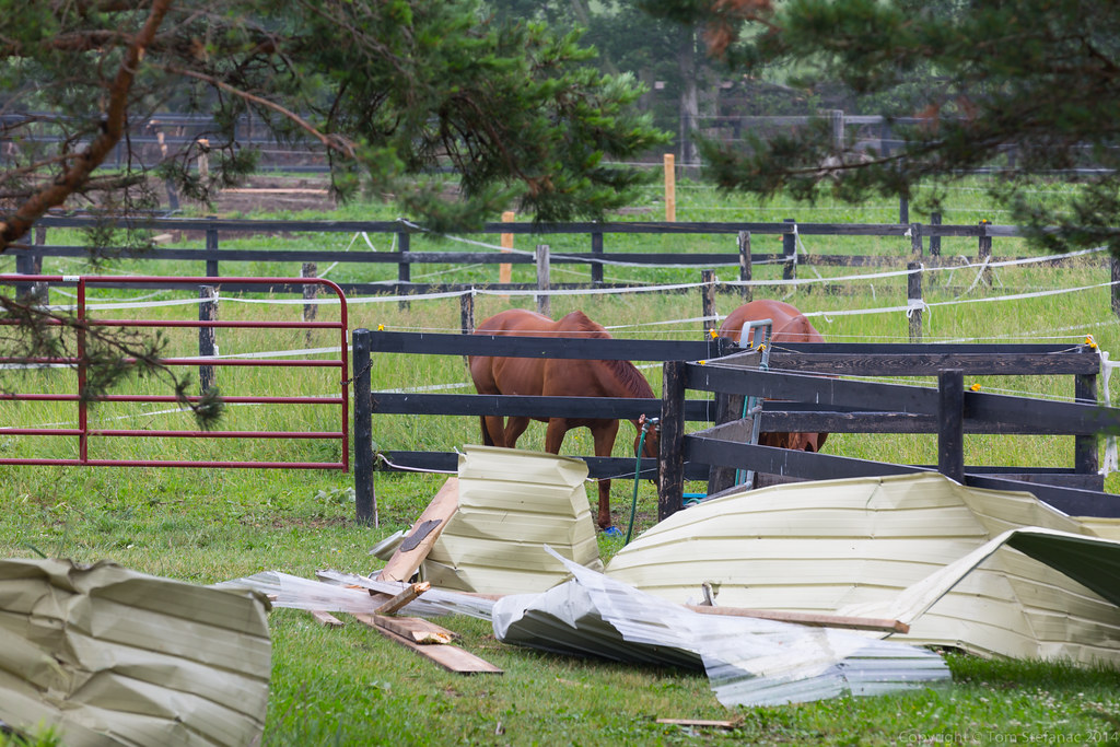
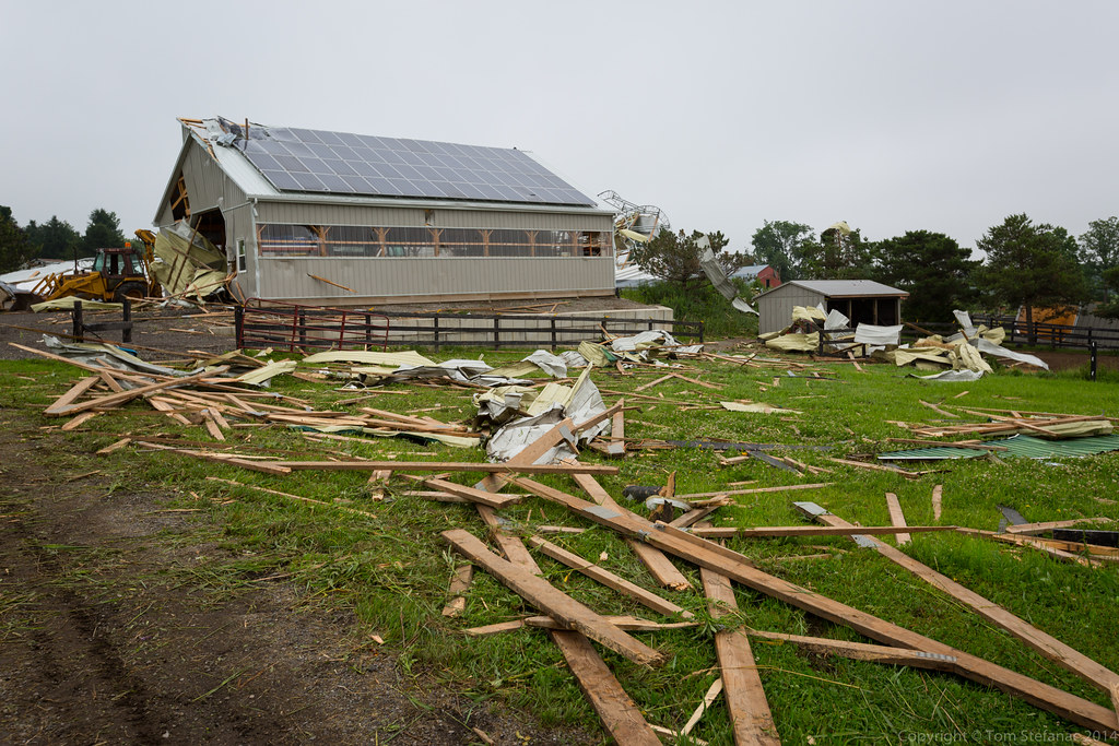
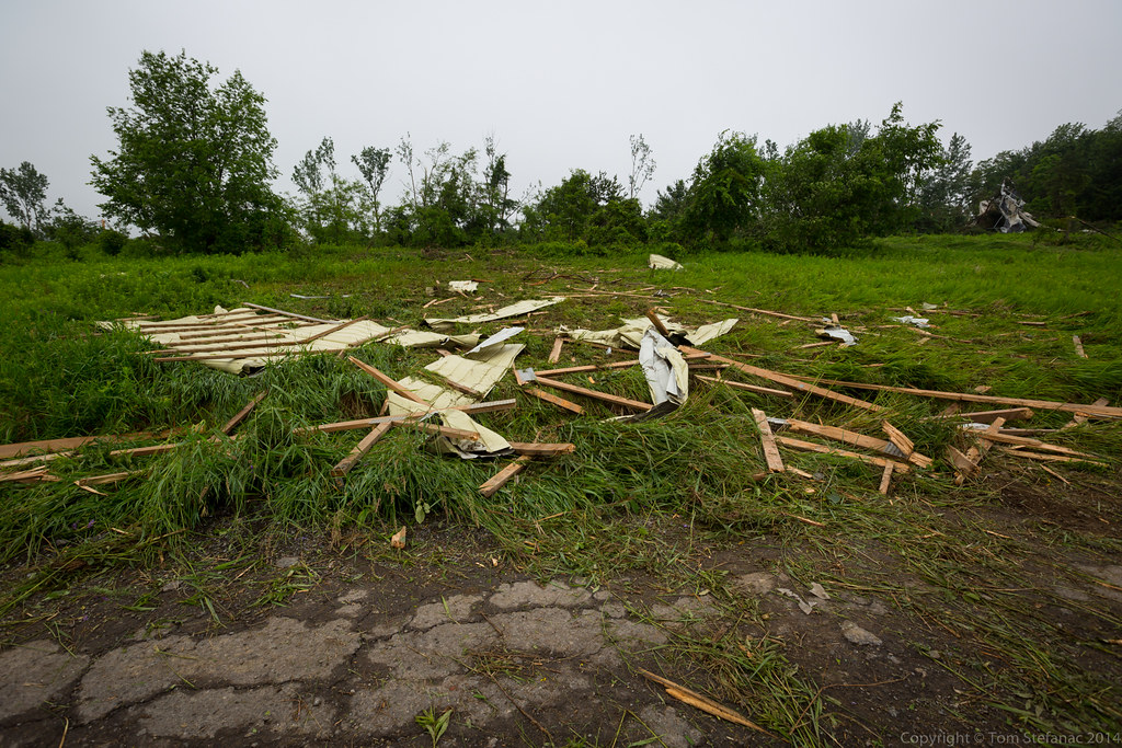
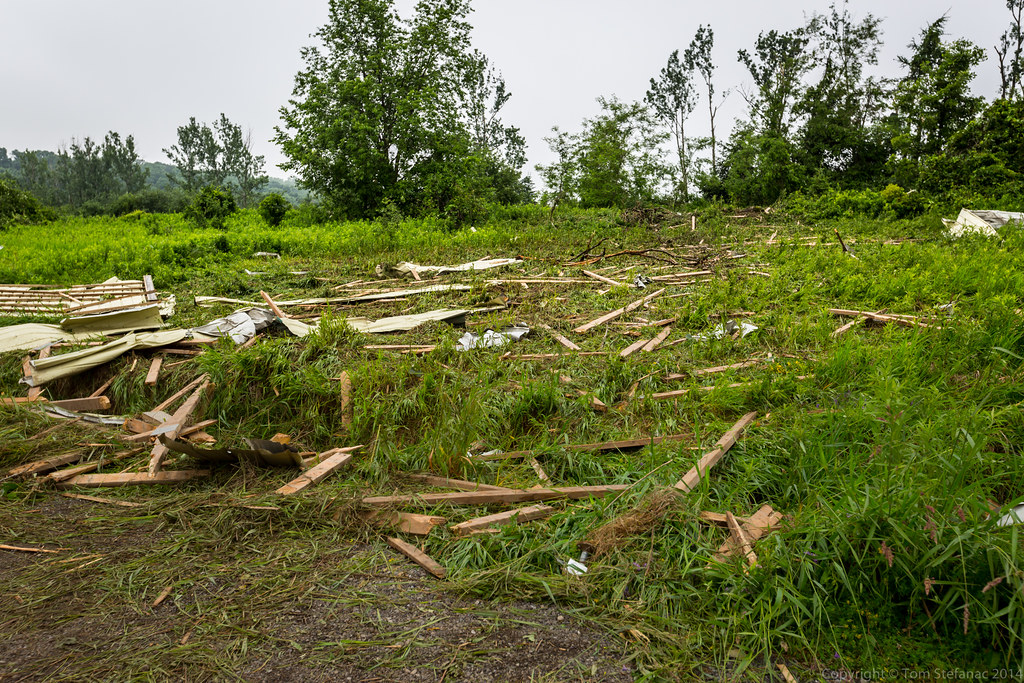
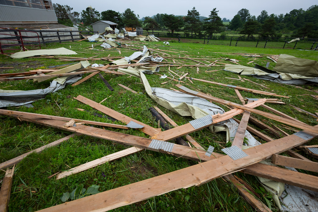
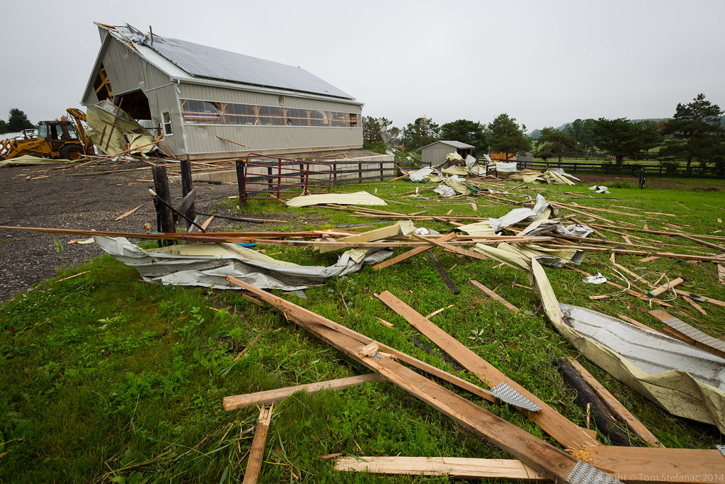
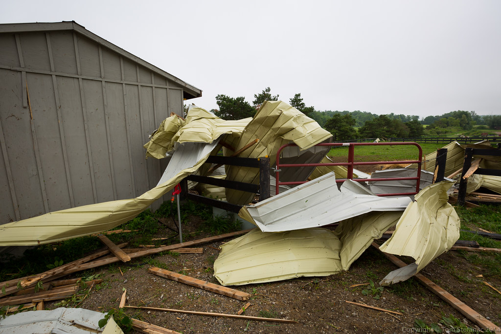
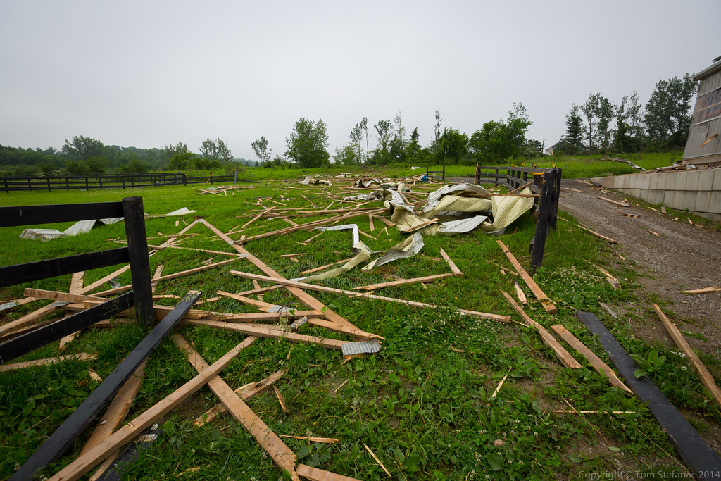
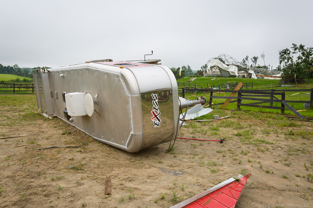
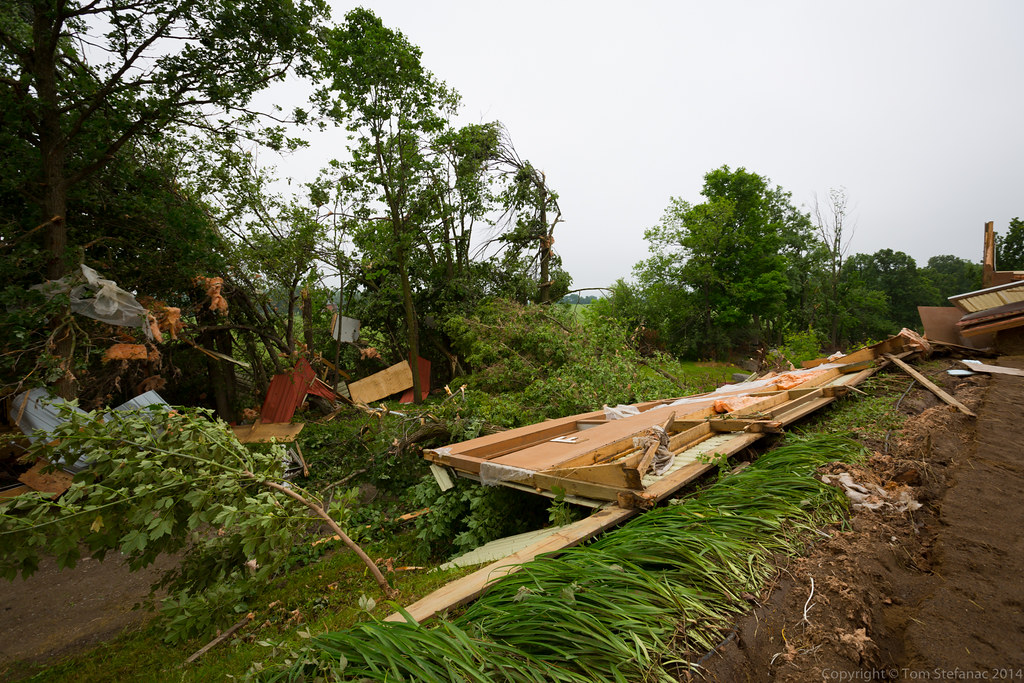
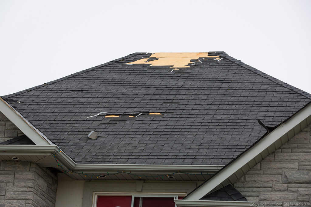
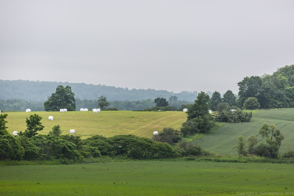
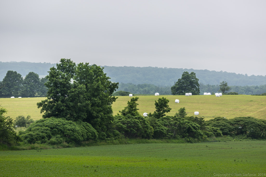
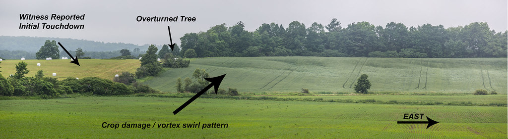
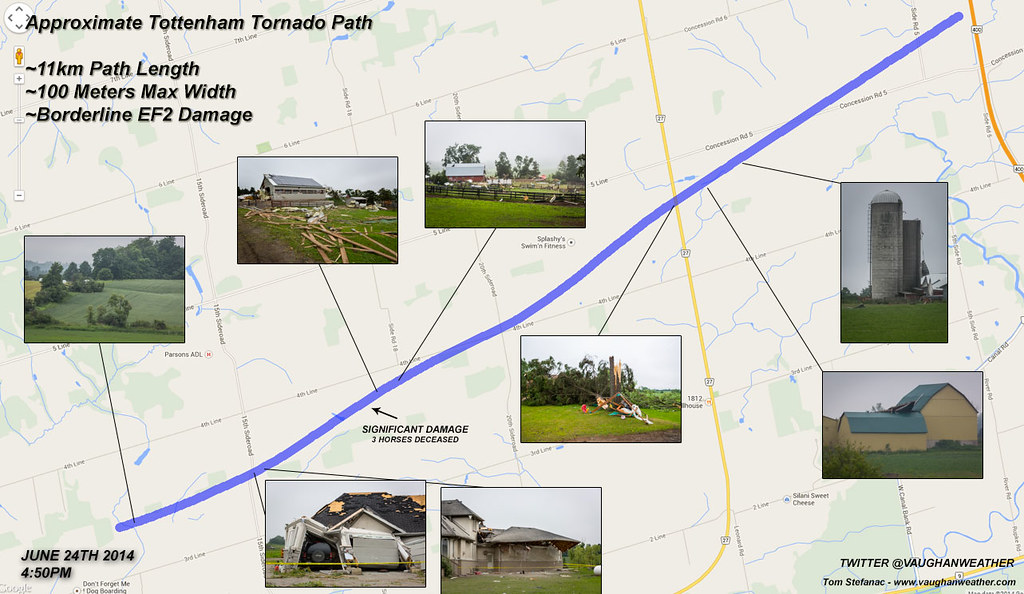
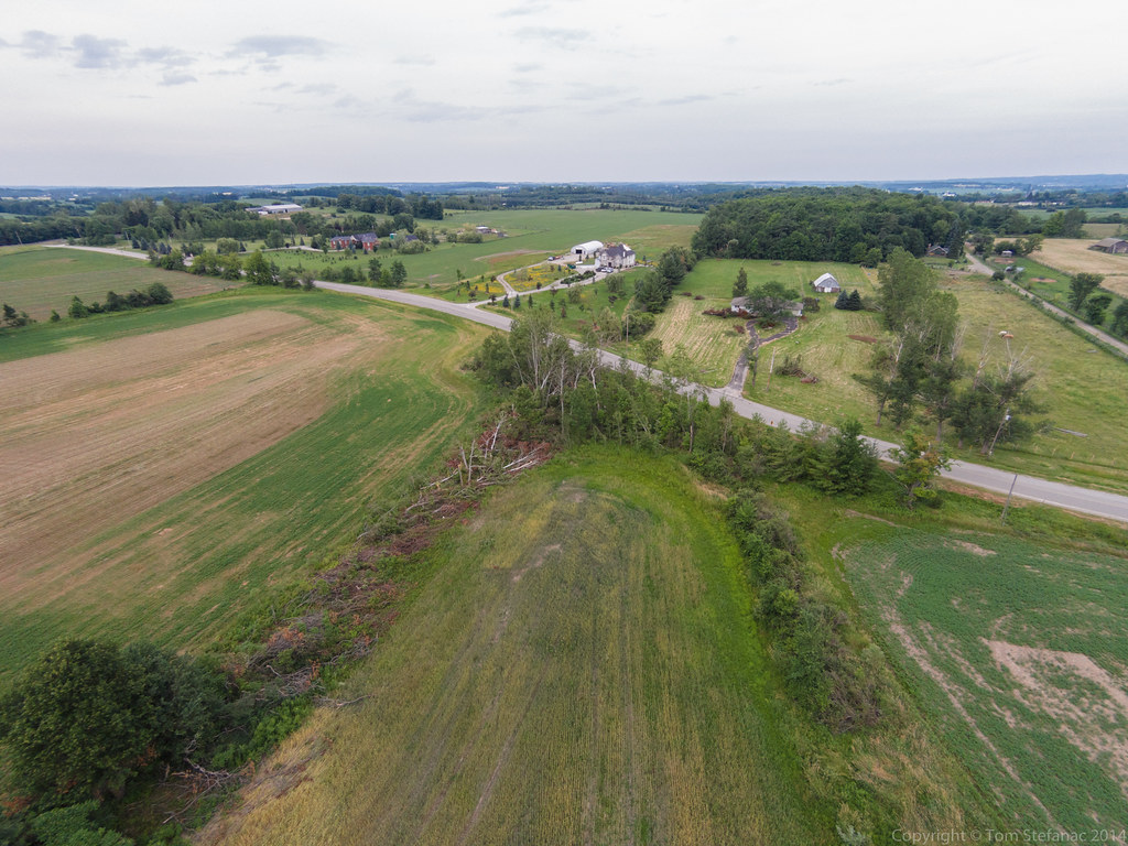
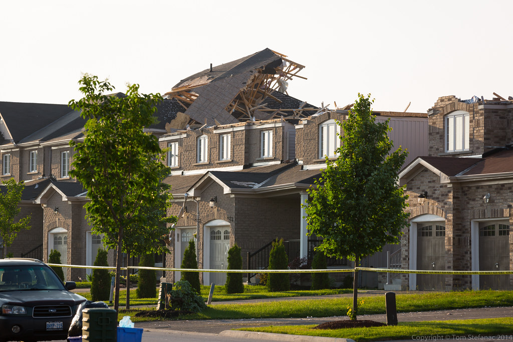
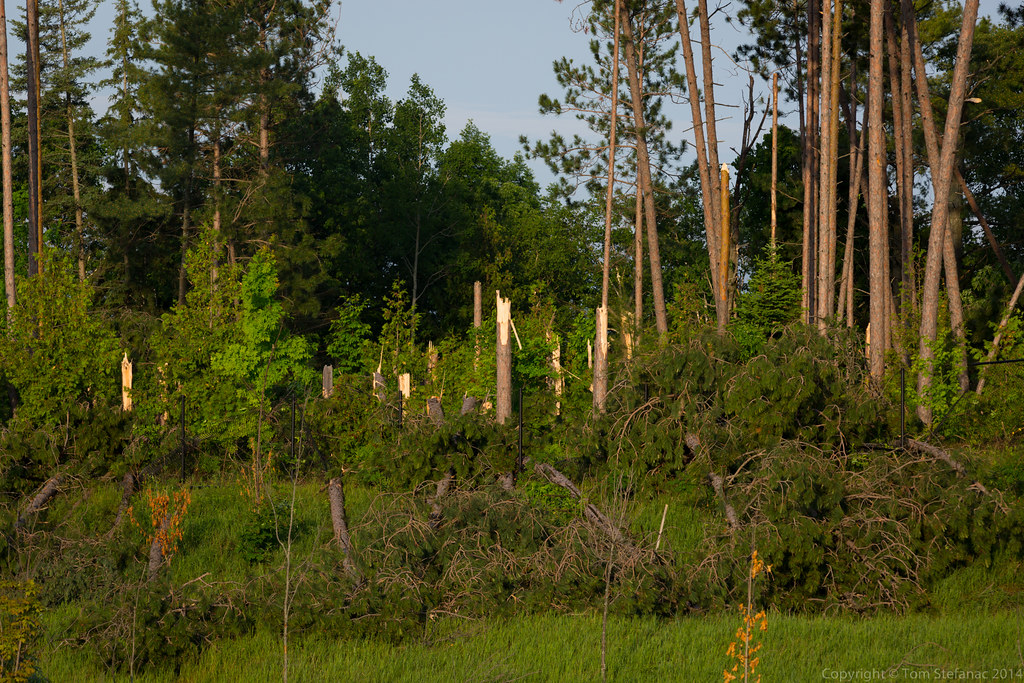
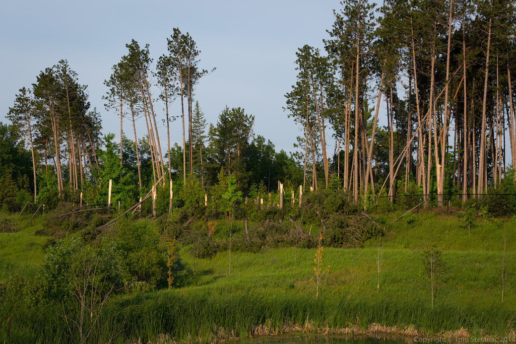
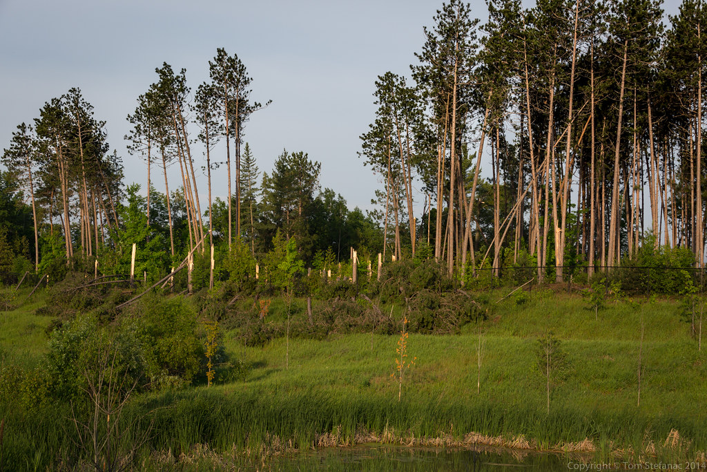
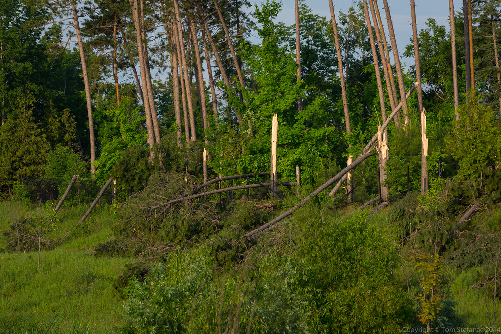
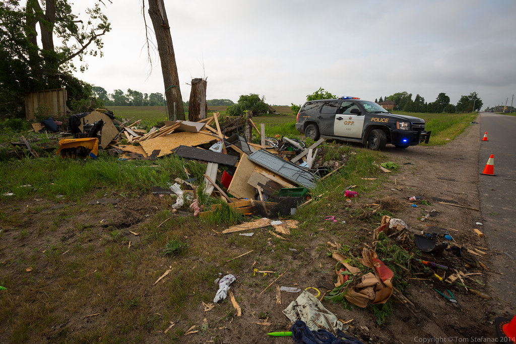
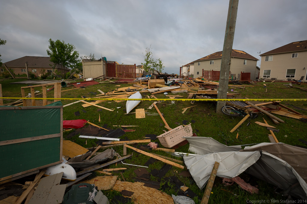
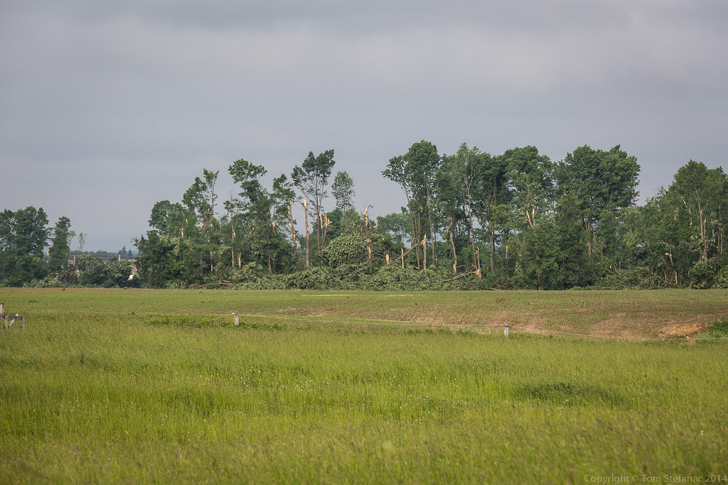
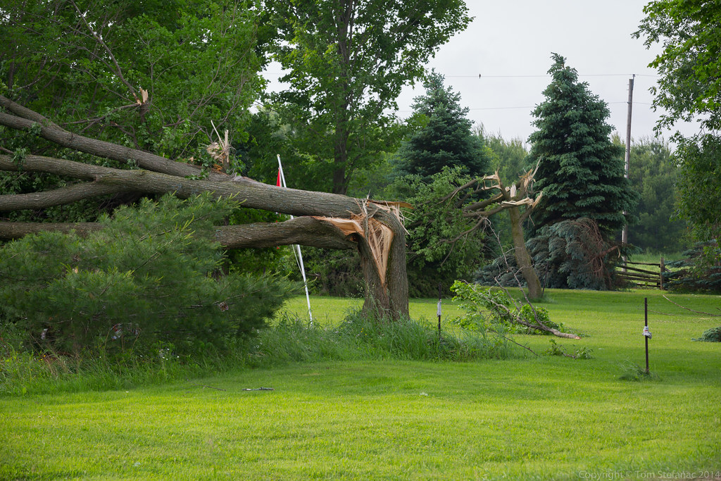
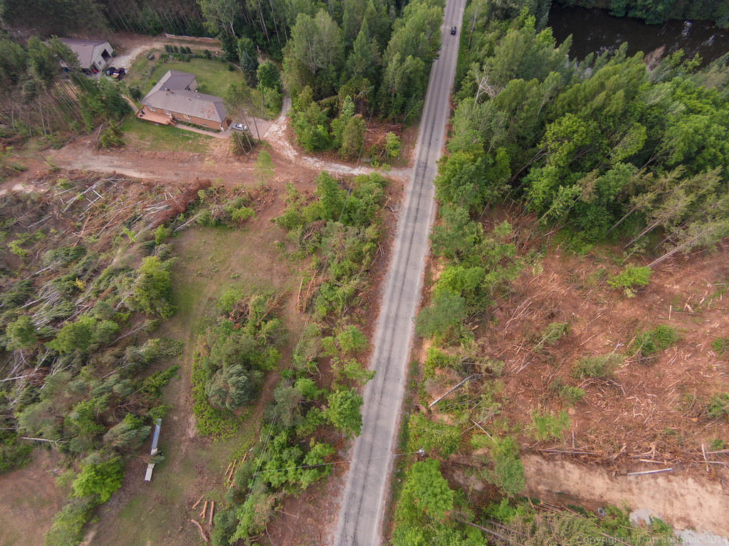
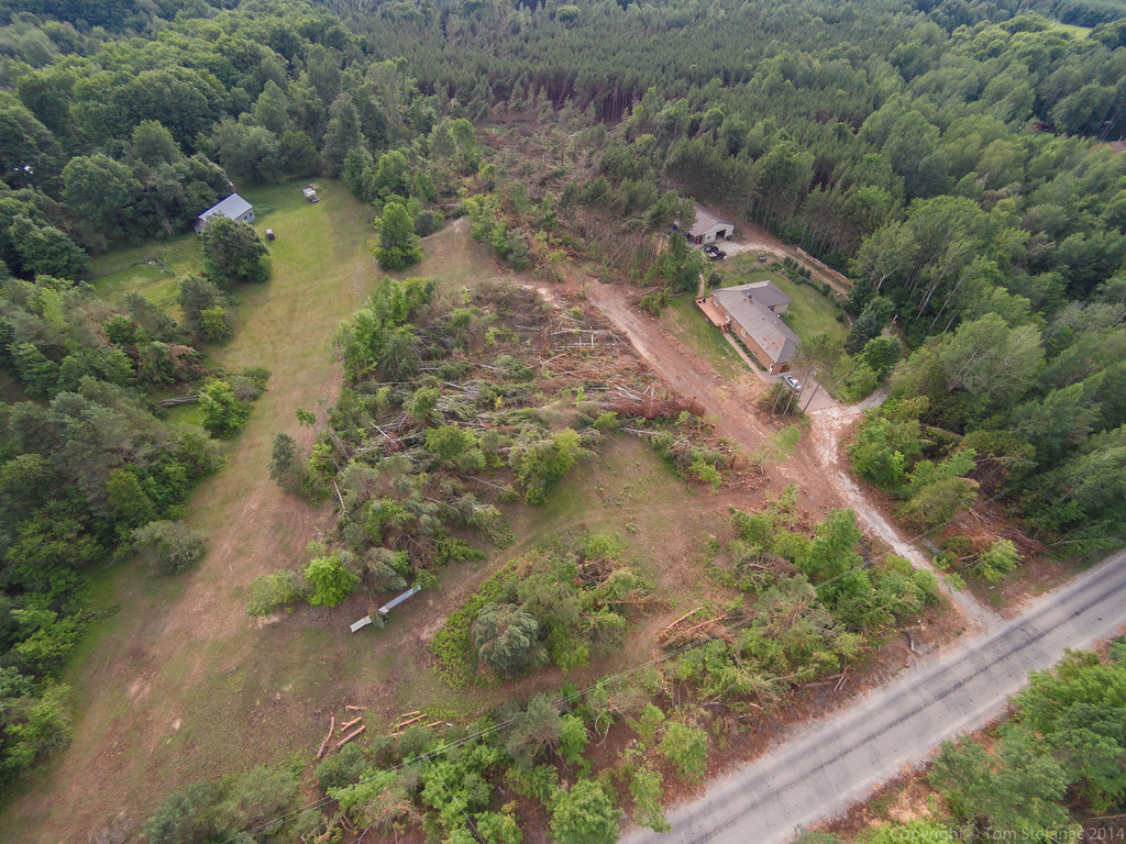
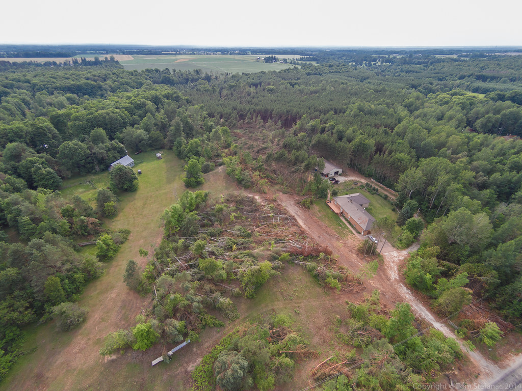
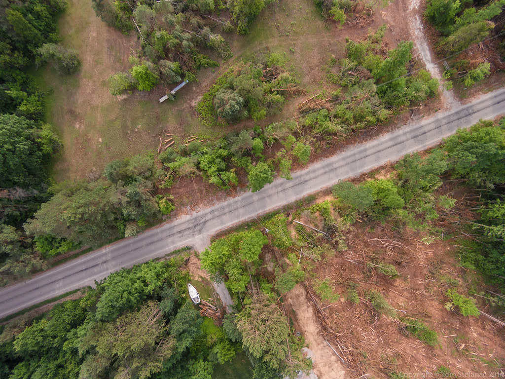
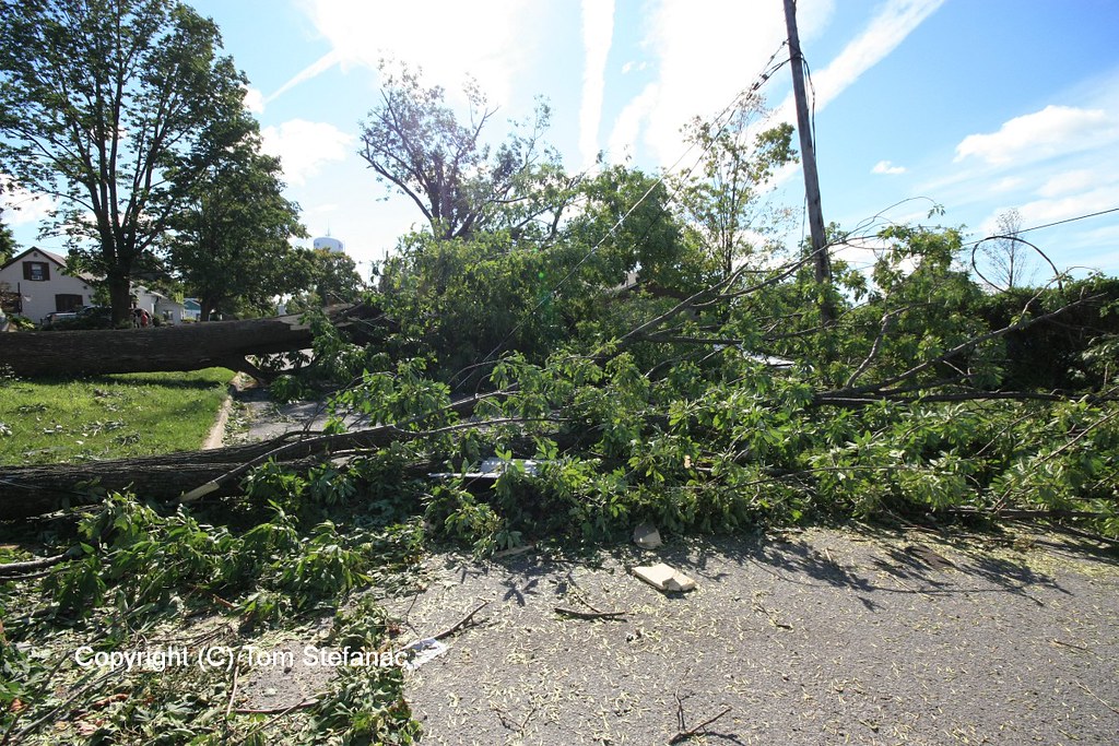
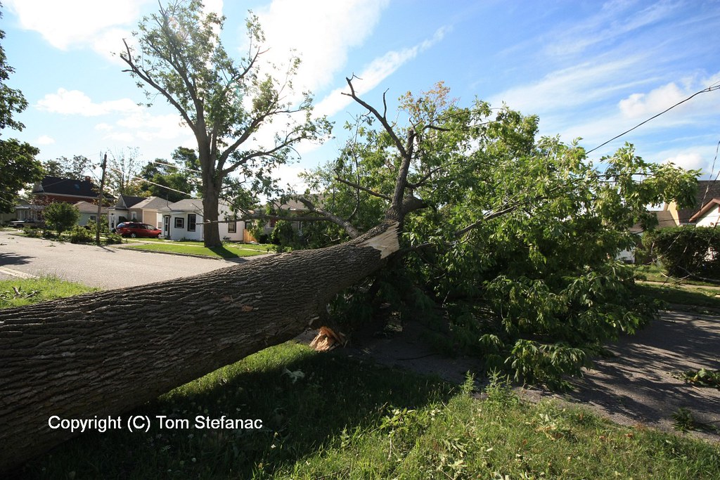
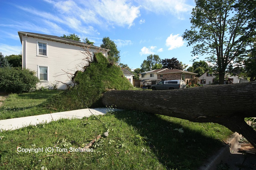
Tottenham – EF1 – 2014
On the afternoon of June 24th a weak EF1 tornado was spawned from a non-supercell thunderstorm. The tornado damaged several homes and killed one horse.


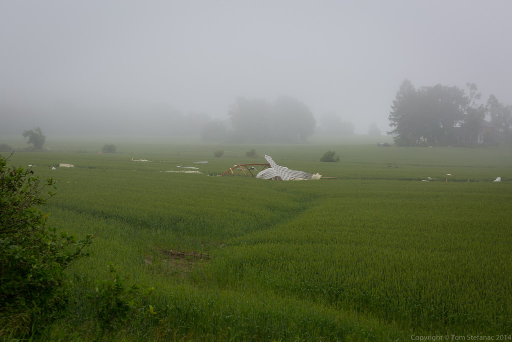
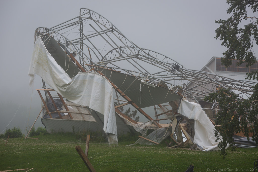
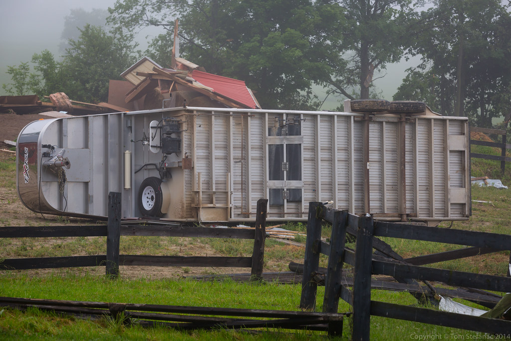
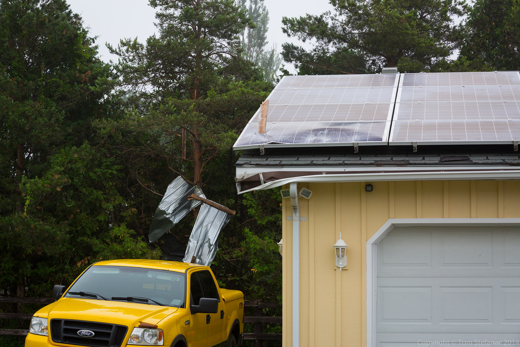


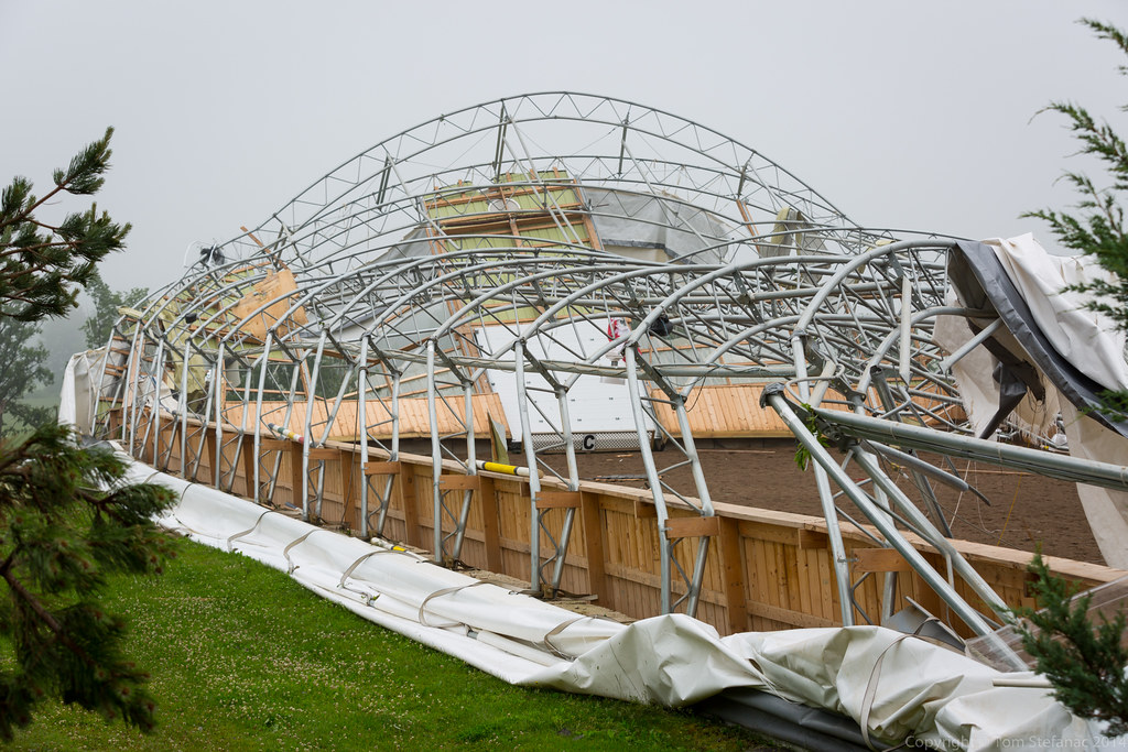
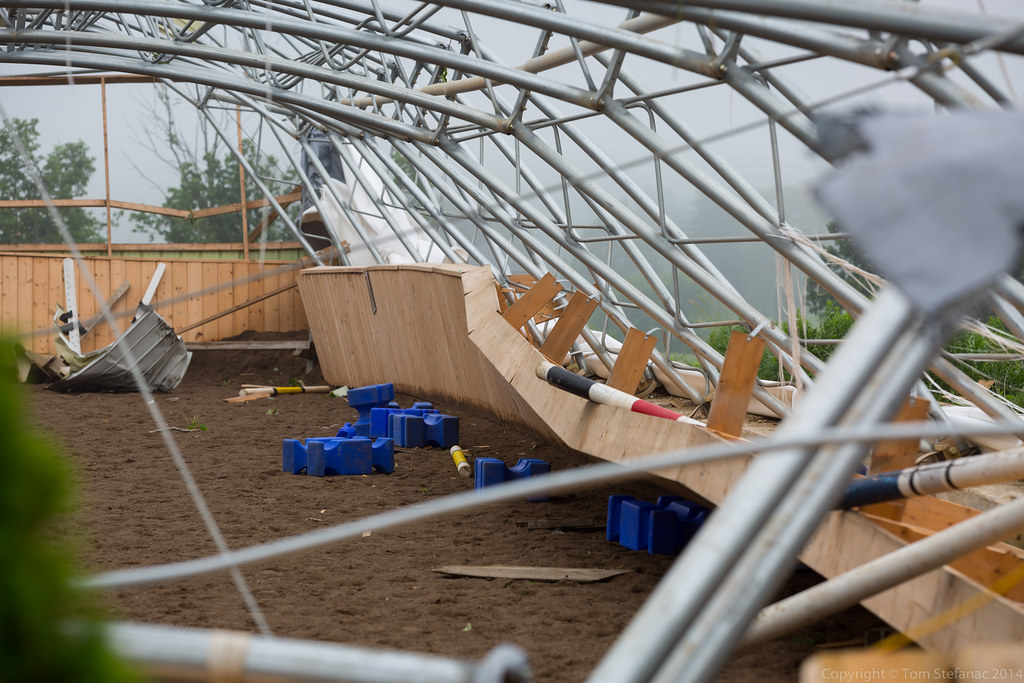
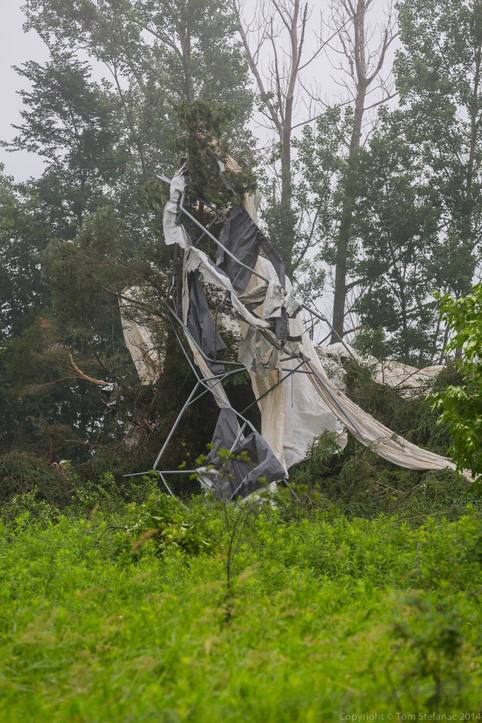
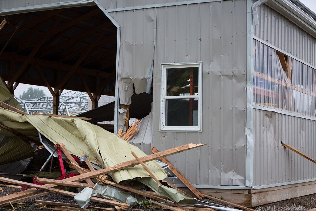
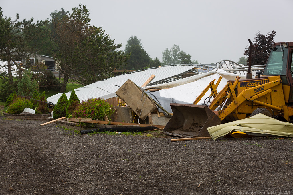
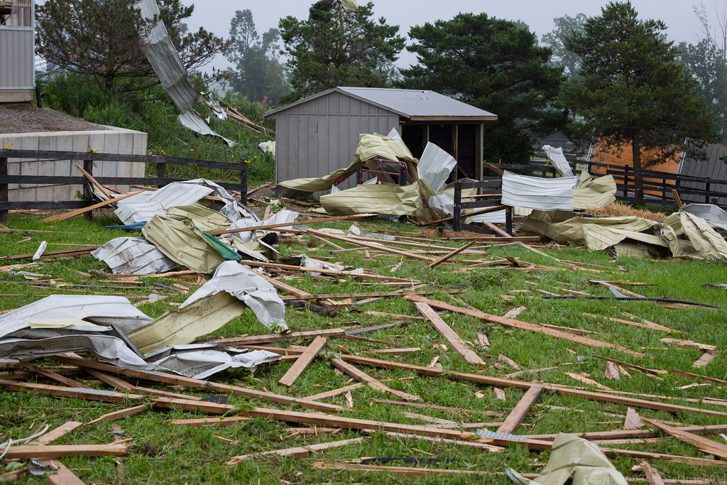


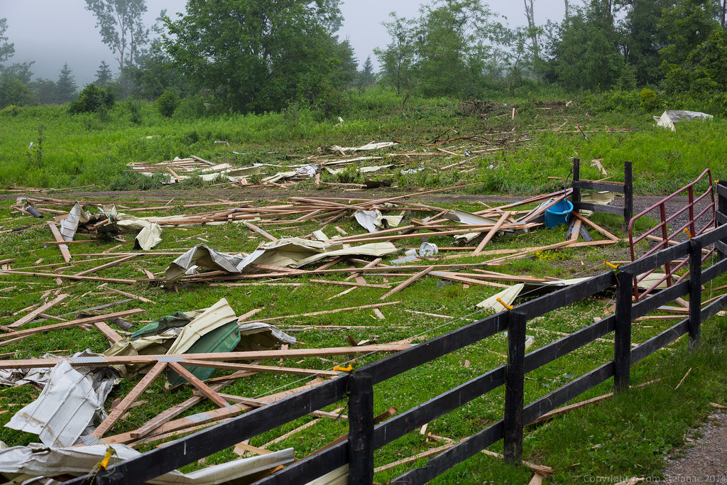
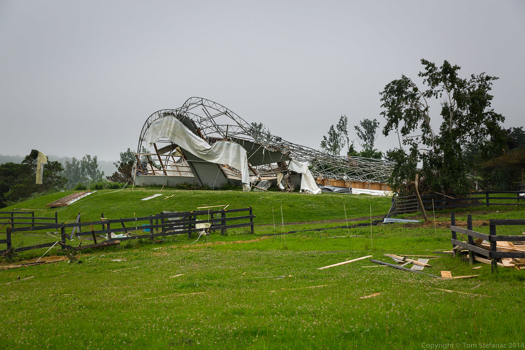

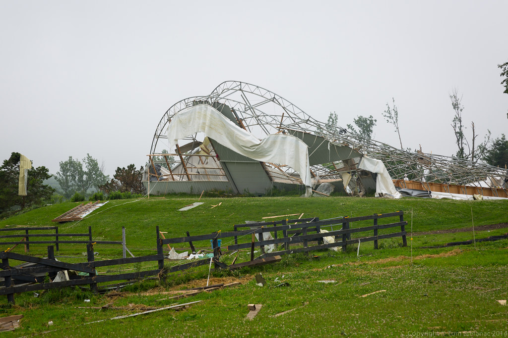
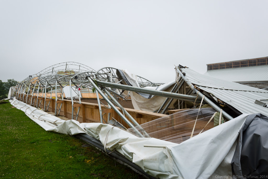
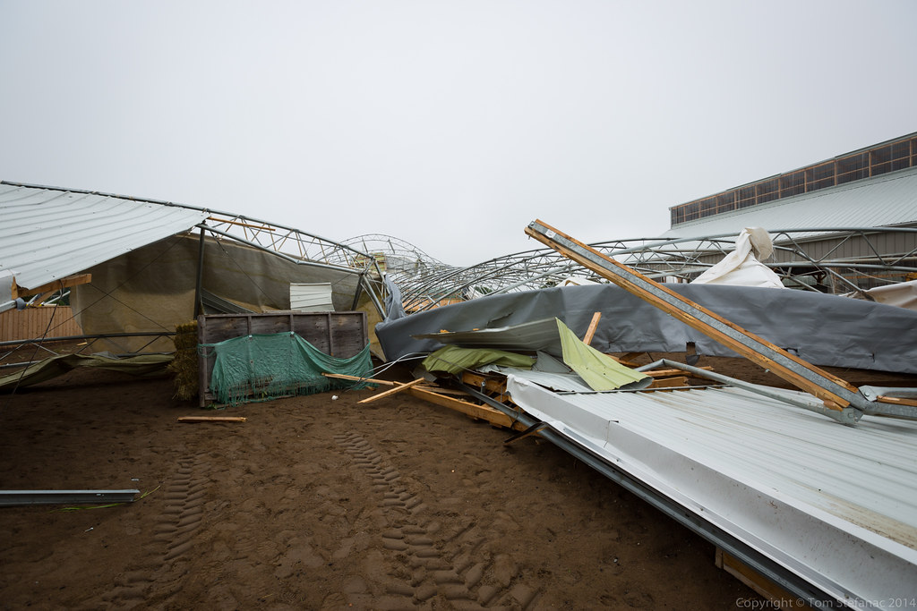
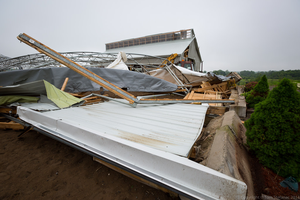

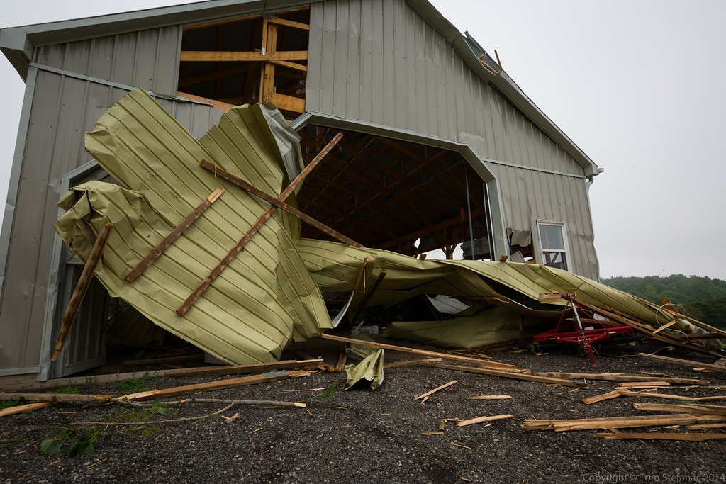
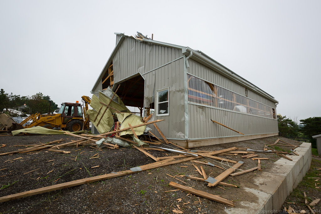

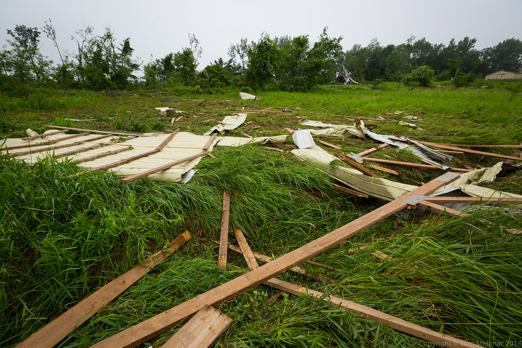


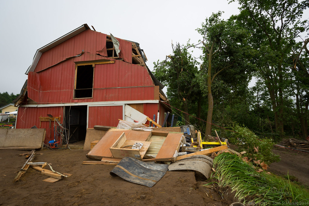

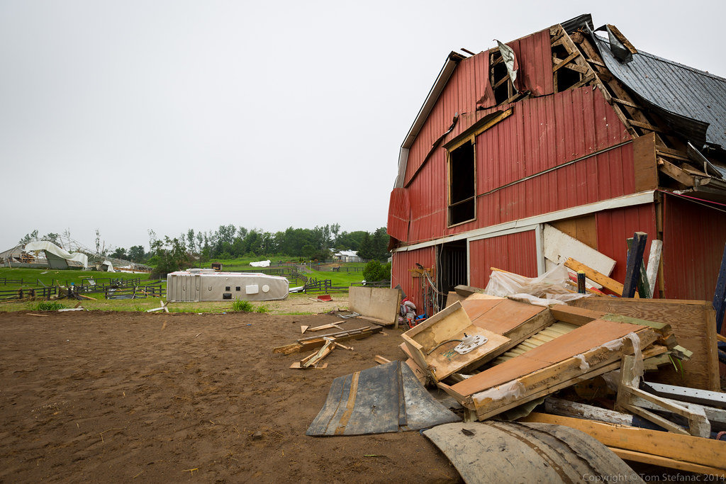

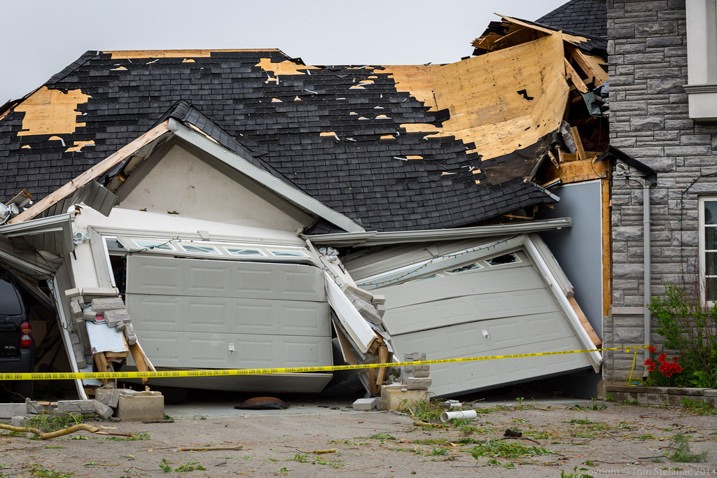

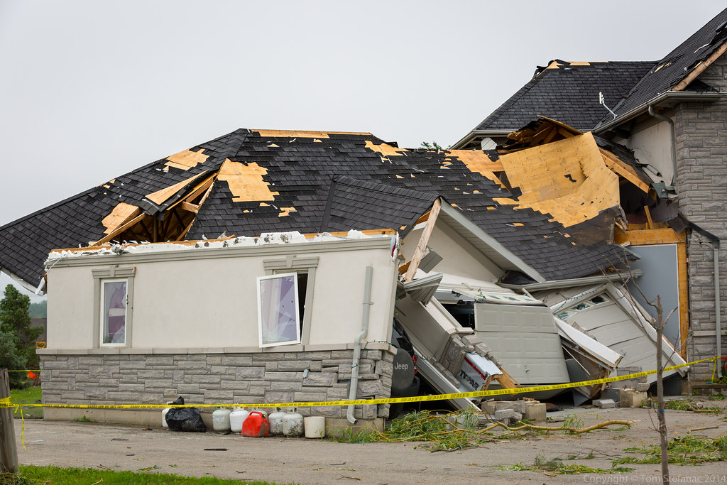

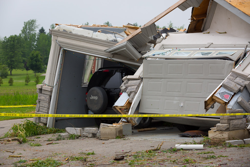

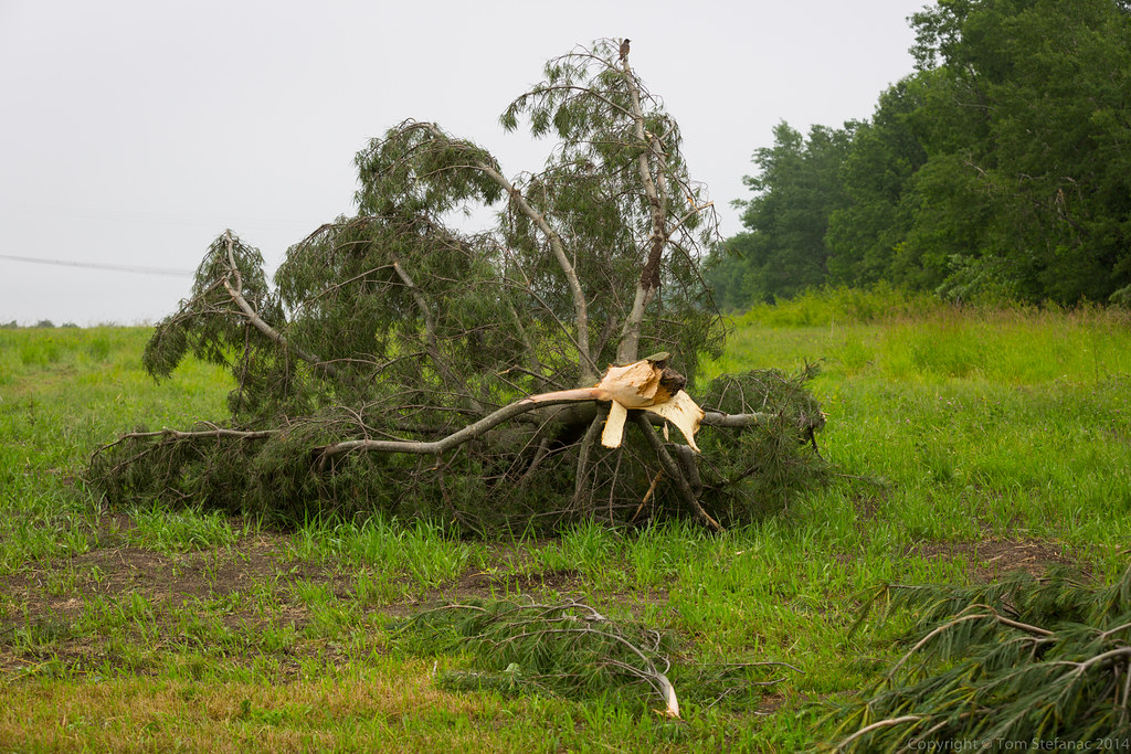
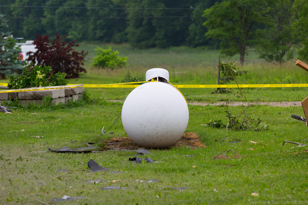
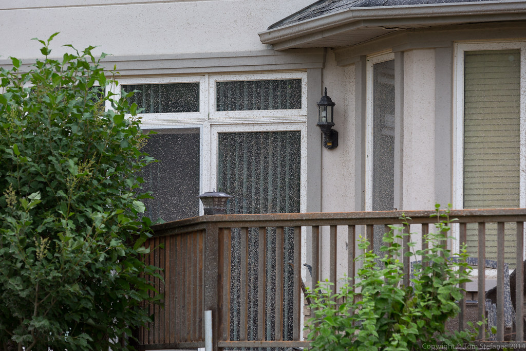
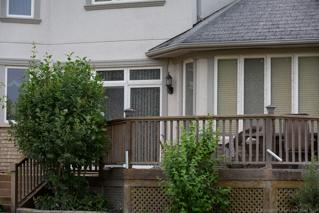
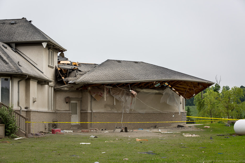

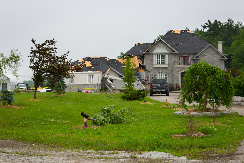

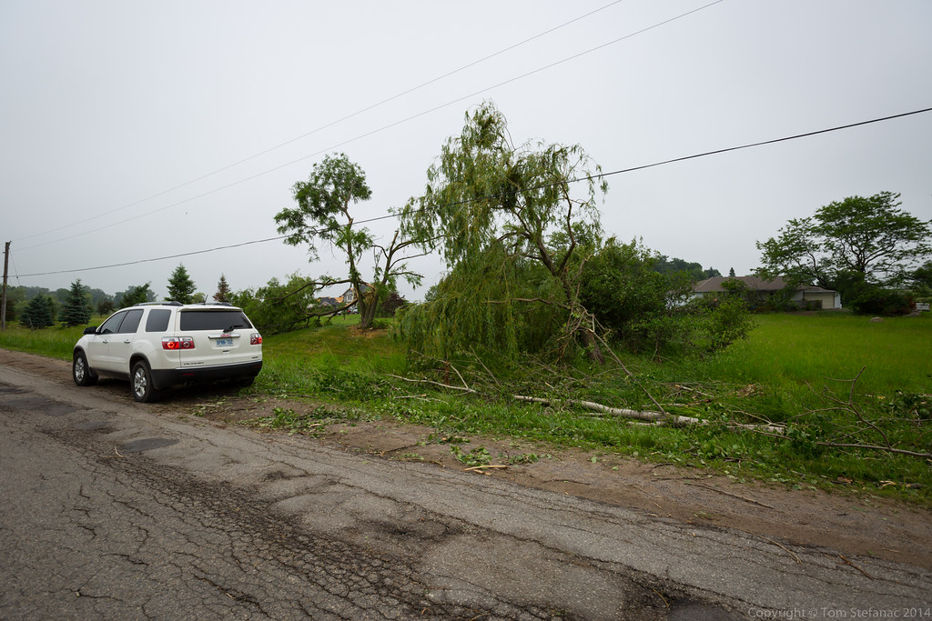


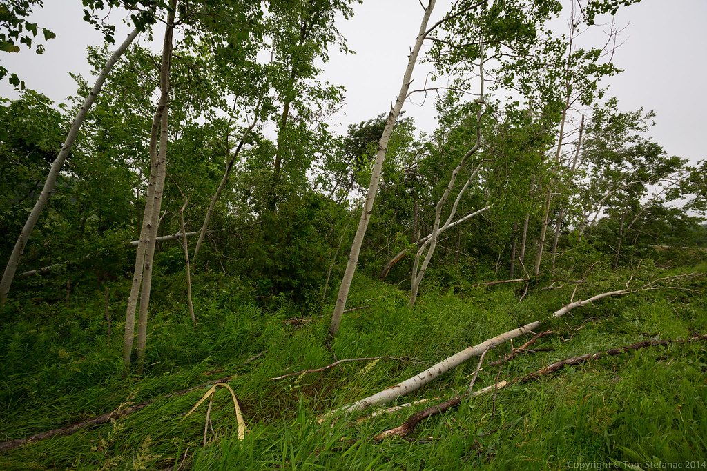


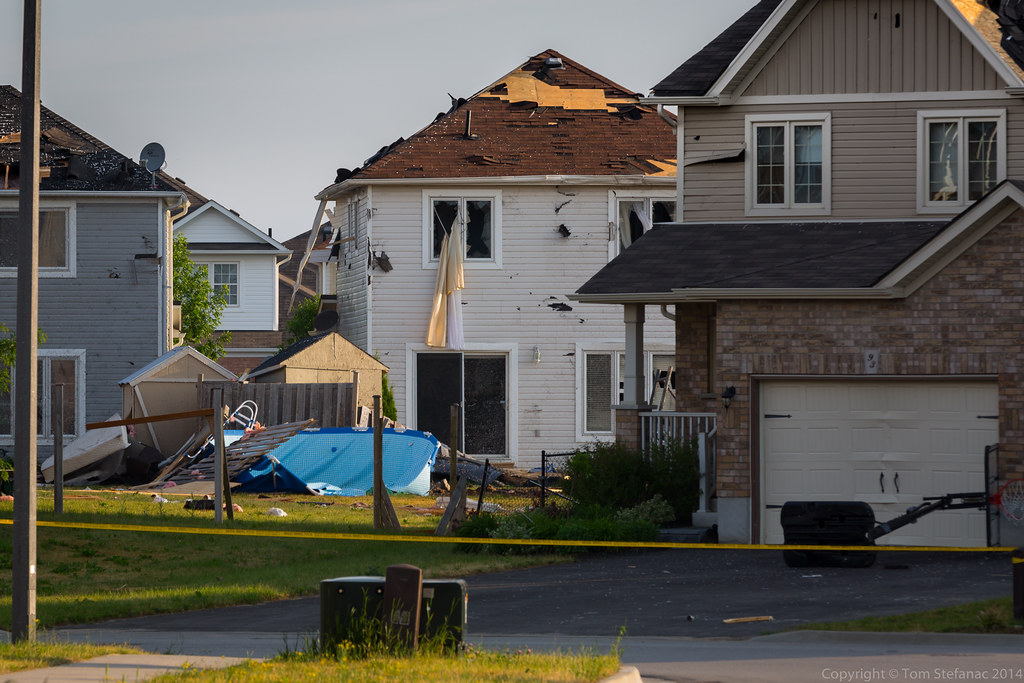
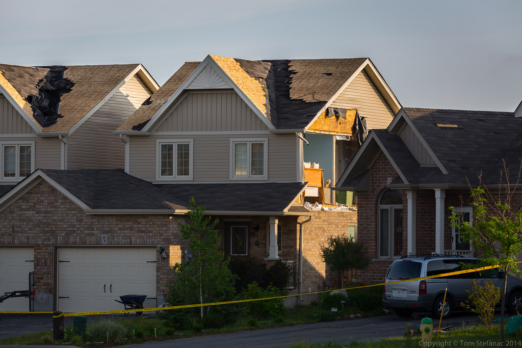
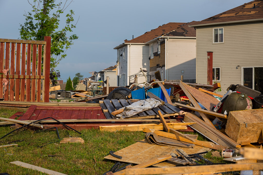
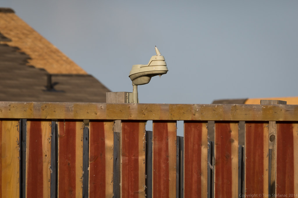
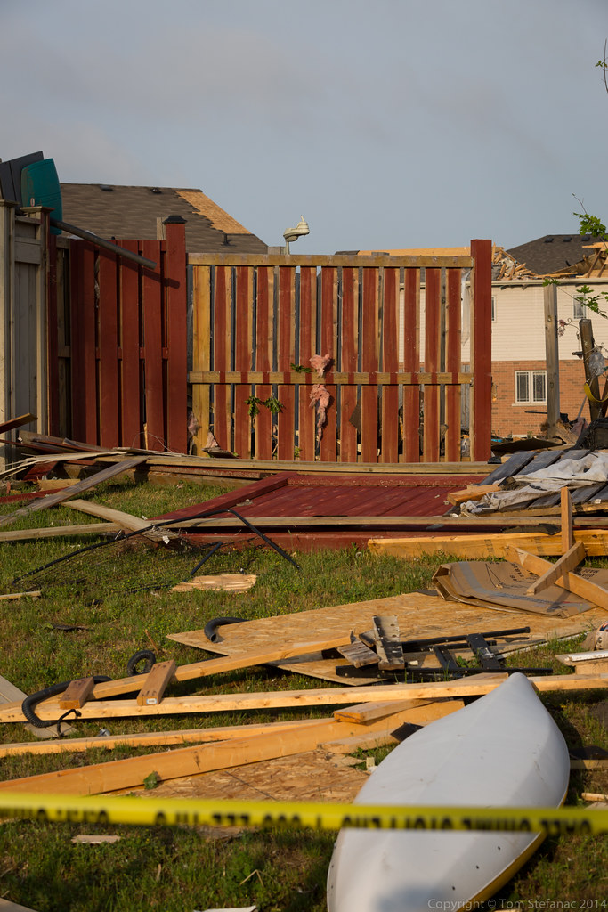
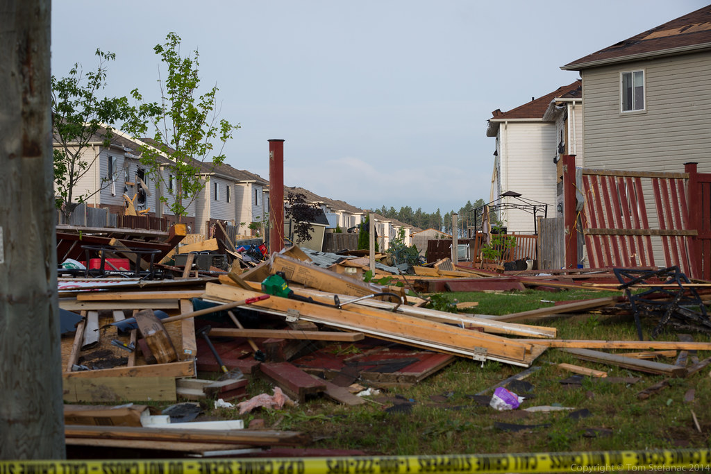
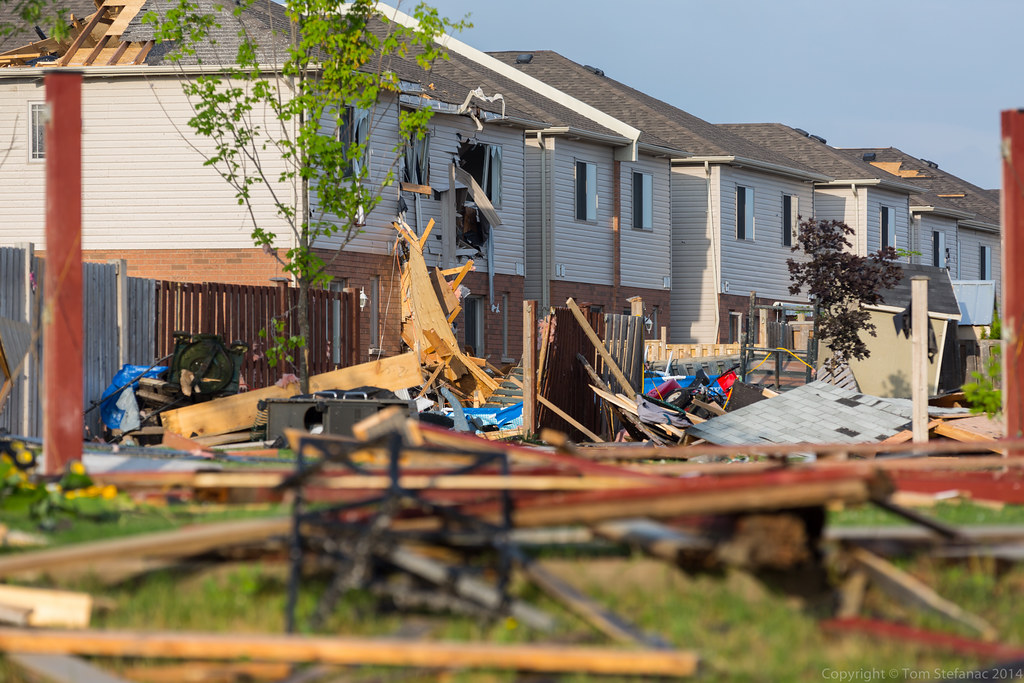

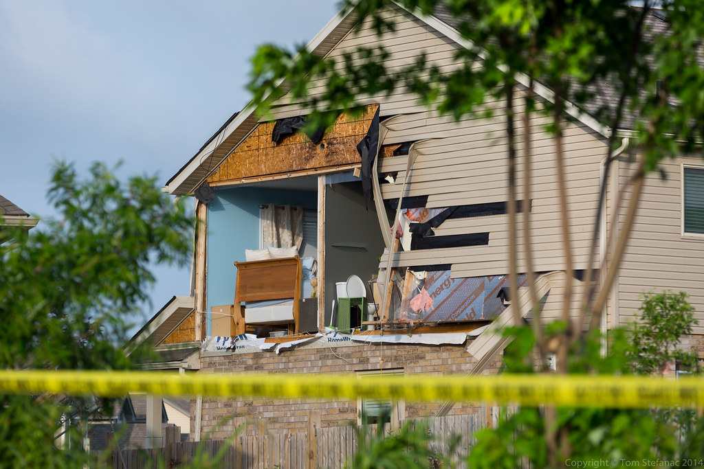
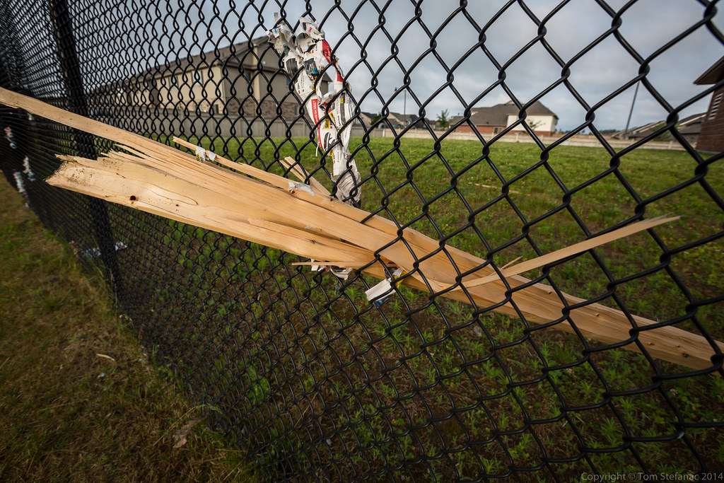
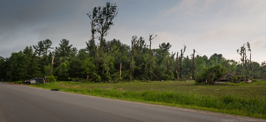


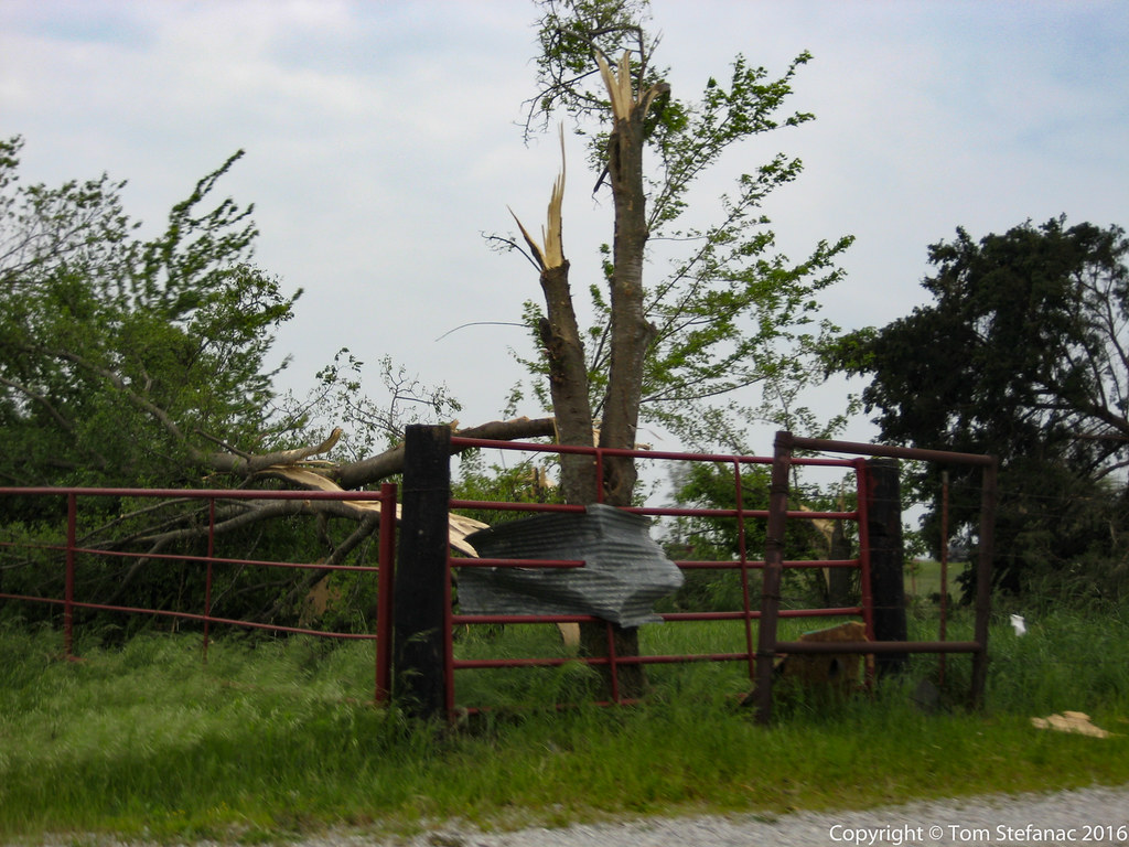
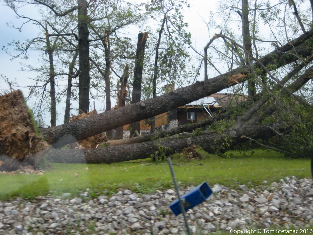
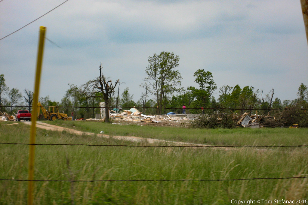
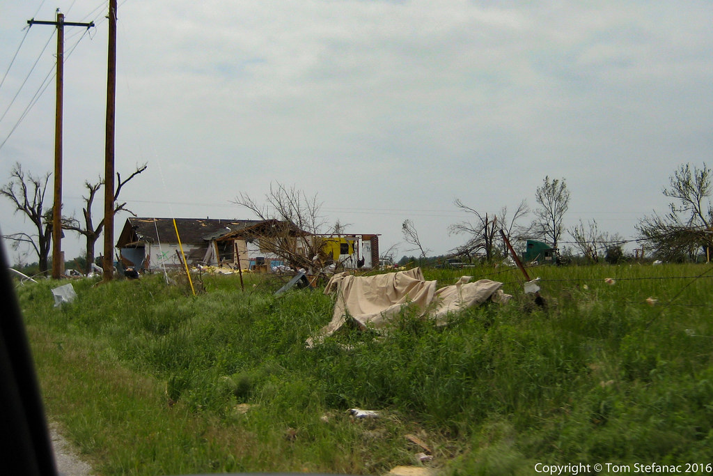
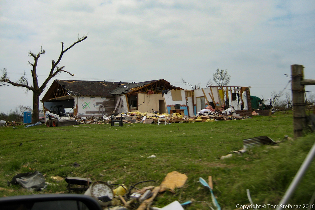
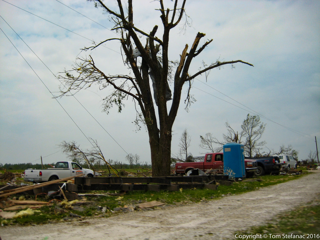
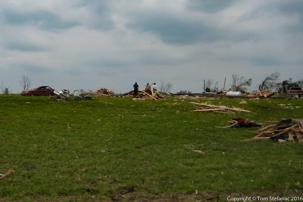
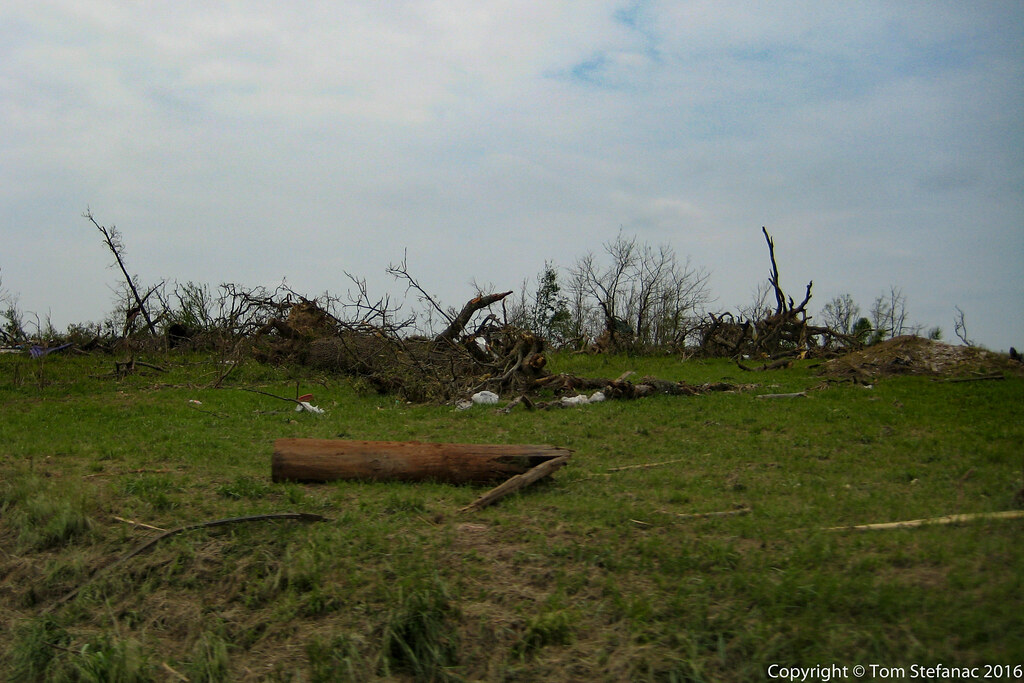
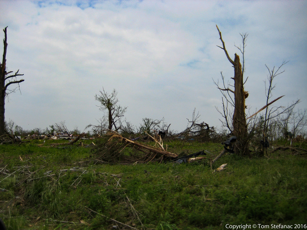
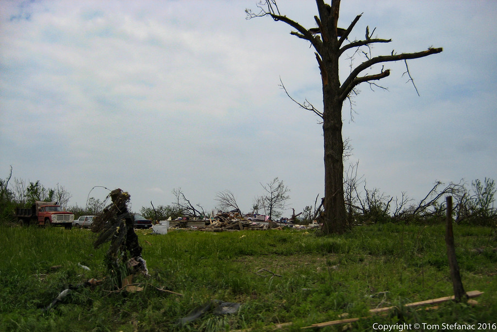
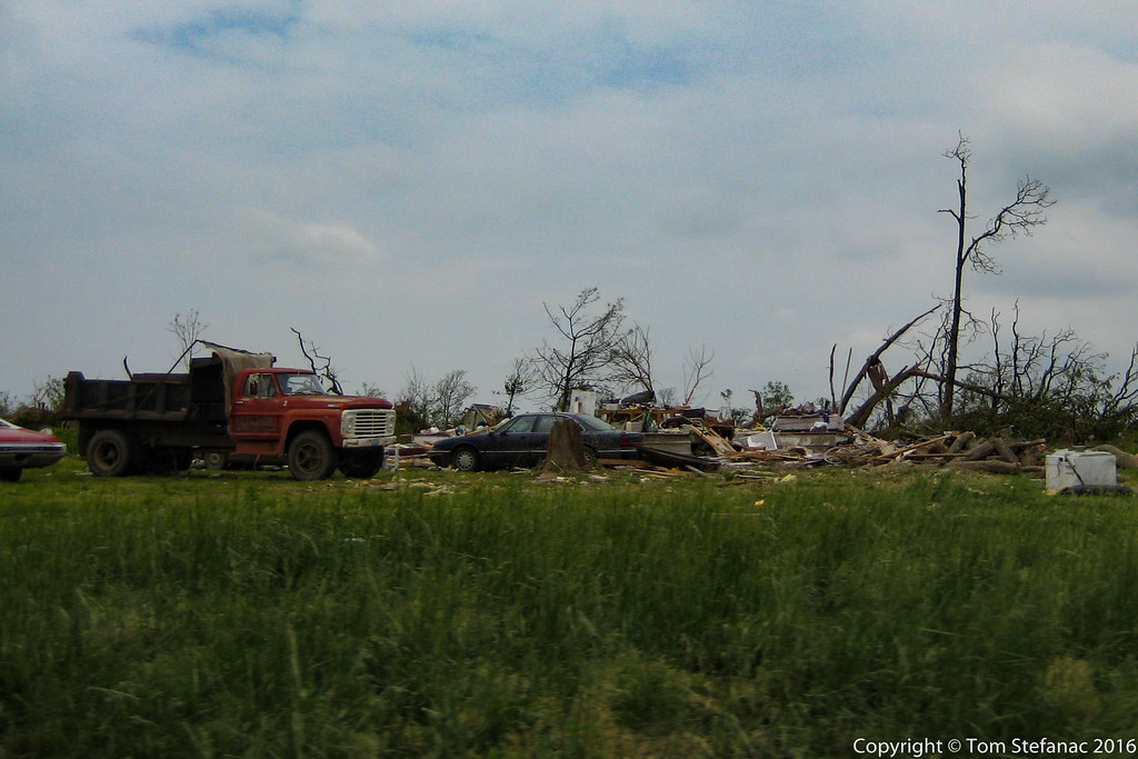
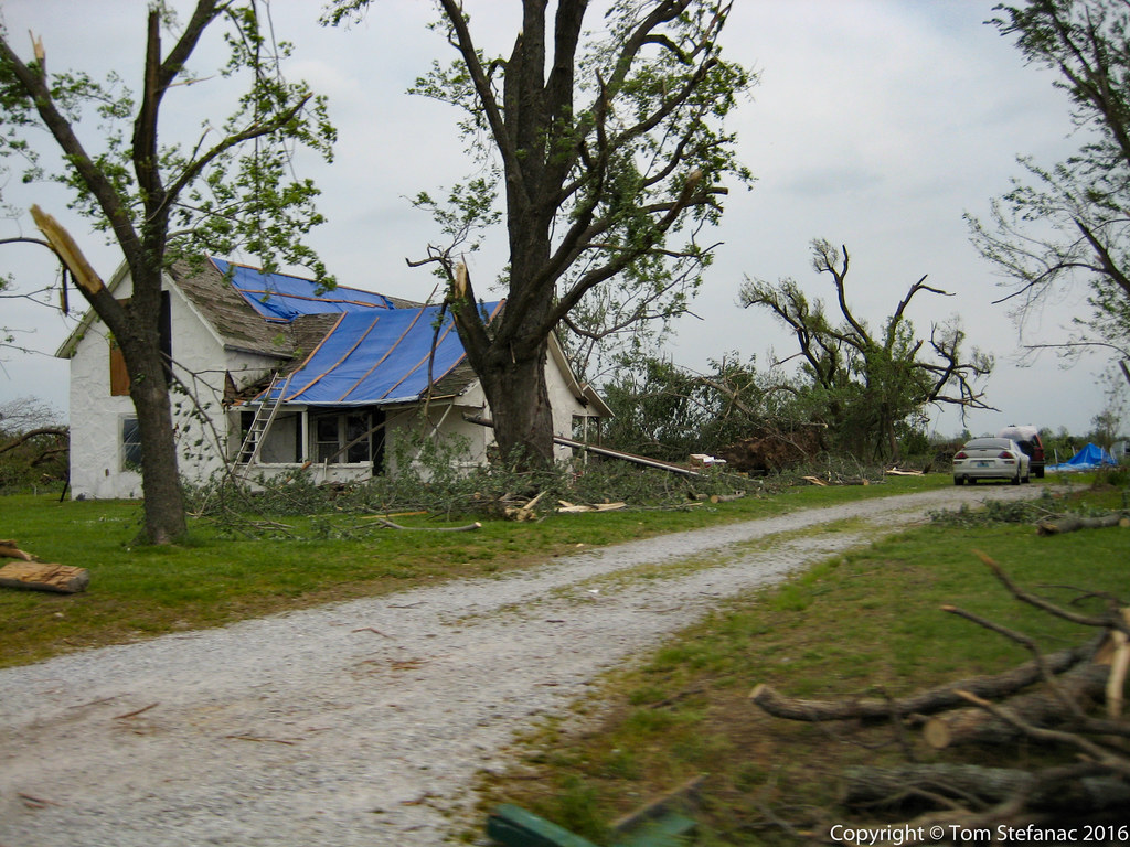
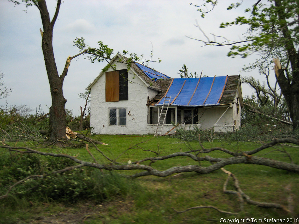
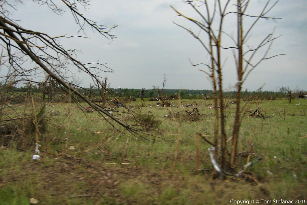
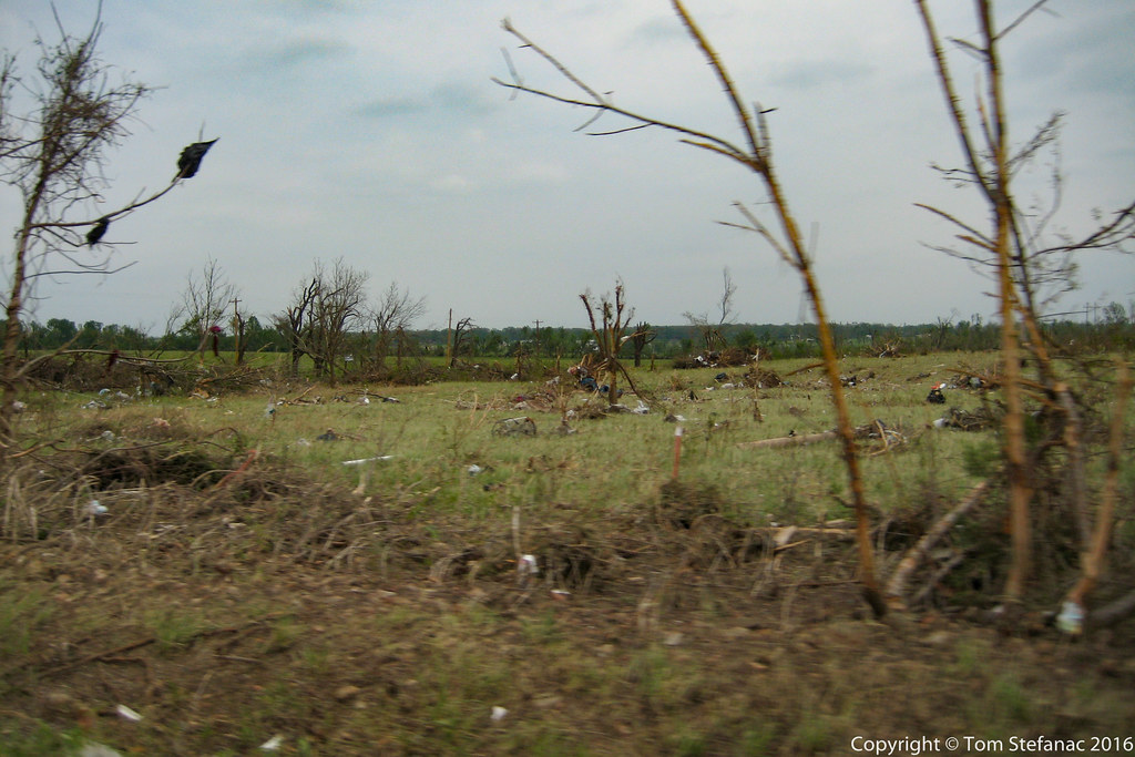
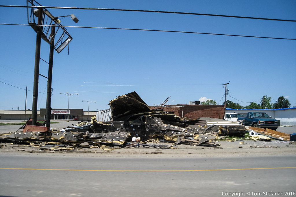
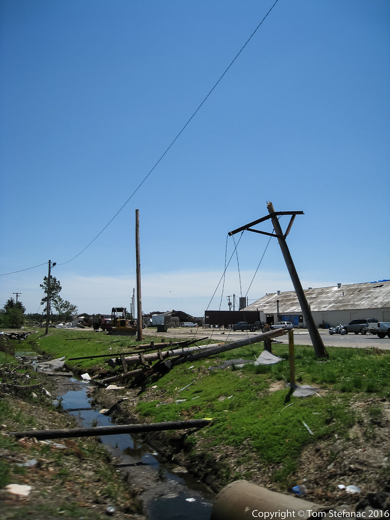
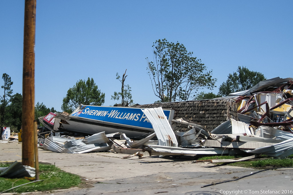
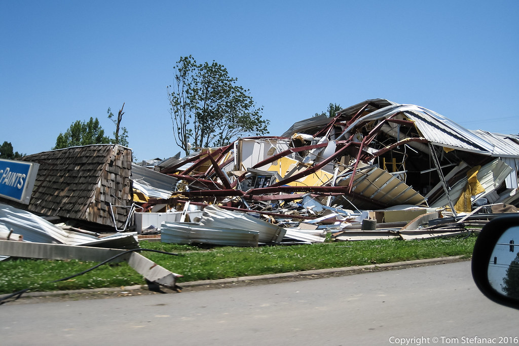
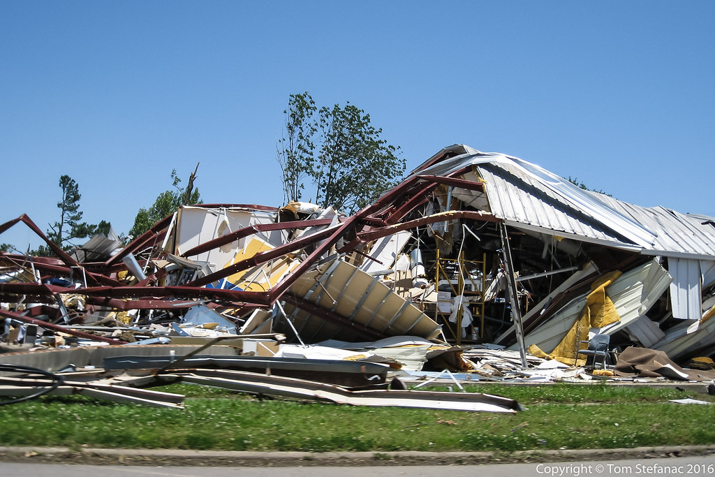
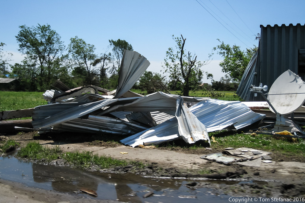
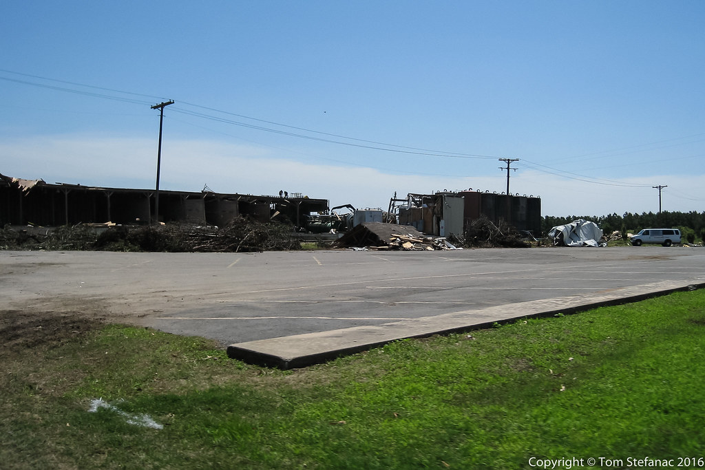
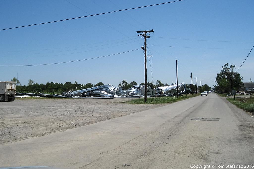
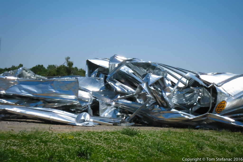
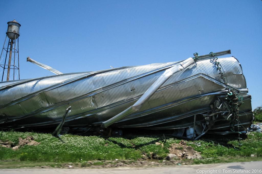
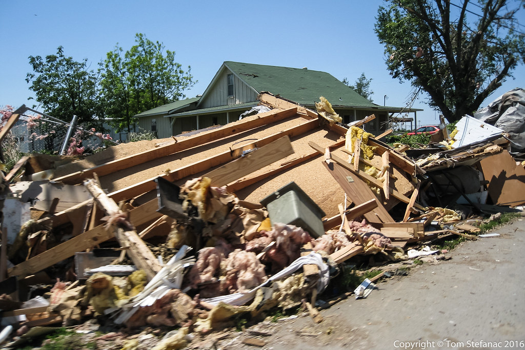
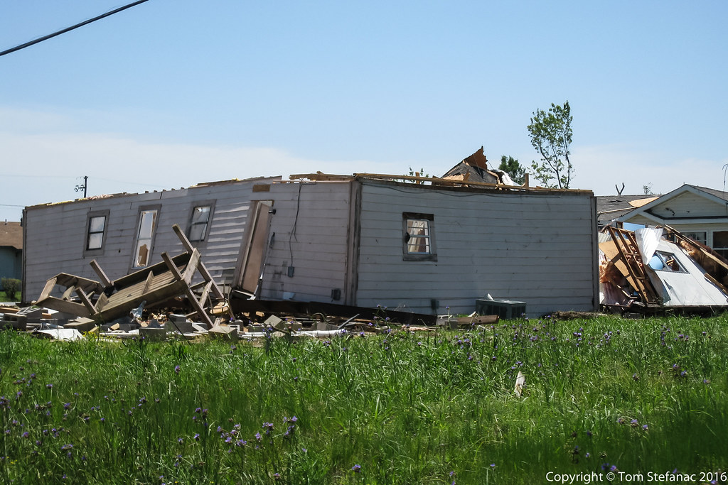
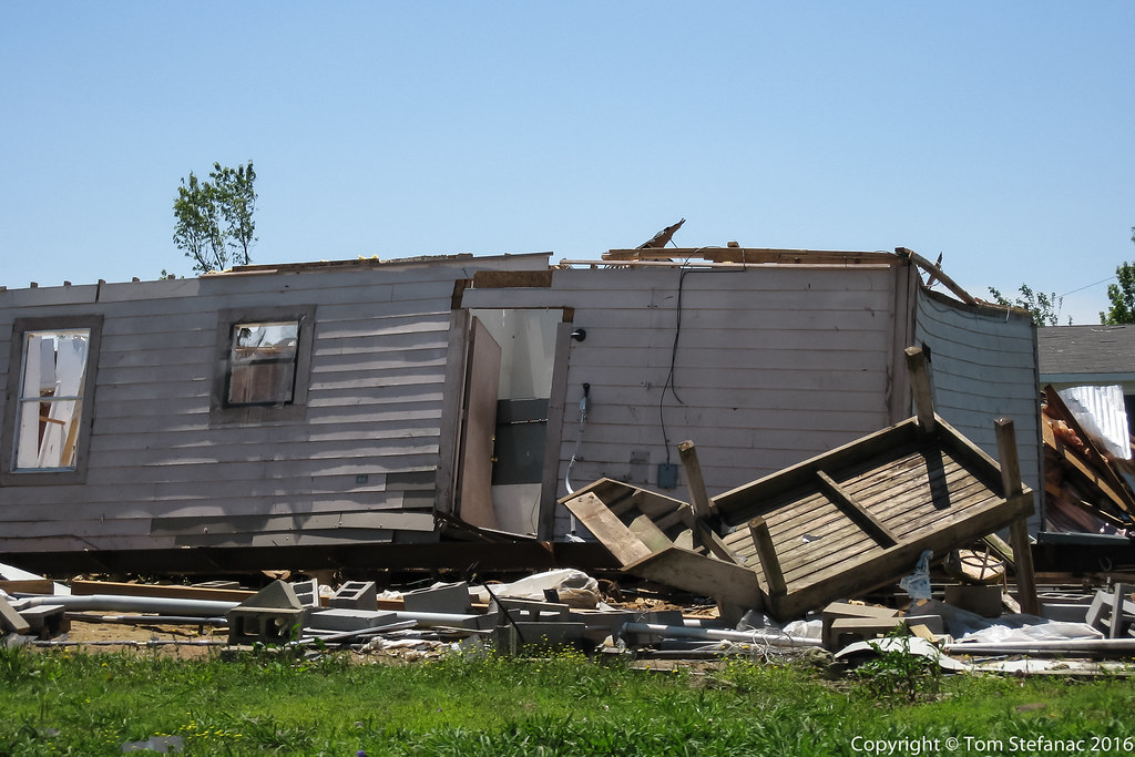
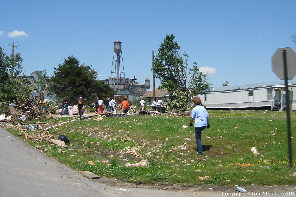
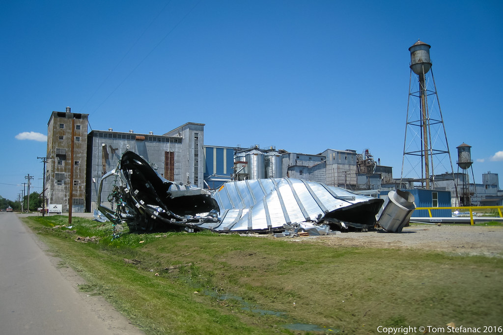
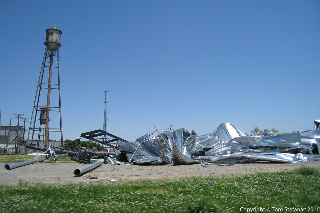
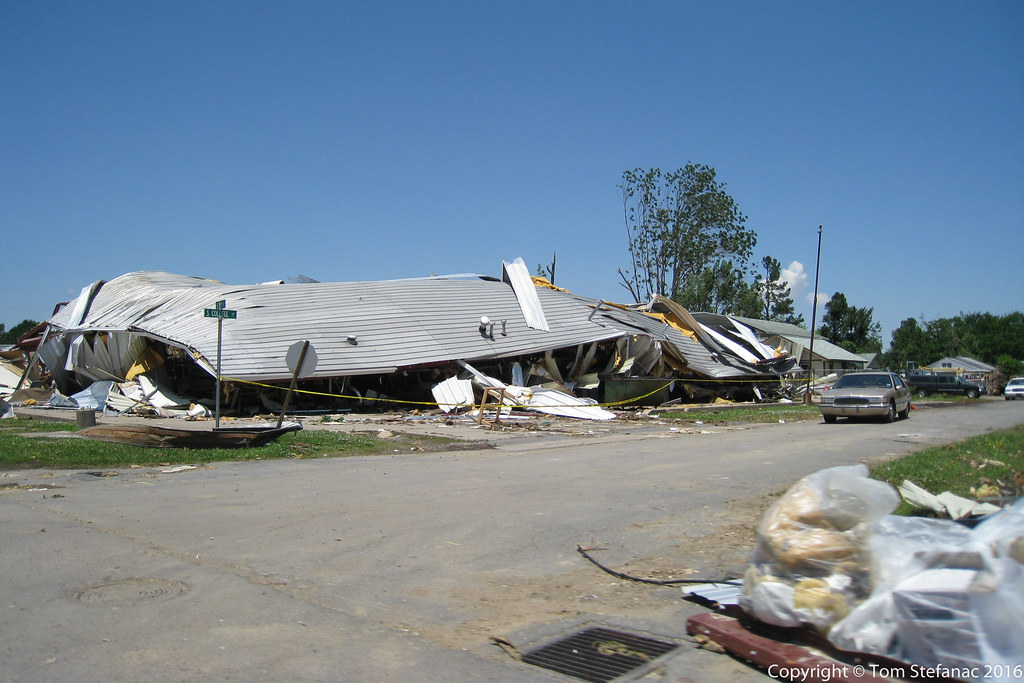
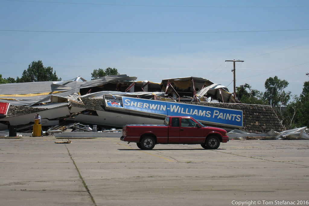
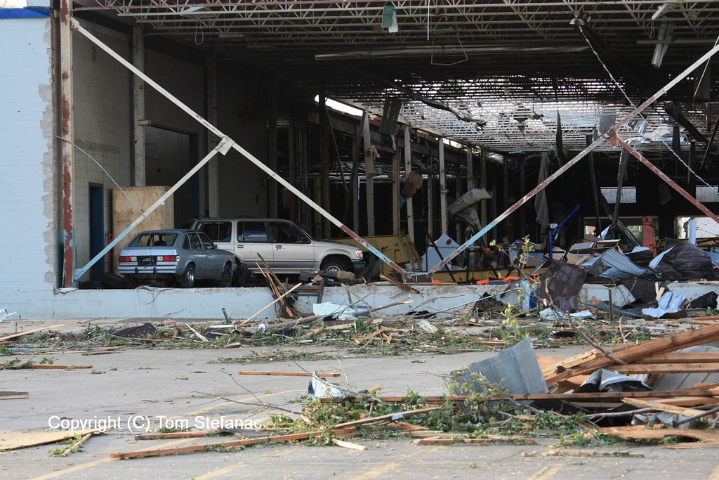
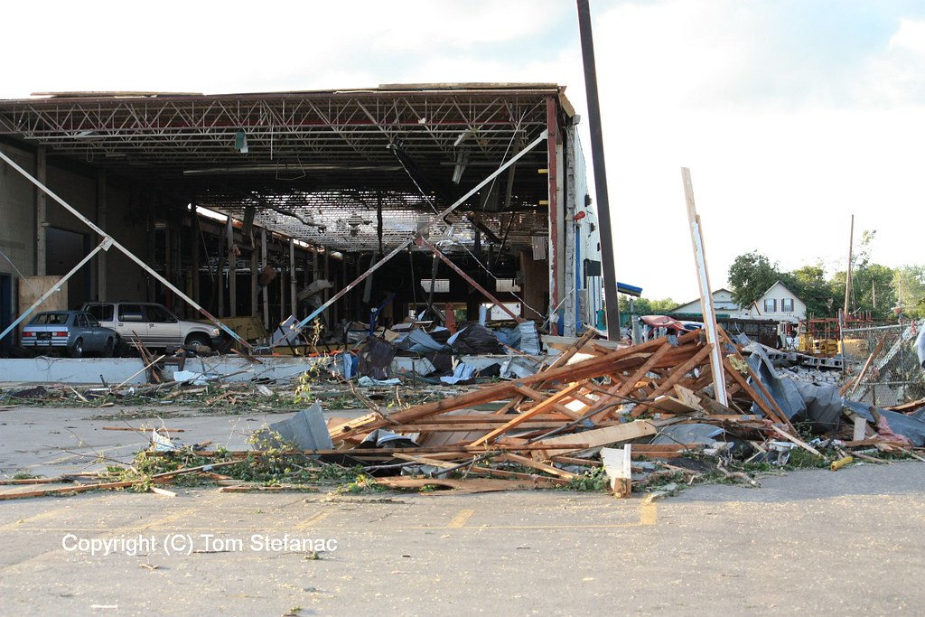
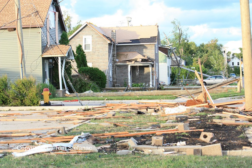
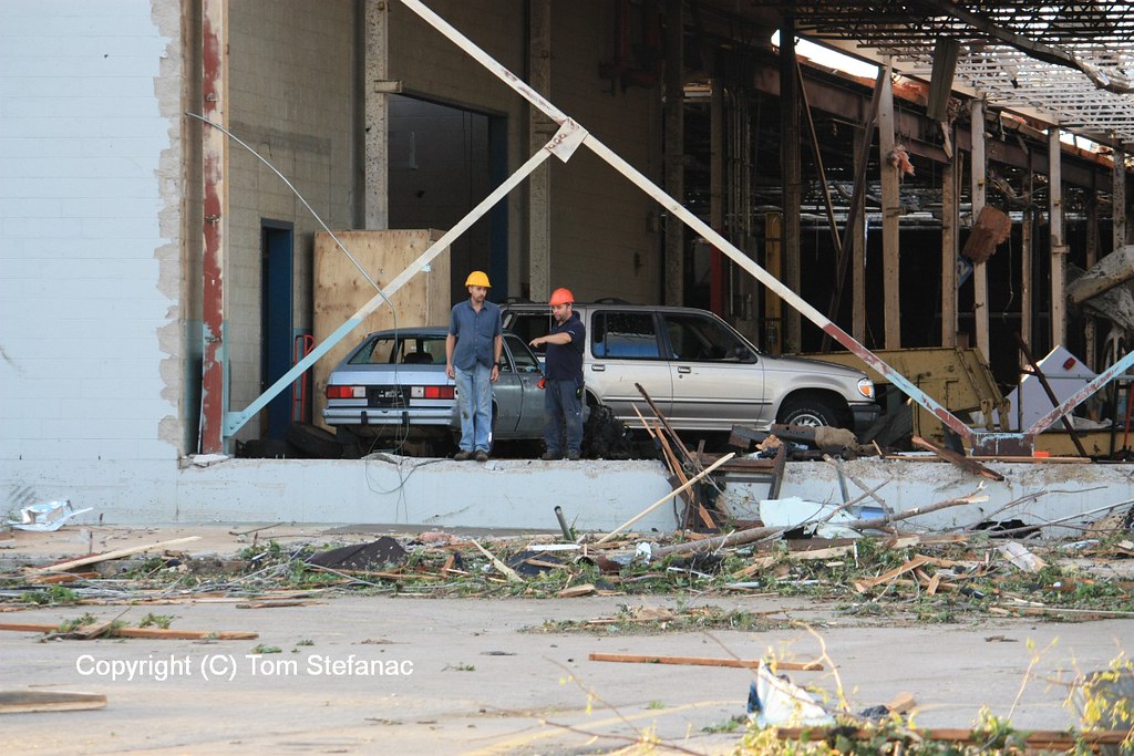
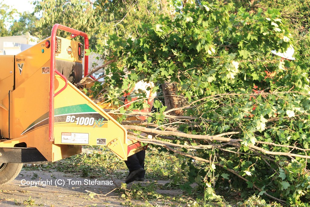
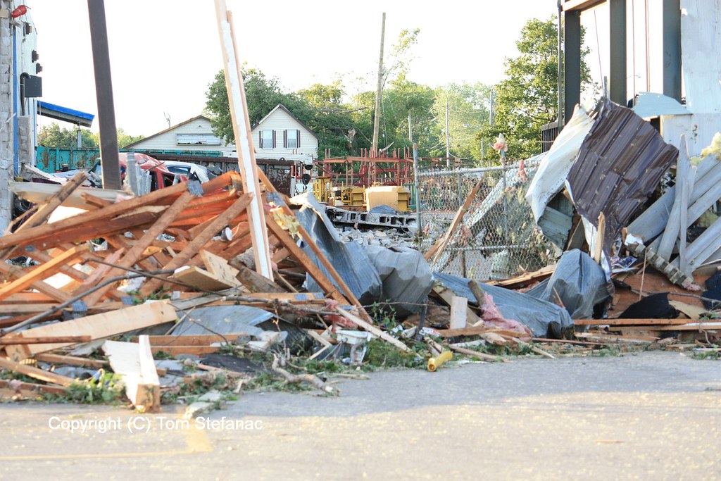
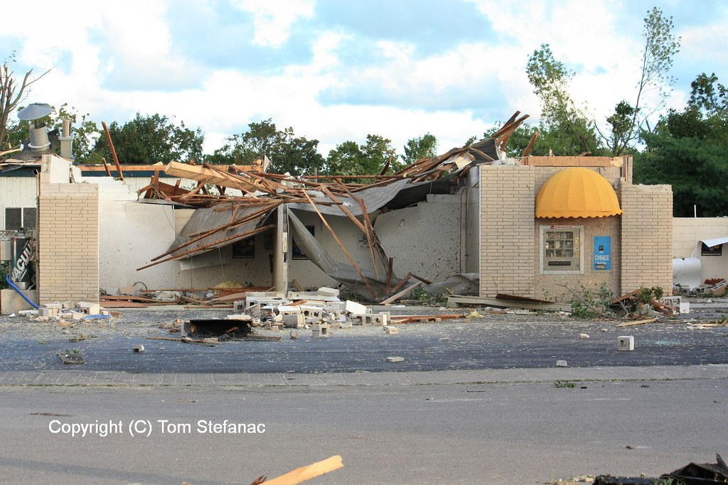
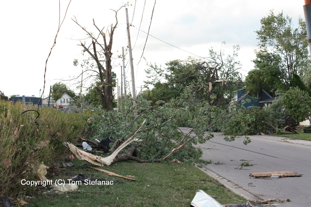
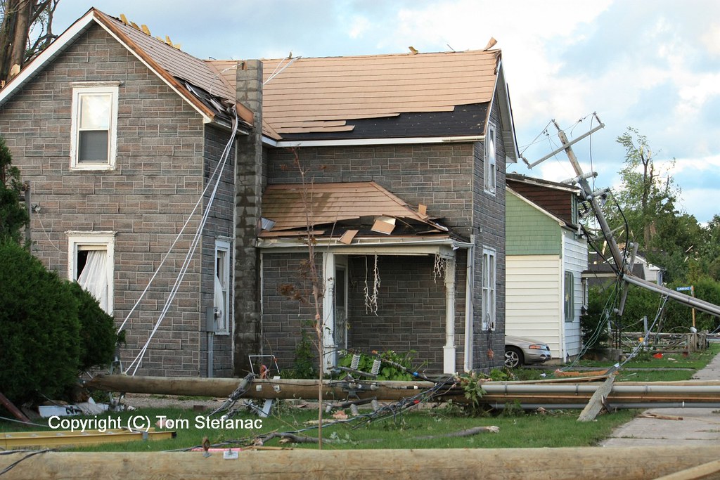
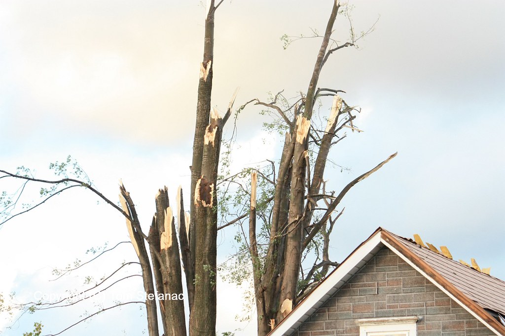
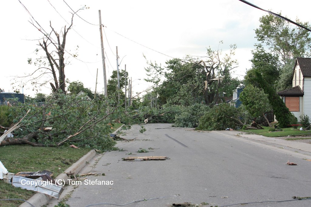
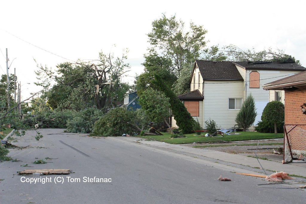
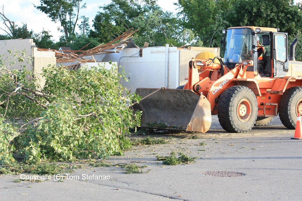
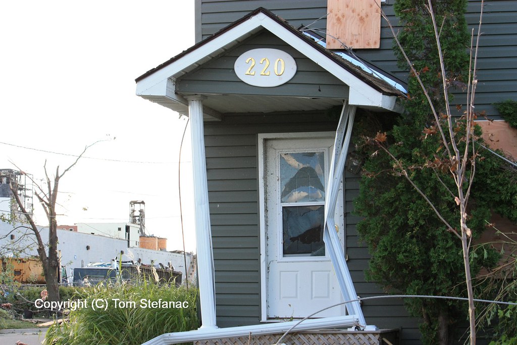
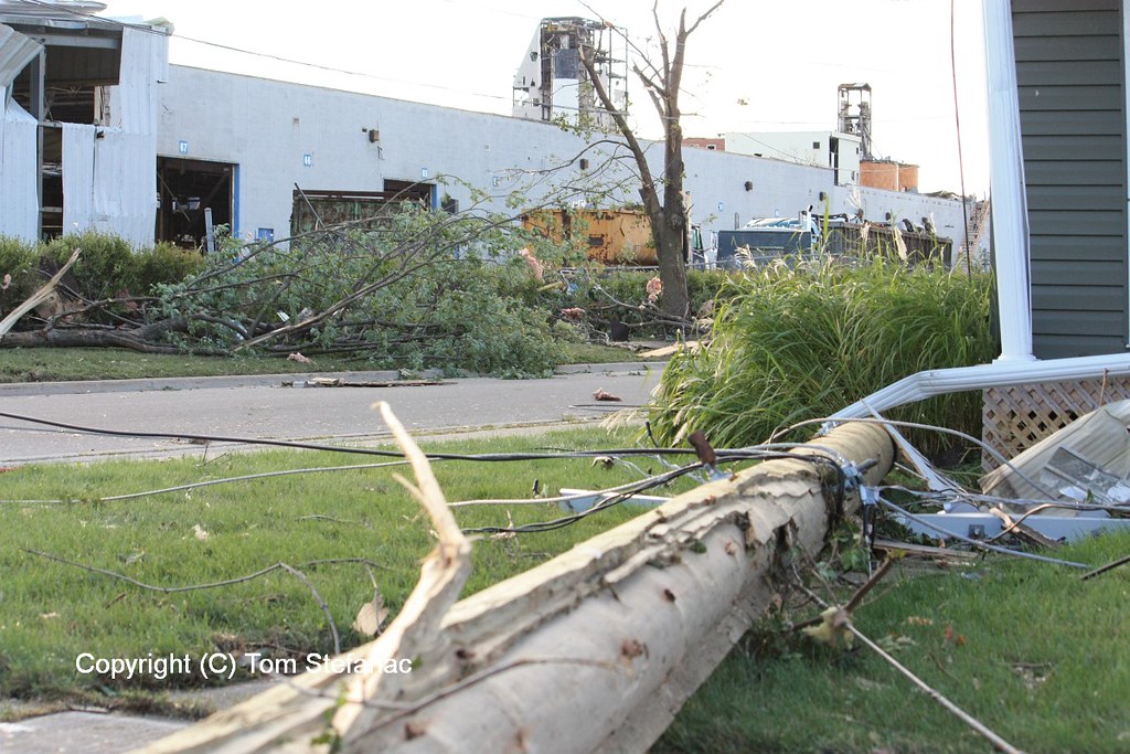
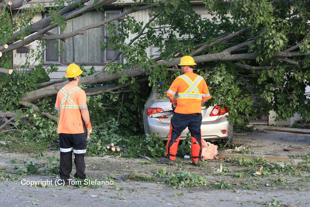
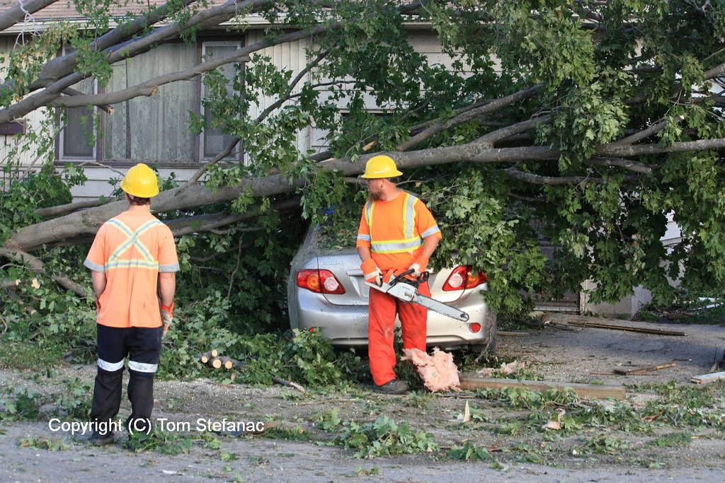
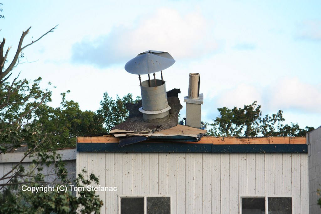
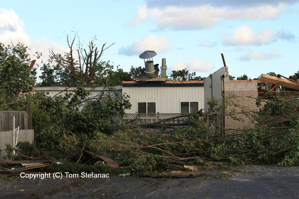
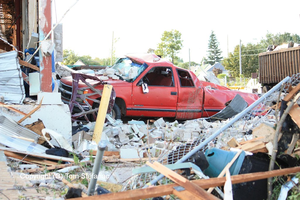
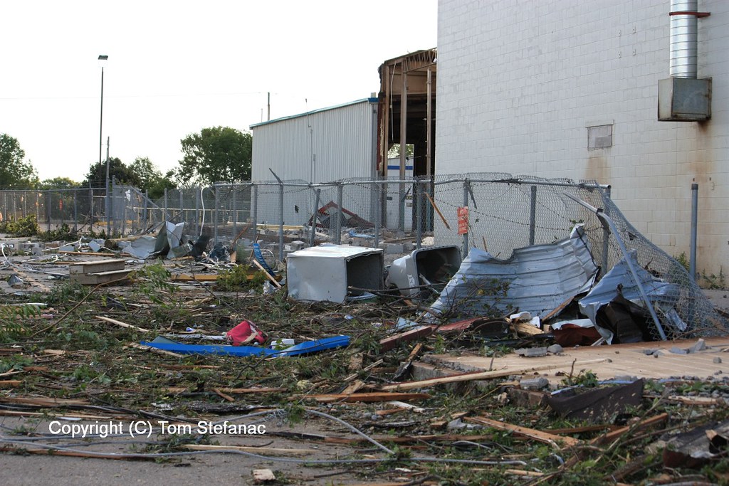
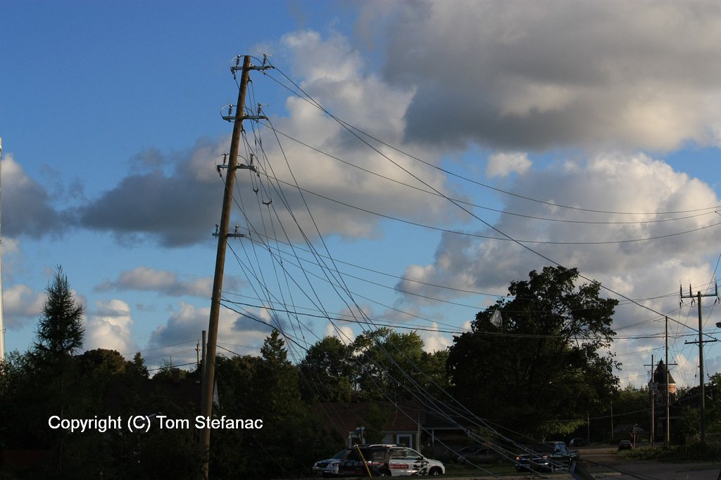
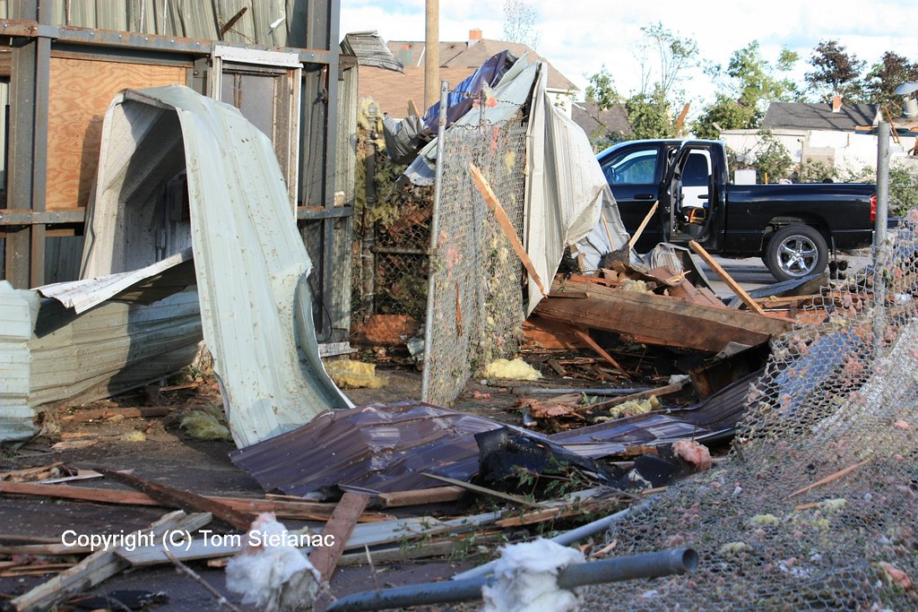
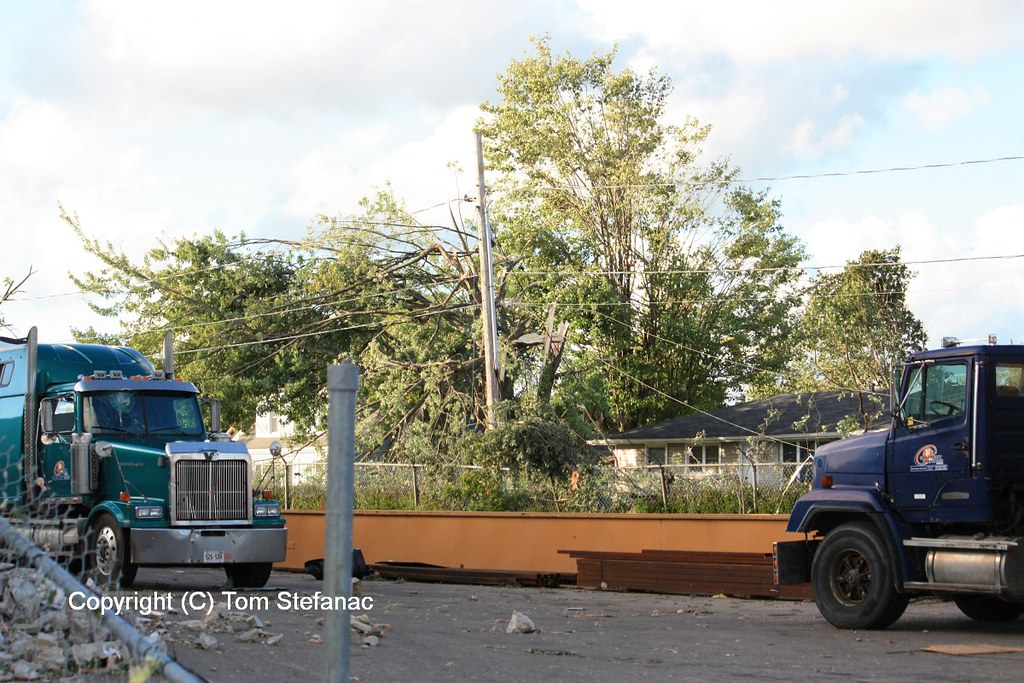
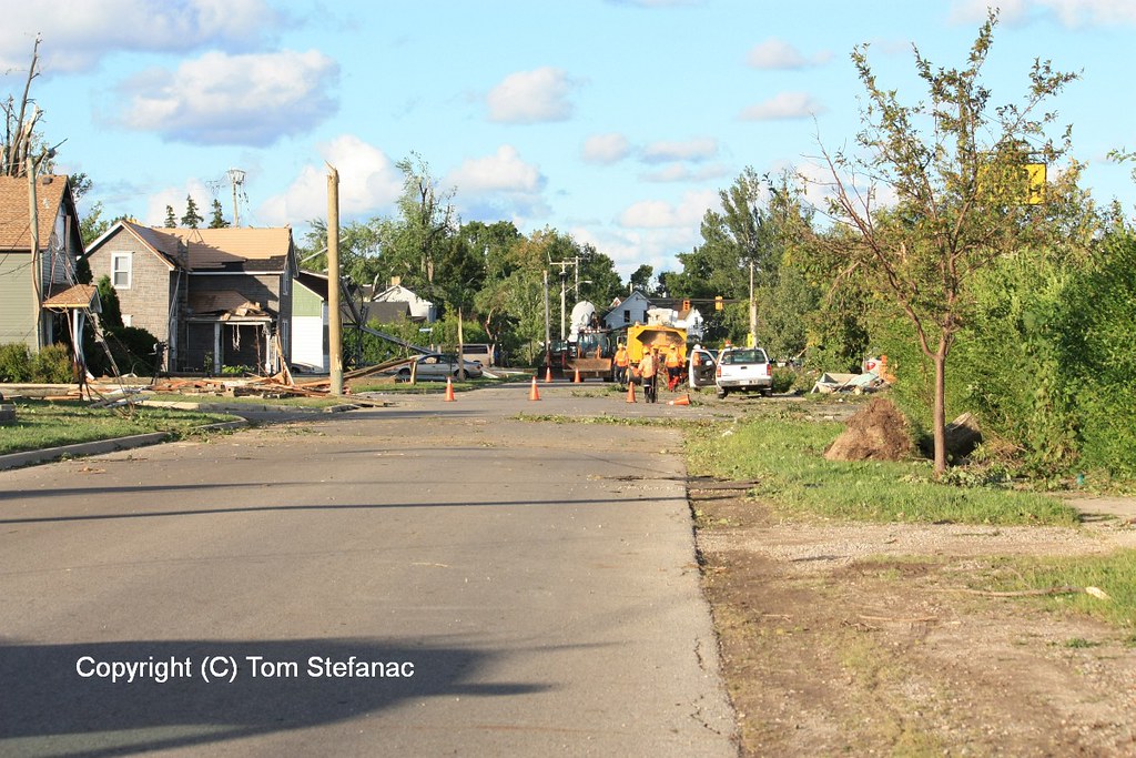
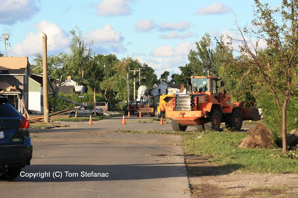
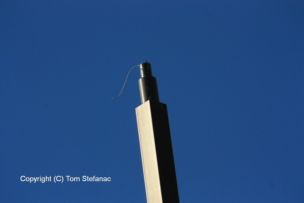
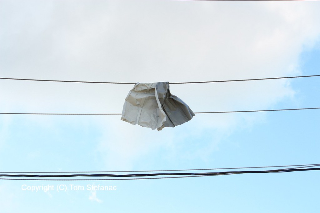
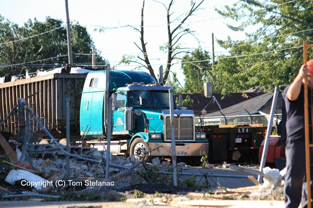
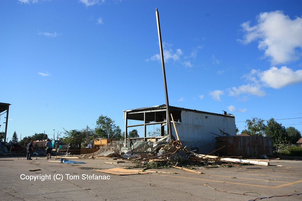
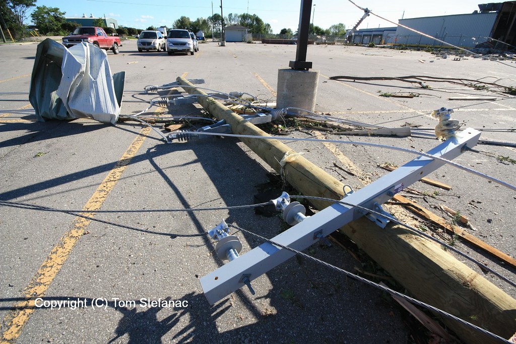
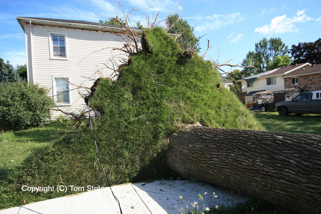
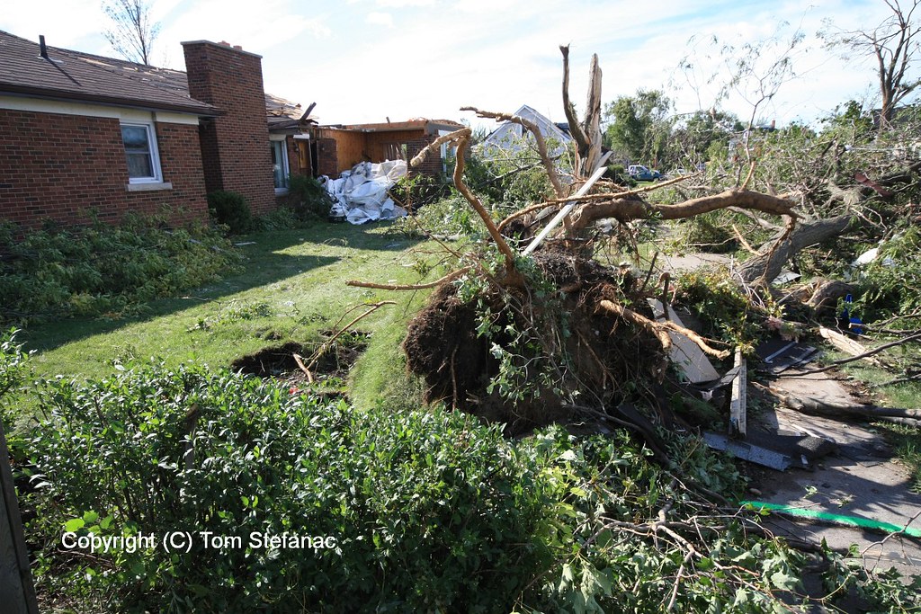
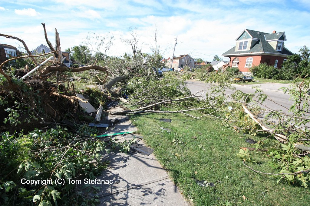
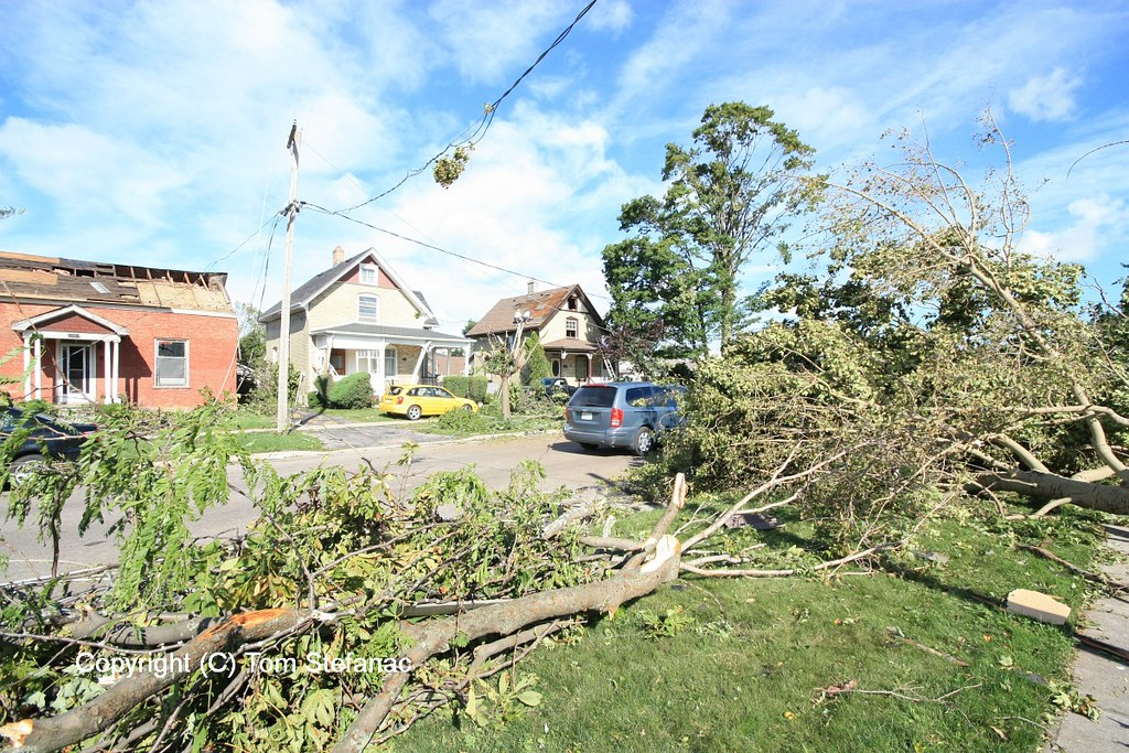
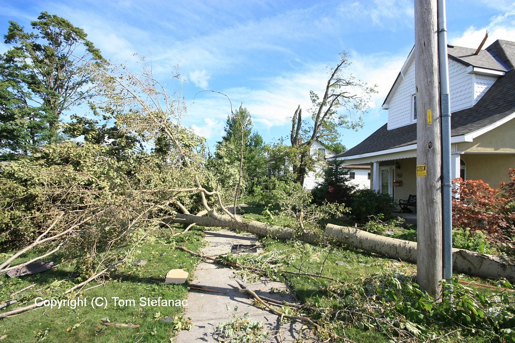
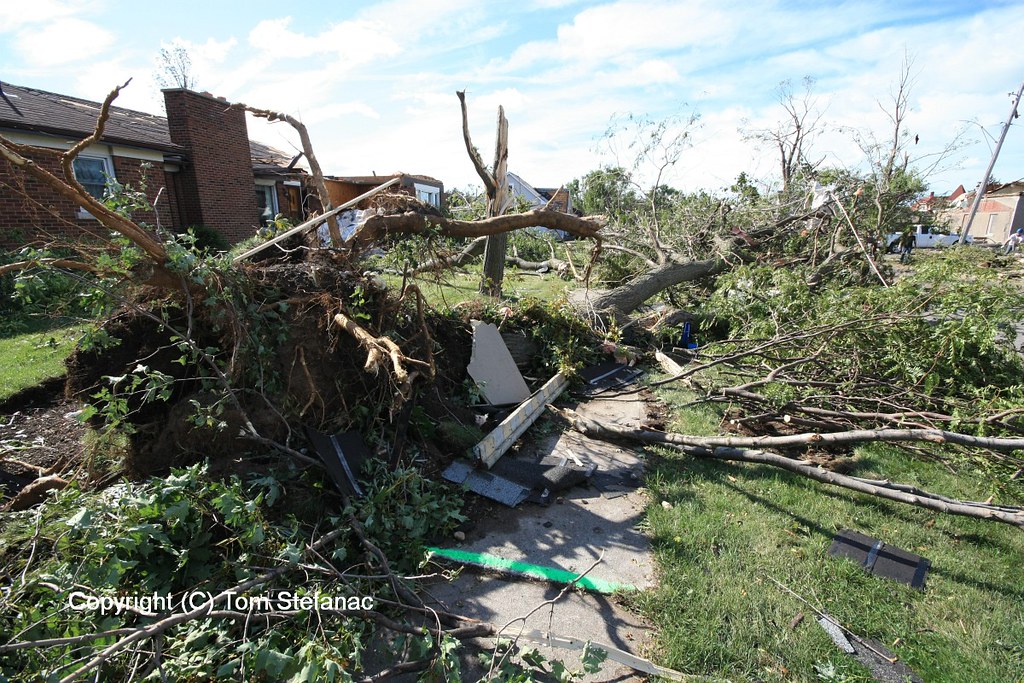
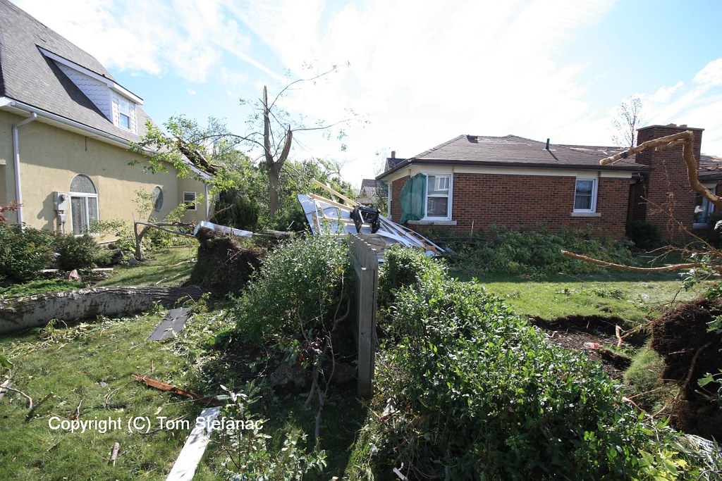
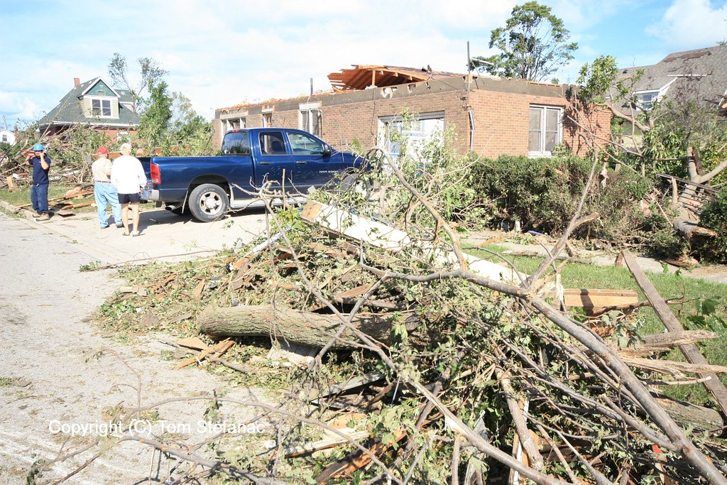
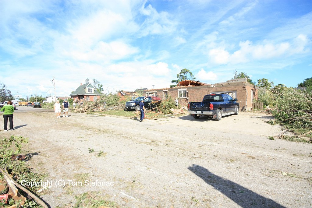
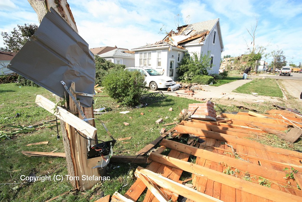
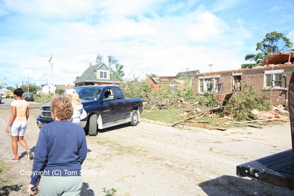
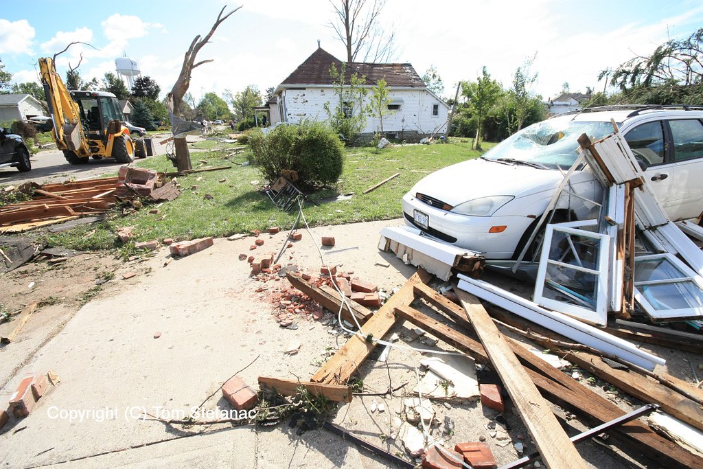
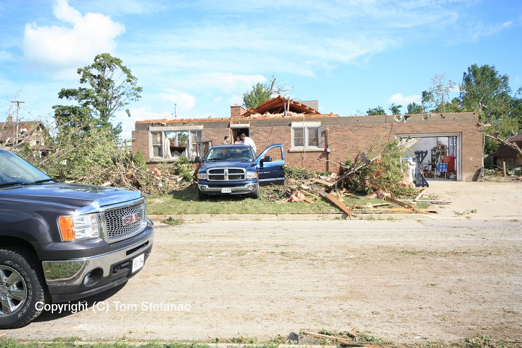
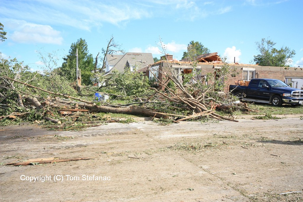
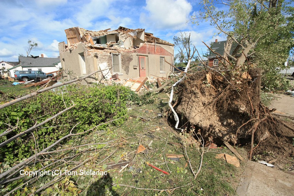
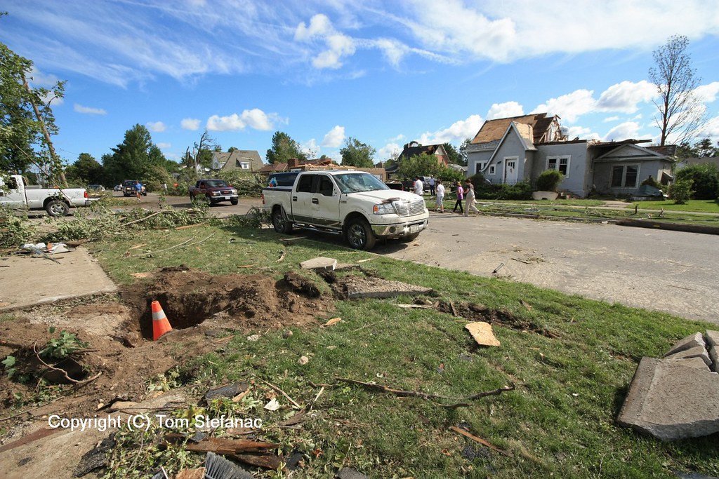
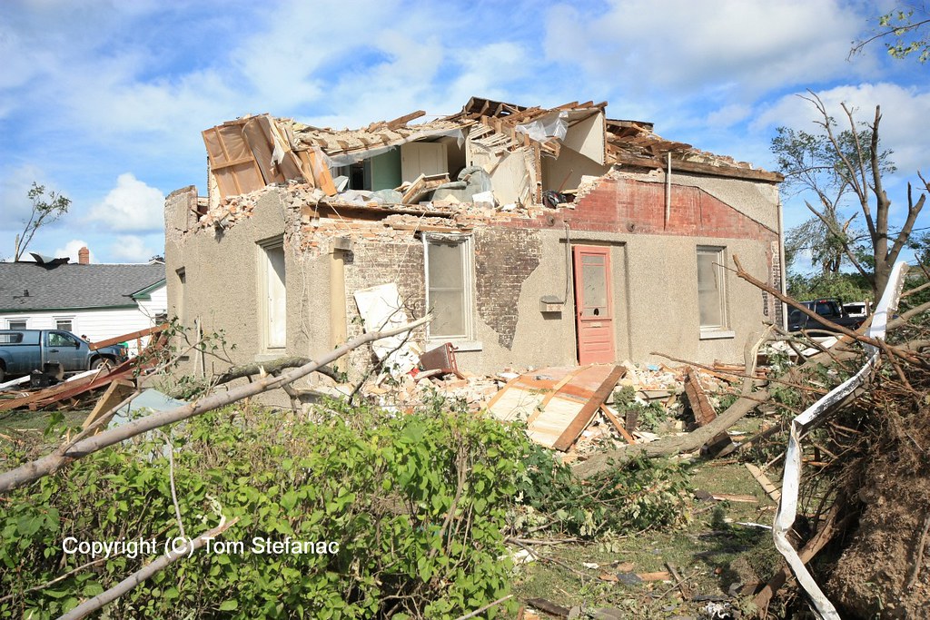
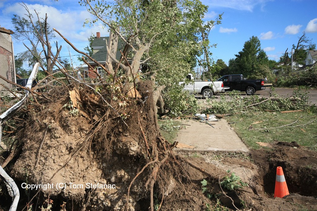
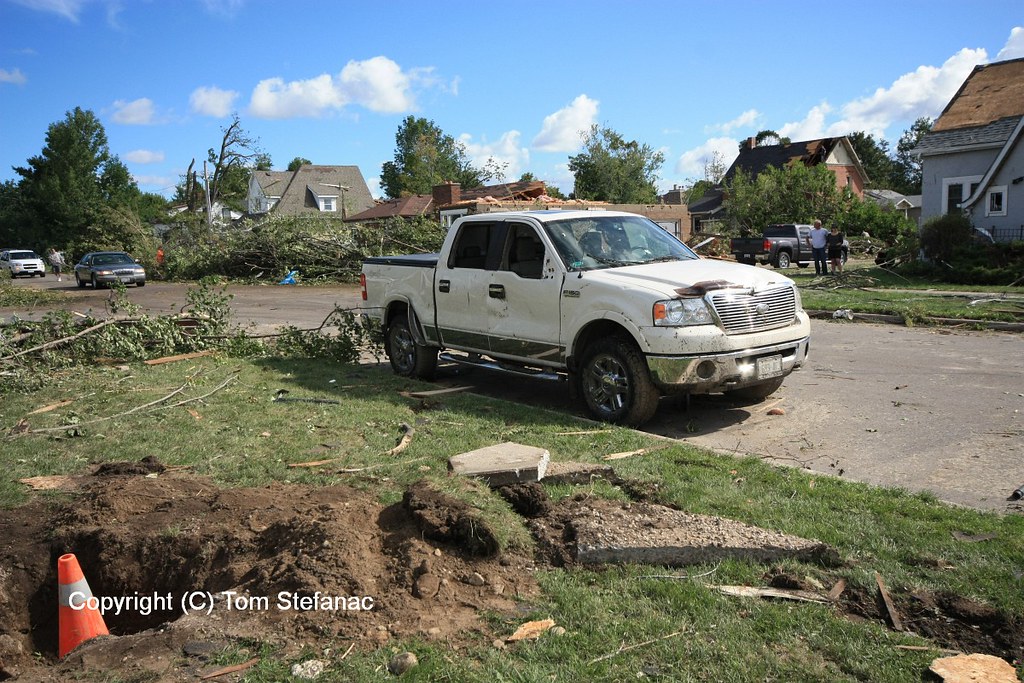
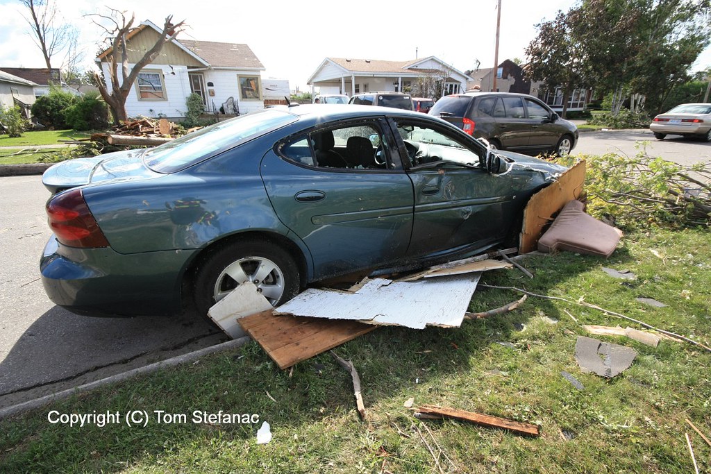
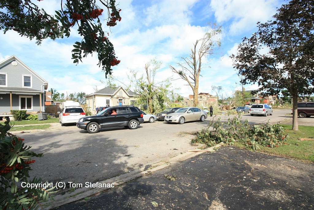
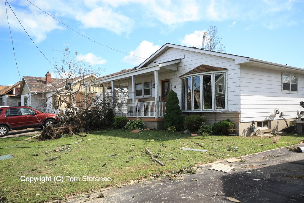
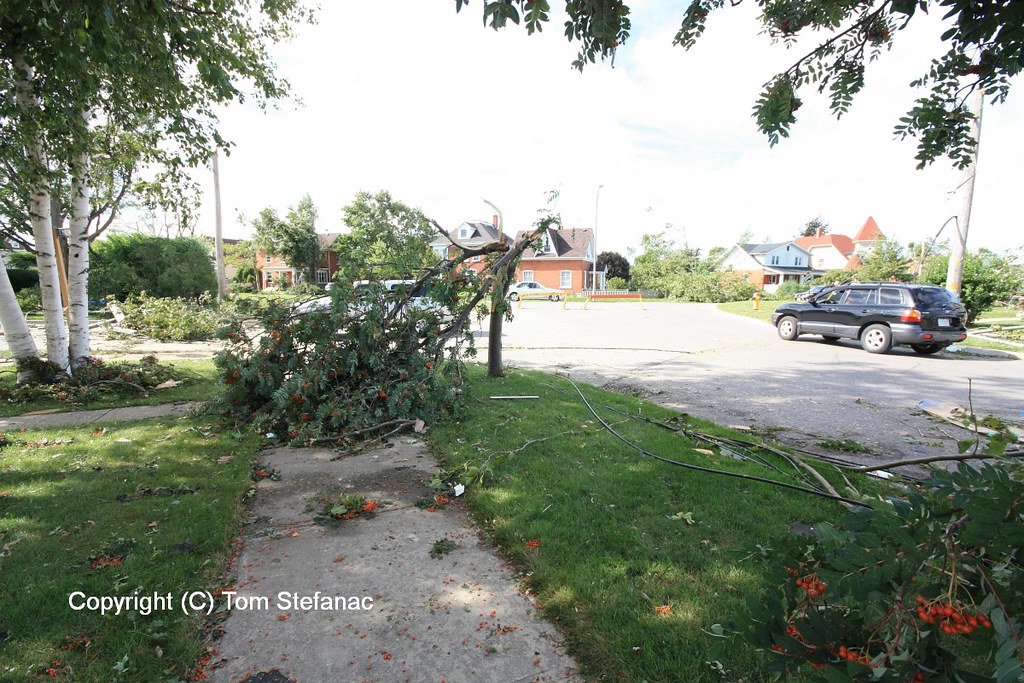
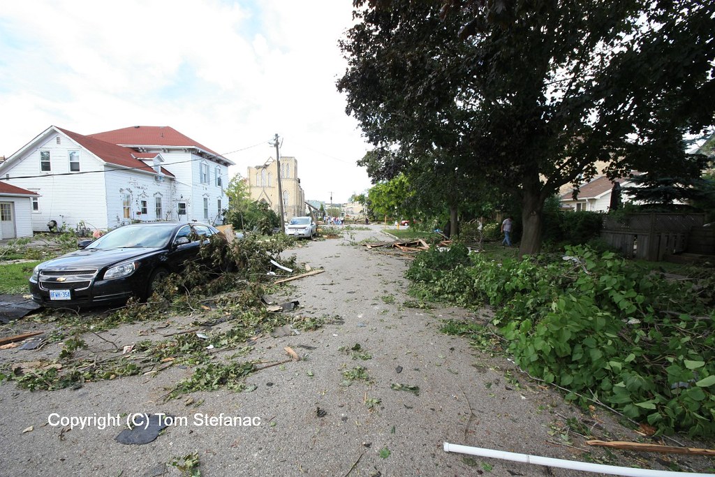
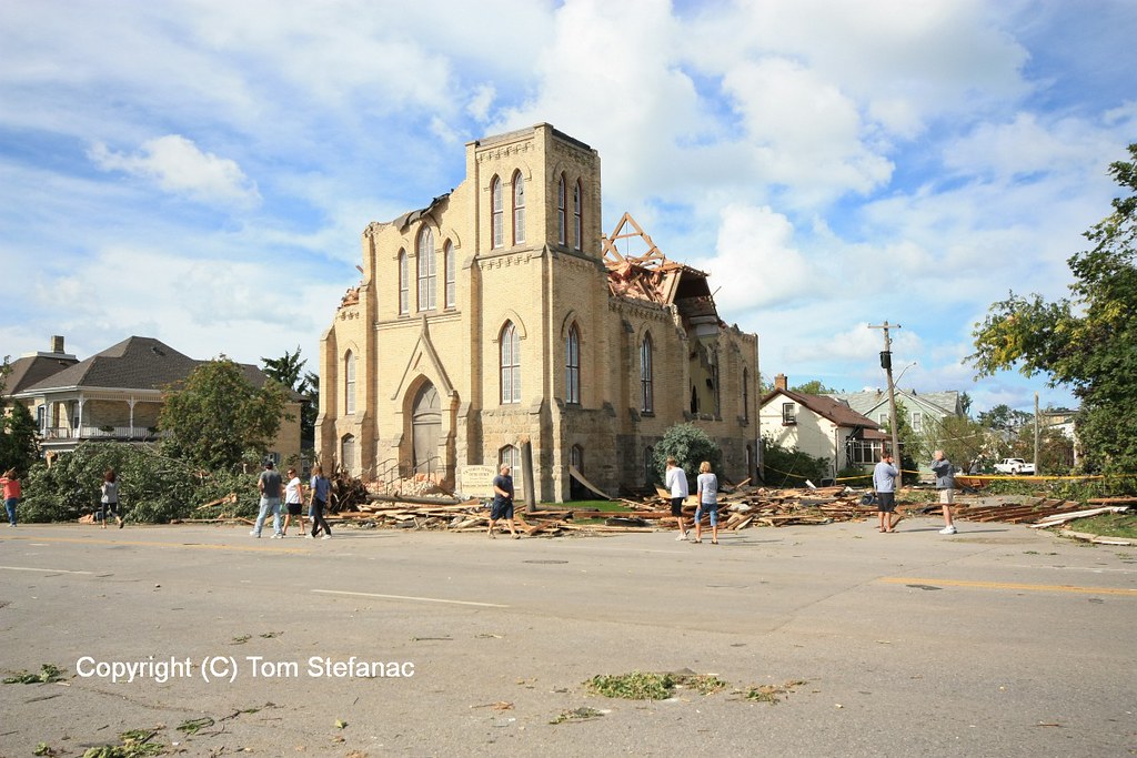
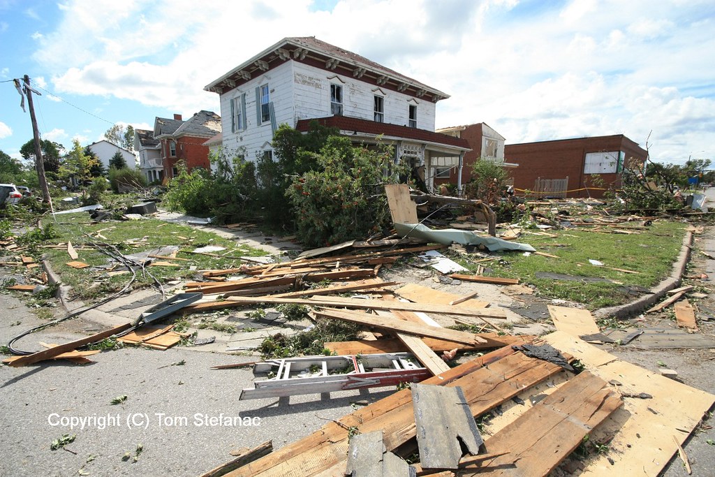
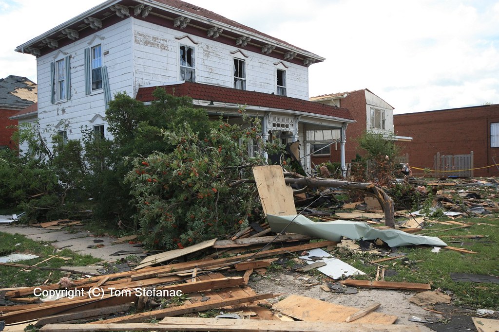
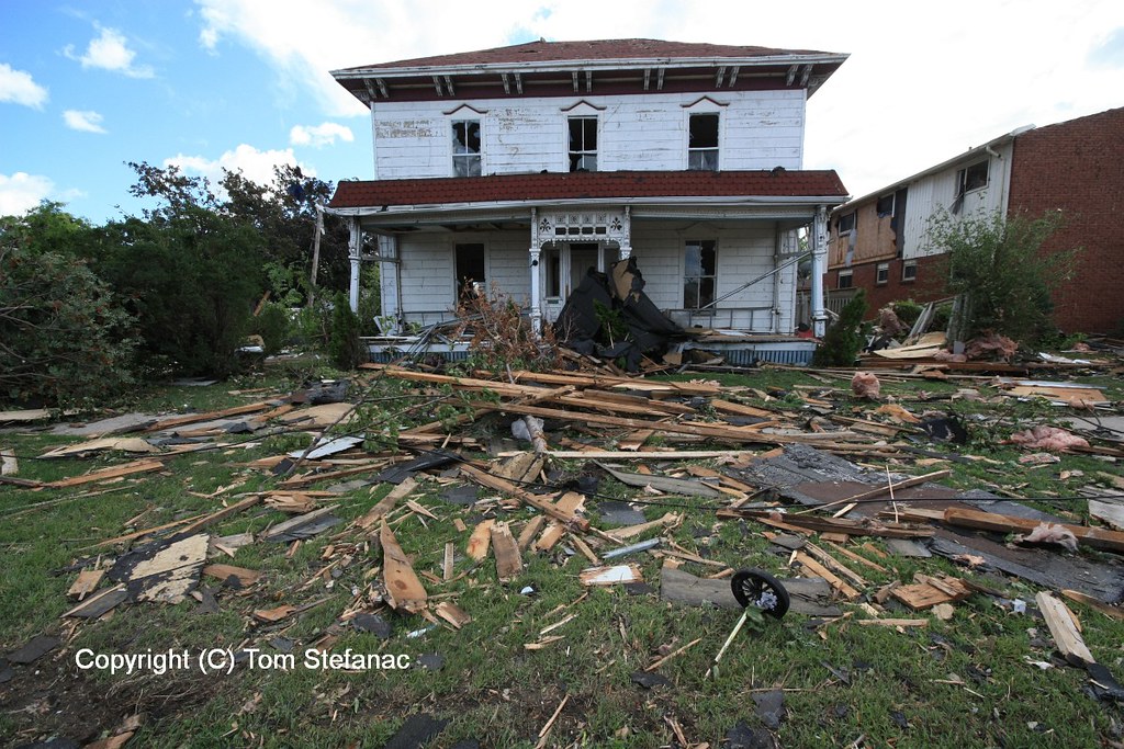
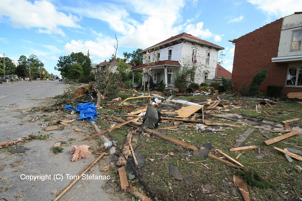
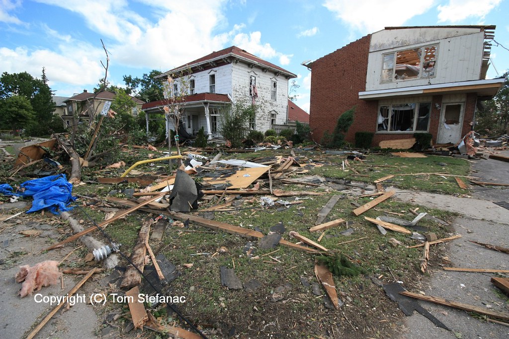
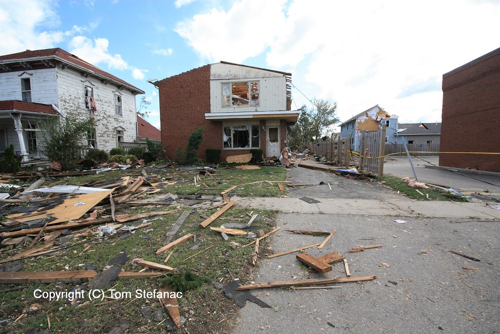
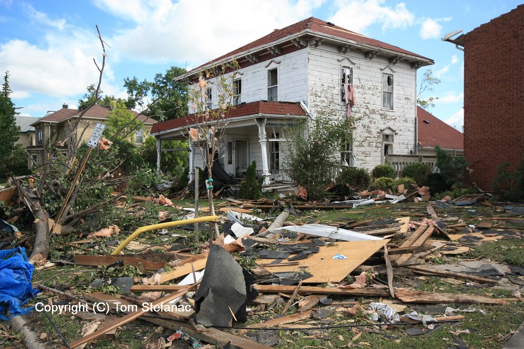
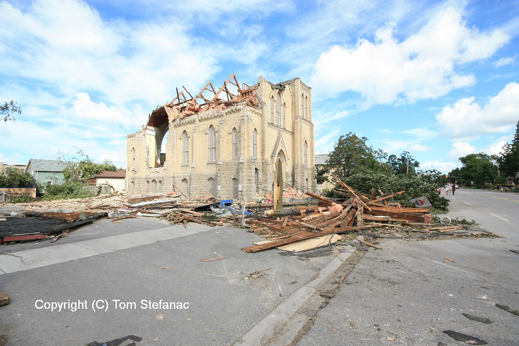
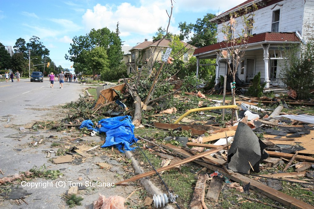
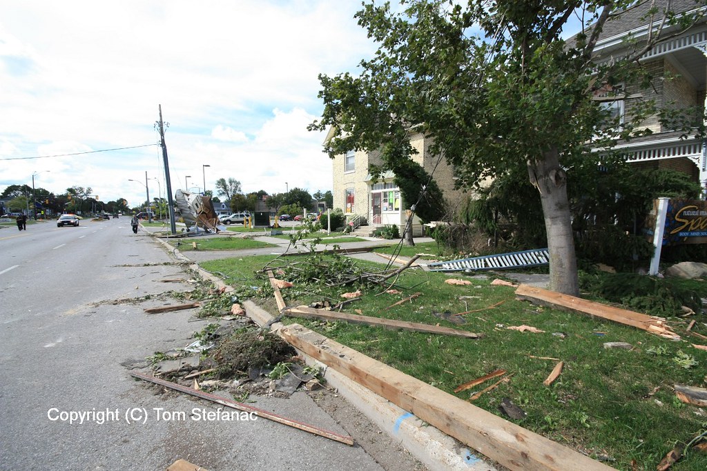
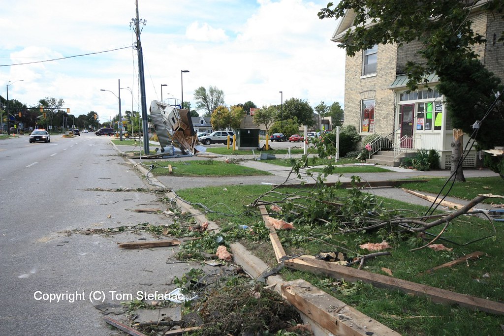
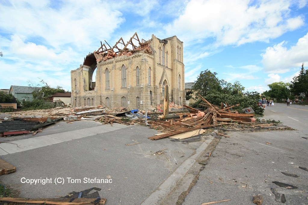
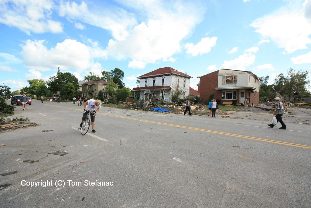
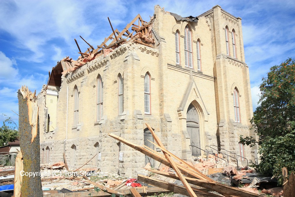
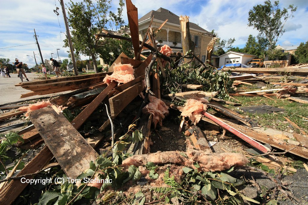
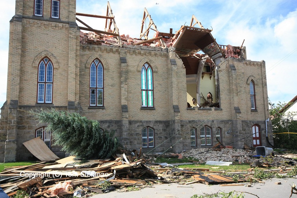
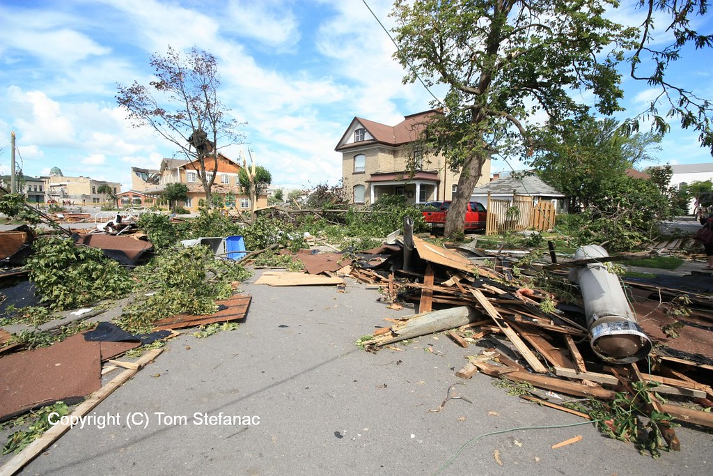
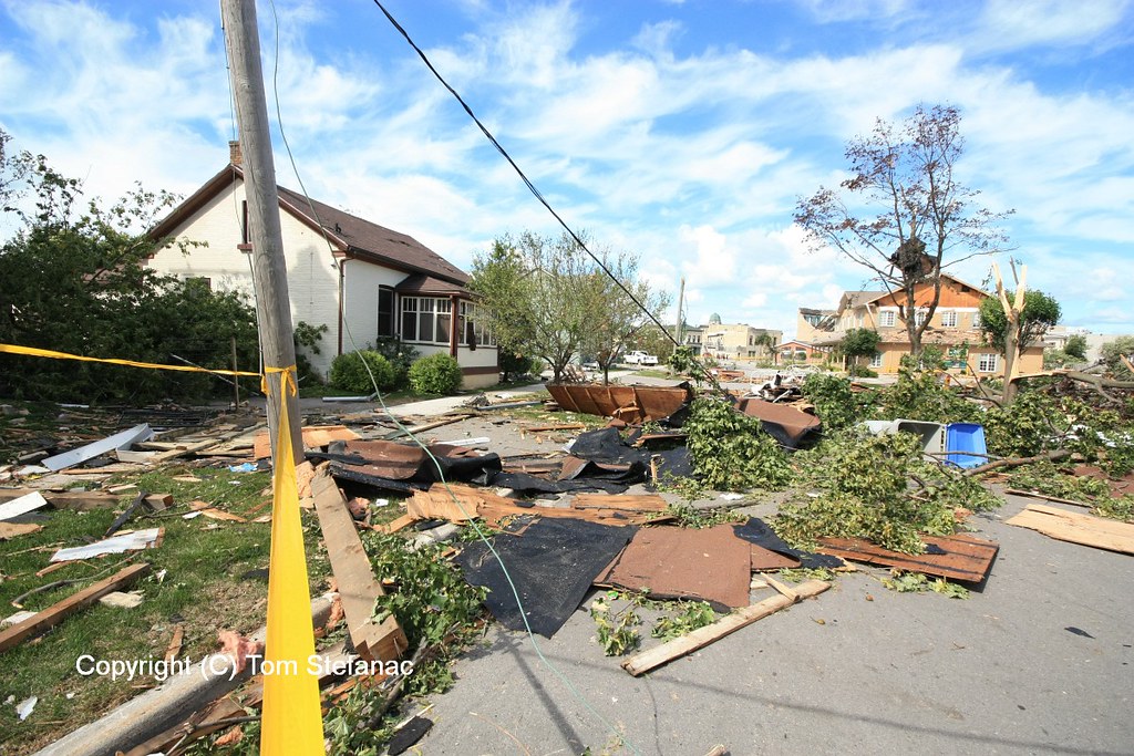
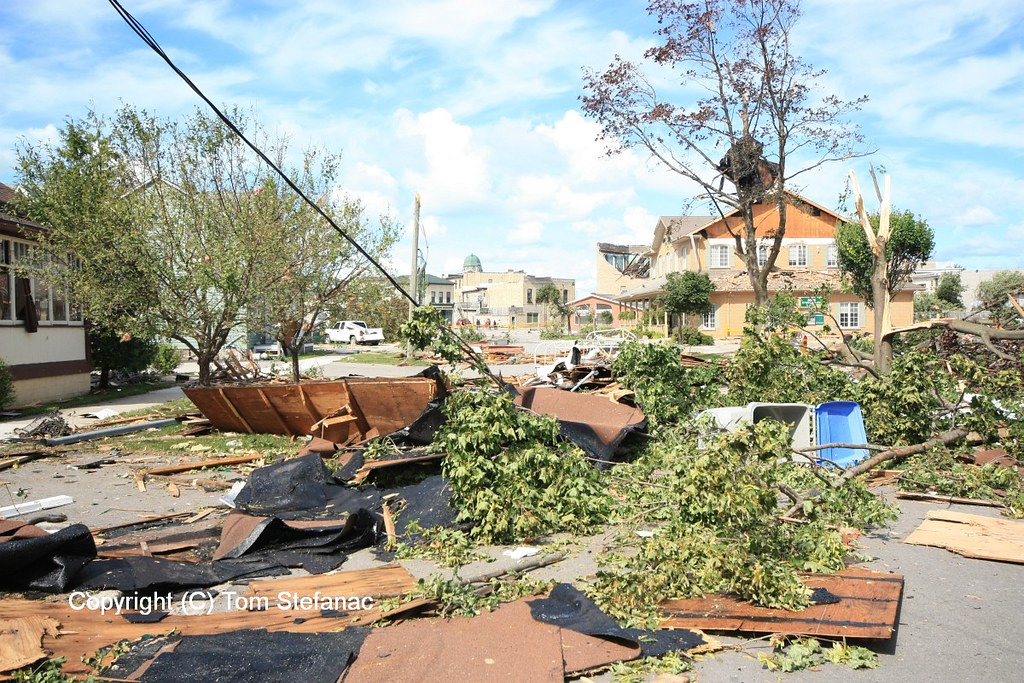
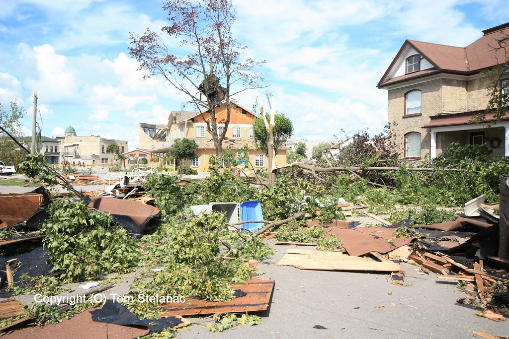
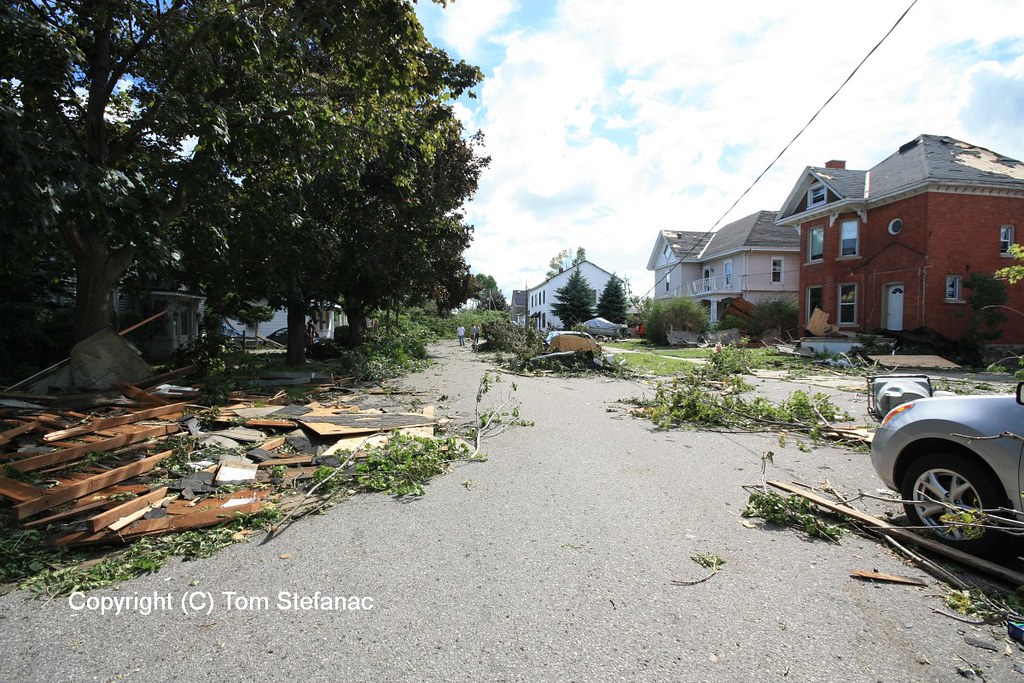
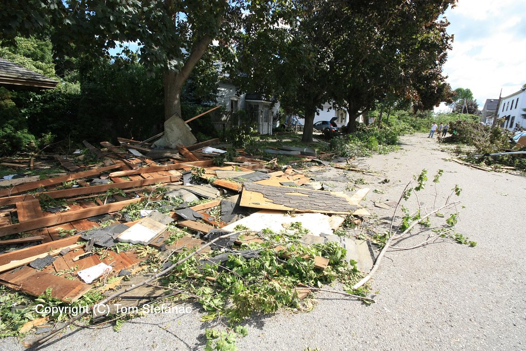
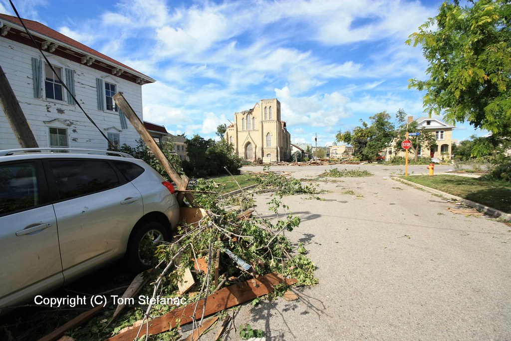
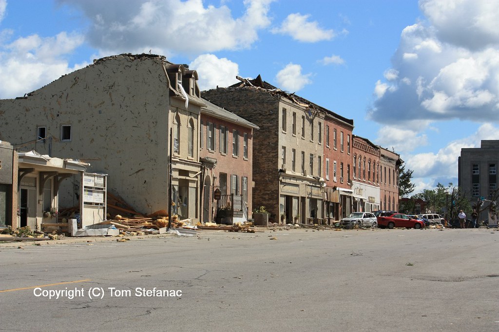
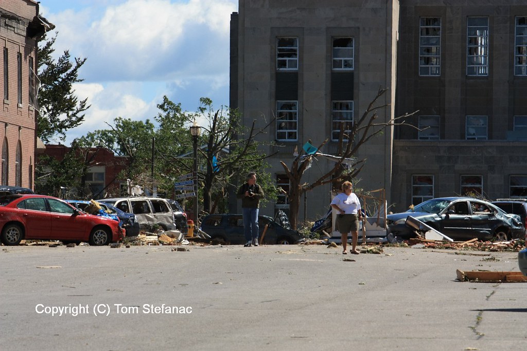
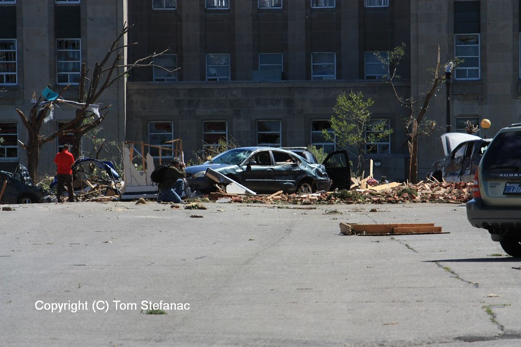
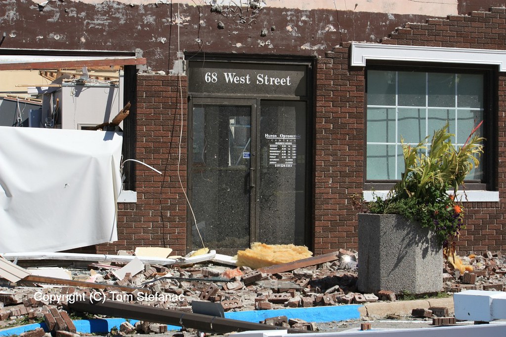
Goderich – F3 – 2011
Here is an assortment of damage photos I took in Goderich less than 24 hours after a large F3 tornado ripped through the town.


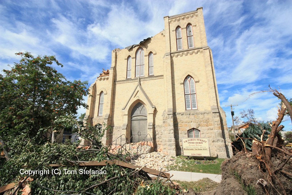
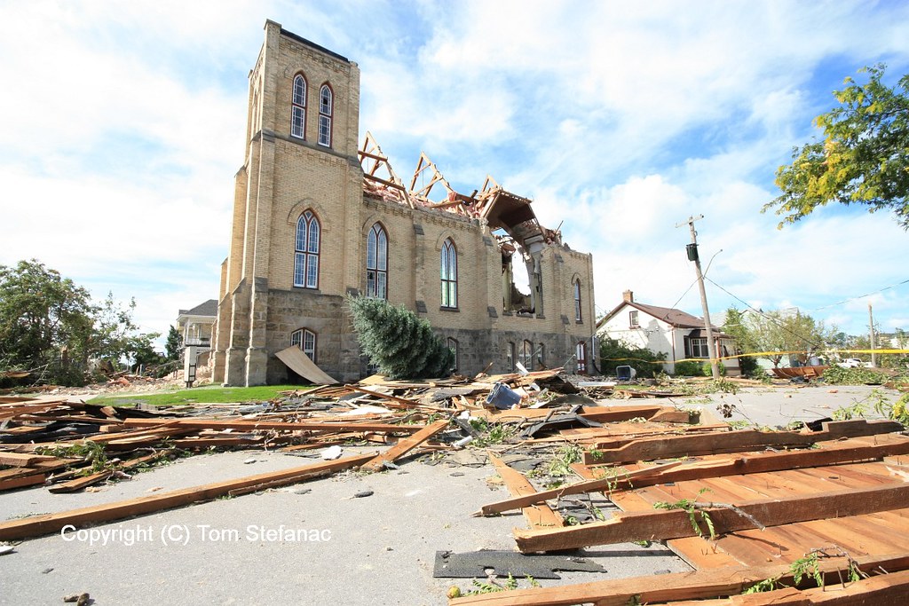
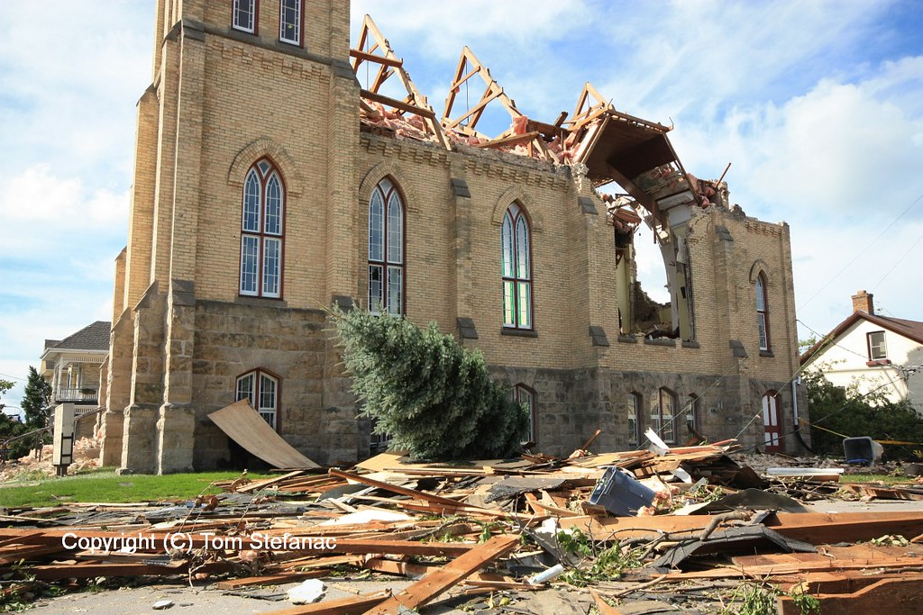
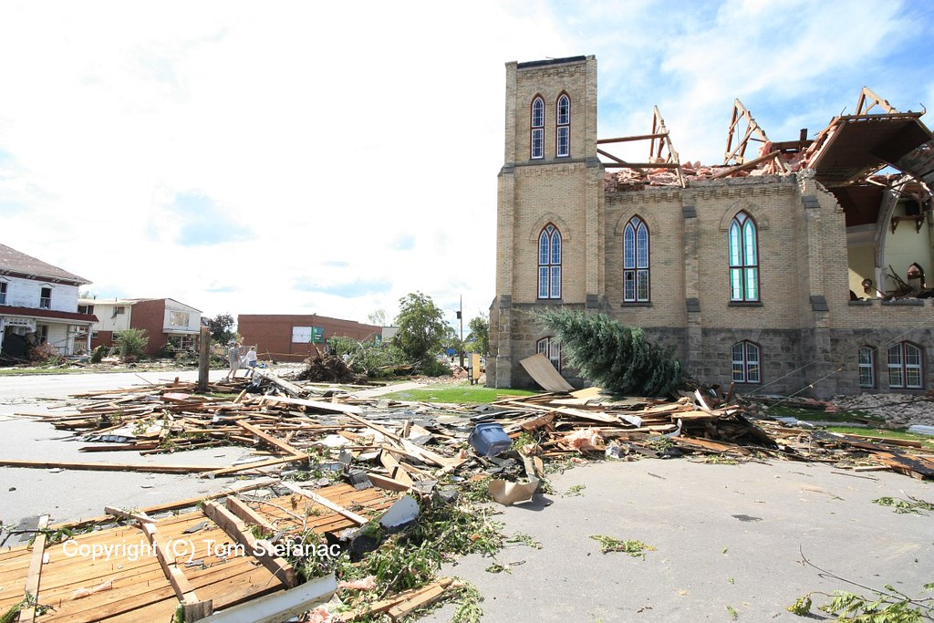


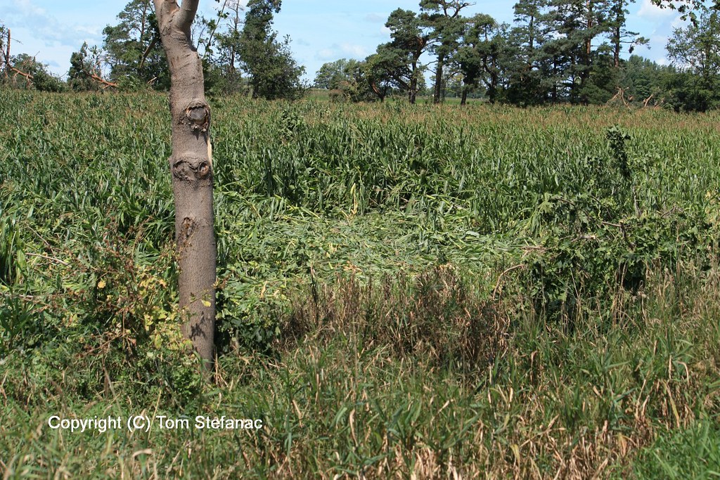
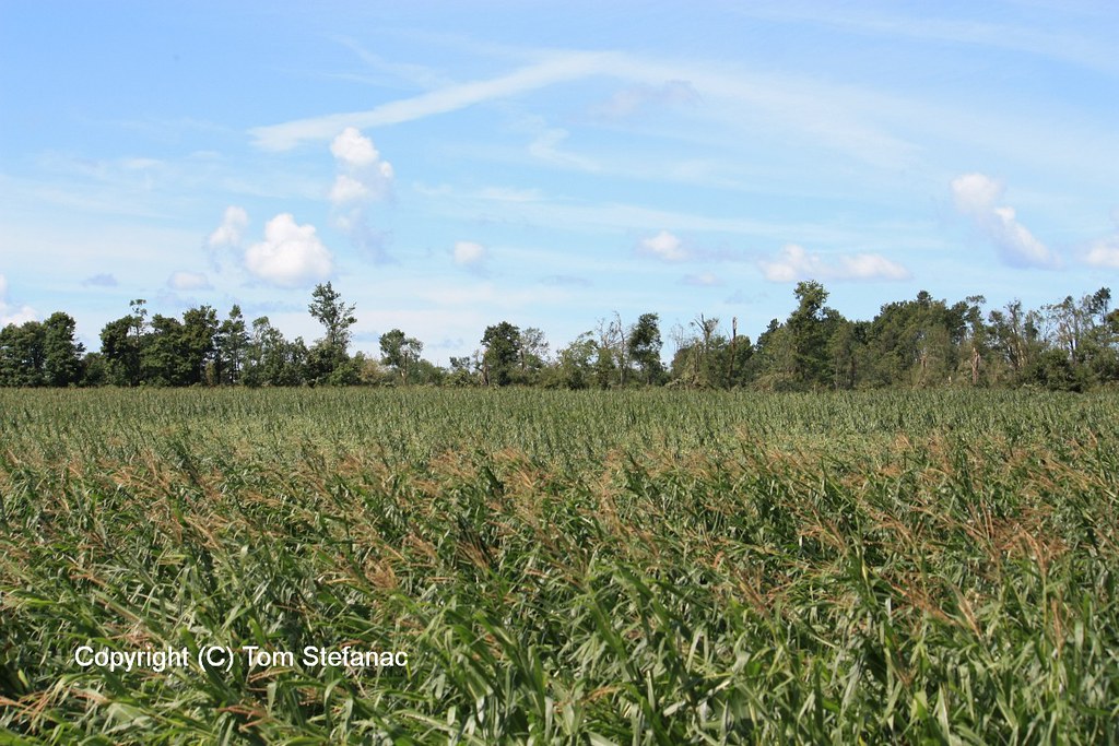
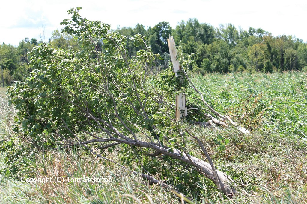
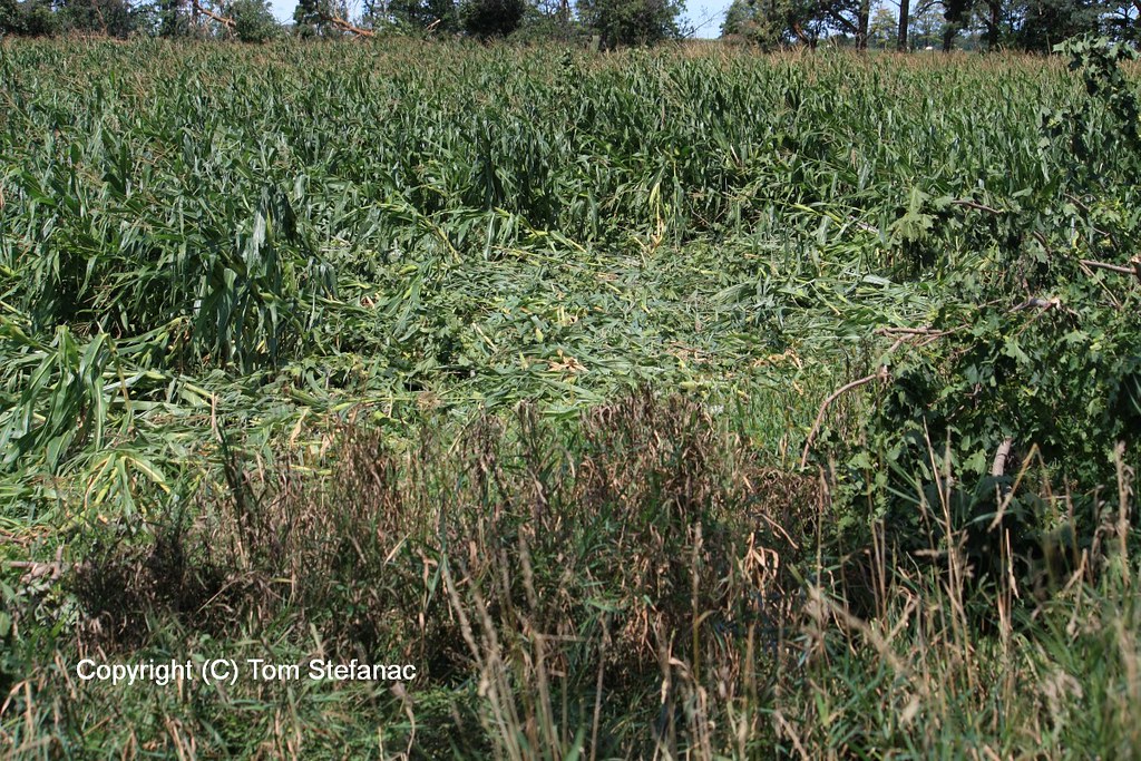
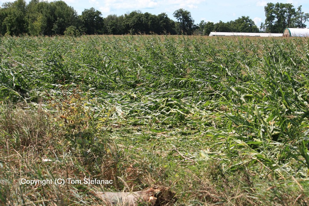


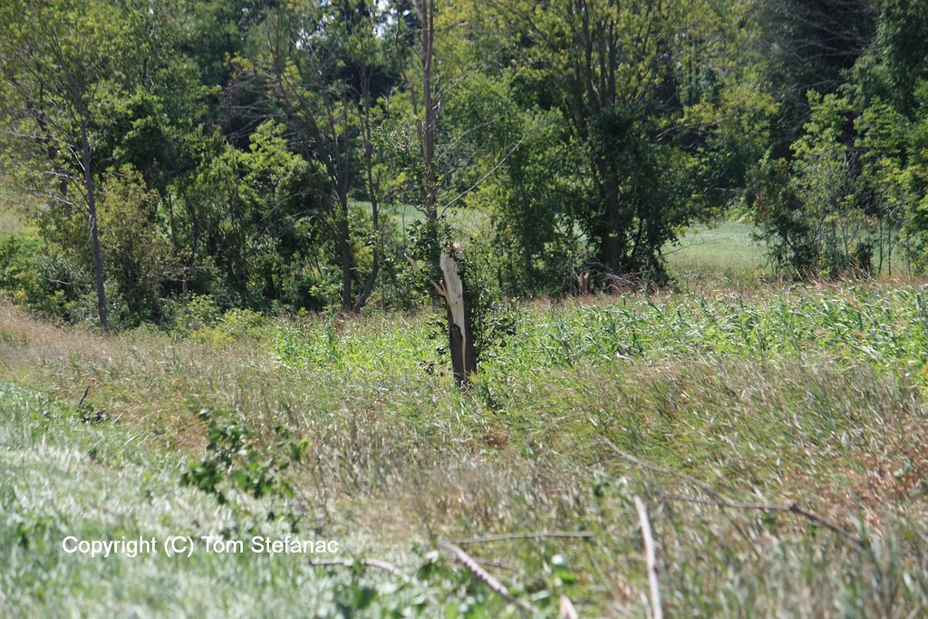
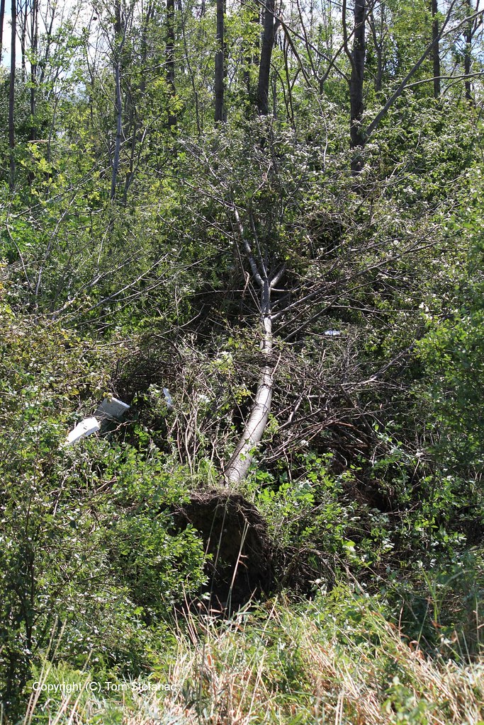

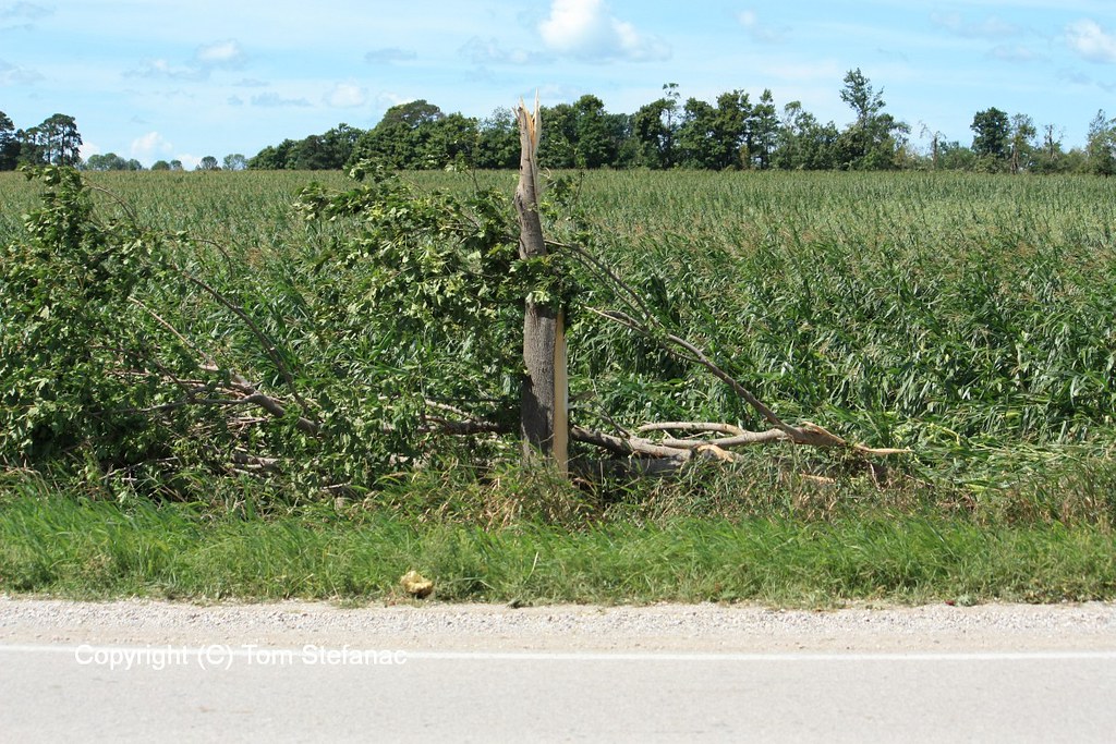


June 27th 2015
This was a very unusual weather patter for late June. Basically, a low pressure system amplified by a neutral trof developed over southern Illinois and quickly deepened when an MCS formed with the center of the low and fed back energy. The low pressure system then quickly tracked north-east from Indiana and occluded as it reach Southern Ontario. Despite the occlusion occuring, there was enormous low level wind energy and weak instability which allowed the system to continually fill with rain and weak embedded storms all in addition to remnant moisture from the pre-existing MCS.

Despite this being a synoptic system that really just made for a miserable and cool weekend, I somehow decided that it would be a good idea to head down to the Lake Ontario shoreline. It was actually very tropical storm like with constant winds and rain bands battering the shore and his actually created some interesting weather.


June 25th 2015


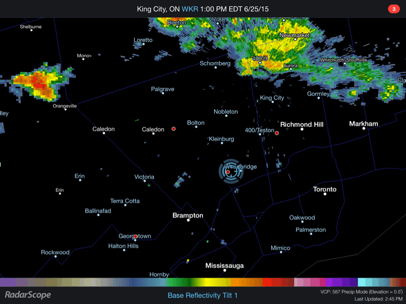
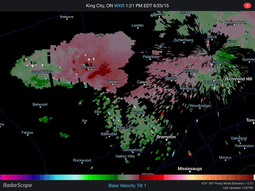
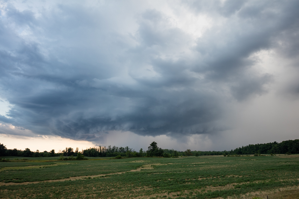
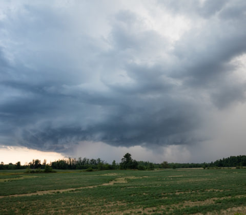
Here are a couple GIF loops showing the storm and the associated velocity couplet. You’ll also find a time-lapse video at the bottom showing the supercell mesocyclone and associated wall cloud in motion with clear rotation.