Posts By Tom
June 8th 2015
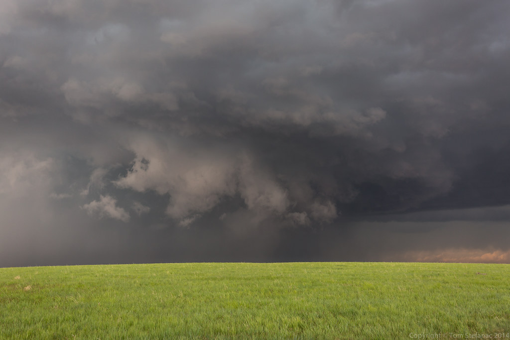
This was one of those somewhat unusual setups where storms were poised to fire along a trough from a secondary low behind a weak cold front. The initial cold front brought weak storms and drenching rains overnight and into the morning.


April 30th 2015
This was the real start of my chase-cation. There was a very marginal potential for severe storms and tornadoes were a virtual impossibility based on probabilities. It was a usual weird as could be high plains setup where by some miracle of the storm relative wind fields and near non existent moisture, the high plains would somehow produce storms which would grow in strength by evening and eventually everything would be pushed out by a cold front sinking south from Wyoming. Weird things happen above 1500 meters in elevation!


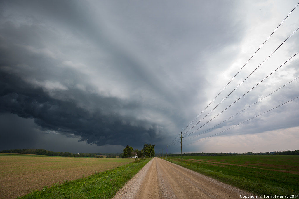
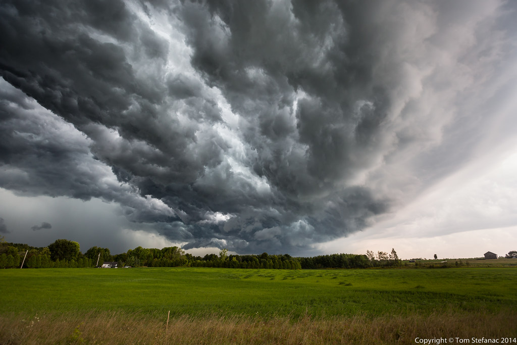
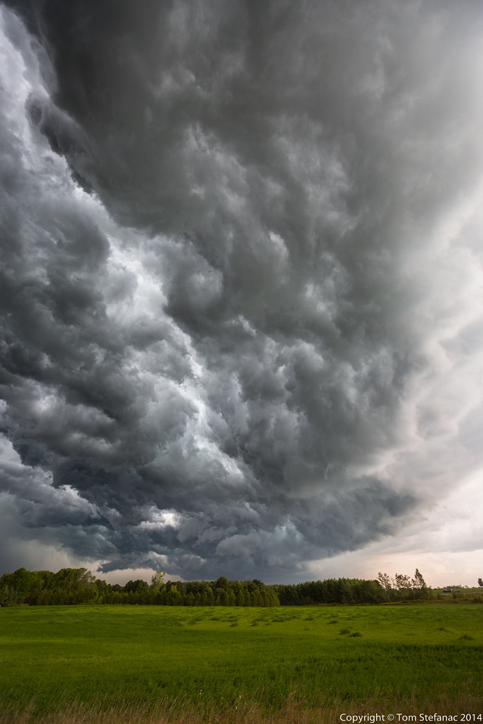
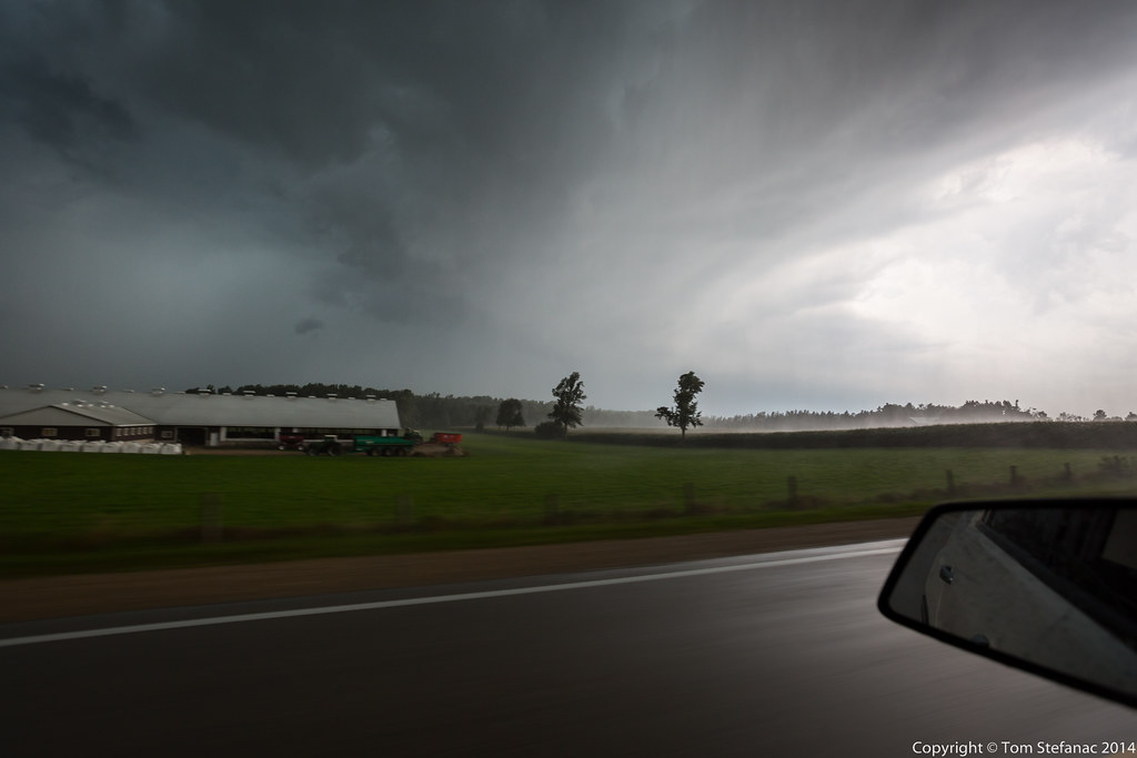
May 11th 2015
On this day a messy warm front which was severely stunted by the cold water of the great lakes struggled to make it into Southern Ontario. Shear profiles supported a linear squall line at best along a trof line and energy was very weak with peak cape around 800 j/kg.


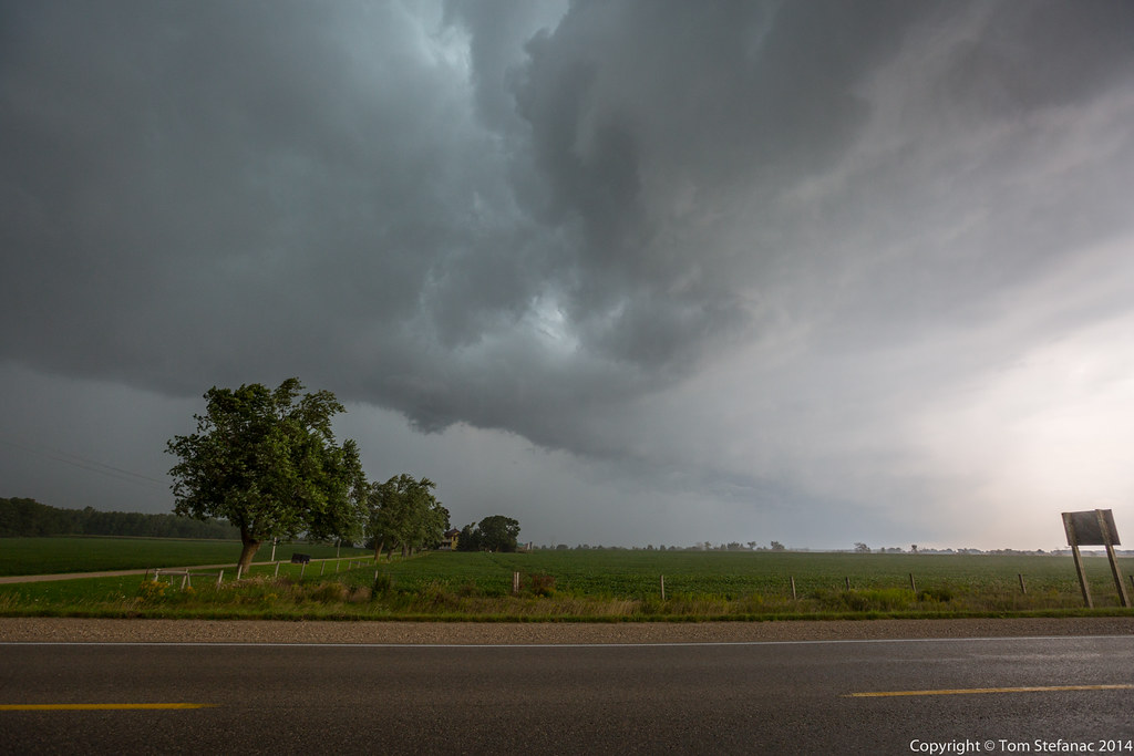
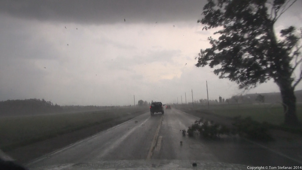
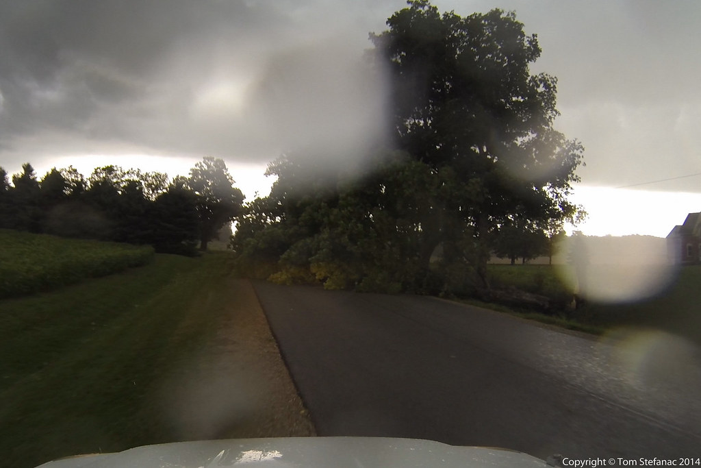
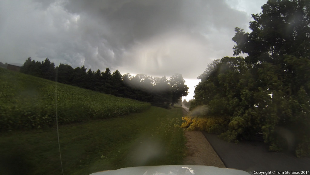
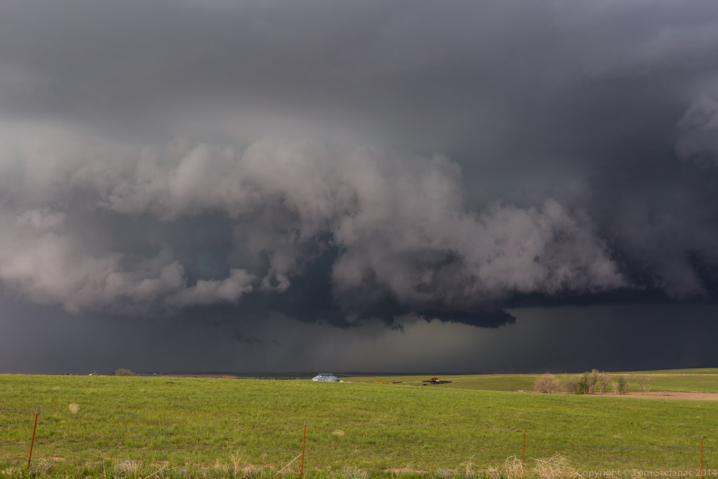
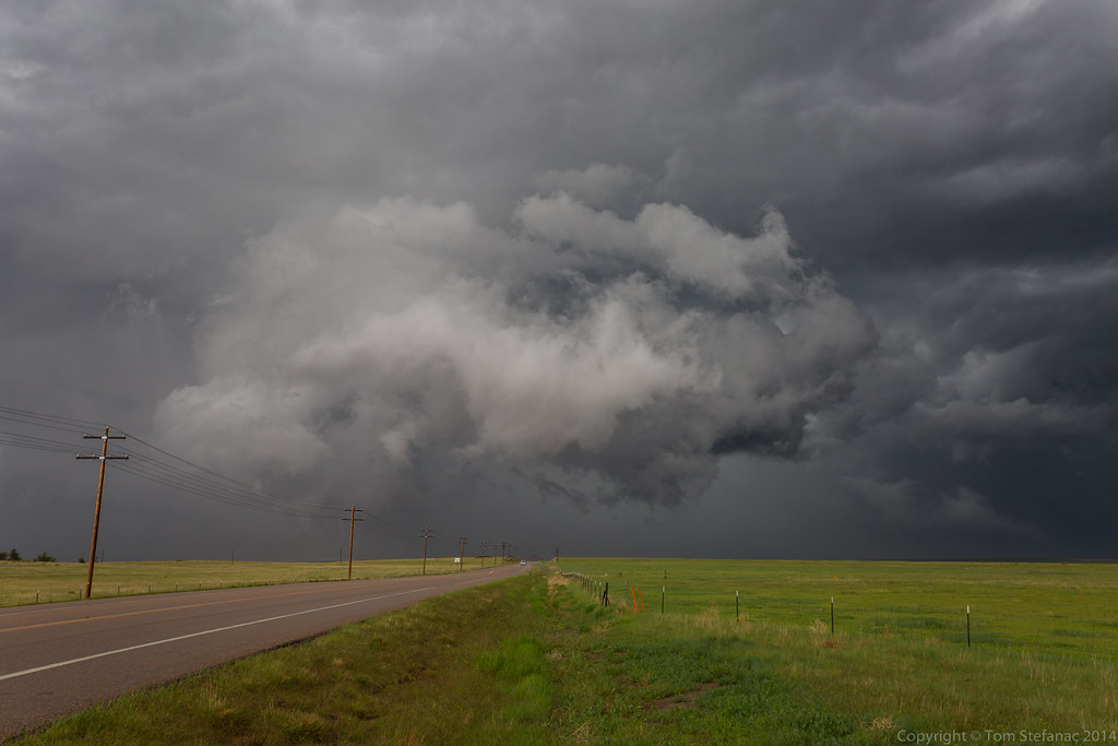
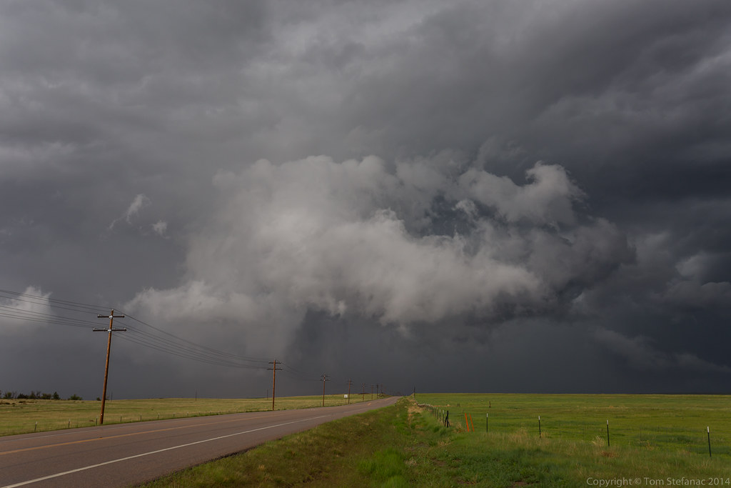
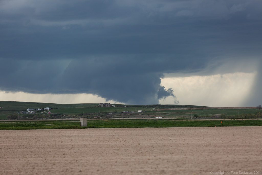
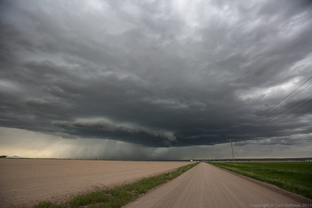
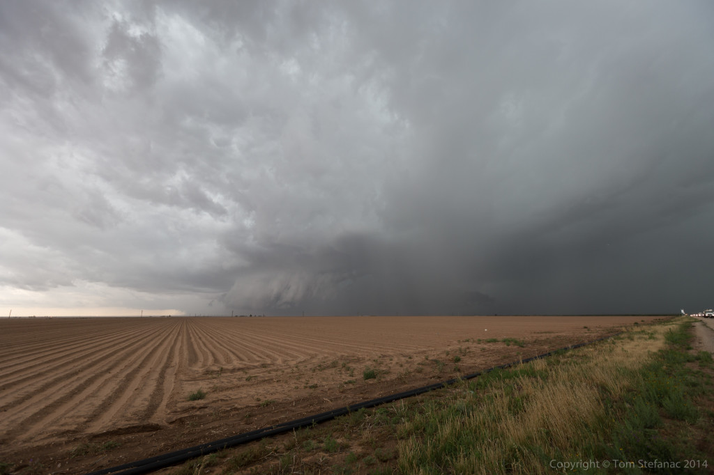
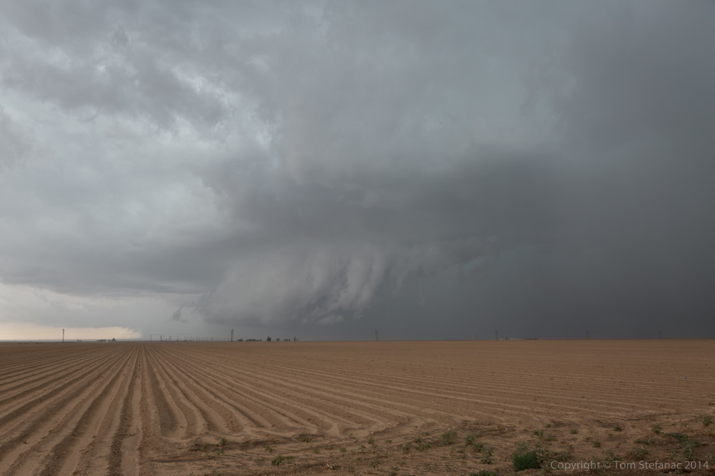
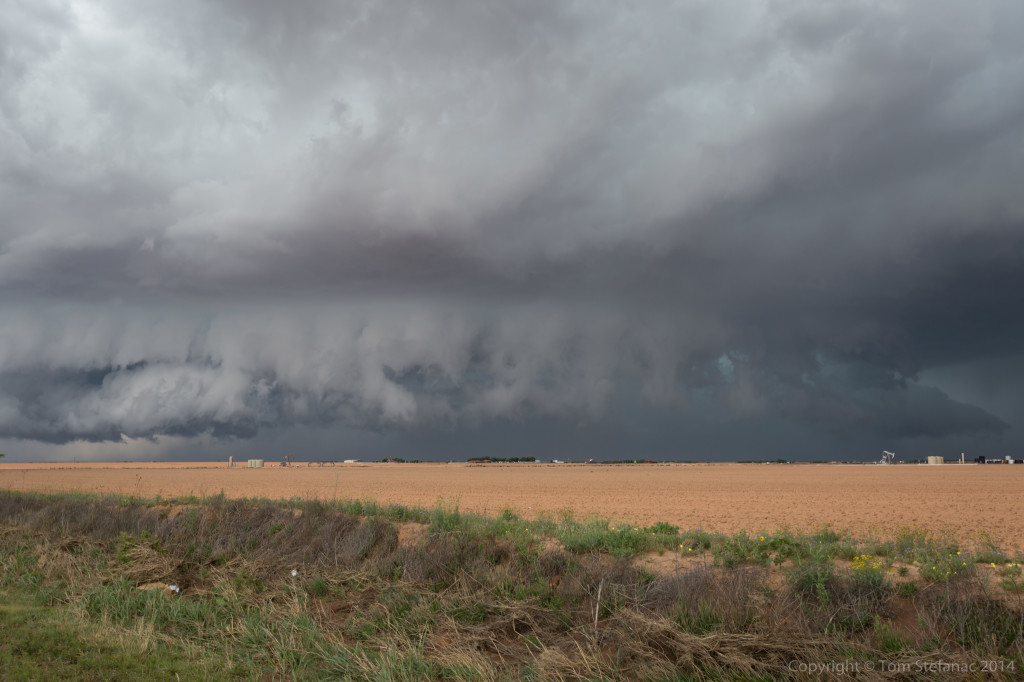
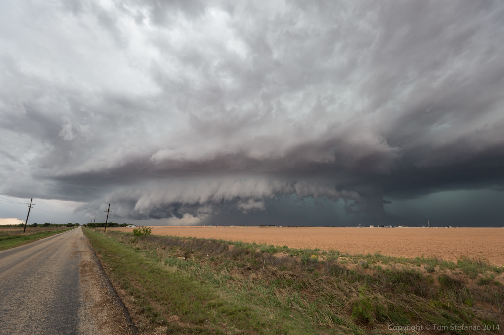
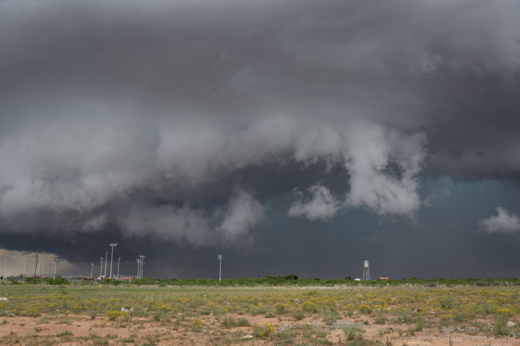
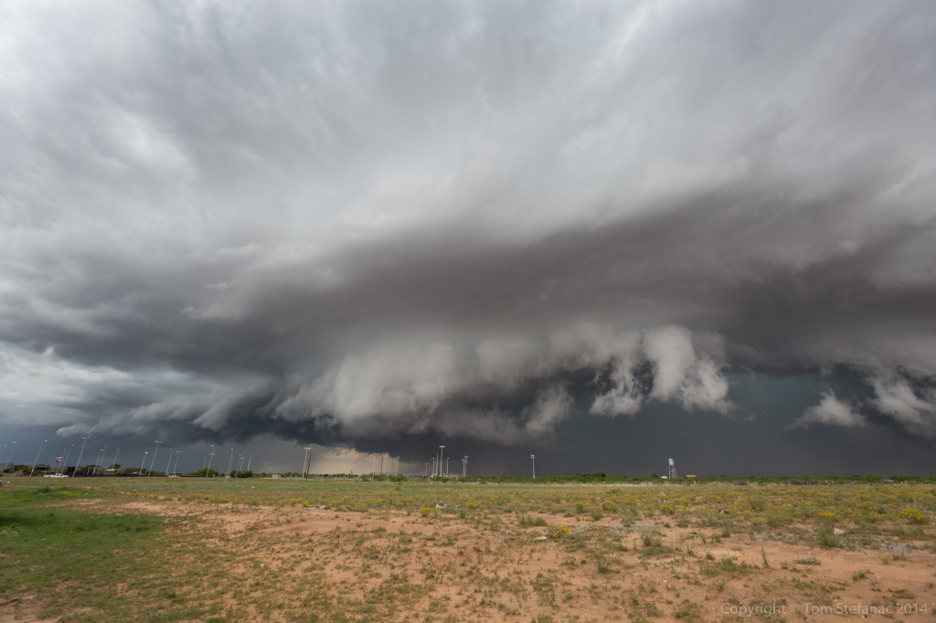
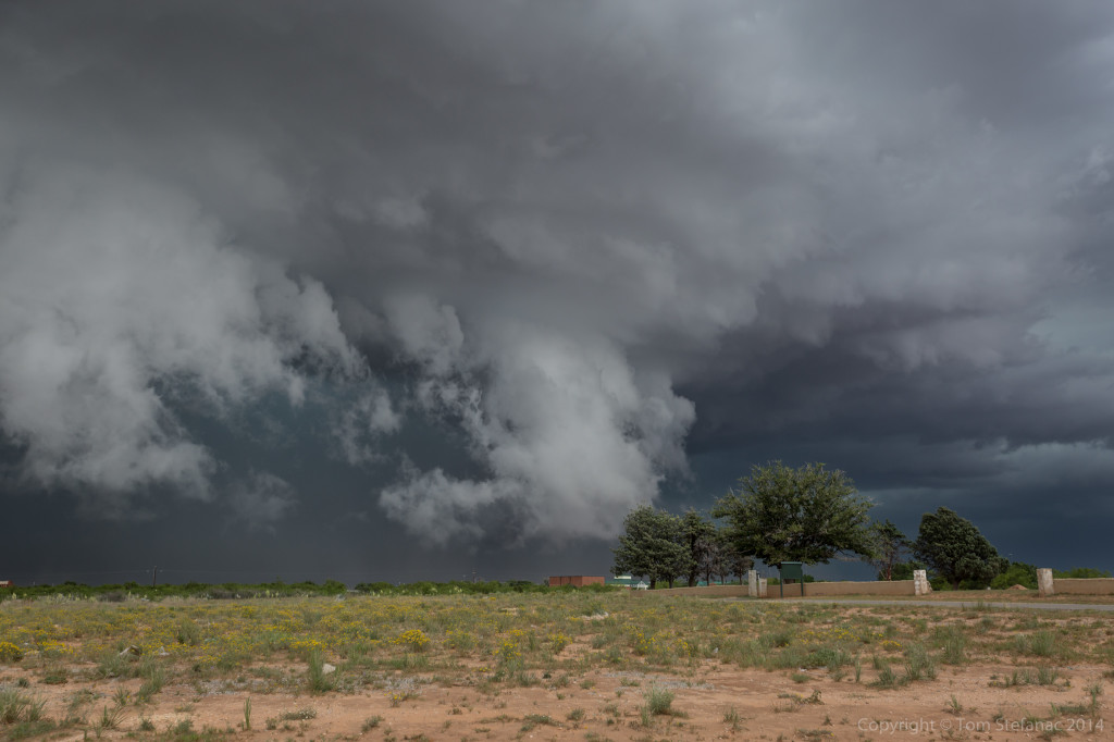
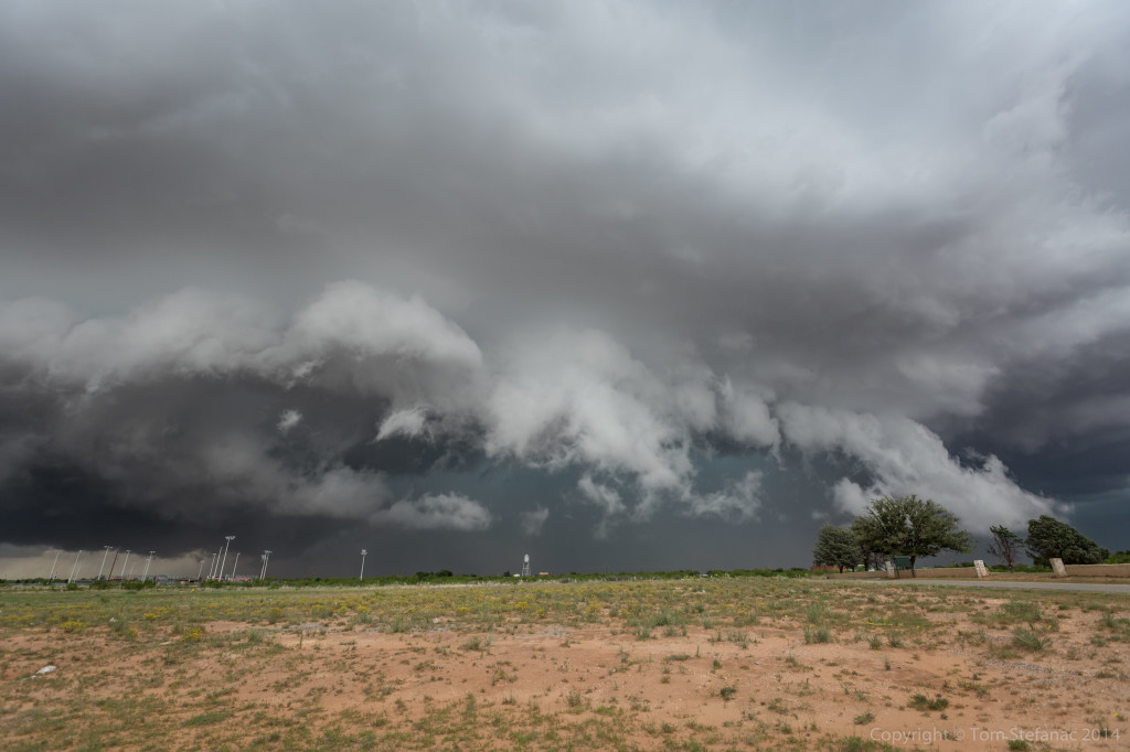
May 30th 2015
The models two days prior had already indicated that today was going to be a long chase day with a slow moving cold front and pre-frontal trough sparking off convection as it crept into a warm southwesterly wind field. By 11AM storms had already started to quickly form and by midday the action was in full swing.


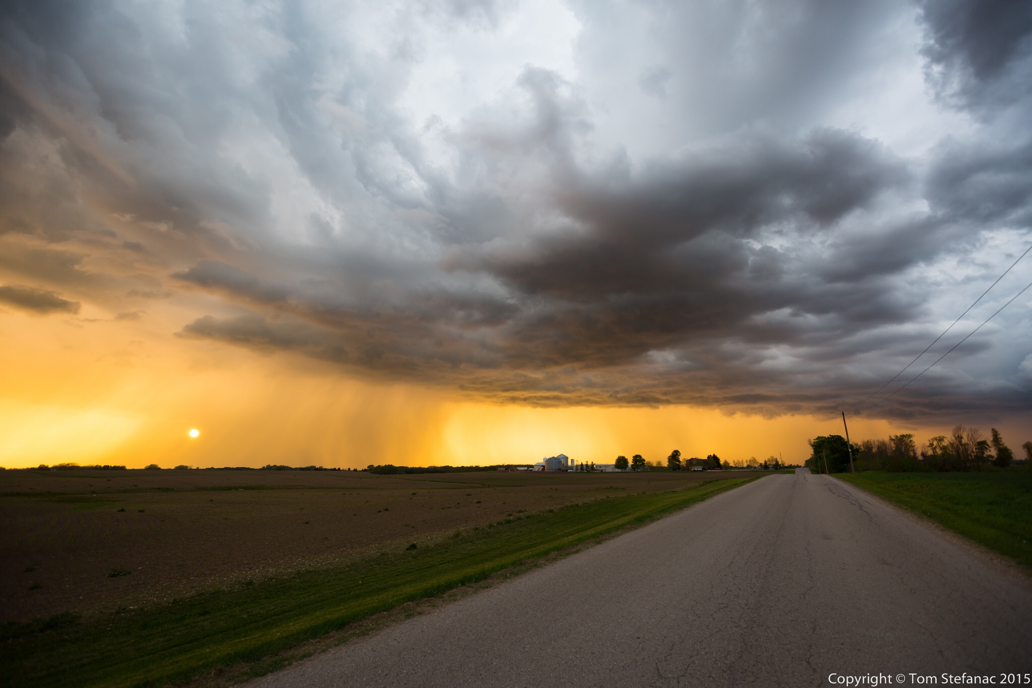
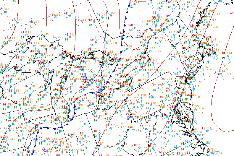
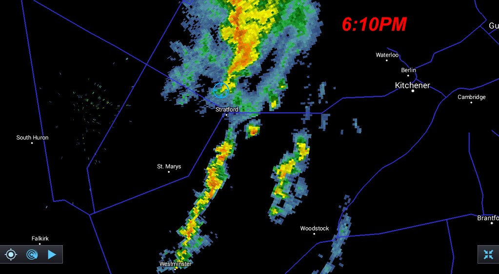
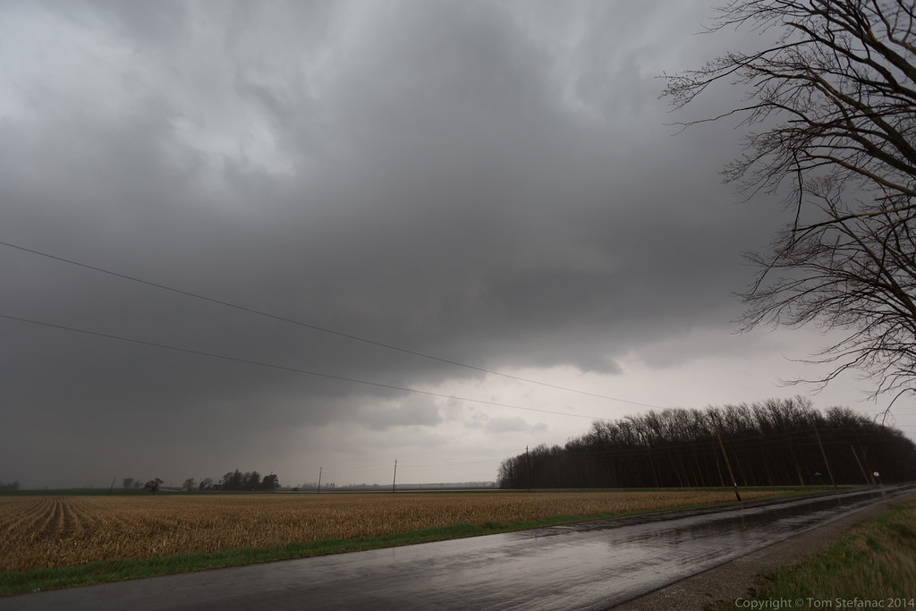
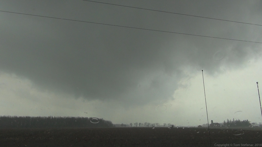
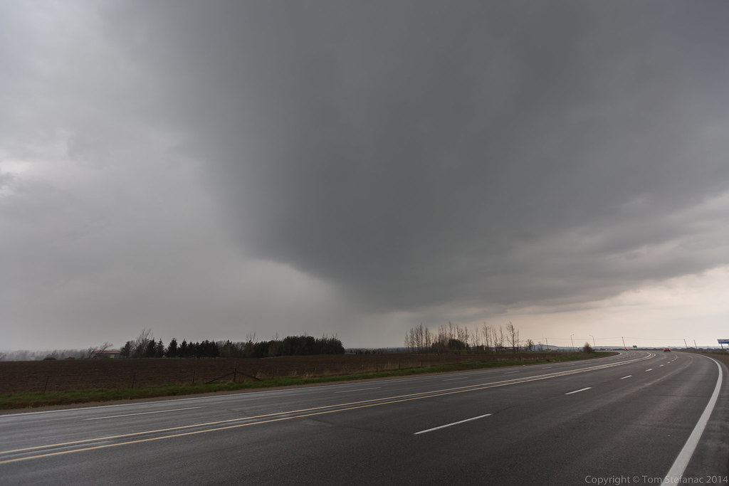
May 18th 2015
Today was the first “real” Southern Ontario chase that presented any possibility of actual thunderstorms. Having gotten back from tornado alley I was not storm deprived but I was not expecting much either. After chasing down in the alley, Southern Ontario can be pretty boring. I usually don’t feel the storm vibe here until late June or early July when SDS (storm deficite syndrome) begisn to set in again.
The play was going to be along a cold front swooping in from Michigan. There were indications that there could have been some storms earlier in the day around 18Z/2PM along a pre-frontal trough however mid level subsidence crushed everything. I spent a few hours at the Cambridge Onroute service centre. Things inititally looked somewhat promising but then the cu field quickly began to show signs it was just turning into pancake cloud. Pancake cumulus is a term often used by pilots to describe cumulus that hit an inversion and stop growing vertically but instead flatten out and turn into stratus, from the air they look like pancakes apparently.
Again, the only area of pre-frontal convergence was right between the lake breeze boundaries just west of Hamilton and you can see how the clouds are flattening out and not growing any taller. They were all hitting this nasty 600mb inversion and it was just halting their development.


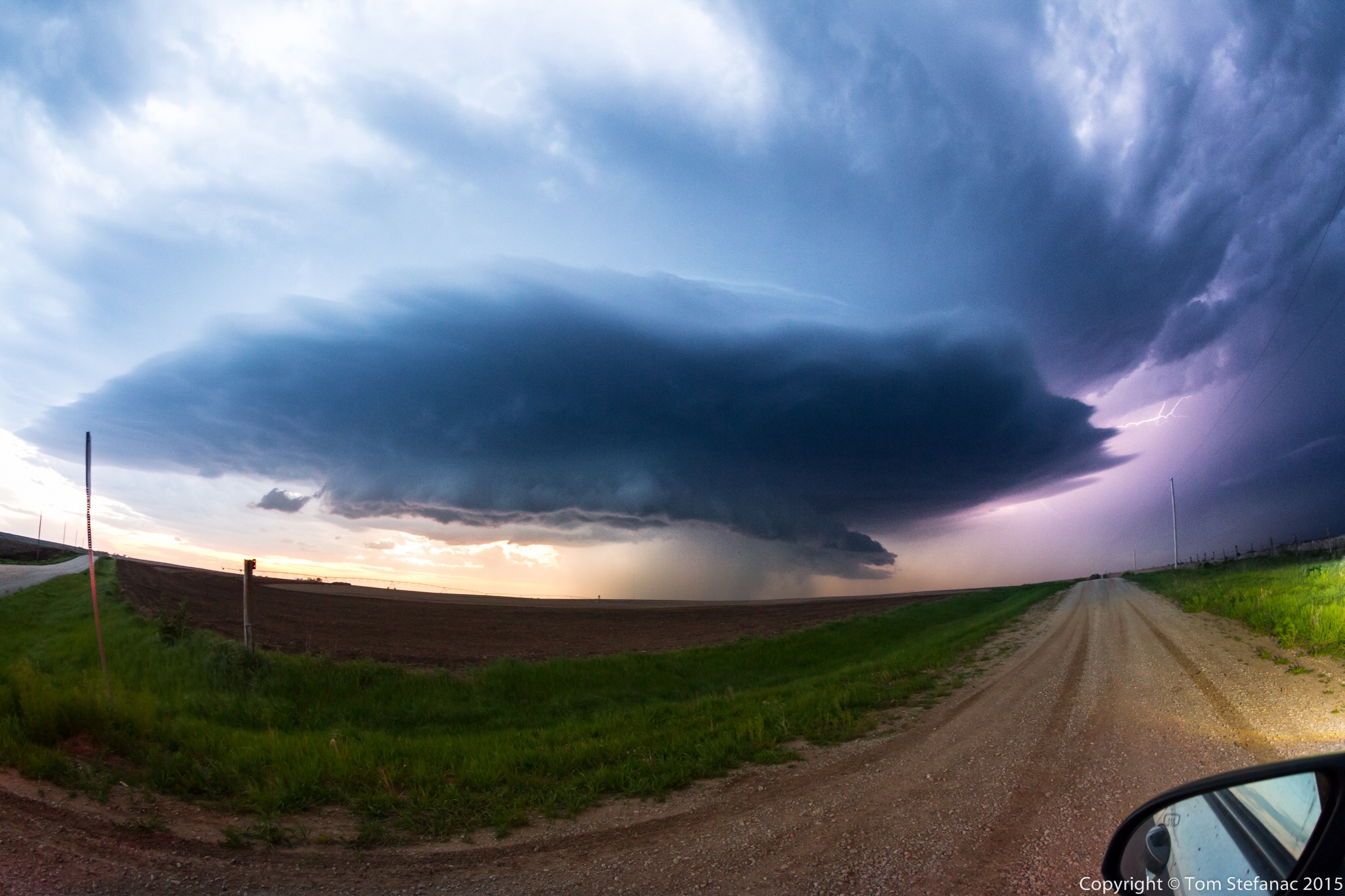
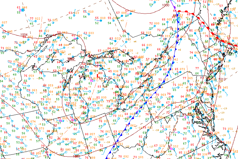
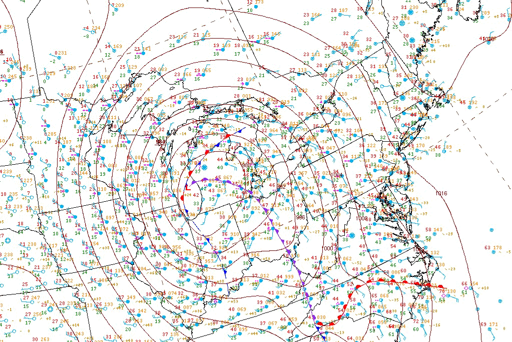
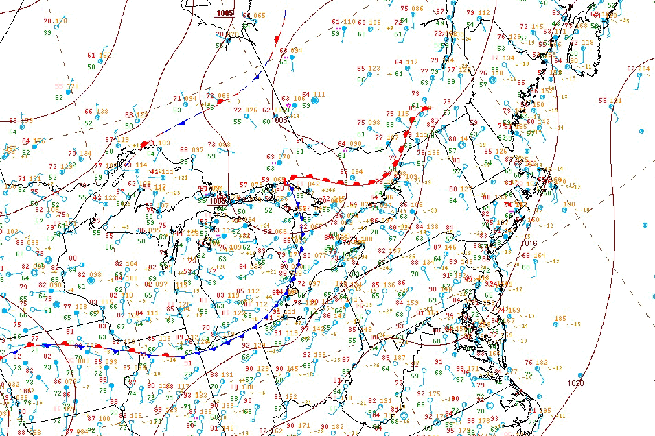
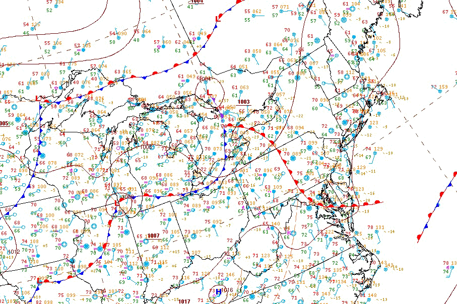
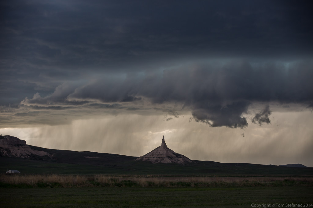
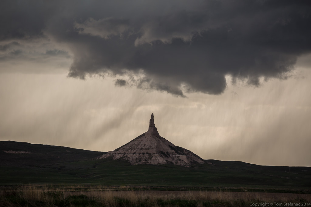
May 3rd 2015
Today was the first real chase day that showed some potential for severe storms. A thermal trof was swinging in from the west and coupling itself with a cold front descending from North Dakota into Eastern Nebraska. The best lapse rates were right on the nose of warm air where there was a southeasterly wind field. The biggest problem at the time was a lack of good 500mb support but otherwise bulk shear numbers were set to rise as the day progressed.
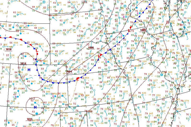
HPC surface analysis 21Z May 3rd 2015


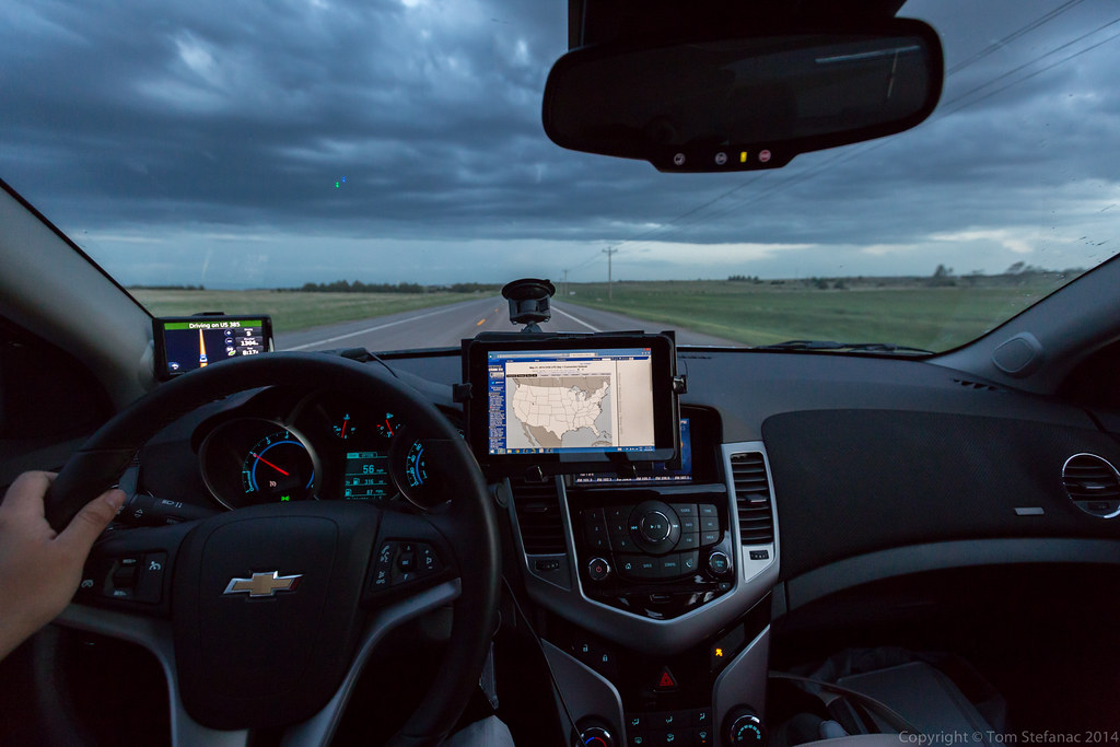
iPad Air 2
Before I write one word praising Apple or the iPad let me be very clear, I’m not an Apple fanboy. I prefer the Android ecosystem and the flexibility and openness of their devices which include an easy to access and manipulate file system. However there are some things that just work better in combination.
In this case the iPad Air 2 is the ideal platform for the latest version of RadarScope which runs smoothly and virtually flawlessly. The iPad also provides a very stable portable / mobile hotspot for other devices to connect to and the added or increased precessing power ensures that there are no hiccups. So between the hardware and software everything runs very smoothly.
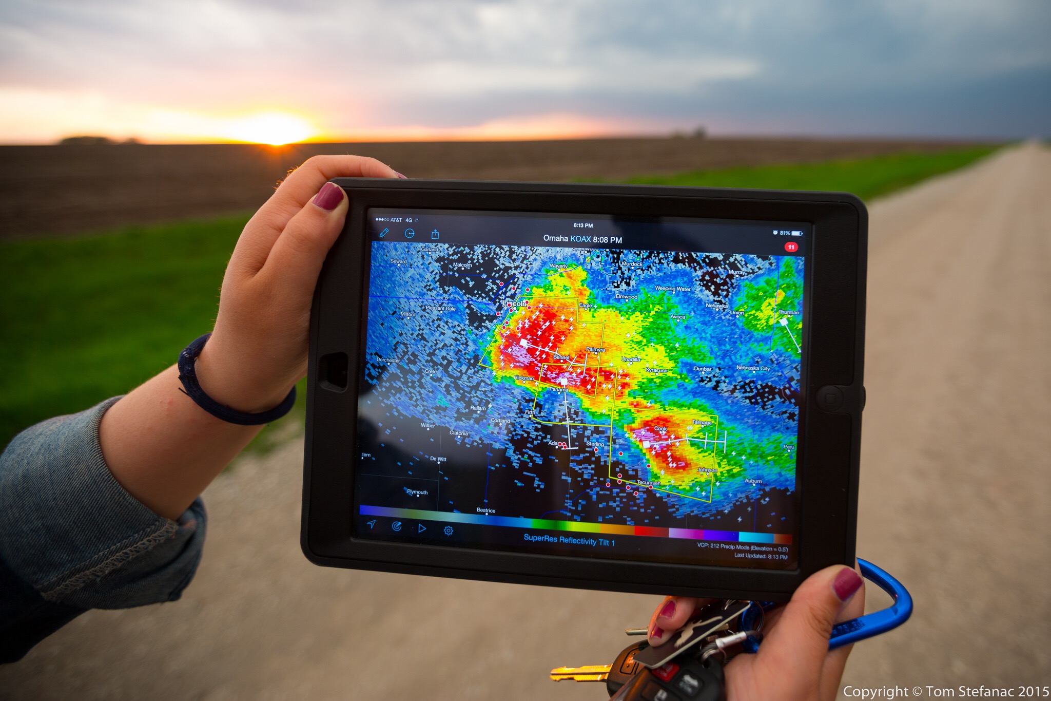
Jen holds the iPad Air 2 in a field showing the radar image of an encroaching supercell thunderstorm which is visible in the background
The reason why I chose the iPad instead of a larger Android tablet is two fold. Firstly, it was simply the only tablet on the market which offered both GSM and CDMA service, so in theory it can run on standard 3G/4G LTE networks but it can also run on Verizon and Sprints weird GSM/CDMA hybrid technology. Secondly, I already have a bunch of Android tablets and wanted something different which would give me a pure integration for RadarScope. Hence, the iPad Air2 was the perfect device to allow me to accomplish both. Using it as a hotspot also allowed me to mitigate the need for an expensive portable hotspot. I find the more devices you need to link together, the more problems you’ll have and the more likely it is that something will go wrong.
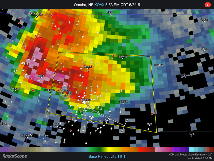
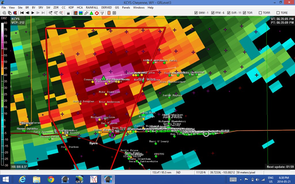
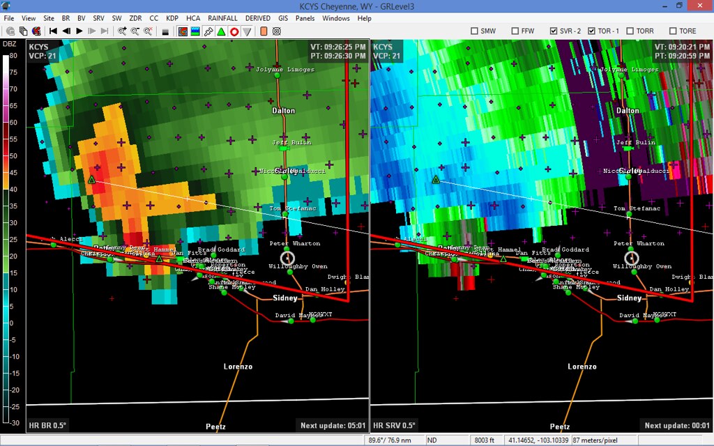
RadarScope showing a large supercell near Hickman NE using Level 3 data
Here’s a small GIF loop taken from the iPad using radar scape showing standard level 3 data from the KOAX radar in Omaha, Nebraska. We’re the blue circle which is derive from the GPS chipset that’s built into the cellular modem in the iPad.

RadarScope showing a chain of storms rolling across central Kansas using Level 2 data.
Here’s another shot showing the iPad in action as we drove through east-central Kansas. You can see that the iPad is in “hotspot” mode sharing the connection with my Dell Tablet which had GREarth running. You’ll also note that the radar data is very fine. RadarScope calls this data “super resolution” but it’s really just the 0.5 degree Level 2 radar data. The beauty however is that the WDT server strips the rest of the layers (0.8 through 19) out and you just have the lowest available level which is really only what we care about when chasing and looking at reflectivity data. By sending out only the needed layer the file is substantially smaller than it would normally be. For example if I attempted to view this same radar data on my Dell Venue 8 using GR2AE one frame of radar data would contain all 19 tilts and be approximately 3mb in size. It’s not a big deal when your in an LTE zone but once a hundred chasers show up and start straining what limited cellular framework there is even LTE data will slow down. Now just imagine trying to use GR2AE when you only have 1 bar of 3G data. So for me it’s simply a more efficient way of looking at the same data.
There are of course trade offs, GR2AE is an incredibly powerful piece of software sporting NROT, MEHS, and other specific algorithms which require all tilts and are extremely accurate and very useful. It can do circles around RadarScope but the reality is when your chasing, you just need basic radar data, all the fancy stuff is for the analysis after the chase or best served as tools that forecasters need when issuing warnings in real-time.
WunderMap App showing surface observations, a stationary front and visible satellite data over Southwestern Ontario
The iPad is also a good tool when used with iPad specific applications such as WunderMap. To explain it in a nutshell, if you know what GREarth is, then WunderMap is an extremely watered down version of that. The one thing the WunderMap App boasts which few other programs can offer is data from personal weather stations and some of this data is real-time updating ever 2 seconds. My own weather station updates every 5 seconds and is used in the WunderMap app. Obviously you need to take any data from these stations with a grain of salt since the quality control and placement can be questionable but it still provides a huge volume of actual observations far greater than you could ever get if you were only use airports, METAR stations and mesonets. So this iPad specific app can be very useful for quick nowcasts or simple situational awareness.

Chase Vehicles
Over the years I’ve had a variety of different vehicles. The first on the list was my mom’s old 1998 Chrysler Intrepid. The car held together well and ran for a good 17 years but in the winter of 2015 it bit the dust.
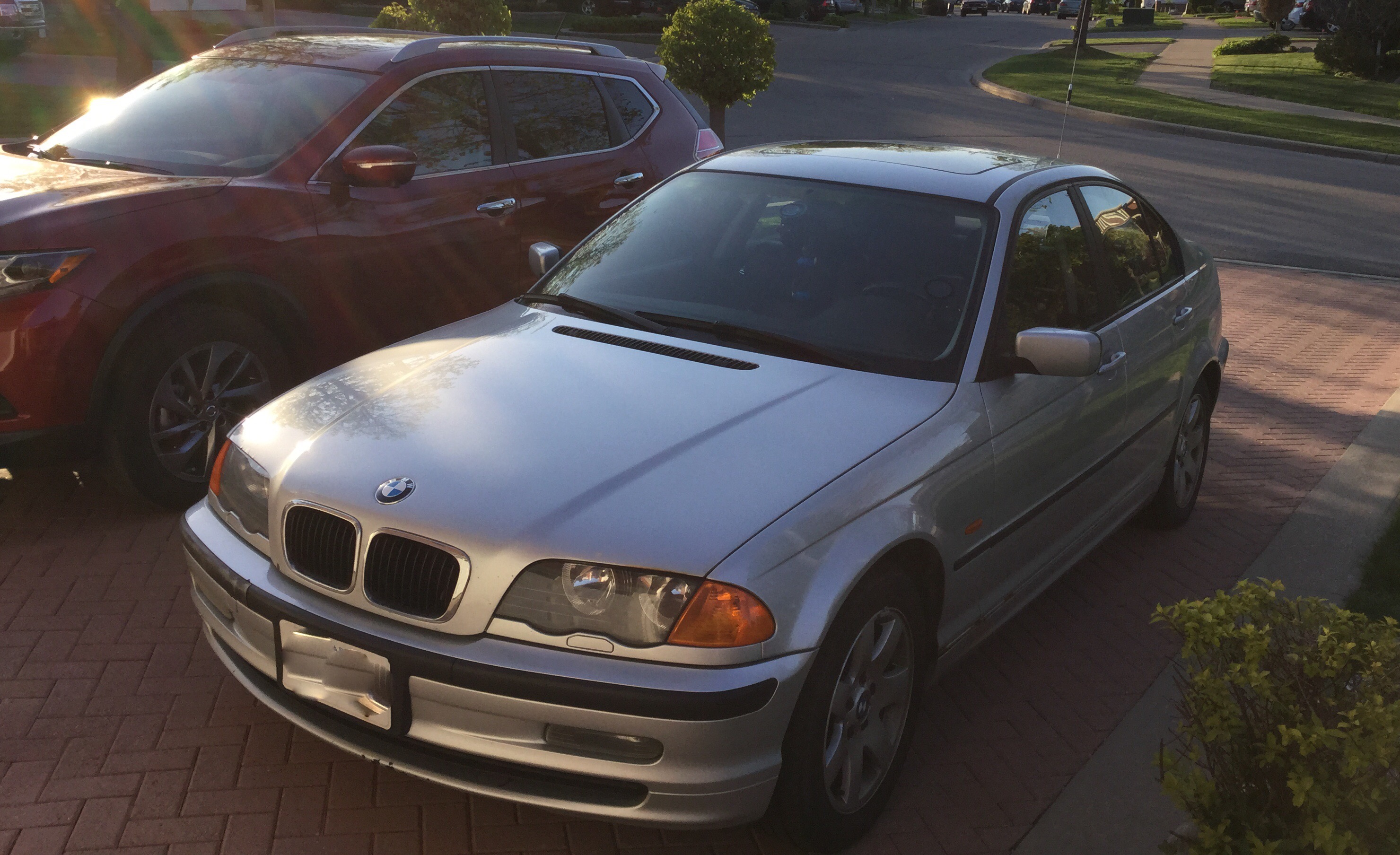
My 2000 323i BMW with a trunk mounted antenna
My personal vehicle, a 2000 BMW 323i is presently my Southern Ontario chase vehicle. It’s getting up there in age, wear and the body is starting to slowly go. I would never dream of taking this car down south into the central plains of the U.S as it would likely get “hurt” by the large hail stones that those storms can produce. Unlike the great plains, hail is a far lesser risk in Southern Ontario and it’s extremely difficult to find anything that can really start to threaten your vehicles body.
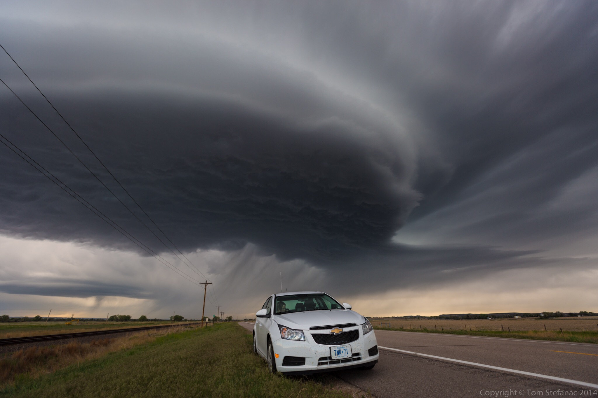
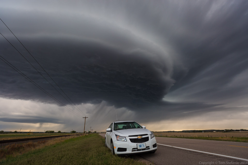
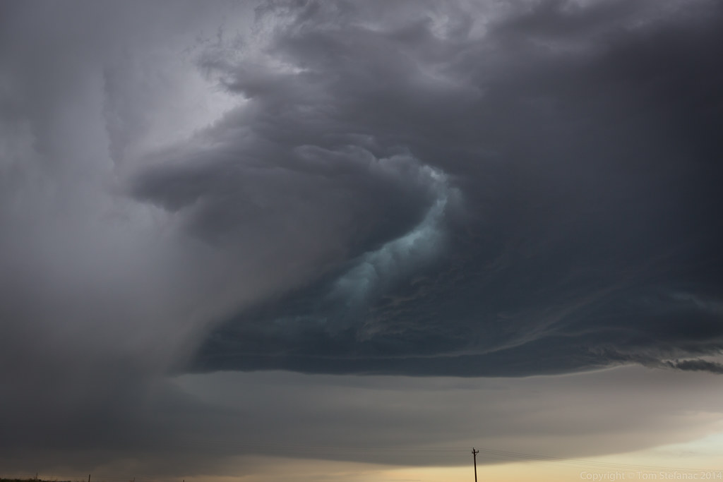
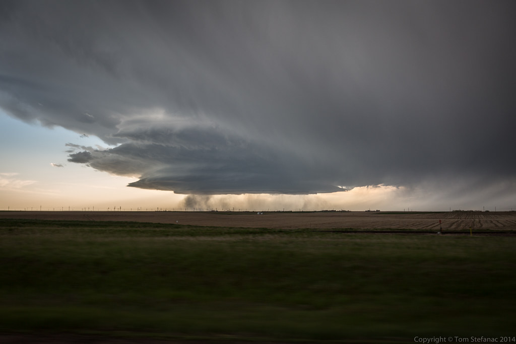
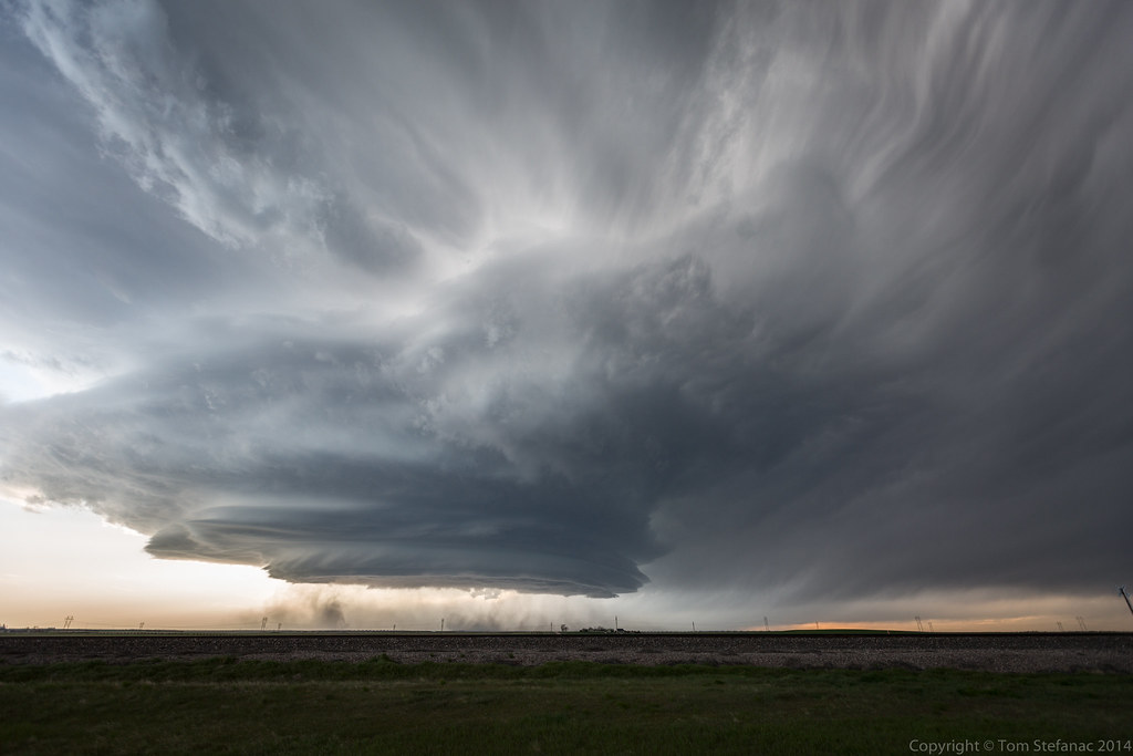
My 2014 Chevy Cruze in Nebraska as a low precipitation supercell bears down
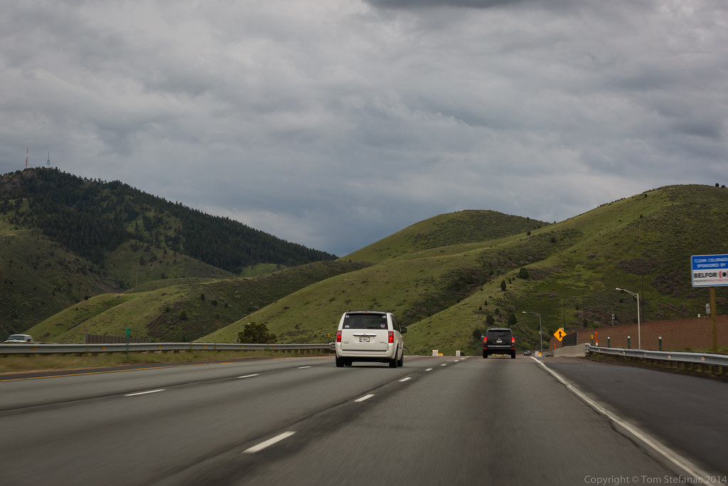
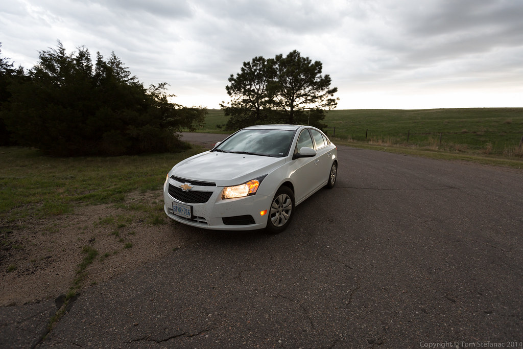
As far as rental vehicles go, I’ve used a 2010 Honda Civic, 2011 Chevy Impala, 2014 Chevy Cruze and more recently a 2014 Toyota Corolla. The “joy” with all these vehicles is that my installs need to be sturdy yet completely temporary without any trace once the car is returned. Whether it’s a rental car or not, I treat all vehicles as if they are my own and really take care of them.
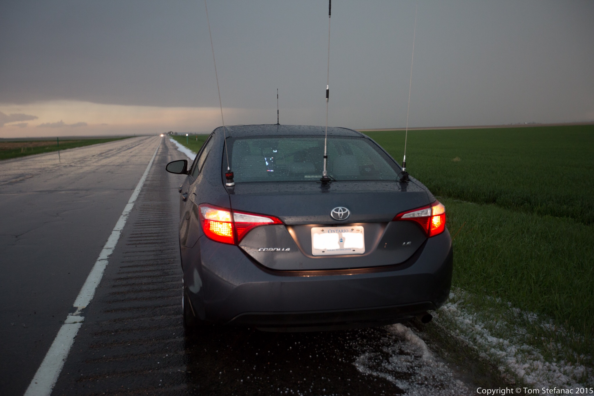
My 2014 Toyota Corolla on a Colorado highway after flooding rain and small hail
No matter which vehicle I’m using, whether it’s my own or another there are a few basic items that always go.
The first thing is my HAM radio, I’ll always take my Icom V8000 with a 5/8th whip antenna that’s trunk lip mounted. If there’s space I’ll also take my quad band Yaesu FT-9800. I like the V8000 becuase it has a whopping 75 watts of power and when you couple that with a high gain whip antenna you can go the distance. It’s also very efficient for simplex transmissions maximizing the efficieny of low power transmissions. The FT-9800 gives me flexibility to use any repeaters that are in the area no matter what the frequency so I can always get into or listen in on any skywarn or canwarn nets.
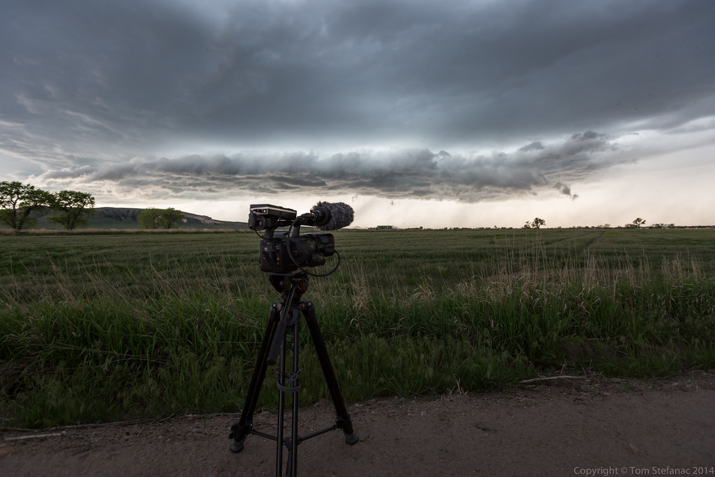
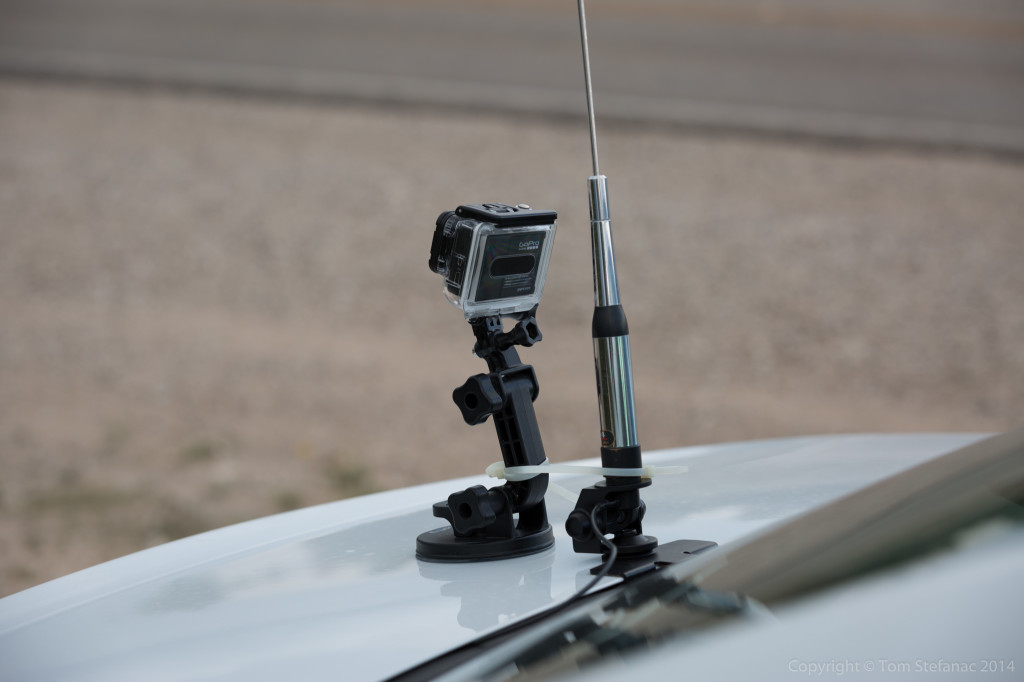
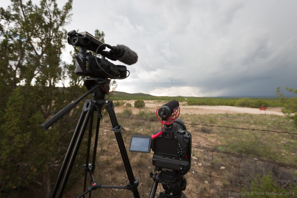
The second item I always bring is my manfrotto magic arm / Sony CX700V combo. This ensures I always have a good working dashcam that I can pan/tilt/zoom. I’ve also recently become a big fan of just using my GoPro inside for super wide shots through the windshield. The GoPro is a Hero3 Black unit and shoots beautiful 2k video. Between the two cameras I can get a wide and tight shot of the same or different subject matter which is great. It also minimizes windshield clutter.
The third item or items I should say are my tablets/mobile computers. Currently I have a Nexus 7, iPad Air 2 and Dell Venue 8 running a full Windows 8 desktop environment. The Nexus 7 is great for PYKL3 while the iPad Air 2 hosts a cellular chipset and not only provides me with a mobile hotspot but runs Radar Scope beautifully. Lastly, the Dell Venue 8 can run windows native programs like GREarth, Level 3 and Level 2 Analyst without any issue in addition to a host of other programs such as Digital Atmsophere and Unidata IDV. These three devices I can power from two Anker chargers, and there’s very little draw on the vehicles electrical system plus the batteries last forever and they occupy very little space unlike a clunky laptop.
My essential non-optional items are my cell phone, camera gear, GPS and a road atlas. I also carry basic emergency gear with me at all times which includes some pylons, flares, a safety vest, first aid kit, bottled water, electric tire pump, automotive tool kit, full gas canister and jumper cables. In theory, I should be able to handle most any emergency with my basic emergency gear. The biggest threat all chasers or anyone doing a lengthy road trip in a relatively rural area faces is a flat tire. Depending on the severity of a flat, a canister of run-flat tire filler can prolong your drive when coupled with a good electrical tire pump. The other option is changing the tire then and there at the side of the road which is where the cones, tools, vest and even potentially flares come in handy. The gas canister is also a good idea. I’ve been in situations before where storms have knocked out power and suddenly I have to drive 200km on a quarter tank of gas. A 10 or 20 litre can will get you an additional 150 – 300 kilometers and more importantly gives you peace of mind that you’re okay.
The GPS is a no-brainer, when used correctly it does all the hard thinking for you or at least the majority of it. Plus, it keeps you on track, when your chasing and busy thinking about so many other things it’s easy to miss a turn but the GPS will at least remind you that your turn is coming up. Plus you can see all the roads around you and it’ll help with your judgement calls. There is one major problem though with anything electronic, and that’s the possibility of failure. As such, I always keep a road atlas with me, the atlas never fails, does not need batteries or a power cable and works in any weather. I also like to use the atlas to see rest stops, nearby towns, primary roads and it gives me a quick refrence of what’s around.
You might be wondering why I seem to choose smaller 4 door sedans over midsize vehicles? The answer is simple, for me, chasing does not have to be about having the biggest or baddest vehicle on the road. I choose my vehicles based on the volume of space I need. Smaller vehicles also have better gas milage and better overall range. Larger SUV’s are certainly more capable off road but I find choosing to go off road can be a disasterous idea at times, especially since these roads can have my uknowns such as obstancles, flooding and hazards like potholes. No matter what vehicle your in, attempting to cross a flooded roadway with an uknown water depth is dangerous, and no SUV can drive beyond a dead-end road in time to escape a tornado or hail core bearing down. So with these things in mind, I realise that I don’t really require the added benefits of all-wheel drive or higher wheel bases that suv’s provide. Instead I choose to stick to paved roads, or only venture short distances with plenty of escape time on unpaved roads.
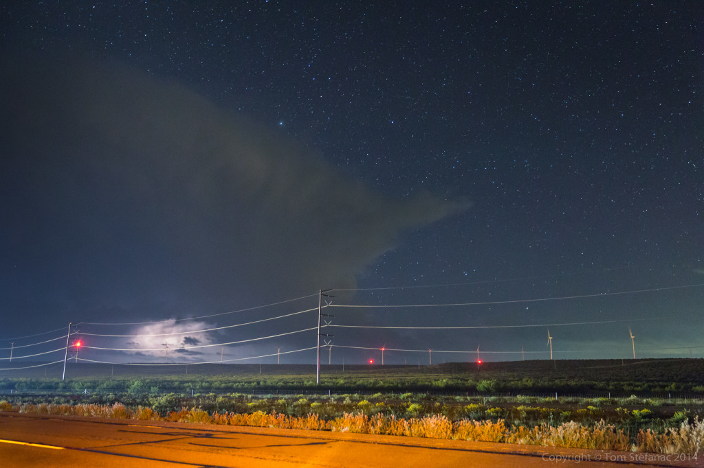
Aurora Borealis – March 17th 2015


April 2nd 2015 – BUST


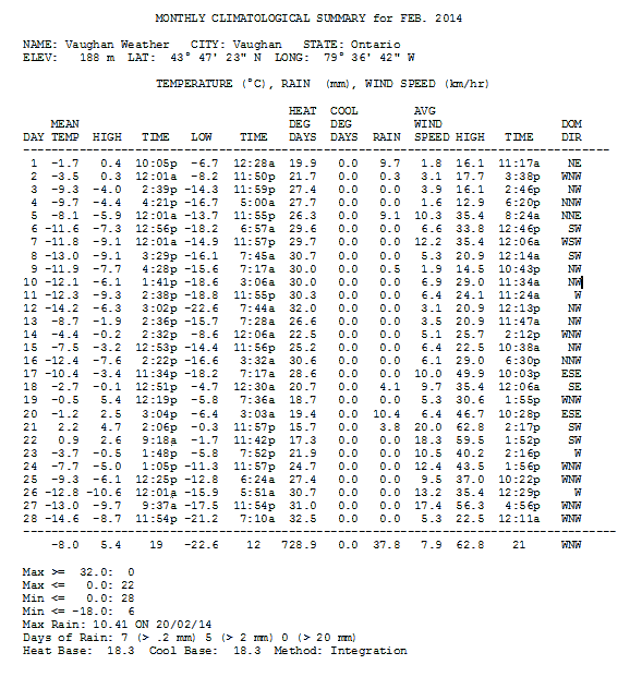
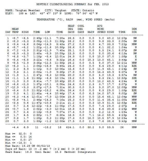
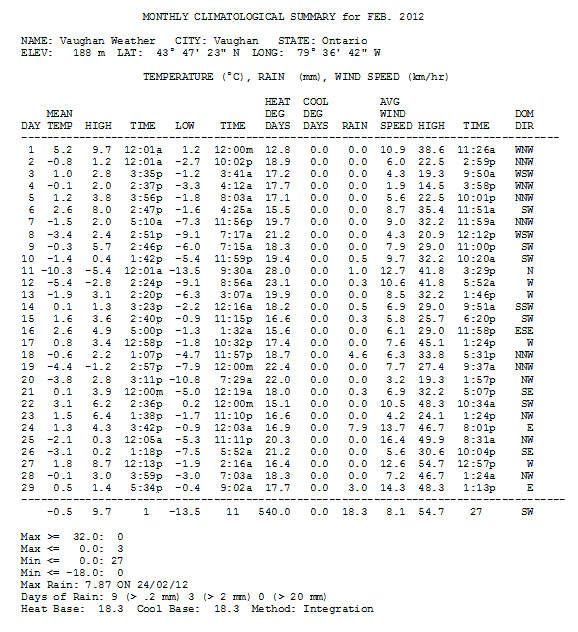
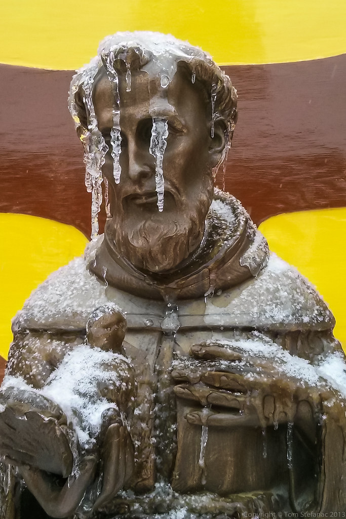
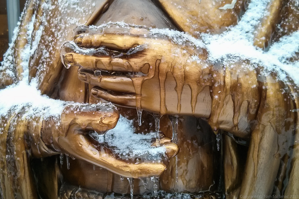
March 1st 2015 – Record Cold February
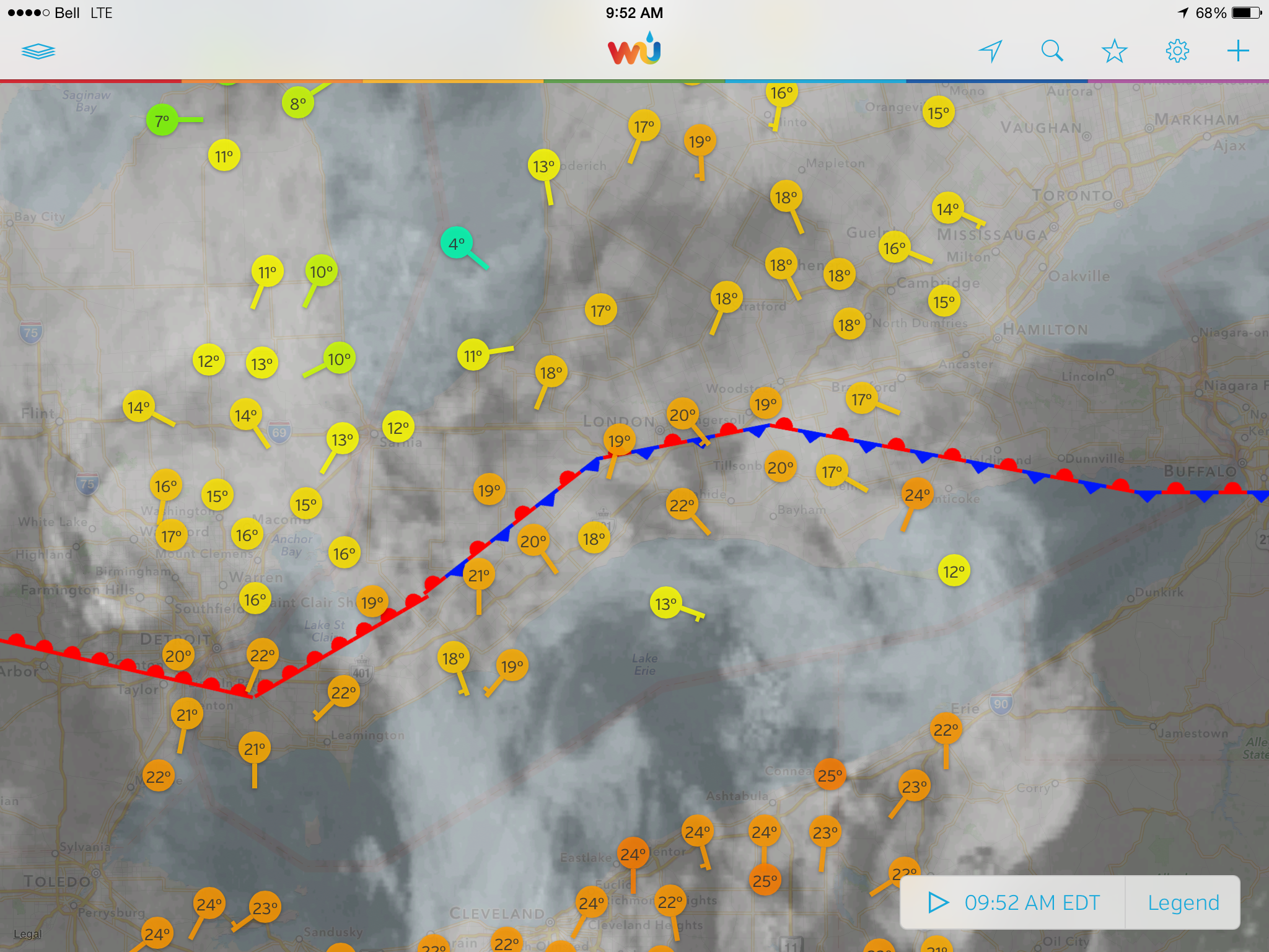
I’m not a climatologist and I was not around in the late the 70’s but according to the record books, this past February was certainly something record breaking to live through and challenged the February’s of 1977 through 1979.
December was relatively warm, at least compared with last year! The mean temperature was a balmy 0.0C with the coldest temperature of -10.3C having been recorded on the 2nd and the warmest high of 10.1C on the 24th. By January more polar air was making it’s way south and the mean temperature plummeted to -7.3C with the first sub -20C low being reported on the 13th when the mercury dipped to -21.4C at 7:34AM.
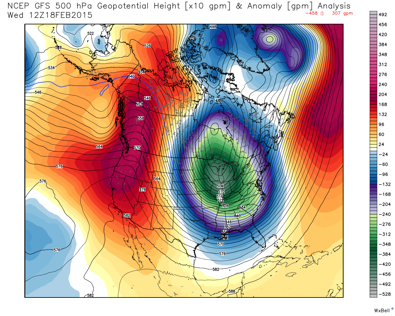
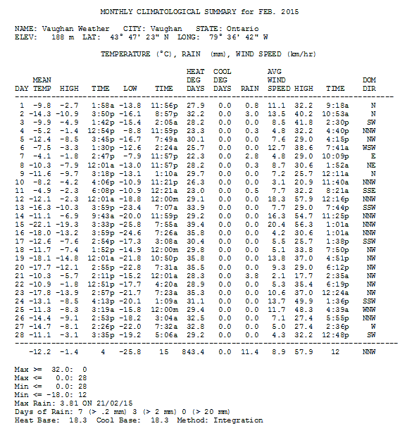
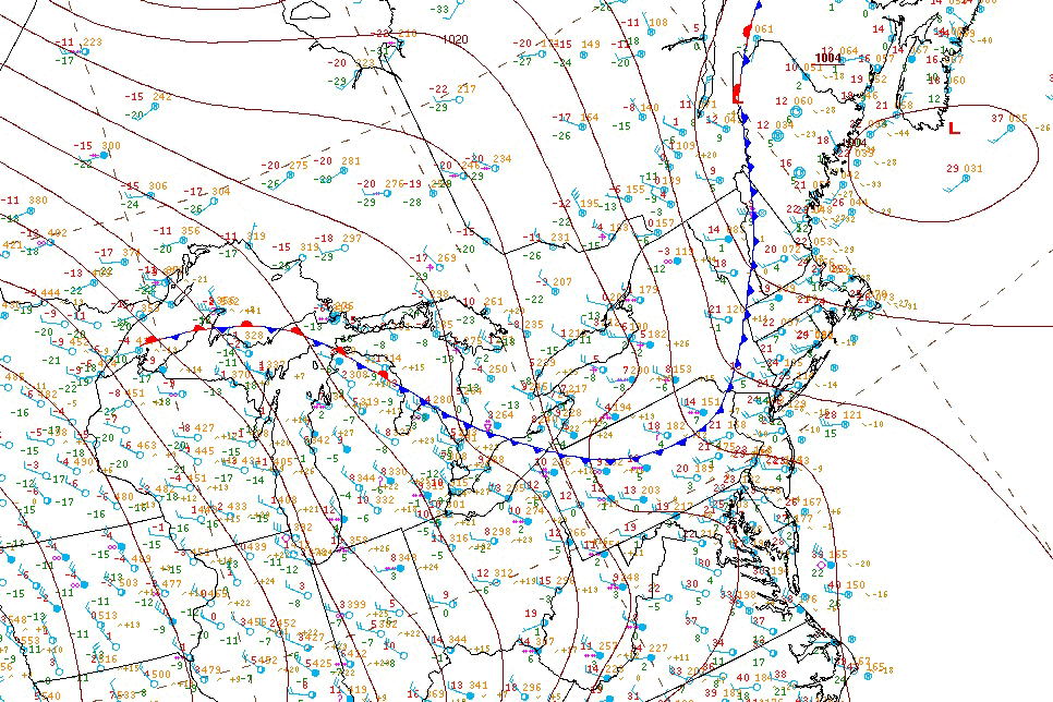
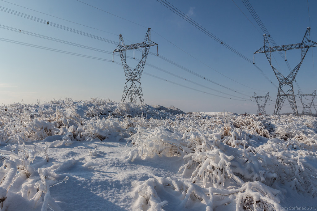
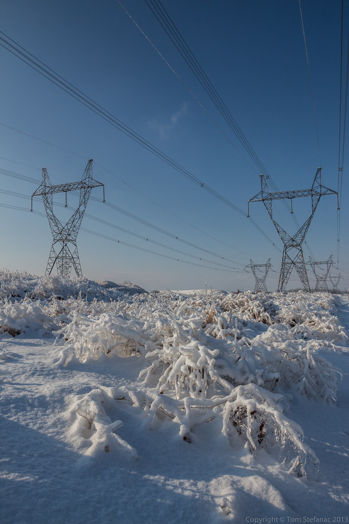
Getting into February, the first half of the month was cold with overnight lows regularly dipping into the -15C to -18C range but by the 12th things were really beginning to tank. Blocking from the west (see image above) allowed wave after wave of arctic high pressure, and I’m talking deep arctic air to dive south through Manitoba and into Ontario and Eastern Canada where we just simply froze.
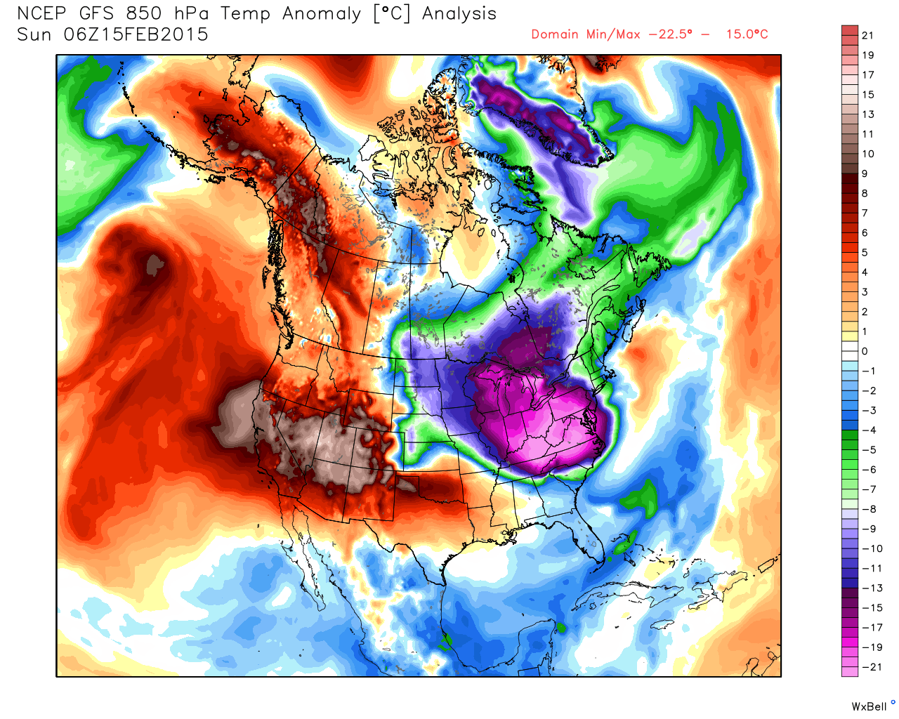
Pictured above is the 850MB temperature departure from normal on Feb 15th which was and so far remains the coldest overall day of the current winter and past winters going back to at least 2007. Not only was it just freezing, but this was the first time I’ve actually recorded a windchill in the minus 40’s. If your wondering, the windchill hit a whopping -41.7C / -43.1F at 8:06AM as the mercury dipped to -25.7C with a wind speed of 40.2 km/h pushing the scales to a new unseen low since my record keeping began back in 2010.
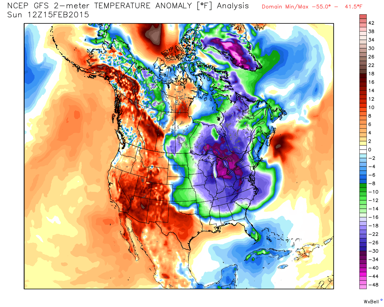
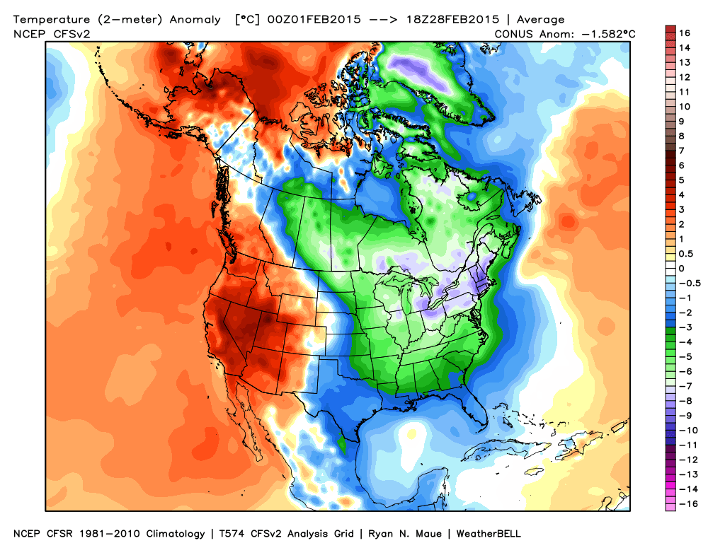
Wind chills and perceived temperatures aside, the actual 2 meter temperature departure from normal was not only on the order of some 15 degrees Celsius but the extent of the cold air was impressive with the Bahamas, Florida and Cuba getting a taste of the winter. Did I mention that much of the eastern half of North America was also freezing?
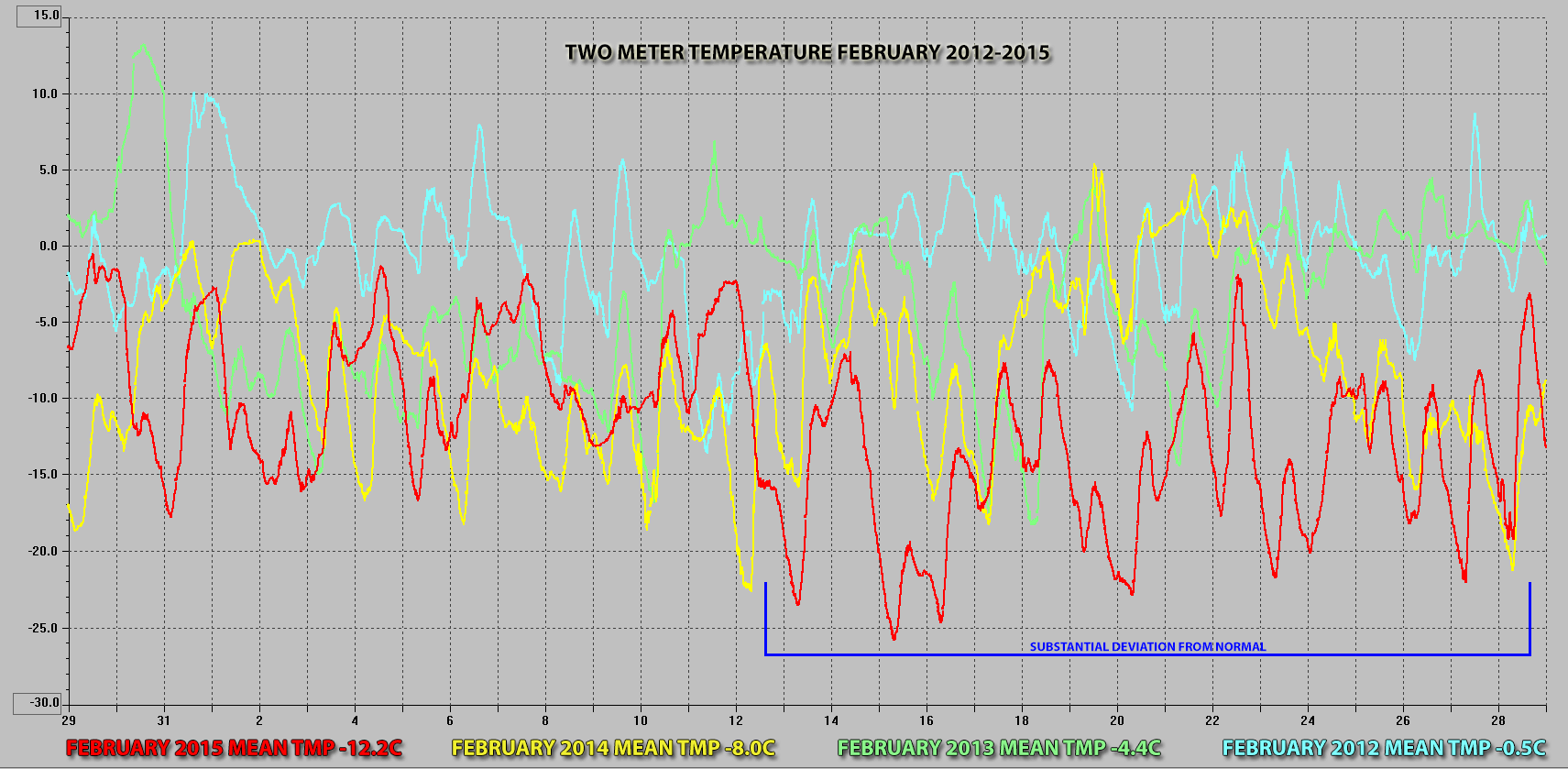
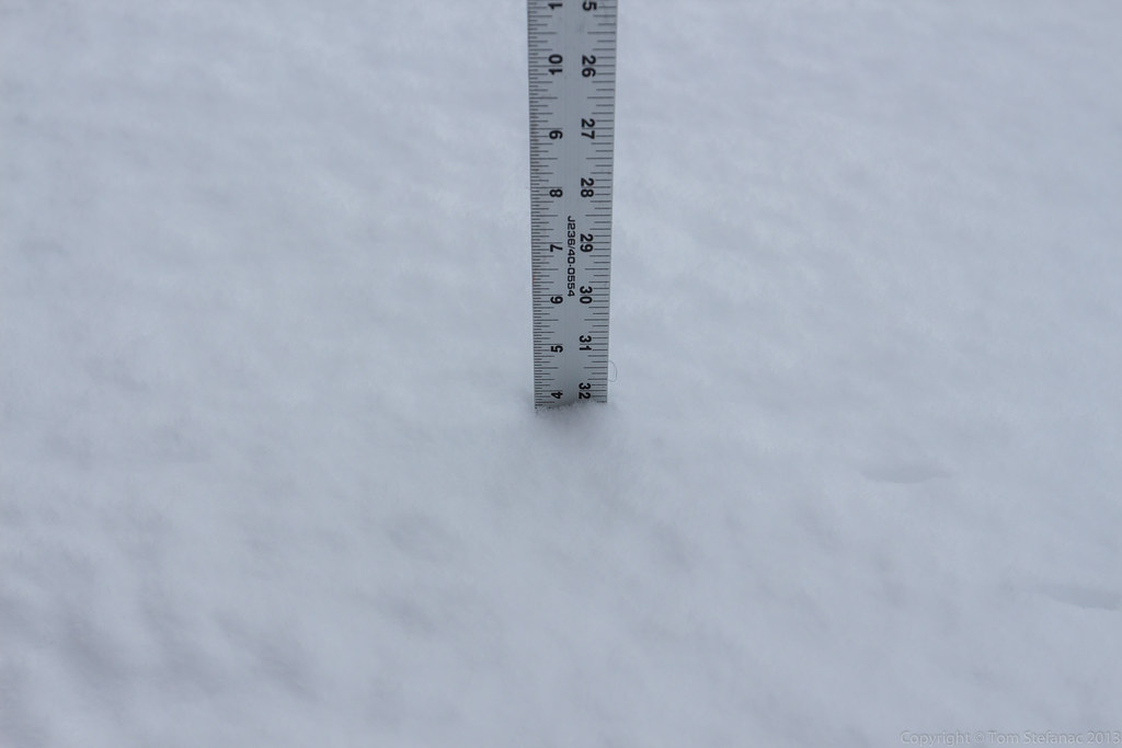
In the above graph, I’ve merged the February’s of 2012 through 2015 to show how progressively each February has actually become colder. In 2012 the mean temperature was -0.5C and by 2015 it has now dipped to -12.2C with a significant portion of that departure occurring in the second half of the month. Also interesting to note is that the entire month has been below freezing without a single day allowing for any thawing.
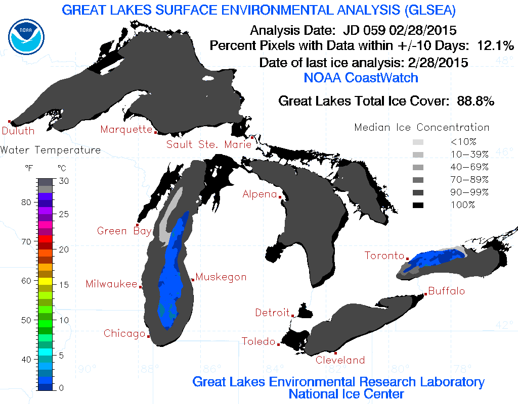
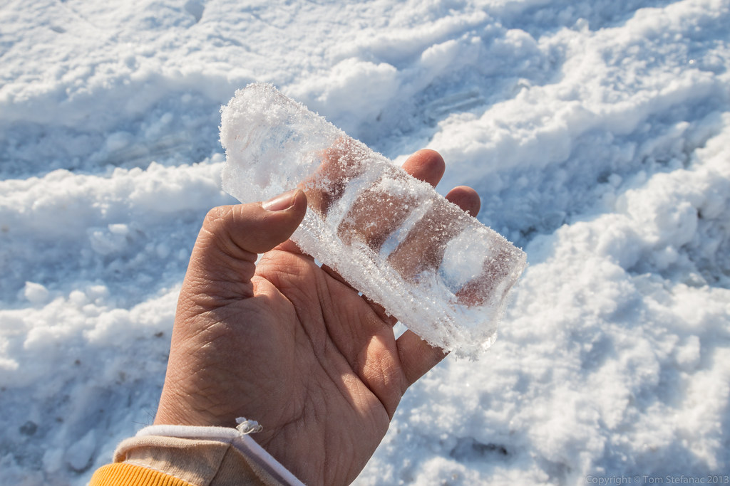
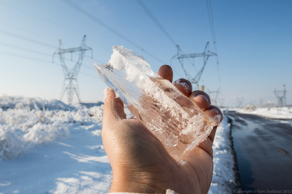
Actually the last above freezing day was January 24th which means it has been below freezing at my home in Vaughan for 35 consecutive days. This has also had the net effect of helping to lower the frost line progressively closer to the to the 60cm / 2ft mark which would be disastrous for many peoples water lines. The Great Lakes have also been feeling the brunt of the cold with ice cover reaching record levels and shipping grinding to a stand still.
The biggest question now is what will March hold? From the looks of the CFS and other climate models, the trend of cooling for the given forecast period looks to continue and spring may be much further than we would like to think!
 But in the meantime (get it? mean time?) I’ve included a map here from the CFS V2 summarizing February 2015 which has been below normal for the majority of North America and all of Greenland. The monthly climate summaries for February 2012 through 2015 are also located below.
January 7th 2015 – Arctic Blast


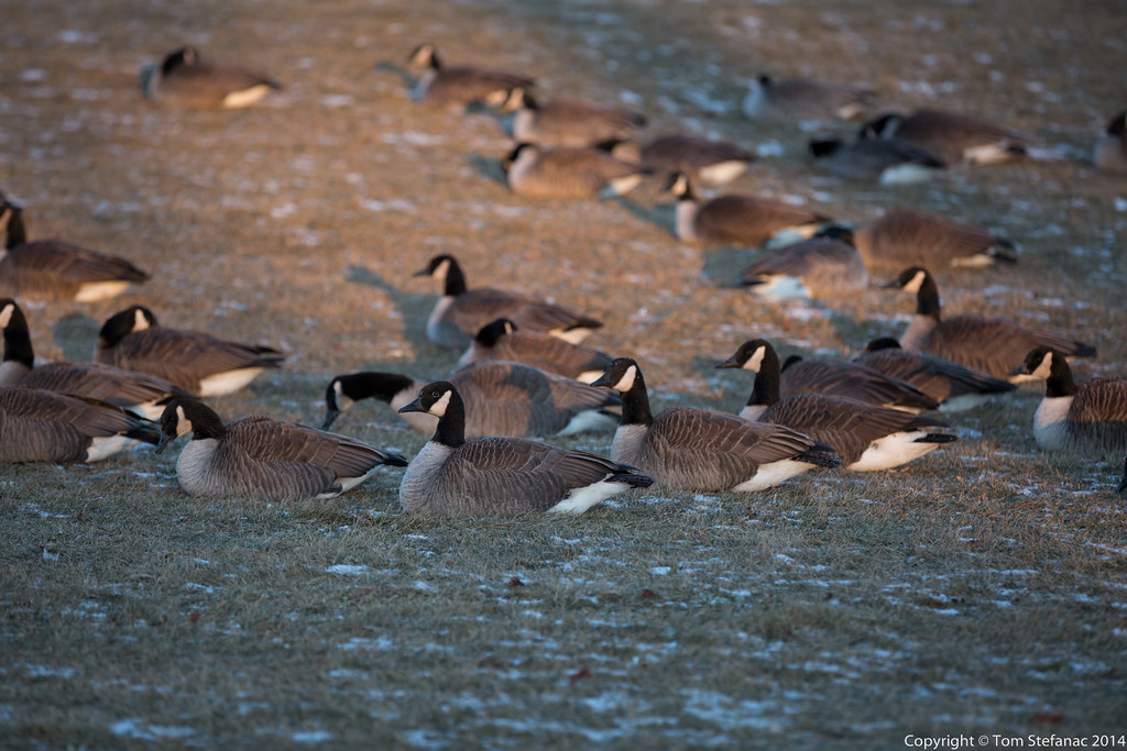
Here’s a brief video showing the steam devils in action!
The video is from 2015 but I still have 2014 on my mind so ignore that error! There’s also no audio because some nearby hunters kept firing off their .22 and missing the Geese they were trying to hit. So it was a little annoying.
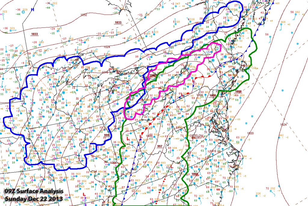
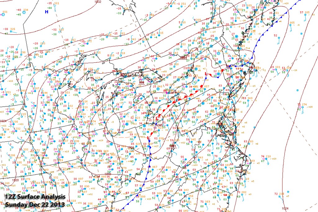
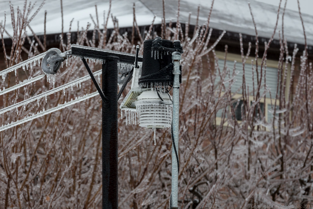
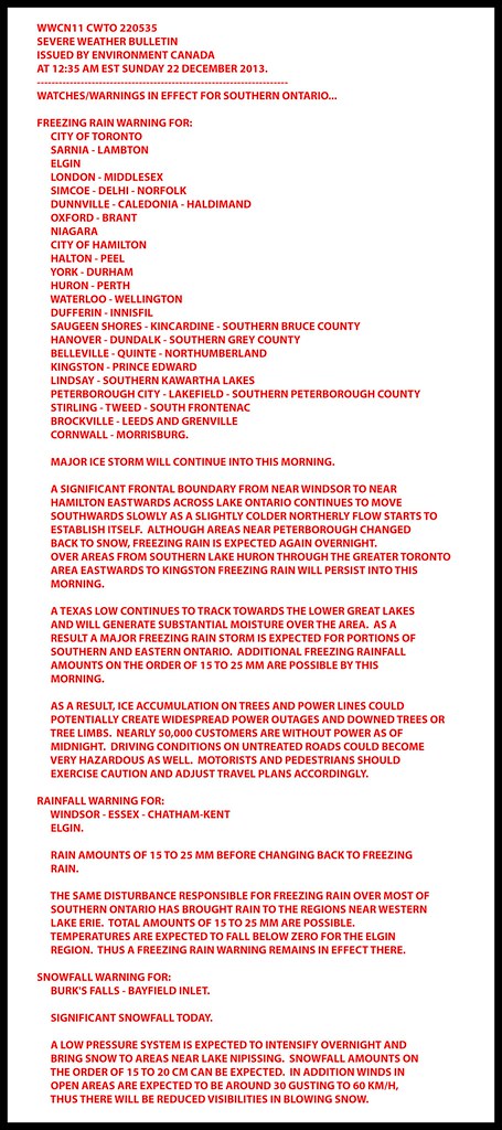
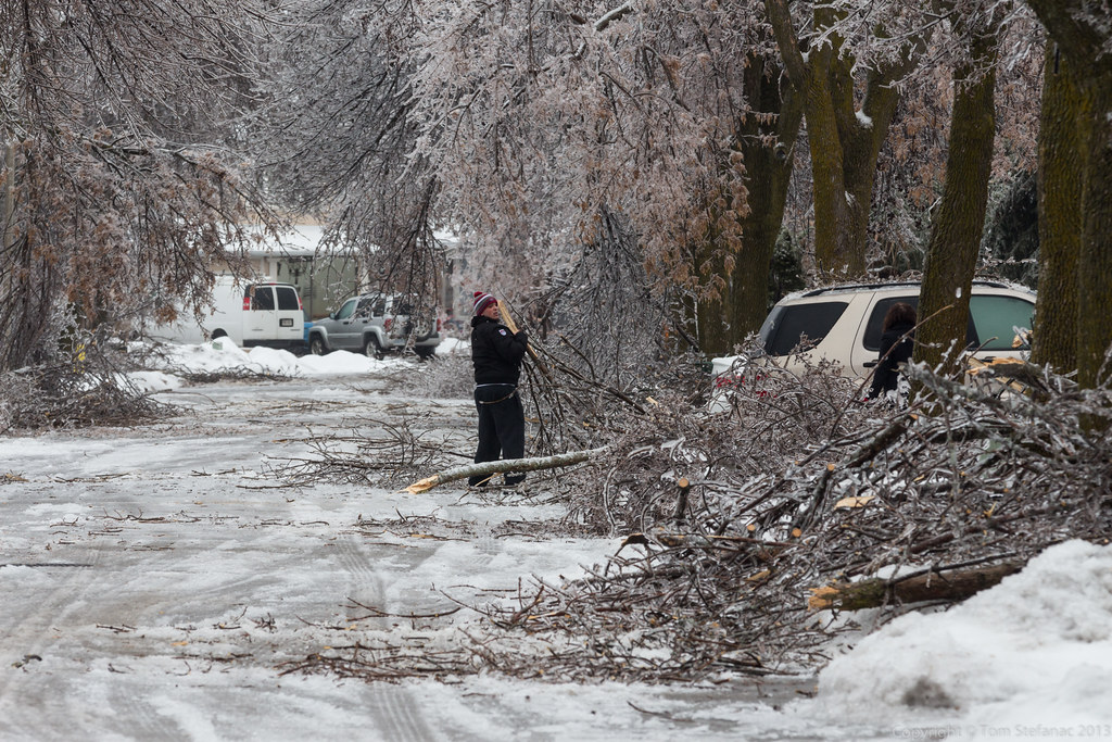
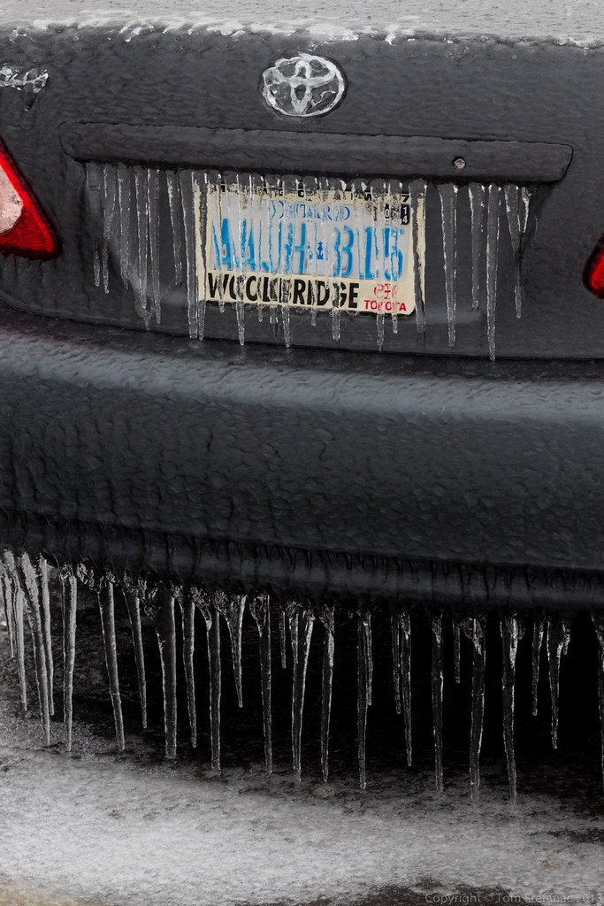
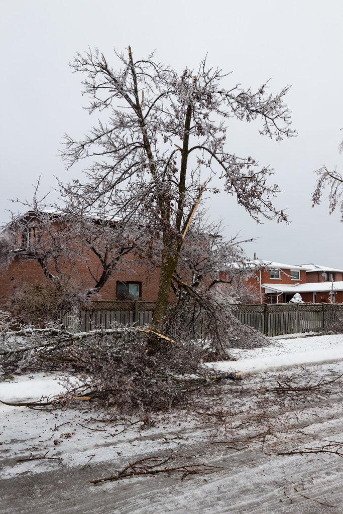
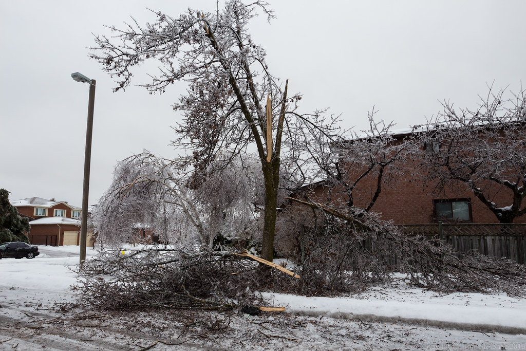
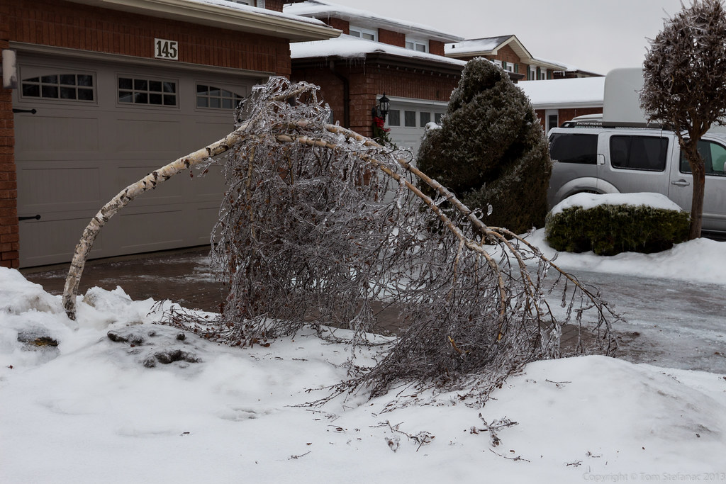
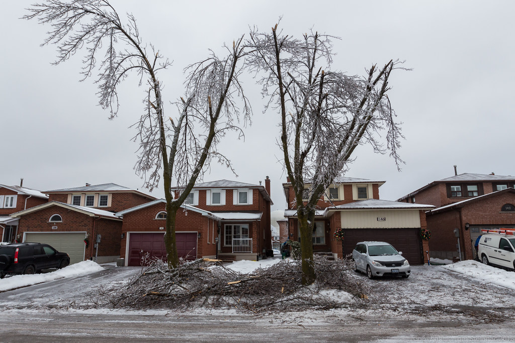
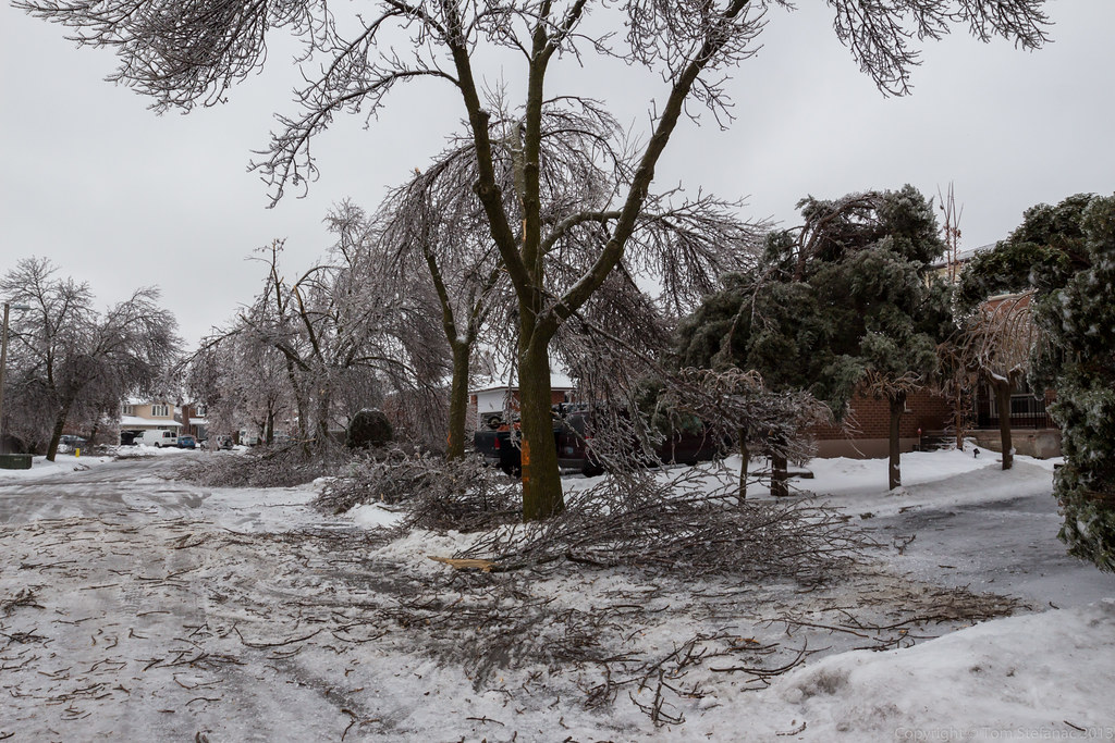
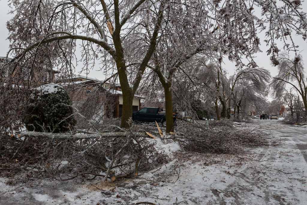
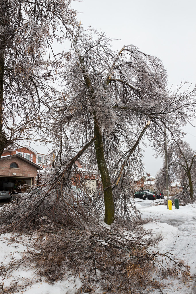
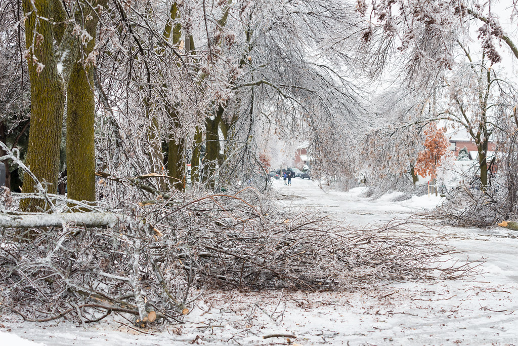
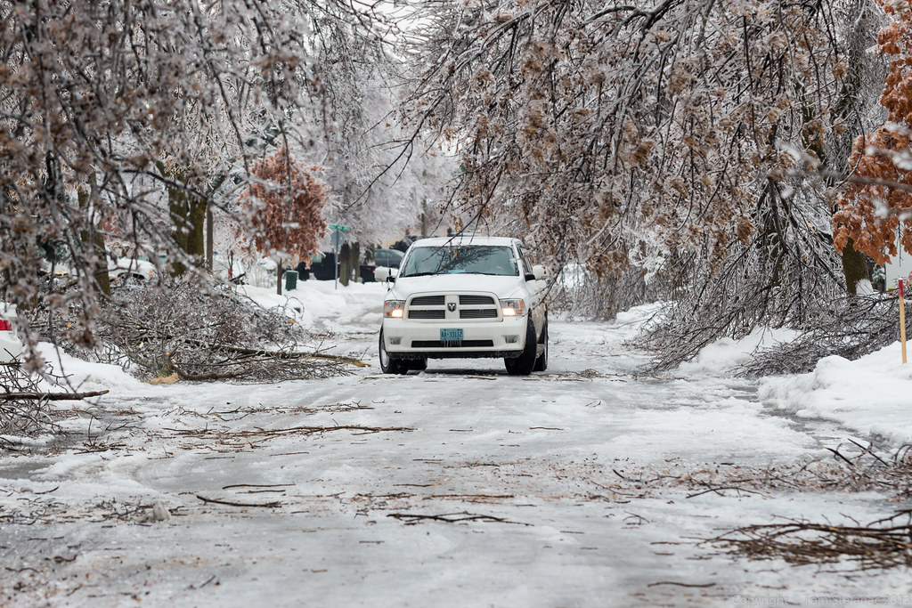
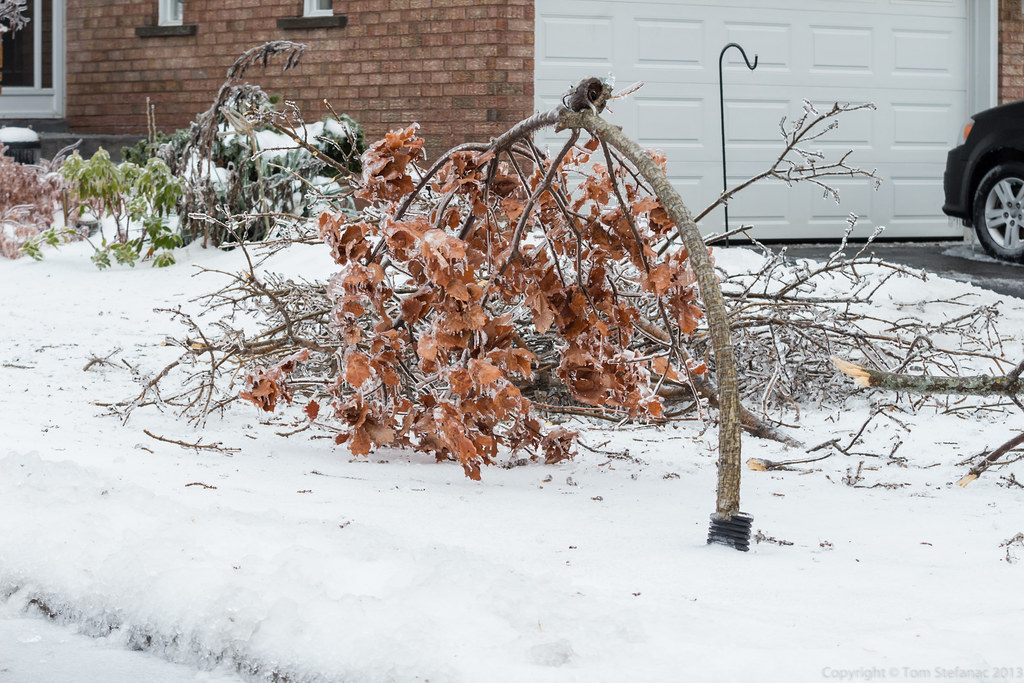
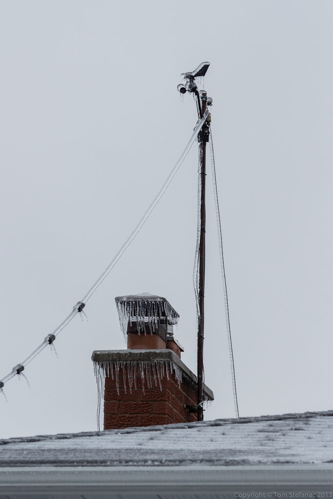
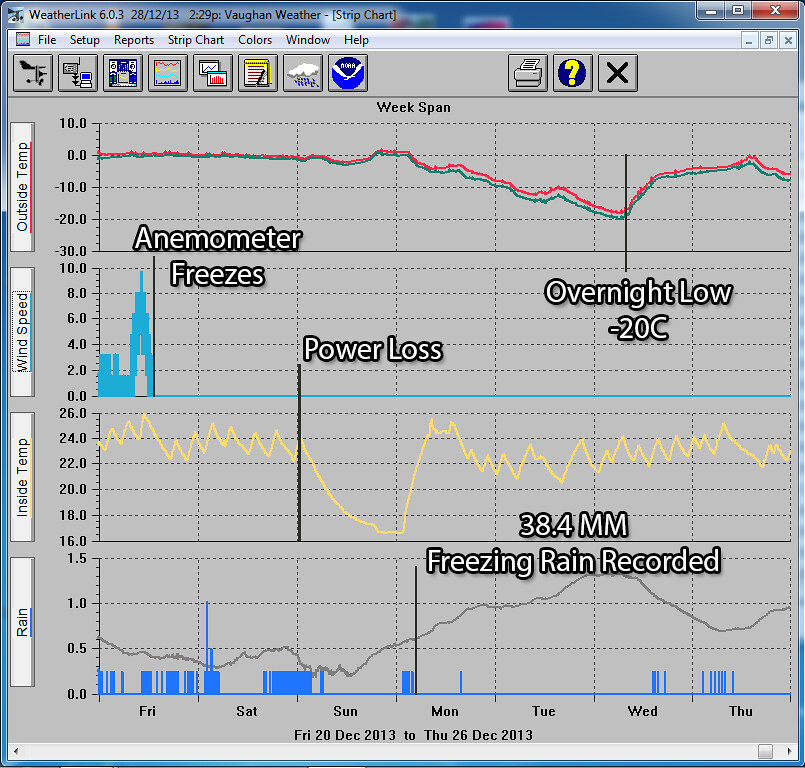
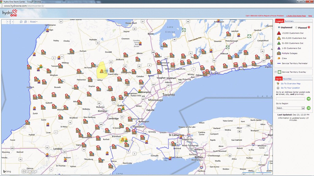
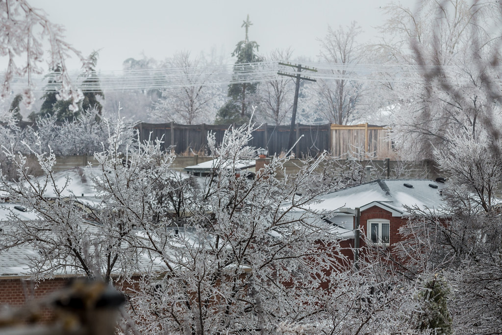
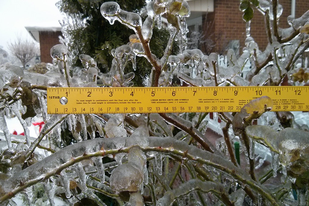
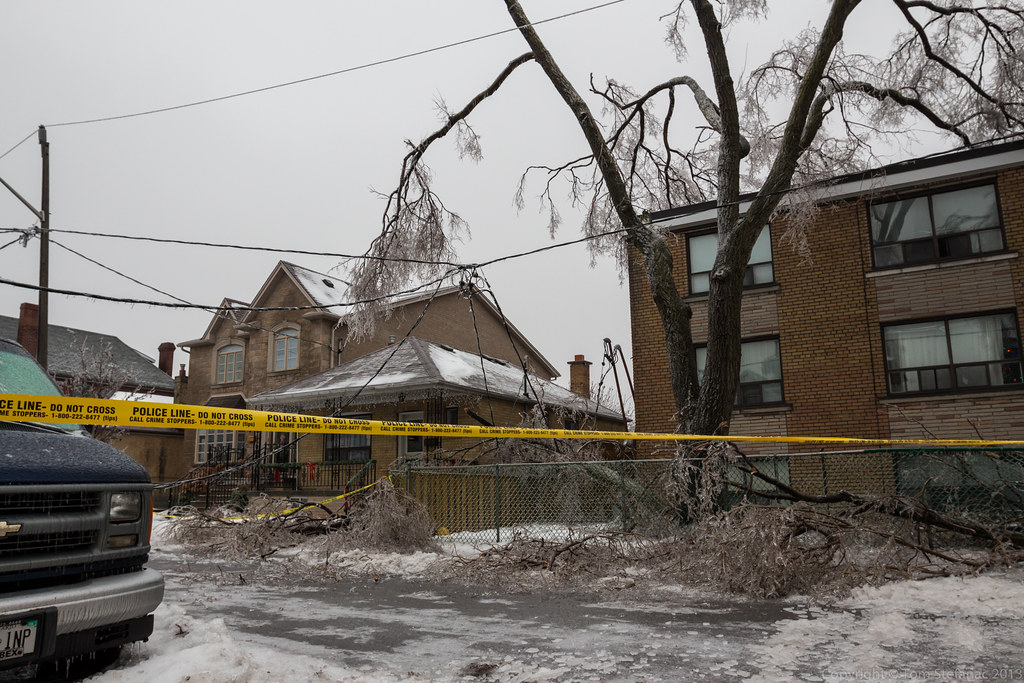
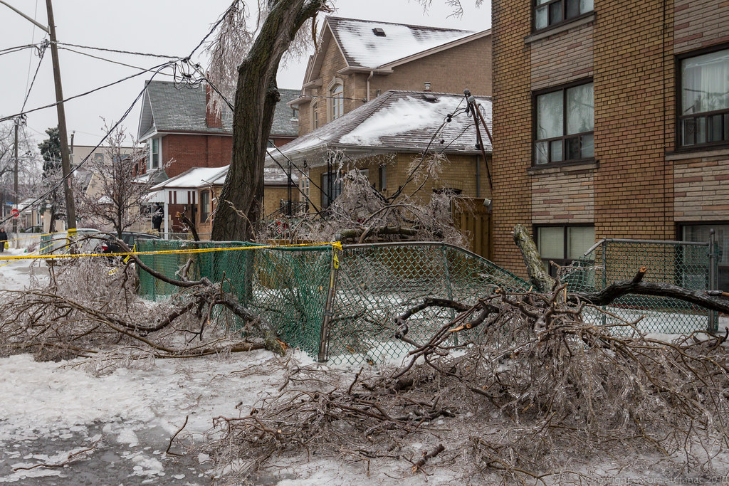
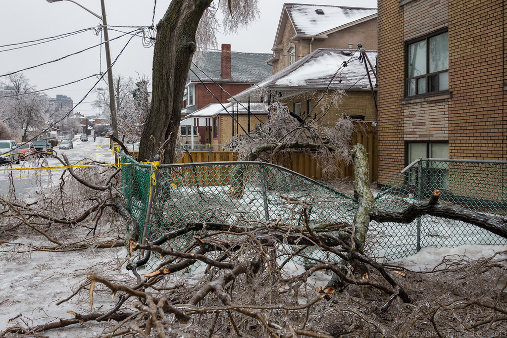
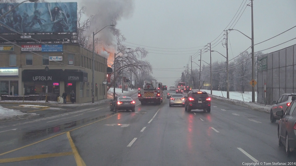
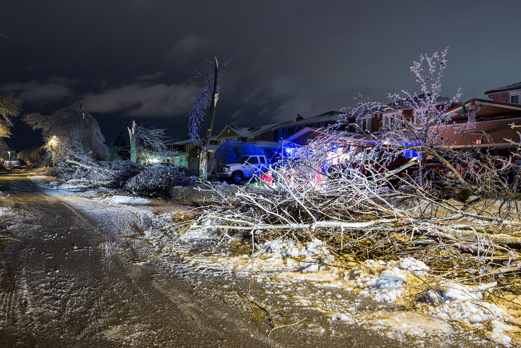
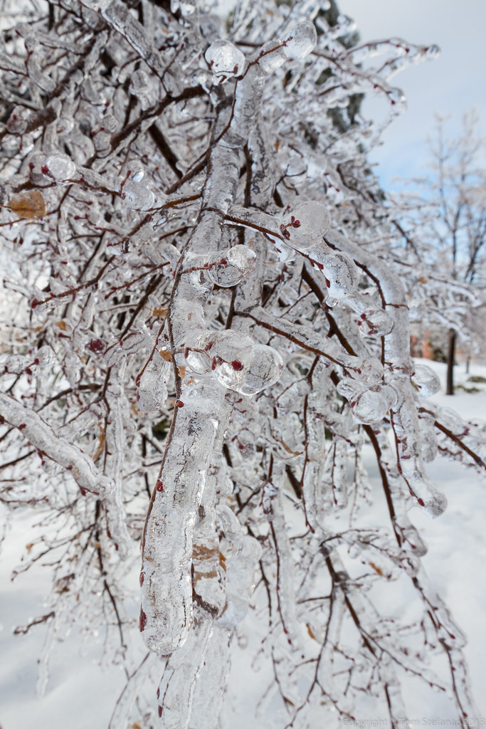
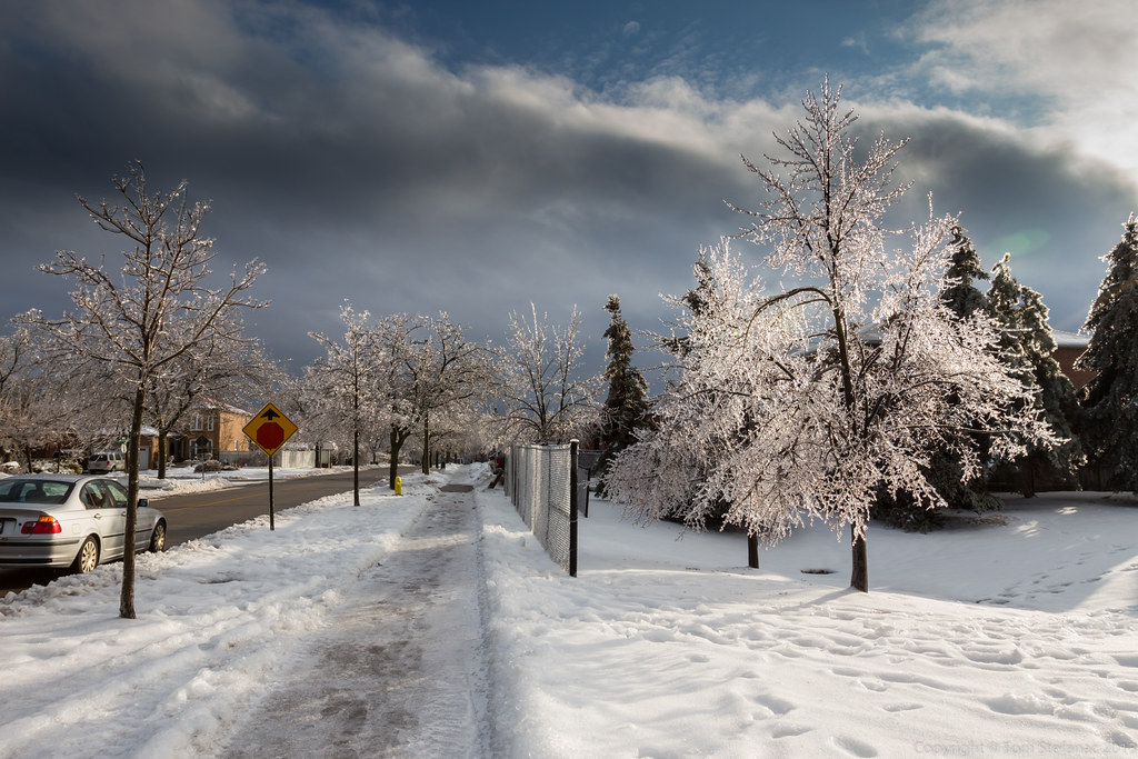
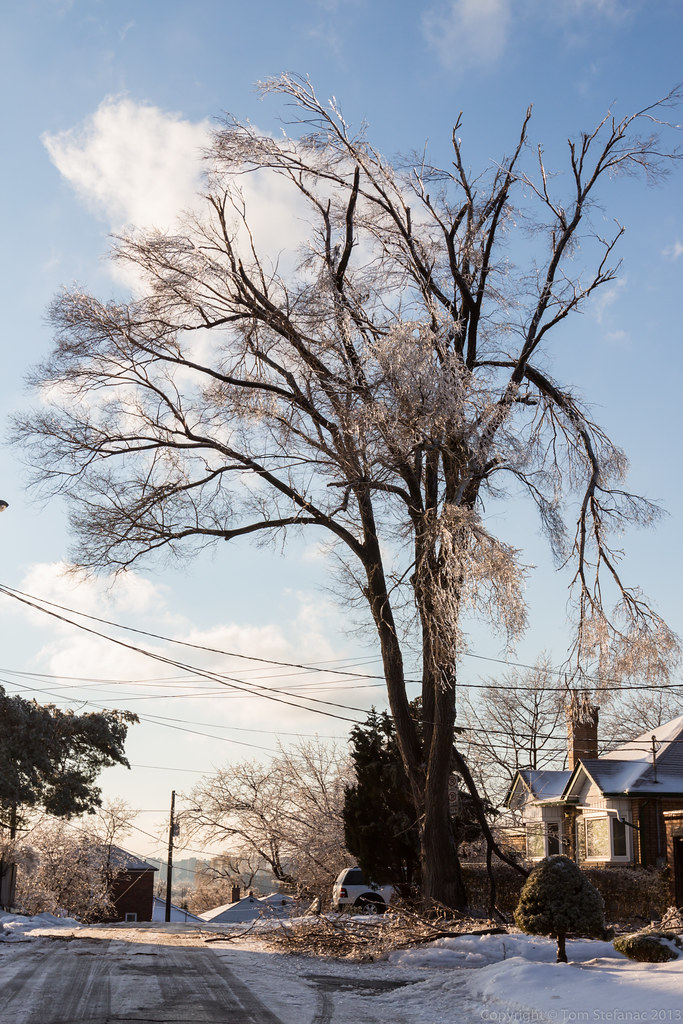
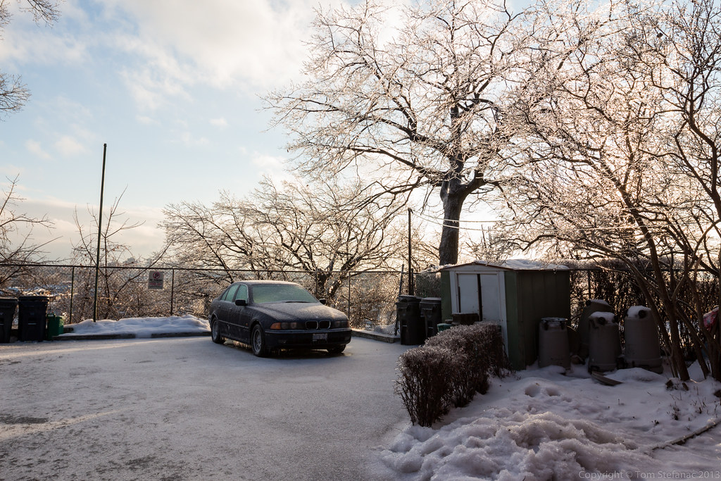
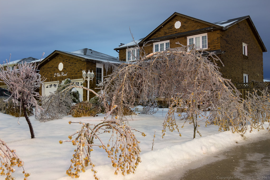
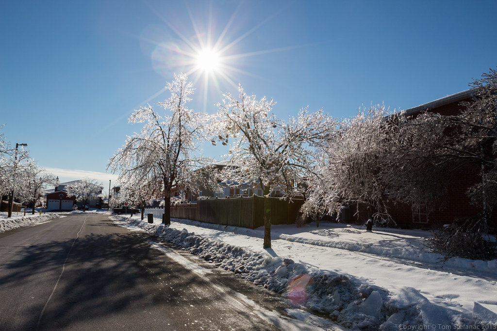
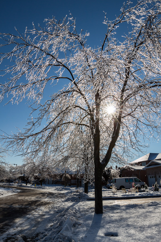
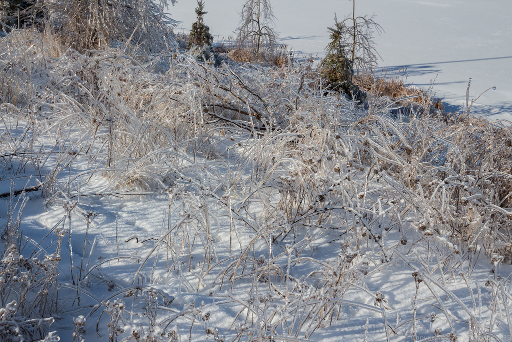
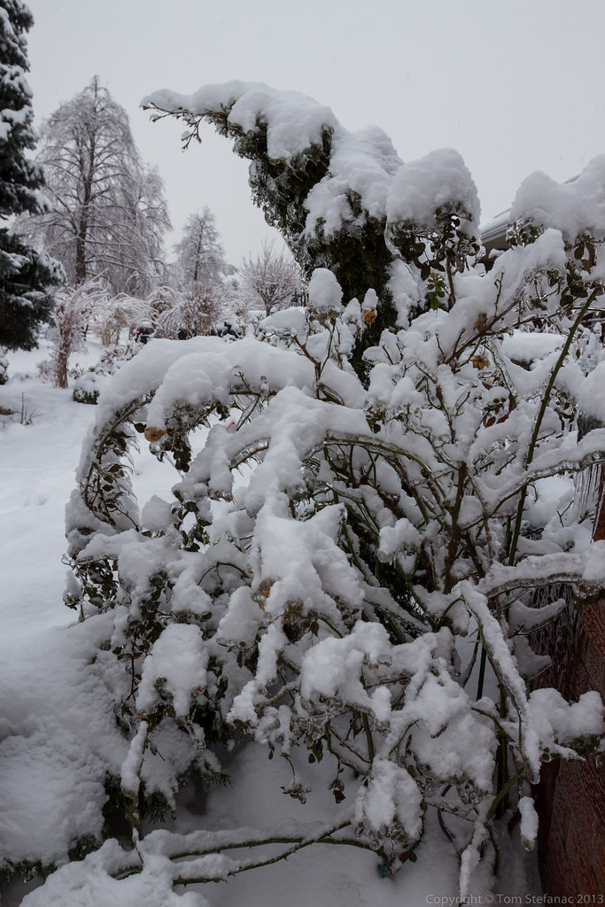
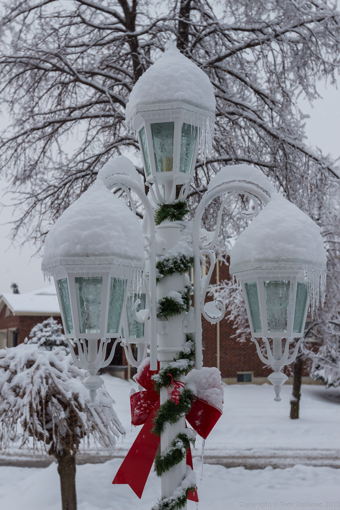
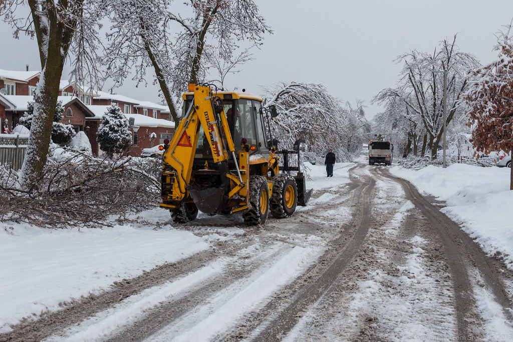
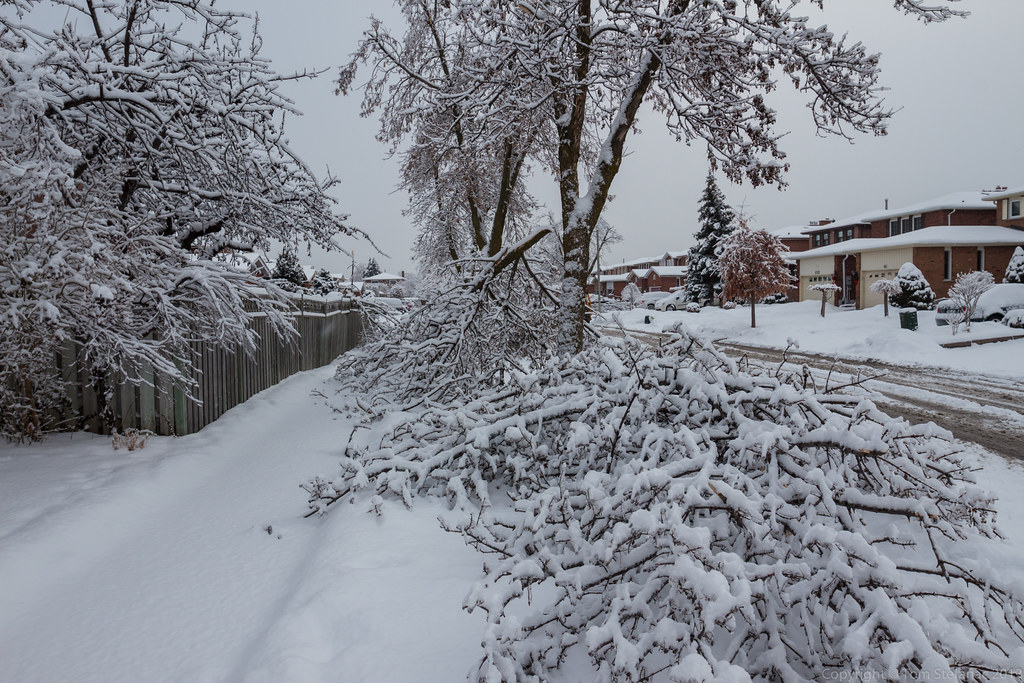
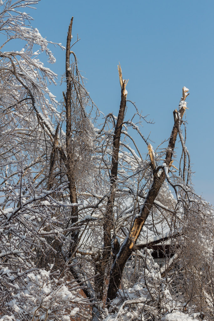
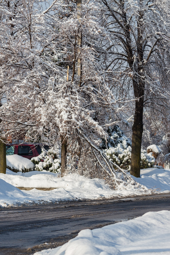
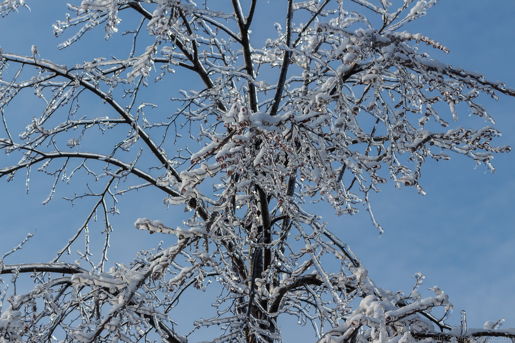
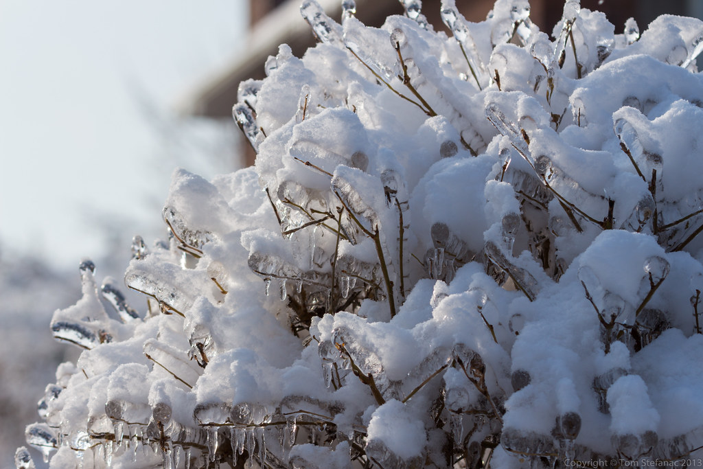
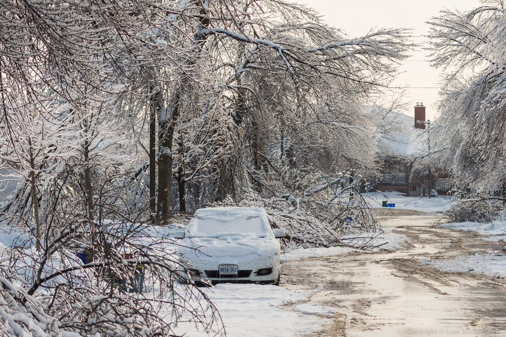
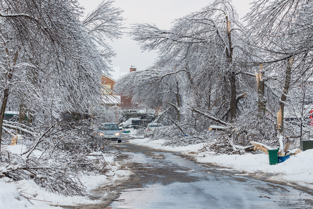
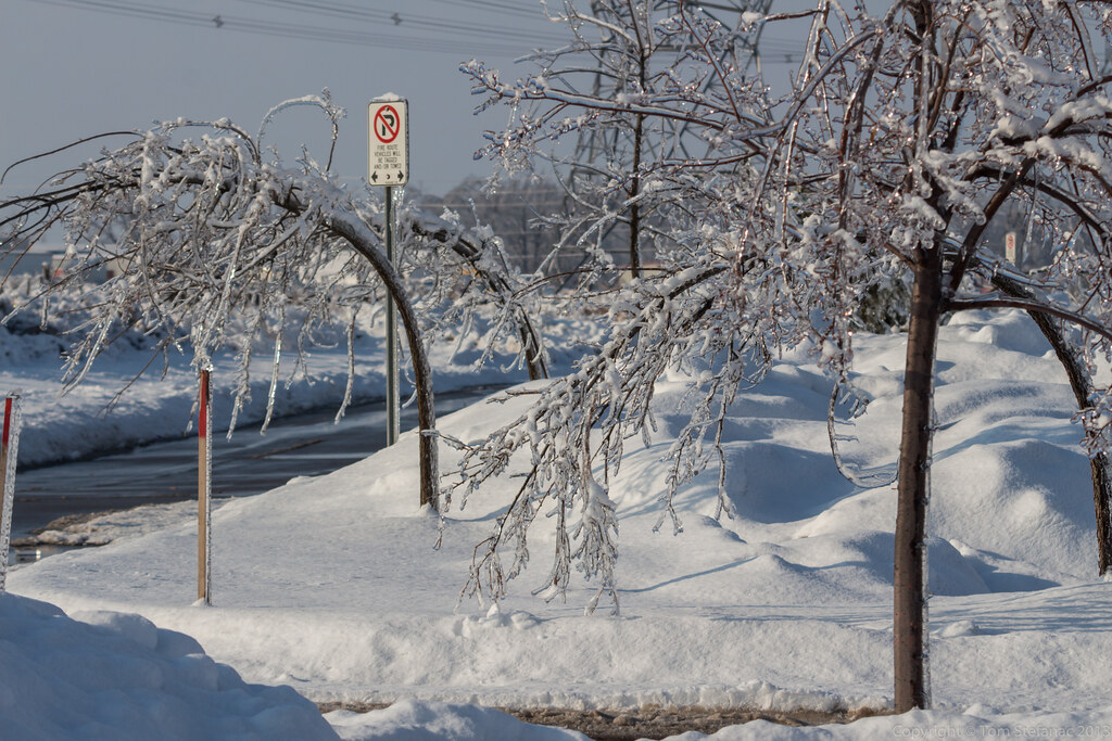
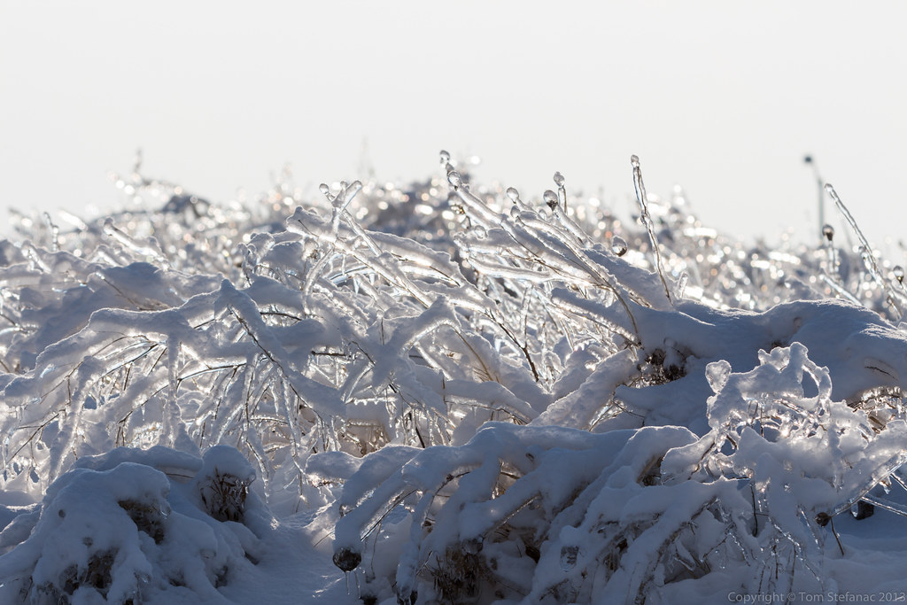
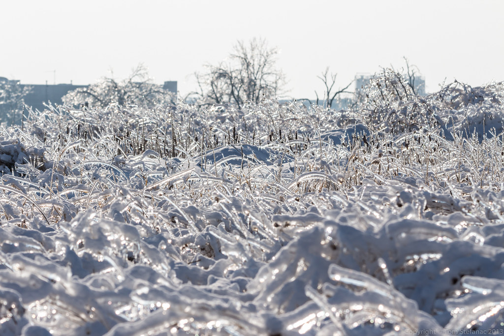
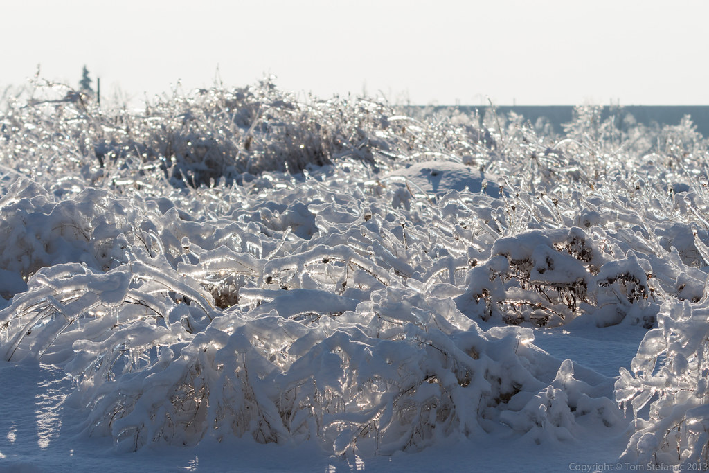
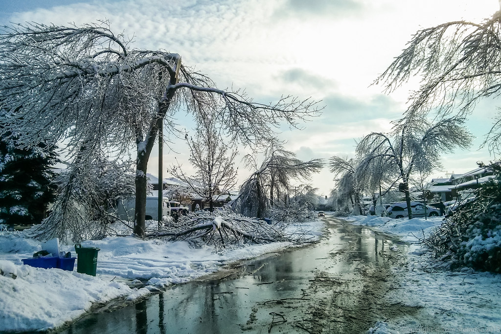
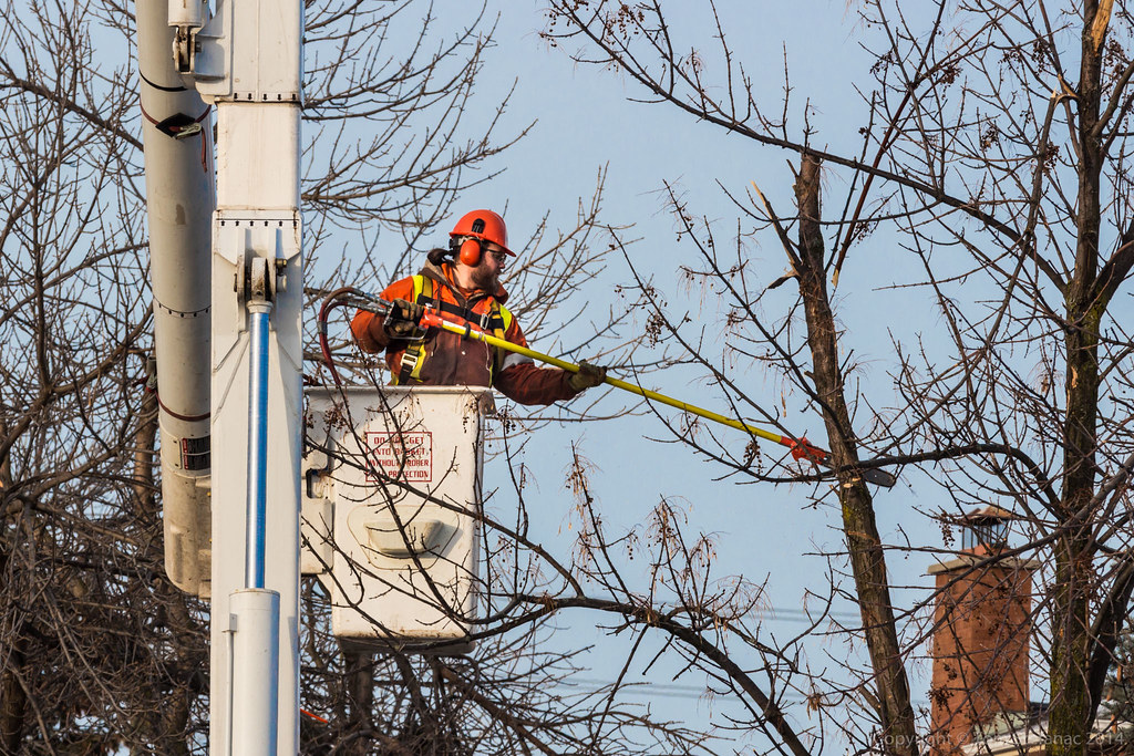
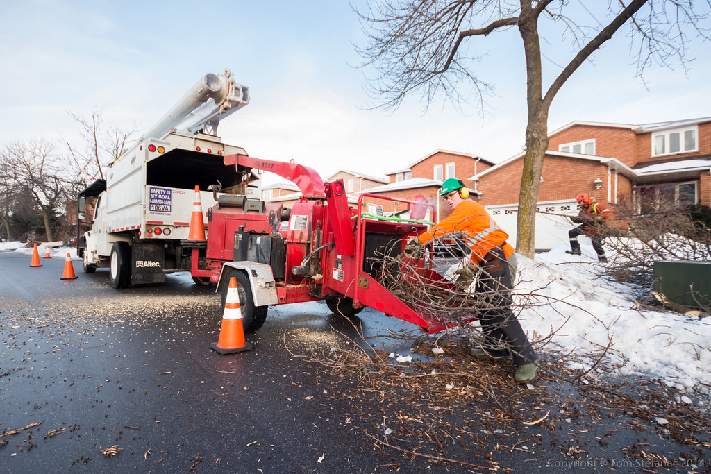
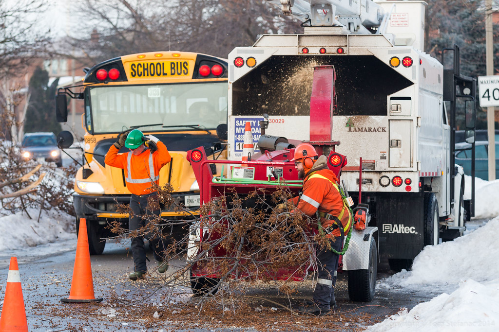
December 20th 2013 – The Historic Ice Storm


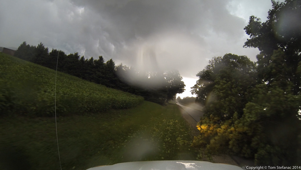
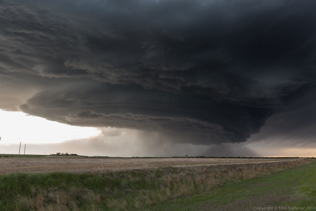
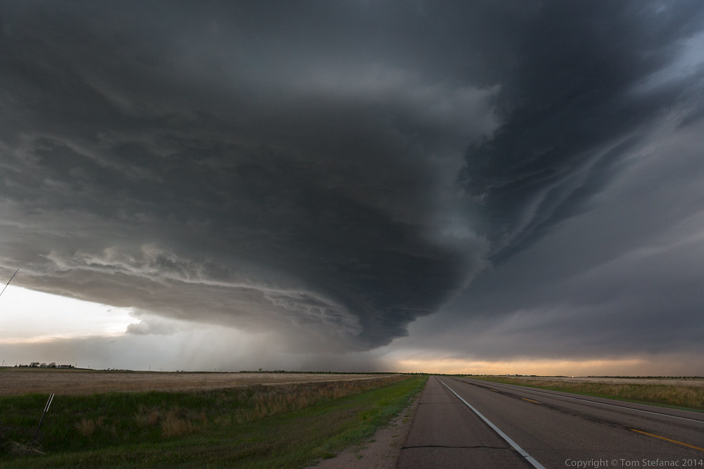
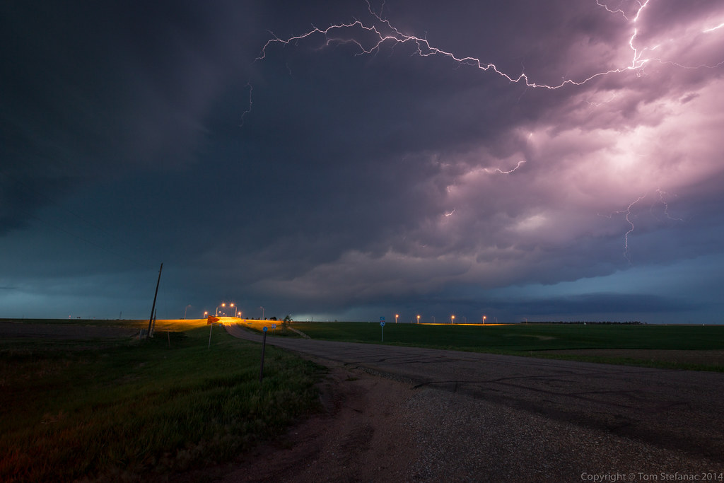
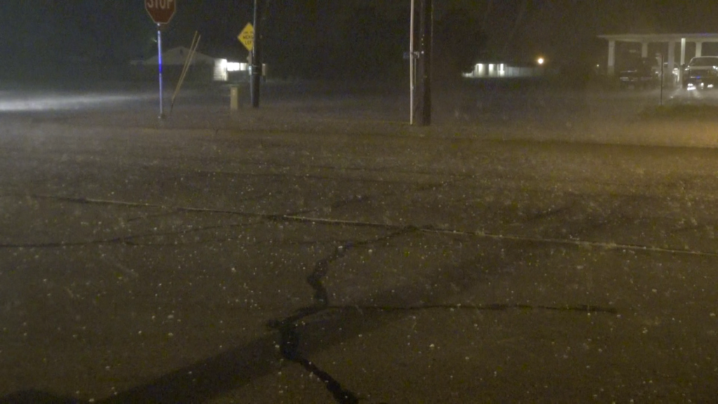
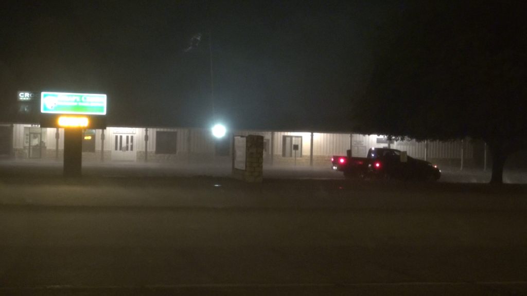
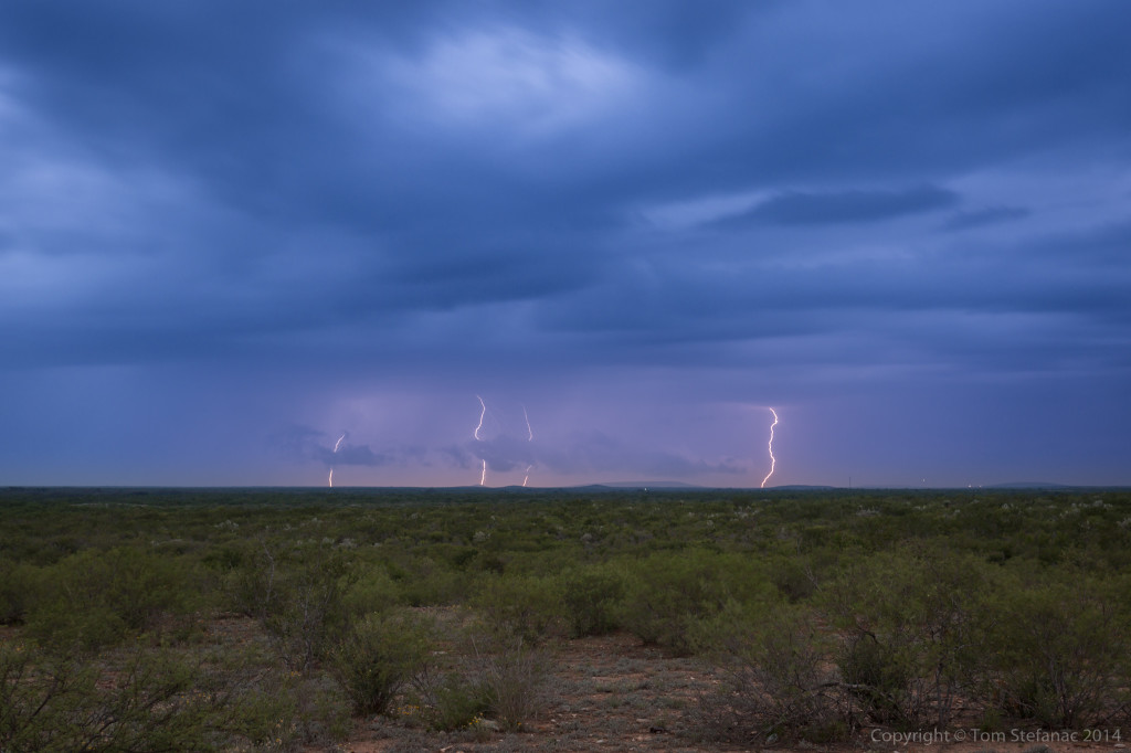
July 26th 2014
This was an interesting chase, in fact it was not so much of a chase as much as it was an outing just to see some lightning. It’s always a tough call to drive 2 hours in any direction just for the potential that there might be something that might make for a possibly interesting photo.
There was a meso-low developing over central lake Huron and storms were expected to initiate along a boundary near the centre. While I was driving up there was nothing, but the HRRR painted a pretty picture. I left my home around 8PM and arrived in Wasaga Beach around 9:30PM.
There really was not much to do so I started to photograph the midway and other things while I waited for the storms which eventually began to fire off around 11PM.


November 18th 2014


Here’s a brief video showing how bad things were. Moving pictures tend to do these types of situations more justice than still photos. This was definitely one of the more intense snow squalls I can remember in a while!
Solar Eclipse – October 23rd 2014


May 22nd 2014


May 21st 2014


May 9th 2014


May 20th 2014


May 19th 2014


")


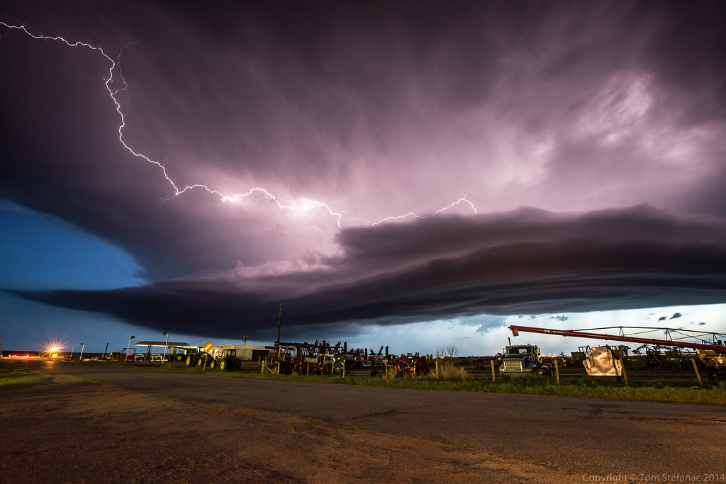
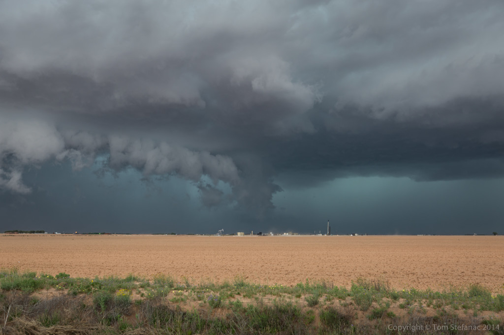
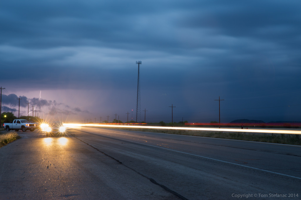
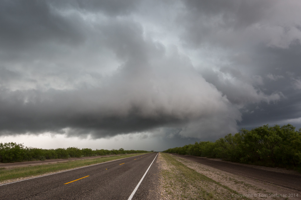
May 26th 2014 – Tornado Alley – Day 10
Storm began to fire off a boundary early in the afternoon between Andrews and Seminole Texas while slowly drifted east-southeast. The first storm I intercepted was just south-west of Lamesa, TX. I took me a little longer to get into position since I had to drive up from Uvalde, TX nearly 6 hours away.
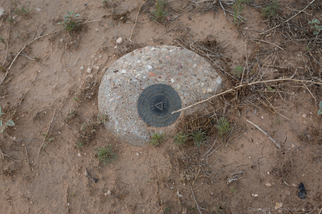
While taking photos I almost tripped on this stone, I look down to find it was part of the U.S Geologic Survey. Interesting.
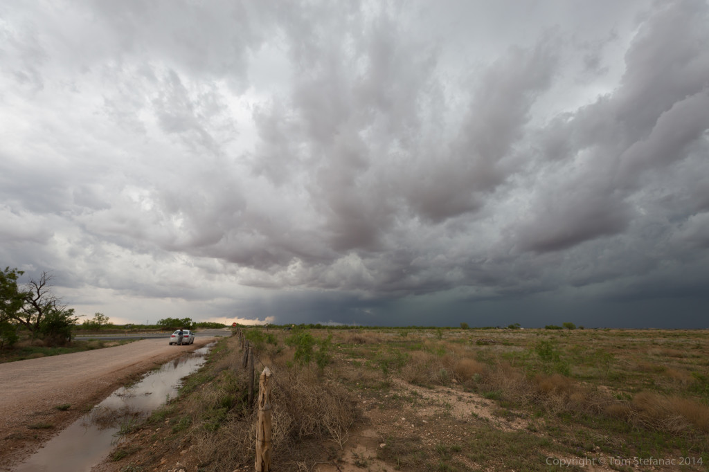
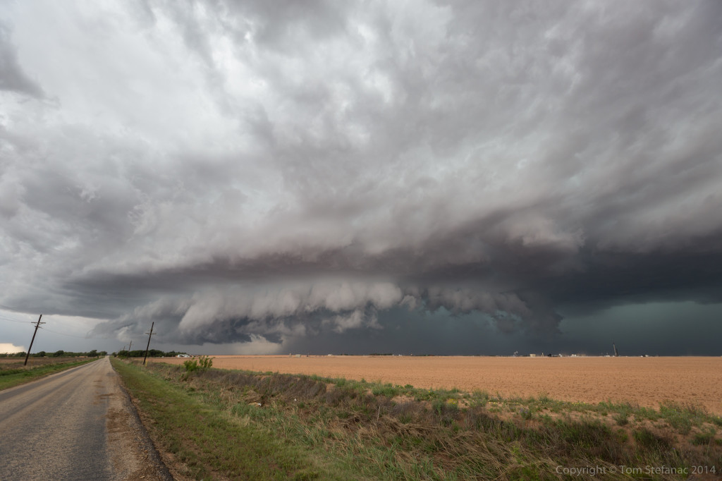
As the storm approached my position it was a little messy looking but the inflow was growing and there was a lot of upward motion. The core also had this green look to it.
Falling south and stopping just north of Big Spring, there was an interesting inflow feature, almost like a tail that was growing and being blocked by a falling rain curtain that was wrapping around.
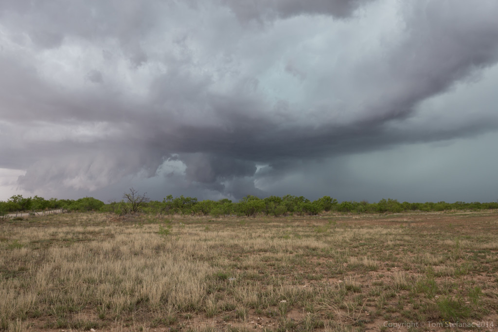
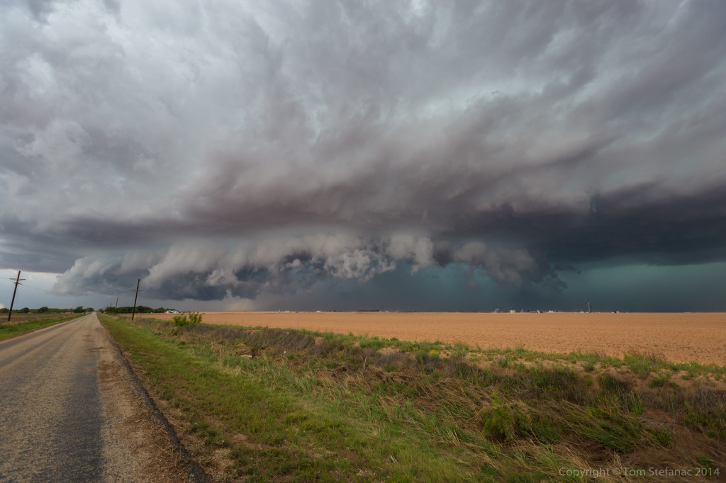
A couple minutes later the feature was completely obscured but the storm was really hugging the ground and the gate to gate rotation on radar was tightening up.
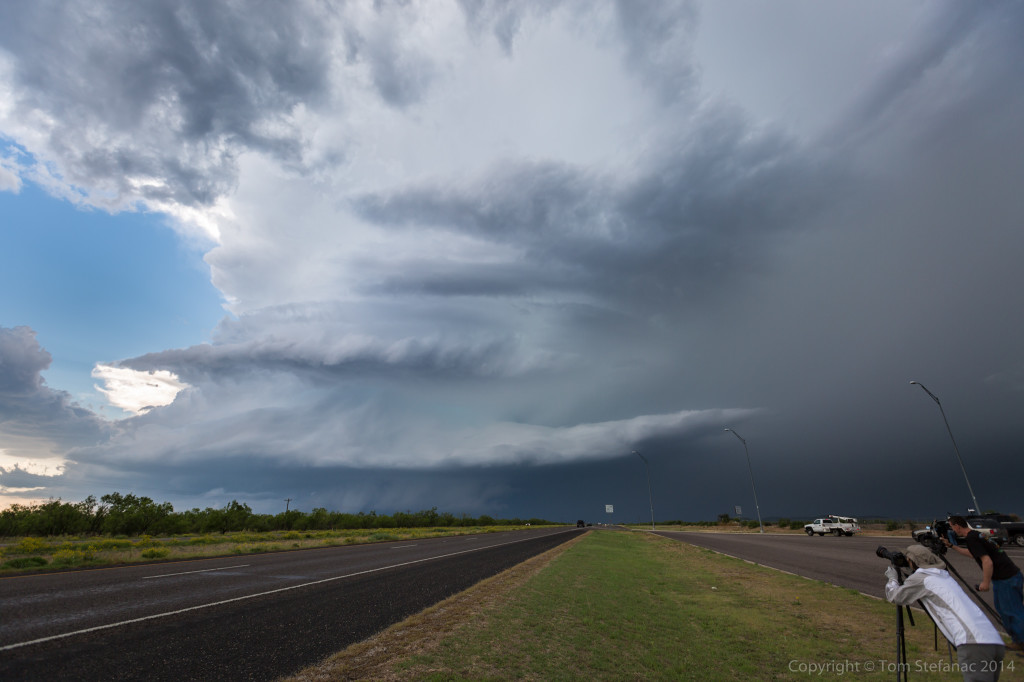
Shifting south once again, the storm continued to morph and became this scary but colourful glob of inflow, outflow and supercell structure painted in the sky against a brown field lined with grass.
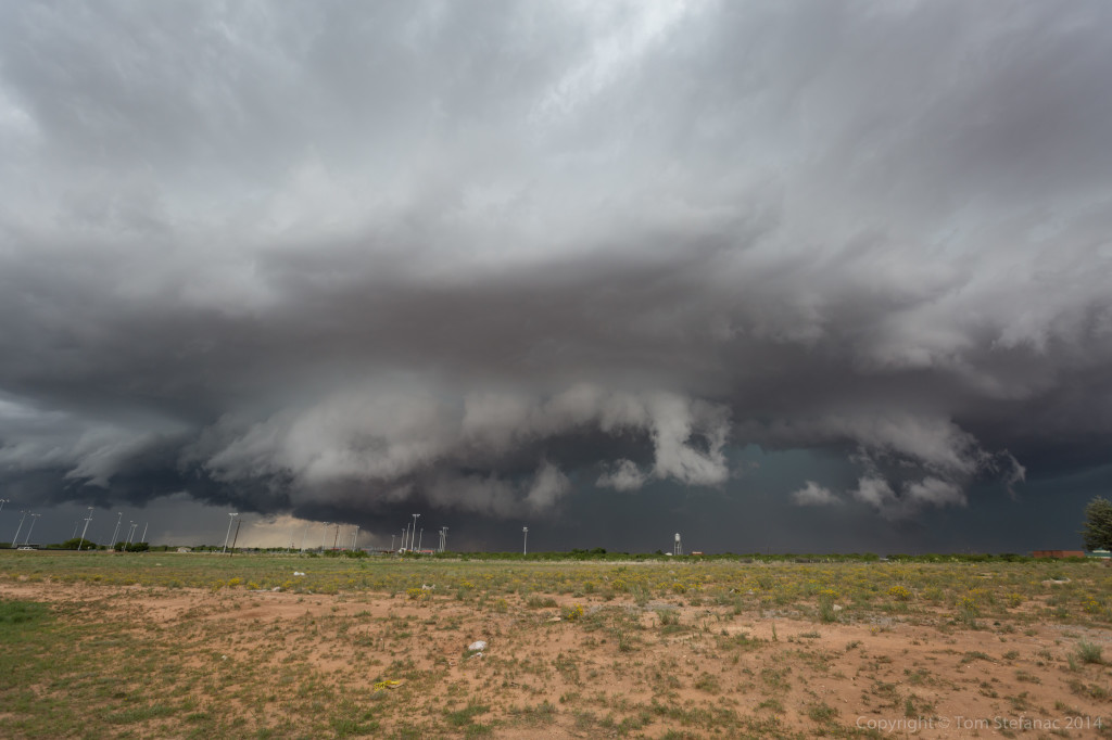
A clear inflow notch was developing on radar and very visible in person underneath the semi-visible vault. By this point, the storm was beginning to pull south hard, drifting towards the town of Big Spring directly. Initially it looked like a clean miss but now the storm was really shearing off and trying hard to go south.
The storm continued to head towards me and I stuck around for as many photos as I could before having to move!
Unfortunately finding a clearing in the town of Big Spring was not easy since it sort of sits in a valley and it is a built up town. The already busy streets were also now deluged with chasers bailing south. I was able to find this view behind a tractor supply company.
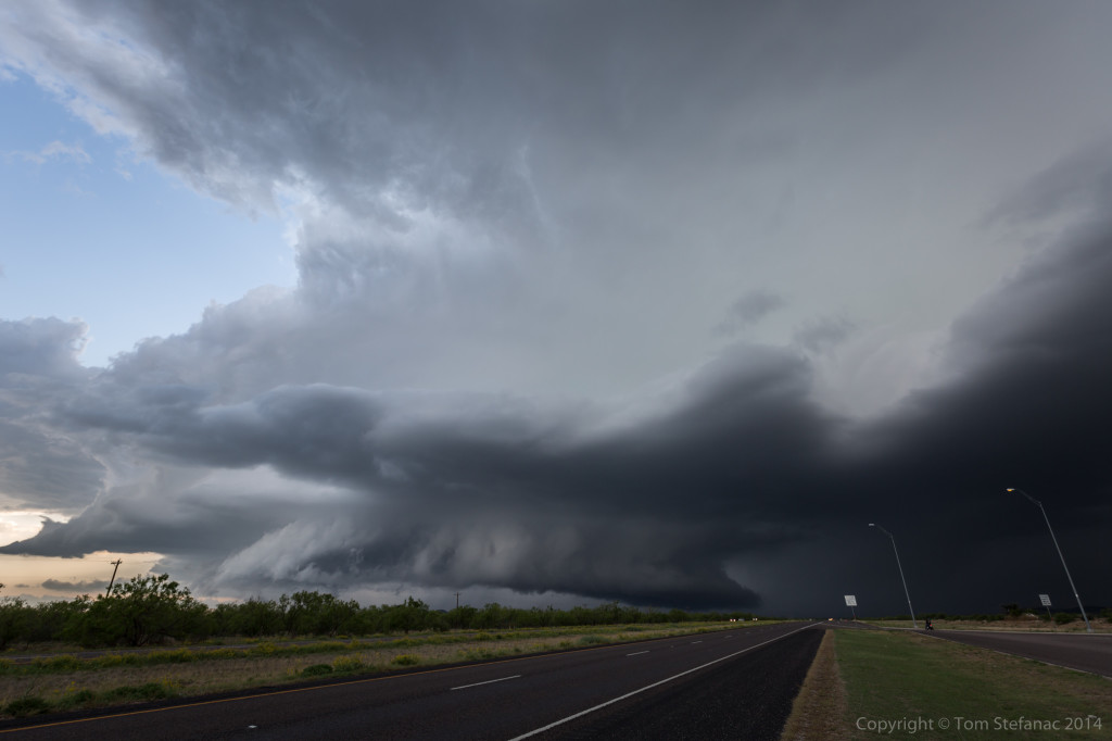
Again, there was incredibly strong inflow into the notch just behind the trees in the above photo. The scud was also rising blazing fast! The storm was absolutely ready to produce a tornado except it was going to be buried in rain.
These shots, especially the vertical perspective look gives an idea of how abrupt the synoptic environment, or in this case meso-scale environment transformed into a storm scale environment. Also, this is a super wide angle lens, about as wide as you can get before your into a fish-eye, so despite the storm looking far away, it was actually almost on top of Jen and myself!
Eventually the original storm, we’ll call it the northern cell, just became to difficult to follow. It crossed the interstate east of Big Spring and produce a rain-wrapped tornado. I’m not a fan of rain-wrapped anything, you have to be way too close to see those tornadoes, I’m picky and tend to go for the text-book cones, but I guess beggars can’t always be choosers!
The entire boundary which gave life to the original storm, was sparking off new storms progressively farther west. I positioned myself for the slow approach of the next storm in the line.
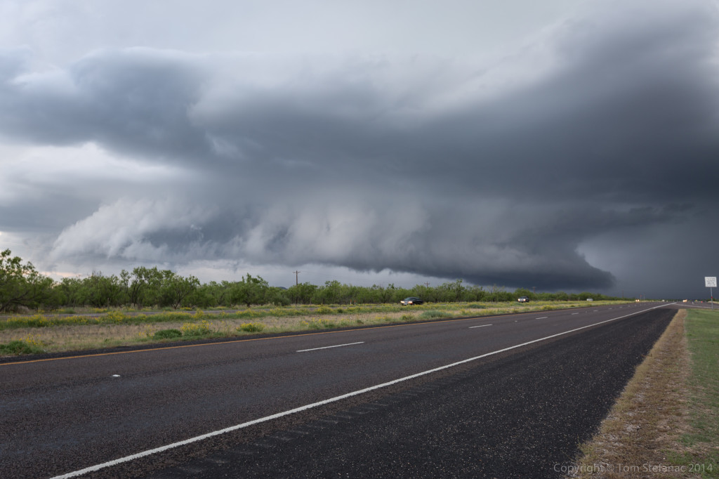
As the storm drew closer, some nice forward flank and rear flank structure came into view.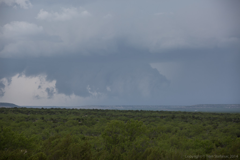
The storm also had a persistent wall cloud.
This was my GoPro setup at the time, that way I could get video of the storm as I was running away!
Every now and then the storm would produce a funnel-like cloud but I don’t think it ever produce a true funnel cloud that I could see.
I was shooting both tight video and wide angle stuff. I’ll eventually have to put everything together in a nice timelapse.
I eventually had to re-position again as the storm began to take a bit of a dive south. There was a rest stop near Sterling City, TX which was a great spot! Silver Lining tours were also in the rest area as well as numerous locals.
I know many storm chasers try hard to keep people out of their photos, but I often like to put them in the picture. It’s realistic, and gives life to the environment as it was at the time.
The supercell structure was also awesome! You just don’t ever see stuff like this in Ontario!
Did I mention the storm had a wicked wall cloud?
Eventually the storm passed just to our north, and I mean the core and all missed by 1 mile! Unfortunately for us chasers, it eventually got caught up in the outflow of the earlier storm and died, but for a while it was sure looking crazy!
Later in the evening I tried to get lightning shots of yet another supercell but the road network was not all that great, nor were the vantage points or the head lights glaring at me!
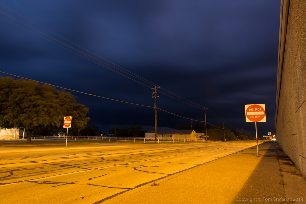
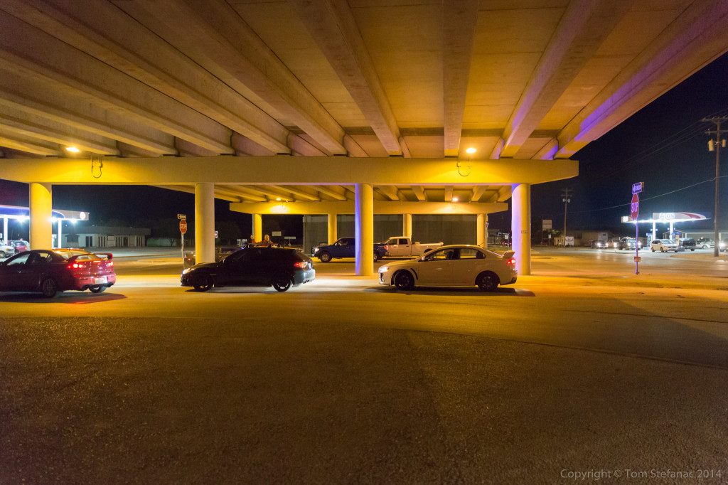
As the third storm of the day drew closer I found an overpass to park under. There was no tornado threat at the time, just hail, and I figured I would ride the storms core out with some mighty concrete protection.
There were numerous locals that began showing up shortly after I was established well off the roadway up against a vertical wall. They however parked on the road and thought they were sheltering from a tornado!
A representative from the local fire department showed up and moved most of them along, but it’s a tough call, I know sheltering under a bridge is not the best idea, but sending people blindly out into the storm is not a great idea either.
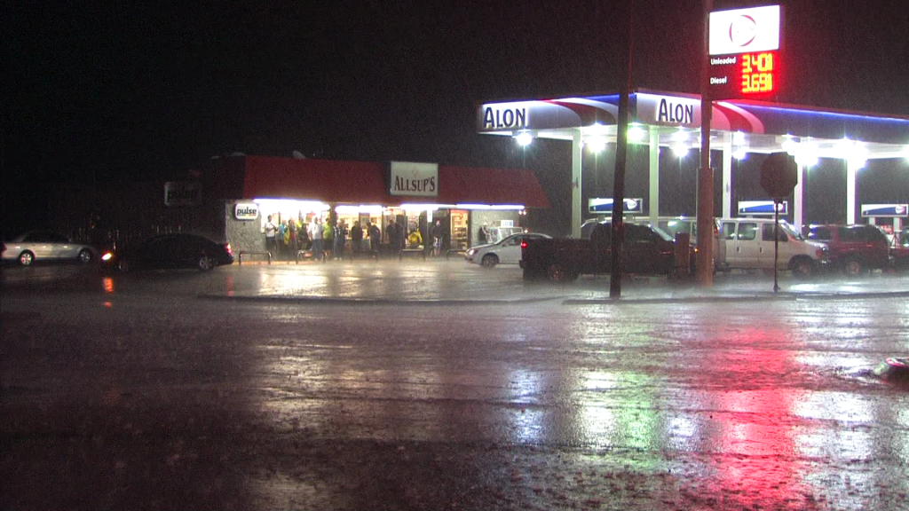
Several vans showed up and another tour group (Cloud 9 I think) showed up the Alon gas station and all got out to see the storm.
It was a fun core, probably not for the people trapped out in it, but it was not overly crazy, some 1-1.5 inch hail, some 50-60 MPH winds and a blaring tornado sired. The video is pretty cool!
Later that evening as I headed north back to Big Spring to grab one of the few remaining hotel rooms, Jen and I stopped for some lightning photos just south of the town. Against the star filled sky, the storm looked cool. I had hoped for some anvil crawlers but it seemed to all be buried deep in the storm.
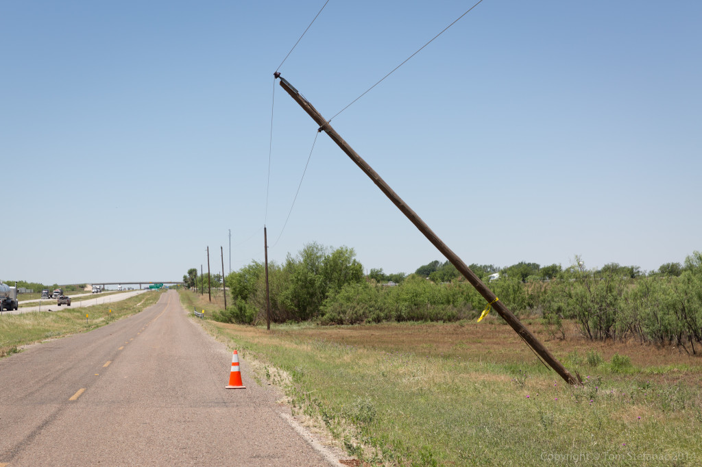
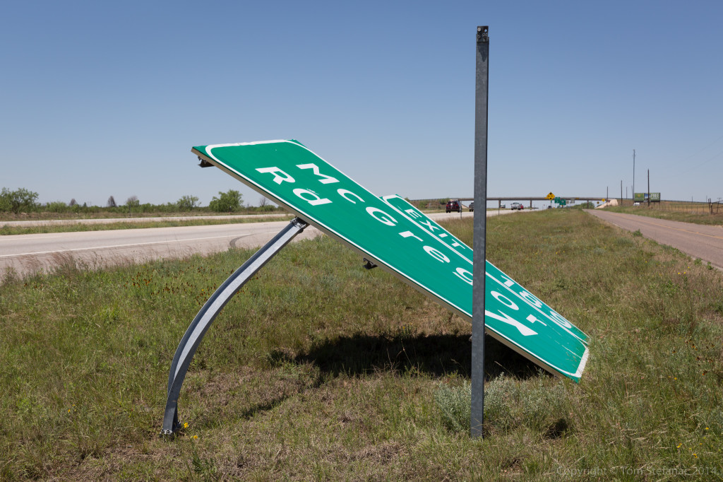
The next day I went out hunting for tornado damage, and found it, just west of Big Spring near exit 189 on I-20.
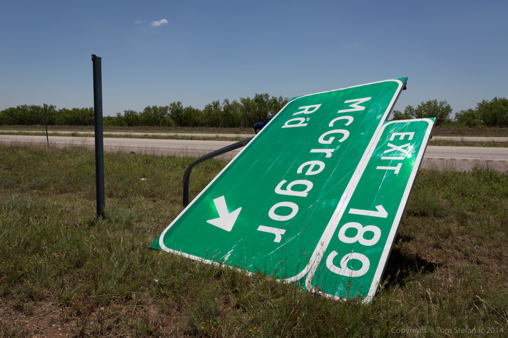
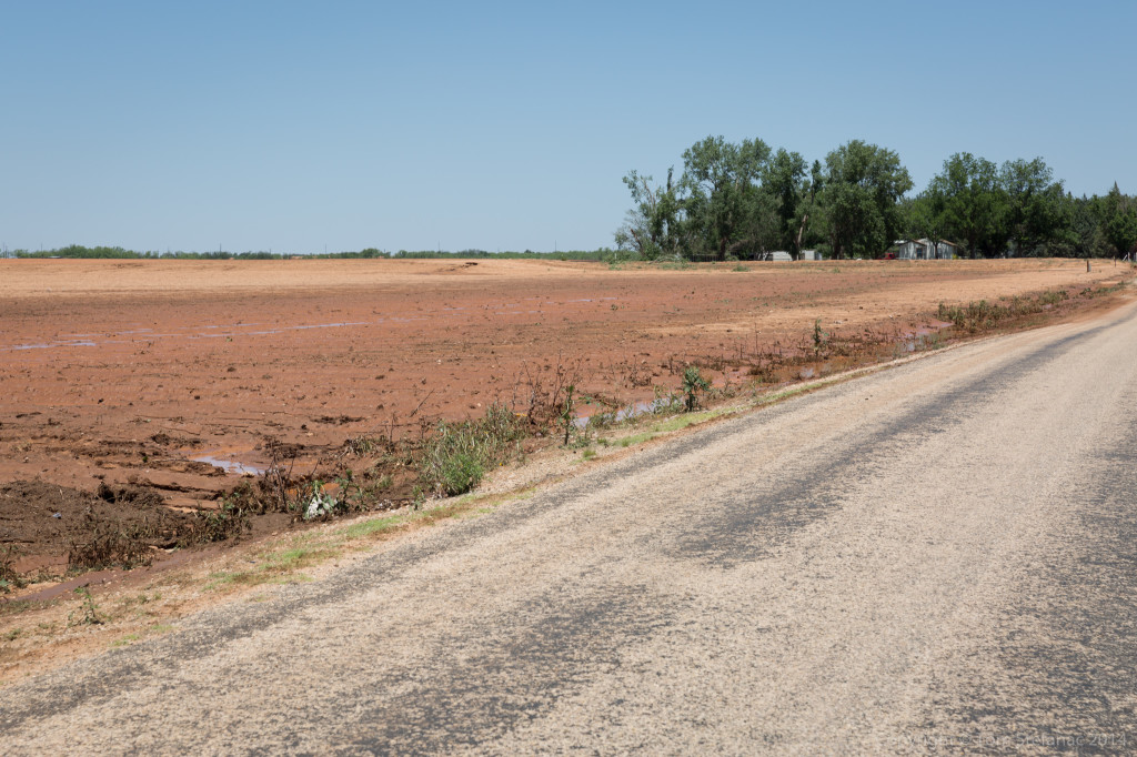
The tornado whipped across this field just missing some houses and “trimming” the trees, before taking out a number of power poles.
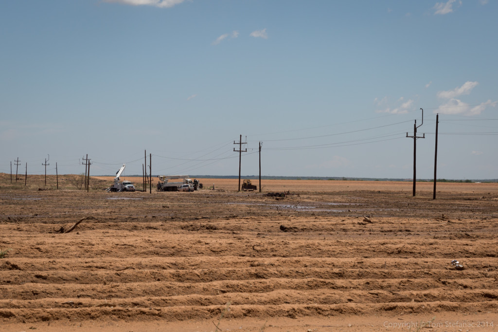
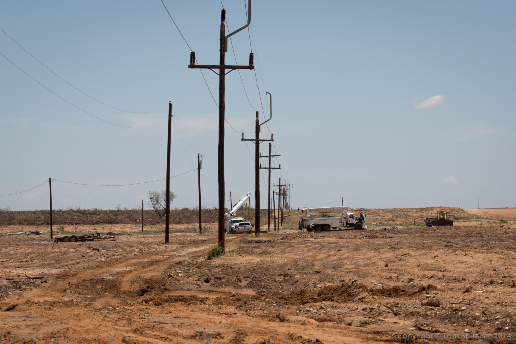 Crews were busy repairing everything but luckily there was no major damage, from the shredded weeds, trees and damage to the odd structures hit, the tornado was probably on the order of 50-60 feet wide and a higher end EF-1 in nature.
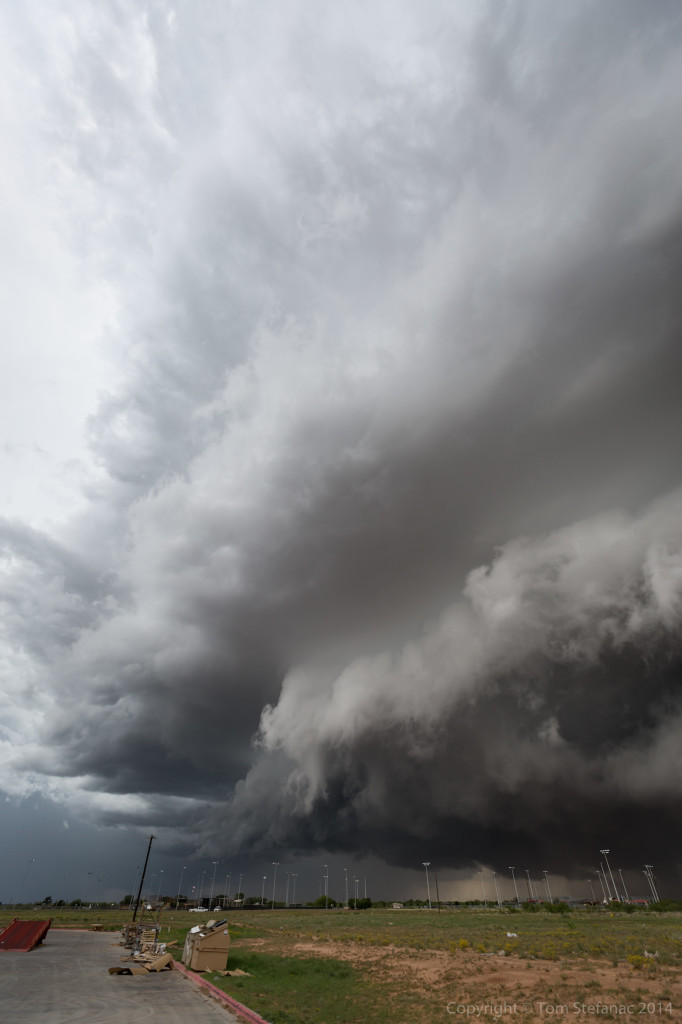
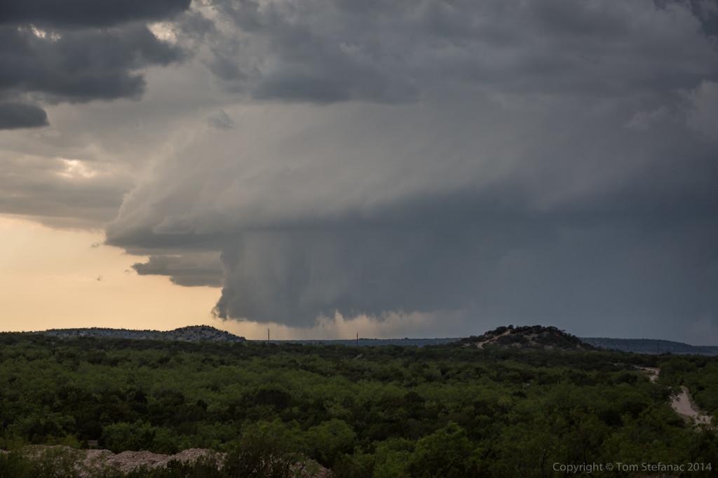
May 25th 2014 – Tornado Alley – Day 9
 We started the day in Hobb NM and raced south towards my target of McCamey, I figured convection would initiation along an outflow boundary from the morning convection just over the border in Texas. Around 12:30AM, the first bubbles of lift turned into a storm!
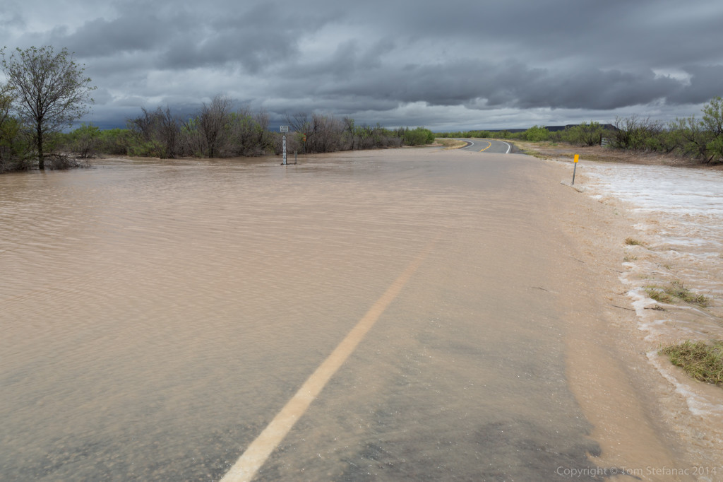
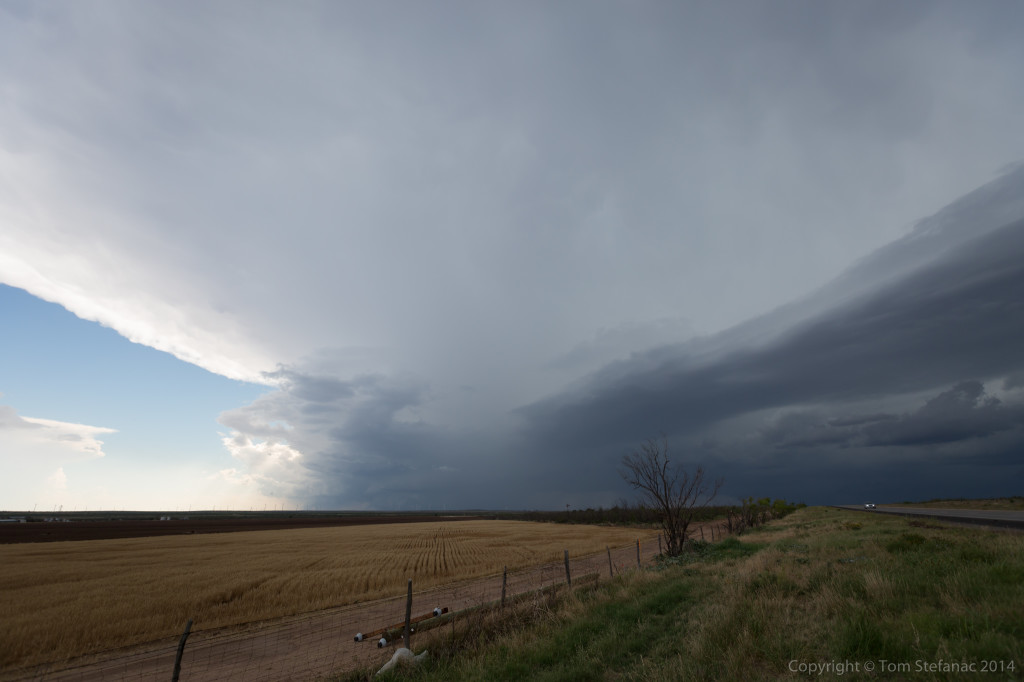
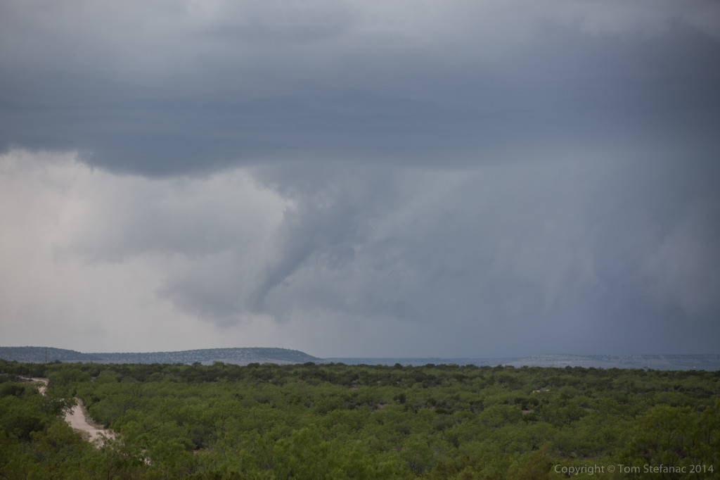
I took a less traveled road to my destination to find it was flooded! This little mishap cost me 30km! Ah well, won’t do that again! The initial storm which was targeted near Sanderson, TX went to poop after it ate too much outflow! Another healthier, outflow free storm was chugging along in Mexcio and that was my new target.
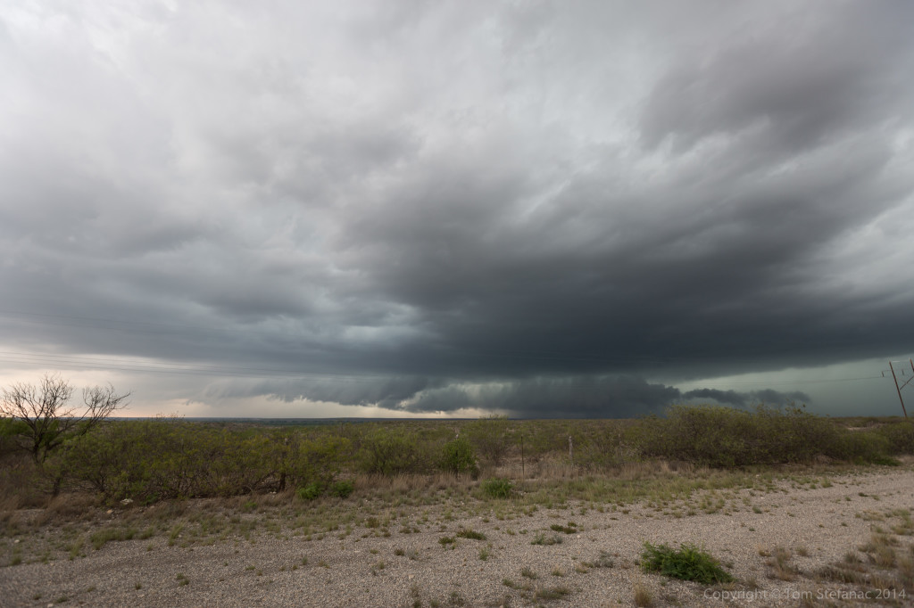
Jen and I raced south to Del Rio TX and watched the storm roll across the border from Mexio to Texas.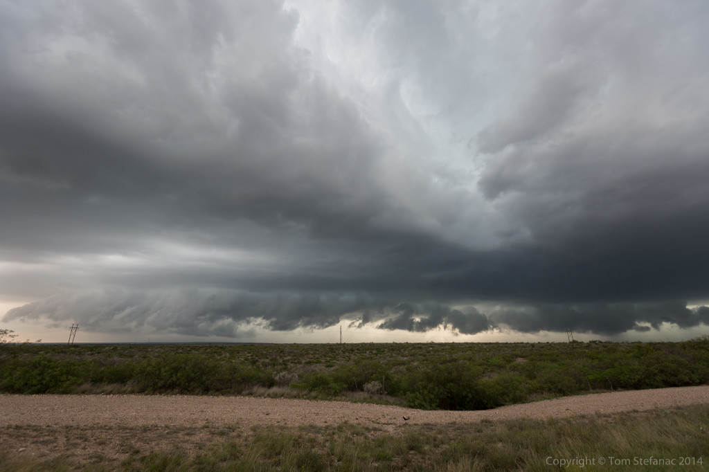
The storm had more a linear appearance to it in reality than what the radar suggested but it was still an energized supercell with plenty of potential. Unfortunately the road network was not all that great for this storms motion!
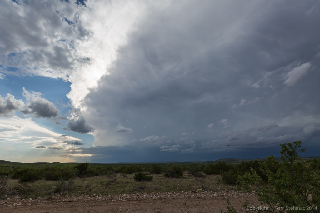
This was an outflow feature that crossed the road in from of me. Cool, but no threat here.
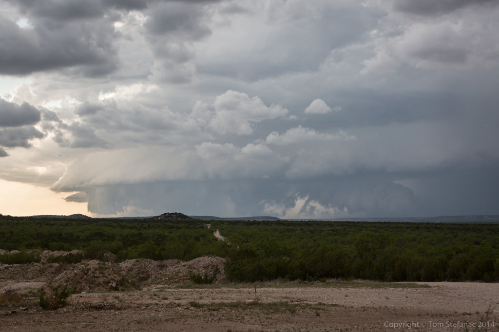
Eventually I was able to get ahead of the storm but it was becoming a big mess! Instead I opted for some lightning photos.
We’re now spending the night in Uvalde TX, tomorrow it looks like a play in this general part of Texas again.